This 5-Mile Idaho Hike Leads To A Giant Granite Spire Shaped Like A Chimney
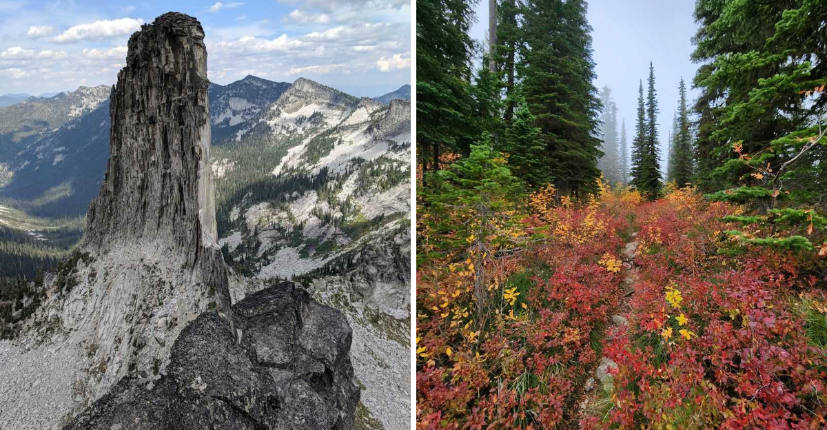
Halfway up this Idaho trail, the mountain starts showing off.
A slab of granite suddenly punches into the skyline, nearly 380 feet tall and skinny enough to look like somebody dropped a castle chimney in the wilderness and walked away.
That is when the hike stops feeling ordinary.
The whole trip is only about five miles round trip, but the payoff has serious “wait, what is THAT?” energy. One minute you are climbing through quiet mountain country.
Soon, you are staring at a stone giant that looks far too theatrical to be natural.
Early travelers noticed the resemblance too, and the nickname stuck.
Bring good boots and enough water to keep the complaining under control. The camera is nonnegotiable. Nobody is going to believe Idaho casually left this thing sitting on a ridgeline.
Climb Horton Ridge With Bigger Mountain Views Opening Behind You
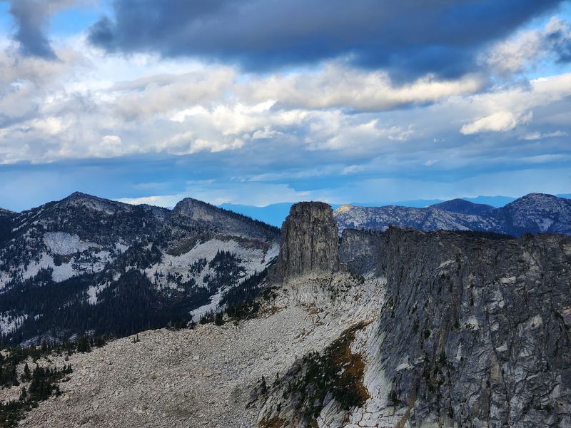
Something funny happens on the first mile of this climb: you keep turning around. The west-side trailhead sits high on Horton Ridge at roughly 6,100 feet, so the route begins with broad Selkirk views almost immediately.
Trees crowd the trail at first, mostly subalpine fir and spruce that smell sharp and sweet in the sun. Then the canopy begins to open in patches, and suddenly there is sky where there used to be branches.
McCormick Ridge appears first, a long green wall to the west. Gunsight Peak follows, its notched profile easy to pick out once someone points it out to you.
The grade is steady rather than brutal through this stretch, which makes it a good place to settle into a rhythm and let your legs warm up. Trekking poles help if your knees complain on descents.
Keep glancing over your shoulder anyway. Each switchback trades a little breath for a wider slice of the northern Selkirks, and the payoff builds the whole way up.
Spot The Granite Spire Rising Dramatically Above The Selkirk Backcountry
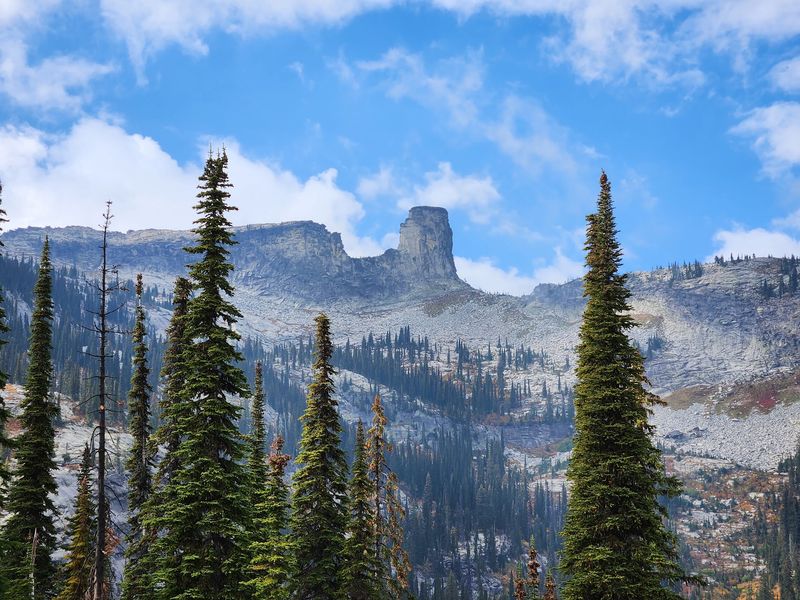
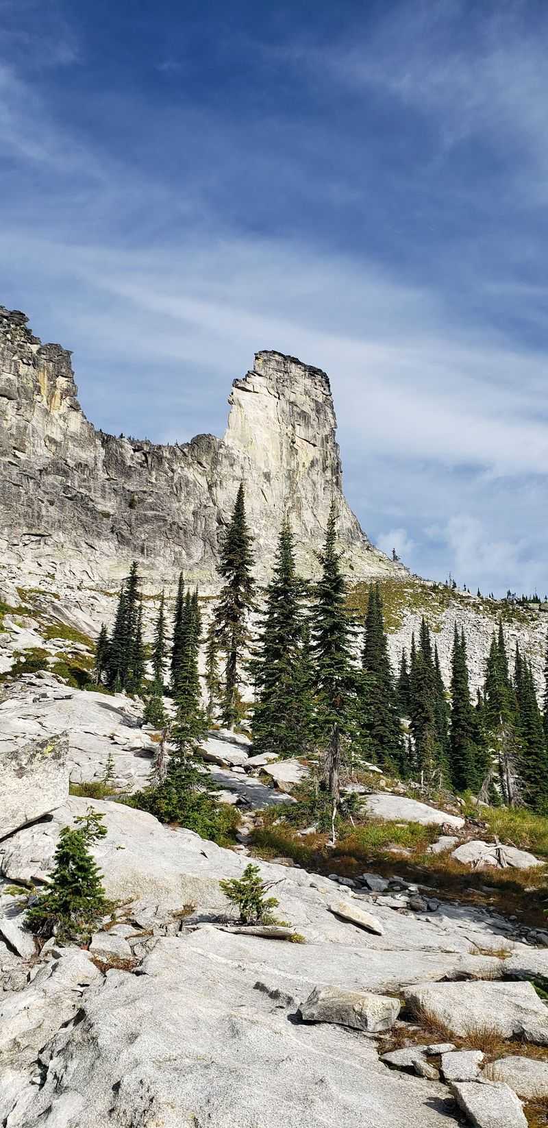
Chimney Rock earns its nickname honestly. Locals call it the lightning rod of North Idaho, and once you see the thing standing alone on the crest, the name makes perfect sense.
The spire is a three-sided tower of granite and granodiorite that tops out at 7,124 feet. Roughly 380 feet of bare rock climbs straight up from the ridge, with clean vertical walls that catch afternoon light and glow pale gold near sunset.
What makes the sight so startling is the emptiness around it. There are no roads in view, no buildings, no power lines, just miles of rumpled forest and stone stretching across the Selkirk Crest.
Rock climbers have long treated the spire as a regional landmark, though most hikers are perfectly happy admiring it from solid ground. Binoculars are worth carrying if you enjoy tracing the cracks and ledges along its faces.
Give yourself a few quiet minutes here. Photographs flatten the scale, and standing still is the only way to feel how large it really is.
Pass High-Country Forest And Meadows On The Way Up
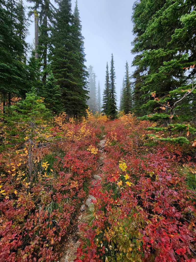
Wildflowers are the quiet reward on this trail. Between forested stretches, the path spills into open high meadows where blossoms crowd the trail edges through midsummer, low and bright against the granite soil.
Huckleberries come next. By early August, sections of the route pass through a thick carpet of the bushes, and the berries are small, dark, and tart in a way no store-bought fruit can match.
Snack as you walk, but stay alert and make noise, since bears love these slopes for the same reason you do.
The forest here feels different from lowland woods. Trees grow shorter and more twisted the higher you climb, bark scarred by wind and heavy winter snow, and the ground crunches with dry needles and lichen-crusted stone.
Listen for the whistle of marmots among the rocks and the chatter of ground squirrels darting between logs. Birds move through the meadow edges in the cooler hours.
No streams cross the route, so pack every drop of water you plan to drink.
Pause For Views Of Gunsight Mountain Hunt Peak And Sundance Mountain
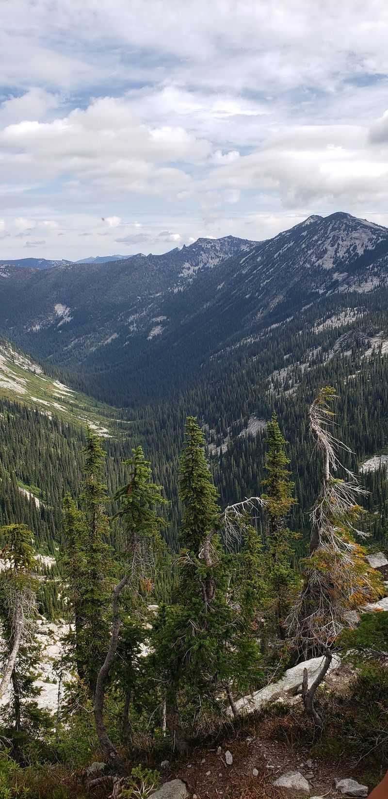
Three names come up again and again along Horton Ridge: Gunsight Mountain, Hunt Peak, and Sundance Mountain. All three step into view as the trail gains height, and picking them out becomes a pleasant game.
Gunsight is the easiest to identify, thanks to the deep notch that gives it its name. Hunt Peak sits nearby with Hunt Lake cradled in the basin below, a bright blue coin of water visible from the upper slopes.
Sundance Mountain rounds out the lineup, its broad shoulders marked by decades of forest regrowth.
From higher up, Gunsight Peak reads as part of the Selkirk Crest running north, and the whole chain lines up like teeth on a saw blade. A downloaded map with peak labels turns the panorama into something you can actually name.
Find a flat boulder, sit down, and eat lunch here rather than rushing on. Snacks always taste better at elevation, and this is one of the trail’s best benches.
Cell service is spotty at best, so save your maps ahead of time.
Reach The Shoulder Of Mount Roothaan For The Best Look At Chimney Rock
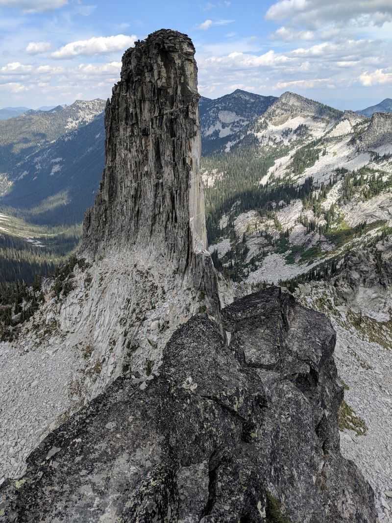
Ask anyone who knows these mountains where to photograph Chimney Rock, and the answer is Mount Roothaan. The trail follows Horton Ridge right to the peak’s rocky shoulder, and that is where the view snaps into focus.
Mount Roothaan climbs to 7,326 feet, about 200 feet taller than the spire itself and roughly half a mile to its south. Looking down at a landmark this famous, rather than up at it, changes everything.
From the summit, Chimney Rock stands about a mile to the north-northeast, framed against ridgelines that fade toward Canada.
Panoramas open in every direction up here. Granite slabs, patches of stunted timber, and distant lakes fill the view, and on clear days the horizon seems to go on forever.
The shoulder makes a fine turnaround point if the final scramble looks like more than you want. Plenty of hikers stop right there and never feel shortchanged.
Those who push to the top get the full circle of peaks, plus bragging rights earned honestly.
Pack For A Moderately Strenuous Outing Despite The Relatively Short Mileage
Five miles sounds easy on paper. This one is not, and the numbers explain why: roughly 1,235 feet of elevation gain, packed into a route that most people need at least four hours to finish.
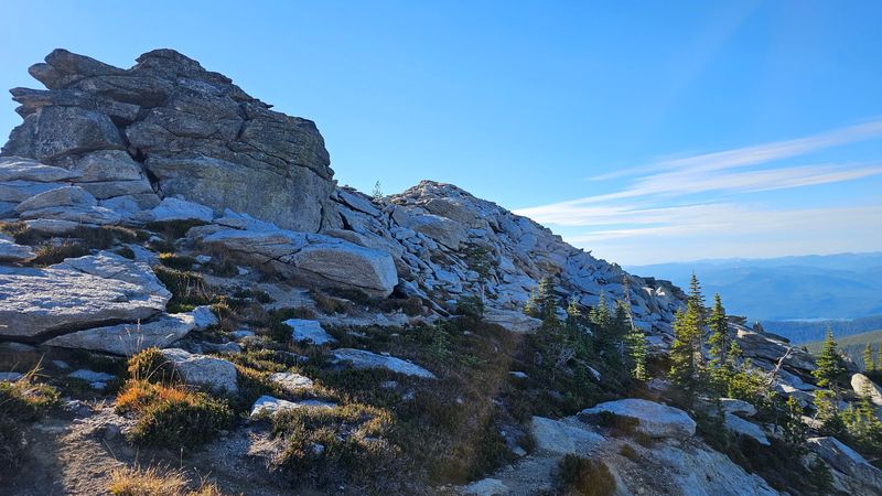
Guidebooks call the hike moderately strenuous, and the final half mile to the summit of Mount Roothaan has earned the nickname mountain goat country. Steep, rocky, and hands-on in spots, it turns walking into scrambling over stacked boulders.
Broad talus fields cover parts of the upper route, where loose stone shifts underfoot.
Good hiking boots with real ankle support are essential, not optional. Bring more water than you think you need, since the trail has no source at all, plus sunscreen, a wind layer, and food for the descent.
Snow lingers in shaded pockets into late June, sometimes hiding gaps between boulders, so probe carefully early in the season.
Fit, sure-footed kids handle the trail well up to the boulders. Turning back at the shoulder is always a reasonable choice.
Use A High-Clearance Vehicle For The Rough Approach To The Trailhead
The drive is part of the adventure, and it deserves respect. Getting to the Mount Roothaan and Chimney Rock trailhead means a long stretch of gravel forest roads, and a high-clearance vehicle is strongly recommended.
The last third of a mile before the Horton Ridge trailhead is the real test. Steep pitches, embedded rocks, and deep ditches slow everything to a crawl, and low-clearance cars without all-wheel or four-wheel drive should not attempt it.
Take it slow, pick your lines carefully, and the road goes fine.
Signage is essentially nonexistent along the approach, and mapping apps list the trailhead at Unnamed Road, Sandpoint, ID 83864. Download offline maps before leaving pavement, because service disappears well before the ridge.
Parking sits atop Horton Ridge at 5,100 feet, a small clearing with room for a handful of vehicles.
Top off fuel in town, check your spare tire, and give yourself extra daylight. Arriving unhurried makes the whole outing more enjoyable, and this corner of Idaho rewards patience.
Take In Priest Lake Country From Nearly 7,000 Feet Above Sea Level
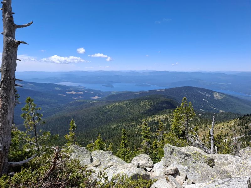
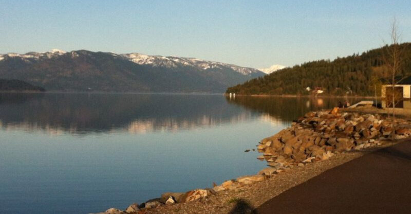
Water changes the whole picture up here. From about 7,300 feet on Mount Roothaan, Priest Lake spreads out nearly a mile below, a long ribbon of blue set deep in green timber.
Panoramic views run in every direction, taking in Priest Lake country and the ranges beyond it. Morning haze often softens the far edges, while afternoon light sharpens the shoreline into crisp curves and bays.
Wind moves constantly across the summit rocks, cool even in August.
Solitude is part of the appeal. Hikers frequently reach the top without passing another soul, and the silence at that height feels almost physical.
Plan to linger. Pull out a sandwich, find a wind-sheltered slab, and trace the lake’s islands and inlets with your eyes while your legs recover for the walk down.
Head back with enough daylight to handle the boulders and the rough road safely. Views like this one make the case that northern Idaho keeps some of its very best scenery for people willing to climb toward it.