This North Carolina Mountain Hike Has A Haunting Connection To A 1983 Plane Crash
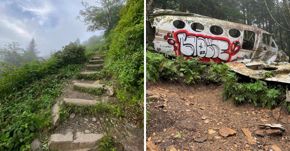
For decades, hikers climbed into a remote corner of western North Carolina looking for something far stranger than a mountain view.
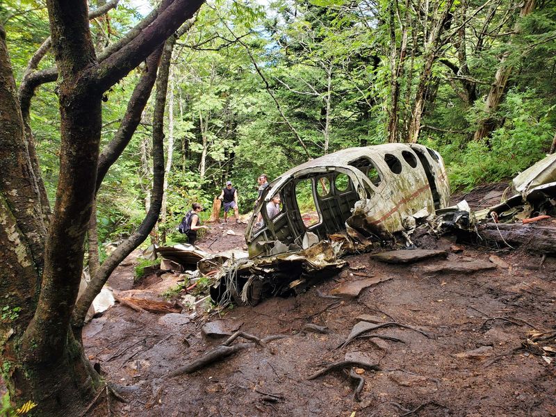
Pieces of a crashed airplane were still sitting in the forest.
The wreck dated to 1983, and over time, curiosity pulled more people off the established trail to see it for themselves. That eventually became a problem, with unofficial paths cutting through fragile habitat and raising safety concerns.
Then, in 2023, the aircraft debris was removed.
So no, there is no eerie wreck waiting in the trees anymore.
What remains is the story, the wild mountain scenery, and the slightly unsettling feeling of knowing what once sat hidden just beyond the trail.
Start At One Of The Highest Stops Along The Blue Ridge Parkway
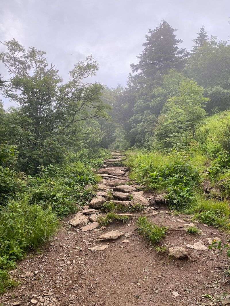
Waterrock Knob sits near Milepost 451.2 on the Blue Ridge Parkway, where the visitor center stands at roughly 5,820 feet and surrounding summits climb even higher.
From here, the established Waterrock Knob Trail heads uphill through high-elevation forest toward expansive views of several Appalachian mountain ranges.
The National Park Service describes this as one of the Parkway’s highest areas, with weather that can feel completely different from conditions in the valleys below.
Nearby Browning Knob Overlook sits at about 5,770 feet and looks toward the 6,260-foot Browning Knob, another prominent summit in the Plott Balsams.
The elevation makes layers useful even during warmer months, while sturdy footwear helps on the steeper portions of the established trail.
Before making the drive, check current Blue Ridge Parkway road conditions because ice, snow, storms, and maintenance can temporarily affect access.
Learn What Happened In The Mountains Here In 1983
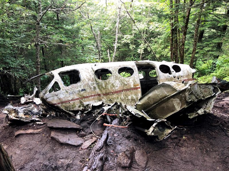
The quiet scenery carries a difficult history. In November 1983, a Cessna 414A crashed into mountainous terrain near Waterrock Knob at an elevation of roughly 6,000 feet, and both people aboard died.
The aircraft’s engines were recovered after the crash, but the remote terrain made a complete cleanup difficult. Its fuselage, wings, and other debris remained scattered on the mountainside for decades.
Over time, knowledge of the wreck spread well beyond the immediate area, especially as hiking websites and social media began directing more people toward it.
What had once been an obscure piece of mountain history gradually became an unofficial destination, creating a problem that the National Park Service eventually decided it could no longer leave unaddressed.
Understand Why The Plane Wreckage Is No Longer There
Anyone following older hiking posts may still expect to find pieces of the aircraft beneath the trees, but that information is outdated.
On June 27, 2023, National Park Service contractors used a helicopter to remove the remaining wreckage because of the site’s remote location.
The agency said increasing visitation had created both hiker-safety problems and serious resource damage.
People were reaching the wreck through unauthorized social trails, where hikers could become lost or injured while repeated foot traffic caused trampling, erosion, soil compaction, and vegetation loss.
The removal ended the decades-long presence of the visible wreckage, so visitors should not rely on older photographs or trail descriptions that portray twisted sections of fuselage and wings still scattered across the slope.
The mountain’s aviation history remains, but the physical attraction that once drew people off established routes is gone.
Stay On Established Trails To Protect A Remarkably Fragile Landscape
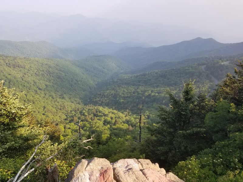
The strongest current guidance from the National Park Service is simple: do not leave established routes to search for the former crash site.
When the wreckage was removed, Blue Ridge Parkway officials specifically asked visitors not to go off trail because of both safety risks and environmental damage.
Waterrock Knob is one of only four high-elevation areas within the Parkway where rare and sensitive species are particularly concentrated.
Among them is the pinkshell azalea, a striking native shrub whose wild range is limited to the mountains of North Carolina.
That rarity gives every patch of high-elevation vegetation more significance than it might appear to have from the trail.
Staying on established paths, carrying out everything you bring, and resisting the temptation to follow faint side tracks are far better ways to respect both the landscape and the history associated with it.
Take In The Mountain Views From Browning Knob Overlook
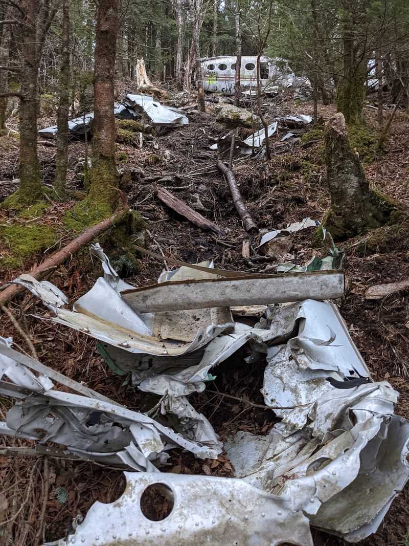
You do not need to search for a crash site to understand how rugged this terrain can be.
Browning Knob Overlook, located along the entrance road to the Waterrock Knob Visitor Center at Milepost 451.2, provides a clear view toward Browning Knob and the surrounding mountain country.
The National Park Service places the overlook at 5,770 feet, with Browning Knob itself rising to 6,260 feet. From this elevation, ridges overlap toward the horizon while clouds can move quickly across the higher peaks.
It is also an easier place to appreciate why mountain navigation demands respect, particularly when fog or low clouds settle over the Plott Balsams.
The overlook is frequently affected by winter closures caused by ice and snow, so current Parkway conditions should always be checked before a cold-season trip.
Hike The Established Waterrock Knob Trail Instead Of Following Old Crash-Site Directions
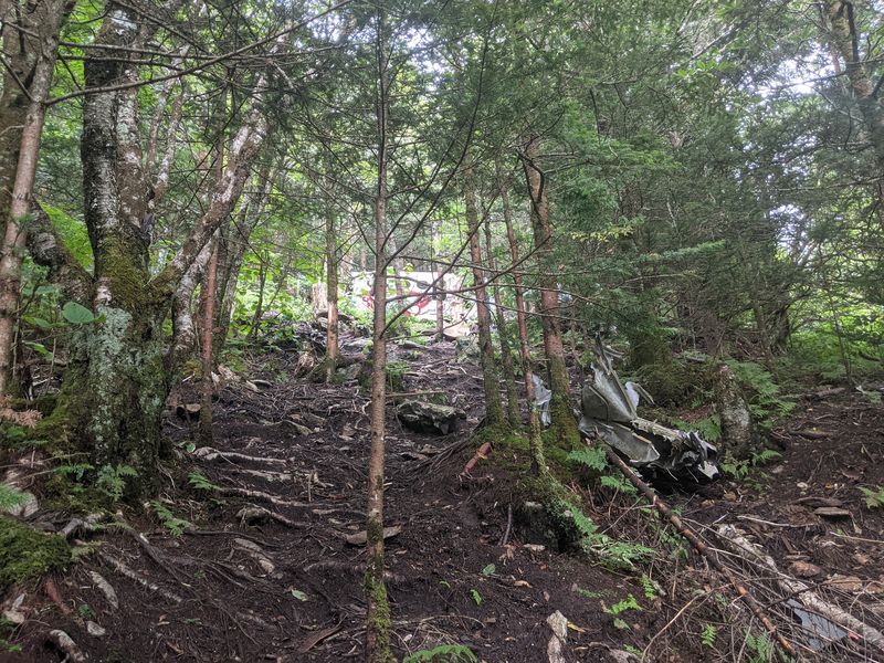
Older online guides often contain detailed instructions for leaving the Waterrock Knob route and following faint blazes or social trails toward the former plane wreck. Those directions should now be considered outdated.
The National Park Service removed the wreckage specifically because unauthorized access was putting hikers and sensitive resources at risk.
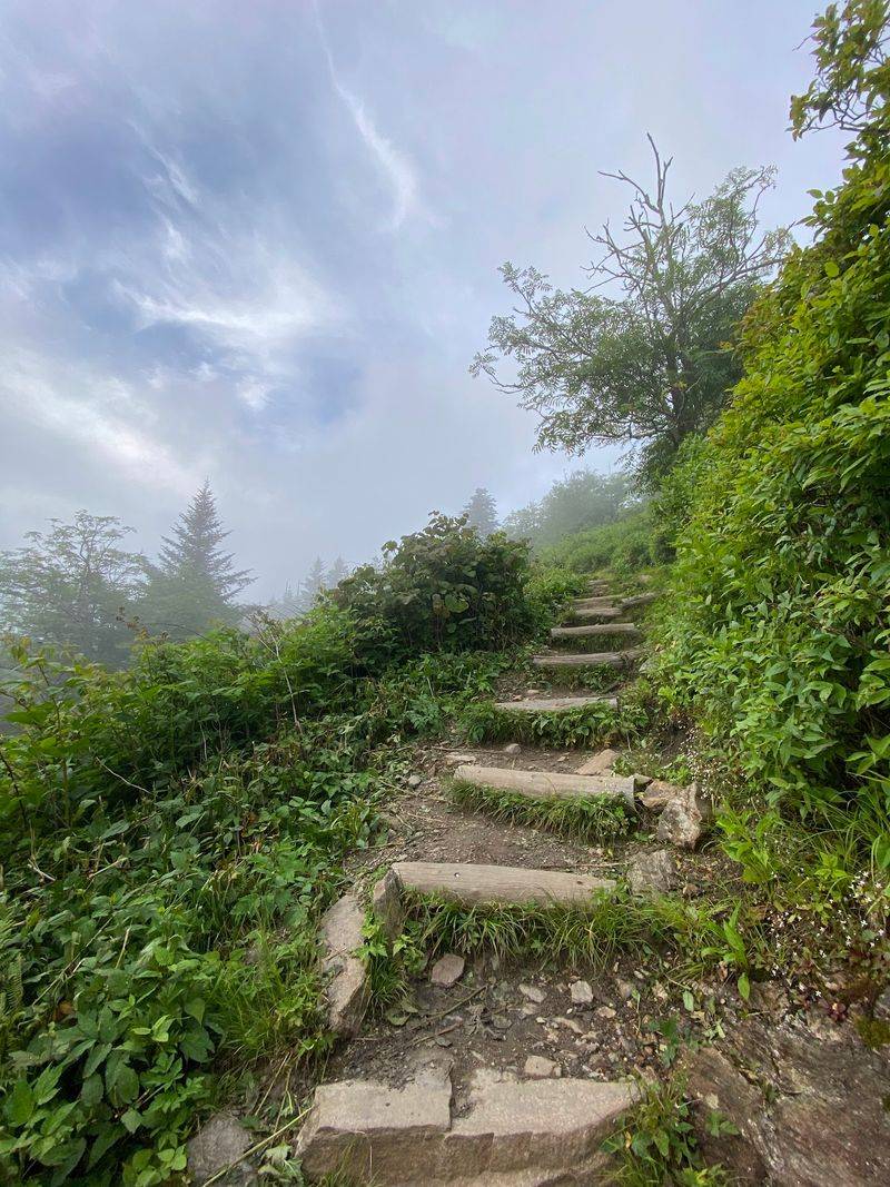
A better outing follows the established Waterrock Knob Trail from the visitor center toward the summit area.
NPS describes the route as an uphill mountain trek through terrain that showcases the area’s high-elevation landscape and broad views.
Conditions can change quickly this high in the mountains, so bring appropriate footwear, water, and an extra layer, and turn around if storms or poor visibility make continuing uncomfortable.
The combination of elevation, scenery, and history already gives the established trail plenty of character without venturing onto unofficial paths.
Remember The Human Story Without Turning The Site Into A Souvenir Hunt
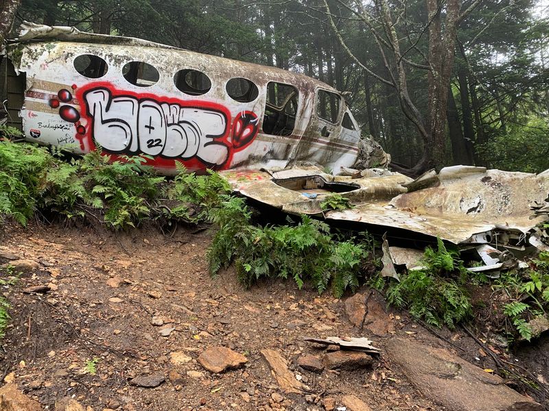
The 1983 crash was not simply an unusual collection of metal in the woods. Two people lost their lives there, which makes treating the history with restraint particularly important.
The National Park Service’s 2023 removal announcement confirmed both fatalities while focusing its action on visitor safety and protection of the surrounding environment.
There is no need to hunt for overlooked fragments, leave objects behind, mark trees, or create new paths toward the former wreckage area.
In fact, doing so would run directly against the agency’s request for visitors to stop damaging the site.
The more respectful approach is to learn the history, appreciate how isolated and rugged this section of the mountains is, and leave the landscape undisturbed.
Nearly four decades of wreckage on the slope made the crash unusually visible, but its removal allows the forest to recover while the story remains part of Waterrock Knob’s past.
Leave With A Different Perspective On This North Carolina Mountain
Waterrock Knob can still deliver the elements that made people curious about this corner of the mountains long before the plane wreck became an online destination.
The high-elevation trail climbs through a distinctive Appalachian landscape before opening toward Browning Knob and the surrounding ridges. Despite the Blue Ridge Parkway being relatively close, the broad mountain views and rugged terrain can make this stretch feel surprisingly remote.
The Cessna wreckage that once drew hikers into the forest is no longer there, and that changes how this story should be approached today.
Visitors can stay on the established trail while learning about the events that unfolded on the mountain in 1983.
The experience offers historical context without turning the area into a search for remaining debris, which the National Park Service ultimately chose not to preserve as part of its restoration efforts.
It makes for a quieter kind of mountain outing, one where the scenery and the history both deserve a little space.
Disclaimer: We did our best to make this article as accurate, current, and responsible as possible at the time of publication, using available historical records, National Park Service information, and other reliable sources.
Details involving trail access, road conditions, closures, weather, visitor center operations, park regulations, and official guidance can change without notice, especially in high-elevation areas along the Blue Ridge Parkway.
The remaining aircraft wreckage connected to the 1983 crash near Waterrock Knob was removed by the National Park Service in 2023, so older hiking guides, social media posts, photographs, and online directions that describe visiting the wreckage are now outdated.
Visitors should not leave established trails or attempt to locate the former crash site.
Doing so can create safety risks and may damage sensitive high-elevation habitat.
This article is intended to provide historical context and general travel information, not directions to an unofficial or closed destination.
Before visiting, check current National Park Service and Blue Ridge Parkway updates, follow all posted signs and regulations, stay on designated routes, prepare for rapidly changing mountain weather, and treat the history of the 1983 crash with appropriate respect.