This Northern Idaho Bike Trail Winds Through Mountains And Tall Pine Forests
I have ridden a lot of trails. Most of them demand something from you.
This one gives. The second you clip in and start rolling, the mountains take over and the world quiets down.
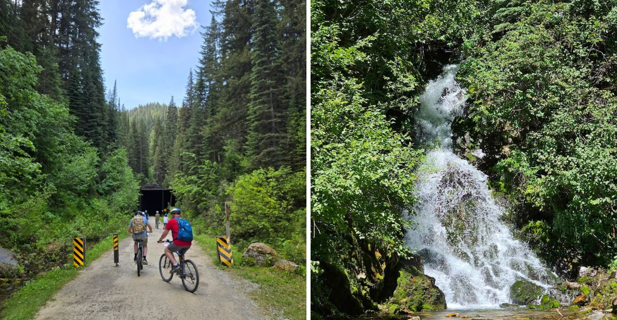
You are gliding through a cathedral of tall pines, crossing trestles suspended above valleys that seem to go on forever, and plunging into tunnels so dark you cannot see your own hands.
This is a 15-mile rail-to-trail experience carved through a remote corner of Idaho that most people drive past without a second thought.
Idaho does not advertise it loudly. It does not need to.
Word travels on its own among cyclists who know that some of the best rides hide in plain sight.
The Trail That Rewrote My Definition Of A Bike Ride
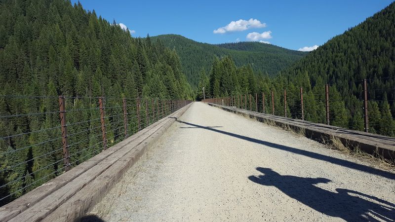
Not every bike ride earns a permanent spot in your memory. This one absolutely does.
The Route of the Hiawatha stretches 15 miles through some of the most dramatic mountain scenery you will ever pedal through. It follows the old Milwaukee Road railroad corridor, which was once called one of the most scenic stretches of railroad in the entire country.
That reputation still holds up today.
The trail drops nearly 1,000 feet over its length. The average grade sits between 1.6% and 2%, which means the downhill is steady but never scary.
You are not racing downhill out of control. You are cruising comfortably while the forest blurs past you in shades of deep green.
Families with young kids ride this trail. So do seasoned cyclists looking for something different.
The mix of ages and skill levels on any given day tells you everything about how accessible this trail really is. It rewards everyone equally.
That is rare for a mountain trail.
A Railroad With A Second Life Worth Celebrating
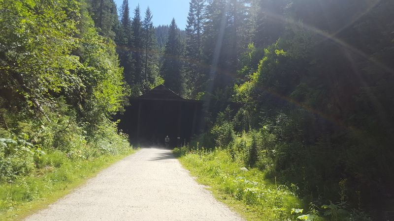
Some railroads retire quietly. The Milwaukee Road got a far more exciting second act.
Originally part of the Chicago, Milwaukee, St. Paul and Pacific Railroad, this corridor carried trains through the Bitterroot Mountains for decades. When rail service ended, the line sat dormant.
Then the Rails-to-Trails movement stepped in and transformed it into something extraordinary.
The Idaho section of the Route of the Hiawatha officially opened in May 1998. That makes it over 25 years old now, and it has only grown in popularity since.
Converting old rail lines into public trails is one of the smartest things communities can do with forgotten infrastructure.
The original railroad grade is actually what makes this trail so rideable. Engineers built the line with a gentle, consistent slope to keep heavy trains moving efficiently.
Cyclists today benefit from that same careful engineering every time they roll down the mountain. History has a funny way of being useful.
Seven Trestles With Incredible Mountain Views
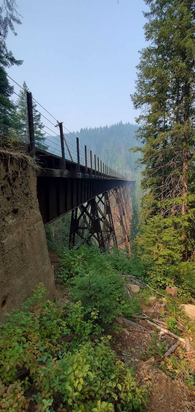
Heights are either your favorite thing or your least favorite thing. After crossing these trestles, you might change your mind either way.
The Route of the Hiawatha features seven sky-high trestles spanning deep mountain canyons. Some of these trestles reach heights of up to 230 feet above the canyon floor inside the Loop Creek drainage.
That is roughly equivalent to standing on top of a 23-story building while riding your bike.
The trestles are solid and well-maintained. They are not rickety old wooden structures that creak dramatically underfoot.
They are open-sided, which means the views are completely unobstructed. You can look straight down into the canyon while you ride across.
Most riders slow down on the trestles to soak in the scenery. A few stop entirely just to stand there and take it all in.
The combination of rushing water far below, towering pines on both canyon walls, and open sky above makes these crossings genuinely unforgettable. No photo fully captures what it feels like to stand on one of these structures in person.
Getting There Starts At Lookout Pass Ski Area
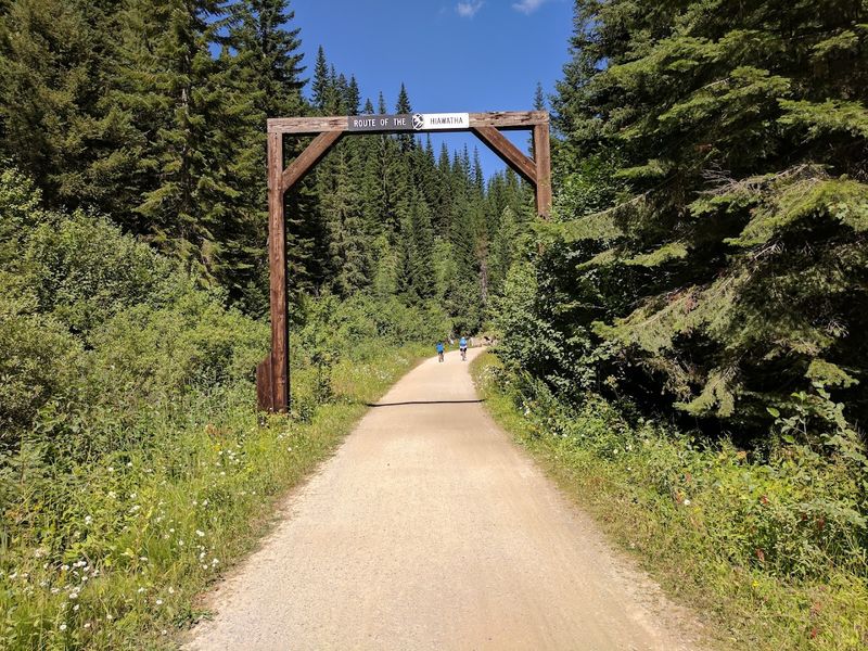
Finding the trailhead is actually one of the easier parts of this whole adventure. Everything runs through Lookout Pass Ski Area.
The ski area sits right off Interstate 90 near the Idaho and Montana border. During summer months, it transforms into the operations hub for the Route of the Hiawatha.
Trail passes, bike rentals, helmets, and shuttle tickets are all available right there at the base.
You do not need to bring your own bike to enjoy this trail. Riders can reserve rental bikes through the Route of the Hiawatha operation, with pickup and trail access coordinated through the Lookout Pass area.
Helmets are strongly recommended for all riders and required for riders under 18 on the Route of the Hiawatha.
The shuttle system is what makes the whole experience work so smoothly. Since the trail runs mostly downhill, you end up several miles away from your starting point.
Shuttle buses bring riders and their bikes back up to the top at the end of the ride. The whole operation is well-organized and clearly built for people who have never done anything like this before.
Dense Pine Forests That Feel Like A Different World
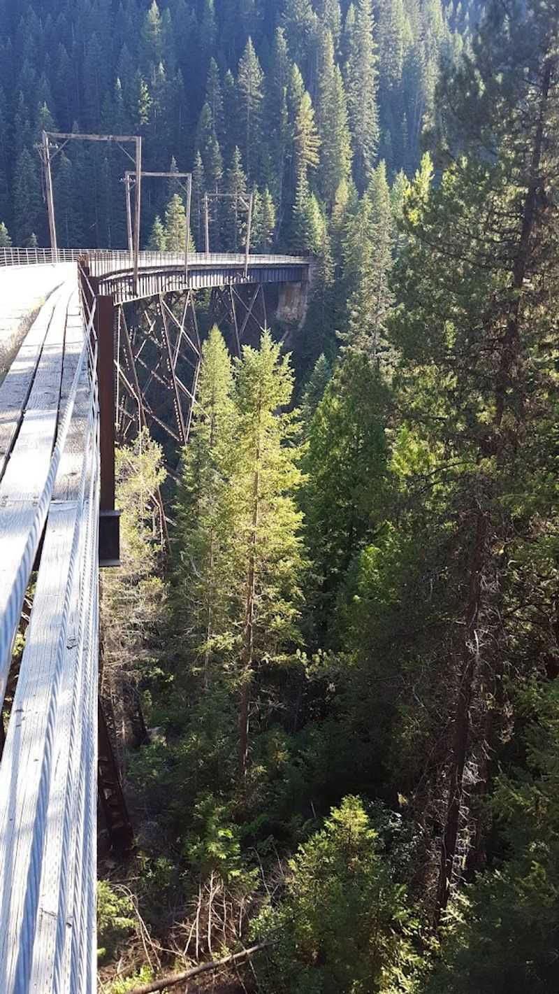
There is something deeply calming about riding through a forest so thick that the outside world simply disappears.
The Bitterroot Mountains in this area are lined with thick conifer forests and towering evergreens. Towering ponderosa pines, western red cedars, and Douglas firs line the trail for miles.
The canopy creates a natural tunnel of green that feels almost surreal on a sunny summer day.
Wildlife is active in these forests. Deer, birds, and small mammals are common sightings along the trail.
The relatively quiet nature of the trail, compared to a busy highway or noisy tourist attraction, means animals are not constantly startled away. Riders who move at a relaxed pace tend to spot the most.
The forest also provides welcome shade during warm summer rides. Temperatures inside the tree cover can feel noticeably cooler than open mountain terrain.
That natural air conditioning is a genuine bonus when you are pedaling through July or August. The combination of shade, scenery, and silence makes the forested sections of this trail feel like riding through a living postcard.
Ten Historic Tunnels That Tell A Real Story
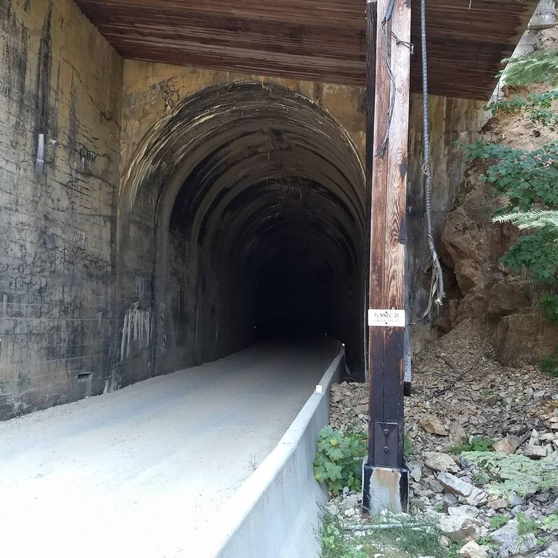
Ten tunnels on a single trail sounds like a lot. Once you start riding, it starts to feel like exactly the right amount.
The Route of the Hiawatha passes through 10 historic train tunnels that were originally bored through solid mountain rock for the Milwaukee Road railroad. Riders actually bike through nine of the ten tunnels along the route.
Each one has its own character, length, and atmosphere.
Shorter tunnels give you just enough time to appreciate the cool darkness before sunlight returns. Longer tunnels require real commitment and a working bike light.
The stone and concrete portals at the entrances are beautifully preserved, framing each tunnel mouth like a piece of industrial architecture that has aged remarkably well.
The tunnels were engineered in the early 20th century using techniques that were cutting-edge at the time. Drilling through mountain rock without modern equipment was an enormous undertaking.
Riding through these structures today is a quiet reminder of how much physical effort went into building the original railroad corridor. History feels very close in these dark, cool passages.
That connection to the past adds a layer to the ride that pure scenery alone cannot provide.
When To Go And What To Expect Each Season
Timing a trip to this trail correctly makes a significant difference in the experience you walk away with.
The Route of the Hiawatha usually operates from late May through mid-September, depending on weather and trail conditions. That gives you roughly four months of riding season each year.
The trail sits at elevation and the mountain winters here are serious, which is why the season window is relatively tight.
Early season riding in May and June can bring cooler temperatures and occasional wet conditions. The forests are at their most vivid green during these months, and crowds are typically lighter than peak summer.
July and August bring warmer weather, longer days, and the highest visitor numbers. Weekdays in July are busy.
Weekends are busier.
September is arguably the best month to ride here. Temperatures are comfortable, the deciduous trees along the trail begin to show early fall color, and the summer crowds have thinned out considerably.
The light in September has a quality that photographers specifically seek out. If your schedule allows flexibility, aim for a weekday in early September.
The trail feels almost entirely different when you have stretches of it completely to yourself.
The Rushing Rivers And Creeks Running Below
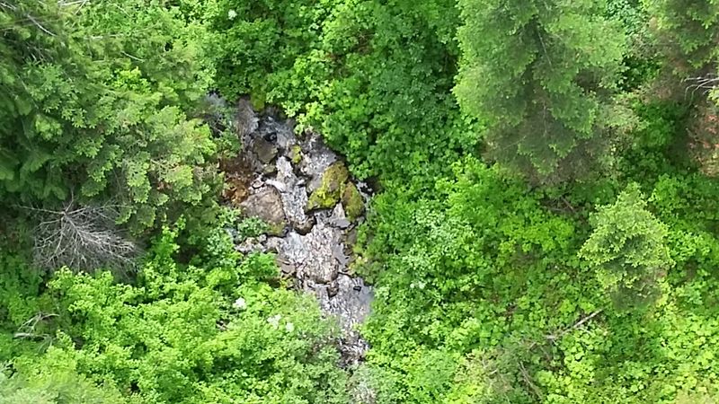
Water has a way of making everything feel more alive. This trail has plenty of it running alongside and beneath you.
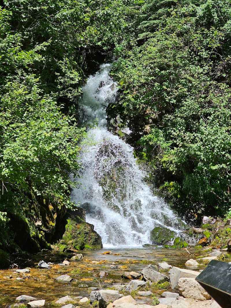
The Bitterroot Mountain watershed feeds numerous creeks and small rivers that flow through the canyons the trail crosses. The sound of rushing water accompanies much of the ride, particularly in the canyon sections near the trestles.
That constant background noise of moving water adds a sensory layer to the experience that goes beyond just the visual scenery.
Loop Creek runs through the most dramatic canyon section of the trail, directly below some of the highest trestles. Standing on a trestle and looking down at the white water moving through the rocks far below gives you an immediate sense of just how deep these canyons actually are.
The scale is genuinely surprising the first time you see it.
Spring and early summer bring the highest water levels as snowmelt feeds the creeks from above. By late summer the flow decreases, but the water never disappears entirely.
The creeks stay cold and clear throughout the season. The combination of cold mountain water, dark forest, and rugged canyon walls creates a landscape that feels completely removed from everyday life.
Why This Trail Earned The Crown Jewel Title
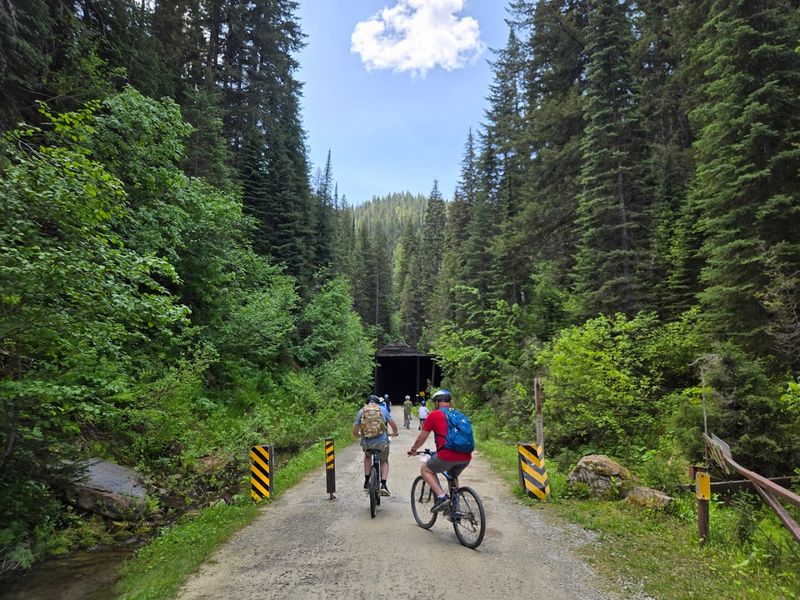
Not many trails pick up a nickname like Crown Jewel of Rail-to-Trails and actually live up to it. This one does.
The combination of elements on this trail is genuinely unusual. Most rail trails offer pleasant scenery and a smooth surface.
The Route of the Hiawatha delivers all of that plus 10 historic tunnels, 7 dramatic trestles, nearly 1,000 feet of elevation drop, and a mountain setting that would be impressive even without the engineering highlights.
The trail is located at coordinates 47.367038, -115.667582, near the Idaho and Montana border along Interstate 90. That location puts it within a reasonable drive of several major Pacific Northwest cities, making it accessible for a weekend trip without requiring a multi-day expedition.
The Rails-to-Trails Conservancy and similar organizations have converted hundreds of old rail corridors across the country into public trails. Very few of those conversions resulted in something as consistently spectacular as this one.
The original railroad engineers chose this route for its engineering logic, but the scenery they passed through was extraordinary. Cyclists today are the direct beneficiaries of decisions made over a century ago.
That is the kind of history worth riding through.