This Tiny Georgia Town Has A Line Through Downtown Where You Can Stand In Two States At Once
Most borders come with fences, guards, or at least a sign asking for your passport. This one comes with a simple line and a lot of smiling tourists.
Picture it. One foot rests in Georgia.
The other sits in a whole different state. Nobody checks your ID.
Nobody asks you to pick a side. You just stand there, grinning, while a friend snaps the photo.
It sounds like a small thing. Somehow it never feels small.
Kids hop back and forth like it is a game. Grown adults do the exact same thing, only with more photos.
The line is only the start. The downtown around it is compact, friendly, and easy to wander.
Local shops and cozy spots to eat make the stroll worth stretching out. Plenty of small towns in Georgia have charm.
This one also has a party trick.
A Blue Line With A Big Job
My shoes found the best geography lesson in town before I found lunch. A blue stripe marks where Georgia meets Tennessee.
Paint may seem like a simple way to show a state boundary. Here, it turns an invisible border into something everyone can see.
I stood beside the stripe and checked the ground before moving closer. With one foot on either side, I could stand in two states.
Children may want to hop across again and again. Grown-ups often pause too, especially when someone offers to take a photo.
Keep your eyes on the sidewalk while you look for the line. Streets and driveways still serve everyday traffic on both sides.
For a clear picture, have your photographer stand back a few steps. Try to include the stripe and both sides of downtown.
The paint helps explain the border, but it does not create it. The state boundary would remain even if the pavement changed.
That detail made me look around with fresh interest. Ordinary storefronts suddenly seemed part of a giant outdoor map.
You do not need a ticket to enjoy this small surprise. Give yourself a few minutes to notice it properly.
Lunch could wait while I took one more look at my feet. The line belongs to downtown McCaysville, Georgia.
Two Towns Sharing One Downtown
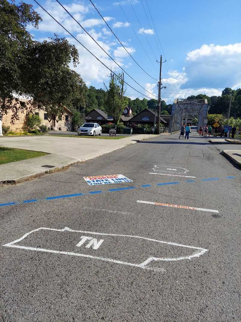
The border plays a quiet trick on first-time visitors. Its two neighboring towns look like one connected downtown.
Georgia sits on one side, and Copperhill, Tennessee, sits on the other. Shops and streets continue across the boundary.
I expected the crossing to feel grander somehow. Instead, the change was easy to miss without watching the pavement.
That easy connection is what makes the place fun to explore. You can notice state details while following an ordinary sidewalk.
Start with a slow walk rather than a fast drive. Small changes are much easier to spot when you are on foot.
A photo of the boundary makes a handy memory. It also helps younger visitors understand how two communities can share one center.
There is no need to turn the crossing into a race. Let people pass while you stop for pictures or read nearby signs.
Need a simple plan for your visit? Pick one side for lunch, then walk across to see the other.
Keep track of where you parked before browsing. Connected streets can look familiar when you return with full hands.
By the end, the border felt less like a wall. It felt like an invitation to pay closer attention.
One River With Two Names
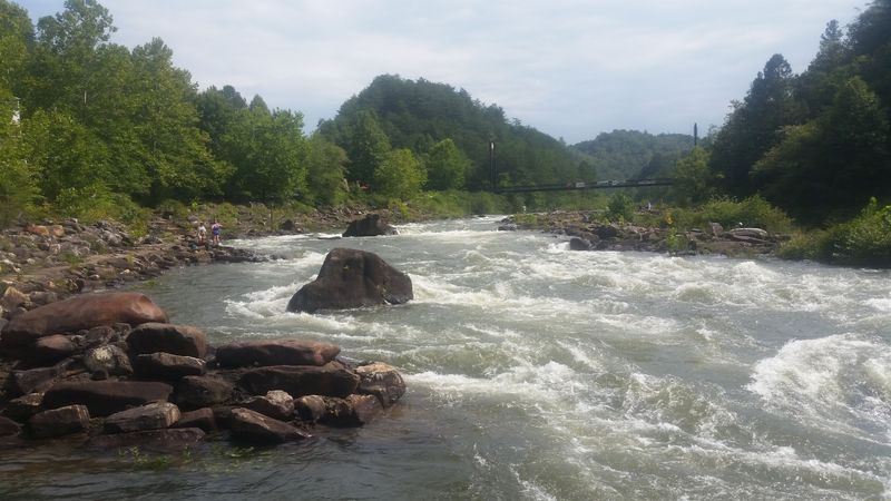
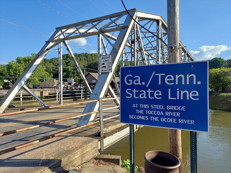
The river pulls off a neat name change without changing its course. In Georgia, the water is called the Toccoa River.
After crossing into Tennessee, that same water is called the Ocoee River. It is an easy fact to remember here.
I like watching water when a town gets busy. Its steady movement gives the border another shape to think about.
Look for a safe public spot with a clear view. You can enjoy the scene without stepping close to the edge.
Use the two river names as a quick map lesson. Find Georgia and Tennessee first, then trace the water between them.
River views can also make a pleasant pause after lunch. Sit where seating is available and let others share the space.
Conditions near moving water can change, so stay aware of your surroundings. Keep children beside you when viewing the river.
The name change adds depth to the blue downtown stripe. Both point to the same boundary in different ways.
Before leaving, look upstream and downstream for a moment. One flowing river carries two familiar names through this mountain area.
A Street That Changes Its Name
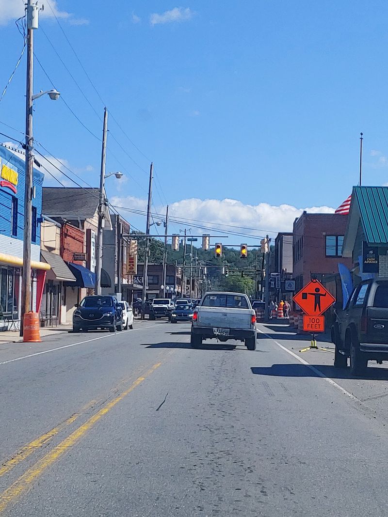
Street signs offer a second chance to catch the border. Toccoa Avenue becomes Ocoee Street across the state line.
That switch matches the river’s change from Toccoa to Ocoee. Together, the names make local geography easier to follow.
I noticed how much a simple sign can explain. A familiar-looking road suddenly tells you which state you are in.
Check the street names as you walk through downtown. It is a small puzzle that takes little time to solve.
Traveling with children? Ask them to find the name change before pointing it out.
The challenge works best when everyone stays on the sidewalk. Watch for traffic whenever you cross a street.
Street names also help when you need to find your way back. Note one nearby sign or landmark before exploring farther.
A photo of each name can tell the story without a long caption. Put the pictures together later and compare them.
The signs are ordinary tools for drivers and walkers. Here, they also show how closely the two communities fit together.
Before heading on, take one last look at the road. A few steps can change its name without changing your route.
A Train Ride Into The Middle Of It All
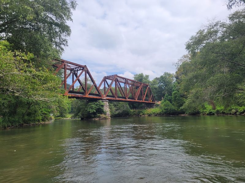
A train can turn the border visit into part of a bigger outing. The Blue Ridge Scenic Railway brings passengers downtown.
That arrival gives visitors a chance to explore on foot. The painted boundary becomes one stop during a longer day.
I would check the current train schedule before making lunch plans. Departure times and available trips can change by date.
Allow time to leave the train area and get your bearings. A calm start makes the short downtown walk more enjoyable.
Families can make a simple scavenger hunt from the visit. Look for the blue line, river, bridge, and changing street name.
Keep track of your return time if you came by rail. Set a reminder before the shops or riverside views distract you.
The train also gives everyone a shared starting point. Agree where to meet if your group wants to browse separately.
Pack lightly enough to walk comfortably between stops. You may want free hands for a snack or a photograph.
Rail travel and a two-state walk make an unusual pair. One carries you into town; the other needs only your feet.
A Bridge That Connects The Story
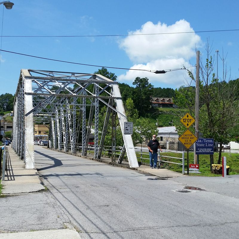
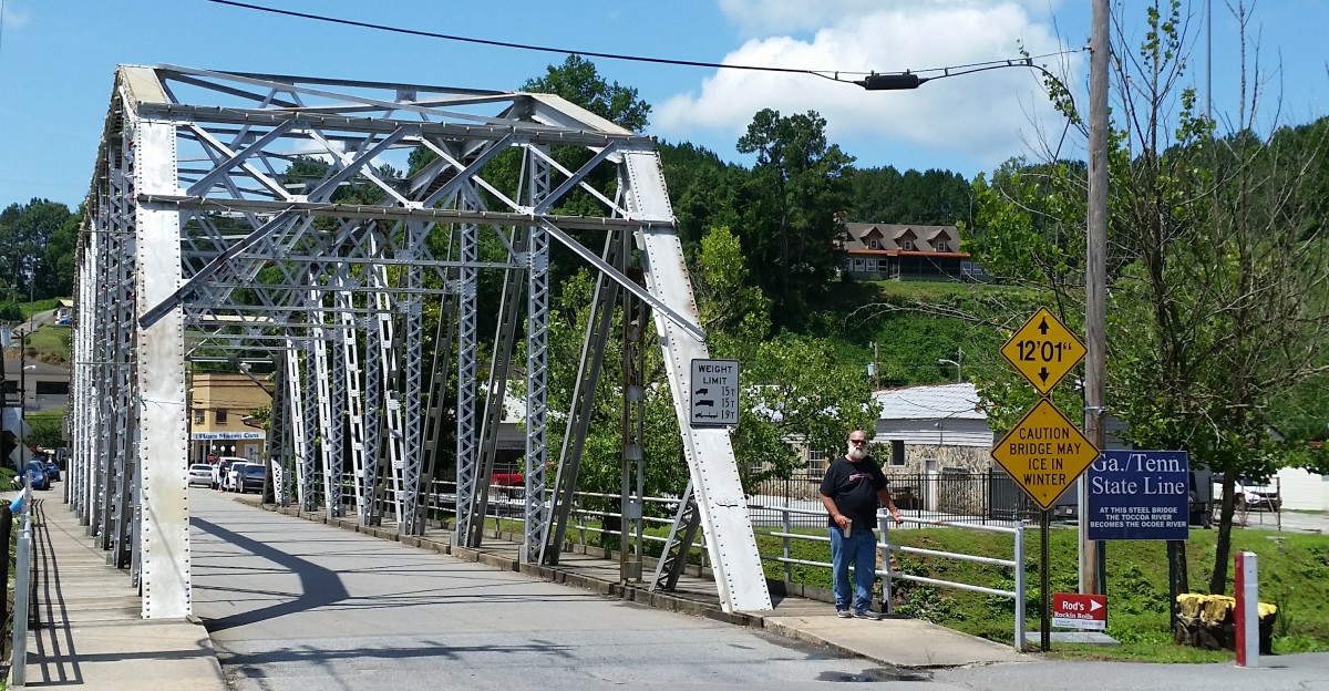
Old steel gives this river crossing a look no painted stripe can match. The current steel bridge was built in 1921 and moved to its present location in 1936.
Cars and pedestrians use the bridge to cross between the neighboring downtown areas. Its sturdy frame also makes a striking photo.
From a safe viewing spot, notice the shape of the steel. Then look down toward the water flowing beneath it.
I found that the bridge made the map feel real. Streets, river, and state boundary all meet within a short walk.
Pedestrians should follow posted guidance and use the space provided for walking. Leave room for others coming from either direction.
For pictures, stop only where it is safe and allowed. A clear view from nearby can show more of the bridge.
The bridge’s long history offers an easy opening for a local history chat. Imagine how many ordinary trips this crossing has supported.
No long lesson is needed to appreciate its age. The steel structure tells part of the story just by standing there.
If your group has different walking speeds, choose a meeting point nearby. That keeps everyone comfortable while exploring the crossing.
Afterward, glance back before continuing through downtown. The bridge looks different when the river and buildings share the frame.
Shops And Lunch Beside The Water
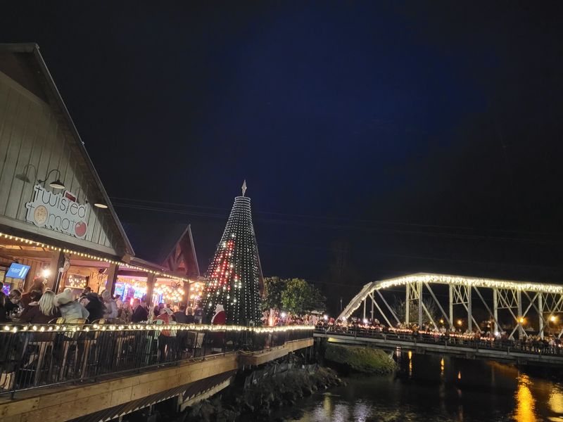
My lunch search finally had some competition. The Riverwalk Shops offered places to browse beside the water.
Boutiques and galleries give the area more than a quick photo stop. Nearby riverside dining can round out a visit.
Food tastes better when you are not watching the clock. Check menus and hours before choosing where to eat.
I would save a little time for the shops afterward. Browsing gives you a different view of the downtown area.
Window displays can catch your attention without a plan. Step inside when something interests you and follow each shop’s posted hours.
For a relaxed meal, ask about available seating with a river view. Seating and menus can vary from place to place.
Visitors arriving with children may appreciate a simple break between stops. Lunch gives everyone time to reset before more walking.
Keep the walkway clear when pausing for pictures. Other people are there to shop, eat, and enjoy the river too.
The shops make the state-line trip feel like a full afternoon. You can mix a little browsing with food and fresh air.
By the time I sat down, the border had already sparked plenty of conversation. That is a fine companion for lunch.
River Adventures Beyond The Sidewalk
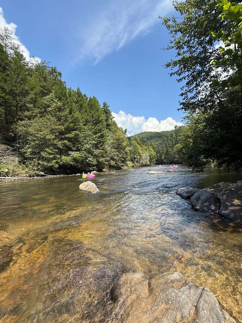
The river is more than a backdrop for border photos. It also draws visitors interested in time on the water.
Rafting, tubing, kayaking, and fly fishing are activities associated with this area. Each offers a different way to enjoy the river.
I would choose the outing before packing for the day. A fishing trip calls for different gear than a float.
Check current conditions and operator details before entering the water. River flows, access points, and schedules may change.
Wear a properly fitted life jacket for paddling or tubing. Follow the guidance provided for the activity you choose.
Fishing takes planning too, especially across a state boundary. Check the current rules and license requirements for your exact location.
Someone in the group prefer dry shoes? A riverside walk still lets them enjoy the water.
Bring water, sun protection, and clothing suited to the weather. Keep personal items secure when spending time near the river.
The downtown stripe makes geography playful, but the river asks for care. Give moving water your full attention.
After an outing, a meal can bring everyone together again. Comparing favorite moments is easy when the river runs nearby.
An Easy Starting Point For Your Visit
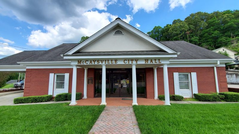
A good day starts with knowing where to begin. The visitor center is at 53 East Market Street, Georgia 30555.
Use it as a point to check while planning your downtown walk. Confirm current hours before relying on a visit inside.
I like choosing one clear starting point in an unfamiliar town. It makes lunch plans and meeting up much simpler.
From there, build a short route around your interests. The line, street names, bridge, and river each tell another part.
Comfortable shoes matter more than a packed schedule. A slow pace helps you notice details that a quick drive would miss.
Check the weather before setting out. River views and outdoor photos are easier to enjoy when you dress for conditions.
Bring your phone or camera, but look up between pictures. Storefronts, signs, and the water deserve more than a screen.
If you are traveling with others, choose a meeting spot first. That simple step leaves everyone free to explore comfortably.
Leave room in the plan for lunch or a snack. Hunger sent me looking; geography gave me a reason to linger.
The best souvenir may be a photo of your feet across the line. Better still is knowing what that line means.