Utah Has A Scenic Drive That Connects All Five National Parks And Every Mile Of It Feels Like Another Planet Entirely
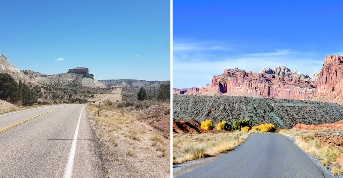
Distinct worlds link together along one single strip of asphalt. This Utah highway takes you through red rocks and deep canyons.
Every turn reveals a landscape that looks like another distant planet. I feel so small when standing next to these ancient cliffs.
Can you drive across the entire state in just one weekend? Natural arches frame the blue sky in a very dramatic way.
The earth glows with a fire that never seems to fade. You will see things that defy every sense of normal logic.
This journey is a rite of passage for every true explorer. Start your engine and prepare for a very wild ride.
The Road Itself
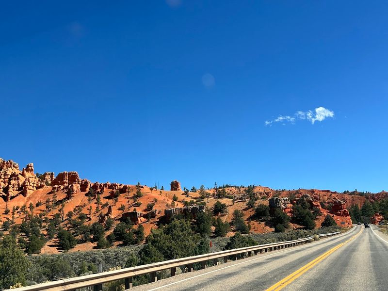
Highway 12 Scenic Byway runs for 124 miles through southern Utah. It connects Panguitch near US-89 to Torrey near Capitol Reef National Park.
This route was designated an All-American Road in 2002. That is the highest honor the federal government gives to a scenic byway. Not every road earns that title, and Highway 12 Scenic Byway wears it well.
The road climbs over the Aquarius Plateau at nearly 9,600 feet. It dips into canyon bottoms and rises back up without warning. You will grip the wheel tighter in some spots, and that is perfectly fine.
Narrow ridgelines called hogsbacks stretch along certain sections. The road runs right along the spine of these formations.
Drop-offs fall away on both sides, and the views stretch for dozens of miles.
I started my drive early in the morning, when the light was still soft and golden. The colors shifted every few minutes as the sun moved higher. No filter on any camera could fully capture what I saw with my own eyes.
Bryce Canyon Country
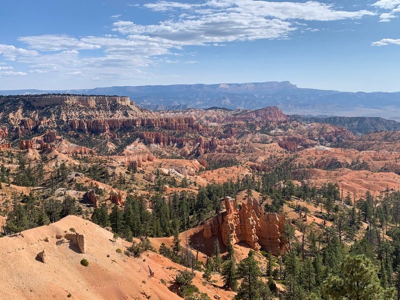
Bryce Canyon National Park sits near the western end of this route. It is one of the five national parks that Highway 12 Scenic Byway connects across southern Utah.
The park is famous for its thousands of orange and red hoodoos.
Hoodoos are tall, thin spires of rock carved by frost and rain over millions of years. Standing at Bryce Point and looking down into the amphitheater below is genuinely breathtaking.
The colors shift from deep red to soft pink depending on the time of day.
I arrived just before sunrise, which I strongly recommend. The hoodoos seem to glow from the inside when that early light hits them. It is the kind of moment that makes you forget you were tired from waking up before dawn.
Bryce Canyon sits at high elevation, so temperatures can be cool even in summer. Bring an extra layer if you plan to hike the Navajo Loop or Queen’s Garden Trail. Both trails drop you right into the hoodoo formations, which feels surreal.
Grand Staircase Region
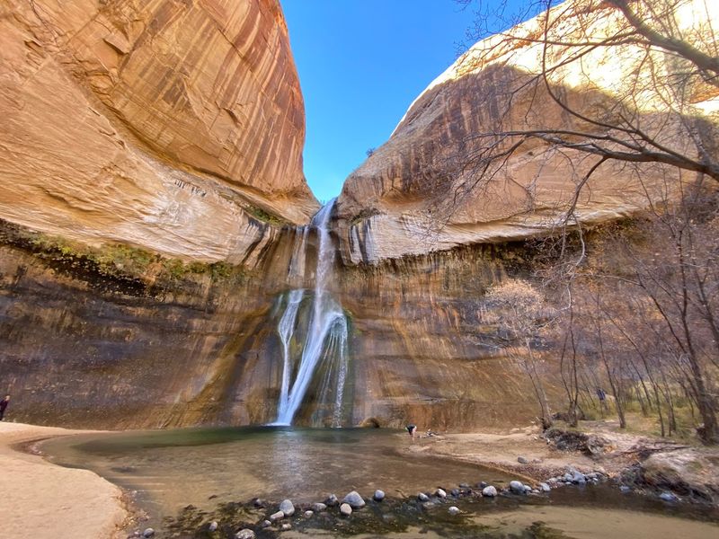
Grand Staircase-Escalante National Monument covers nearly 1.9 million acres in Utah. It is one of the largest national monuments in the country.
Highway 12 passes directly through part of this remarkable landscape.
The monument gets its name from a series of ascending rock layers. These layers step upward from the Grand Canyon in Arizona all the way north through Utah.
Each layer represents a different geological period, some hundreds of millions of years old.
I pulled over at several unmarked spots just to stare at the rock walls. The colors ranged from deep burgundy to pale cream to vivid orange. No two sections looked alike, even within the same short stretch of road.
The town of Escalante sits right along the byway inside this region. It is a small town with a big personality and serves as a useful base for hikers.
Several trailheads lead into the backcountry from here, including routes to slot canyons and natural arches.
Calf Creek Recreation Area is one highlight not to miss near Escalante. The trail leads through a narrow canyon to a 126-foot waterfall.
Seeing that waterfall in the middle of such dry desert terrain feels wonderfully unexpected.
Escalante Petrified Forest
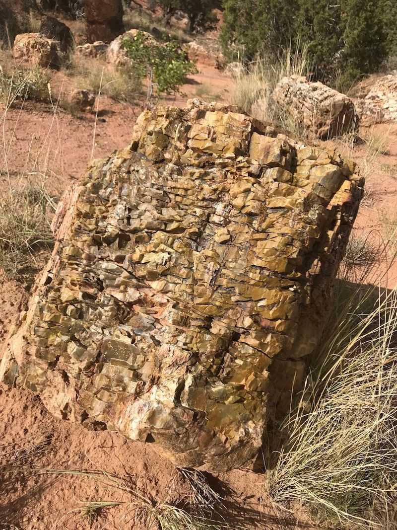
Just outside the town of Escalante sits Escalante Petrified Forest State Park.
It is a small but fascinating stop that many drivers miss entirely. That would be a real shame, because what is preserved here is extraordinary.
The park protects ancient logs that turned to colorful stone over 150 million years ago. These logs were once massive trees that fell and were buried under sediment.
Minerals slowly replaced the wood, creating stone replicas in vivid purples, reds, and yellows.
Walking among the petrified logs feels like visiting a natural museum with no roof. The colors in the stone are almost too bright to believe. I kept bending down to look closer, convinced my eyes were playing tricks.
Wide Hollow Reservoir sits right next to the park and adds a surprising splash of blue to the landscape. You can rent paddleboards or kayaks during warmer months.
The contrast between the red desert and the calm blue water is visually striking.
The park at 710 Reservoir Rd also has a campground with views over the reservoir. Spending a night here puts you in a quiet spot far from crowds.
Waking up to that desert stillness before getting back on the byway is a reset your brain will thank you for.
Anasazi State Museum
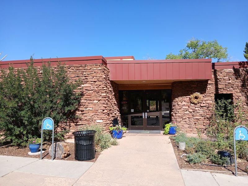
In the small town of Boulder sits one of the most significant archaeological sites in the American West.
Anasazi State Park Museum preserves the remains of a village occupied around 1050 to 1200 CE. The people who lived here were ancestors of today’s Pueblo peoples.
The museum holds over 40,000 artifacts recovered from the site. These include pottery, tools, and items used in daily life centuries ago.
Seeing these objects up close adds real human weight to what otherwise might feel like abstract history.
An outdoor replica of an ancient dwelling has been constructed on the grounds. Walking through it gives a sense of how compact and clever these homes were.
The builders used local stone and understood the landscape in ways that still impress archaeologists today.
Boulder itself is one of the most remote towns in the continental United States. It was the last community in the country to receive mail by mule, which continued until 1940.
That fact alone tells you how isolated and untouched this corner of Utah remains. I spent about two hours at the museum and wished I had more time.
Hogsback Ridge Drive
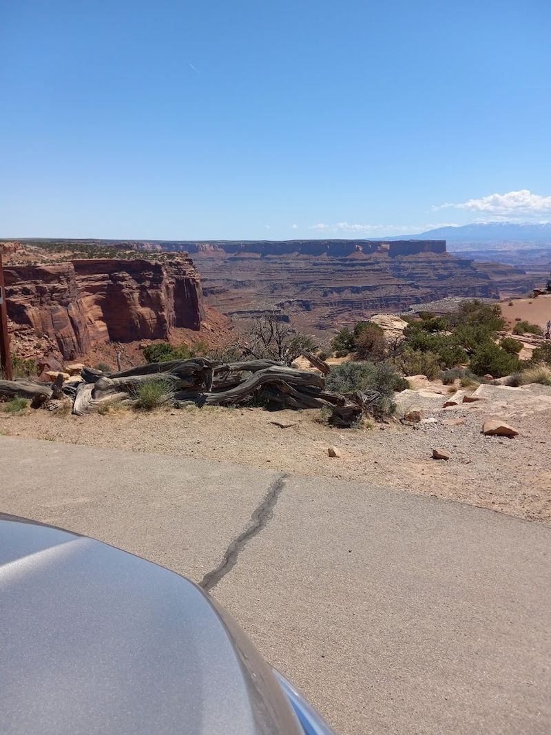
Between Escalante and Boulder lies one of the most dramatic stretches of road I have ever driven.
The hogsback section of Highway 12 Scenic Byway runs along a narrow rock spine. The road is paved but feels almost impossibly perched between two worlds.
On both sides, the land drops sharply into canyon floors far below. There are no guardrails in many sections. The road is just wide enough for two cars to pass carefully.
I slowed to about 20 miles per hour and kept both hands firmly on the wheel. Even so, I could not stop glancing at the views on either side.
The canyons below glowed in shades of orange and rust, and the sky above was an almost painful shade of blue.
This section is not recommended for people with a strong fear of heights. But if you can manage it, the reward is extraordinary.
There is simply no other road in Utah that gives you this particular feeling of being suspended above an ancient landscape.
Pullouts exist at certain points along the ridge where you can stop safely. Getting out and standing at the edge is a completely different experience from viewing it through glass.
Capitol Reef Access
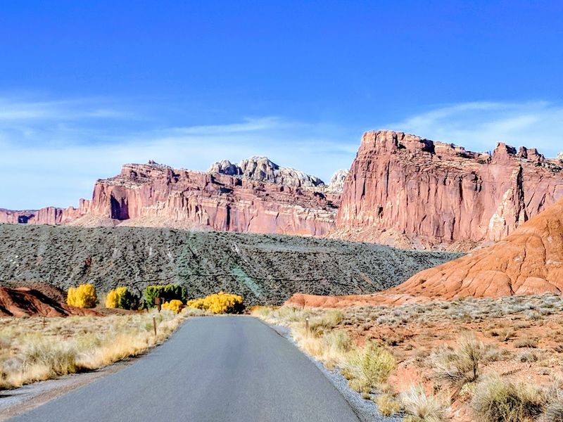
At the eastern end of the byway, the landscape shifts again toward Capitol Reef National Park.
This park protects a 100-mile long wrinkle in the earth called the Waterpocket Fold. It is one of the most dramatic geological features in North America.
The fold was created about 65 million years ago when layers of rock were pushed upward and bent. What you see today is the exposed edge of that ancient upheaval.
The result is a wall of colorful, tilted rock that stretches across the Utah horizon.
Highway 12 connects to State Route 24, which cuts through the heart of Capitol Reef. Driving through the canyon here feels completely different from any earlier section of the trip.
The rock walls close in, and the scale of everything around you becomes almost overwhelming.
I ended my drive through this area just as the afternoon light turned the cliffs deep amber. It was a fitting close to a stretch of road that had already delivered more beauty than I knew what to do with.
Best Time To Visit
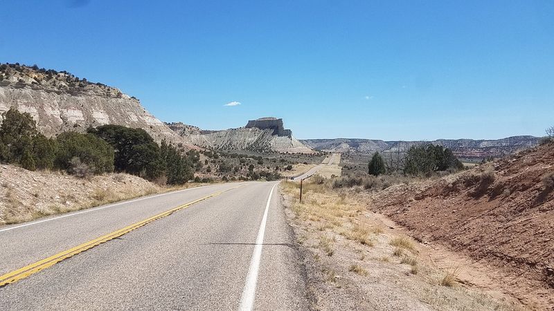
Spring and fall are the most popular seasons to drive Highway 12 Scenic Byway. In spring, wildflowers bloom along the roadside and the air is cool and clear.
Fall brings golden aspens at higher elevations and softer light that photographers love.
Summer draws the largest crowds, especially near Bryce Canyon. Temperatures in the canyon bottoms can climb above 90 degrees Fahrenheit. Higher sections of the byway stay cooler, but expect more traffic at popular overlooks.
Winter offers a completely different experience on the byway. Snow covers the higher elevations and the hoodoos at Bryce Canyon look stunning dusted in white.
However, some secondary roads and facilities may close, so check conditions before you go.
The byway itself stays open year-round, but mountain weather in Utah can change quickly. Always carry water, snacks, and an extra layer regardless of the season.
I visited in early October and found it nearly perfect. The crowds had thinned, the light was golden all day, and the air smelled like pine and dry earth.
If you can only pick one time to make this trip, fall is the answer without question.