Visitors Walk Among Thousands Of Petroglyphs Carved Along This Idaho Canyon Rim
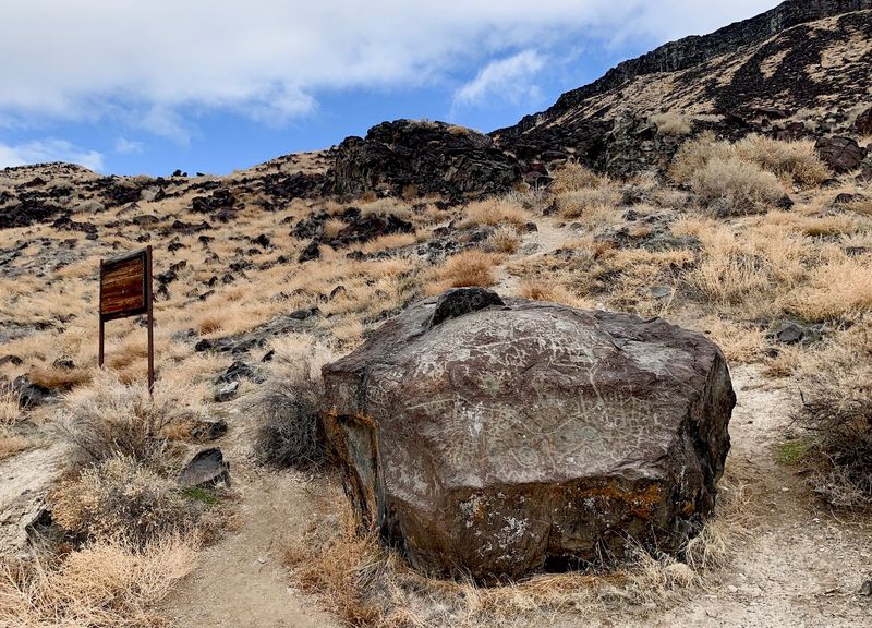
A boulder beside a quiet rural road in southwest Idaho may hold one of the oldest maps of the Snake River country. The lines carved into its dark basalt are believed to trace rivers and landmarks, drawn by Northern Shoshone people long before the 1800s.
Then the story gets stranger, because in 1924 state lawmakers floated a plan to haul the rock to Boise, possibly in pieces. The plan fell apart, but damage turned up on the stone soon after.
I like how this spot asks for so little and gives back so much. There’s no visitor center or ticket booth, and the Snake River slides by right across the road.
I can’t imagine a better way to test your sense of direction. Could you read a map carved centuries before anyone drew Idaho’s borders?
A Roadside Boulder With A Very Old Story To Tell
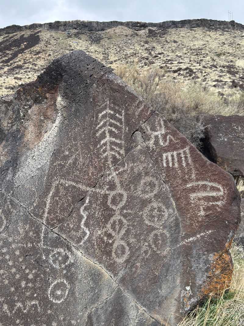
Most maps end up in glove boxes, but this one has stayed put for centuries. Map Rock Petroglyphs Historic District sits along Map Rock Road near Melba, in the Snake River Canyon of southwest Idaho.
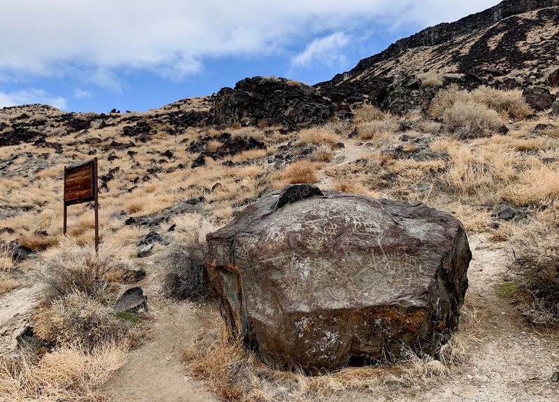
The star of the show is a single large basalt boulder. Its surface is covered in carved lines and symbols that people have studied for generations.
Getting close is refreshingly simple. The main rock sits right beside the road, so there’s no long trail or steep climb between you and the carvings.
That ease is a big part of the charm. You can pull over, step out, and stand face to face with ancient rock art within a minute or two.
Don’t expect a polished park, though. The site is rustic, open, and mostly left as it is, with sagebrush slopes rising behind the boulder.
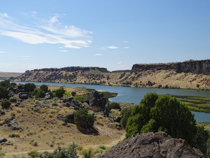
Across the road, the Snake River keeps rolling through the canyon. The setting pairs deep human history with a working river landscape, all in one quick stop.
Treasure Valley folks can reach it in under an hour. That makes it a tidy add-on to any afternoon drive south of Nampa.
Lines That May Trace The Snake River Valley
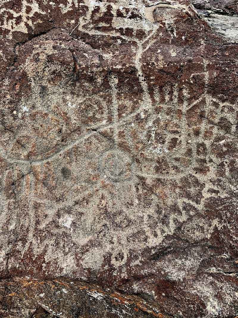
Why call it Map Rock at all? The carvings are believed to represent the Snake River Valley, making the boulder a kind of ancient chart of the region.
Look closely and you’ll spot winding grooves alongside other symbols. Many people read those curving lines as rivers and the marks around them as landmarks.
Nobody can confirm every meaning with certainty. That mystery is half the fun, since each viewer ends up playing detective with the stone.
It’s a little humbling, too. Modern travelers lean on phone screens, while someone long ago pressed geography into solid rock.
The idea of a carved map also changes how you see the canyon around you. Suddenly the river below feels connected to the lines in front of your nose.
Try tracing the main grooves with your eyes, not your fingers. Then turn and look across the road at the real Snake River flowing past.
Plenty of folks leave wishing they knew more about each symbol. Honestly, that lingering question feels like the right souvenir from a place this old.
The Northern Shoshone Hands Behind The Carvings
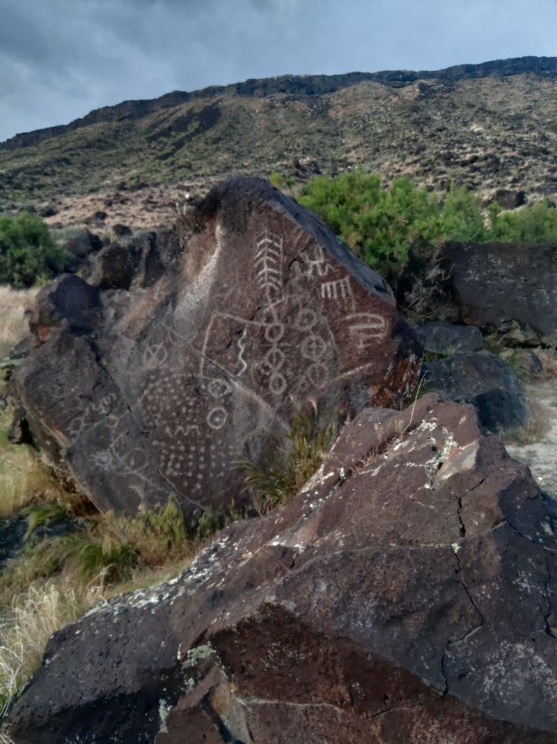
Long before Idaho had highways or county lines, people were reading this canyon closely. The Map Rock carvings are attributed to Northern Shoshone people and are believed to date to before the 19th century.
That timeline puts the work well ahead of the pioneer trails many Idahoans learned about in school. It’s a reminder that this landscape had mapmakers and storytellers first.
Carving basalt takes patience. Every line on the rock meant hours of deliberate effort, which hints at how important the message must have been.
The Snake River was central to life here, offering water, fish, and a route through rough country. A map of the valley would have carried real practical weight.
Standing beside the boulder, you’re looking at a record made by people who knew this ground intimately. That connection gives the place a quiet seriousness.
Treat the rock as you would any treasured heirloom. It belongs to a living cultural heritage, not just to the past.
A little respect goes a long way here. The carvings have lasted this long, and careful visitors help keep them around for the next few centuries.
The 1924 Scheme To Move The Rock To Boise
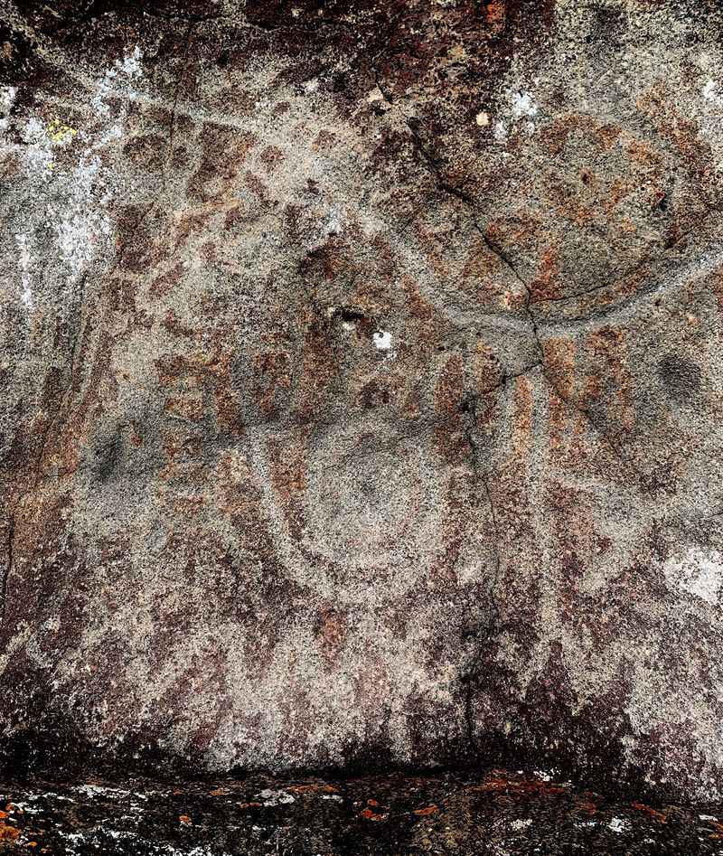
Here’s a plot twist worthy of a small-town legend. In 1924, Idaho state lawmakers discussed taking Map Rock and moving it to Boise.
The idea reportedly included sending the boulder in pieces. Hauling a giant chunk of basalt across the desert was never going to be graceful.
Thankfully, the plan was abandoned. The rock stayed in the canyon where it was carved, right beside the river it seems to describe.
The story didn’t end cleanly, though. Damage was found on the rock soon after the scheme fell apart, leaving a scar on its long history.
That episode makes the boulder feel even more precious today. It survived ambitious politicians, decades of weather, and a century of curious passersby.
It also shows how differently people once thought about artifacts. Today, the idea of chopping up ancient rock art for a capitol display sounds unthinkable.
Next time someone at a Boise gathering brags about the city’s history, you’ll have a fun comeback. One of its strangest almost-acquisitions still sits quietly near Melba.
Dark Basalt And A Rugged Canyon Backdrop
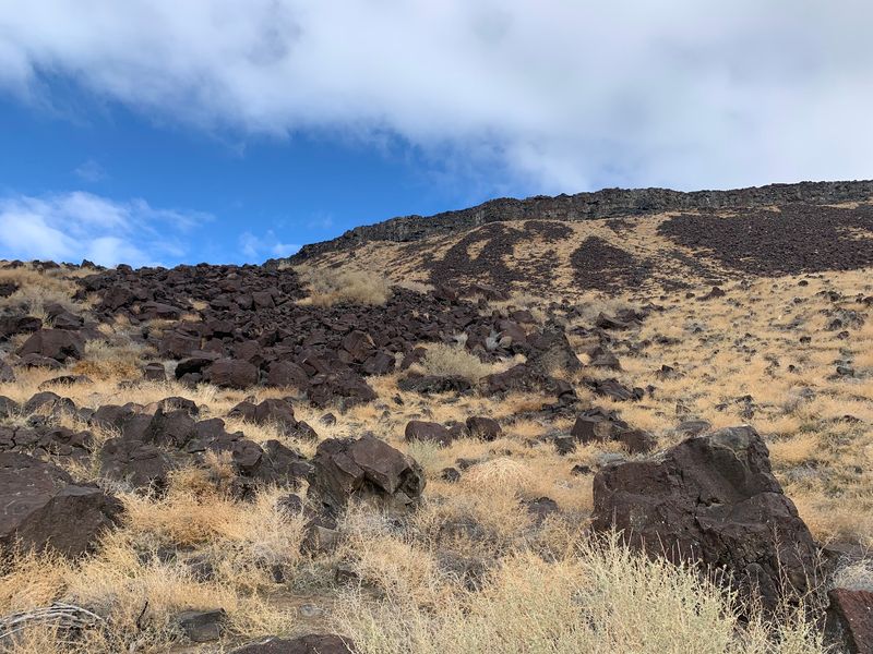
Volcanic rock makes a surprisingly good canvas. The Map Rock boulder is basalt, the same dark stone that shapes so much of the Snake River Plain.
Basalt is tough and dense. Carvings pecked into its surface can hold up remarkably well over long stretches of time.
The hillside above the road is scattered with plenty of other boulders. Their rough shapes and rusty patinas give the slope a wild, textured look.
Many folks enjoy wandering the slope and admiring the unique rocks. Just keep your boots off the carved boulder itself.
Sagebrush and dry grasses fill the gaps between stones. In summer, the whole scene leans toward browns and golds, while spring can bring a touch more green.
The canyon walls frame everything nicely. You get a strong sense of place without needing a long hike to earn the view.
Geology fans will find plenty to study here. It’s an easy spot to talk about lava, erosion, and river power with curious kids in the back seat.
Rock Art On One Side, River On The Other
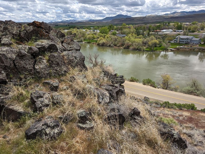
Few historic sites come with a river view this close. The Snake River runs right across the road from Map Rock, so ancient carvings and moving water share the same frame.
That pairing feels meaningful. The rock is believed to map this very valley, and the river is still doing its thing a few steps away.
The area also draws people for recreation. Fishing and water sports happen along this stretch, giving the spot a mixed personality.
One minute you’re pondering centuries-old symbols. The next, you might spot a boat or someone casting a line from the bank.
That blend makes it easy to stretch a visit. Pack a snack, enjoy the water, and circle back to the boulder when the light shifts.
Bring a camera for wide shots that show both sides. A photo with the rock and river together tells the whole story at a glance.
It’s a strong reminder of why people gathered here long ago. Water, fish, and a natural travel corridor made this canyon worth knowing, and still do.
Bonus Petroglyphs Waiting A Little Farther Down The Road
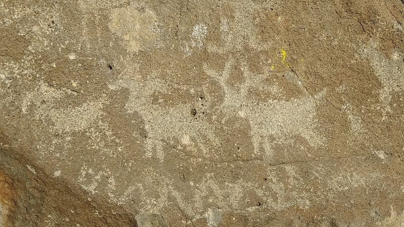
Plenty of people drive away after one rock and miss the encore. Additional petroglyphs sit roughly three quarters of a mile to just under a mile southeast of the main boulder along Map Rock Road.
Those carvings rest a short distance up off the road, around 50 to 60 feet. Some people find them clearer than the faded marks on the main rock.
Finding them can take some patience. The path isn’t marked, and not everyone spots the rocks on the first try.
Go slowly and scan the slope above the road. Dark boulders with lighter carved lines tend to stand out once your eyes adjust.
Wear sturdy shoes for the short scramble. The ground is uneven, and loose rock is part of the territory.
The extra effort pays off with a fuller picture of the site. It turns a quick roadside stop into a small treasure hunt along the canyon.
Keep expectations relaxed and enjoy the search. Even if the second panel stays elusive, the views along that stretch of the Snake River are well worth the detour.
Good Light Makes All The Difference
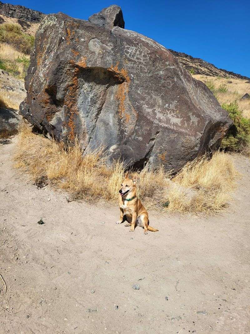
Timing matters more than you’d guess at this rock. The carvings on the main boulder are faded, so lighting can make them pop or make them nearly disappear.
Bright overhead sun tends to flatten the surface. Lower, angled light helps shadows settle into the grooves and reveals more detail.
Early morning and late afternoon are your friends here. Sunsets over the canyon can also turn the whole scene into a glowing bonus.
Bring patience and maybe a pair of sunglasses. Shifting your position a few steps left or right can change what you see on the stone.
Photographers should experiment with angles rather than relying on one straight-on shot. Side views often capture the carved lines better.
Overcast days can be tricky but not hopeless. Soft light sometimes evens out glare, letting subtle marks show without harsh reflections.
Think of it as a slow reveal. The longer you look, the more the lines seem to surface, which feels fitting for something carved so long ago.
A Faded Sign And A Hands-Off Rule
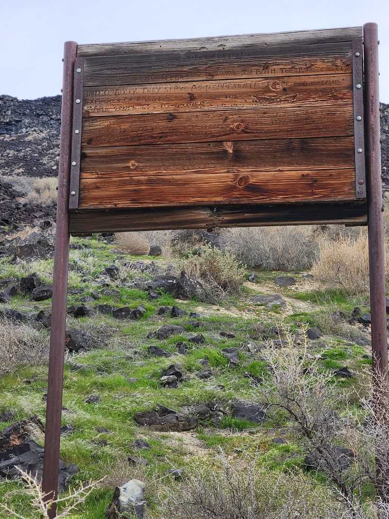
Don’t count on signage to announce your arrival. An old wooden marker stands near the site, but its text has weathered away to almost nothing.
That means it’s easy to cruise right past. Watch your map closely as you travel along Map Rock Road.
The lack of information also means no history panel on site. Reading up before you go makes the visit far richer.
A few facts in your pocket go a long way. Knowing about the Shoshone origins and the 1924 Boise plan turns a rock into a story.
One rule deserves real attention. Climbing on the petroglyphs is prohibited, so admire the carved boulder from the ground.
Hands, shoes, and chalk all wear down ancient surfaces. Even small scuffs add up over years of visitors.
The good news is that the rock has largely escaped graffiti. Keeping it that way depends on every person who stops to look, including kids eager to explore.
Set the tone early with your crew. A quick talk in the car keeps the boulder safe and the visit stress-free.
Parking Space For About Two Cars
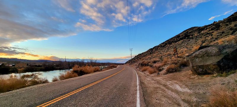
Forget about a parking lot. Map Rock offers roughly room for a single vehicle on each side of the road, and that’s about it.
Plan accordingly if you’re traveling with a group. Carpooling makes life easier, especially on pleasant weekend afternoons.
For your GPS, the address is Map Rock Rd, Melba, ID 83641. The site lies south of Nampa in Canyon County, along the Snake River Canyon.
Treasure Valley residents can make the trip in under an hour. It works well as part of a larger loop through the Melba area.
There’s no admission booth and no set visitor hours posted on site. Still, conditions on rural roads can change, so check before driving.
Pull fully off the pavement when you stop. Traffic is light, but drivers don’t always expect someone parked beside a boulder.
Bring water and snacks, since there are no facilities at the rock. A little preparation keeps the outing easy and pleasant for everyone.
Who Will Love This Quiet Canyon Stop
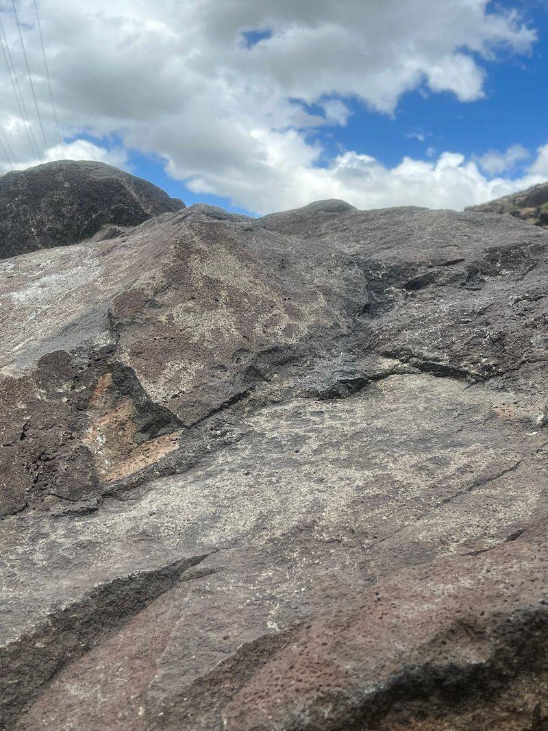
Some outings need a full day and a cooler full of supplies. This one suits anybody with a curious streak and an hour or two to spare.
History buffs will appreciate the age and mystery of the carvings. Photographers get rock art, canyon walls, and river views in one tight frame.
Families can turn the stop into a lesson without a lecture. Kids enjoy exploring the hillside and hunting for more marked rocks, as long as they stay off the carved boulder.
Grandparents may find it nostalgic. Generations of Treasure Valley students have visited on school trips over the years.
Budget-minded travelers will like the setup too. There’s no ticket booth at the boulder, so the main cost is fuel.
People hoping for trails, restrooms, or a visitor center should adjust expectations. The experience is simple, raw, and best for those who enjoy self-guided wandering.
Bucket-list fans should put it on the list. Seeing ancient Idaho rock art at least once feels like a rite of passage for anyone who calls the state home.
Snakes, Sun, And Smart Seasonal Planning
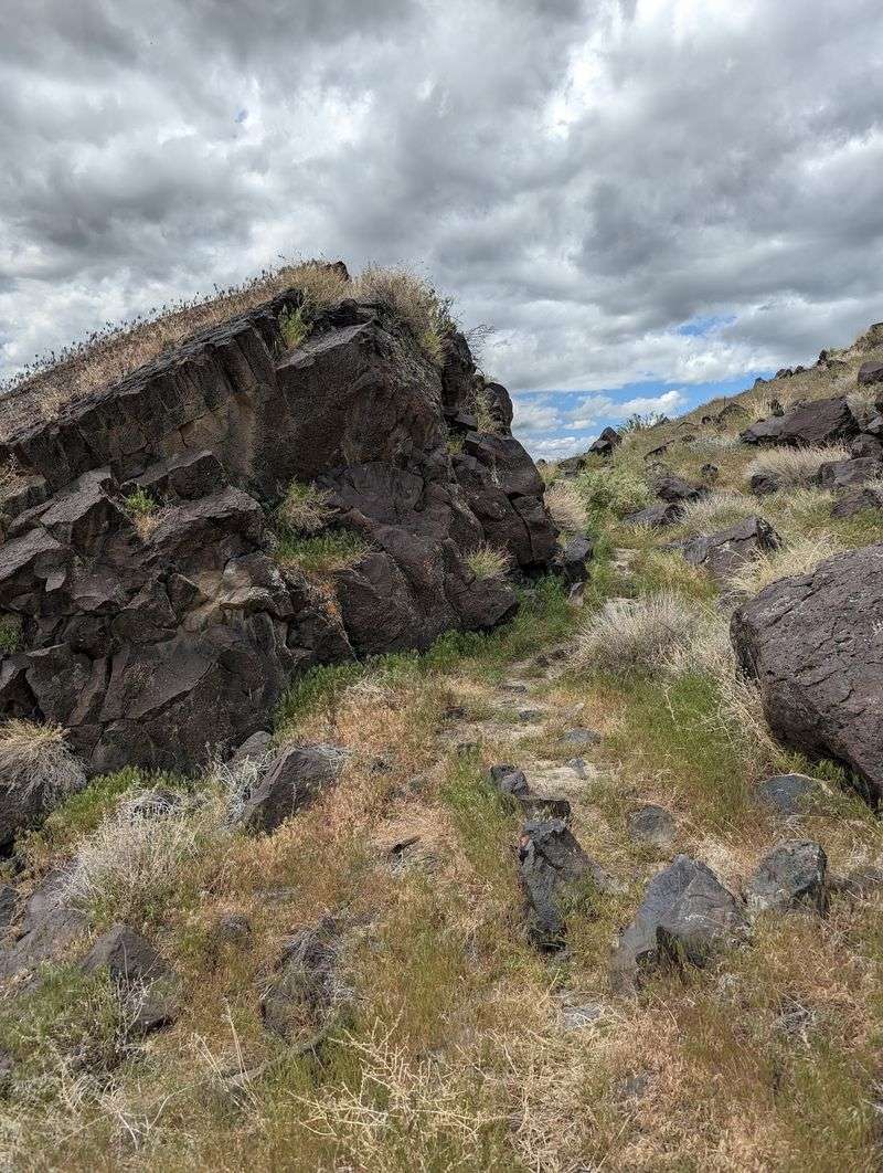
The Snake River Canyon earns its name in more ways than one. Snakes have been seen around the site, so watch where you step and reach.
Rattlesnakes live in this part of Idaho. Stick to open ground, avoid putting hands into crevices, and keep pets leashed.
Summer heat can be intense in the canyon. Shade is scarce, so pack water, a hat, and sunscreen for even a short stop.
Spring and fall tend to feel more comfortable for poking around the hillside. Cooler air makes the search for the second panel far more pleasant.
Paths up the slope can grow over after the growing season. Expect brush and uneven footing if you go hunting for extra carvings.
Winter can be quieter and starker, with crisp views across the canyon. Road conditions vary, so check ahead before heading out.
None of this should scare you off. A little awareness simply keeps the focus where it belongs, on the rock art and the river.
Worth The Detour For Curious Idahoans
Not every historic site needs a gift shop to make an impression. Map Rock Petroglyphs Historic District proves that a single boulder can carry an enormous story.
You get ancient carvings believed to map the Snake River Valley. You also get a canyon setting and a river close enough to hear.
Toss in a quirky 1924 near-heist by state lawmakers. Suddenly a roadside stop becomes a conversation starter for the whole drive home.
The site has rough edges, of course. Parking is tight, signage is faded, and the carvings ask for good light and patient eyes.
Those quirks add to the adventure rather than spoiling it. Finding the second panel up the road feels like earning a small prize.
For anyone in the Treasure Valley, this makes an easy afternoon outing. It’s close, low-cost, and packed with real Idaho history.
Go with respect, keep your feet on the ground, and bring a little curiosity. The rock has been waiting a long time for someone to try reading its map.