10 Scenic Utah Roads That Lead You Through The West’s Most Beautiful National Parks
Utah is home to some of the most breathtaking landscapes in America, and the roads that wind through them are just as spectacular as the destinations themselves. Driving these scenic routes gives you front-row seats to towering red rock formations, deep canyons, and endless desert vistas.
Whether you’re planning a road trip or just dreaming about one, these highways will take you on an unforgettable journey through the West’s most stunning national parks.
1. Scenic Byway 12
Picture yourself cruising along one of America’s most celebrated highways, where every turn reveals a new wonder. This 124-mile stretch connects Bryce Canyon and Capitol Reef, offering views that’ll make you want to pull over every few minutes.
You’ll climb over Boulder Mountain, pass through the town of Escalante, and cross the famous Hogsback ridge where the road balances on a narrow spine of rock. The elevation changes create dramatic shifts in scenery, from ponderosa pine forests to slickrock desert.
I recommend starting early in the morning when the light hits the red rocks just right. Give yourself a full day because you’ll want to stop at multiple overlooks and hiking trails along the way.
2. Highway 191 to Arches
Your gateway to Arches National Park begins on this desert corridor that runs north-south through Moab. The contrast between the red sandstone cliffs and the snow-capped La Sal Mountains creates an almost surreal backdrop.
Before you even reach the park entrance, you’ll spot massive rock formations lining the roadside. The Colorado River runs parallel to portions of this route, adding another layer of beauty to your drive.
Summer temperatures can be brutal here, so carry plenty of water. The section between Moab and the park entrance is especially photogenic during golden hour. You’ll also pass numerous trailheads and rock climbing areas that are worth exploring if you have extra time.
3. Capitol Reef Scenic Drive
History and geology blend perfectly along this partially paved route through Capitol Reef’s historic Fruita district. You’ll pass through pioneer orchards where you can actually pick fruit in season, surrounded by towering canyon walls.
The road follows the Fremont River and ventures into Grand Wash, where sheer cliffs rise hundreds of feet on both sides. Further along, you can explore Capitol Gorge, where pioneers carved their names into the rock over a century ago.
A high-clearance vehicle is recommended for the unpaved sections, especially after rain. Bring cash if you’re visiting during harvest season because the fruit-picking experience is something special. The entire drive is about 8 miles one-way.
4. Highway 9 Through Zion
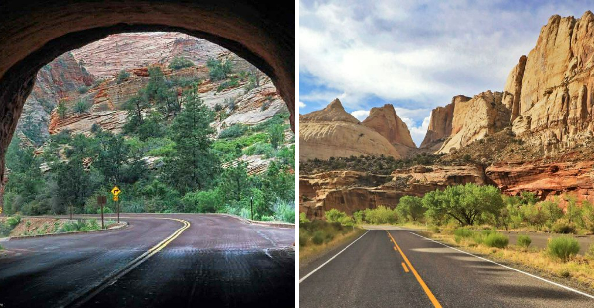
Prepare to have your breath taken away as you enter Zion Canyon on this stunning approach route. The Virgin River accompanies you as vertical walls of Navajo sandstone rise thousands of feet overhead.
Driving through the canyon feels like entering another world, with formations like the Watchman and Bridge Mountain dominating the skyline. During spring, waterfalls cascade down the cliffs, adding even more drama to the scene.
Note that private vehicles are restricted in the main canyon during peak season, so you’ll need to use the free shuttle system. The western approach from Springdale offers the most classic views. Early mornings provide the best lighting and fewer crowds at the overlooks.
5. Burr Trail
Adventure seekers will love this 66-mile route that transitions from paved to dirt as it crosses some of Utah’s wildest terrain. The dramatic switchbacks descending into Long Canyon are absolutely unforgettable and look like something from a movie.
You’ll travel through Grand Staircase-Escalante National Monument and into Capitol Reef, experiencing incredible solitude along the way. The layered rock formations display millions of years of geological history in vibrant colors.
Check road conditions before going because the unpaved sections can be impassable when wet. A four-wheel-drive vehicle isn’t always necessary, but it certainly helps. Pack extra supplies since services are limited, and cell reception is basically nonexistent out here.
6. Highway 24 Along the Fremont
Following the Fremont River, this highway offers a gentle introduction to Capitol Reef’s wonders without requiring a park entrance fee for most of the scenic sections. The road parallels ancient rock layers that tell stories dating back millions of years.
You’ll see petroglyphs left by the Fremont people, historic buildings from pioneer settlers, and the dramatic Waterpocket Fold formation. Cottonwood trees line the river, providing beautiful green contrast against the red and cream-colored cliffs.
Stop at the petroglyphs panel near the visitor center for a glimpse into ancient history. The drive is accessible year-round, though summer heat can be intense. Several pullouts offer quick photo opportunities without requiring long hikes.
7. Highway 211 to Canyonlands
This 34-mile connector road to Canyonlands’ Needles District is an attraction in itself, featuring incredible rock art and stunning formations. Indian Creek flows alongside portions of the route, creating a ribbon of green through the red desert.
Watch for Newspaper Rock, where hundreds of petroglyphs cover a large cliff face, offering one of the Southwest’s best rock art displays. As you get closer to the park, the distinctive red and white banded spires appear on the horizon.
The road is paved the entire way, making it accessible for all vehicles. Rock climbers flock to the Indian Creek area for its world-class crack climbing. Plan extra time because you’ll definitely want to stop at multiple viewpoints along the way.
8. Zion-Mount Carmel Highway
Engineering meets natural beauty on this remarkable 25-mile road that climbs through Zion National Park’s eastern section. The highlight is definitely the 1.1-mile tunnel carved right through the mountain in 1930.
As you emerge from the tunnel, massive windows cut into the rock reveal stunning glimpses of the canyon below. Beyond the tunnel, you’ll encounter incredible checkerboard patterns in the sandstone and panoramic views of slickrock formations.
Keep in mind that larger vehicles need a tunnel permit and escort. The switchbacks on the western end are pretty intense, so take your time. Spring and fall offer the most comfortable temperatures for exploring the pullouts and short trails.
9. Highway 95 Bicentennial Route
Known as the Bicentennial Highway, this remote route cuts through some of Utah’s most isolated and spectacular country. You’ll cross high desert plateaus with views of the Henry Mountains and access points to both Natural Bridges and Glen Canyon.
The road passes through deep canyons carved by the Colorado River and its tributaries. You might drive for miles without seeing another car, giving you a real sense of the West’s vast emptiness.
Fill your gas tank before starting because services are few and far between. The section near Natural Bridges National Monument features particularly impressive geology. Wildlife sightings are common, especially during dawn and dusk hours when deer and other animals are most active.
10. Kolob Terrace Road
Escape the crowds on this lesser-known route into Zion’s backcountry, where you’ll experience a completely different side of the park. The road climbs from desert lowlands through forests of aspen and pine to high plateaus with sweeping views.
Wildflowers blanket the meadows in summer, and fall brings golden aspen leaves that contrast beautifully with the red rocks. You’ll find access to amazing hiking trails, including the route to the famous Subway slot canyon.
This road typically closes in winter due to snow, so check conditions before visiting. The pavement is good, but the route is narrow and winding in places. Bring layers because temperatures can vary dramatically with elevation changes throughout the drive.

