The Washington Hikes Every Outdoor Lover Should Experience At Least Once
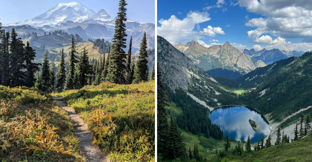
I have never forgotten the first time a trail genuinely humbled me. Not because it was brutal, but because it was so alive it felt almost unfair.
Washington does that to people. This state holds some of the most quietly devastating landscapes on the planet, and most of them are hiding in plain sight behind a trailhead sign.
Ancient forests, volcanic ridgelines, valleys carved by forces older than memory. Washington keeps delivering long after you think you have seen its best.
These hikes are not just worth doing once. They are the kind that rewire something in your brain and make every other outdoor experience feel like a rough draft.
1. The Enchantments
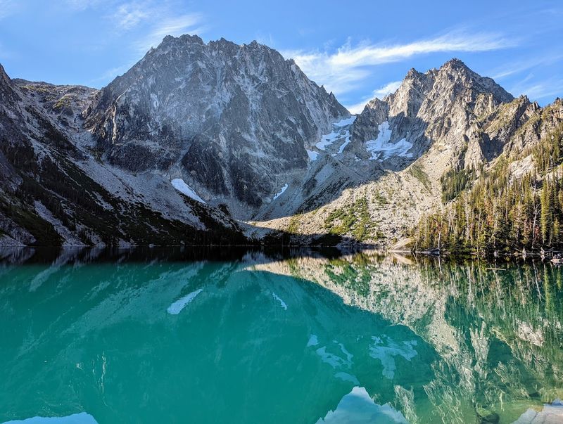
Overnight permits for The Enchantments are famously competitive, which tells you immediately how sought-after this place has become. That number alone should tell you how special this place is.
Most people tackle the full 19-mile thru-hike in a single brutal, beautiful day.
The trail packs in over 4,500 feet of elevation gain, and every foot of it earns you something extraordinary. Golden larches glow like fire in early October.
Aquamarine lakes sit perfectly still between walls of granite that look almost too dramatic to be real.
Starting from the Colchuck Lake trailhead and finishing at the Snow Lakes trailhead, the route demands solid fitness and careful planning. Bring more water than you think you need.
The alpine zone feels genuinely remote, even on a busy permit day.
Few trails in the entire Pacific Northwest deliver this level of sustained beauty from start to finish. If you only do one epic hike in your life, this one deserves serious consideration.
Start early, move steadily, and let the scenery do the rest.
2. Skyline Trail
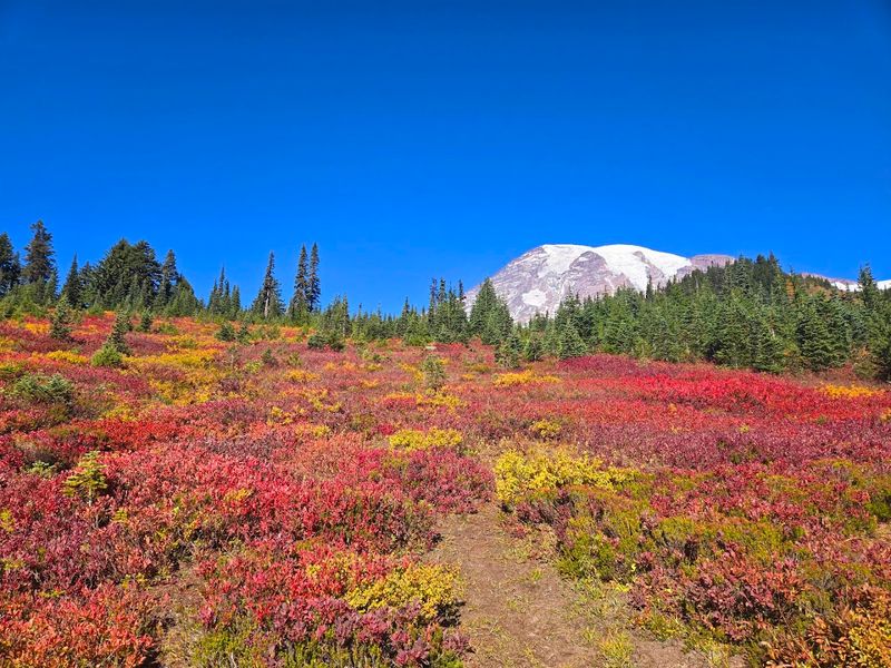
Some mountains you admire from a distance. Rainier pulls you in close and dares you to comprehend it.
The Skyline Trail Loop at Mount Rainier delivers that feeling on a reliable basis. It starts and ends at the Paradise area, one of the most visited spots in the park.
The loop covers roughly 5.5 miles and rewards you with non-stop views of Rainier almost the entire time. You pass cascading waterfalls, fields of wildflowers, and sections of trail that feel genuinely alpine.
July and August bring the most dramatic flower displays.
Arrive early because parking at Paradise fills fast on summer weekends. The Henry Jackson Visitors Center nearby is worth a quick stop before you hit the trail.
A $30 vehicle entry fee applies unless you carry a National Parks pass.
Even experienced hikers tend to slow down on this loop just to look around. The scale of Rainier from this angle is hard to fully process.
It is the kind of view that makes you forget how tired your legs are.
3. Alpine Lakes Wilderness
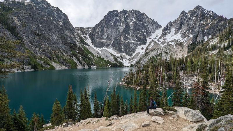
Turquoise water so vivid it looks digitally enhanced, backed by the sharp granite spires of Dragontail Peak. That is what waits at the end of the Colchuck Lake trail.
And yes, it actually looks like that in real life.
The hike is 8 miles round-trip with a solid but manageable elevation gain. It serves as the gateway to The Enchantments, so you will share the trail with some very motivated hikers on their way to bigger objectives.
The trail through old-growth forest in the lower section is genuinely beautiful on its own.
Mountain goats have a habit of appearing on the rocky slopes above the lake, seemingly unbothered by anyone watching them from below. Photographers love this trail for obvious reasons.
Early morning light on those granite spires is something special.
A day-use permit is required during peak season, so check the current regulations before heading out. The Icicle Creek area near Leavenworth serves as the base for this trail.
If you are only doing one day hike in the Alpine Lakes Wilderness, Colchuck Lake makes a very strong argument for being the one.
4. Hoh River Trail
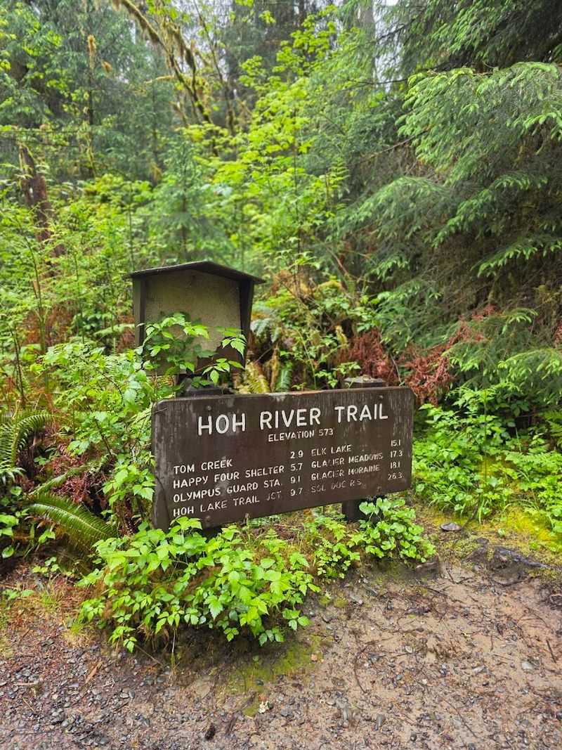
Few places on Earth make you feel this small this fast. The Hoh River Trail pulls you into a world of massive bigleaf maples draped in thick green moss, forming a canopy so dense it filters the light into something soft and almost dreamlike.
The rainforest starts immediately, no long approach required.
One of the best things about this trail is its flexibility. You can walk a half mile and feel completely immersed in the rainforest.
Or you can keep going for days, eventually reaching the base of Mount Olympus if you are feeling ambitious.
The Hoh Rainforest receives around 140 inches of rain per year, which explains the extraordinary moss and fern growth covering nearly every surface. Roosevelt elk roam through the area regularly.
Spotting a herd moving silently through the trees is the kind of moment that sticks with you.
The river itself runs alongside much of the trail, clear and cold, with plenty of spots to sit and watch the water move. The Hoh Rain Forest Visitor Center sits at the trailhead and is worth a visit.
It is located along Upper Hoh Road off Highway 101 on the Olympic Peninsula.
5. Hurricane Ridge
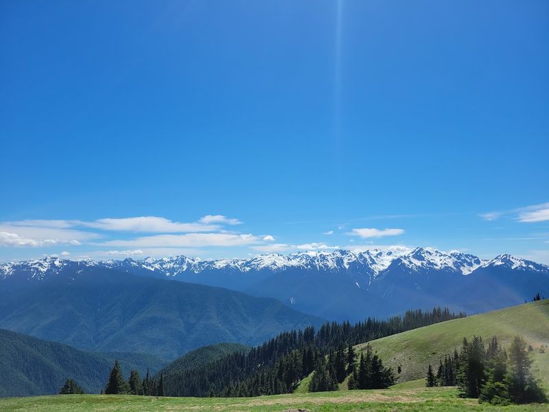
Not every great hike requires suffering through a brutal approach. Hurricane Ridge proves that accessible can still mean absolutely spectacular.
The road takes you up to around 5,200 feet, and the views start before you even lace up your boots.
From the ridge, the Olympic Mountains spread out in every direction, jagged and snow-capped even in summer. The wildflower meadows bloom brilliantly from July through August, and black-tailed deer wander through them with total confidence.
It feels like a nature documentary set.
The Hurricane Hill Trail is the most popular route from the ridge, covering about 3.2 miles round-trip with modest elevation gain. The payoff at the summit includes views of the Strait of Juan de Fuca and, on clear days, Vancouver Island.
That is a view worth the short climb.
The original Hurricane Ridge Visitor Center burned down in 2023, but a temporary summer Visitor Contact Station now provides maps, trail information, restrooms, and water for visitors heading into the area.
Road access can be limited in winter and early spring due to snow, so checking ahead saves frustration.
Summer weekends draw crowds, but arriving before 9 a.m. usually means a calmer experience on the trail.
6. Mount Si
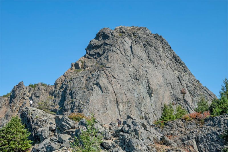
For Seattle-area hikers, Mount Si is basically a rite of passage. Nearly everyone has a Mount Si story, whether it is their first real mountain hike or their hundredth lap up the same relentless switchbacks.
It earns its reputation every single time.
The trail is 7.6 miles round-trip and climbs over 3,150 feet to the summit. That elevation gain is no joke, especially in the upper section where the trail gets steep and rocky.
But the summit views on a clear day stretch all the way to Puget Sound and the Cascades beyond.
The trail sits just 30 miles east of Seattle off I-90, making it one of the most convenient big climbs in the region. The trailhead parking at Mount Si Road in North Bend fills up fast on weekends.
Getting there by 7 a.m. on a Saturday is not an overreaction.
A Discover Pass is required for parking at the trailhead. The forest in the lower sections is quiet and shaded, which makes the early miles genuinely enjoyable before the real climbing begins.
Many hikers use this trail specifically to train for bigger objectives in the mountains.
7. Heliotrope Ridge Trail
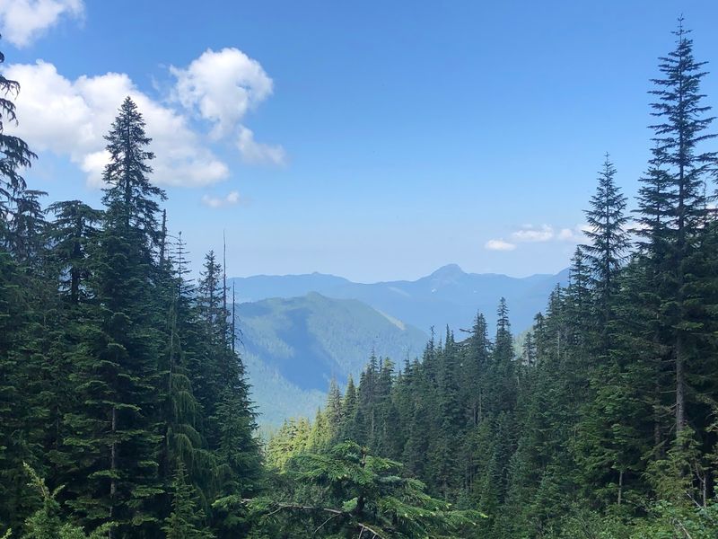
Getting close enough to a glacier to feel cold air rolling off it is a genuinely rare experience on a day hike. Heliotrope Ridge makes that happen in under three miles.
The Coleman Glacier on Mount Baker’s north flank is enormous, and the trail puts you right in front of it.
The trail covers roughly 5.5 miles round-trip and involves a few river crossings that can be lively depending on the season. Always check current trail reports before heading out.
The crossings add a sense of adventure without requiring technical skills.
The forest in the lower section is old-growth, dense and shaded, with the sound of rushing water accompanying most of the climb. Then the trees thin, the terrain turns rocky, and the glacier appears ahead like a wall.
The transition is sudden and dramatic.
Harrison Camp sits near the upper section and serves as a base for Mount Baker summit climbers. Watching a rope team gear up for the summit while you eat your trail snacks is a memorable experience.
The trailhead is accessed via Glacier Creek Road off Highway 542, northeast of Bellingham in the Mount Baker Wilderness.
8. Mount St. Helens Summit
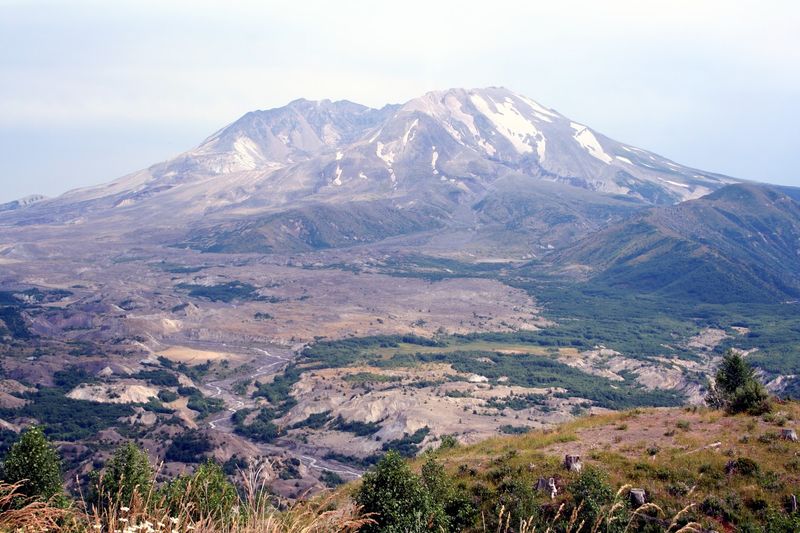
Standing on the rim of an active volcano and peering down into a steaming crater is not something most hiking trails offer. Mount St. Helens does, and the experience is unlike anything else in the region.
The 1980 eruption reshaped this landscape completely, and the evidence is everywhere.
The most popular summit route is the Monitor Ridge Trail, covering about 10 miles round-trip with over 4,500 feet of elevation gain. The upper section is steep, loose, and ashy, requiring solid footing and a determined attitude.
Trekking poles are genuinely useful here.
Climbing permits are required year-round, and they become especially competitive during the main climbing season. Daily climber limits vary depending on the time of year, so checking the latest permit availability before planning your hike is essential.
Permits are released months in advance, so planning ahead is essential if summiting is your goal.
Views from the rim include Spirit Lake below, the rebuilt lava dome inside the crater, and Mount Rainier, Mount Adams, and Mount Hood on clear days. That is three volcanoes visible from one volcano.
The Climber’s Bivouac trailhead is located off Forest Road 830 near Cougar in Gifford Pinchot National Forest. Book your permit early and do not skip this one.
9. Cape Flattery
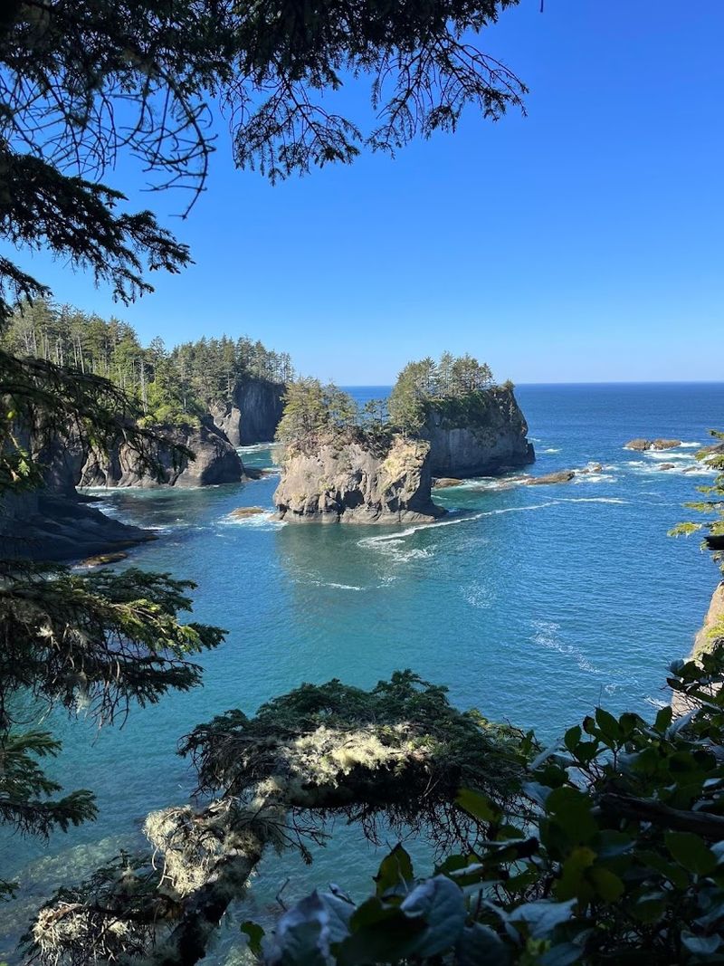
The westernmost point in the continental United States deserves a visit, and the trail to get there is surprisingly easy. Cape Flattery is short, accessible, and ends with one of the most dramatic coastal views in the entire Pacific Northwest.
The buildup through wind-bent cedar trees makes the final reveal even better.
The trail covers about 1.5 miles round-trip from the trailhead on the Makah Reservation near Neah Bay. The boardwalk sections and viewing platforms make it manageable for most ages and fitness levels.
A Makah Recreation Pass is required to access the trailhead and is available in Neah Bay.
At the end of the trail, you stand above sea stacks rising out of the churning Pacific while seabirds circle below you. On clear days, Tatoosh Island and its lighthouse sit just offshore.
The sound of waves crashing against the cliffs below adds something no photograph can fully capture.
Spring and early summer bring nesting seabirds to the area, adding a wildlife element to the experience. The drive to Neah Bay along Highway 112 follows the Strait of Juan de Fuca and is worth slowing down for.
Cape Flattery is short on distance but enormous on impact.
10. Wonderland Trail
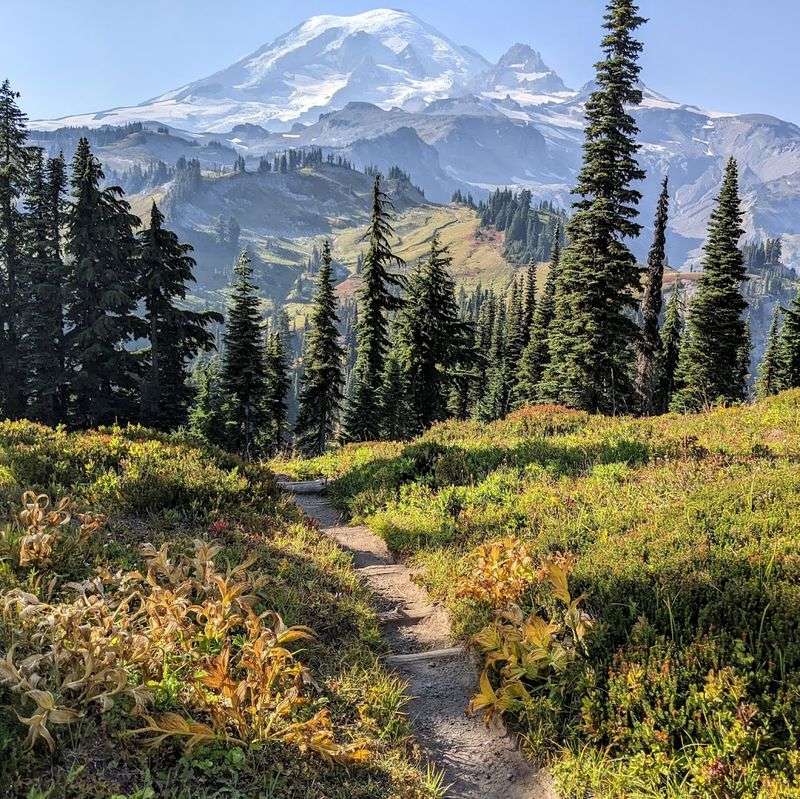
Ninety-three miles. That is the full circumference of the Wonderland Trail as it wraps completely around Mount Rainier.
It is widely considered one of the greatest long-distance hikes in the entire country, and the competition for permits proves it.
Each year, a limited number of backpacking permits are released, and the demand is fierce. Most hikers complete the trail over ten to fourteen days, moving through old-growth forest, river valleys, and high alpine passes.
The terrain changes constantly, which keeps the experience fresh every single day.
Total elevation gain across the full route adds up to about 27,000 feet, along with another 27,000 feet of descent. That is not a typo.
Your legs will know about every single one of those feet by the end of the first week.
The reward, though, is unmatched. You see Rainier from every angle, in every kind of light, through every type of weather.
Some sections feel wild and remote. Others pass through open meadows so beautiful they almost seem staged.
Finishing the full loop is a genuine achievement that stays with you for years.
11. Maple Pass
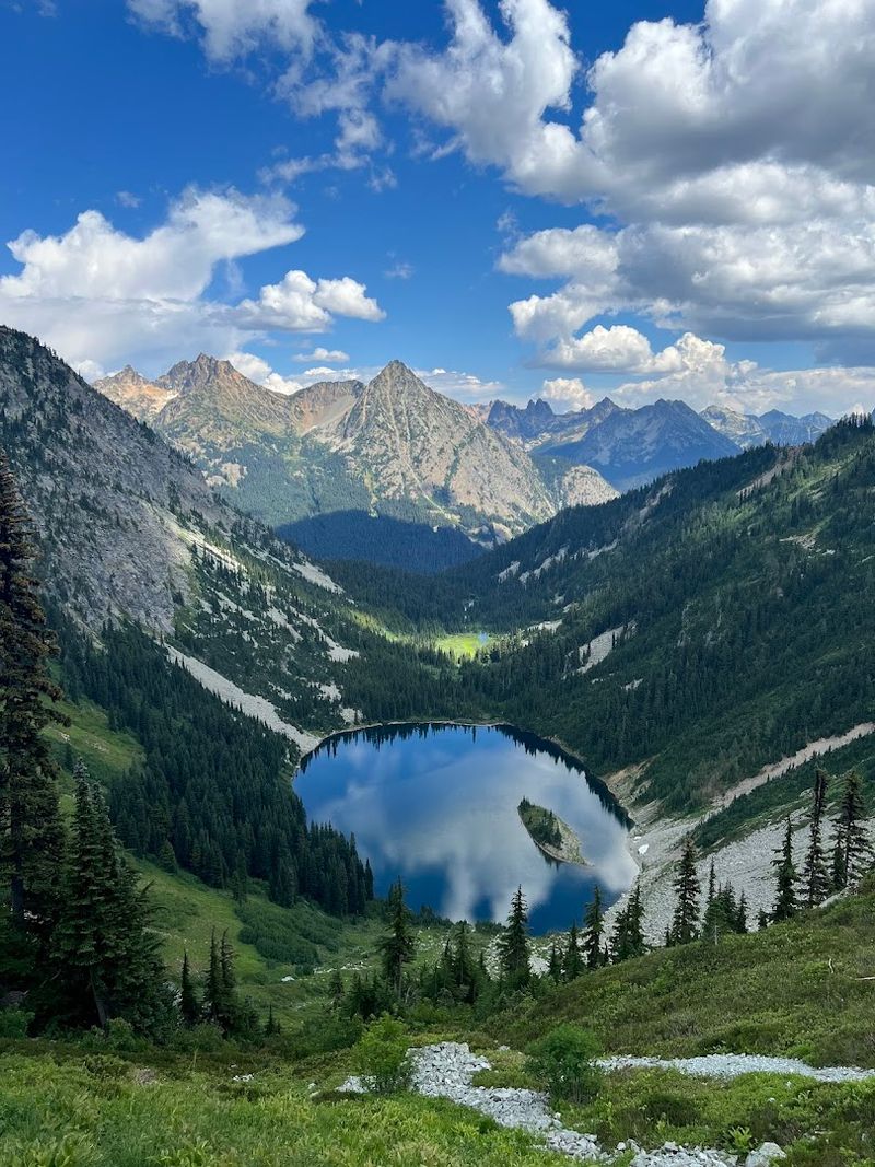
Every year in early October, the larches around Maple Pass turn gold, and hikers flood the trailhead to witness it. The timing is tight, usually just a week or two, but catching it right feels like winning a small lottery.
Worth every alarm set at 4 a.m.
The loop covers about 7.5 miles with 2,000 feet of elevation gain, making it accessible for most fit hikers. Going clockwise gets the steep climb out of the way early.
The counterclockwise direction saves the best views for last, which is its own kind of reward.
Lake Ann sits below the pass and looks almost impossibly picturesque framed by rocky peaks. The ridgeline sections open up panoramic views of glaciated summits in every direction.
It consistently ranks among the most scenic loops in Washington for very good reason.
The drive to the trailhead along Highway 20 is scenic enough to justify the trip on its own. Stop at the Diablo Lake Overlook on the way.
By the time you reach the trailhead, you are already in a good mood before the hike even begins.