This 3-Mile Idaho Trail Is Our July Waterfall Hike Of The Month
July hikes love making big promises, but this central Idaho trail actually brings receipts.
The walk starts with creek noise, canyon shade, and that suspiciously pleasant feeling that nature might be setting up a surprise.
Then the trail keeps going. Boots get dusty. Snacks start sounding important.
The canyon tightens just enough to make the whole place feel more dramatic than expected.
Historic remnants add a little old-mountain mystery, like the trail has stories it refuses to explain too quickly.
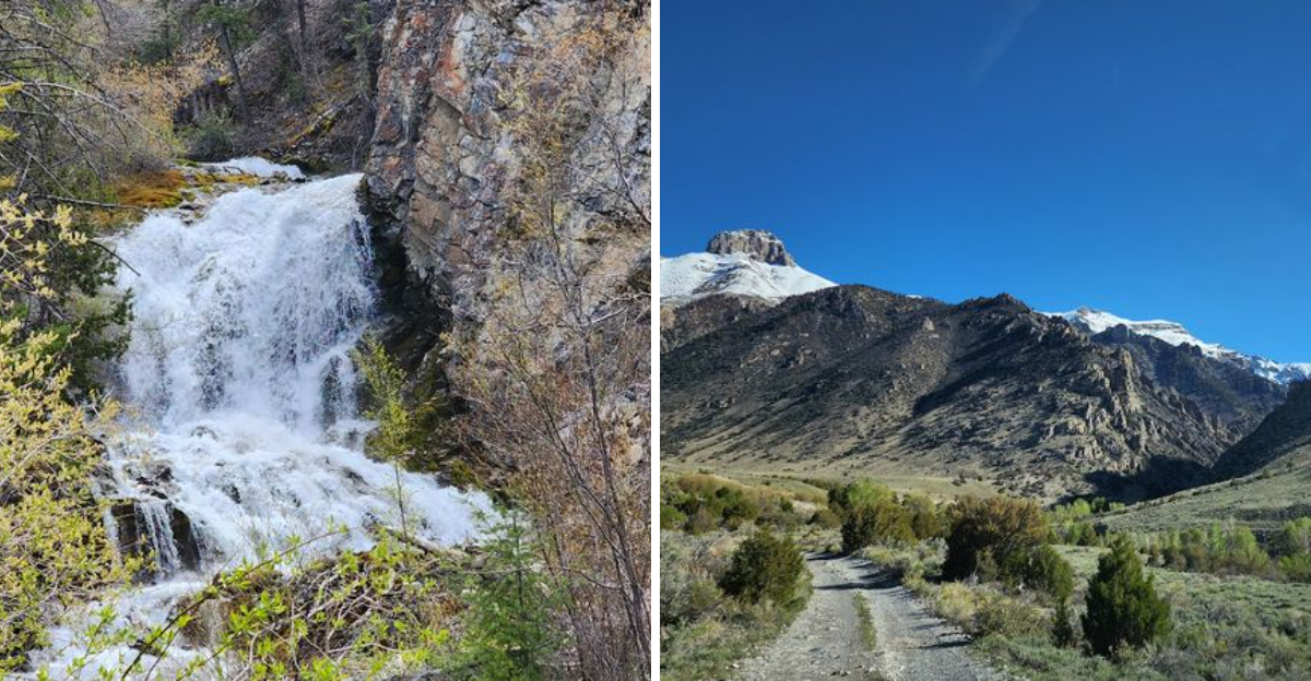
Then comes the real payoff. Water appears from the rock itself, which feels less like a normal waterfall and more like the mountain found a hidden faucet.
A three-mile hike should not be allowed to feel this cinematic, but here it is, showing off anyway.
By the time the creek, canyon, ruins, and waterfall all make their case, tired legs may have no choice but to forgive the effort.
The Canyon Starts Cooling Things Down Fast
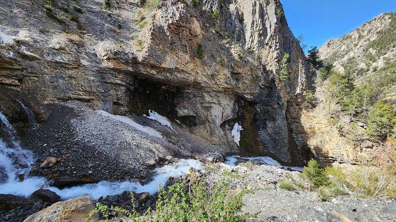
Heat starts losing its grip once the canyon walls begin rising around Lower Cedar Creek Trail. Summer in central Idaho can feel bright, dry, and punishing by midday, so the cooler pocket along the creek feels like an immediate reward.
Shade from trees and rock walls helps soften the sun, while cold water moving nearby adds a refreshing edge to the air.
The trail does include exposed stretches, so hikers should not treat it like a fully shaded forest walk, but the canyon still gives the route a noticeably cooler mood than the open valley around Mackay.
Starting early makes the effect even better. Morning light reaches the rocks slowly, the creek sounds sharper in the quiet, and the climb feels far more manageable before the day heats up.
The setting also helps hikers slow down instead of charging toward the waterfall too fast. Canyon walls, scattered trees, rushing water, and rocky turns give the short route enough texture to feel bigger than its mileage.
For a July hike, that cooler canyon entrance is exactly the kind of welcome people want.
Cedar Creek Keeps The Trail Moving Beside You
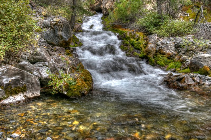
Water does a lot of the storytelling on this hike. Lower Cedar Creek stays close through much of the route, giving the trail a steady soundtrack of rushing, splashing, and sliding over rock.
That sound matters more than people expect in July. Even when the sun reaches open sections, the creek keeps the hike feeling alive and cooler than the surrounding country.
Clear mountain water moves through narrow channels, past stones, and beside rugged canyon walls, adding small moments of interest long before the main waterfall appears.
Some spots invite hikers to pause and watch the current work through the rocks, though slippery banks and uneven footing deserve respect.
The creek also helps guide the mood of the trail. It starts as a companion, becomes a reason to keep going, and eventually builds anticipation as the canyon tightens and the destination gets closer.
Idaho has bigger waterfall hikes and more famous routes, but this one benefits from constant water presence. The creek keeps every step from feeling like filler on the way to the final reveal.
Three Miles Feels Just Right For A July Waterfall Chase
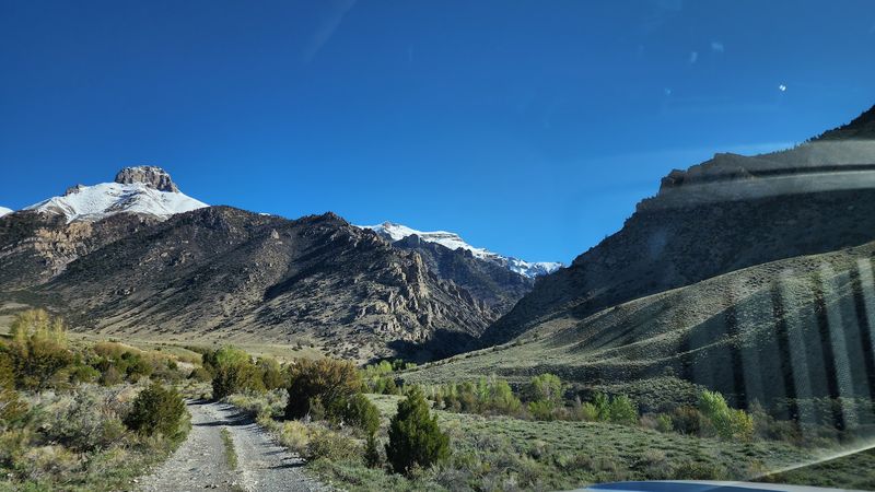
Lower Cedar Creek Trailhead sits near Mackay in the Salmon-Challis National Forest, reached from town by following Seefried Lane and Lower Cedar Creek Road toward the signed trailhead. Location matters here, so this detail belongs at the start of any plan before anything else.
Visit Idaho describes the route as a three-mile out-and-back hike, which makes it especially appealing for July travelers who want a real payoff without giving up an entire day.
The mileage feels manageable, but the trail is not completely effortless. Rocky footing, gradual climbing, and rougher sections near the upper part of the route give it enough challenge to feel earned.
That balance is the reason it works so well as a hike-of-the-month pick. Families with capable older kids, casual hikers, and road-trippers looking for a short central Idaho adventure can all find something to like here.
The distance leaves time for a snack break, photos, and a slower return through the canyon. A three-mile waterfall chase sounds modest on paper, but this one packs creek scenery, history, and a strange rock-wall waterfall into a compact route.
The Old Hydroelectric Ruins Add A Surprise Backstory
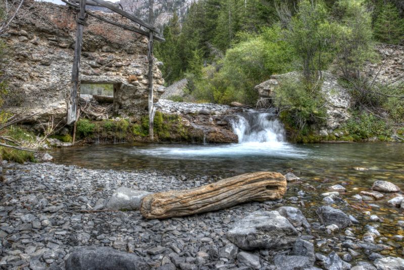
History sneaks into the canyon before the waterfall takes over the conversation. The Forest Service notes that Lower Cedar Creek Trail follows the creek past an old dam site and old wooden flumes, remnants tied to the area’s early hydroelectric past.
Those weathered pieces of infrastructure give the hike an unexpected layer, especially because they appear in a place that feels rugged and remote today.
Wood, stone, water, and canyon walls start telling a story about how much effort it once took to bring power and industry into mountain communities.
Instead of passing a polished museum display, hikers encounter remains right along the route, shaped by time and weather. That makes the history feel more immediate.
Kids may notice the old structures first because they look mysterious against the canyon setting, while adults may find themselves wondering how workers built and maintained anything in such difficult terrain. The ruins also help break up the hike nicely.
Before the final waterfall payoff, the trail offers a second reason to pause and look closely. Lower Cedar Creek is not only scenic.
It carries evidence of human ambition hidden into the rocks.
You Hear The Waterfall Before The Payoff Fully Appears
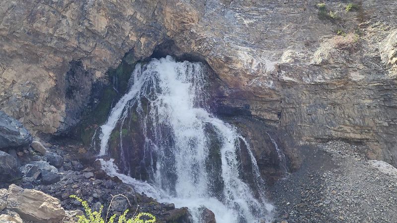
Anticipation builds the best way possible near the end of the trail. Before Hole in the Rock fully shows itself, the sound of water grows stronger, deeper, and harder to ignore.
That approach makes the reveal feel more exciting than a simple viewpoint sign ever could.
The Forest Service describes the trail as ending at Hole in the Rock, where a spring gushes from the canyon wall, and that unusual origin is exactly what makes the destination memorable.
Water does not simply tumble from a visible stream above in the usual waterfall fashion. It bursts straight out of rock, creating a cold, forceful display that looks almost impossible the first time you see it.
Flow can vary by season and conditions, so July visitors should not expect every visit to look identical, but the feature remains striking because of how the water emerges. Mist, sound, and canyon stone all crowd the senses at once.
After following Cedar Creek through the canyon, reaching a waterfall that appears to come from inside the mountain feels like the trail saved its strangest trick for last.
Rocky Sections Make The Short Hike Feel More Adventurous
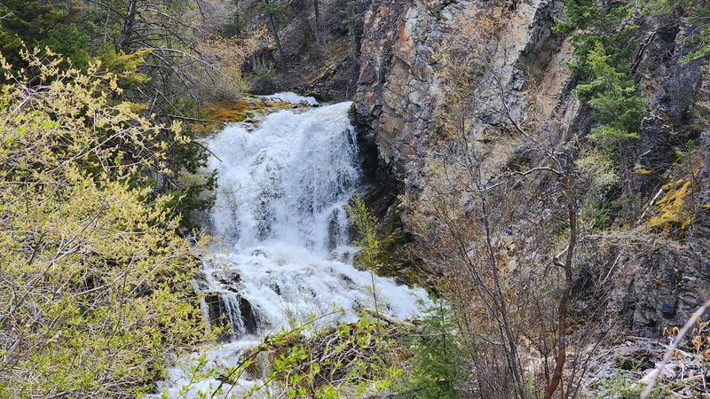
Short mileage does not mean completely soft terrain. Lower Cedar Creek Trail includes rocky sections, uneven footing, and areas where hikers need to pay attention instead of strolling on autopilot.
That texture gives the route more personality and helps the three-mile distance feel like a real adventure. Sturdy shoes are the smart move, especially near creekside sections, loose rock, or steeper stretches closer to the waterfall.
The trail is often described as moderate rather than difficult, but conditions can change with weather, runoff, erosion, and seasonal use. A GPS track or offline map is useful because some travelers have noted that parts of the route can be less obvious than expected.
The dirt-road approach also sets the tone before the hike begins. Lower Cedar Creek Road can have ruts, gravel, and rough spots, so careful driving matters.
Once on foot, the rocky character becomes part of the fun. Every small scramble, creekside turn, and uneven step makes the waterfall feel more earned.
It is still a short outing, but it refuses to feel boring.
Mackay Gets A Hidden Summer Trail Worth Finding
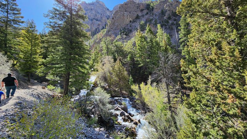
Mackay makes a fitting gateway for this hidden-away waterfall hike. The town sits in central Idaho near the Lost River Range, surrounded by open valley views, big mountain shapes, and the kind of quiet roads that make a short adventure feel farther from routine than it actually is.
Reaching Lower Cedar Creek Trailhead requires leaving town and following signs along the dirt-road approach, so visitors should not expect a heavily developed trailhead with every comfort waiting at the end.
Visit Idaho notes a small parking area and a single picnic table, with no restrooms or trash facilities, which means preparation matters.
Pack out everything, bring enough water, and do not rely on cell service to solve poor planning. That rustic setup is also part of the appeal.
The trail feels hidden because it has not been polished into a big attraction. After the hike, Mackay itself is worth a little time, especially for travelers who like small towns surrounded by serious scenery.
A waterfall morning plus a slow town stop makes the whole trip feel like a central Idaho find.
This Waterfall Finish Makes The Climb Feel Fair
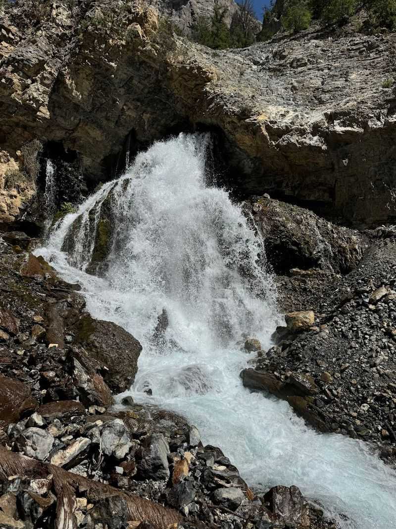
A strong finish can forgive a lot of rocky footing, and Hole in the Rock does exactly that.
After the creekside walking, old flumes, canyon shade, and final push toward the sound of falling water, the spring bursting from the rock wall feels like a reward with real personality.
It is not the tallest or most famous waterfall in Idaho, but it is one of the stranger and more memorable ones because of the way the water emerges directly from the canyon face.
Hikers often pause longer than planned here, partly because the mist and sound cool the air and partly because the view takes a minute to fully process.
The return trip follows the same route back, but it tends to feel easier after the main payoff has delivered. Dogs may be allowed on many national forest trails, but visitors should confirm current Salmon-Challis National Forest rules and keep pets controlled around water, rocks, and other hikers.
For July, Lower Cedar Creek Trail lands in a sweet spot: short enough to finish before the worst heat, scenic enough to feel special, and surprising enough to remember afterward.