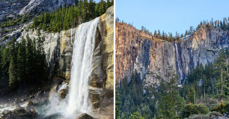
These 11 California Trails With Waterfalls Are Actually Worth The Effort
Waterfall hikes love to make people negotiate with themselves.
The trail climbs. The shade disappears at the wrong moment. Someone starts asking how much farther it is with the tone of a person who might accept lies.
Then the sound of rushing water slips through the trees, and every dusty step starts looking a lot more reasonable.
A California trail earns instant forgiveness when the payoff comes crashing over rock.
These hikes are not just about checking off a scenic stop. The best waterfall routes make the effort feel like part of the reward.
Some lead through forest. Others cut into canyon country or follow creeks that tease the view before the big reveal.
Easy strolls have their place, but a little sweat can make cold spray feel even better.
Worth it does not always mean brutal. It means the trail gives back.
A strong view, a cool pause, a place to sit, and that satisfying moment when everyone gets quiet because the waterfall finally has the floor.
1. Upper Yosemite Falls Trail, Yosemite National Park, California
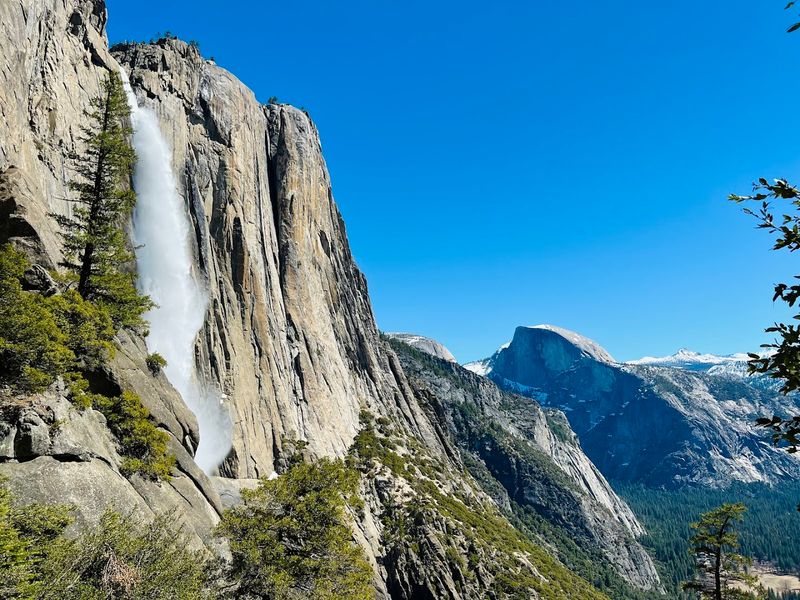
Standing at the top of one of the tallest waterfalls in the world takes genuine effort, and the Upper Yosemite Falls Trail makes no attempt to hide that fact.
At 7.2 miles round trip with 2,700 feet of elevation gain, it is widely described as a leg-burner that tests endurance from the first switchback.
The climb is relentless but structured, with the falls audible and visible at various points along the ascent.
Most of the difficulty is front-loaded, meaning the steepest sections come early and the upper terrain opens into broader views as elevation is gained.
The panoramic perspective from the top of the falls is genuinely expansive, taking in the full sweep of Yosemite Valley in a way that no valley-floor viewpoint can replicate.
Spring and early summer bring the falls to full roar, fed by Sierra snowmelt, while late summer can reduce the flow significantly.
Carrying extra water and wearing layers is practical since temperatures at the top can differ noticeably from the valley floor.
The trail is considered open year-round, though early morning starts help avoid afternoon heat and crowds during peak season.
2. Wapama Falls Trail, Hetch Hetchy, Yosemite National Park, California
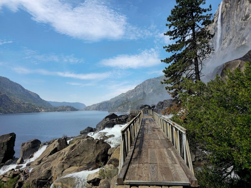
Hetch Hetchy offers a quieter version of Yosemite grandeur, and the Wapama Falls Trail is the main reason to make the drive out there.
At approximately 5 miles round trip, the route runs along the edge of the reservoir before delivering a powerful seasonal waterfall dropping directly into the water below.
The scale of the surrounding granite walls gives the whole experience a dramatic, almost theatrical quality.
Access to the Hetch Hetchy area runs from sunrise to sunset, and the road closes during snowy conditions or when overnight snow is forecast.
Vehicles and trailers exceeding 25 feet in length or 8 feet in width are not permitted on the narrow winding road. Parking delays are possible on mid-day weekends due to limited lot capacity.
Swimming and boating in the reservoir are prohibited to protect the drinking water supply, and pets are not allowed on any trails within this area.
Late spring is the prime window for visiting since snowmelt drives the falls to their most powerful flow.
During unusually high water periods in spring or early summer, sections of the trail and its bridges may become impassable or result in hikers getting thoroughly soaked by spray.
3. Alamere Falls via Palomarin and Wildcat Beach, Point Reyes National Seashore, California
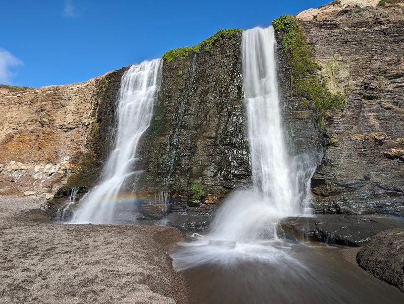
A waterfall that drops straight onto a beach is not something most hikers encounter in a lifetime, which makes Alamere Falls genuinely worth the long haul to reach it.
The National Park Service confirms the recommended route requires a minimum 13-mile round trip, following the Coast Trail to Wildcat Campground and then walking roughly one mile south along Wildcat Beach, accessible only during low tide.
Checking tide charts before heading out is essential planning, not optional.
The NPS explicitly warns against using any unmaintained shortcut or trail labeled as an Alamere Falls trail. Those routes involve crumbling cliffs, dense poison oak, heavy tick exposure, and zero cell service.
Search and rescue operations in this area occur nearly every week due to visitors attempting to scramble down unstable cliff faces.
The falls themselves stand approximately 30 to 40 feet tall and feature several distinct drops before reaching the sand.
There is no entrance fee for Point Reyes, but the Palomarin Trailhead parking lot, reached via a rough gravel road for the last 1.2 miles, fills by around 10 am on weekends.
Arriving early and staying on designated trails are the two most important things to keep in mind.
4. Cataract Trail, Mount Tamalpais Watershed, Marin County, California
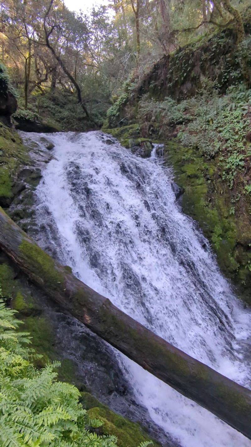
After a good rain, few trails in the Bay Area match Cataract Creek for sheer visual payoff per mile.
The Parks Conservancy highlights this route for its varied terrain, scenic views, picnic stops, and what they describe as spectacular waterfalls.
The trail is listed at 2.70 miles round trip, though longer loop options extending to 7 or 7.5 miles are available for hikers who want more ground covered.
The difficulty ranges from moderate to strenuous depending on the chosen route, with steady elevation gain throughout.
Late fall through early spring is the prime window when the creek runs strong and the falls put on their best show.
During dry summer months the water can drop to a trickle, which significantly changes the experience.
The path winds through lush woodland including redwood groves, creating the feel of a temperate rainforest corridor.
Access within the Marin Municipal Water District land runs from sunrise to sunset.
Swimming in the pools beneath the falls is prohibited to protect the public drinking water supply, and mossy rocks near the water can be dangerously slippery at any time of year.
Leashed dogs are permitted on this trail, and appropriate footwear matters after heavy rain when the path turns muddy.
5. James K. Carr Trail to Whiskeytown Falls, Whiskeytown National Recreation Area, California
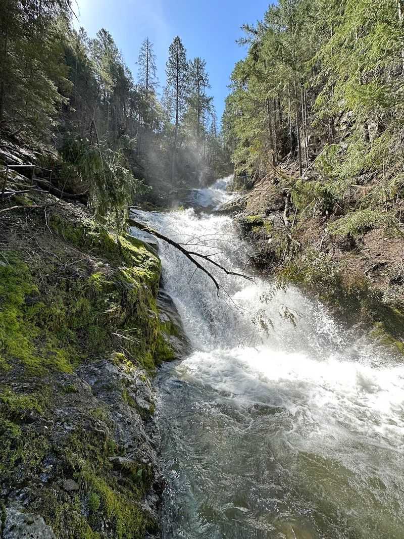
Short does not mean easy here.
The James K. Carr Trail covers 3.4 miles round trip with 750 feet of elevation gain, and the National Park Service rates it as strenuous, meaning the climb earns the view rather than just presenting it.
The falls at the end provide a genuinely refreshing payoff, with a clear pool at the base that rewards the effort on a warm day.
The Whiskeytown visitor center operates Wednesday through Sunday from 8:30 am to 4 pm, and an entrance pass is required to access the recreation area.
Following the 2018 Carr Fire, most trails in the park have reopened, and Whiskeytown Falls is currently accessible.
It is recommended as an alternative to other trails that remain closed due to hazardous post-fire conditions.
Locking vehicles and removing valuables from sight is standard advice for any trailhead in the area.
The route itself moves through recovering forest that shows both the resilience of the landscape and the visible marks of recent wildfire history, which adds an unexpected layer of context to the hike.
Carrying enough water for the full climb and descent is practical given the strenuous rating and limited shade on portions of the trail.
6. Tokopah Falls Trail, Sequoia National Park, California
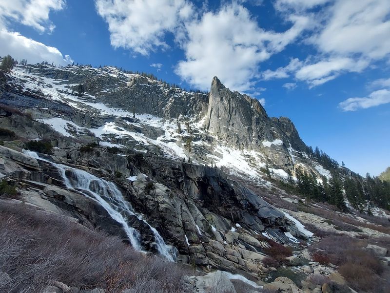
Granite canyon walls, a riverside trail, and a 1,200-foot cascade at the end make Tokopah Falls one of the more visually dramatic hikes in the southern Sierra Nevada.
The National Park Service lists the route as 3.4 miles round trip with 600 feet of elevation change, putting it in the moderate range and making it accessible to a wider range of fitness levels than many Sierra hikes.
The trailhead sits just beyond the Marble Fork Bridge in Lodgepole Campground, where day-use parking is available.
Wildlife sightings along the route are common, with marmots, deer, and bears all documented in the area.
The falls are entirely seasonal, fed by Sierra snowmelt, and peak flow runs from late spring through early summer, typically May through July.
By August the volume drops sharply, and by September and October only a thin trickle may remain.
The trail is inaccessible in winter when snow and ice close the path along with Lodgepole Campground.
Access to Sequoia National Park requires payment of an entrance fee, which was $35 per private vehicle for up to seven days as of 2024.
Caution near the water is important in spring and early summer due to powerful undercurrents generated by heavy snowmelt runoff.
7. Falls Loop Trail, McArthur-Burney Falls Memorial State Park, California
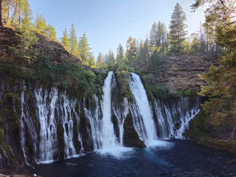
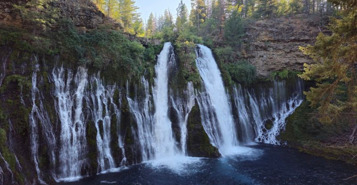
Theodore Roosevelt reportedly called Burney Falls the eighth wonder of the world, and while that claim is hard to verify, the waterfall itself is genuinely unusual.
Standing 129 feet tall and flowing at roughly 100 million gallons per day year-round, it is fed by hundreds of natural springs within the surrounding volcanic rock rather than relying solely on seasonal snowmelt.
The Falls Loop Trail covers 1.2 miles and provides direct access to the falls and the overlook above them.
After undergoing erosion repairs, the Falls Loop Trail officially reopened in December 2024.
For summer 2026, a pilot reservation program requires advance day-use bookings on Fridays, Saturdays, Sundays, and holidays from May 15 through September 27.
Monday through Thursday visits do not require reservations, and same-day bookings are not accepted.
Parking passes are limited and typically cost $10 to $11 per vehicle plus a processing fee. Annual California State Parks pass holders still need a reservation, though the entry fee is waived.
Parking along Highway 89 outside the park is illegal. Surrounding trails including the Burney Creek Trail and P.S.E.A.
Trail remain closed due to storm erosion, but the Rim Trail, Headwaters Trail, and Pioneer Cemetery Trail are currently open.
8. Pfeiffer Falls and Valley View Loop, Pfeiffer Big Sur State Park, California
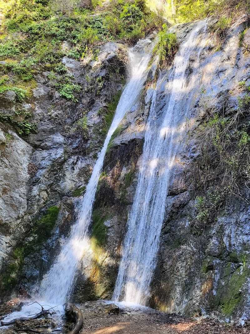
After more than a decade of closure, the Pfeiffer Falls Trail came back online around June 2021, and the reunion with this 60-foot redwood-framed waterfall was worth the wait.
Combined with the Valley View Trail, the route forms a roughly 2-mile round-trip loop that moves through a mix of coastal redwood and oak woodland, crossing a recently repaired footbridge along the way.
The Valley View Overlook adds a sweeping perspective of the Big Sur River Valley, Point Sur, and Andrew Molera State Park.
Pfeiffer Big Sur State Park is open from 8 am to sunset.
Dogs are welcome on designated paths like the Warden’s Path and River Path and in day-use lots and campgrounds, but they are not permitted on the hiking trails that include the falls route.
The redwood canopy keeps the trail shaded and relatively cool even on warmer days.
The pace of the loop allows for a genuinely immersive experience rather than a rushed checklist hike.
Seasonal rainfall affects how full the falls run, with late winter and spring typically producing the strongest flow.
The combination of towering trees, the sound of the creek, and the reveal of the falls at the end of the canyon path makes this one of the more complete short hikes on the Central Coast.
9. Sturtevant Falls Trail, Angeles National Forest, near Arcadia, California
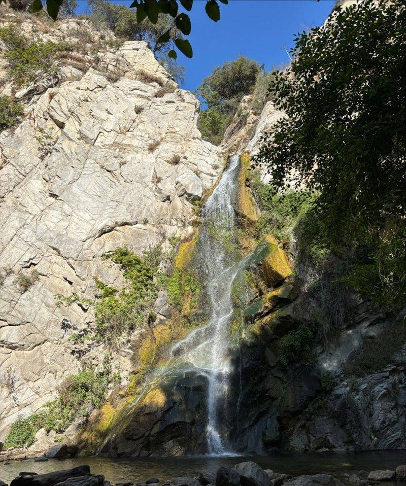
Chantry Flat Road reopened on October 2, 2024, following years of closure after the 2020 Bobcat Fire, which means Sturtevant Falls is accessible again for the first time in a long stretch.
The trail covers 3.3 miles as an out-and-back with roughly 680 feet of elevation gain, rated moderate.
Hikers often describe it as an upside-down route since the trail descends steeply at the start and the real work comes on the return climb back to the trailhead.
The path follows a creek through a lush canyon, passing century-old resort-era cabins that add historical texture to the surroundings.
Multiple creek crossings are part of the experience, and the 50-foot cascade at the end flows nearly year-round with the most impressive display appearing after spring rainstorms.
As of March 2026, both the Sturtevant Falls trail and the Sturtevant Loop are confirmed open.
Chantry Flat Road may still experience intermittent closures for ongoing fire-related repairs, so checking the Angeles National Forest Chantry Flat page or calling (818) 899-1900 before visiting is recommended.
An Adventure Pass costing $5 for a day or $30 for a year is required for parking. Cell coverage in the area is limited, and grilling and smoking are prohibited due to extreme fire danger.
10. Escondido Falls via Edward Albert Trail, Malibu, California
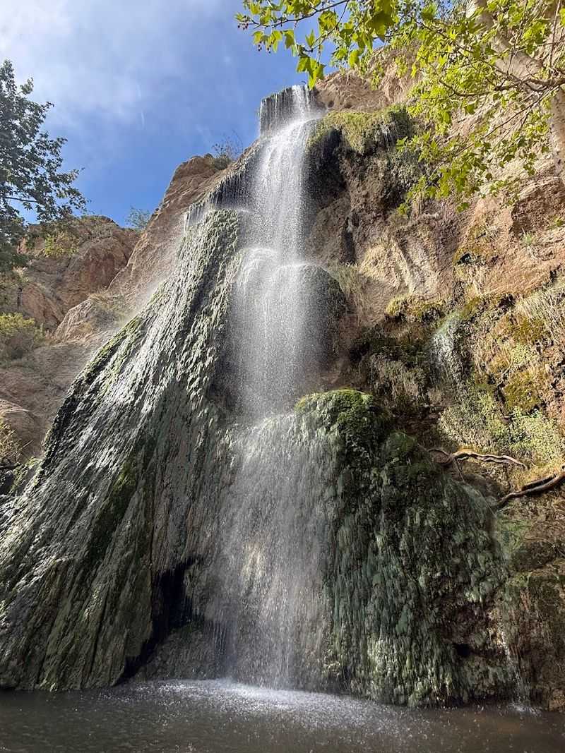
Recognized as the tallest waterfall in the Santa Monica Mountains, Escondido Falls tops out at 150 feet across multiple tiers according to the Mountains Recreation and Conservation Authority.
The catch is that the upper falls are officially closed to the public for safety reasons, and the public parkland ends at the lower tier which stands 40 to 50 feet tall.
Visiting during or just after a rainy stretch is the key to seeing any meaningful flow since the falls depend entirely on rainfall and can be dry during extended dry spells.
The hike spans approximately 4.2 miles round trip with 400 to 500 feet of elevation gain to the base of the falls.
The first section follows a paved road called Winding Way for roughly 0.75 to 1 mile before the canyon trail begins.
Parking is available at a lot located at 27200 Winding Way in Malibu, with a fee of $12, and a portable toilet is provided at the lot but no facilities exist beyond that point.
The canyon trail crosses Escondido Creek multiple times, and those crossings can be dry depending on the season.
Once inside the canyon, the path stays mostly shaded under oak and riparian woodland.
Smoking and open fires are strictly prohibited throughout the area due to high fire risk, and climbing beyond the lower falls boundary is not permitted.
11. Feather Falls Scenic Area and Recreation Trail, Plumas National Forest, near Oroville, California
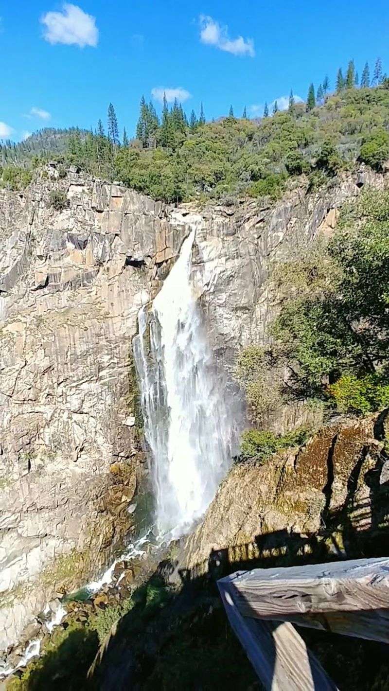
At 410 feet, Feather Falls ranks among the tallest free-leaping waterfalls in the United States, and the Forest Service recommends setting aside 4 to 6 hours for the full hike, which tells you something about the scale of the commitment involved.
The trail system features upper and lower sections that form a loop to the falls overlook, with the total distance landing in the range of a solid half-day effort.
The payoff at the overlook is a full-frontal view of the cascade plunging into the canyon below.
Spring and early summer bring the strongest flow, fed by snowmelt from the surrounding mountains.
The trail passes through mixed pine and oak forest, with canyon views opening up as the route progresses toward the overlook.
Elevation change along the loop is significant enough that trekking poles are useful, particularly on the descent sections.
Bringing plenty of water and snacks is practical given the recommended time commitment.
The Plumas National Forest area around Oroville sees far fewer visitors than Yosemite or Sequoia, which means the overlook experience tends to feel less crowded even on weekends.
Checking current trail conditions with the Plumas National Forest before visiting is advisable since seasonal road and trail access can vary based on weather and fire conditions.