You Can Enjoy All 9 Of These California Road Trips Without Breaking The Bank
A road trip should not require a financial recovery plan, we can all agree on that, right?
The best ones keep things simple. A full tank, a decent playlist, and a route with enough scenery to make the miles feel useful.
Expensive hotels, fancy reservations, and overplanned stops can stay home for once.
Sometimes the smarter trip is the one with roadside views, free overlooks, and room to pull over just because something looked good.
A budget-friendly drive through California can still come with coastline, desert views, and towns worth wandering.
These road trips prove that memorable does not have to mean pricey. The real fun comes from choosing routes where the scenery does most of the work.
Pack lunch. Split gas. Leave space for cheap tacos, a lake stop, or a sunset that costs absolutely nothing.
1. Highway 1 From Monterey To Big Sur
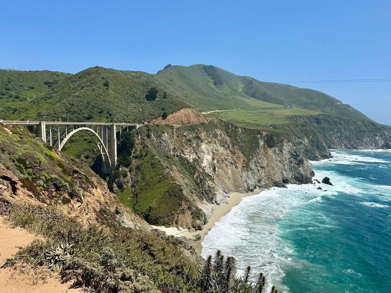
Few drives anywhere in the world match the raw drama of the stretch of Highway 1 that runs south from Monterey toward Big Sur.
The road clings to cliffs above the Pacific Ocean, offering views that shift constantly with the light and weather.
Cell service tends to disappear quickly along this corridor, so downloading offline maps before leaving Monterey is a practical first step.
The route passes through Point Lobos State Natural Reserve, Garrapata State Park, and eventually reaches the towering redwoods inside Pfeiffer Big Sur State Park.
Many of the pullouts and vista points along the way are completely free to use, making it easy to stop as often as wanted without worrying about extra fees.
Bixby Creek Bridge, one of the most photographed structures in California, has a free turnout on the northern side where visitors can park and take in the full scale of the arch.
Timing the drive for a weekday morning tends to mean lighter traffic and better parking at popular spots. The coastal weather can shift quickly, so layering clothing is a smart move.
Bringing enough food and water for the day is also recommended since services along the route are limited and tend to be priced higher than in town.
2. Highway 395 From Lone Pine To Bishop
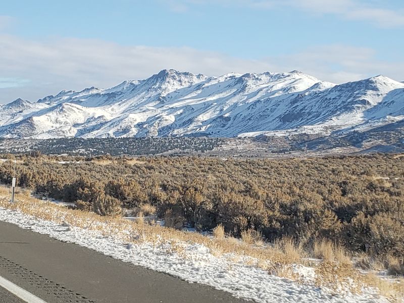
Running along the eastern edge of the Sierra Nevada, Highway 395 between Lone Pine and Bishop is one of those drives that feels cinematic in the best possible way.
The Alabama Hills sit just west of Lone Pine and have served as a backdrop for countless Western films, and walking among the rounded granite boulders there costs nothing at all.
The contrast between the golden desert floor and the snow-capped peaks rising behind it creates a visual experience that is genuinely hard to match.
The town of Lone Pine itself has a small historic downtown with affordable dining options, and the Museum of Western Film History on Main Street offers a reasonably priced look at the region’s Hollywood connection.
Heading north toward Bishop, the road passes through the Owens Valley, which offers wide open views and a sense of space that feels rare in modern travel.
Ancient Bristlecone Pine Forest, located in the White Mountains east of Bishop, charges a modest fee and rewards visitors with some of the oldest living trees on the planet.
Bishop has a solid selection of budget-friendly motels and a lively farmers market during the summer months.
The drive itself takes about an hour without stops, but planning for a full day allows time to explore the Alabama Hills and any trailheads along the way.
3. Golden Chain Highway From Nevada City To Columbia
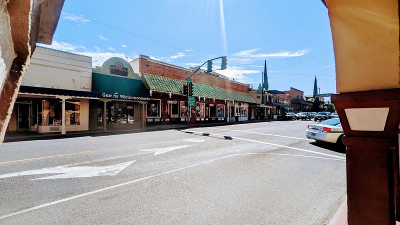
Gold fever once swept through the Sierra Nevada foothills, and the Golden Chain Highway still carries echoes of that era through every small town it connects.
Running along Highway 49, this route links Nevada City in the north to the living history town of Columbia in the south, passing through Grass Valley, Auburn, Placerville, and Sonora along the way.
The stretch covers some of the most charming and historically layered small-town scenery in California.
Nevada City has a beautifully preserved Victorian downtown with independent shops and cafes that feel genuinely local rather than staged for tourists.
Columbia State Historic Park, near the southern end of the route, allows visitors to walk through a remarkably intact gold rush town where some buildings date back to the 1850s.
The drive itself passes through rolling oak woodland and pine forest, with the landscape shifting noticeably as elevation changes.
Marshall Gold Discovery State Historic Park in Coloma marks the site where gold was first found in 1848, and a visit there adds real historical depth to the journey.
Budget travelers will find that much of what makes this route special, the scenery, the history, and the small-town atmosphere, requires little more than time and a full tank of gas.
4. Redwood Highway From Eureka To Crescent City
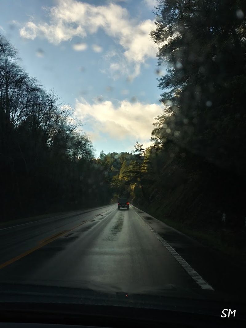
There is something almost disorienting about driving through a forest where the trees are older than most civilizations.
The Redwood Highway, following Highway 101 and Avenue of the Giants north from Eureka to Crescent City, passes through groves of coastal redwoods that have been growing for thousands of years.
The scale of the trees does not fully register until standing beside one on foot.
Humboldt Redwoods State Park, located along the Avenue of the Giants, protects the largest remaining old-growth coastal redwood forest in the world.
Day-use access to most areas of the park is free, and short walks like the Founders Grove Nature Loop Trail take less than half an hour while delivering enormous visual impact.
The drive from Eureka to Crescent City without stops takes roughly two hours, but stretching it across a full day allows time to walk multiple groves and stop at the visitor center in Burlington.
Prairie Creek Redwoods State Park, closer to Crescent City, has elk meadows where Roosevelt elk graze in the open and can be observed from the road at no cost.
Crescent City itself has affordable lodging options and a working harbor that offers a quiet, unhurried atmosphere.
The entire corridor through the redwoods tends to feel cooler and mistier than the surrounding region, making layers a practical packing choice year-round.
5. Rim Of The World Scenic Byway From San Bernardino To Big Bear Lake
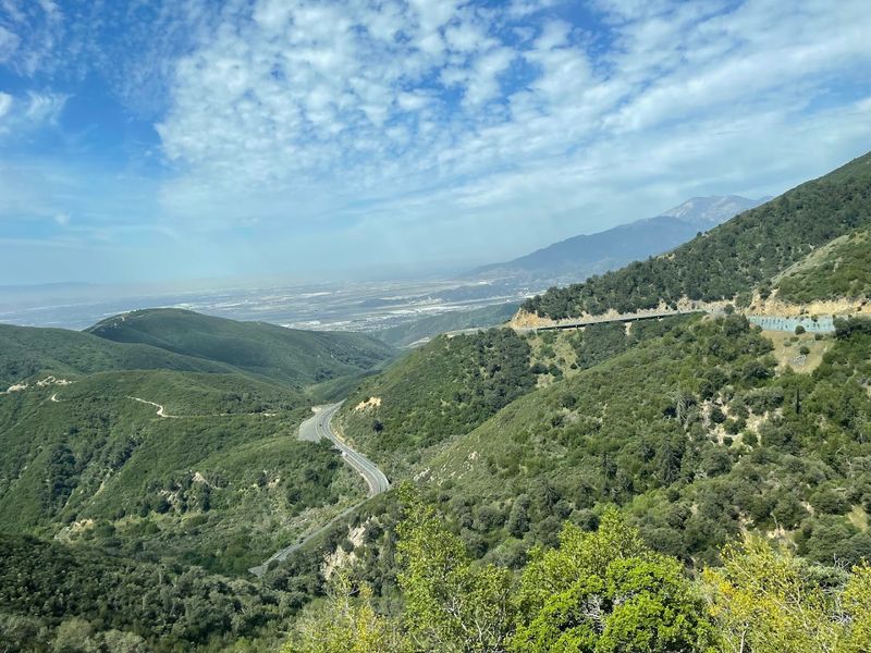
Climbing out of the San Bernardino Valley and into the San Bernardino Mountains, the Rim of the World Scenic Byway follows Highway 18.
The name of the road is not an exaggeration.
At certain points the road runs along a narrow ridge with views dropping away sharply on both sides, offering panoramas that stretch toward the desert floor far below.
The drive covers roughly 40 miles from the base of the mountains to Big Bear Lake and passes through the communities of Crestline, Lake Arrowhead, and Running Springs along the way.
Lake Arrowhead Village has free parking and a lakeside walking area that makes for a pleasant mid-drive stop.
Big Bear Lake itself has a free public beach at Meadow Park and a handful of affordable lunch spots near the main village area.
Adventure Pass permits are required for parking at most national forest trailheads along the route, but simply driving the byway and stopping at vista points does not require one.
Snow can close or complicate portions of the road during winter months, so checking Caltrans road conditions before heading up is worth the two minutes it takes.
The fall foliage season tends to bring particularly vivid color to the higher elevation stretches of the route.
6. Historic Route 66 From San Bernardino To Barstow
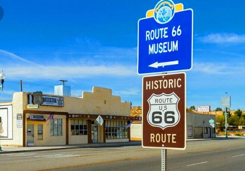
Route 66 carries a mythology that few other roads in the world can claim.
The stretch running east from San Bernardino through Rancho Cucamonga, Fontana, and Victorville before reaching the high desert town of Barstow follows the original alignment of the Mother Road and passes through communities that still wear their Route 66 heritage proudly.
The California Route 66 Museum in Victorville is a worthwhile stop for understanding the cultural history of the highway and charges a modest admission fee.
Elmer’s Bottle Tree Ranch, located along the National Trails Highway near Oro Grande, is a free outdoor folk art installation made entirely from vintage glass bottles and metal pipes that catches light in unexpected ways throughout the day.
The stretch through the Cajon Pass offers a dramatic transition from the inland valley up into the high desert.
Barstow has several affordable dining options along Main Street and the Route 66 Mother Road Museum, which is housed in a historic Harvey House building.
The Mojave Desert landscape along this stretch has its own stark beauty, with Joshua trees, dry washes, and wide open skies that feel genuinely different from coastal or mountain California.
Most of the best stops along this corridor are either free or very low cost, making it one of the most budget-friendly road trips in the state.
7. Feather River Scenic Byway From Oroville To Quincy
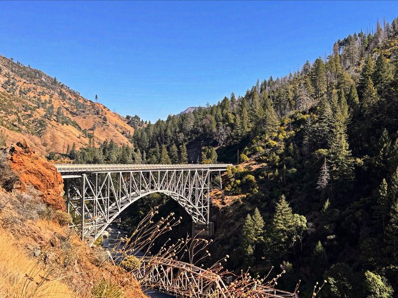
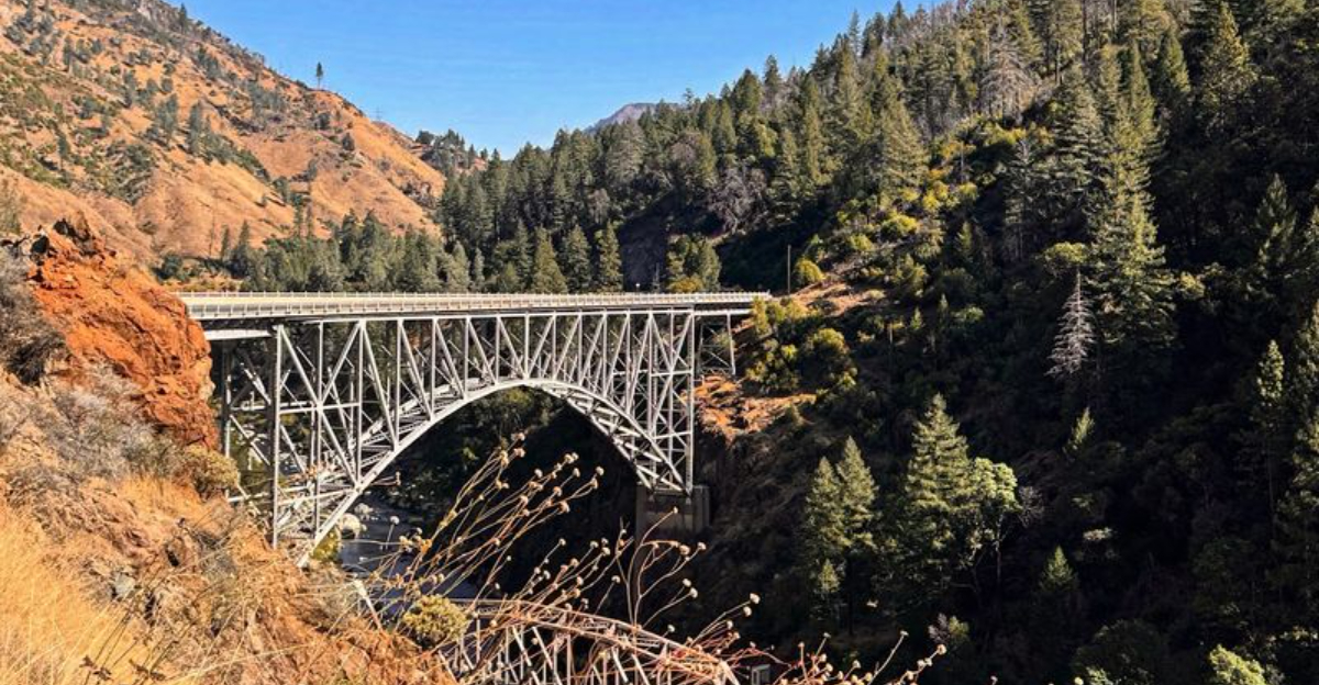
Running through one of the least-traveled and most rewarding canyons in California, the Feather River Scenic Byway follows Highway 70 from Oroville northeast to Quincy through the Feather River Canyon.
The river itself shifts between deep emerald pools and rushing white water depending on the season, and the road follows it closely enough that the sound of moving water is nearly constant.
The canyon walls rise steeply on both sides, creating a sense of enclosure that feels very different from the open vistas of coastal or desert drives.
The byway passes through the small railroad community of Pulga and the historic town of Keddie, where a Victorian-era rail junction still stands.
Several free pullouts along the route offer direct access to the river for fishing, swimming, or simply sitting beside the water.
The Feather River is a designated Wild and Scenic River in portions of this corridor, which helps explain the remarkable clarity of the water.
Quincy, at the eastern end of the drive, has a charming downtown with locally owned restaurants and a county courthouse that dates back to 1921.
The drive from Oroville to Quincy covers roughly 70 miles and takes about two hours without stops.
8. Ebbetts Pass Scenic Byway From Arnold To Markleeville
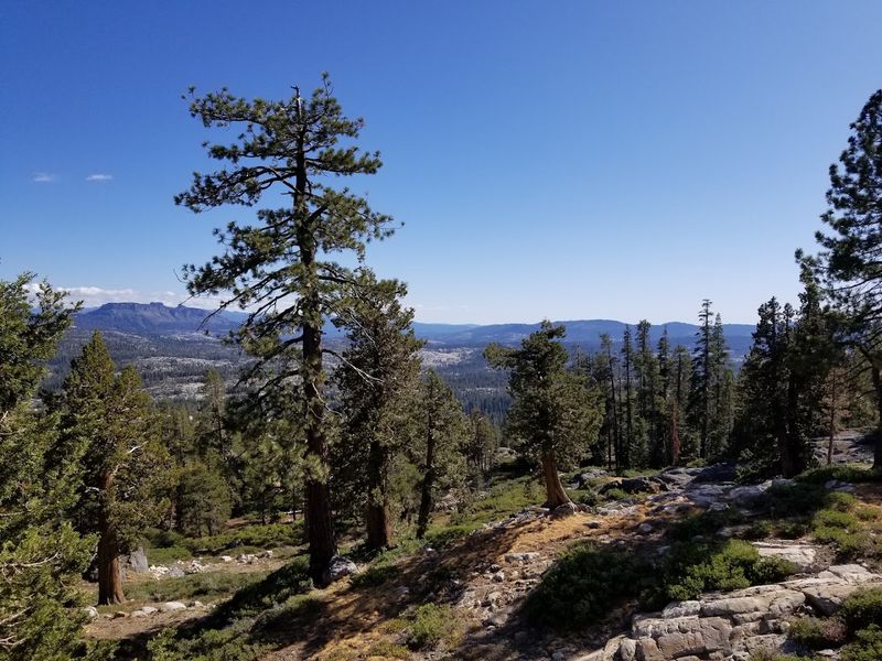
Crossing the Sierra Nevada at 8,730 feet, Ebbetts Pass is one of the highest and most dramatic mountain passes in California that can be reached by a regular passenger vehicle.
The scenic byway follows Highway 4 from the forested foothill town of Arnold eastward through the Stanislaus National Forest and over the pass before descending into the quiet high desert community of Markleeville.
The road is closed to vehicles with trailers or RVs beyond a certain point due to its narrow and winding nature, which actually helps keep the route peaceful and uncrowded.
The Big Trees area near Arnold protects a grove of giant sequoias inside Calaveras Big Trees State Park, which charges a vehicle day-use fee and offers some of the most accessible old-growth sequoia viewing in the state.
Beyond the park, the road climbs steadily through mixed conifer forest before opening into rocky alpine terrain near the summit.
The volcanic rock formations near the pass have an otherworldly quality that surprises many first-time visitors.
Markleeville has a genuine small-town character with a historic hotel and a handful of local businesses along its short main street.
Hot springs enthusiasts will find Grover Hot Springs State Park just a few miles outside of town, offering affordable soaking in a mountain meadow setting.
The byway is typically open from late May through early November depending on snowpack conditions.
9. Volcanic Legacy Scenic Byway From Mount Shasta To Lassen Volcanic National Park
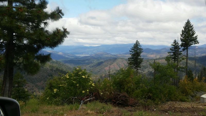
Connecting two of the most geologically active landscapes in the continental United States, the Volcanic Legacy Scenic Byway runs south from the town of Mount Shasta along Highway 89 toward Lassen Volcanic National Park.
The route passes through McCloud, around the eastern shore of Lake Siskiyou, and through the Hat Creek Valley before reaching the park entrance.
The volcanic geology of the region is visible throughout the drive in the form of lava flows, cinder cones, and hydrothermal features that sit right alongside the road.
McArthur-Burney Falls Memorial State Park sits along the byway and is home to a 129-foot waterfall that flows year-round, fed by underground springs rather than snowmelt.
The park charges a vehicle day-use fee and offers short trails that lead directly to the base and top of the falls.
Burney Falls is genuinely one of the most impressive waterfalls in California and tends to be less crowded than better-known sites further south.
Lassen Volcanic National Park charges a standard national park entrance fee, and a single-entry ticket covers access to the Lassen Volcanic National Park Highway.
The park road is typically open from late June through October.
Spending a full day on the byway from Mount Shasta to the southern end of the park covers roughly 100 miles of consistently remarkable scenery.