These 9 Stunning Idaho River Islands Feel Like Hidden Worlds Waiting To Be Explored
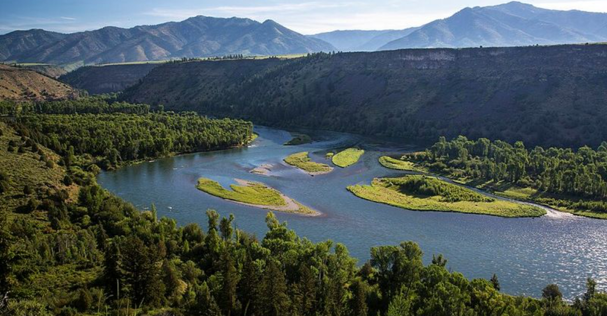
Most road trips stick to the shoreline. The more interesting ones occasionally require a bridge, a boat, or a little curiosity.
Idaho’s rivers hide stretches of land that feel wonderfully separate from everything around them. Water shapes the pace.
Wildlife moves nearby. Even familiar scenery looks different once the mainland slips behind you.
Some islands carry visible traces of the past. Others feel almost untouched when the crowds stay away.
Each visit offers its own version of quiet, adventure, or unexpected discovery.
Reaching them may take extra planning, but that effort is part of the appeal. Ordinary afternoons can quickly become stories worth retelling.
These river islands reveal a side of the state that many travelers overlook. Leave the usual route behind and see what has been waiting between the banks.
1. Ritter Island
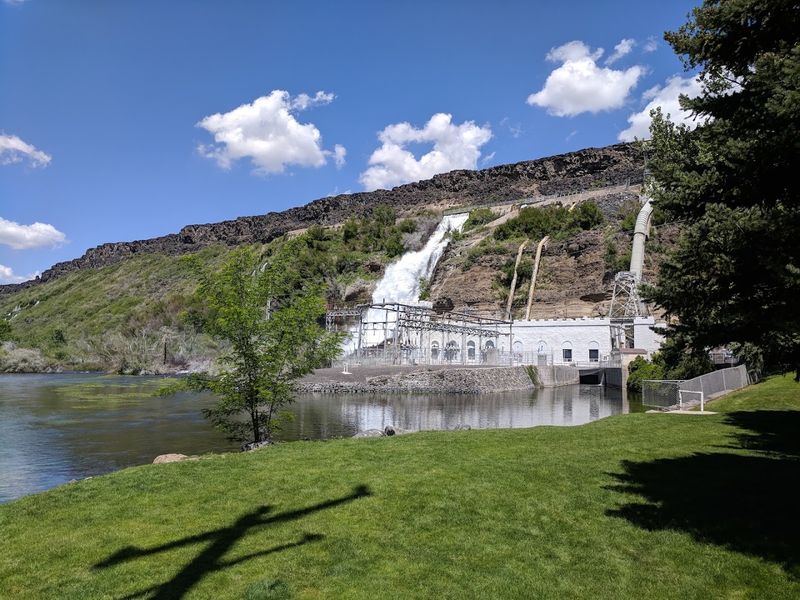
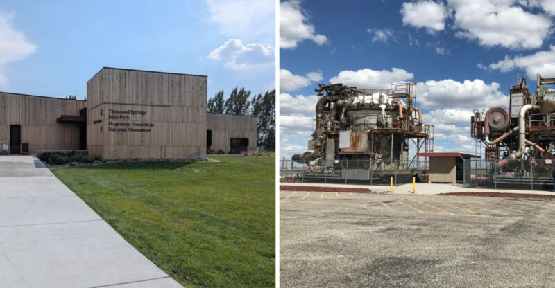
Spring-fed waterways create a refreshing backdrop for exploring Ritter Island, one of the distinct units within Thousand Springs State Park near Wendell.
Visitors reach the island by following Thousand Springs Grade into the Snake River canyon, where lawns, mature trees, waterfalls, and historic agricultural buildings fill the landscape.
Minnie Miller Springs supplies part of the clear water that moves through the property, while preserved structures recall the island’s years as a working dairy farm.
Walking routes allow guests to view the springs, photograph the farmstead, watch for birds, and spend time beside the Snake River without following an especially demanding trail.
Historical interpretation adds useful context to the scenery by explaining Minnie Miller’s role in the property and the farming activity that once shaped the island. Public access is seasonal rather than year-round.
For summer 2026, Idaho Parks and Recreation lists Ritter Island as open from Memorial Day weekend through Labor Day weekend, Thursday through Monday from 10 a.m. to 3 p.m. It is closed Tuesday and Wednesday and during the remainder of the year.
The approach road is narrow and steep, so visitors should review current vehicle guidance before making the descent. With those practical details handled, Ritter Island offers a balanced combination of natural features and local history.
2. Kelly Island
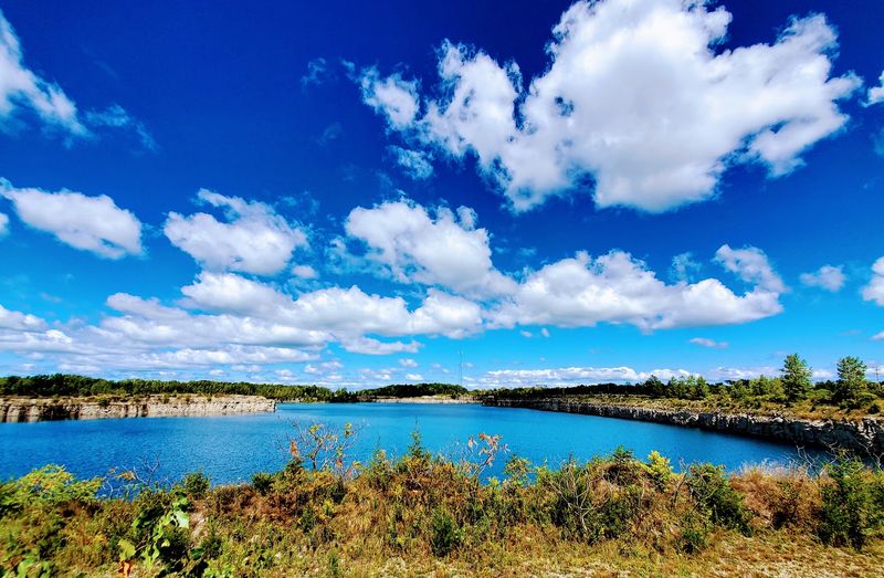
Cottonwood trees provide welcome shade around Kelly Island Campground, a Bureau of Land Management recreation area roughly 25 miles northeast of Idaho Falls.
The campground occupies part of the South Fork of the Snake River corridor and gives visitors direct access to fishing, boating, wildlife viewing, and relaxed time beside moving water.
Current BLM information lists 14 single campsites and one reservable group site, along with picnic tables, fire rings, vault toilets, pull-through spaces, and a central water spigot.
Electrical hookups are not available, so campers should arrive prepared for a straightforward outdoor stay rather than a full-service campground experience.
Trout fishing remains one of the strongest reasons to visit, though anyone entering the river should check water conditions and carry suitable safety equipment. Nearby foothill views add depth to the cottonwood-lined setting, especially during quieter mornings and evenings.
Kelly Island is neither an elaborate resort nor a completely undeveloped backcountry site. Its appeal comes from having basic facilities without losing the atmosphere of an eastern Idaho river campground.
Overnight fees changed for the 2026 season, making it important to confirm current rates and availability before traveling.
The group campsite is the only site that can be reserved directly through the BLM Upper Snake Field Office, while the regular sites operate on a first-come, first-served basis.
3. Sportsman Park Island
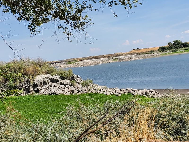
A small Snake River island brings cultural detail and waterfront scenery into the center of Idaho Falls. Sportsman Park, also associated with Pedersen Park, contains the Japanese Friendship Garden at 600 Broadway.
Stone paths, landscaped water features, Japanese fencing, garden structures, and carefully arranged viewing areas give the island a much different character from the city streets only a short distance away.
One route known as the Dragon’s Path crosses a pond, while a deck and viewing platform create places to pause beside the water.
A large Japanese lantern presented by Tokai-Mura recognizes the sister-city relationship that helped inspire the garden. Volunteers contributed many hours to developing and maintaining its features, giving the space a strong community connection.
The rocky island also has ties to early transportation history because it was the site of an important bridge across the Snake River in eastern Idaho.
Today, the setting works best as a short and respectful visit rather than a high-energy recreation stop.
Guests are asked to remain on designated paths and follow garden rules. Reservations are no longer accepted for the Japanese Friendship Garden or its surrounding area, allowing the public to enjoy it during an ordinary walk through Sportsman Park.
Its compact size makes it easy to combine with downtown sightseeing or a longer walk along the Idaho Falls River Walk.
4. Eagle Island
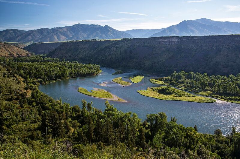
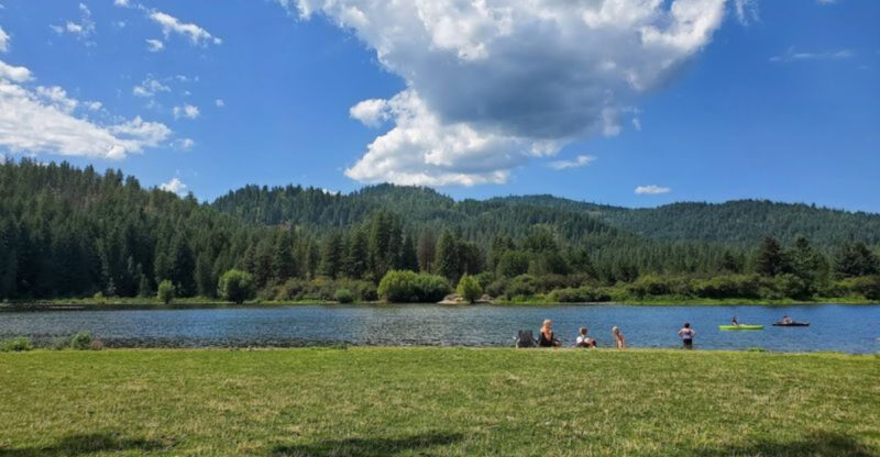
Broad lawns and more than five miles of trails give Eagle Island State Park enough space to support several kinds of outdoor recreation.
The 545-acre park lies west of Boise between northern and southern channels of the Boise River, creating an island landscape within easy reach of the Treasure Valley.
Warm summer days bring people to the swimming beach and grassy picnic areas, while walkers, horseback riders, and dog owners can follow routes beneath mature trees.
Nonmotorized boats are permitted, giving appropriately equipped visitors another way to enjoy the park’s water features.
Disc golf adds a more active option without requiring a trip into the mountains. Despite its convenient setting, the park still retains stretches of open ground and a rural atmosphere that can feel removed from nearby development.
Families can settle near the beach, groups can reserve shelters, and visitors with limited time can choose a shorter walk instead of building an entire day around the trip.
Eagle Island should not be described as remote or hidden, but its accessibility is part of its value.
Idaho Parks and Recreation returned vehicle operations to the park’s main State Street entrance in April 2025 after temporary construction-related changes.
Day-use areas in Idaho state parks generally operate from 7 a.m. to 10 p.m. unless otherwise posted, though current entrance conditions, fees, swimming notices, and activity availability should always be checked before departure.
5. Friendship Island
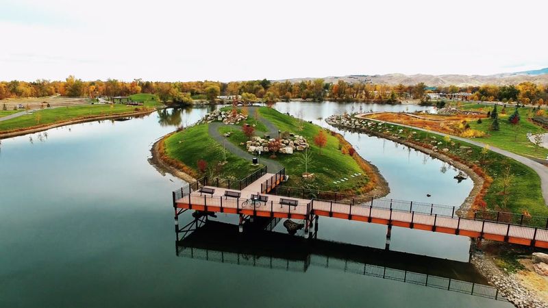
Water surrounds a formal gathering space inside Boise’s 55-acre Esther Simplot Park. Friendship Island sits among approximately 23 acres of ponds at 3206 Pleasanton Avenue, placing it close to open lawns, wetlands, a playground, restrooms, and Greenbelt connections.
Its landscaped setting makes it better suited to ceremonies and quiet gatherings than to rugged island exploration. Boise Parks and Recreation currently allows the island to be reserved as a garden facility with a listed capacity of 100 people.
Reservations apply to formal ceremonies, and city policies require participants and photographers to remain on manicured turf or paved surfaces.
Visitors who are not attending an event can still enjoy the larger park, walk near the ponds, use nearby paths, or watch activity on the water.
Fishing, wading, and swimming are permitted in designated portions of Esther Simplot Park, subject to current conditions and posted rules.
Friendship Island is separate from the park’s reservable pavilion and pier, so anyone arranging an event should make sure the correct facility has been selected.
Pets are not permitted in Esther Simplot Park under city code, although service animals are welcome. Rather than feeling isolated, the island works as a distinctive centerpiece within a busy urban recreation area.
Its convenient position near the Boise River Greenbelt also allows visitors to include it in a longer walk or bicycle outing.
6. Three Island Crossing
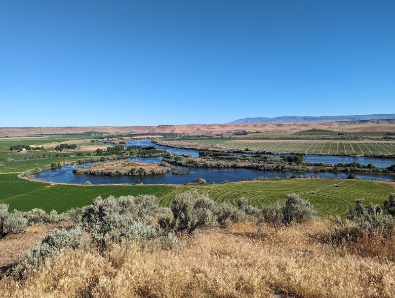
River history shapes nearly every part of a visit to Three Island Crossing State Park near Glenns Ferry.
Although the park is not one individual island that visitors freely explore, it overlooks the Snake River area where nineteenth-century Oregon Trail travelers used islands and gravel bars while attempting to reach a northern route.
Modern guests can learn about the crossing at the Oregon Trail History and Education Center, which currently operates daily from 9 a.m. to 4 p.m. and closes on holidays.
Exhibits, covered-wagon displays, historical interpretation, and surviving wagon ruts help explain the movement of emigrants through the region.
Thoughtful interpretation also recognizes that Native communities lived on and used this land long before the Oregon Trail passed through it.
Historical conditions at the river were difficult, so the story is best presented as an educational subject rather than a dramatic adventure recreated for entertainment.
Beyond the interpretive center, the park has picnic areas, campgrounds with water and electrical service, eight cabins, fishing access, and disc golf. Its address at 1083 South Three Island Park Drive places it about two miles from Interstate 84 at the Glenns Ferry exit.
Three Island Crossing fits this collection because of its close relationship with the Snake River’s historic island route, though visitors should expect a developed state park and history center rather than an isolated island destination.
7. Snake River Islands Wilderness Study Area
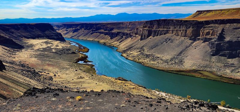
Branching channels create numerous islands along the South Fork of the Snake River in southeastern Idaho. These island corridors are managed through a combination of public agencies and private ownership, making careful route planning essential.
Cottonwoods and willows line many of the banks, while side channels, gravel bars, and broad floodplains provide habitat for birds and other wildlife.
Fishing is a major draw because the South Fork supports native Yellowstone cutthroat trout along with rainbow and brown trout.
Idaho Fish and Game describes it as one of the country’s finest trout-fishing rivers, but the same water that supports a respected fishery also requires preparation from boaters. Access is not comparable to entering a developed city park.
Designated boat ramps, current permits, parking fees, equipment requirements, and public-land boundaries must all be considered before a trip begins.
Overnight camping between Conant and Byington requires a free self-issued permit, and camping is limited to designated sites.
Restrictions also protect active bald eagle nesting areas.
People without suitable boating experience can still appreciate parts of the corridor from established access areas and viewpoints rather than attempting to land on unfamiliar islands.
Conant, Byington, Lorenzo, and Menan are among the managed boat-access locations connected with the South Fork. Current maps and agency notices should guide every visit because currents, submerged obstacles, seasonal conditions, and regulations can change.
8. Together Treasure Valley Dog Island
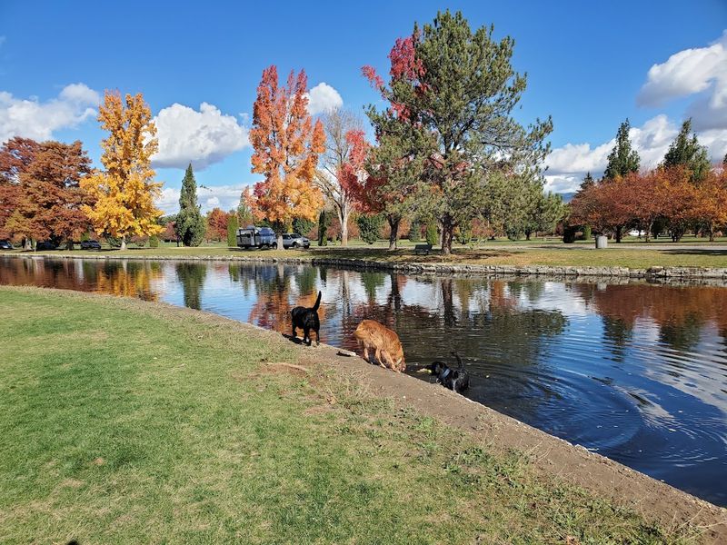
Four-legged visitors get their own waterside recreation space in the southwest corner of Ann Morrison Park. Together Treasure Valley Dog Island is a year-round Boise destination with a 5.4-acre active off-leash area surrounded by a pond.
Dogs can run, play, and enter the water where conditions permit, while a separate fenced space serves animals that may be more comfortable in the designated shy-dog area.
Two picnic shelters and nine benches provide seating for owners who remain responsible for supervising their pets.
The island operates from sunrise to sunset and is distinct from Ann Morrison Park’s broader seasonal off-leash program.
Dogs must remain leashed while traveling to and from the designated area, including along Greenbelt paths, roads, parking areas, and other spaces where Boise’s regular leash ordinance applies.
Owners must also follow posted off-leash regulations and clean up after their animals. Seasonal changes can affect the pond.
Boise lowers water levels during colder months, and the city advises visitors to use caution around exposed banks and avoid unsafe ice.
Temporary closures are also possible during major events or maintenance work, making a current park check useful before leaving home.
Dog Island is developed and community-focused rather than secluded, but its combination of open space, water access, shelters, and separate activity areas gives local pet owners an unusual outdoor option within Boise.
9. South Fork Island Complexes
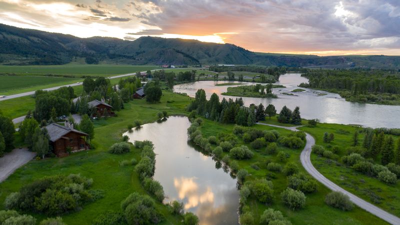
Changing channels form several island complexes as the South Fork of the Snake River moves northwest from Palisades Dam.
The Bureau of Land Management describes the full river corridor as extending 66 miles through high mountain valleys, rugged canyons, and broad floodplains before meeting Henrys Fork near the Menan Buttes.
During its first nine miles, the river follows a narrower channel before widening around groups of islands. Cottonwoods, willows, side channels, and gravel bars give these areas their layered appearance while supporting important riverside habitat.
Anglers value the South Fork for its Yellowstone cutthroat, rainbow, and brown trout populations.
Idaho Fish and Game also manages the river with a particular focus on protecting native Yellowstone cutthroat trout, which means fishing rules and conservation programs deserve attention before casting a line.
Reaching many of the islands requires a boat and an understanding of current river conditions. Established access points, self-issued permits, designated camping rules, sanitation requirements, and parking fees apply in different sections.
Private property also borders portions of the river, so an island visible from the water should not automatically be treated as open public ground.
Travelers who are not prepared for independent boating can use developed access areas or authorized guiding services.
Presented accurately, the South Fork Island Complexes are not one single attraction but a broad river landscape best explored with current maps, appropriate equipment, and respect for its management rules.