This Tiny California Gold Rush Town Turns Into A Mountain Biking Playground Deep In The Lost Sierra
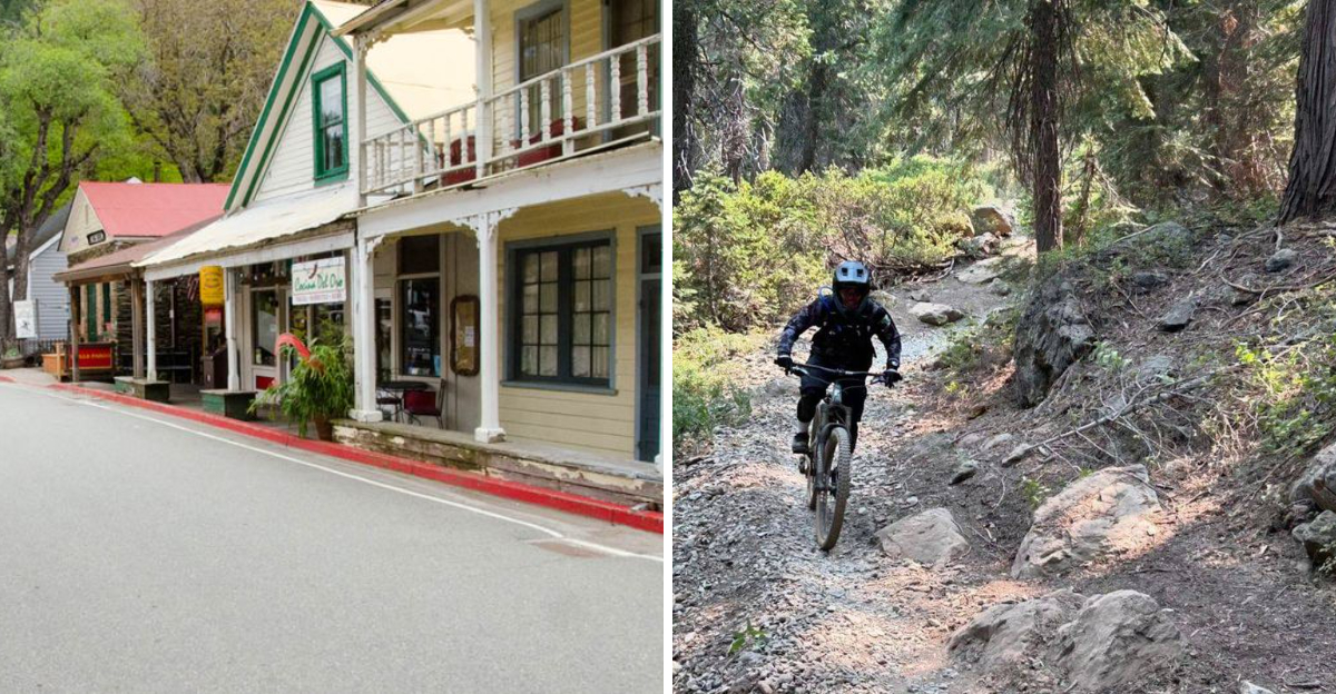
Gold once sent fortune seekers racing into these mountains. Today, the most valuable discovery may be a ribbon of dirt dropping through the forest.
At first glance, the town appears built for slow wandering.
Historic storefronts line the streets, rivers meet beneath wooded slopes, and the surrounding peaks make modern life feel pleasantly distant.
Then a shuttle arrives loaded with bikes and the peaceful scene reveals its wilder side.
Deep in California’s Lost Sierra, old mining country has become a legendary escape for riders who prefer their scenery fast and slightly muddy.
Trails begin high above town and plunge through forests, rocky sections, creek crossings, and terrain that demands full attention.
The reward is not only the descent. It is finishing the ride somewhere that still feels small enough to explore on foot afterward.
Two Wild Rivers Meet Right In Town
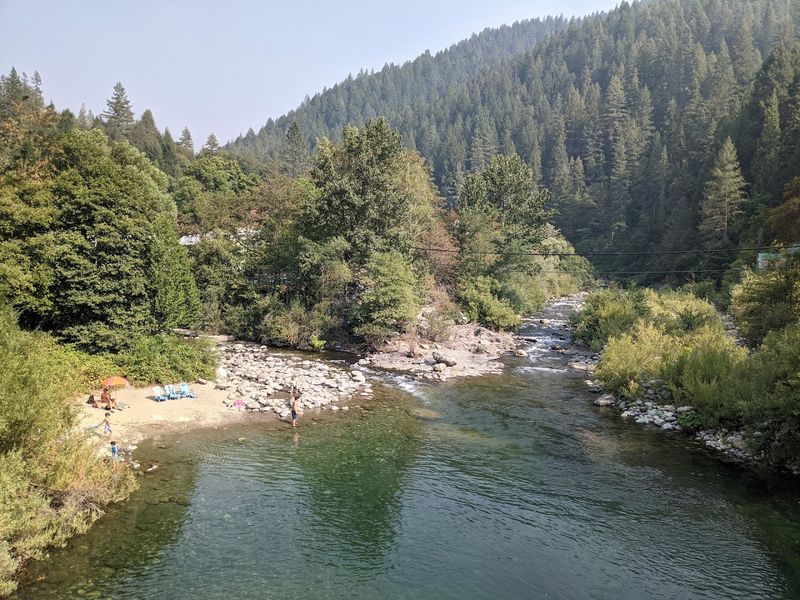
Not many small towns can claim that two rivers literally collide within their borders, but Downieville pulls it off without any fanfare.
The Downie River flows into the North Yuba River right at the edge of the historic downtown, creating a constant backdrop of rushing water and smooth granite boulders that frames nearly every visit.
Rocky banks line both waterways, and during warmer months the pools between the rocks become natural gathering spots for visitors cooling off after a long day on the trails.
The sound of moving water carries throughout the town, giving the whole place an ambient energy that feels both calming and alive.
The confluence also shapes the landscape in practical ways, since the terrain rises steeply on all sides from the river valleys, creating the dramatic elevation changes that make the surrounding trails so popular with cyclists.
Standing at the water’s edge near Main Street and looking upstream, the scale of the surrounding mountains becomes immediately clear.
The rivers are not just scenic backdrops here but defining features that explain why this particular spot became a settlement in the first place.
Its Gold Rush Story Began In 1849
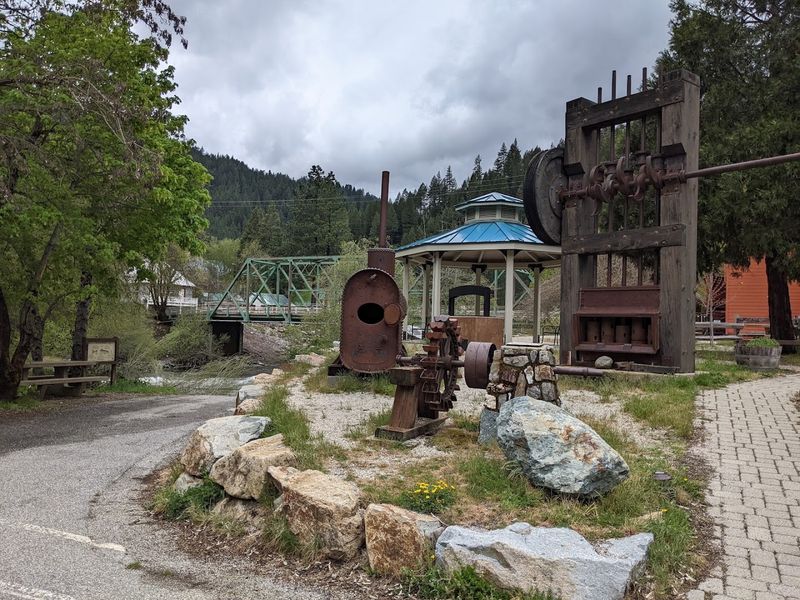
Long before mountain bikes existed, people came to this corner of the Sierra Nevada chasing something else entirely.
In the autumn of 1849, a group of prospectors made their way up the North Fork of the Yuba River and found gold, setting off a chain of events that would shape Sierra County for generations.
The settlement that grew from that discovery was first called The Forks, a practical name for a place sitting at the junction of two rivers.
It was later renamed after William Downie, who led one of the early prospecting groups into the area. By 1850 the community had taken shape, and it has held onto its identity ever since.
More than 175 years later, that origin story is still present in the town’s architecture, its museum, and even the rivers themselves, where recreational gold panning keeps the memory of the rush alive.
Sierra County as a whole retains a strong connection to its mining past, and Downieville serves as its county seat and most recognizable symbol of that era.
Visiting today means stepping into a place where history did not fade but simply settled into the landscape.
The Downtown Still Looks Like Another Era
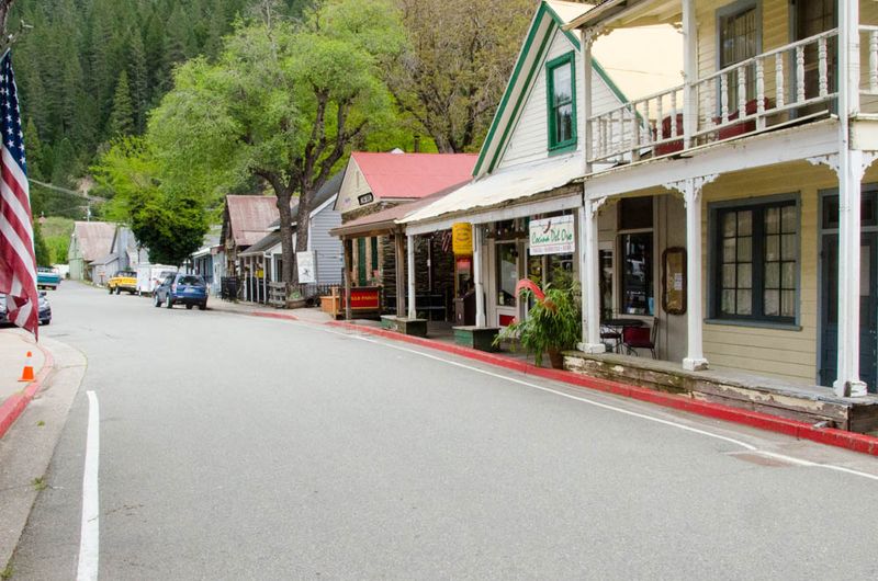
Walking through downtown Downieville feels less like visiting a tourist attraction and more like accidentally wandering into a place that time simply did not update.
Old wooden storefronts line the narrow main street, and stone buildings from the mid-1800s still stand in active use rather than sitting behind velvet ropes.
Shaded porches overhang the sidewalks, and the streets themselves are narrow in the way that only pre-automobile towns tend to be.
Steep forested slopes rise on every side, pressing the buildings close together and giving the whole downtown a sheltered, almost tucked-in feeling that is genuinely rare.
Downieville is frequently cited as one of the least-changed gold rush towns remaining in California, which is a remarkable distinction given how many historic communities have been altered over the decades.
The scale stays human, with nothing towering or sprawling, and the materials feel honest, wood and stone rather than vinyl or glass.
For visitors arriving after winding through river canyons on Highway 49, the first view of the downtown can feel like a reward, proof that the drive was worth every curve.
The atmosphere does not feel staged or restored but simply preserved by geography and small-town stubbornness.
The Downieville Museum Occupies An 1852 Building
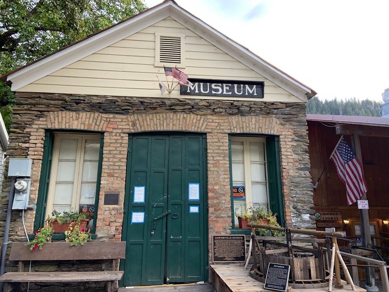
Some buildings carry their history on the outside, and the Downieville Museum is a clear example.
The structure at 318 Main Street, Downieville, CA 95936 was originally built in 1852 by Chinese emigrants who used it as a store, making it one of the oldest standing commercial buildings in Sierra County.
Inside, the collections cover the full arc of local history, from the earliest days of gold discovery through the mining boom and into the quieter decades that followed.
Photographs, tools, household items, and documents fill the displays, giving visitors a grounded and specific look at what daily life actually looked like in a Sierra Nevada mining community.
The museum operates seasonally and is generally open from May through October, so timing a visit accordingly is worth noting before planning a trip.
The building itself is as much a part of the experience as anything inside it, since the thick stone walls and original construction details are tangible reminders of how long this community has been standing in the same spot.
Mountain Bikers Come From Far Beyond California
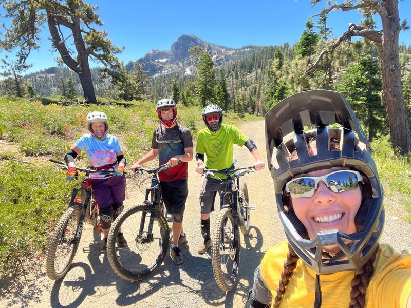
Something shifted in Downieville’s identity over the past few decades, and the shift arrived on two wheels.
What began as a mining boomtown gradually earned a completely different kind of reputation, one built on dirt trails, steep descents, and the specific joy of riding through old-growth forest at speed.
Riders now travel from across the United States and from other countries specifically to experience the trail network surrounding the town.
The combination of elevation, terrain variety, and the novelty of finishing a ride by rolling directly into a historic gold rush downtown is genuinely difficult to replicate anywhere else in the world.
The trails here tend toward the challenging end of the spectrum, with loose rock, exposed roots, and sustained technical sections that reward experienced riders while humbling those who underestimate the terrain.
That difficulty is part of the draw rather than a deterrent for the community that has grown around the sport in this region.
Local bike shops, shuttle services, and accommodations have all adapted to serve the influx of visiting cyclists, giving the town a dual personality that somehow manages to feel cohesive.
The gold rush crowd and the mountain bike crowd share more in common than it might first appear, since both came looking for something extraordinary in a remote mountain setting.
The Famous Downhill Drops Thousands Of Feet
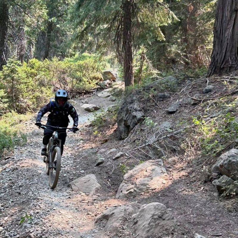
Numbers tell part of the story here, but they do not fully capture what it feels like to drop roughly 5,000 vertical feet over about 15 miles of singletrack trail.
The Downieville Downhill runs from Packer Saddle all the way to the edge of town, and the terrain does not ease up much along the way.
Steep pitches give way to rocky chutes, which open into fast sections of forest trail before tightening again around exposed switchbacks.
The route demands focus from start to finish, and riders who lose concentration on the technical sections tend to remember the experience for the wrong reasons.
Helmets and protective gear are strongly recommended and widely worn among the riders who frequent this trail.
Finishing the descent and rolling into downtown Downieville along the river is an experience that riders consistently describe as one of the most satisfying endings to any trail in the country.
The contrast between the raw wilderness of the upper mountain and the quiet historic streets of the town below creates a sense of arrival that feels genuinely earned.
For mountain bikers, the Downieville Downhill is not just a trail but a benchmark, the kind of ride that gets referenced in conversations about the sport for years afterward.
The North Yuba Trail Offers A Quieter Adventure
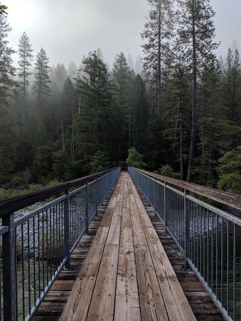
Not every great trail experience involves dropping thousands of feet at speed, and the North Yuba Trail makes a strong case for the slower approach.
Running approximately 16 miles from Downieville to Rocky Rest Campground, the route follows the river through a landscape that changes character gradually rather than dramatically.
Along the way the trail passes through Goodyears Bar, a small community that adds a bit of historical texture to the journey.
Creek crossings punctuate the route at various points, and the North Yuba River remains visible for much of the distance, offering steady views of the water moving through its rocky channel below the trail.
The pace here is fundamentally different from the downhill mountain bike experience, leaning toward observation and endurance rather than adrenaline.
Hikers and cyclists both use portions of the trail, though the terrain is generally more forgiving than the technical descents the area is famous for.
Starting from the Downieville end and heading downstream gives a sense of leaving the town behind gradually rather than all at once, which suits the kind of traveler who prefers their wilderness in measured doses.
Checking current trail conditions before heading out is always a sensible step given that creek crossings and seasonal weather can affect accessibility.
The Rivers Provide A Natural Summer Cooldown
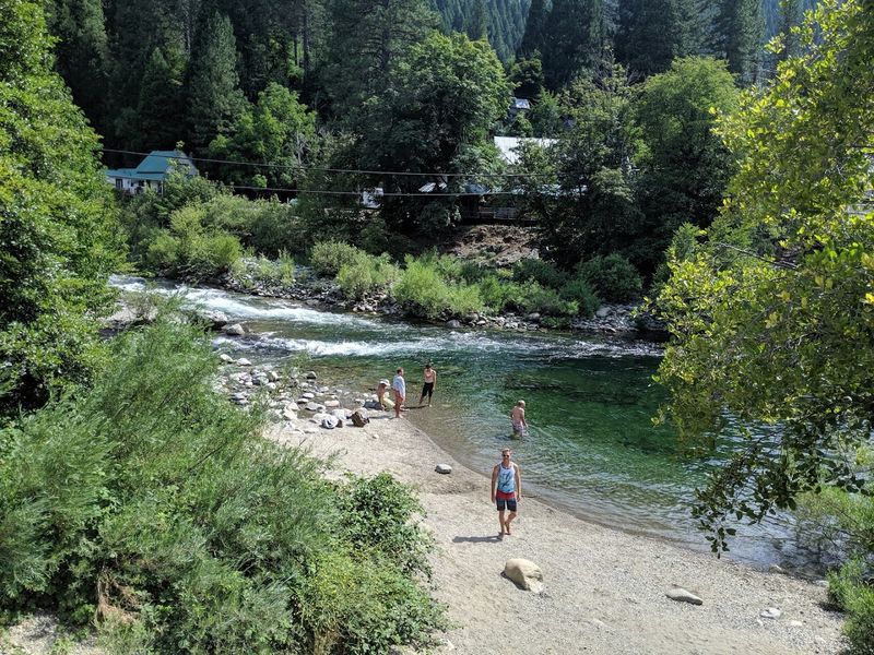
After hours on a dusty trail or a long morning ride, the North Yuba River has a way of resetting everything.
The clear pools that form between the granite boulders along the riverbanks are a reliable draw during warmer months, offering a natural alternative to any air-conditioned escape.
The water runs cold even in midsummer, fed by snowmelt from higher elevations, which makes it genuinely refreshing rather than just pleasant in theory.
Rocky edges along the banks provide natural seating for those who prefer to sit and listen to the current rather than wade directly in, and both approaches feel equally worthwhile depending on the mood.
River conditions can vary significantly depending on the time of year and recent precipitation levels, so exercising caution around the water and reading the current before entering is always worth it.
Families with younger children should pay close attention to depth and flow, as mountain rivers can be deceptively strong even when they appear calm on the surface.
The experience of cooling off in a Sierra Nevada river after a physical day outdoors is one of those simple pleasures that tends to stay with visitors long after the drive home.
Gold Panning Remains Part Of The Experience
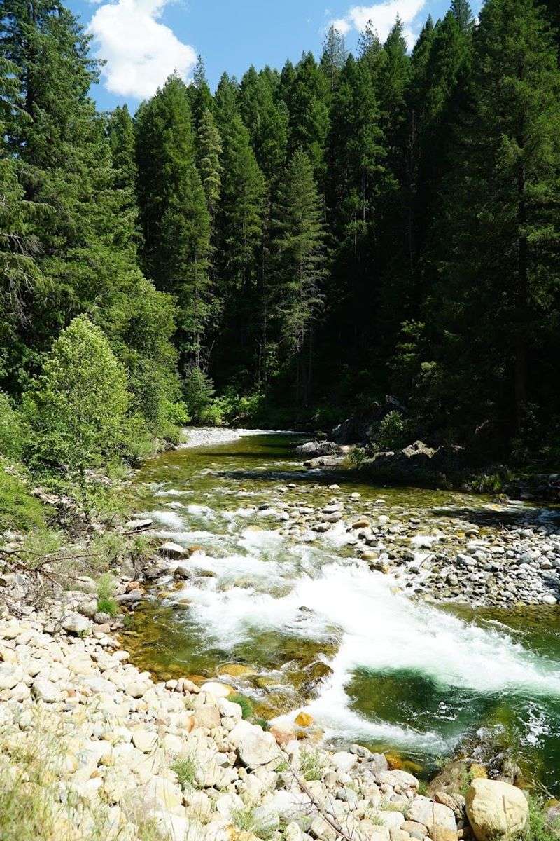
There is something quietly compelling about crouching over a river with a pan and some gravel, knowing that people did the exact same thing in the exact same waterways more than 175 years ago.
Recreational gold panning in the streams and rivers around Sierra County keeps that connection tangible in a way that no museum display quite manages to replicate.
The activity does not require specialized equipment or advanced technique to get started, which makes it accessible to curious visitors of almost any age or experience level.
Basic gold pans are available through local outfitters, and the learning curve is gentle enough that first-timers can pick up the fundamentals within a short session.
Finding actual gold flakes is possible but far from guaranteed, so approaching the activity as a historical experience rather than a prospecting mission tends to make it more enjoyable.
The act of working the gravel and watching the pan settle into its layers connects visitors to the physical reality of what drove thousands of people into these mountains in the first place.
Sierra County as a whole embraces this heritage openly, and the rivers around Downieville remain among the most historically significant waterways in the California gold rush story.