The Gorgeous 40-Mile Kentucky Scenic Drive Locals Say Beats Meditation
Have you ever tried meditating and given up somewhere around minute four? Kentucky has an alternative, and it involves a steering wheel.
There is a forty mile stretch in the far western corner of the state that follows the Mississippi River, and it asks nothing of you except that you keep driving.
This is where the Mississippi and the Ohio meet, and the landscape has barely changed since settlers were rolling west looking for a way through. Bluffs open up over the water.
Bald eagles winter here, along with something like one hundred thousand ducks. There is a lake nearby that only exists because earthquakes dropped twenty five thousand acres of land in eighteen eleven and the river politely filled the hole.
Mark Twain knew this country and wrote kindly about one of the towns along the way. Roll the windows down and let the radio stay off for once.
Where The Calm Starts
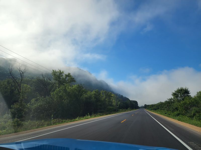
The Great River Road National Scenic Byway runs along the Mississippi River, and Kentucky claims a short, gorgeous piece of it. The state’s stretch covers roughly 40 miles through Ballard, Carlisle, Hickman, and Fulton counties.
Most drivers pick it up near Wickliffe, where the Ohio River meets the Mississippi. From there the route rolls south through farmland, levees, and small river towns.
Signs with a green pilot’s wheel mark the way, which makes navigation simple. I still recommend downloading a map, since cell service dips in spots.
What surprised me most was the quiet. Long stretches pass with no billboards, no chain restaurants, and no honking.
The road stays mostly flat and easy, so first-time visitors will not feel stressed behind the wheel. Bring snacks and a full tank anyway.
Plan two to four hours if you want to stop and look around. Rushing it defeats the whole point.
Start at the Wickliffe area along KY 51 and US 60/62 in Ballard County, Kentucky. From there, just follow the river signs south.
Two Great Rivers Meeting In One View
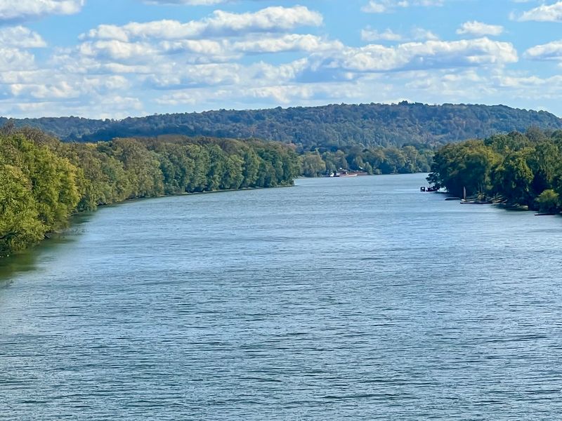
Geography class never felt this real. Near Wickliffe, the Ohio River pours into the Mississippi, and you can actually see two water colors blending.
The Ohio often looks a bit greener, while the Mississippi carries heavy sediment. When they meet, the line between them can show for a while.
I stood there longer than I planned. Watching that much water move is oddly hypnotic, and it does quiet the mental noise.
Barges pass through regularly, stacked high and pushed by tugs. They look slow from a distance, but they move serious weight.
Photographers should aim for morning light, when haze sits low over the channel. Late afternoon works too, especially with clouds.
Wear shoes you do not mind getting muddy. River banks stay soft, and the ground can be slick after rain.
Keep a respectful distance from the water’s edge. Currents here are strong and unpredictable, even when the surface looks smooth.
This is the natural starting point for the Kentucky byway. It sets the tone for everything that follows.
Ancient History At Wickliffe Mounds
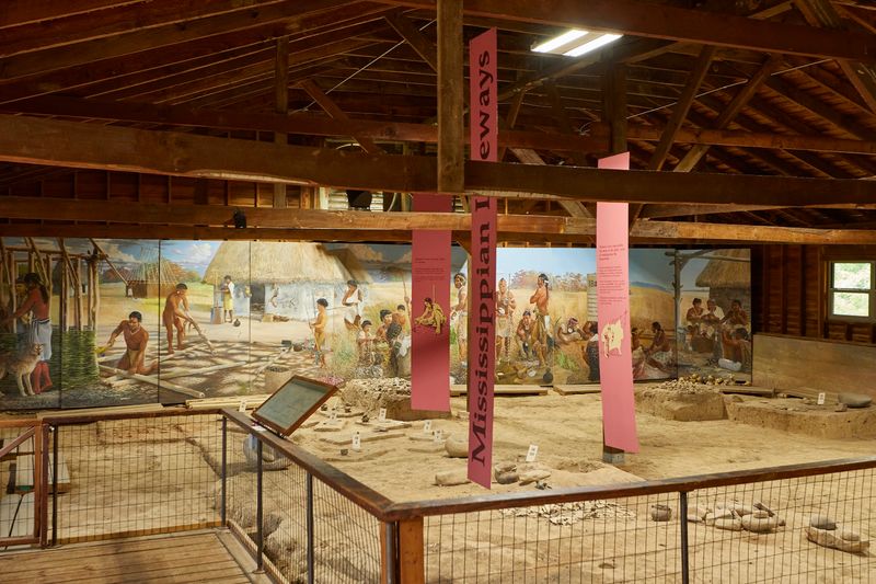
Long before pavement, people built a village on this bluff. Wickliffe Mounds State Historic Site preserves a Mississippian settlement occupied around 1100 to 1350 AD.
The site sits on a rise above the river, which was smart planning. High ground meant fewer floods and a clear view downstream.
Inside the buildings, exhibits show pottery, tools, and excavation history. Reading about daily life here changed how I saw the fields outside.
Walking paths connect the mounds and shaded lawn areas. The whole loop is short, so it fits easily into a drive day.
Staff answer questions without rushing anyone. I learned more in fifteen minutes of conversation than in a stack of brochures.
Check seasonal hours before you go, since the site closes during colder months. A quick phone call saves disappointment.
Treat the grounds gently and stay on marked paths. These mounds are archaeological features, not playground hills.
Find it at 94 Green Street, Wickliffe, Kentucky, right near the byway’s northern end.
Columbus-Belmont State Park And Its Giant Chain
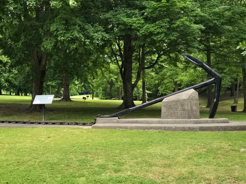
A chain once stretched across the Mississippi here, and part of it still sits in the grass. Columbus-Belmont State Park keeps that huge anchor and chain on display.
The park sits high on a bluff, so the river views stretch for miles. Benches face the water, which is exactly what tired drivers need.
Trails wind along old earthworks from the 1860s. Interpretive signs explain what you are walking past without overwhelming you.
There is a small museum in a historic building near the bluff. It holds artifacts, maps, and photographs from the site’s past.
Picnic tables and shade trees make this my favorite lunch stop on the route. Pack sandwiches and eat with a river view.
Campers can stay overnight, and a playground keeps kids busy. Restrooms are available, which matters on a rural drive.
Bring binoculars for bird watching along the bluff. Hawks and vultures ride the updrafts almost constantly.
The address is 350 Park Road, Columbus, Kentucky, a short detour off the byway.
Hickman’s Riverboat Ferry Crossing
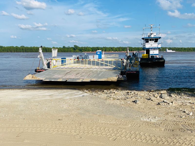
Not every road trip includes a boat ride. At Hickman, a ferry has long carried vehicles across the Mississippi toward Missouri.
Service can change with river conditions, so always check before counting on it. High water and low water both affect operations.
Even without boarding, the landing is worth a look. Watching vehicles roll onto a deck never gets old.
Hickman itself climbs uphill from the water, with brick buildings and steep streets. It earned the nickname of a bluff city for good reason.
Views from the upper streets look out over rooftops and river together. I pulled over twice just to stare.
The town moves at a slow pace, which suits the drive. Stop, stretch, and chat with whoever is around.
Fuel up here if your tank is under half. Stations thin out as you head south.
Look for the ferry landing near Moscow Avenue in Hickman, Kentucky, down by the riverfront.
Wetlands, Wildlife, And Very Patient Herons
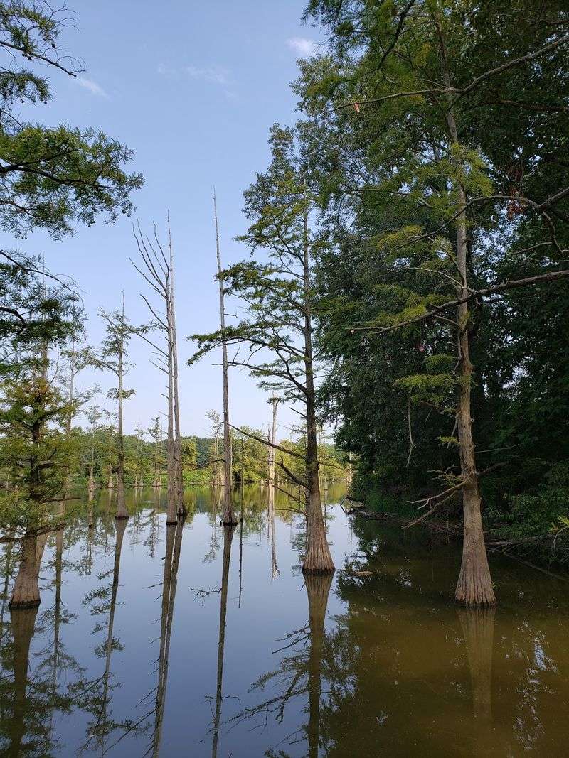
Herons are the unofficial mascots of this drive. Along the sloughs and backwaters, they stand frozen for minutes at a time.
Western Kentucky’s river bottoms hold marshes, oxbows, and flooded timber. That mix attracts an impressive amount of wildlife.
Bald eagles show up in winter, especially near open water. I spotted one perched on a snag and nearly missed my turn.
Spring and fall bring migrating ducks and geese in big numbers. Binoculars turn a roadside pull-off into a full show.
Ballard Wildlife Management Area lies near the northern end of the route. Access rules vary by season, so read posted signs.
Deer and turkey wander near the road at dawn and dusk. Slow down, especially on curves with tall grass.
Insect repellent is not optional in warm months. Mosquitoes near standing water take their job seriously.
Keep your camera on the passenger seat, not in the trunk. Wildlife moments here last about four seconds.
Farm Fields That Stretch To The Horizon
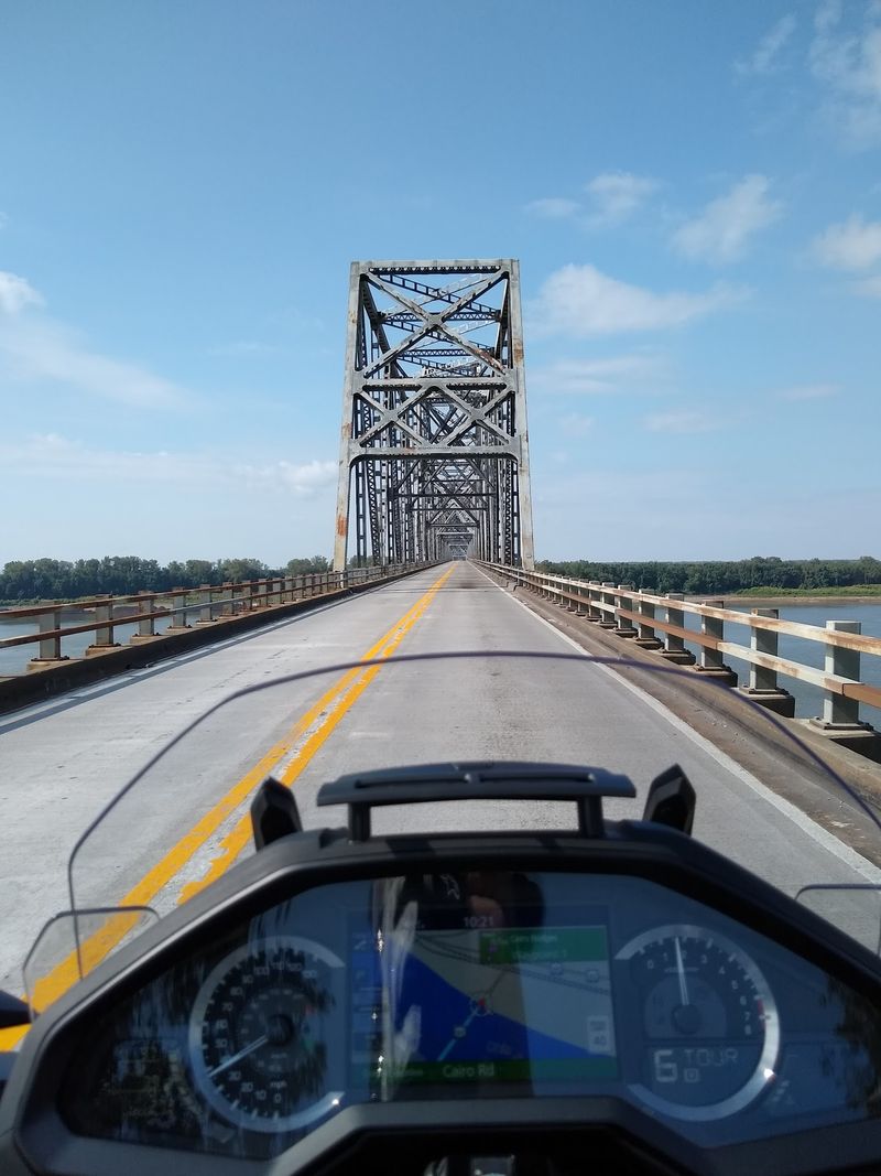
Flat land gets underrated. South of Columbus, the fields open up and the sky takes over half the view.
Corn, soybeans, and wheat fill the river bottoms because the soil here is rich. Centuries of flooding built that dirt.
In midsummer the corn grows tall enough to hide the horizon. By October the same fields turn gold and dusty.
Grain elevators rise above the flat land like small towers. They make surprisingly good photo subjects at sunset.
Tractors and combines share these roads during harvest. Be patient, pass only when safe, and give a friendly wave.
Levees run alongside parts of the route, built to hold back high water. Some have gravel tops used by farm traffic.
I rolled the windows down here and the air smelled like cut hay. That alone lowered my heart rate.
Sunsets over open fields are the closing act. Find a safe pull-off and let it happen.
Smart Ways To Plan The Whole Loop
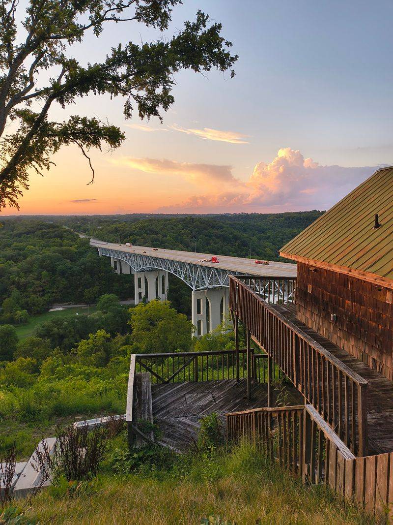
Good planning is what separates a relaxing drive from a frustrating one. Start early, and treat the byway as a half-day trip minimum.
Paducah makes a practical base, with lodging and restaurants before you head west. From there, Wickliffe is a straightforward drive.
Fill your gas tank first. Small towns along the route have limited services and shorter business hours.
Pack water, snacks, and a paper map or offline navigation. Signal drops happen more than you would expect.
Spring and fall offer the best temperatures and light. Summer brings humidity, and winter brings eagle sightings.
Check river conditions if flooding has been in the news. High water occasionally affects low roads and access points.
Watch for gravel edges and farm equipment on narrow shoulders. Steady speeds beat sudden braking out here.
My best advice is simple. Leave the itinerary loose, stop whenever the view earns it, and let the river set the pace.