This Loop Has A Scary Name But An Incredible Idaho Hiking Experience
Do not let the intimidating name fool you, because this trail is far friendlier than it sounds.
Idaho turns an ancient lava field into an easy walking adventure filled with geology hiding beside the highway.
A paved loop crosses hardened basalt shaped by volcanic activity thousands of years ago, making every section a quick lesson in the landscape beneath your feet.
Interpretive signs help explain what happened here without requiring a geology degree. Benches and other facilities keep the outing approachable for a broad range of visitors.
Best of all, it works beautifully as an unexpected road-trip break.
Pull over for twenty minutes and you may stay considerably longer.
A Rest Stop Hiding Volcanic Wonders

Most travelers on Interstate 15 blow right past this pullout. I almost did too, and I would have missed one of Idaho’s strangest landscapes.
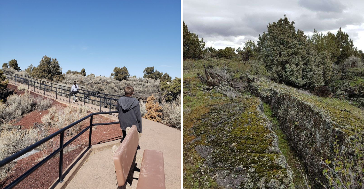
The parking lot sits at the edge of a lava field that stretches far beyond what you can see. A paved walkway leaves the rest area and heads straight onto solidified rock. Within twenty steps, the highway noise fades and the ground turns rough and glassy.
What surprised me most was how ordinary the entrance feels. Clean restrooms, vending machines, shaded picnic tables, and then suddenly you are standing on an ancient eruption.
The south trails are managed with help from the Bureau of Land Management, and the setup is thoughtful. Benches appear right where your legs start asking for them. Signage points you toward loops of different lengths, so you choose your own pace.
If you want to plug it into your map before you drive, the destination is Hell’s Half Acre (south trails), Blackfoot, ID 83221. Trust me, this is the pullover that earns its place on your itinerary.
Fire That Shaped This Ground

Roughly 4,100 to 5,200 years ago, this whole area was glowing. Molten rock poured from the Lava Ridge-Hell’s Half Acre fissure vent and spread across the plain.
Geologists estimate temperatures near 2,000 degrees Fahrenheit. The flow moved thickly, though in places it raced along at surprising speed.
Standing there, I kept trying to picture the scene. The rock still looks like it froze mid-motion, which is the eerie part.
At least eight separate lava lobes have been identified within the field. Each one layered over the last, building the messy, beautiful terrain you walk today.
Two textures dominate the view. Pahoehoe is smooth and ropy, curling in loops like poured batter that stiffened. The other type, called aa, is blocky and sharp, the kind of rock that eats shoelaces.
The eruption marks the easternmost reach of volcanic activity on the Snake River Plain. That same underlying hotspot now powers the geysers up at Yellowstone.
Knowing that connection changed how I saw the place. Idaho is not just farmland and mountains, it is a record of enormous heat and pressure.
Short Loops, Big Payoff
Here is the part that makes this stop so easy to say yes to. The walking is genuinely simple.
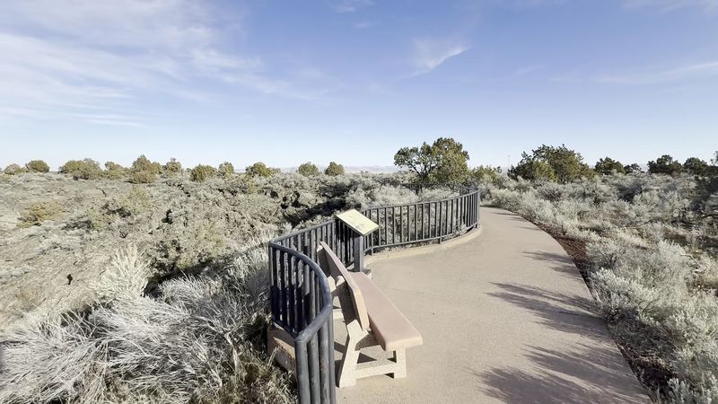
From the southbound rest area, a Lower Loop covers about a quarter mile. An Upper Loop stretches to roughly half a mile and climbs slightly for better views.
The northbound side offers its own options. There is a 0.4-mile Lower Loop, a 0.3-mile Short Loop, and a 0.5-mile Long Loop that branches off the shorter one.
Signs suggest the longer route takes around 45 minutes. I finished it in closer to 25, and I stopped constantly to read and take pictures.
The surface is paved the entire way on the main loops. I never changed out of my regular shoes, which felt almost like cheating on a lava hike.
Benches and covered picnic tables sit along the route. A gazebo-style overlook gives you a wide view toward the Pilot Buttes in the distance.
Wheelchair users can manage the Lower Loops, though a helper is useful for anyone needing assistance. That accessibility is rare for terrain this dramatic.
Hummocks, Pits, And Tubes
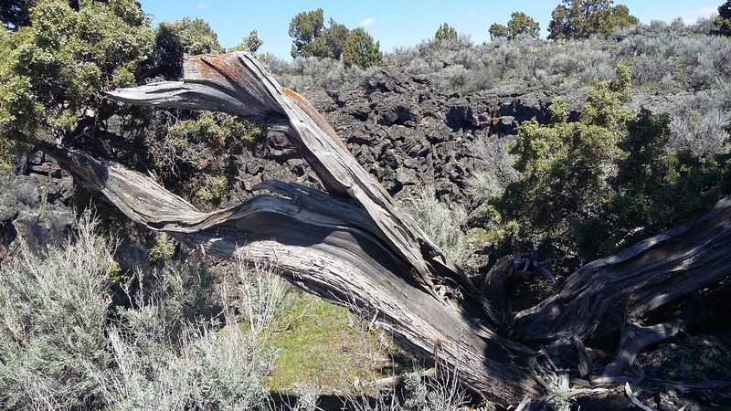
Look past the flat black surface and the field turns into a puzzle. Odd mounds rise here and there, and geologists call them hummocks.
They formed when molten rock and gas drained out from underneath. The cooling crust above sagged, buckled, and left behind these strange humps.
Broad depressions mark spots where lava lakes once pooled. Those basins filled and emptied more than once during the eruption.
Circular pits punctuate the terrain too. Some are shallow dimples, others drop deep enough to make you keep your distance from the edge.
Two lava tube systems sit near the heart of the field. Tubes form when the outer shell of a flow hardens while the inside keeps streaming away.
I found myself crouching to study crack patterns in the rock. Up close, the surface shows swirls, ridges, and glassy sheens that photographs barely capture.
Colors shift with the light, moving between charcoal, grey, and a faint green tint. Late afternoon sun makes the ridges throw long shadows.
Every hundred feet reveals a new formation. That constant variety is why a half-mile loop can hold your attention far longer than expected.
Wildflowers On Hardened Rock
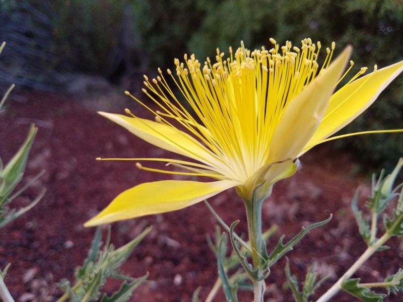
Barren looking ground can be deceiving. Life has quietly moved into every crack of this lava field.
Deep crevices trap moisture and shade, creating tiny sheltered pockets. Plants take advantage and settle in where you least expect them.
Spring and early summer bring the best color. Evening primrose opens pale and delicate, while Indian paintbrush adds sharp splashes of red against the dark stone.
Ferns unfurl inside shaded fissures, looking almost tropical against the basalt. Wild onions push up through gravelly gaps.
Older residents include Utah junipers, some of them centuries old. Their twisted trunks grip the rock with impressive stubbornness.
Sagebrush and bitterbrush fill in the open stretches. Prickly pear cactus shows up too, so watch where you place your hands.
Animals follow the plants. Mule deer, antelope, and rabbits move through the field, especially in cooler hours.
Overhead, golden eagles, red-tailed hawks, and prairie falcons ride the thermals. I watched one hawk circle for several minutes without a single wingbeat. Bobcats, coyotes, and red foxes also roam here, though sightings are uncommon.
Loggers, Landmarks, And Legacy
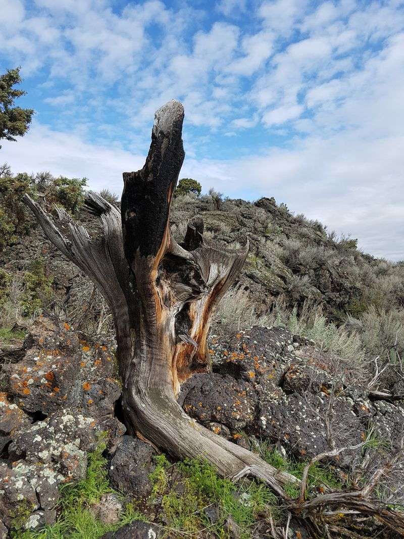
Long before interpretive signs and paved paths, people worked this rugged ground. The lava field once supplied timber to nearby settlements.
Red cedar grew directly on rock here, which sounds impossible until you see the root systems. Early settlers harvested it for fuel and building material.
The village of Woodville, founded in 1889, leaned heavily on those resources. Wagons rolled out loaded with wood cut from this unforgiving terrain.
Cutting continued until around 1942. Coal eventually became easier to obtain, and the logging faded away.
That history gives the walk an extra layer. You are crossing an eruption site that later became a working woodlot.
Recognition arrived in 1976, when part of the area was named a National Natural Landmark. A portion also carries Wilderness Study Area status.
Those designations protect the geology and the ecosystem from heavier development. Scientists still study the flows to better understand basaltic eruptions.
Signs along the south trails explain much of this in plain language. I appreciated how they balanced science with human stories. Reading them felt like getting a free guided tour.
What To Pack Before Walking
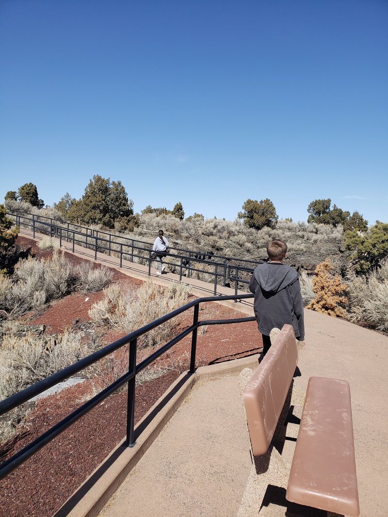
Sun is the main challenge out here. Shade barely exists once you leave the parking area, and the dark rock soaks up heat.
A wide-brimmed hat and sunglasses made a big difference for me. Sunscreen is not optional in midsummer.
Carry more water than you think a half-mile walk requires. Radiating heat off basalt can push the felt temperature noticeably higher.
Closed-toe shoes are smart even on pavement. The surrounding rock is sharp, glassy, and quick to scrape skin.
Stay on marked paths for two reasons. Hidden cracks and tube openings lurk just off trail, and the plant life is fragile.
Winter conditions can close sections due to ice. Checking current advisories before your drive saves disappointment.
Rattlesnakes live in the region, though encounters are rare. Watching where you step handles most of that concern.
The trails stay open around the clock, so early risers and sunset chasers both get their moment. Restrooms at the rest area are reliably clean. Pack out everything you bring in, since litter wedged in crevices is nearly impossible to remove.
Choosing Your Ideal Season
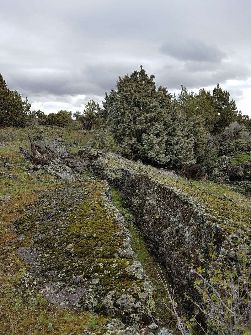
Timing changes the whole personality of this place. I have stopped in different months and never had the same experience twice.
Late spring wins for color. Wildflowers scatter across the dark rock, and temperatures stay comfortable enough to linger at every sign.
Early summer keeps that mildness with longer daylight. Evenings feel especially pleasant once the sun drops toward the horizon.
Peak summer demands strategy. Midday heat radiates off the basalt, so plan for early morning or the hour before sunset.
Photographers should aim for those low-light windows. Deep blue sky against black stone creates contrast that no filter improves.
Autumn brings cooler air and golden native grasses. The smell of sagebrush and juniper gets stronger after rain, which I found unexpectedly wonderful.
Winter dusts the flows with snow and turns the field stark and quiet. Some Idaho trails close when ice builds up, so call ahead or check online.
Crowds are rarely an issue in any season. Even on busy travel weekends, the loops absorb visitors easily.