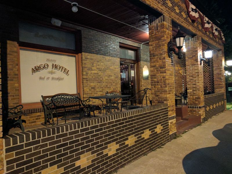
This 31-Mile Nebraska Bike Trail Follows An Old Railroad Through Tiny Towns And Open Farm Country
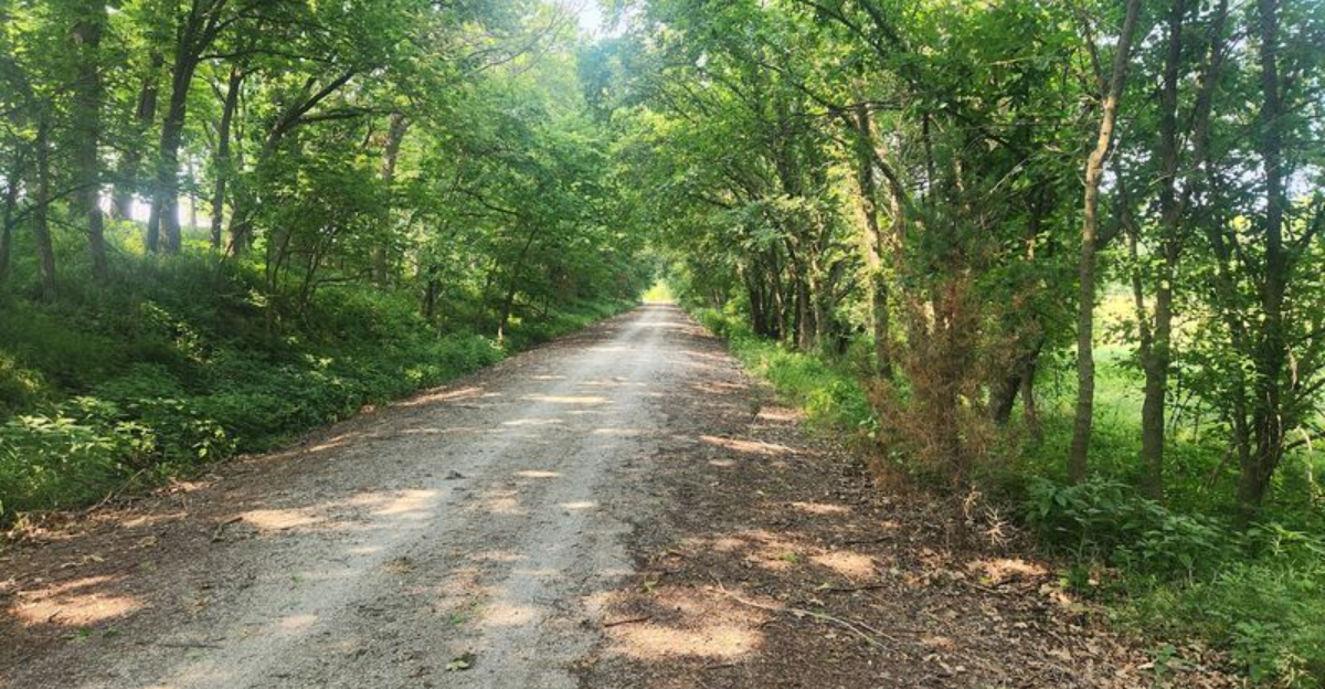
There is something satisfying about riding a route that once belonged to trains.
The grade stays steady, the horizon stretches wide, and the miles begin to feel like a moving window into rural Nebraska.
Farm fields roll past, small towns interrupt the quiet, and the old railroad corridor keeps pointing you forward.
This Nebraska trail turns a former rail line into 31 miles of easygoing countryside riding.
You can tackle a short section or make a bigger day of it. Stop when a town gives you a reason. Pull over when the view opens up.
Let the straight stretches carry you into that comfortable rhythm where the pedals almost seem to turn themselves.
Nothing about the route needs to be dramatic. That is exactly why it works.
Ride An Old Union Pacific Railroad Route
Freight trains once rolled where bicycle tires now crunch over limestone.
The Homestead Trail occupies a former Union Pacific corridor, a line that once helped move agricultural traffic into the railroad’s larger network.
Rail use faded over the years, and Union Pacific formally filed the corridor for abandonment in 1999.
What happened next is the part that trail users benefit from today.
In 2002 the corridor was purchased through the federal rail-banking system by the City of Beatrice, Lancaster County, and the Nebraska Trails Foundation.
Rail-banking allows an unused rail line to be preserved for public recreation instead of being broken into separate parcels, which is why long continuous routes like this one still exist.
Construction did not happen overnight. Work on the trail began in 2007 and wrapped up in the summer of 2012, meaning the full 31 miles took roughly five years of steady effort to finish.
Knowing that background changes how the ride feels, because the gentle grades and long straight stretches are not accidents of design.
Railroads needed easy slopes and wide curves, and cyclists inherit that same comfort.
Start Where Lincoln’s Trail Network Heads Into The Countryside
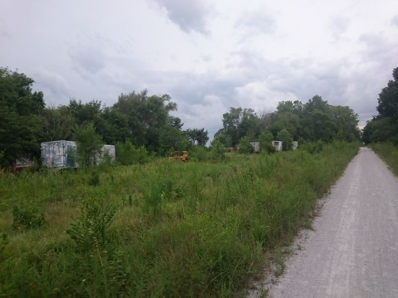
The northern end sits just south of Saltillo Road, and that spot works as a hinge between city and country.
Riders coming down Lincoln’s Jamaica North Trail simply keep going south, and the Homestead Trail picks up from there.
No shuttle, no road detour, no confusing turns. Because of that link, an uninterrupted route runs from downtown Lincoln all the way to Beatrice.
Cyclists who want a genuinely long day can start in the city and finish 40-plus miles later beside a historic depot, with the option of arranging a ride back.
Others treat Saltillo Road as the practical starting line and save their legs for the rural miles.
The scenery shifts quickly once the trail heads south.
Neighborhood edges and busier road crossings give way to fields, fence lines, and long views within a couple of miles, which makes the transition feel surprisingly abrupt in a good way.
Sounds change too, with traffic noise fading into wind, gravel, and birds.
Planning tip for first-timers: figure out water before leaving Lincoln. Services along the rural corridor are limited, so filling bottles at the start and carrying extra is a sensible habit.
Roll Through Miles Of Nebraska Farm Country
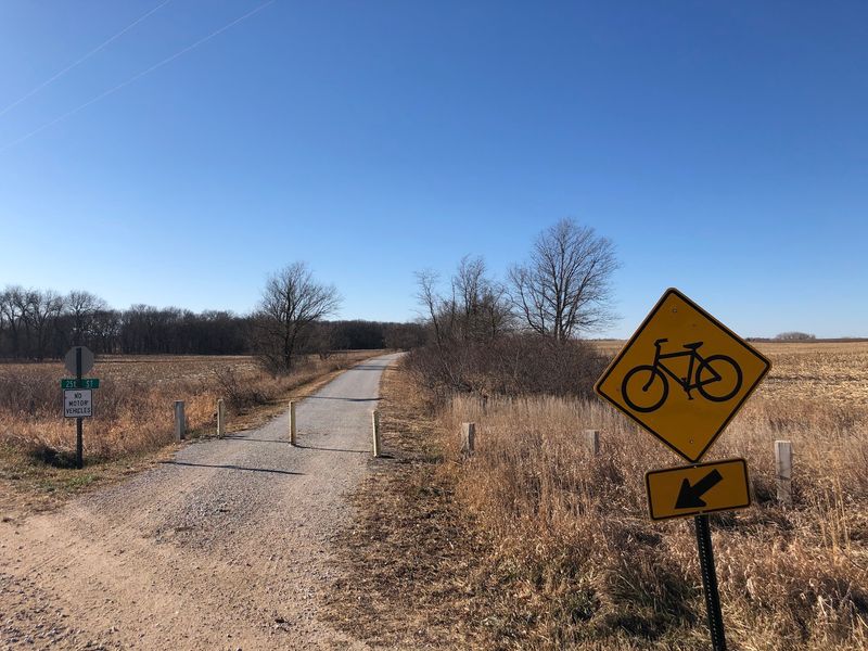
Farmland does most of the talking along this route.
Much of the corridor cuts across the agricultural landscapes of Lancaster and Gage counties, where broad fields replace urban scenery fairly quickly.
Prairie patches, cropland, and occasional tree cover trade places as the miles add up. Habitat variety is greater than a first glance suggests.
Trail users pass through upland, grassland, floodplain, cropland, timber, and pasture, which is part of why birds and small animals turn up so regularly along the way.
Spring and early summer bring the most obvious activity, while late summer fields grow tall enough to feel like green walls.
Open country comes with a trade-off worth planning around. Wind moves freely across these fields, and a headwind on flat ground can feel harder than a hill.
Checking the forecast and riding out into the wind first, then turning back with it, is a small strategy that saves a lot of energy.
Shade is thin in these sections too, so sunscreen, a brimmed cap, and extra water matter more than they would on a wooded path.
The reward is visibility, since sightlines stretch for a long way and sunsets over the fields are hard to beat.
Pass The Tiny Community Of Roca
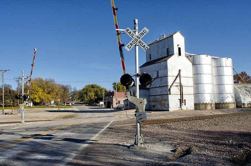
Barely a few minutes south of the trail’s northern end, the first small village appears.
Roca ranks among the earliest communities encountered when heading south from Lincoln, and it gives riders a natural place to begin a shorter outing.
Parking is available here for those who would rather skip the city miles entirely.
The trail parking area in Roca sits at roughly 2000 Saltillo Road, Roca, Nebraska, which puts access within easy reach of the corridor.
Space is generous enough to handle vehicles pulling trailers, a real advantage for families hauling extra bikes or for equestrian users bringing horses.
Arriving early on weekends usually means an easier time finding a spot near the trail entrance.
Using Roca as a base opens up flexible ride lengths.
An out-and-back toward Princeton makes a manageable morning, while stronger riders can push south toward Cortland and turn around before fatigue sets in.
Short loops like these work well for anyone testing how crushed limestone feels under their tires for the first time.
Amenities in a village this size are limited, so expectations should stay modest.
Cross A Remarkable Concentration Of Old Railroad Bridges
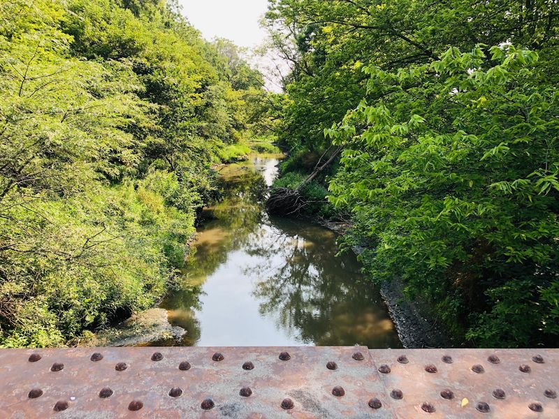
Eighteen bridges in nine miles is a striking number for any rail trail.
That is exactly what the Cortland-to-Pickrell section delivers, built with 18 restored railroad trestles and completed in 2012. Each crossing gives this portion far more railroad character than the open prairie miles.
The structures are genuine remnants of the old Union Pacific line, rebuilt with decking and railings so walkers, riders, and equestrians can use them safely.
Rolling across one after another creates a rhythm that turns the ride into something closer to a moving history lesson.
Hollow sounds under the tires, glimpses of water or ravines below, and steel or timber framing all reinforce where the path came from. Slowing down pays off here.
Bridge decking can feel different from limestone underfoot, and taking a few seconds to look over the railing reveals creek beds, timber, and wildlife that would otherwise slip past unnoticed.
Photographers find some of the best compositions along this stretch, especially where the canopy frames a trestle from a distance.
Riders sharing a bridge with horses or walkers should pass with plenty of warning and patience, since these crossings are narrower than the open trail and courtesy keeps the experience pleasant for everyone.
Pedal Across A Steel Bridge Near Pickrell
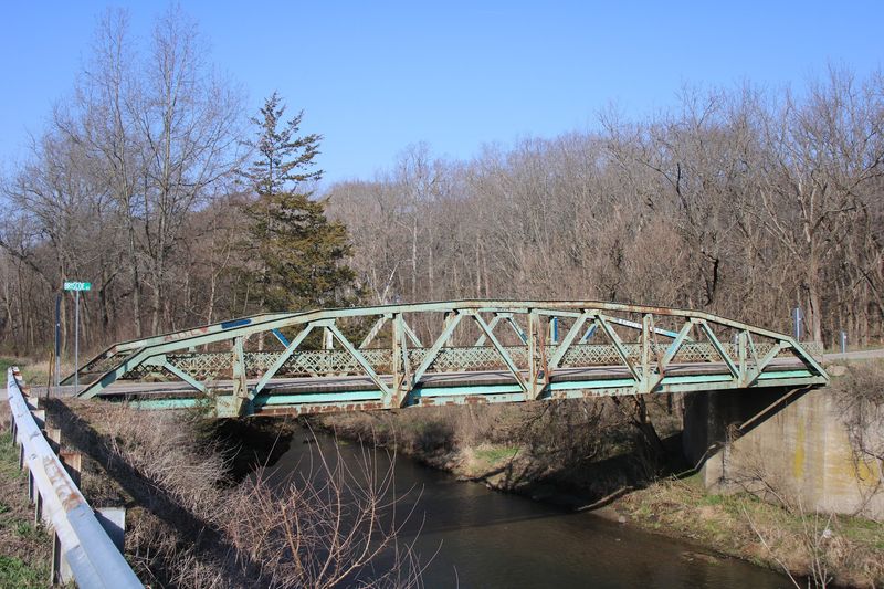
Among all those crossings, one stands out for its scale.
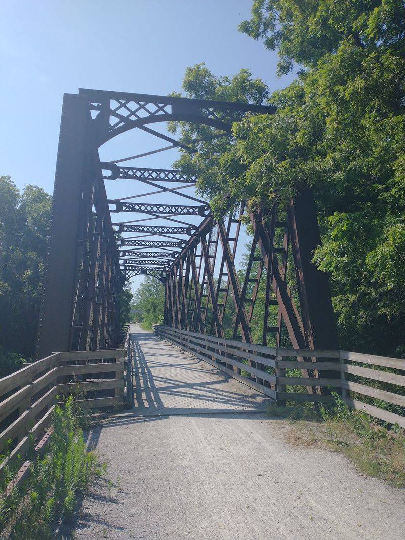
A long steel bridge spans Indian Creek roughly a mile north of Pickrell, and it counts as one of the standout structures on the entire corridor.
The span measures around 120 feet, which gives it real presence compared with the shorter trestles nearby. Approaching it from the north, riders get a sense of the engineering that railroads once demanded.
Steel framing, solid abutments, and the creek running below all combine into a spot that invites a brief stop rather than a quick pass.
Sound carries differently on a bridge this long, with tires and footsteps echoing more noticeably. Practical value comes with the scenery.
The bridge makes an easy landmark for measuring progress, and reaching it signals that Pickrell and the southern half of the route are close at hand.
Riders planning an out-and-back sometimes use this structure as their turnaround point, since it gives the trip a clear destination.
Watching water move under a century-old steel span tends to hold attention longer than another mile of cornfield.
Keeping to one side while stopped allows other trail users to continue by without having to squeeze past on narrow decking.
Enjoy A Crushed-Limestone Surface Instead Of Pavement
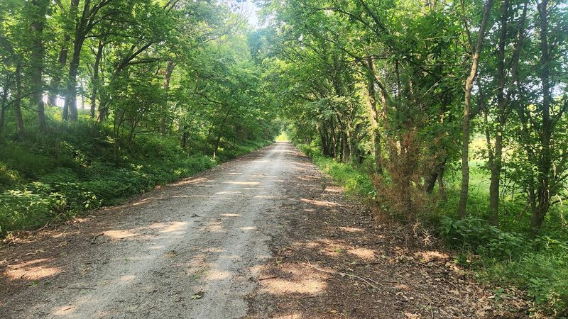
Surface makes a bigger difference than most people expect.
Crushed limestone forms the bulk of the Homestead Trail, giving the ride a distinctly rural feel rather than the polish of a paved urban greenway. The material packs down firm and stays easy to follow.
Some paved segments may appear near town connections, but the natural surface defines the experience.
Tires roll with a soft crunch instead of a hum, and the quieter sound makes it easier to notice birds, wind, and rustling crops alongside the path.
Dust can kick up during dry spells, while heavy rain may leave softer patches until the trail dries out.
Bike choice matters here.
Hybrid, gravel, and mountain bikes handle crushed limestone comfortably, and wider tires with slightly lower pressure smooth out the ride considerably.
Narrow road tires can work when conditions are dry and firm, though they will feel slower and less forgiving than on asphalt.
Expect to average a bit less speed than on pavement, and build that into any time estimate for the full 31 miles.
Fenders help after wet weather, and a rag for wiping down the drivetrain afterward is a small courtesy to the bike.
Use The Trail For More Than Cycling
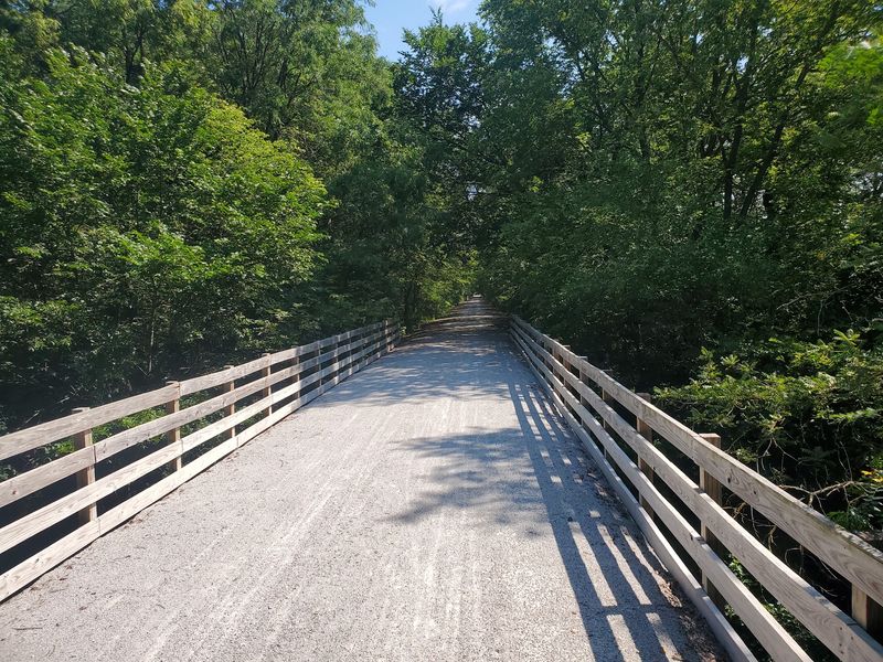
Bicycles get most of the attention, though they are far from the only way to enjoy this corridor.
Hiking and jogging happen along its full length, and the flat grades make steady walking easy on the knees.
Shade in the wooded miles is a favorite draw for people on foot.
Horseback riding is permitted on the crushed limestone surface, with equestrian users advised to stay cautious around other trail traffic.
Passing a horse calls for slowing down and speaking up so the animal is not startled, a small habit that keeps everyone comfortable. The wide corridor and long sightlines help in that regard.
Winter does not close the trail down. Cross-country skiing and snowshoeing are options when seasonal conditions allow, which turns a familiar summer route into something quite different under snow.
Conditions vary year to year, so checking recent local information before heading out makes sense.
Wildlife viewing rounds out the list.
Because the route crosses upland, grassland, floodplain, cropland, timber, and pasture, the variety of birds and animals along the way is better than a single-habitat path would offer.
Dogs are generally welcome on the multi-use trail when kept on a leash, and standard etiquette applies, including cleaning up and keeping pets close when others pass by.
Finish Beside Railroad History In Downtown Beatrice
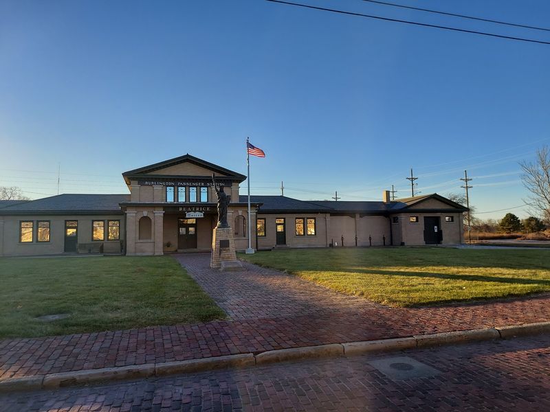
Few rail trails end with such a fitting punctuation mark.
The southern terminus reaches the area around 2nd and Court streets in downtown Beatrice, dropping riders into a walkable stretch of town after miles of open country.
Pavement, storefronts, and shade trees replace fields and trestles. A short stroll leads to the Gage County Historical Society Museum, housed in a restored 1906 Burlington passenger depot.
Exhibits inside cover Gage County’s past, giving context to the farms, small towns, and rail lines encountered along the way.
Standing in a former depot after riding a former railroad connects the two halves of the experience neatly.
The building itself carries plenty of period detail, from its brickwork to the platform-side layout that once handled passengers instead of cyclists.
Checking current hours before arriving is wise, since operating schedules at small museums can change seasonally.
Beatrice also makes a practical endpoint for logistics. Arranging a vehicle pickup here, or parking one before shuttling north, turns a one-way 31-mile ride into the simplest option for most people.
Downtown offers places to rest and eat within walking distance, which is a welcome finish after a long day on limestone.