This 15-Mile California Trail Network Winds Through Wild Marshes With Incredible San Francisco Bay Views
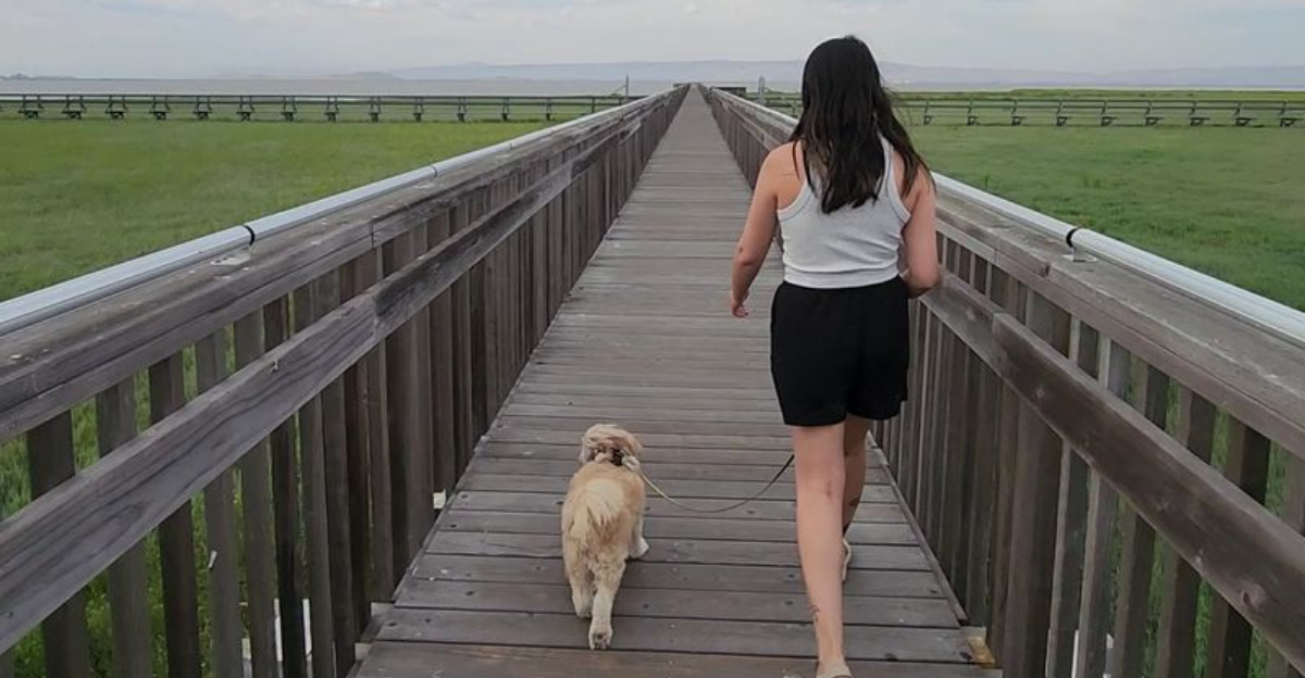
The Bay Area suddenly gets very quiet out here.
A few turns away from busy streets, pavement gives way to long trails edging across open wetlands.
Water flashes between marsh grasses. Birds claim the shallows. The horizon seems to widen with every mile.
More than 15 miles of trails thread through this California preserve, giving walkers, runners, and cyclists plenty of room to choose their own distance.
There is no single finish line demanding your attention.
Follow a levee until curiosity runs out. Stop beside the water when something moves in the reeds.
On clear days, look beyond the marsh toward the wider sweep of San Francisco Bay and the distant landscape surrounding it.
The terrain is mostly open, so sunshine and wind can become bigger factors than the mileage suggests. Water and sun protection belong in the plan.
What does not belong? Hurrying. The skyline can have you back later.
Nearly 15 Miles Of Trails Wait At The Bay’s Edge
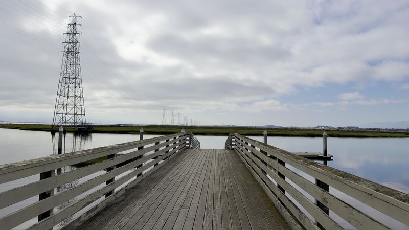
Few urban-edge preserves give visitors this much room to roam.
Almost 15 miles of multi-use trails thread across roughly 1,940 acres of protected land here, which is far more ground than a typical neighborhood nature path offers.
Walkers, runners, and cyclists all share the same routes, and the surfaces range from paved sections to packed gravel and dirt levees.
Planning helps, because the network branches in several directions and signage is not always detailed.
A short outing might cover a mile around the duck pond and the boardwalk, while a longer one can stretch past the airport, the golf course, and out toward the creek levees.
Downloading a trail map before arriving is a smart move, since cell service works but stopping to zoom in on a phone slows the pace.
Distances feel longer than expected because the terrain is so open, with few trees to break up the view or provide shade.
The main entrance area is reached from Embarcadero Road, where the Baylands Nature Preserve is located at 2500 Embarcadero Rd, Palo Alto, CA 94303.
Wild Marshland That Feels Far From Silicon Valley
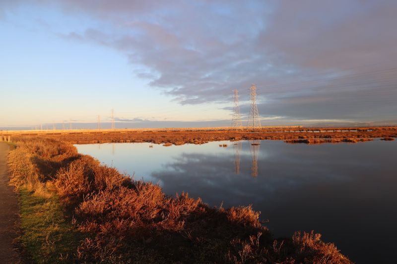
Hard to believe, but the flat green expanse stretching toward the water is one of the largest remaining tracts of relatively undisturbed marshland around San Francisco Bay.
Tidal wetlands sit beside freshwater habitat, and both are stitched together by sloughs, mudflats, and slow-moving creeks.
Pickleweed carpets much of the ground, turning reddish in the cooler months and green again as the year warms. Walking through it feels different from a forest hike because the scale is horizontal instead of vertical.
Sound travels oddly across open water, so a bird calling several hundred feet away can seem close enough to touch.
Wind is a regular companion, and a light jacket often makes the difference between a pleasant walk and a chilly one.
Photographers tend to favor the early and late hours, when low light picks out the texture of the grass and the channels fill with color.
Midday can look washed out under a bright sky, though the bird activity does not necessarily stop.
Staying on marked trails matters here, since the marsh surface is fragile and much of it is wildlife habitat rather than walkable ground.
A Birding Destination With A West Coast Reputation
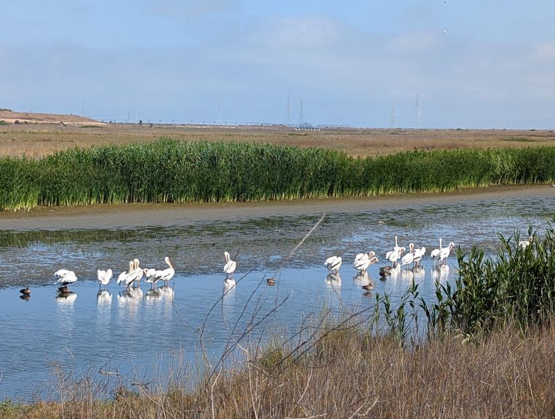
Binoculars are common equipment on these trails, and for good reason.
The preserve is widely regarded as one of the strongest bird-watching areas on the West Coast, thanks to a mix of resident species and enormous seasonal movement along the Pacific Flyway.
Migrants using that route travel between the far north and points well to the south, and many stop here to rest and feed.
Seasons change the cast of characters completely.
Ducks, geese, and large groups of shorebirds fill the mudflats during cooler months, while nesting activity and swallow colonies become more noticeable as the year warms.
Raptors turn up overhead, and herons and egrets work the channel edges with slow, deliberate steps. Newcomers do not need expensive gear to enjoy it.
Standing still near a slough for five minutes usually reveals more than walking quickly for twenty, since birds settle back into feeding once they stop noticing movement.
Speaking quietly and keeping a respectful distance helps everyone, including the birds.
Free field guides and apps make identification easier, and volunteers around the interpretive center are often happy to point out what is around that week.
The Boardwalk That Carries Walkers Over Open Marsh
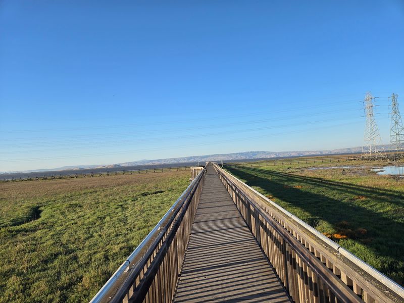
Stepping onto a raised walkway above the wetland changes the whole feeling of a visit.
The Lucy Evans Baylands Nature Interpretive Center anchors this part of the preserve and can be found at 2775 Embarcadero Road, Palo Alto, California.
From there, a long elevated boardwalk stretches across Harriet Mundy Marsh toward open water. Underfoot the planks creak slightly, and below them the cordgrass and pickleweed shift with the breeze.
Water may sit high against the boards during one visit and drain away to shining mud during another, which is part of what makes the walk worth repeating.
Railings run along the sides, making it comfortable for people who want a stable place to lean while watching.
A low-mounted telescope on the center’s deck helps bring distant shorebirds and waterfowl into view, and the height suits children and seated visitors.
The interpretive center itself features displays about local wildlife along with programs for different ages, though hours vary and checking ahead is wise.
Because the boardwalk is narrow, stepping aside for others is simple courtesy during busier weekend hours.
Adobe Creek Loop Turns A Stroll Into A Proper Outing
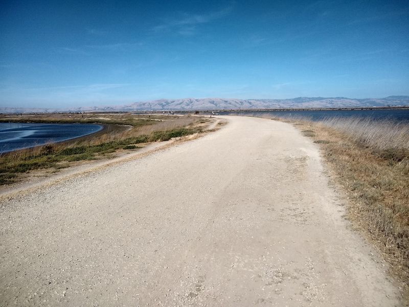
For anyone wanting real mileage instead of a short wander, the Adobe Creek Loop delivers.
Measurements shift slightly depending on where the walk starts and which connectors get used, but a commonly followed version runs roughly 6.7 to 7 miles.
Elevation gain on one current route description comes in at only about 83 feet, which says a lot about the terrain.
Pacing is the main consideration rather than difficulty. Most walkers finish in two to three hours, and cyclists cover it much faster on the sections suited to bikes.
Views stay open almost the entire way, with marsh on one side and levee channels on the other.
Shade is essentially nonexistent, so sunscreen, a hat, and enough water are worth packing even on cool days.
Wind can pick up in the afternoon and push against walkers on exposed levee stretches, which is one reason morning starts appeal to many people.
Restrooms are limited once the loop gets going, so using facilities near the parking areas beforehand saves trouble.
A Historic Duck Pond With A Strange Backstory
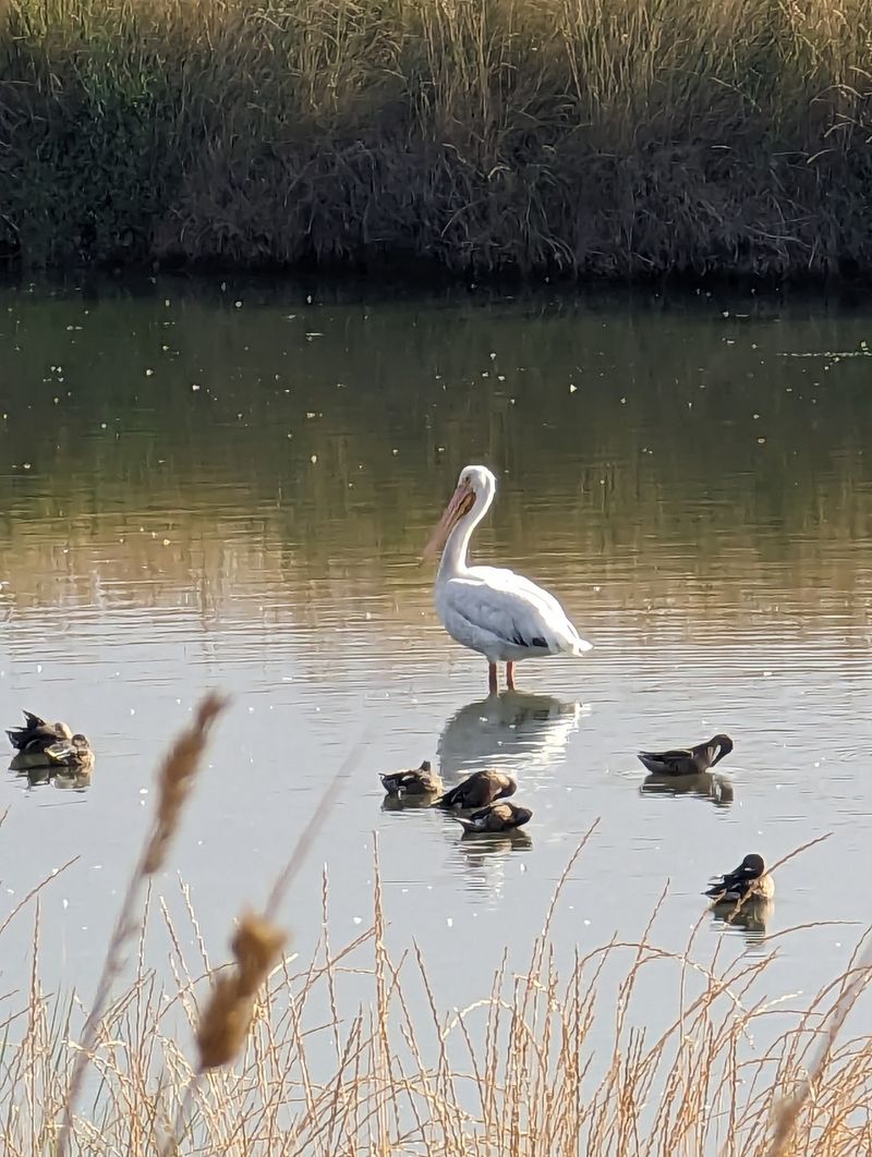
The Palo Alto Duck Pond was originally developed in the 1930s as a saltwater swimming facility, part of a much larger recreation plan for the Baylands.
Siltation problems made that idea impractical, and by 1947 the site had been converted into a bird refuge instead. Today the pond is one of the easiest stops in the whole preserve.
Parking sits close by, the path around the water is short and level, and benches give people a place to sit while ducks, geese, gulls, and pigeons go about their business.
Young children often find it the most engaging spot, since the birds are close and constantly moving.
Feeding the waterfowl is discouraged, because bread and similar handouts are poor nutrition for them and encourage crowding.
Watching from a short distance works better anyway, as the birds behave more naturally when nobody is pressing in.
Many visitors use the pond as a starting point before continuing onto the longer trails, which makes it a useful orientation stop.
Byxbee Park Adds Slopes To A Famously Level Place
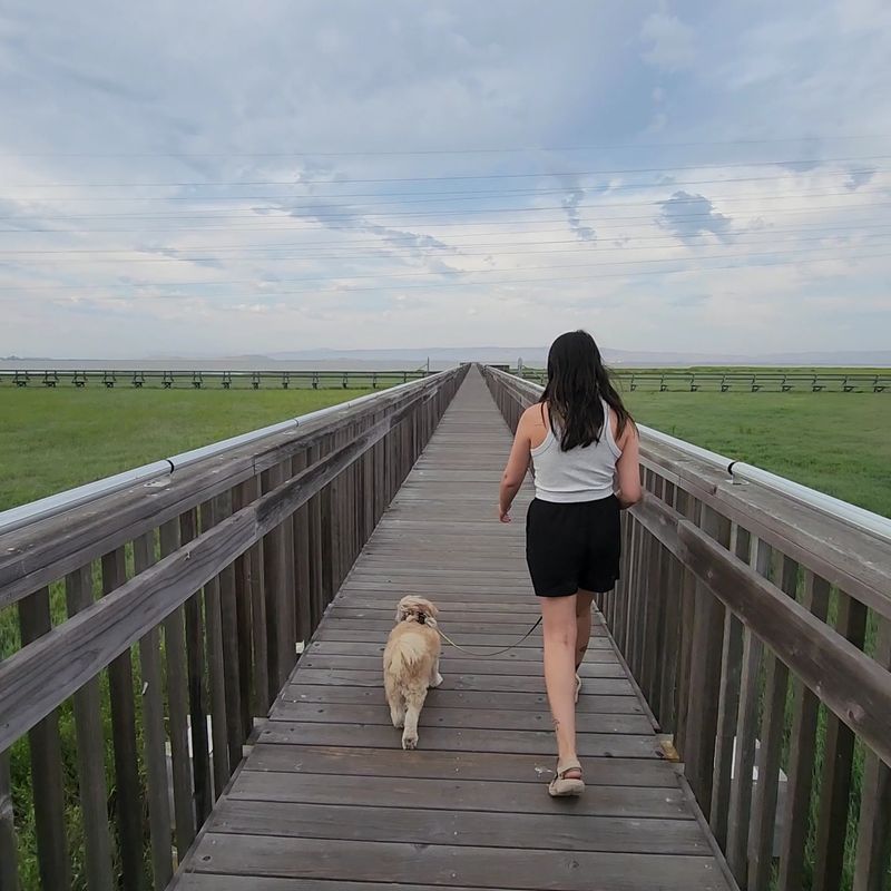
Anyone craving a bit of elevation in this pancake-flat landscape can find it at Byxbee Park Hills.
The rolling ground was built on a former landfill and now offers raised vantage points looking back across the open wetlands and out toward the bay.
It sits at the east end of Embarcadero Road, bordered by Mayfield Slough and part of Matadero Creek. The climb is modest by hiking standards, yet the change in perspective is noticeable.
From the top, the pattern of channels cutting through the marsh becomes much easier to read, and the scale of the preserve makes more sense.
Grass here turns golden in the dry months and green again after winter rain. What sets the park apart is its sculpted, art-influenced character, which feels distinctly different from the natural marsh trails nearby.
Shaped landforms and installed elements give the space a designed quality that surprises first-time visitors. Footing is generally good, though the paths are unpaved and can be uneven in spots.
Nature Minutes From The Freeway Without The Long Drive
Getting here does not require a weekend or a mountain road. The preserve sits just off Highway 101, close enough that a lunch break or an hour after work can genuinely be spent out on the marsh.
Small planes from the nearby airport pass overhead now and then, a reminder that the city is only minutes away. Yet the view from many trail sections holds almost nothing built.
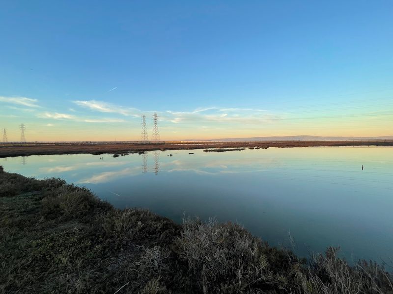
Water, marsh grass, birds, distant hills, and a wide stretch of sky fill most of the frame, and the contrast with Silicon Valley traffic is sharp. That accessibility is a big part of the appeal.
Timing deserves attention, because gates close in the evening and being locked in is an avoidable hassle.
Checking posted hours before an evening visit is worth the effort, particularly for anyone hoping to stay through sunset.
Parking is usually plentiful, though weekend afternoons and special events can fill lots faster.
Weekday mornings tend to feel quietest, with birdsong instead of conversation as the main soundtrack.
A short visit still delivers something worthwhile here, which is unusual for a place with this much open space.