You Would Never Expect To Find Water This Emerald Green In Idaho
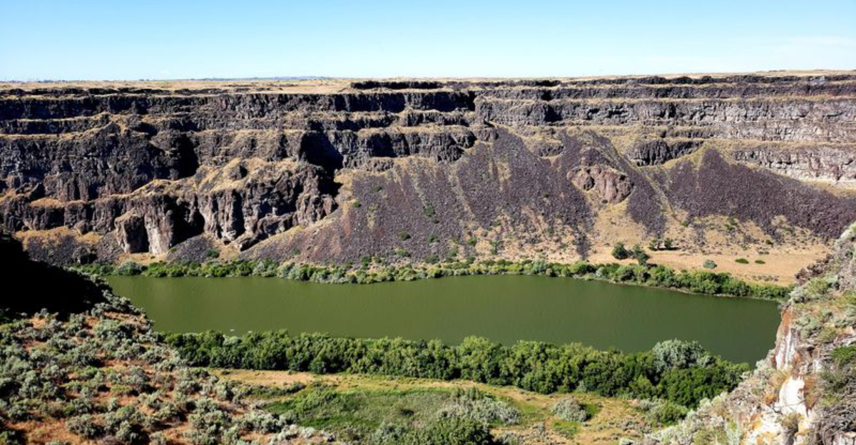
Well, well, well. Who spilled an emerald spell across Idaho?
Far below a canyon rim near Twin Falls, the river suddenly turns such an outrageous shade of green that it looks less like water and more like something bubbling inside a witch’s cauldron.
Only this potion stretches for miles.
Drivers expecting the usual rocky scenery tend to slow down fast once that glowing ribbon appears hundreds of feet below. The cliffs make it even more dramatic, dropping so sharply that the whole view feels slightly bewitched.
And no, there are no flying monkeys handling parking.
Just pull over safely, walk to the overlook, and prepare for a color that photographs almost suspiciously well.
Idaho may be famous for potatoes, but apparently somebody slipped a little emerald magic into the landscape.
How wickedly convenient.
Watch The Snake River Change Color Beneath The Canyon Rim
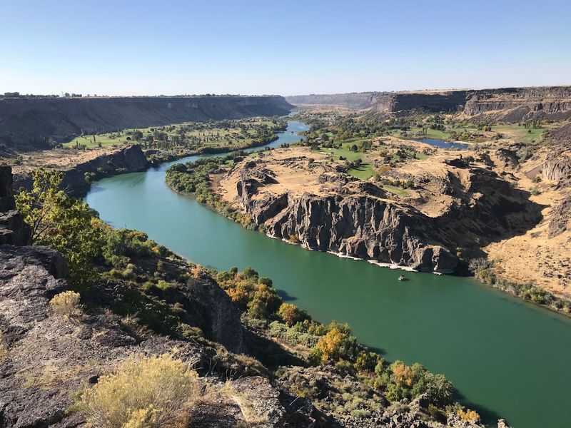
Stand along the rim near Twin Falls and the first surprise may be the color below. Depending on sunlight, reflections, water depth, vegetation, and surface conditions, the Snake River can shift from deep blue-green to a brighter jade tone against the canyon walls.
No single shade is guaranteed, and that variability is part of the appeal. Dry rock, sagebrush, and golden summer grasses can make the greener stretches appear even more vivid by contrast.
A polarized lens may reduce some glare, but simply changing your viewing angle can make an equally noticeable difference. Walk a short distance along the rim and compare the water directly below with bends farther down the canyon.
One section may look teal while another appears much darker.
The safest description is also the most interesting one: under the right conditions, the Snake River here really can look remarkably emerald green.
Follow The 7.6-Mile Canyon Rim Trail For Changing Views
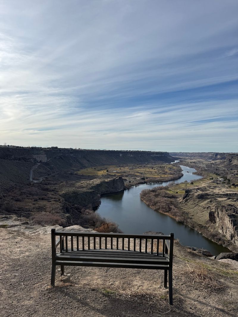
Twin Falls maintains a 7.6-mile paved Canyon Rim Trail that follows the gorge and connects views toward the Snake River, Perrine Bridge, Pillar Falls, and Shoshone Falls. You do not need to walk the full route to understand why it is worth exploring.
A short section can shift the perspective from a straight-down river view to a broad panorama where the canyon stretches toward the horizon.
The Twin Falls Visitor Center near the Perrine Bridge is one of the easiest starting points, and cyclists can use the paved trail to cover more ground without repeatedly moving the car.
Exposed sections offer limited shade, so summer walks are more comfortable with water and sun protection. Treat the trail as a chain of overlooks rather than a single destination.
Stop where the canyon opens widest, turn around when you have had enough, and let each bend reveal a slightly different version of the Snake River below.
Stand Beside The Perrine Bridge Nearly 500 Feet Above The River
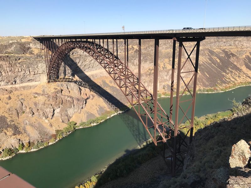
The Perrine Bridge gives the canyon an instant sense of scale. The steel span carries U.S. 93 across the gorge nearly 500 feet above the Snake River, and vehicles crossing it look tiny when viewed from the rim.
Pedestrian access lets visitors cross on foot and look both directions through the canyon, though anyone uncomfortable with heights may prefer nearby viewpoints.
The bridge is also internationally known for BASE jumping, and jumpers may occasionally be seen launching from the span and opening parachutes below, although there is no guarantee you will catch one during a visit.
Looking west brings Centennial Waterfront Park and lower canyon country into view, while the river continues east toward Pillar Falls and Shoshone Falls.
Seeing the bridge from above and then later from the canyon floor makes its height far easier to appreciate than any number alone.
Drop To Centennial Waterfront Park For A Water-Level Perspective
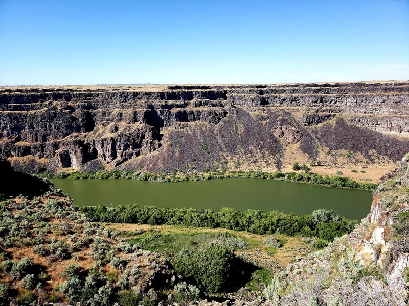
Centennial Waterfront Park changes the entire relationship with the canyon. Instead of standing above the Snake River, you are down near the water with the cliffs rising around you and the Perrine Bridge towering overhead.
The river’s green and blue-green tones become more prominent at this level because the surface fills much more of the view.
The park is also a common launching point for kayaks and paddleboards heading upstream toward Pillar Falls when river conditions allow.
Pillar Falls is formed by striking basalt formations in the river, but reaching it by water requires appropriate equipment, planning, and attention to current conditions.
Visitors who prefer to stay on land still get one of the best lower-canyon perspectives in Twin Falls.
Look back toward the bridge, then compare that scene with the rim you stood on earlier. The two viewpoints feel dramatically different despite being only a short drive apart.
See A Completely Different Snake River At Shoshone Falls
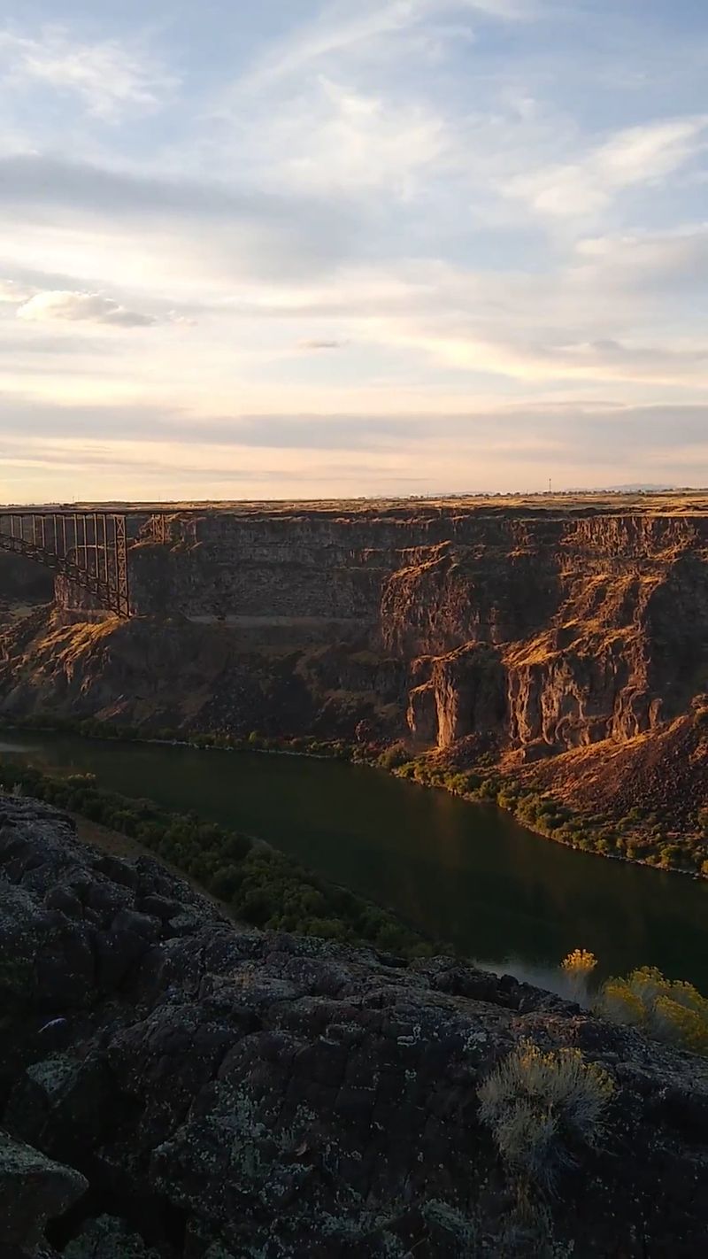
East of Twin Falls, the Snake River drops 212 feet at Shoshone Falls, a waterfall higher than Niagara Falls and long nicknamed the “Niagara of the West.”
The important thing to know is that its appearance changes substantially throughout the year.
Spring often brings stronger flows, while summer and fall can be lower because water reaching the falls is influenced by upstream releases, irrigation demand, reservoir management, snowmelt, and other conditions.
Twin Falls officials caution against treating the falls as simply “on” or “off,” so checking the city’s live camera before visiting is far more useful than relying on an old photograph. Even when flow is modest, the canyon itself remains impressive.
The primary viewing area is close to parking, and several viewpoints make it possible to see the falls and surrounding gorge without committing to a long hike.
Look Past The Water And Read The Canyon’s Volcanic History
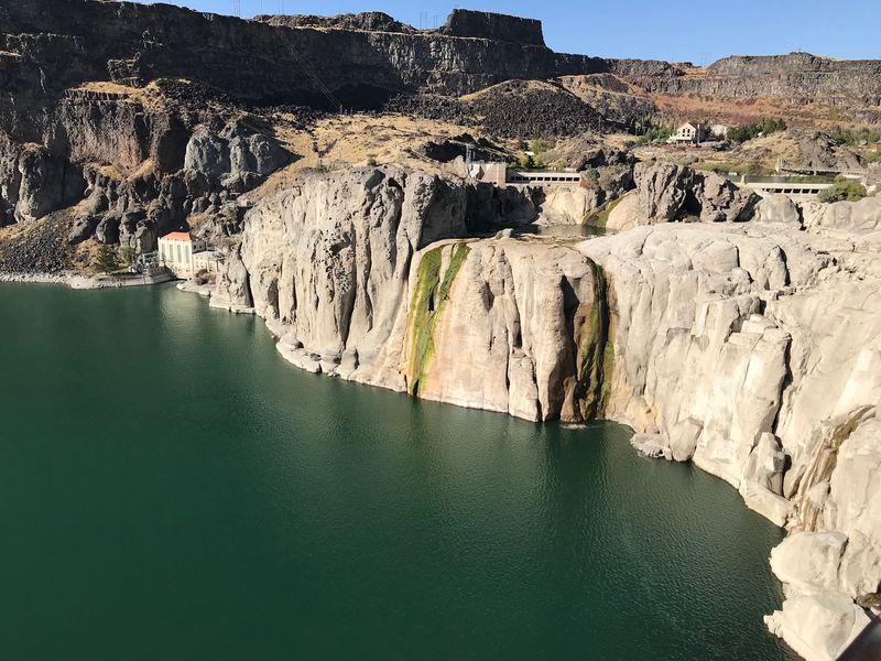
The Snake River Canyon extends for more than 50 miles across south-central Idaho, cutting through volcanic terrain and dropping hundreds of feet below the surrounding plateau near Twin Falls.
Ancient lava flows helped build this landscape long before the Snake River and major prehistoric floods carved and reshaped the gorge.
From the rim, darker bands of rock, ledges, talus slopes, and patches of vegetation break up the canyon walls, while irrigated fields begin surprisingly close to the edge above.
That contrast between agricultural plateau and raw volcanic gorge is one of the most distinctive parts of the view.
The river may be what draws your camera first, but the scale of the cliffs becomes harder to ignore the longer you stay. Remain behind railings and established boundaries where they are provided, because loose rock and exposed drop-offs occur in other sections.
The canyon offers plenty of drama without stepping closer than necessary.
Add Box Canyon Springs For An Even Brighter Blue-Green Detour
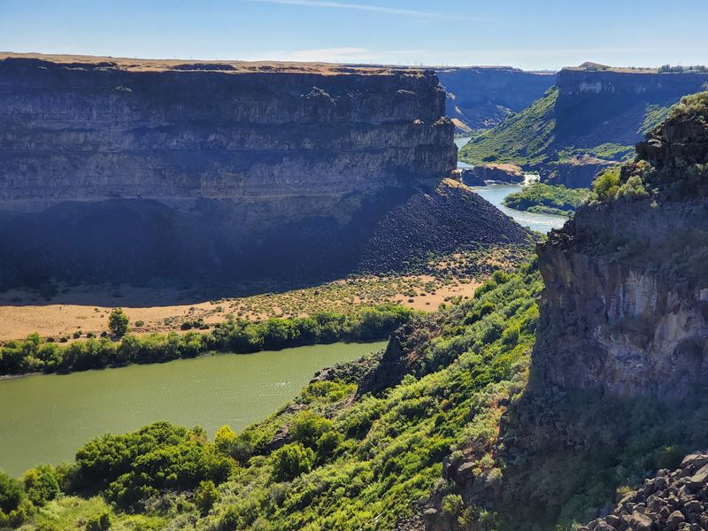
Box Canyon Springs Nature Preserve near Wendell offers a useful comparison for anyone fascinated by the Snake River’s color.
Part of Thousand Springs State Park, the preserve protects one of the largest springs in North America, where clear groundwater emerges into a steep canyon before flowing toward the Snake River.
Under favorable light, the water can appear brilliant turquoise or blue-green against pale rock and dense vegetation.
The setting feels very different from the broad Snake River Canyon near Twin Falls, with a tighter gorge and a stronger focus on clear spring water.
An overlook provides an easier view into the canyon, while a trail descends into the preserve for visitors prepared for a more strenuous outing.
Check current Idaho State Parks conditions before heading over, and give the preserve enough time to stand on its own rather than treating it as a rushed add-on.
Come In Late Summer For The Strongest Dry-Against-Green Contrast
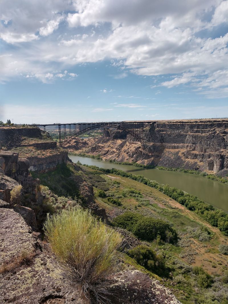
By August, exposed grasses around the Twin Falls canyon often fade toward tan and gold while sagebrush keeps its dusty green and volcanic walls absorb the strong summer light.
Against that muted landscape, the Snake River can look especially vivid where the water catches a green or blue-green tone.
Late summer also requires realistic expectations at Shoshone Falls because flow may be lower than during spring, depending on current water management and releases upstream.
Longer rim walks are more comfortable earlier in the morning or later in the day, when temperatures ease and the light becomes softer.
Wildfire smoke can occasionally reduce long-distance visibility in Idaho during late summer, so checking local conditions before planning photography is worthwhile.
On a clear evening, warm canyon walls above and cooler water below create one of the most striking seasonal contrasts around Twin Falls.
Disclaimer: Information in this article was reviewed against current official and tourism sources as of August 20, 2026.
Snake River Scenic Overlook is an existing scenic viewpoint in the Twin Falls area, and the broader descriptions of the Snake River Canyon, Perrine Bridge, Canyon Rim Trail, Centennial Waterfront Park, Shoshone Falls, and Box Canyon Springs are based on documented attractions and current visitor information.
Because river color, waterfall flow, water levels, smoke, lighting, vegetation, and recreation restrictions can change, photographs and descriptions should not be interpreted as guarantees of the exact conditions visitors will encounter.
The article’s central claim that portions of the Snake River near Twin Falls can appear unusually green, jade, teal, or blue-green is a visual description rather than a permanent scientific classification of the river’s color.
The apparent color can vary substantially with sunlight, viewing angle, reflections, water clarity, depth, surrounding vegetation, weather, and photographic conditions.
“Emerald green” is therefore reasonable descriptive language for favorable conditions, but visitors should not expect the river to display precisely the same color on every day or from every overlook.
The more fantastical language in the introduction, including references to spells, potions, witches, and flying monkeys, is clearly figurative rather than factual.