Few Colorado Trails Are As Gentle And Scenic As These 9 Senior-Friendly Routes
A friend once told me she missed hiking but no longer wanted every trail to feel like a workout. That sent me searching for something better.
Turns out, easier does not have to mean less interesting.
Colorado has gentle trails where the scenery shows up without demanding steep climbs or endless switchbacks first.
I found routes beside rivers, around lakes, and past red-rock formations, with several offering benches or accessible surfaces along the way.
They leave room to stop, look around, and actually enjoy the afternoon. That is the kind of hiking I wanted for this list.
Beautiful walks, manageable routes, and plenty worth seeing along the way.
1. Animas River Trail, Durango
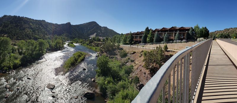
Just imagine for a second a smooth path that threads straight through a mountain town. Water rushes on one side, and history rolls by on the other.
The Animas River Trail stretches nearly seven miles through Durango’s Animas River Greenway.
The trail is a hard-surface shared-use path designed for broad accessibility, though Durango is still upgrading several older sections to meet current ADA standards.
Access points appear frequently, so you can start short and build up. Parks, the community recreation center, and the public library all connect to it.
Animas City Park, Rank Park, and Santa Rita Park sit along the route. Bridges cross the water at several points, and small waterfalls add sound.
Interpretive signs share pieces of the town’s mining and railroad past. Reading a few turns a stroll into a self-guided history lesson.
Inline skating and cross-country skiing keep the trail busy through the seasons. Bird and wildlife watching reward anyone who moves slowly.
The path runs beside the historic Durango and Silverton Narrow Gauge Railroad. Time it right and a steam train chugs past, whistle and all.
Warm months bring tubers and kayakers bobbing down the current. Watching them from a shaded bench is a fine way to spend an hour.
Shade comes and goes, so a hat helps on sunny stretches. Water fountains and restrooms exist in the larger parks.
The corridor runs from Oxbow Park and Preserve in the north down to River Road in the south, Durango. Bring a camera, because the river changes color with every bend in the light.
2. Garden Of The Gods Paved Path, Colorado Springs
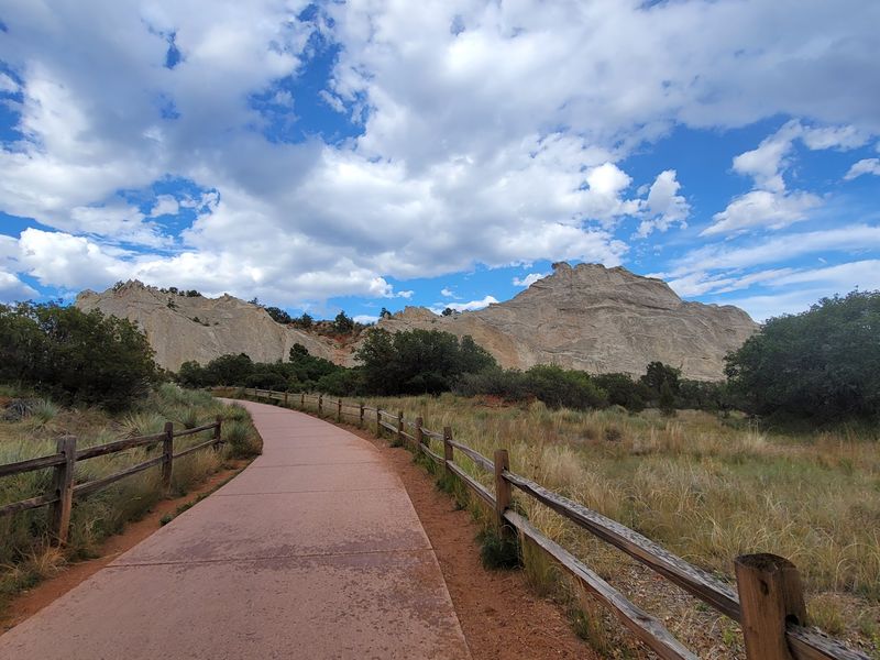
Garden of the Gods Park sits just outside Colorado Springs, and it is a National Natural Landmark. The Perkins Central Garden Trail forms a paved 1.5-mile loop through the middle of it.
Elevation gain stays under 30 feet across the whole route. Wide pavement handles wheelchairs, walkers, and strollers without any fuss.
Named formations line the way like characters in a story. Watch for White Rock, the Kissing Camels, and Pulpit Rock.
Guided nature walks run regularly for anyone curious about the geology. Birders bring binoculars, and photographers bring patience.
Entry costs nothing, and the gates stay open all year. Weekends fill up fast, so aim for an early start.
Morning light turns the rock a deeper red than midday sun does. Late afternoon works beautifully too, with cooler air and long shadows.
Benches appear often enough that resting never means sitting on a curb. Restrooms and shade shelters are spaced along the loop as well.
Winter mornings can be icy in shaded corners, so tread carefully. Summer afternoons heat up quickly, which is another reason to go early.
The Visitor and Nature Center sits at 1805 N. 30th Street, Colorado Springs. Few paved miles in the state pack this much drama into so little effort.
3. Boulder Creek Path, Boulder
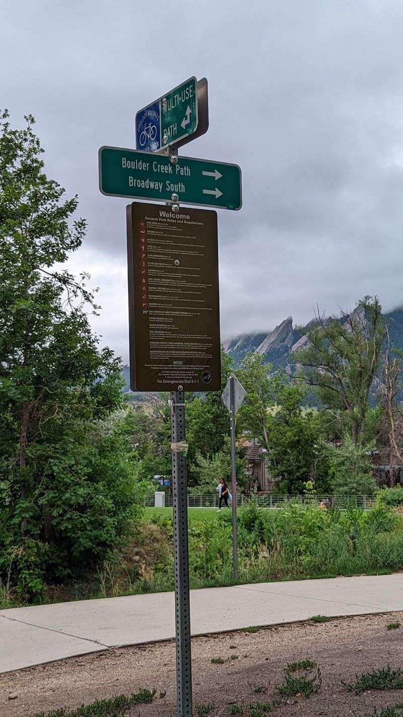
Let me be real for a second, a trail that pleases everyone is rare. Yet this one comes remarkably close.
The Boulder Creek Path runs roughly 5.5 miles one way through Boulder. Flat pavement makes it friendly to wheelchairs and strollers alike.
The corridor follows Boulder Creek right through the middle of town. Start near the mouth of Boulder Canyon for the best mountain views.
Eben G. Fine Park anchors the western end with picnic tables and shade. The route also passes the Boulder Public Library and the Dushanbe Teahouse.
Farther along, the University of Colorado campus comes into view. Benches and grassy banks invite frequent stops.
Runners, cyclists, and skaters share the path in every season. Summer brings tubers riding the creek with plenty of laughter.
Picnicking beside the water is practically a local tradition. Squirrels, ducks, and songbirds keep the entertainment going.
Cottonwoods provide shade through much of the central section. Winter clears the leaves and opens up longer sightlines toward the foothills.
Parking near the canyon mouth fills early on weekends, so arrive before mid-morning. Weekday afternoons stay much calmer.
The path stretches from Eben G. Fine Park at 101 Arapahoe Avenue, Boulder, east toward the Stazio Ballfields near 55th Street. Walk a mile or five, then reward yourself with tea beside the creek.
4. Washington Park Loop, Denver
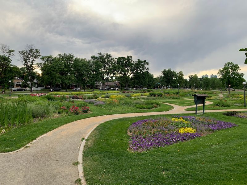
You could have knocked me over with a feather when I saw how green this corner of the city is. Two lakes, flower beds, and 155 acres of open lawn.
Washington Park in Denver wraps wide paved loops around Smith Lake and Grasmere Lake. The full circuit measures about 2.36 miles.
Surfaces stay smooth and level the entire way. ADA accessibility means walkers and wheelchairs roll along comfortably.
Grassy areas spread out on both sides of the path. Spreading a blanket and doing nothing at all counts as a valid plan.
The gardens here are famous and carefully tended. One bed is modeled after George Washington’s Mount Vernon garden.
Paddle boating on Smith Lake draws crowds in warmer months. Anglers cast lines at both lakes throughout the season.
Lawn bowling and tennis courts add a social element. Picnic shelters make family gatherings simple to organize.
Birdwatchers do especially well during spring and fall migration. Herons, geese, and songbirds all make appearances.
Mature trees shade long stretches of the loop, which helps on hot afternoons. Benches sit at regular intervals near the water.
The park was designed between 1899 and 1908, giving it a stately, old-fashioned layout. It stays open year round.
Weekday mornings are quietest, while weekends bring joggers and cyclists in numbers. Parking is easiest along the eastern edge.
Find it at S Downing St and E Louisiana Ave, Denver. Two laps, one bench break, and the whole city seems to slow down.
5. Cherry Creek Trail, Denver
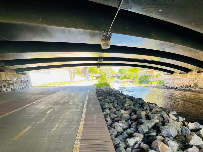
Are you seeing what I’m seeing? A single paved corridor running roughly 40 to 45 miles through the metro area.
The Cherry Creek Trail runs from downtown Denver through Cherry Creek State Park and continues south through Parker toward Franktown. Nearly all of it is paved and pleasantly flat.
Most sections measure eight feet wide, so passing is never awkward. You can walk half a mile or half a day.
Downtown stretches drop below street level, muffling traffic noise. Bridges overhead create a surprisingly peaceful tunnel effect.
Farther along, the route passes the Cherry Creek Shopping District. Leafy neighborhoods and quiet suburbs follow after that.
Tree-lined segments deliver shade exactly when summer sun starts to bite. Connections to other regional paths let you extend the outing.
South of the city, the trail enters Cherry Creek State Park. That preserve covers roughly 4,000 acres of grassland and wetland.
The 850-acre reservoir anchors the park with wide open water views. Boating, fishing, paddleboarding, and swimming all happen there.
Birdwatching improves dramatically once the wetlands appear. Pelicans, hawks, and shorebirds are regular sightings.
Numerous street-level access points make short segments easy to plan. Pick a park, park the car, and walk out and back.
Flash flooding can close low sections after heavy rain, so check conditions first. Otherwise the surface stays reliable year round.
The route begins near the South Platte River confluence in downtown Denver and continues south through the metro area toward Franktown. Choose your mile, and the trail handles the rest.
6. Lair O’ The Bear Park Trail, Morrison
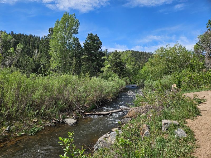
I had to do a double-take at the idea of a castle tucked into the foothills. Yet there it stands, stone towers and all.
Lair o’ the Bear Park sits about four miles west of Morrison in Jefferson County. The Bear Creek Trail is a natural-surface creekside route with gentle sections near the trailhead, but it is not fully accessible.
Surfaces here are natural rather than paved, and accessibility is limited. Still, the grade is gentle enough for many easygoing walkers.
The popular route toward Dunafon Castle runs about two miles out and back. Elevation gain totals roughly 157 feet across that distance.
Cottonwoods and box elders shade the creekside path generously. Even July afternoons stay reasonably cool along the water.
Dunafon Castle is private property, but the view from the trail is free. Its storybook towers rise above the trees across the creek.
Bear Creek supports a busy cast of wildlife. Birders spot American Dippers bobbing on wet rocks year round.
MacGillivray’s Warblers and Yellow-breasted Chats nest in the thickets. Lazuli and Indigo Buntings turn up in season with flashes of blue.
Anglers work the water for brown and rainbow trout. Quiet pools near the bridges tend to produce the best luck.
Picnic areas line the creek, most of them shaded and close to parking. Bringing lunch here beats any restaurant patio.
Spring runoff makes the creek loud and lively, while autumn turns the canopy gold. Slow down, listen to the water, and let the castle surprise you around the bend.
7. Riverwalk Trail, Pueblo
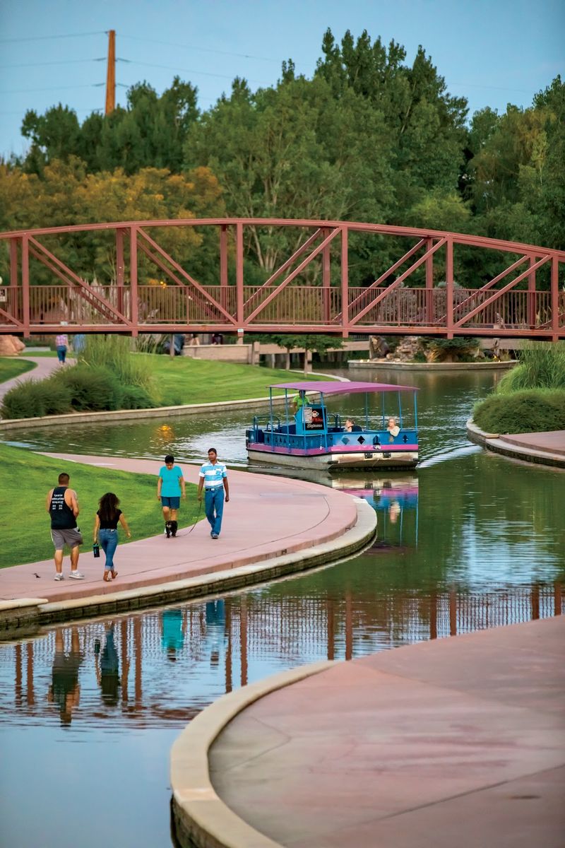
It makes you wonder, doesn’t it, how a city rebuilds its relationship with a river. Pueblo managed it with concrete, art, and patience.
The Historic Arkansas Riverwalk, known locally as HARP, winds a mile through downtown Pueblo. Paved walkways follow the channel on both sides. Crowds stay lighter here than on Denver-area routes. Quiet mornings feel almost private.
Access is free, and the walkways stay open around the clock every day. Lighting makes evening strolls comfortable.
More than 60 pieces of public art line the route. Sculptures, murals, and mosaics turn the walk into an open-air gallery.
The Veterans’ Bridge stands out as the emotional centerpiece. It is the only monument in the country honoring all branches of military service.
Narrated excursion boats glide along the channel with local history commentary. Sitting for that tour gives tired legs a genuine break.
Pedal boats operate on Lake Elizabeth for anyone wanting a little arm work. Families and groups tend to gravitate there.
Shops and dining sit steps from the water, so coffee is never far. Shaded benches appear frequently along the promenade.
The Walk of Valor Experience adds interactive historical stops along the way. Each one takes just a few minutes to explore.
Spring and fall bring the most comfortable temperatures for a full loop. Summer evenings work well once the sun drops.
You will find it along the Arkansas River in downtown Pueblo. Come for the flat pavement, linger for the sculptures and the stories.
8. Sawhill Ponds Loop, Boulder
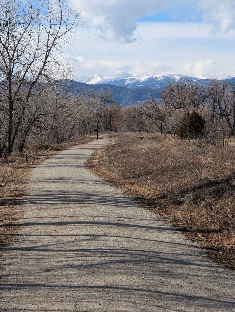
Here’s a crazy thought: a wildlife sanctuary sitting minutes from a busy college town. That combination should not work, yet it absolutely does.
Sawhill Ponds has a network of mostly flat trails winding among the ponds, and visitors can combine them into a short loop.
The area is officially identified as mobility-friendly, with accessible parking and mobility-device access to the fishing pier and picnic areas.
ADA accessible parking, fishing piers, and picnic areas all exist on site. Planning a comfortable outing takes very little effort.
The preserve contains 18 individual ponds created from former gravel pits. Together they create habitat that birds clearly appreciate.
Waterfowl and marsh-nesting species gather in impressive numbers. A bird blind lets you watch without startling anything.
Migrating ducks and geese pass through in spring and fall. An Osprey nest gives regulars something to check on each season.
Muskrats paddle between the cattails at dawn. Red-winged blackbirds, robins, and chorus frogs supply the soundtrack.
Anglers cast from the piers in near silence. The ponds hold enough fish to make an afternoon worthwhile.
Bicycles are not allowed, which keeps the atmosphere calm and unhurried. Leashed dogs, however, are welcome company.
Mornings bring the best light and the most bird activity. Mosquitoes show up in midsummer evenings, so pack repellent. Shade is limited across parts of the loop, making a wide hat a smart choice. Benches near the water invite long pauses.
Find the trailhead near 75th Street and Valmont Road in Boulder. Bring binoculars and leave your hurry in the car.
9. Canyon Rim Trail, Castlewood Canyon State Park, Franktown
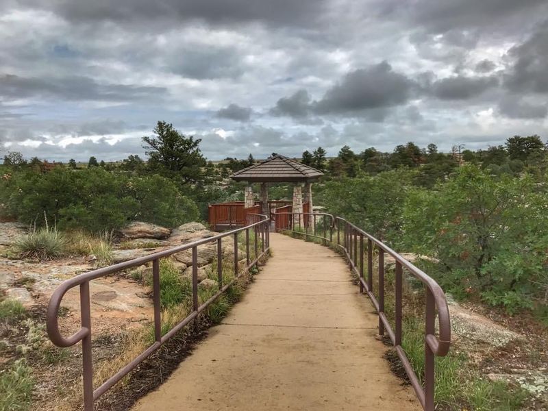
Have you given any thought to how much drama hides at the edge of the plains? A canyon carves itself into the grassland with almost no warning.
Castlewood Canyon State Park protects 2,628 acres of Colorado’s Black Forest region near Franktown. The Canyon View Nature Trail is paved and fully ADA accessible.
The paved Canyon View Nature Trail is about 1.2 to 1.5 miles total, depending on the current park listing. Navigation stays simple, with clear signage throughout.
Pavement follows the very lip of the canyon rim. Overlooks reveal the depth and width of the gorge below.
Panoramic views open toward the Front Range and Pikes Peak on clear days. Sunset light on those distant summits is worth the timing.
Geological layers in the canyon walls tell a long story. Interpretive stops explain how water shaped the whole scene.
An audio tour highlights the plains habitat along the way. Listening while you walk adds depth without adding distance.
Ruins of the Castlewood Dam, which burst in 1933, remain visible in the park. A historic homestead site sits nearby as well.
Nature study and photography are the main draws for slower walkers. Ponderosa pines frame nearly every viewpoint.
Leashed dogs are permitted on this trail. Restrooms and picnic tables sit close to the parking area. The park stays open year round, though winter winds can bite on the exposed rim.
You will find it five miles south of Franktown on Highway 83, Franktown. Stand at the railing, breathe deep, and let the plains stretch out forever.