These 8 Quiet Northern California Escapes Are Made For Fresh Air And Fewer Crowds
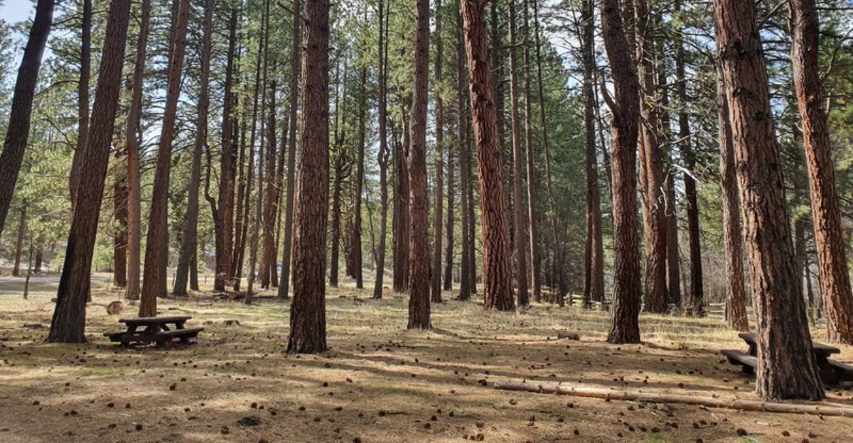
There are weekends when the best plan is simply finding somewhere the noise does not follow.
No packed boardwalks. No fighting for a parking space. No schedule built around reservations. Just open air, quiet roads, and enough room to let the day stretch out on its own.
Northern California still has escapes where solitude feels realistic instead of aspirational.
The appeal might be a lake with more shoreline than people, a forest trail where footsteps replace traffic, or a small town that never seems interested in rushing anyone along.
These places work because they leave space for pauses.
Take the long lunch. Stay on the trail a little longer. Sit somewhere scenic without feeling like you need to move for the next person.
These eight escapes are for anyone who wants the trip to feel calmer than the week that came before it.
1. Trinity Alps Wilderness, Trinity County
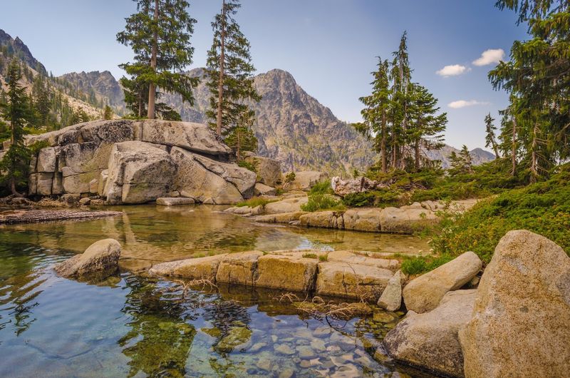
Picture a county bigger than Delaware with roughly 13,700 residents and not a single incorporated city.
That is Trinity County, and the 517,000-acre Trinity Alps Wilderness sitting inside it is the second largest wilderness in the state.
Elevations climb from about 2,000 feet in shady creek drainages to around 9,000 feet at the chiseled summits.
More than 600 miles of trail thread through granite basins, meadows, and quiet lake shores, with routes ranging from easy afternoon strolls to punishing multi-day climbs.
Locals will tell you fall is the sweet spot here, when the air turns crisp and the crowds that clog Yosemite or Lake Tahoe simply never show up.
Even Trinity Lake, the third largest lake in California, stays surprisingly open during peak summer weekends.
Planning matters if you want to sleep out here.
Overnight trips require both a wilderness permit and a campfire permit, available at outdoor kiosks at the Weaverville Ranger Station, the Supervisor’s Office in Redding, the Shasta Lake Ranger Station, and several fire stations.
Campfire permits can also be handled online.
Call the Weaverville Ranger Station for a recorded trail conditions message before you go, and check current fire restrictions. Some trails cross old burn scars, so a quick call to a ranger saves surprises.
2. Sinkyone Wilderness State Park On The Lost Coast
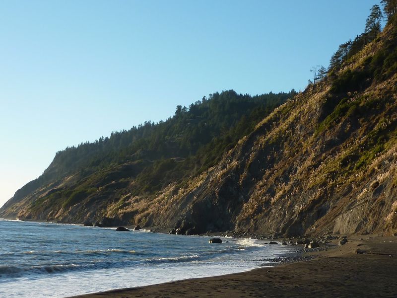
Hardly anyone stumbles onto Sinkyone by accident. The roads in are narrow, steep, and often unpaved, which is precisely why this slice of the Lost Coast still feels like the edge of the map.
Black-sand beaches sit tucked beneath bluffs that drop straight into the Pacific.
Trails climb through wind-bent grasslands and pockets of old redwood, then dip back down to driftwood-strewn coves where the only sounds are waves and sea lions barking offshore.
California State Parks is upfront about the situation: primitive facilities and difficult access naturally keep visitor numbers low. Expect vault toilets, no showers, and long stretches without cell service.
Roosevelt elk wander the ridges here, and spotting a herd grazing above the surf is a memory that sticks.
A high-clearance vehicle helps, and driving in after heavy rain is a gamble worth skipping.
Bring more food and water than you think you need, plus layers, since coastal fog can drop the temperature fast even in July.
Backpackers often walk the Lost Coast Trail south from Usal Beach, though even a single overnight at one of the walk-in camps delivers that far-from-everything feeling.
Tell someone your plans before you leave pavement. Out here, self-reliance is part of the deal.
3. Tolowa Dunes State Park In Del Norte County
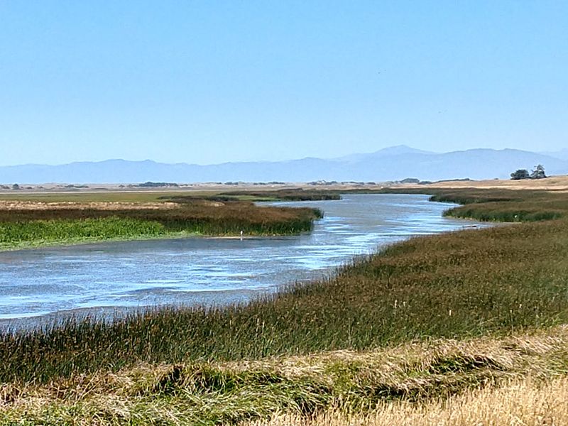
Just north of Crescent City, an ancient dune system rolls inland from the shoreline like frozen waves.
Tolowa Dunes State Park protects that landscape along with wetlands, ponds, wooded ridges, and miles of beach that rarely see a crowd.
Birdwatchers quietly love this place. The wetlands sit along the Pacific Flyway, so spring and fall bring waves of migrating waterfowl, shorebirds, and raptors hunting over the grass-covered dunes.
Trails here are informal compared to a manicured state park.
Some paths turn sandy and soft, others get muddy in winter, and a few fade into open dune where you simply pick your line and keep the ocean on your left.
Horseback riders share several routes, and beachcombing after a storm can turn up shells, agates, and interesting driftwood.
Lake Earl and Lake Talawa, the big shallow lagoons nearby, add paddling and fishing options for anyone hauling a kayak.
Come prepared for real North Coast weather. Wind off the water is nearly constant, fog rolls in without warning, and a waterproof jacket beats a fleece almost every day of the year.
The park’s name honors the Tolowa people, whose villages and traditions are tied to this coastline going back thousands of years.
4. Castle Crags State Park in Castella
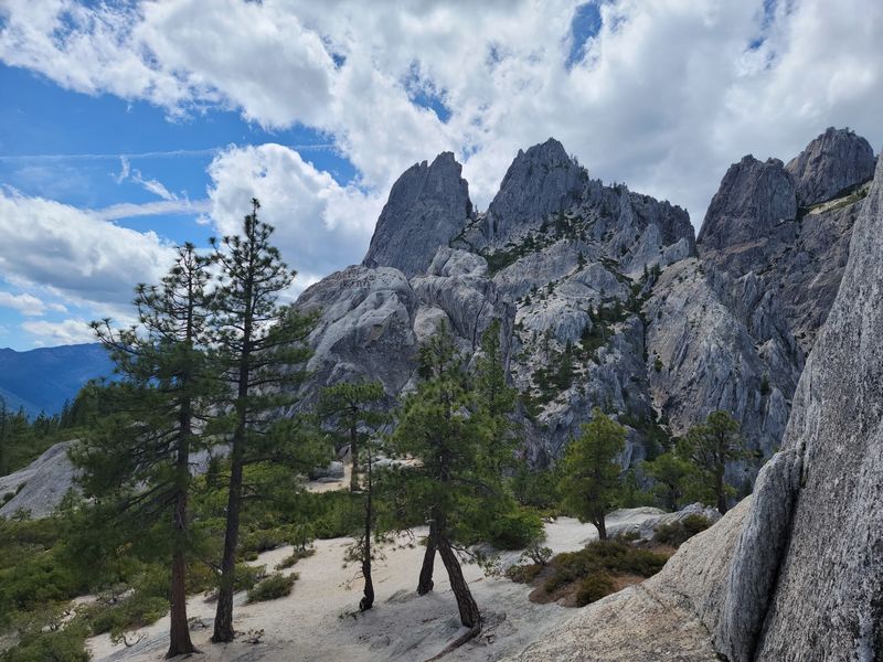
Some places make you work for the view. Castle Crags hands you one of the best granite skylines in the state from a trailhead you can reach minutes after leaving Interstate 5.
The crags themselves are ancient granite spires, worn into towers and fins that jut above thick conifer forest.
The Sacramento River runs through the lower part of the park, and on clear days Mount Shasta looms to the northeast like a giant white scoop of ice cream.
Hikers usually aim for the Crags Trail, a steady climb that ends near Castle Dome with a payoff view worth every switchback.
Shorter options exist too, including easy riverside paths and the Indian Creek Nature Trail for families with young kids.
The park is currently open, and its campground makes a solid base for exploring the Shasta region without booking a hotel. Sites fill on summer weekends, so reserving ahead is smart.
Fun detail: a section of the Pacific Crest Trail passes right through the park, so you may meet thru-hikers smelling of trail dust and ambition.
5. Lava Beds National Monument Near Tulelake
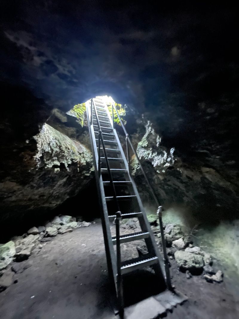
More than 800 caves sit beneath the sagebrush here, formed when rivers of lava crusted over and drained away thousands of years ago.
Lava Beds National Monument, almost brushing the Oregon border, is one of the strangest and quietest parks in California.
Aboveground you get high-desert scenery: black basalt flows, cinder cones, spatter cones, and trails that wander across ground that looks freshly poured.
Below the surface, lava tubes range from easy walk-in tunnels with staircases to tight crawls that demand knee pads and nerve.
Bring a helmet and at least two flashlights per person. Visitors also need a free cave permit and a quick screening to protect bats from white-nose syndrome, so stop at the visitor center first.
Wear sturdy shoes and long sleeves, because basalt is sharp and low ceilings catch heads constantly. Cave temperatures stay cool year-round, which feels wonderful in August and chilly in April.
The monument also holds serious history. Petroglyphs and pictographs left by Modoc people appear at several sites, and the Modoc War of 1872 to 1873 played out across this lava landscape.
Because it sits far from cities, night skies here are spectacular. Let your eyes adjust and the Milky Way appears without any effort.
6. Marble Mountain Wilderness In Klamath National Forest
Light use. Solitude.
Those are the exact words Forest Service material uses to describe the trails threading through the Marble Mountain Wilderness, and that alone should get any tired hiker’s attention.
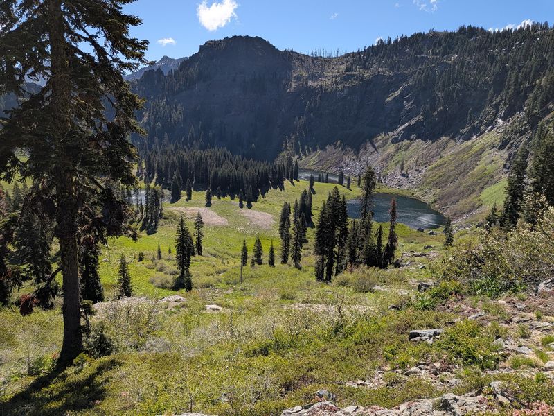
Spread across a huge chunk of Klamath National Forest, this wilderness holds dozens of alpine lakes, deep glacier-carved canyons, and broad meadows that light up with wildflowers in early summer.
Hundreds of miles of trail connect them, including a long stretch of the Pacific Crest Trail.
The name comes from pale bands of marble and limestone that streak certain ridges, a surprise in a region dominated by granite and volcanic rock.
Standing on that light-colored rock while looking down at a green lake basin feels almost otherworldly.
Fishing draws plenty of visitors to lakes like Cliff, Ukonom, and Campbell. Black bears live here too, so hang food properly or pack a bear canister.
Snow can linger in high basins into June, and mosquitoes peak right after melt-out. Late summer through early fall usually brings the best mix of dry trails and calm weather.
Roads to trailheads are often long, rough, and unsigned, so download maps before losing service. Carry a paper map as backup, because batteries fail at inconvenient moments.
7. Modoc National Forest In Northeastern California
If your goal is to see almost nobody for an entire day, aim northeast.
Modoc National Forest covers a corner of California that even most Californians never visit, and the Forest Service describes it as a quiet place where solitude and outdoor recreation meet.
Landscapes shift constantly across the forest.
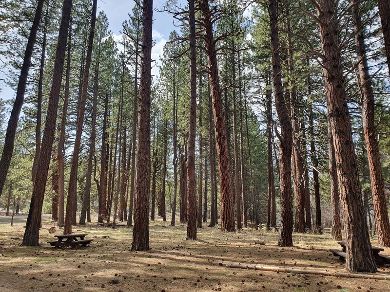
Juniper flats give way to pine woodland, rimrock cliffs, volcanic craters, and the high Warner Mountains, where the South Warner Wilderness holds streams, meadows, and peaks above 9,000 feet.
Wildlife watching is a genuine highlight. Pronghorn sprint across open sagebrush, mule deer move through the timber, and the nearby Modoc National Wildlife Refuge fills with sandhill cranes and geese during migration.
Anglers fish reservoirs and small creeks, hunters know the area well, and rockhounds hunt for obsidian and other volcanic finds in designated spots.
Dispersed camping is widely allowed, which means claiming your own patch of forest for the night.
Services are thin out here. Fuel up in Alturas, carry extra water, keep a spare tire in good shape, and expect long gravel roads between anything resembling a town.
Fair warning about winter: heavy snow closes many routes, so late spring through October is the practical window for most visitors.
8. Bucks Lake Wilderness, Plumas National Forest
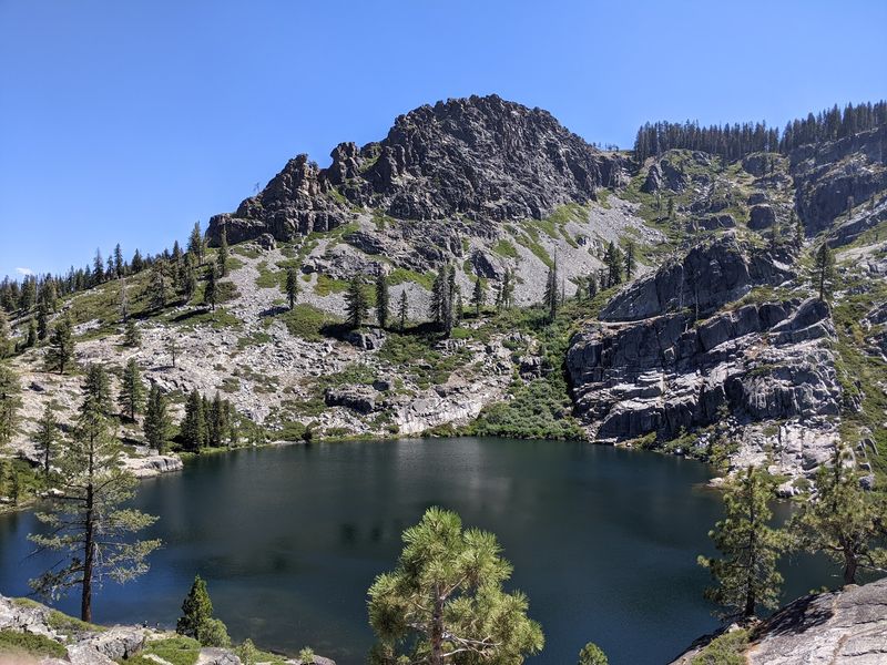
West of Quincy, tucked into Plumas National Forest, a compact wilderness delivers exactly what a weekend needs: mountain lakes, shady forest trails, and viewpoints that stretch across ridge after ridge.
Bucks Lake Wilderness stays under the radar partly because the busy reservoir just outside its boundary grabs most of the attention.
Boaters and campers cluster around Bucks Lake itself while the backcountry trails stay wonderfully empty.
The Forest Service describes the Three Lakes Trail as offering plenty of solitude, and that description holds up.
A section of the Pacific Crest Trail crosses the area, giving day hikers an easy way to sample a famous long-distance route without committing to months of walking.
Granite outcrops along the higher ridges open up long views toward the Sierra and the Feather River country.
Trout fishing is popular in the lakes, and anglers who hike a mile or two past the road usually have the water to themselves.
Practical notes: some access roads are rough dirt, mosquitoes get enthusiastic in early summer, and afternoon thunderstorms build fast in August.