Head To This Underrated Wisconsin Park For An Incredible Fossil Hunting Adventure
A county park can look ordinary from the parking lot and still hide hundreds of millions of years beneath the grass.
In Wisconsin, one compact stop drops into a rocky ravine where exposed shale, limestone, and fossil shells turn a short visit into a hands-on geology lesson.
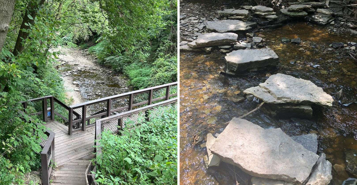
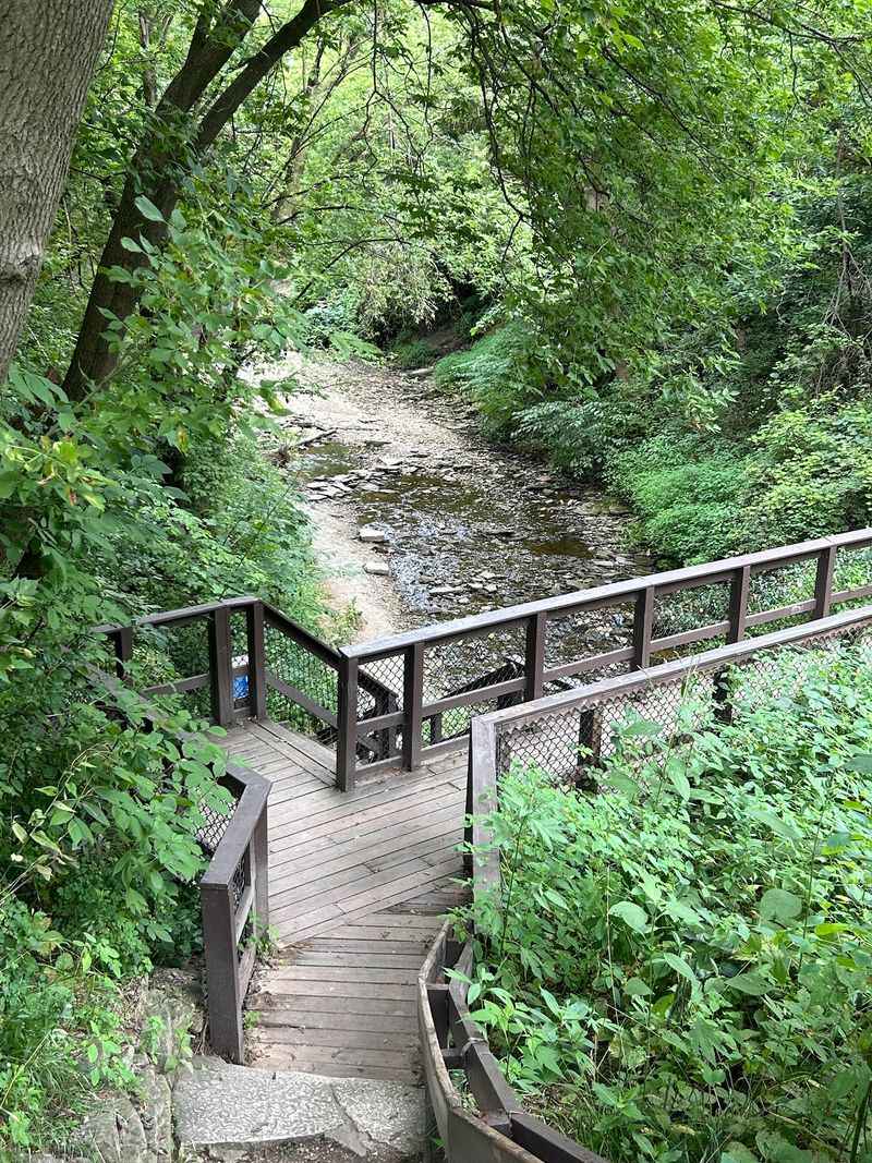
The staircase leads straight into the interesting part.
A seasonal waterfall, creek, shaded walls, and fossil-rich layers give curious visitors plenty to inspect without requiring a long hike.
Tiny park, enormous timeline!
Conditions change with rain and season, so sturdy shoes help. Take your time near the rock layers and look closely.
The best souvenir may be realizing how much history can fit inside a very small place.
Three Acres Of Ancient Seafloor
Small parks rarely pack this much geology into so little space. Wequiock Falls County Park covers roughly three acres in Brown County, Wisconsin, yet it exposes a full slice of the Niagara Escarpment.
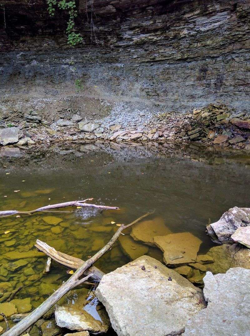
Cliffs about 25 feet tall curve around Wequiock Creek. The upper caprock is Silurian Mayville Dolomite, hard and pale, holding the ledge that the water pours over.
Beneath that sits the Ordovician Maquoketa Formation, made of green and greenish-blue shales and carbonates. Those softer layers crumble and slide, which is exactly why fossils keep appearing at your feet.
I stood at the bottom and traced the line where one rock unit meets the other. That thin boundary marks millions of years of change in a tropical sea that once covered this part of the state.
The lesson here is simple. Look at the walls, not just the water, because the rock tells the older story.
Give yourself twenty minutes just to study the layers before you start searching for shells. You will spot patterns you would otherwise walk right past.
You will find the park at 3426 Bay Settlement Rd, Green Bay, tucked a few steps off the highway.
Shale Banks Full Of Shells
Fossils can appear in the blue-gray rocks of the Maquoketa Formation, with brachiopods, bryozoans, crinoid material, and occasional corals among the possibilities.
Visitors can examine and photograph finds, but Brown County rules prohibit removing fossil material from the park.
That mud was once a warm seafloor crowded with creatures. Now their shells sit pressed into stone along the creek banks.
Brachiopods are the most common find, with ribbed shells that look a bit clam-like. Crinoid stem pieces appear as small round discs, sometimes stacked like tiny coins.
Bryozoans show up as delicate, lacy textures on flat chips of rock. Horn corals are among the rarer fossils that may be spotted here, alongside more common brachiopods, bryozoans, and crinoid remains.
Skip the hammer and chisel entirely. Brown County prohibits removing, damaging, or disturbing rocks, minerals, and fossil material, so fossils should be observed and left where they are found.
Bring a hand lens or phone camera and plenty of patience. Close inspection and photographs let you study the fossils without removing anything from the park.
Spotting the remains of creatures that lived in an ancient Wisconsin sea hundreds of millions of years ago puts the park’s enormous timeline into perspective.
Through The Tunnel Downstream
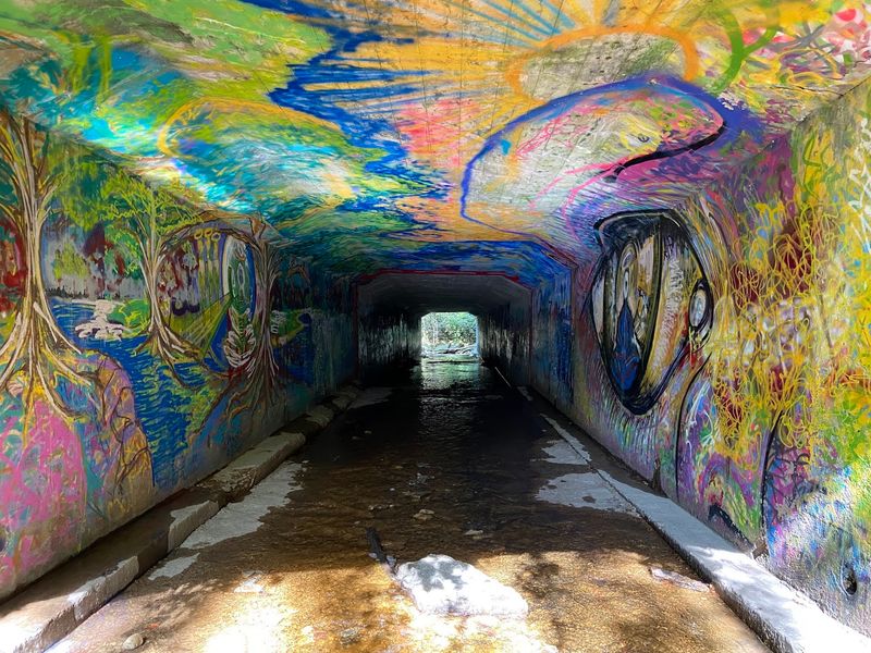
Fossil-rich layers also occur downstream beyond the tunnel beneath the road, a route used during guided geology and fossil programs at the park.
Walking through that culvert feels like a small dare. Local artists have covered the concrete with layers of colorful graffiti, which makes for oddly good photos.
On the far side, exposed Maquoketa rocks contain fossil-bearing layers where visitors may spot brachiopods, bryozoans, crinoid material, and other ancient marine remains.
Dry weather matters enormously for this stretch. Wet shale turns into slick paste, and the creek bed rocks get treacherous fast.
I wore old shoes and was grateful. Expect mud on your ankles and plan a spot in the car for dirty footwear.
Move slowly and look carefully at exposed rock surfaces and loose material, but leave all fossils, rocks, and minerals in place as required by Brown County park rules.
Keep an eye on kids near the water and the banks, since the footing shifts without warning.
Fifty Stone Steps Down
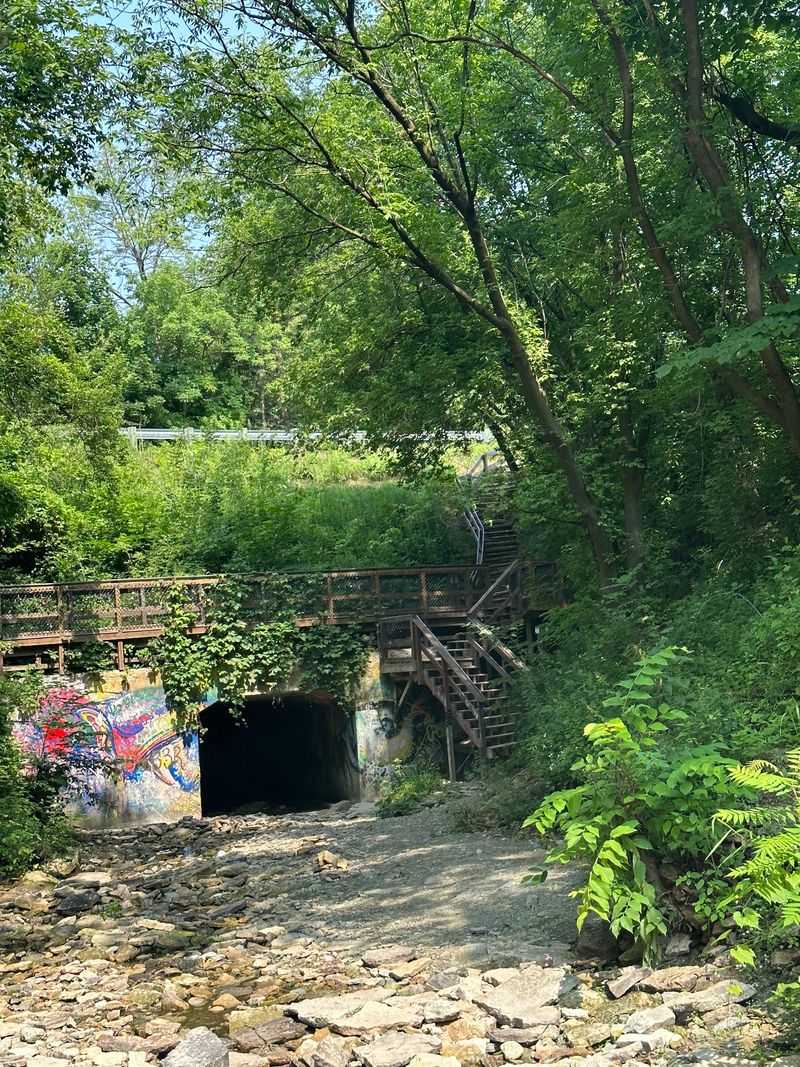
Getting to the good stuff means committing to the stairs. From the small lot, a paved path leads west to an overlook that peers down into the gorge from above the waterfall.
The full trail is short, roughly 0.2 to 0.3 miles out and back. Fitness is not the issue here; footing is.
A staircase leads down into the ravine, where uneven and potentially slippery footing makes careful steps important.
Strollers and wheelchairs cannot make the descent. The upper lawn and overlook remain enjoyable, and the walking bridge area gives a solid view for anyone staying up top.
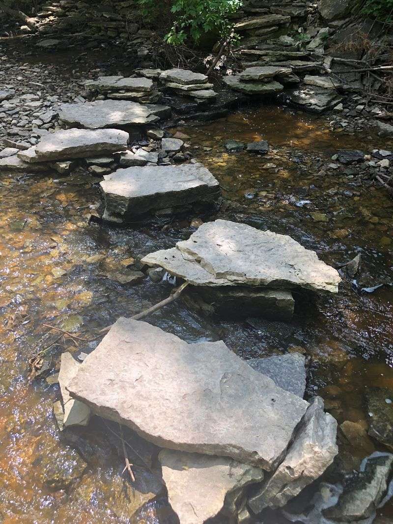
At creek level, the ground turns to rock and mud all the way to the base of the falls. Non-slip footwear is not optional if you plan to explore down there.
Once below, you can stand almost beneath the ledge where the water lands. Looking straight up at that curved cliff face is the single best photo angle in the park.
Timing The Water Just Right
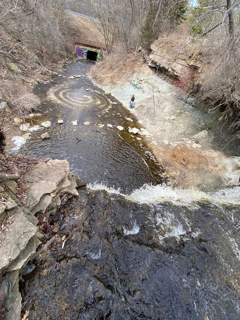
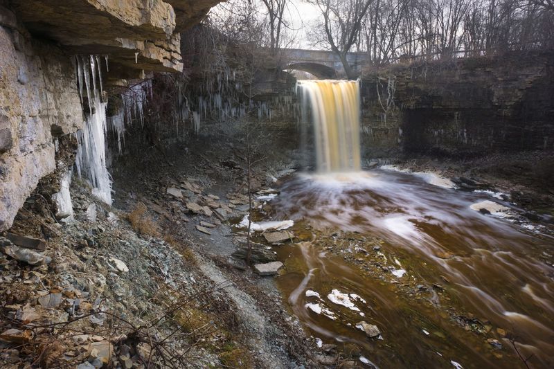
Water levels here swing wildly, and that changes everything about your visit. Spring snowmelt and heavy rain turn Wequiock Creek into a loud, foaming rush over the 25-foot ledge.
By midsummer, the flow often thins to a trickle or stops entirely. Photographers groan, but fossil hunters quietly celebrate.
Lower water can expose more of the creek bed and its rock layers, making geological features and fossils easier to spot without removing them.
Winter brings a third version of the place. Splashing water freezes into strange columns and glassy sheets clinging to the rock face.
Ice cleats make a cold visit far safer, since the stairs and lower rocks glaze over. The tradeoff is that fossil hunting basically pauses until thaw.
Early fall can reveal more exposed rock when creek flow is low, though waterfall conditions depend heavily on recent rainfall and seasonal weather.
Check the forecast for the days before you go, not just the day itself.
Markers That Remember 1634
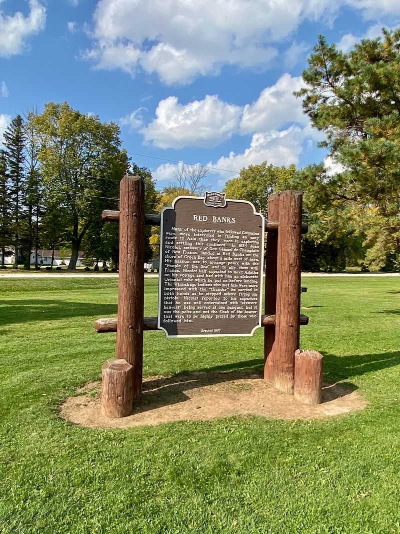
Fossils are not the only old story on this lawn.
Near the parking area stands a monument honoring Jean Nicolet, traditionally regarded as one of the earliest European explorers to reach what is now Wisconsin in 1634, though the precise location of his landing remains uncertain.
An Official Wisconsin Historical Marker at the park commemorates Red Banks and Jean Nicolet’s 1634 journey to the Green Bay region.
The historical markers add a very different timeline to a site whose exposed rock layers reach back hundreds of millions of years.
That combination is unusual for a park this small. Deep geologic time and recorded human history share the same patch of grass.
Spend five minutes with the signs before you leave, ideally with a snack at a picnic table. The context makes the cliffs feel less like scenery and more like a record.
The contrast between ancient marine fossils and a historical marker tied to 1634 makes the park’s two very different timelines easy to compare.
Picnics, Restrooms, And Parking
Practical stuff decides whether a short stop feels relaxed or rushed. Happily, the amenities punch above the park’s tiny footprint.
Picnic tables sit scattered across a mowed lawn under mature shade trees. Restrooms are on site, and a water spigot lets you rinse muddy fossils and hands.
Parking is the pinch point. The lot is small, and it fills quickly on weekends and whenever the falls are running strong.
Arriving early solved that for me. Before ten in the morning I had space, quiet, and better light in the ravine.
Do not expect big highway signage announcing the entrance. GPS aimed at Bay Settlement Road brings you right to it without drama.
Brown County follows a Carry-In/Carry-Out policy, so visitors should take all trash and recyclables with them and leave every rock, mineral, and fossil in the park.
The park is currently open daily from dawn to dusk, so available visiting time naturally shortens as daylight decreases.
Insect repellent belongs in your bag during summer, since the shaded creek bottom attracts plenty of biting company.
Wildflowers Along The Ravine Edge
Spring brings woodland wildflowers around the ravine, with visitors reporting species such as trout lily, bloodroot, Solomon’s seal, and Dutchman’s breeches near the stairway.
Spring wildflower timing varies with temperature and seasonal conditions, so exact bloom dates change from year to year.
Birds echo through the gorge all season, and the creek’s murmur carries surprisingly far. Standing at the bottom, the highway noise nearly disappears.
Geocachers can complete an EarthCache focused on the park’s geology, but there is no physical container to find and natural materials must remain in place.
Lush summer foliage keeps the lower ravine cool and shaded, which helps on hot afternoons. Autumn swaps green for deep reds and golds above the pale cliff face.
Stay on designated routes, avoid unstable rock edges, and protect vegetation around the ravine while exploring the park.
Leashed dogs and curious kids both love the creek bed when water is low. Just watch footing and keep small hands away from unstable banks.