This Nebraska Bluff Has A Paved Road That Climbs 800 Feet Right To Its Summit
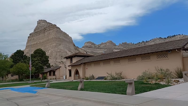
Driving west across Nebraska, the land stays flat for so long that your eyes stop expecting anything. Then a wall of layered rock lifts out of the plains like someone stacked it there overnight, and a narrow ribbon of concrete disappears straight into its side.
There is a road up that thing, and it goes all the way to the top through tunnels blasted through solid stone. What looks like an easy roadside pullover turns into one of the most surprising twenty minutes of driving in the state.
A Rock Wall Rising Above the North Platte Valley
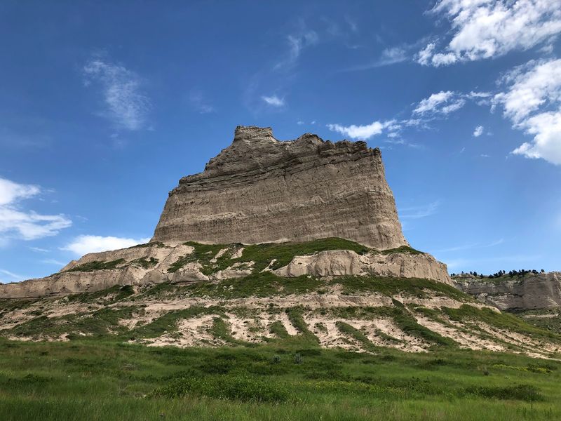
Eight hundred feet of layered sandstone and siltstone stand above the North Platte River valley in Scotts Bluff County, and there is almost nothing gradual about it. The plains run flat right up to the base, then the land goes vertical.
The summit sits at 4,616 feet above sea level, which puts the high point of the bluff close to a mile up. That number surprises people who think of Nebraska as one long tabletop.
The monument covers roughly 3,000 acres of badlands, prairie, and bluff face just outside Gering, in the Panhandle. Cactus grows here.
So do yucca and short grass, the kind of dry-country plants that feel more like Wyoming than corn country.
What separates the place from other overlooks is the access. A paved road climbs the whole 800 feet, passing through three tunnels cut into the rock, and delivers you to a parking lot near the top.
No shuttle. No steep scramble required.
Just a steering wheel and a few careful curves.
The Oldest Concrete Road in the State
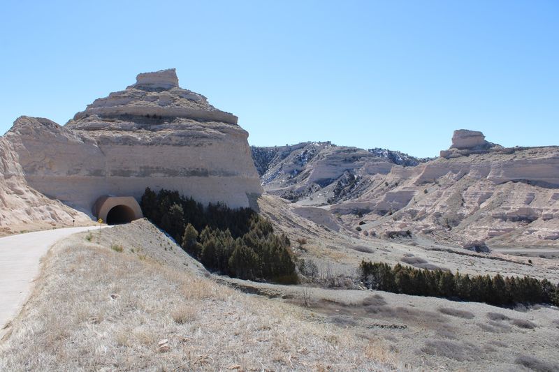
Crews working between 1932 and 1937 carved and poured what became the Scotts Bluff Summit Road, a 1.6-mile climb that still carries traffic today. It holds the title of Nebraska’s oldest concrete road.
Building it meant blasting through rock rather than wrapping around it. The result is the only set of vehicular tunnels in the entire state, three of them, each swallowing the car for a few seconds of cool shade before spitting it back into sunlight.
Depression-era road work tended toward the practical, but the design here shows restraint. The route hugs the contours instead of slicing across them, so from below the road nearly disappears into the bluff face.
Low stone walls line the edges in places. The curves are tight enough that a slow speed feels like the only reasonable option.
Nearly a century on, the concrete is still doing its job. Not many roads from that era survive with their original purpose intact, let alone one that climbs this hard.
Three Tunnels and a Few Tight Curves
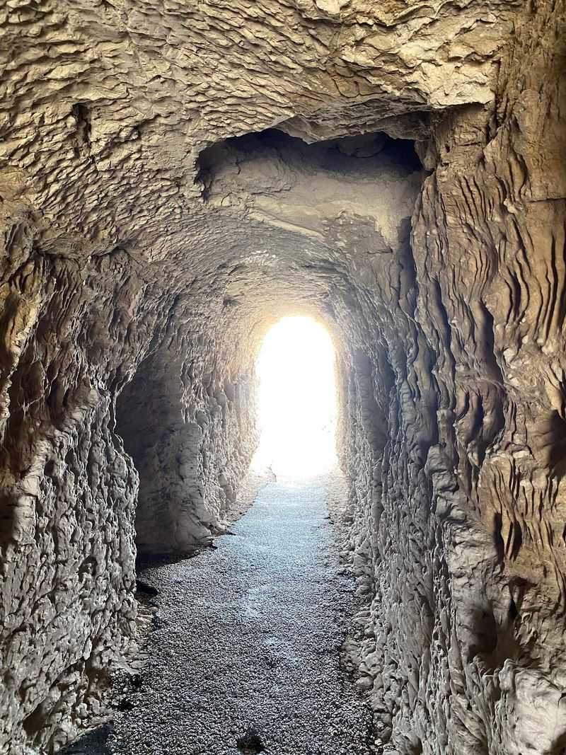
Kids in the back seat tend to start counting the moment the first tunnel appears. One, two, three, each one a short dark arch punched through sandstone with daylight waiting on the other side.
The tunnels are the reason oversized vehicles cannot make the climb. Trailers, RVs, and anything tall get turned back at the bottom, since there is no room to correct a mistake halfway up.
Pullouts along the way are essentially nonexistent, so the drive is a commitment once started. That is part of why the whole thing takes only a few minutes despite the elevation gain.
Curves come sharp and often. Second gear is your friend on the way down.
Weather closes the road more often than people expect. Snow and ice shut it through parts of winter, and rockfall from overnight storms can hold the gate closed until crews clear the debris.
When that happens, the walking trail from the bottom still goes through. The gate stops cars, not feet.
A Landmark That Guided Hundreds of Thousands West
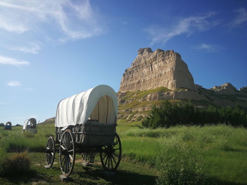
Before the road, before the monument designation, the bluff did one job extremely well: it told travelers where they were. Wagon trains on the Oregon Trail, the California Trail, and the Pony Express route used it as a fixed point in an otherwise featureless horizon.
More than 350,000 people moved past this rock in the mid-1800s. Those going by the Mormon Trail on the north side of the river could see it clearly too.
The bluff helped and hindered at once. Its bulk forced wagons to detour, eventually funneling through Mitchell Pass on the south side.
Deep ruts pressed into the ground by iron-rimmed wheels are still visible on the grounds. Standing in them gives the history a physical weight that a plaque never manages.
Replica wagons and oxen sit near the base, set up so you can walk among them. The monument itself was established in 1919, which makes the preservation effort older than the road that now climbs it.
Rock Layers Stacked Over Millions of Years
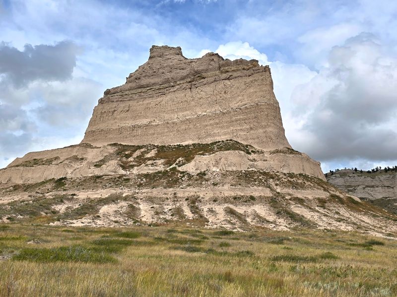
Look closely at the cliff face and the bands read like shelving. Pale siltstone, sandstone, volcanic ash, each layer laid down at a different moment and now exposed by erosion.
The visible strata span roughly 22 to 30 million years. A tough limestone cap sits on top, and that cap is the whole reason the bluff still exists while the surrounding land wore away around it.
Erosion built this place by subtraction. Everything you see is what water and wind failed to remove.
The badlands spreading out below the bluff show the same process in miniature, with gullies and knobs cutting through softer ground. It looks nothing like the irrigated fields a few miles east.
Rockfall is an ongoing part of that story, which explains why crews sometimes clear debris off the road after a storm. The bluff has not finished eroding.
Geology here is not an abstract subject. It is happening slowly, in full view, right above the parking lot.
What You Can See From the Top
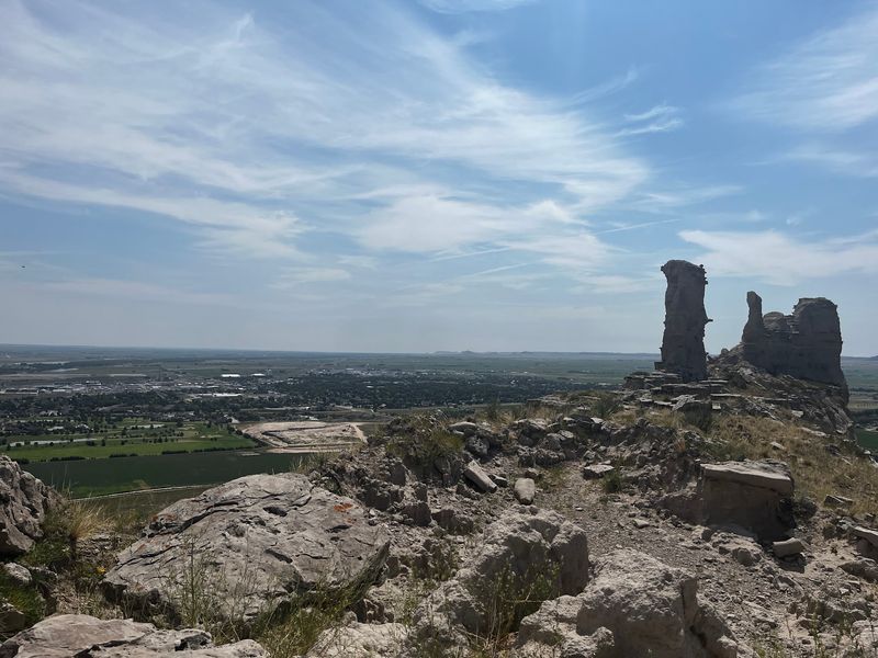
The payoff at the summit arrives in every direction at once. North Platte River valley farmland spreads out below, the towns of Gering and Scottsbluff sit in plain view, and the badlands ripple off toward the horizon.
On a clear day the sightline stretches about twenty miles east to Chimney Rock, that thin spire poking up from the plains. Laramie Peak in Wyoming can show up on the western edge when the air is sharp enough.
Sunrise does something particular to the cliff faces here. Low gold light catches the layered rock and stretches long shadows across the badlands, and the prairie stays quiet enough to hear the wind working.
Wind is nearly constant up top, so a jacket earns its place in the car even in warm months.
Two paved paths lead from the summit parking area. The South Overlook runs roughly 300 yards out, while the North Overlook trail goes a bit farther, closer to three quarters of a mile round trip.
Saddle Rock Trail for Those Who Want to Earn It
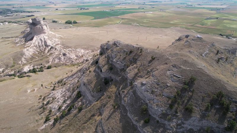
Skipping the car is an option, and a good number of people do exactly that. The Saddle Rock Trail climbs from the visitor center area to the summit, gaining the full 800 feet on a paved surface with switchbacks and a tunnel of its own.
Strenuous is the right word for it. The grade is steady and the sun has nowhere to hide out there.
Water matters more than people assume on a dry prairie climb. So does timing, since afternoon heat in the Panhandle can be unforgiving.
Rattlesnakes live in this landscape, and signs make that clear. Staying on the pavement and keeping an eye on the ground handles most of the concern, and burrows near the trail are more common than the animals themselves.
Up top, the trails connecting the overlooks are short and easy, which makes for a fair reward after the climb.
Hikers also get a workaround: when the vehicle gate closes for the day, the trail stays open on foot.
The Visitor Center and Its Oregon Trail Museum
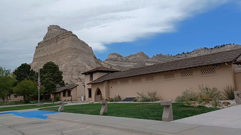
At the base, a low building holds the museum, a theater, restrooms, and a gift shop. It gets more foot traffic than almost anything else at the monument.
Exhibits walk through westward expansion and why this particular rock mattered so much to people covering fifteen miles a day. Photographs show the scale of the bluffs from the flats, which helps explain the landmark’s pull.
A short film, around ten minutes, runs in the theater and sets up the rest of the visit well. Watching it first is a reasonable move.
Rangers here handle questions with genuine interest and often point people toward other stops in the area. Talks about Conestoga wagons happen on the grounds, and hands-on items like animal fur and jaw casts tend to hold younger attention spans.
Bathrooms are clean, the building is well kept, and there is enough shade indoors to reset before or after the climb.
Living history demonstrations turn up on the grounds during parts of the year.
Free Admission, Which Still Catches People Off Guard
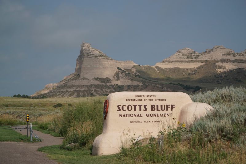
No entrance fee. No reservation system.
No timed ticket to fuss with before leaving the house.
Parking at the base is ample, the museum costs nothing to enter, and the summit road carries no toll. For a national monument with this much infrastructure, that is unusual enough to mention.
Families traveling on a budget get a real outing out of it. A couple of hours, a mountain-sized view, a museum, and a ranger talk, all without opening a wallet.
The gift shop is there if you want a souvenir, and the National Park Passport stamp draws people who collect them.
Pets are welcome on the grounds, which makes the stop easier for anyone road-tripping with a dog in the back seat.
Plan on about two hours for a full visit including both overlook trails. An hour covers the basics if the clock is tight, and the hike from the bottom adds considerably more.
Very few places deliver this kind of payoff for the price of gas.
When the Gate Closes Before the Sunset Does
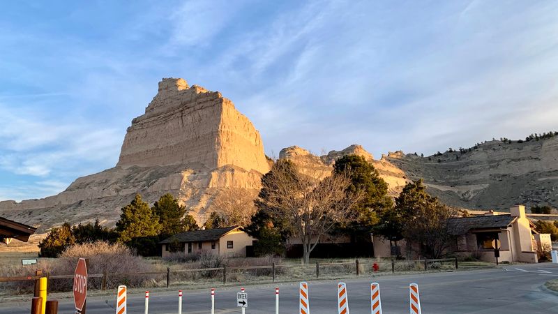
Here is the detail that trips up photographers: the vehicle gate on the summit road closes well before dark. In summer that can mean the road shuts while the sun is still hours from setting.
Anyone hoping to shoot golden hour from the North Overlook needs a different plan, and that plan is usually the Saddle Rock Trail on foot.
Winter brings a separate set of closures. Snow and ice can keep the road shut entirely, though the visitor center and museum stay open and the views from the base remain impressive.
Rockslides after heavy rain occasionally hold the gate closed in the morning until crews clear the roadway. Delays like that usually run short.
Calling ahead or checking the park’s status before making the drive out to the Panhandle saves a lot of frustration, especially in the colder months.
Mid-morning to early afternoon is the safest window for getting all the way up. Sunrise, for those willing to arrive early, rewards the effort with the best light on the cliff faces.
Wildlife, Cactus, and a Prairie That Feels Like Somewhere Else
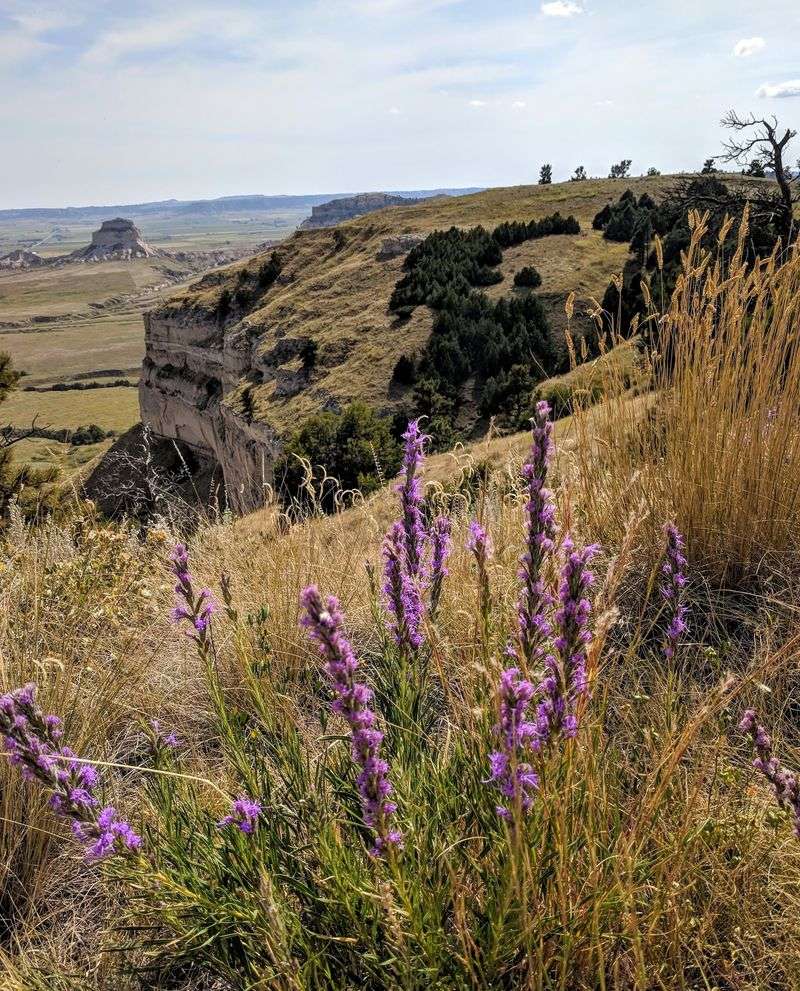
Cactus in Nebraska surprises first-time visitors more than the bluff does. Prickly pear grows right along the trails, mixed with yucca and short grasses suited to a dry western Panhandle climate.
Birds work the updrafts along the cliff faces, and the summit is a solid spot to watch them ride the wind. Swallows dart around the rock in warmer months.
Rattlesnakes belong to this ecosystem and are posted about clearly. Sightings happen, but they are not an everyday occurrence, and staying on paved surfaces keeps risk low.
Mule deer move through the badlands below, usually at the edges of the day.
The plant life makes the place feel closer to eastern Wyoming than to the Platte valley farms a short drive east. That contrast is part of what makes the Panhandle its own region rather than an extension of the rest of the state.
Bring sun protection. Shade is scarce once you leave the visitor center.
Who Gets the Most Out of the Climb
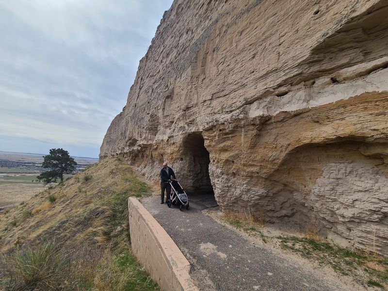
Road trippers crossing the state on a long haul get the biggest return here. The stop breaks up hours of straight driving with something vertical, and an hour is enough to make it count.
History-minded folks find plenty to work with, from the wagon ruts to the museum displays covering the three major trails.
Families do well because the difficulty is optional. Drive up, walk the short paved loops, and nobody has to be talked into anything.
Older visitors and anyone with mobility limits benefit most from the road, which turns an 800-foot climb into a parking spot near the top.
Serious hikers can flip the whole thing and take Saddle Rock Trail for a real workout with a view at the end.
Photographers should study the light and the gate schedule together, since the two do not always cooperate.
For Nebraskans in the eastern half of the state, this is a full day of driving each way. Pairing it with Chimney Rock, about half an hour off, makes the trip out west pay better.
Getting There and Nearby Panhandle Stops
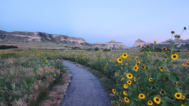
The monument sits at 190276 Old Oregon Trail in Gering, just southwest of Scottsbluff in the western Panhandle. Signs pick you up well before the turn, and the bluff itself is hard to miss.
From Denver the drive runs roughly three hours across open plains. From the Black Hills or the Badlands it makes a natural break on the way south.
Chimney Rock lies about thirty minutes southeast, and visiting both in one afternoon gives a fuller sense of what pioneers were navigating by.
Ample parking sits at the base near the visitor center, with a second lot near the summit for those who drive up.
The park opens in the morning and the visitor center runs on standard daytime hours, though the vehicle gate closes earlier than the grounds do. Checking current conditions before setting out is smart, particularly between late fall and spring.
Gering and Scottsbluff sit close enough for food and fuel, so the logistics of a day trip stay simple.
The Case for Pointing the Car West
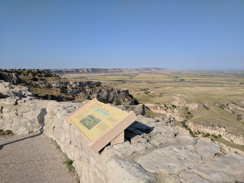
Few states get a landmark this dramatic and then build a road straight up it in the 1930s and keep the whole thing free nearly a century later. The combination is odd in the best way.
What lands hardest is the scale shift. You spend hours watching flat ground, then climb 800 feet in under two miles and look back at twenty miles of country you just crossed.
The tunnels alone justify the detour for anyone who likes old engineering. Three of them, the only ones in Nebraska that carry vehicles.
Add the wagon ruts, the layered rock, the rangers who actually enjoy explaining it, and a museum that puts the whole picture together, and a short stop tends to stretch longer than planned.
Pick a clear morning, check the road status, and give it two hours.
Nebraska keeps a reputation for being flat. The Panhandle has been quietly arguing otherwise for about thirty million years.