15 Abandoned North Carolina Places With Stories Creepier Than Any Haunted House
Boo. Some places in North Carolina did not exactly get the memo that they were supposed to disappear quietly.
Empty villages, broken roads, drowned towns, and old industrial ruins still linger in the landscape, looking far too good at being creepy.
Some come with tours and marked trails.
Others are better admired from a respectful distance, preferably before your imagination starts filling in the blanks. That is where the fun begins.
Every cracked wall and weed-covered foundation seems to carry a story, and a few feel eerie enough to make you glance over your shoulder for no good reason.
Bring curiosity, sensible shoes, and maybe one friend who scares easily.
These abandoned places already have the spooky atmosphere completely covered.
15. Henry River Mill Village, Hickory
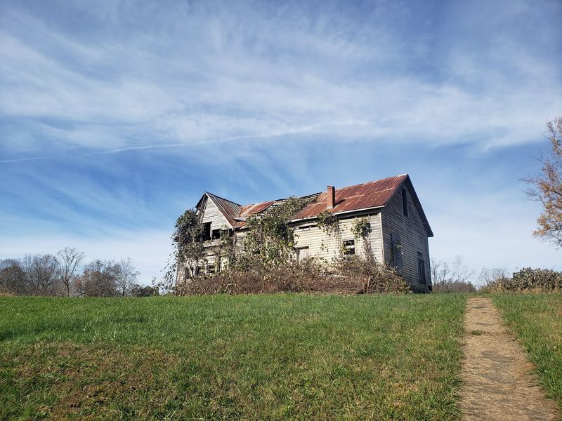
Picture a whole company town frozen mid-sentence: twenty-odd worker cottages, a two-story company store, and the stone shell of a dam that once powered spinning machines.
Cotton yarn was made here from about 1905 until the mill closed around the early 1970s.
Henry River Mill Village sits along the river in the Hickory area, and movie fans recognize it instantly as District 12 from The Hunger Games films.
Lightning likely sparked the fire that destroyed the main mill building in 1977, leaving only foundations beside the water. You can find it at 4255 Henry River Road.
Guided tours walk you past porches worn smooth by generations of mill families, with guides explaining how the village moved from water power to steam and finally electricity by 1926.
Special events and overnight stays in restored cabins give the site an unexpectedly cozy side.
Wear closed-toe shoes, since gravel paths and uneven ground are part of the charm, and bring a camera for those gray clapboard walls.
14. Portsmouth Village, Portsmouth Island
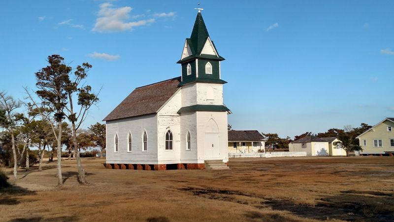
Salt air, marsh grass bending in the wind, and a white church that has not held a Sunday crowd in decades.
The colonial assembly created this settlement in 1753, and it grew into a busy lightering port where cargo moved from big ships to smaller boats crossing shallow Ocracoke Inlet.
Portsmouth Village spreads across the northern tip of Portsmouth Island inside Cape Lookout National Seashore, reachable only by boat.
Its population peaked at 685 in 1860, then shrank after an 1846 hurricane opened a deeper inlet near Hatteras and shipping routes shifted elsewhere.
The last two residents, Elma Dixon and Marian Babb, left for the mainland in 1971. Behind them stood a schoolhouse, homes, and the former U.S.
Life-Saving Station, decommissioned in 1937.
Walking the sandy lanes of this 250-acre historic district feels like stepping inside a photograph.
Pack water, sunscreen, and insect repellent, because mosquitoes rule the marsh and there are no shops waiting for you.
13. Brunswick Town, Winnabow
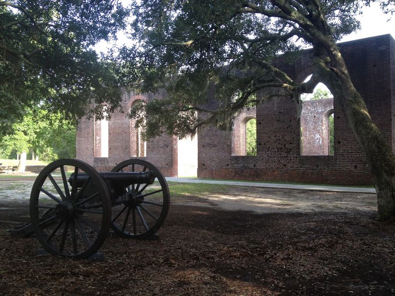
Brick walls nearly three feet thick still rise more than 24 feet above the grass, roofless and open to the sky.
St. Philip’s Church was consecrated in 1768, built with bricks shipped from England, and it remains the most striking thing standing on this old colonial port.
Brunswick Town rests along the Cape Fear River in Winnabow, founded in 1726 by Maurice Moore and named to honor King George I. The address is 8884 St. Philips Road SE.
Tar, pitch, and turpentine left this waterfront for British ships, and royal governors once held court here.
British forces attacked and burned the town in 1776.
Nobody rebuilt it, so streets and house foundations sit in the soil like a map drawn in outline.
Confederate forces later built Fort Anderson across the old town site, surrounding the surviving ruins of St. Philip’s Church.
The state historic site says the church walls survived the later bombardment largely intact.
12. Lost Cove, Yancey County
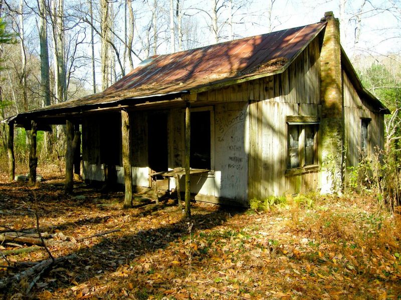
Nothing says vanished quite like a stone chimney standing in the woods with no house around it.
Morgan Bailey settled this hollow shortly before the Civil War, and at its busiest roughly 100 people lived here in thirteen to fifteen houses, with a cemetery and a church that doubled as the schoolhouse.
Lost Cove lies within Pisgah National Forest, but Lost Cove Trail #196 is currently closed under a storm-damage order through October 1, 2026.
Logging, farming, and the railroad kept families fed for nearly a century in a place with no road in. Timber ran short, passenger trains quit stopping, and a request for a road was turned down.
Residents began leaving by the mid-1950s, and the last family walked out in 1957 or 1958.
Historic records describe chimneys, foundations, and other remnants scattered through the former mountain community.
Check current Forest Service alerts before planning a visit, and do not enter while the closure remains in effect.
11. Mortimer, Collettsville
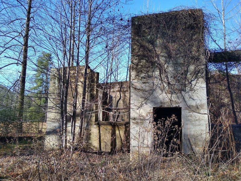
Water built this town, then water erased it.
Mortimer grew as a timber operation deep in the mountains, with a mill, workers, and the constant noise of logs moving downstream.
Once bustling with sawmill activity, Mortimer sits within Pisgah National Forest not far from Collettsville, where Wilson Creek carves through steep hillsides.
Major flooding in the 1940s wrecked much of what remained, and the community was never rebuilt.
Scattered industrial remnants still turn up around the recreation area: concrete slabs, old stonework, and pieces of metal wrapped in vines and rhododendron.
The setting explains the story better than any plaque could. Towering hardwoods crowd the roadside, the creek runs loud and cold over granite, and you get an immediate sense of how quickly a narrow valley can turn dangerous during heavy rain.
Bring a picnic, wear shoes that handle wet rock, and plan extra time for the winding gravel drive.
Cell service thins out fast, so download directions before you go.
10. Cataloochee Historic District, Waynesville Area
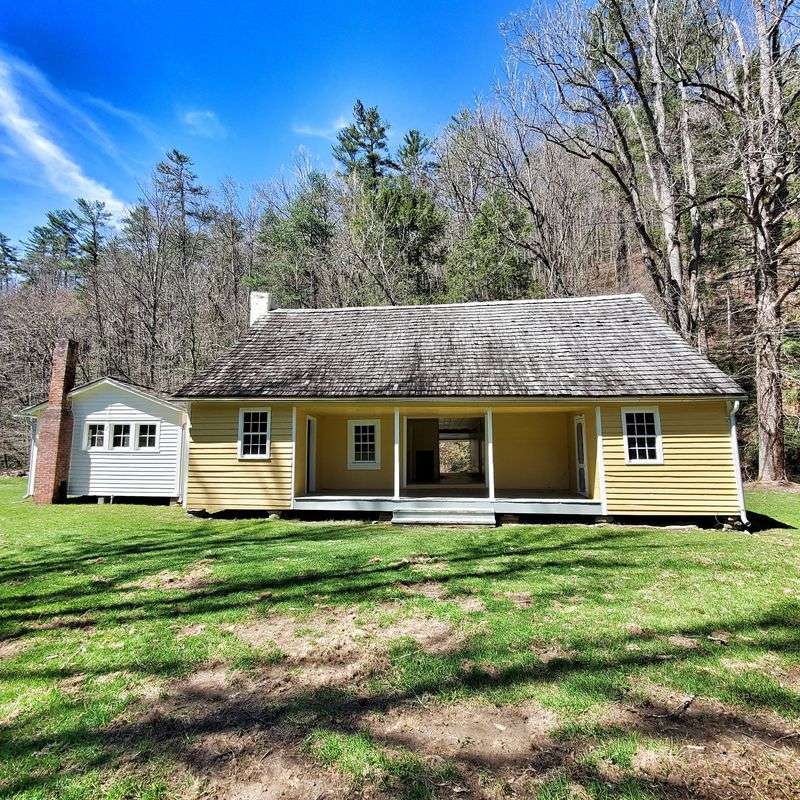
Morning fog settles low in the valley, and the only sounds are birds and a creek moving over stones.
Generations of mountain families farmed this bowl of land, building homes, barns, churches, and a schoolhouse that still stand along the valley floor.
Cataloochee occupies a remote corner of Great Smoky Mountains National Park reached by gravel road from the Waynesville area.
Families moved out gradually as the national park took shape in the early twentieth century, leaving buildings behind rather than tearing them down. You can step inside empty rooms, read names carved into old wood, and imagine chores, church suppers, and school lessons filling the quiet.
Elk graze the meadows at dawn and dusk, which makes early arrival worth the effort.
During the September and October elk rut, the valley’s fields are closed to pedestrians, and visitors must remain at least 50 yards from elk.
Pack food and water, since there are no stores nearby, and expect a slow, curving drive both directions.
Pit toilets are available near the main parking areas.
9. The Road To Nowhere, Bryson City
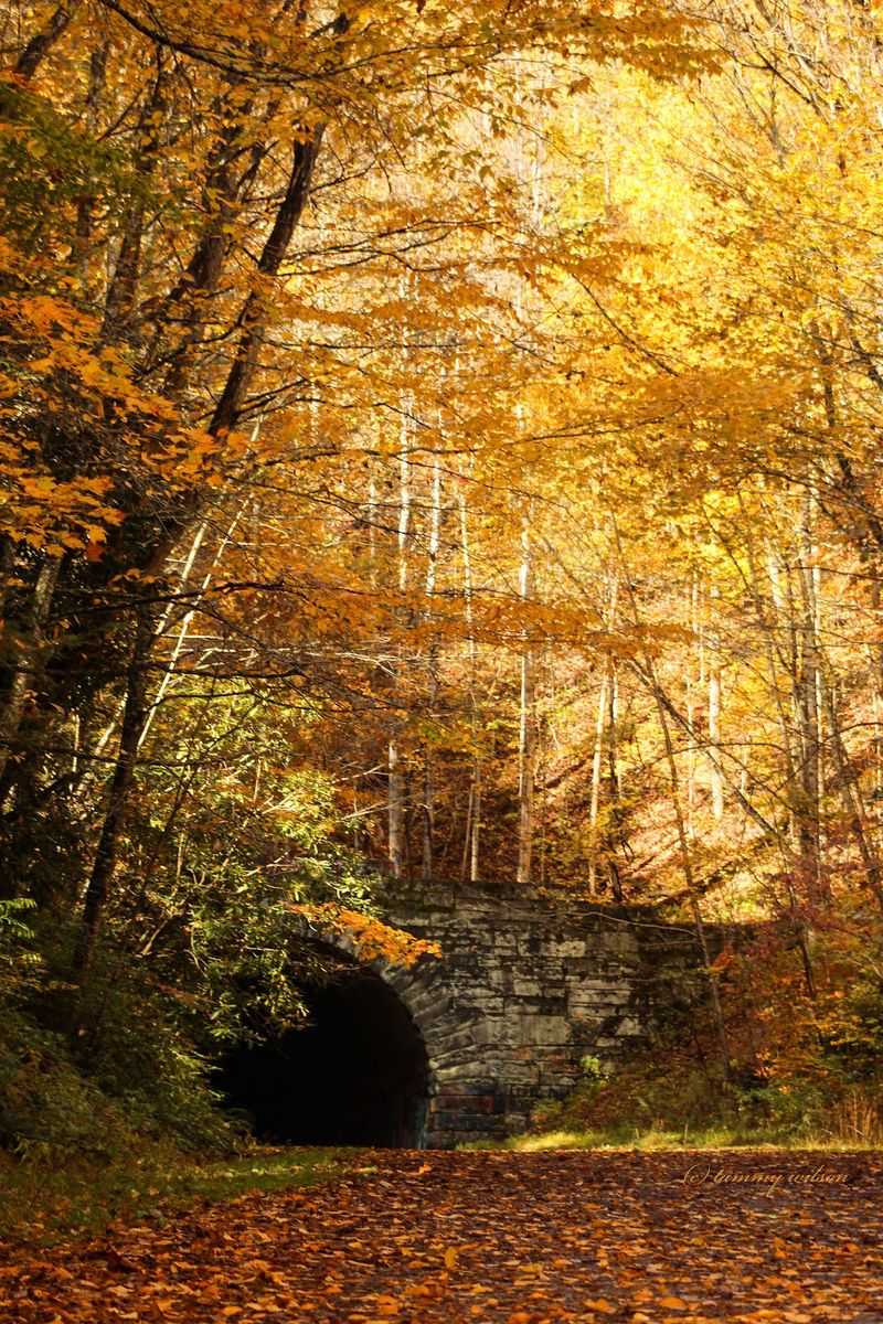
A perfectly good highway climbs into the mountains, curves past overlooks, and then simply quits at the mouth of a long, dark tunnel.
Grass pushes through the pavement, and hikers walk through the tunnel in single file, hands on the wall until daylight appears at the far end.
Lakeview Drive leaves Bryson City and heads into Great Smoky Mountains National Park, offering wide views of Fontana Lake along the way.
The route was meant to replace a road lost when land was taken for Fontana Dam and the park, displacing many families.
Construction stopped, and the promised road was never finished. That unfinished ending is exactly why people come.
The tunnel entrance feels cool and cave-like even in summer, and trails continue beyond it into deep forest.
Bring a flashlight, since the tunnel floor is uneven and puddled.
Cyclists enjoy the quiet climb, and the pullouts make good spots for a sandwich and a long look at the water below.
8. Roanoke Colony Site, Manteo
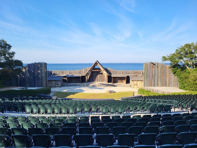
One carved word turned a settlement into a riddle that has lasted more than four centuries.
In 1587, a group of 115 English settlers, families and children among them, arrived on Roanoke Island hoping to build a lasting colony.
Fort Raleigh National Historic Site protects that ground just outside Manteo, shaded by wind-twisted live oaks near the sound.
When John White returned in 1590 after a three-year delay caused by war, he found the place empty, with CROATOAN cut into a post and CRO carved into a tree. The site address is 1500 Fort Raleigh Road.
Homes appeared dismantled rather than destroyed, which suggests a planned move rather than a sudden attack.
Theories range from joining nearby Native communities to disease or Spanish raids, and none has ever been proven.
Walking trails, a visitor center, and exhibits lay out the evidence so you can weigh it yourself.
Arrive late in the day for softer light and cooler breezes off the water.
7. Historic Occoneechee Speedway, Hillsborough
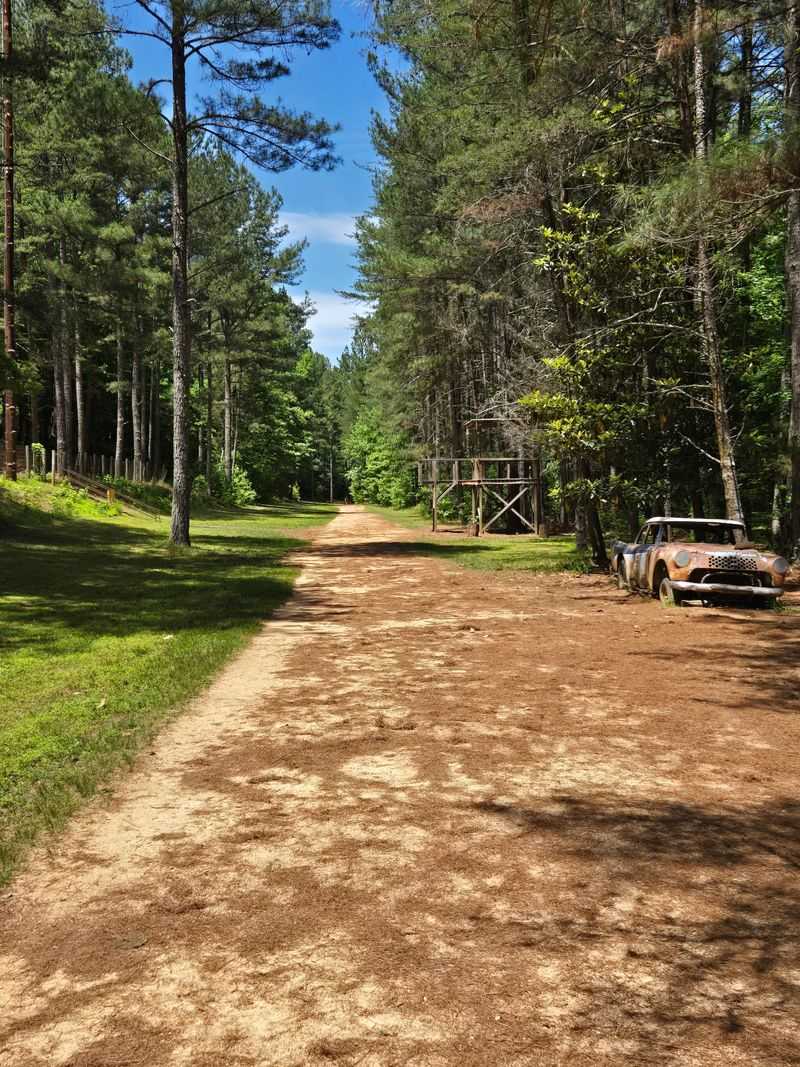
Stand on the old oval and it takes a second to realize you are on a racetrack at all.
Trees now grow where cars once slid through the turns, and the wooden grandstands have weathered into faint shapes along the hillside.
Historic Occoneechee Speedway is now part of Eno River State Park after more than 200 acres containing the track and adjacent preserve were added in 2025.
The address is 320 Elizabeth Brady Road.
Bill France Sr. expanded the former horse track into a one-mile stock-car track in 1947, with later changes shortening it to roughly 0.9 mile. Richard Petty, Fireball Roberts, and Junior Johnson all raced here.
Renamed Orange Speedway in 1954, it held its final NASCAR race in 1968, won by Petty.
It remains the only surviving dirt track from NASCAR’s inaugural 1949 season, with four miles of trails now incorporated into Eno River State Park.
Walking the full oval takes about thirty minutes, and fall colors make it especially pretty.
6. Rattlesnake Lodge Ruins, Asheville
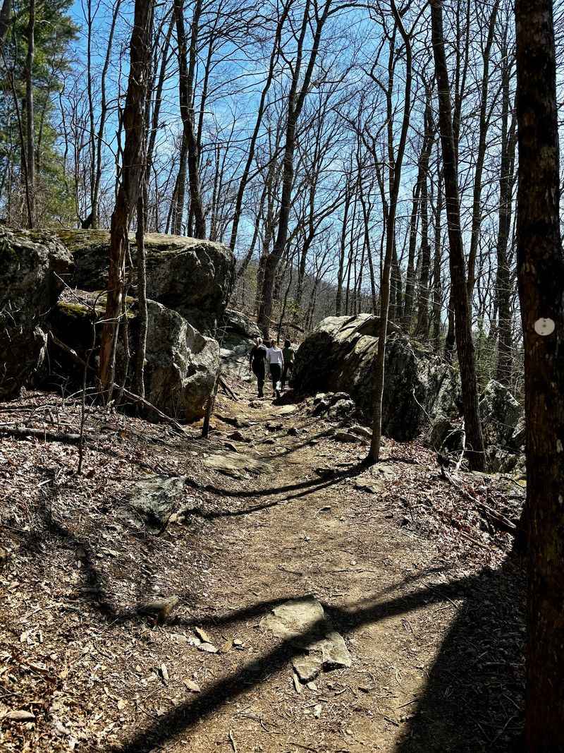
Stone walls appear out of the ferns without warning, low and green with moss, outlining rooms that no longer have a roof.
Dr. Chase P.Ambler built this summer retreat between 1903 and 1904 as a rustic escape from city heat.
Rattlesnake Lodge Ruins wait uphill from the Blue Ridge Parkway at Milepost 374.4 near Asheville, reached by a steady climb on the Mountains-to-Sea Trail. Fire and time took the buildings, but the bones of the place survive.
Look for the lodge foundation, stone walls that once held a swimming pool, remains of a barn, and a spring box that still trickles.
From the Blue Ridge Parkway at Milepost 374.4, two moderately steep approach trails run about half a mile to the Mountains-to-Sea Trail and lodge site.
Birdsong replaces whatever chatter once filled these porches.
Mountain laurel crowds the trail in early summer, and autumn opens up long views through bare branches.
5. Great Falls Mill Ruins, Rockingham
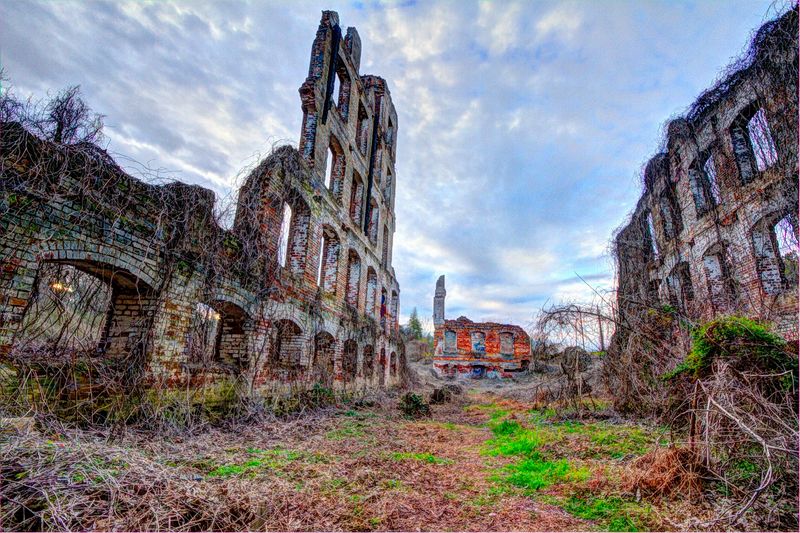
Tall brick walls with empty arched windows rise above the treeline like the skeleton of a cathedral.
The Richmond Manufacturing Company was chartered in 1833 and developed one of the region’s early cotton mills along Falling Creek.
Great Falls Mill Ruins stand near the water in Rockingham, best appreciated from the roadside. Sherman’s troops burned the original complex in 1865, and the site can be viewed from near 425 W Broad Avenue.
Walter Francis Leak and partners rebuilt it in brick in 1869 as Great Falls Mill.
Spinning, dyeing, and weaving all happened under one roof until operations ended during the Great Depression in 1930. A second fire in 1972 left what you see today.
Important note: the property is privately owned and closed to entry, so this is strictly a look-and-learn stop.
Photographers get the best results on overcast days, when soft light brings out the texture of the brickwork without harsh shadows.
Stay on public ground and respect the posted signs.
4. St. Agnes Hospital Ruins, Raleigh
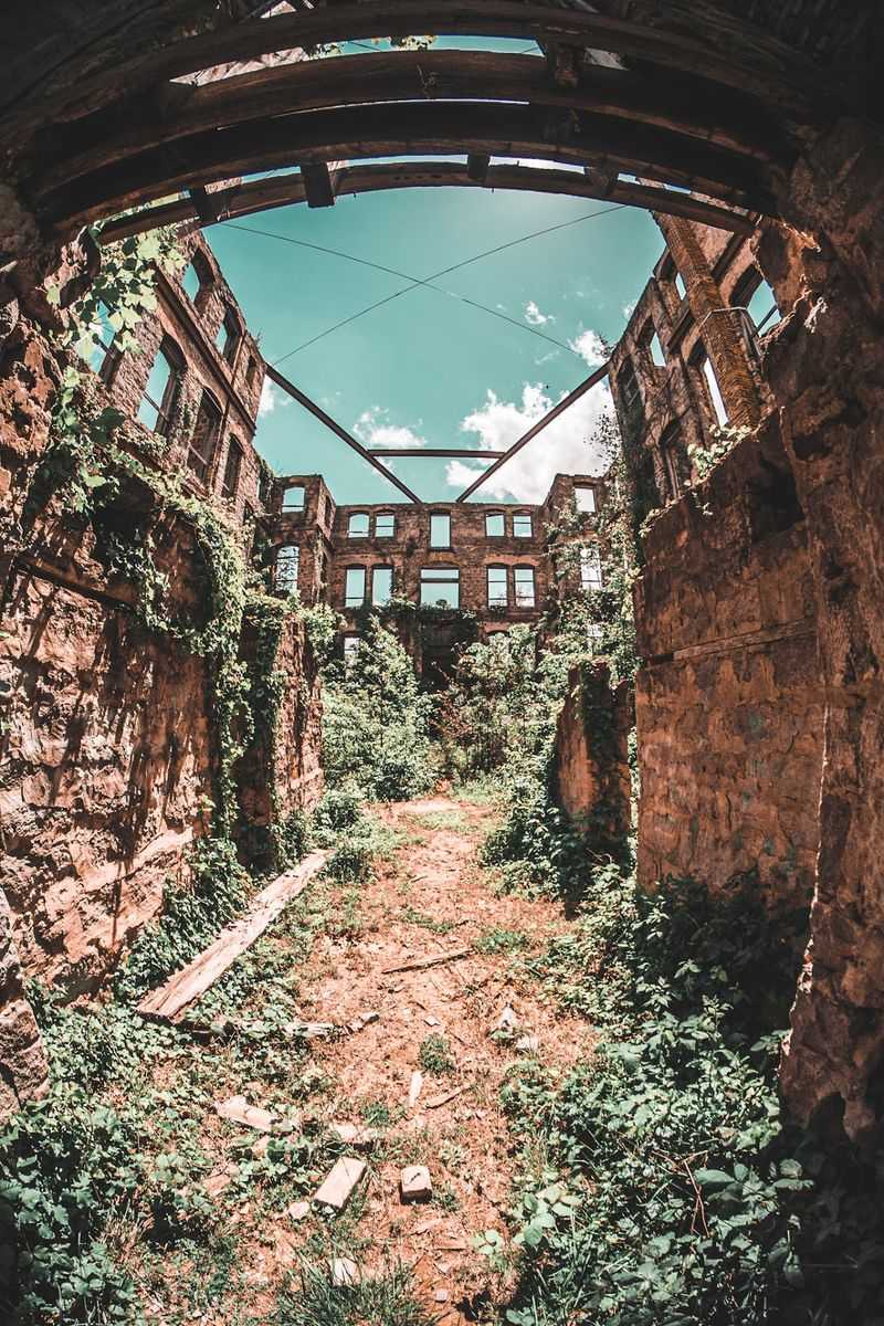
Rough stone walls, empty windows, and a doorway that once welcomed patients who had nowhere else to go.
St. Agnes Hospital served African American patients during segregation and trained African American nurses and doctors at a time when such opportunities were rare.
The surviving shell stands on the Saint Augustine’s University campus in Raleigh, framed by mature trees and open lawn. You will find it at 1315 Oakwood Avenue.
The hospital closed in 1961, and the building has weathered steadily since. What makes this stop powerful has nothing to do with ghost stories.
Generations of families depended on the care given inside those walls, and the staff built a reputation for skill under difficult conditions.
Read the interpretive information nearby before walking the perimeter, and take a few quiet minutes to consider the medical history represented here.
Pair the visit with a stroll through the Oakwood neighborhood, where shaded sidewalks, painted porches, and a couple of neighborhood cafes round out the afternoon nicely.
3. Stonewall Jackson Training School Historic Campus, Concord
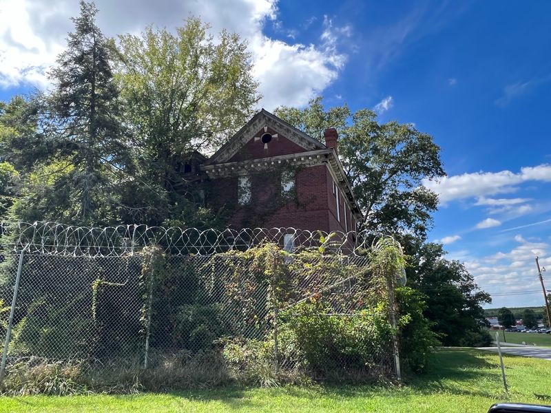
Red brick dormitories with boarded windows sit in rows behind fencing, their trim peeling and their walkways unused.
Opened as a school for boys in trouble with the law, the campus reflects an early twentieth-century idea of rehabilitation through farm work, trades, and classroom lessons.
Stonewall Jackson Training School’s historic campus stands along Old Charlotte Road in Concord, beside the modern facility still operating there.
The original buildings remain largely abandoned, with wide lawns and old oaks separating them.
Please note clearly: these structures are closed to the public and sit on restricted property, so viewing from outside the fence line is the only appropriate approach. Even from a distance, the architecture tells a story.
Symmetrical brick facades, tall windows meant to flood rooms with daylight, and a campus layout that looks more like a college than an institution reveal how planners hoped the place would feel.
Concord’s downtown makes a good follow-up, with brick storefronts, bakeries, and a walkable main street just minutes away.
2. Ghost Town In The Sky, Maggie Valley
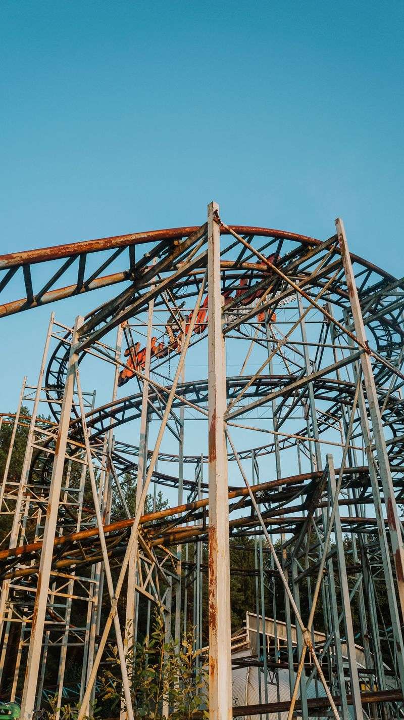
An entire Wild West town built on a mountaintop, complete with a false-front main street, then left to the weather.
Ghost Town In The Sky opened in 1961 on Buck Mountain and drew crowds with staged shows, can-can dancers, rides, and a mile-long chairlift that carried visitors up from the valley floor.
The park overlooks Maggie Valley from the ridgeline, its weathered buildings and rusting chairlift towers visible from certain points below. The original park closed in the early 2000s, reopened under new ownership in 2007, and later fell back into long-term closure after financial and infrastructure problems.
Worth stating plainly: the property is not open for casual exploration, with access limited to occasional private events or arranged tours.
From the valley, you can still picture families riding up the incline railway toward a jail, a bank, and a boardwalk in the clouds.
Maggie Valley itself makes the trip worthwhile, with mountain diners serving biscuits and gravy, craft shops, and scenic drives climbing toward the Blue Ridge Parkway.
1. Endor Iron Furnace, Sanford Area
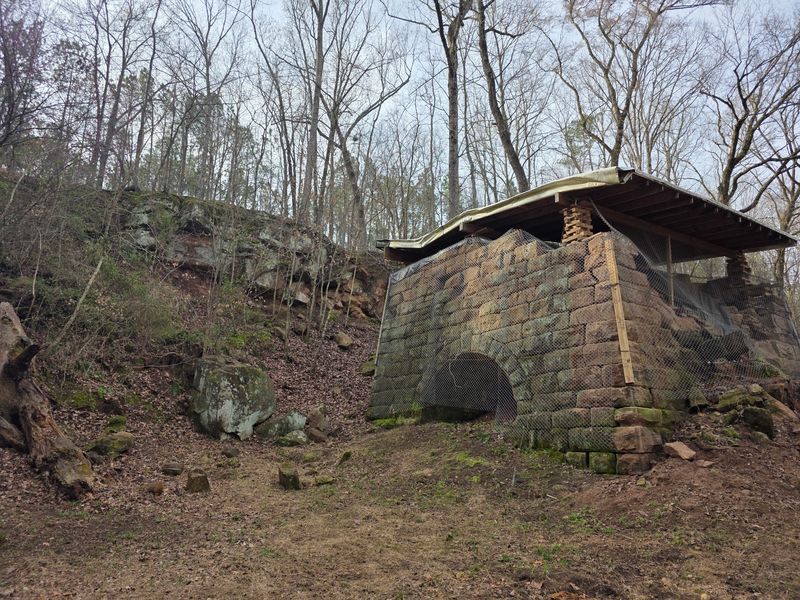
Thirty-five feet of stone and brick masonry rise straight out of the riverside woods, arched at the base like an oven built for giants.
Constructed in 1862, the furnace produced pig iron during the Civil War for munitions and other goods, with the river providing both resources and a route for shipping out.
The 35-foot furnace stands near the Deep River, but Sanford’s current Endor Iron Furnace Greenway does not yet extend to the historic structure.
After changing hands, the works were heavily expanded in the 1870s; large-scale operations ended by 1876, though the furnace continued serving local manufacturers on a smaller scale until 1896.
Remarkably, the structure remains largely intact, its stacked stonework holding firm after more than 150 years of rain and root pressure. Standing at the base, you can almost feel the heat that once poured from that opening and imagine the crews feeding it day and night.
Wear long pants for the walk in, check access details before visiting since conditions change, and pair the stop with paddling or fishing along North Carolina’s Deep River.