This Remote Nebraska Trail Leads Through Badlands Filled With Strange Balanced Rock Spires
The last paved road runs out, and then it’s just washboard gravel, cattle, and grass taller than your tires. Somewhere past the fifteenth mile you start wondering if the map lied to you.
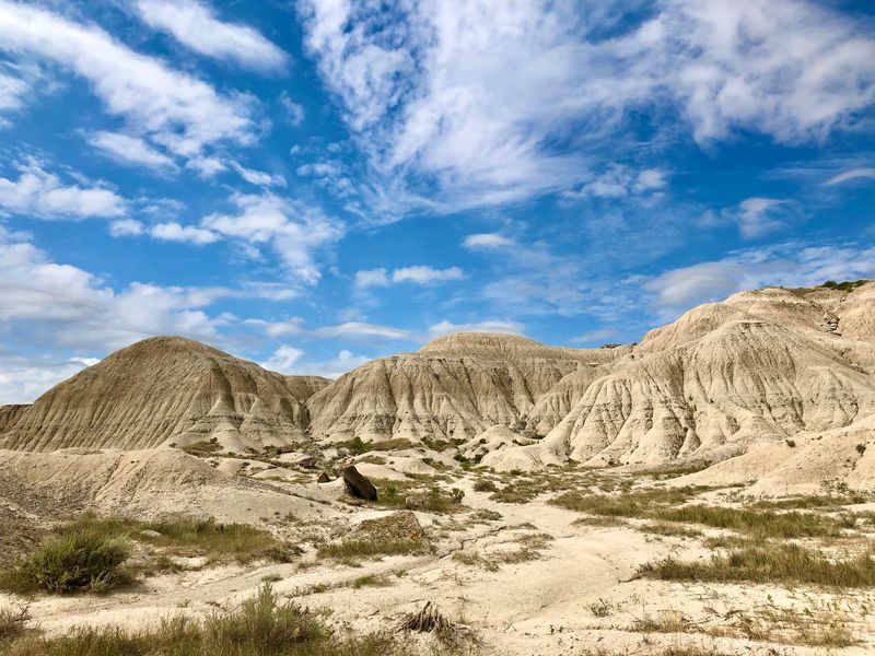
Then the prairie splits open into pale clay pinnacles, ash-streaked ravines, and rock slabs balanced on stems like stone mushrooms, all of it sitting quietly in northwestern Nebraska with hardly anyone around to see it. It looks borrowed from another planet, and it has been waiting here for about thirty million years.
A Moonscape at the End of the Gravel
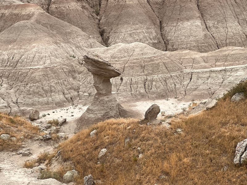
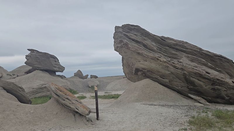
Chalky white ridges, dry stream channels, and clusters of narrow clay pedestals capped with sandstone slabs make up the terrain at Toadstool Geologic Park. The capped pedestals are where the name comes from.
They look like oversized mushrooms rooted in stone.
Spires and pinnacles rise alongside them, some streaked with faint red and green bands left by volcanic ash folded into the layers. The surrounding Oglala National Grassland covers roughly 94,500 acres of remote mixed-grass prairie and rugged badlands, so the formations arrive with no warning and no buildup.
One moment you’re driving through open range with cattle on both sides. The next, the ground drops into ravines and eroded gullies that belong in a documentary about somewhere far from the Panhandle.
The United States Forest Service manages the site, and the light handling shows. There’s a parking area, an interpretive kiosk, picnic spots with shade covers, and trails marked by posts.
Beyond that, the landscape is left alone to do what wind and water have been doing to it for millions of years.
Thirty Million Years of Wind, Water and Volcanic Ash
Picture a warm, humid floodplain crossed by slow rivers, with volcanic ash drifting in from eruptions hundreds of miles west. That was this corner of Nebraska during the Oligocene epoch, somewhere between 30 and 45 million years ago.
Ash settled into river sediment, layer on layer, and hardened into sandstone, siltstone, and clay. Then erosion went to work.
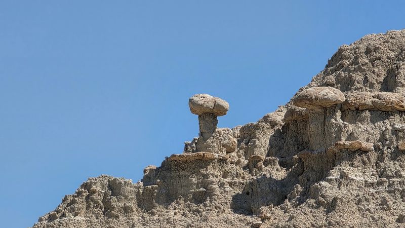
Wind scoured the softer clay out from under harder sandstone caps, leaving slabs perched on skinny stems until the stems finally give out.
That process never stopped. Formations collapse and new ones emerge, which means the park looks slightly different decade to decade.
Some of the classic toadstool shapes that appeared in older photographs have already come down.
Geologists treat the site seriously. Toadstool is the type section for the White River Geologic Group, meaning deposits of similar age across North America get compared against these exact exposures.
An interpretive sign near the trailhead sums up the ancient climate with two words that stick with people: Africa in Nebraska.
Fossil Beds and the Chase Preserved in Stone
Bones turn up in these hills. The beds here have yielded remains of prehistoric mammals that once crossed the same floodplain, and the list reads like a strange safari roster.
Tortoises. Early three-toed horses.
Camels and rhinoceroses. Oreodonts, brontotheres, and entelodonts, those last being heavy-bodied animals with jaws built for serious work.
The standout find is a trackway roughly three-quarters of a mile long, preserved in an old stream channel. It records entelodonts moving after two species of rhinoceros, a single chase frozen in sediment and still readable tens of millions of years later.
Tracks show up in the sandstone along the trail, and interpretive panels help make sense of what you’re looking at. Fossils stay where they are, since this is federal land and collecting is not permitted.
Rock hounds sometimes come out to the surrounding grassland hunting Fairburn agates instead, with mixed luck. The hunt tends to be its own reward when the scenery looks like this.
Nearby, the Hudson-Meng Education and Research Center digs into an even later chapter of the region’s animal history.
The One-Mile Interpretive Loop
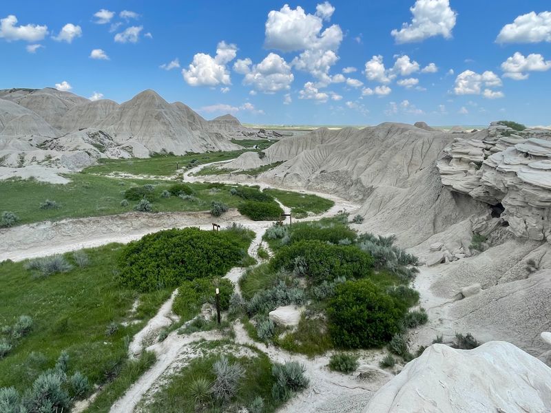
A wooden footbridge and a line of short marker posts get the interpretive loop started, and from there the route follows dry streambeds through the heart of the formations. It runs about a mile.
Numbered stops correspond to a trail guide, pointing out layers, tracks, and the mechanics of how a caprock ends up balanced on clay. It’s a solid hike for people who don’t consider themselves hikers.
Footing deserves attention. Sections narrow, ravine edges drop off without much warning, and the marker posts can blend into pale rock when the sun is high.
It’s easy to lose sight of the parking lot once you’re down in the channels, so keeping track of the posts matters more here than on a typical groomed park trail.
Smaller toadstool formations sit about a mile out, some of them past the sign marking the park boundary. Rock shapes in the creek bottom are worth slowing down for too.
Plan on an hour if you’re reading the signs, less if you’re moving briskly, more if a camera comes along.
Longer Routes Toward Hudson-Meng and the Great Plains Trail
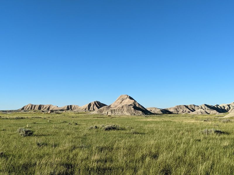
Three miles of prairie separate the park from the Hudson-Meng Education and Research Center, and the Bison Trail links them. Hikers who commit to the out-and-back end up covering a solid chunk of grassland.
The route trades rock formations for wide-open horizon. Grass, sky, distant ridgelines, and quiet broken mainly by wind.
A five-mile loop option folds in portions of the Great Plains Trail for anyone wanting more distance without doubling back the same way.
Navigation is the real challenge out there. Trail markers occasionally sit low in the grass, and there’s no cell service to bail you out, so a GPS unit or downloaded map earns its keep.
Water deserves mention because none exists on site. Shade is scarce to nonexistent, temperatures climb fast under full sun, and the wind rarely quits.
Carry more than you think you need, add sun protection and something for chapped lips, and the long routes become a genuine reward rather than a slog.
Rattlesnakes live here, so watching where you step is part of the deal.
The Reconstructed Sod House on the Prairie
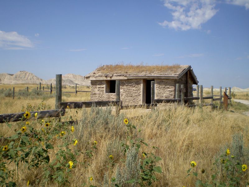
Thick blocks of prairie sod stacked into walls, a small wooden door, and a low roof: the reconstructed sod house near the park sits within easy walking distance of the parking area.
Ducking inside on a hot afternoon explains more about homesteading than any placard could. The temperature drops noticeably, which is exactly why families built with dirt and grass in a place with almost no timber.
Early settlers in this part of Sioux County had few other options. Sod insulated against summer heat and winter wind, and the material was free for the cutting.
The structure is simple, small, and honest about how little space a family worked with. There’s no gift shop attached, no costumed interpreter, just the building and the grassland around it.
Standing in the doorway, the contrast lands hard. Behind you stretch badlands from an era before humans existed.
In front of you sits a home from barely a century and a half ago.
It’s a quick stop that gives the whole visit an extra layer.
Wildflowers, Pronghorn and Panhandle Wildlife
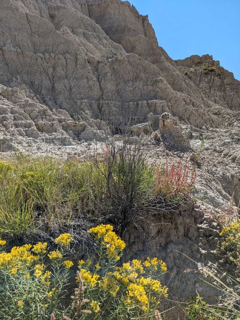
Bare-looking country still grows plenty. Mixed-grass prairie surrounds the formations, and the bloom cycle shifts with the calendar.
Spring brings Missouri milk vetch, shell-leaf penstemon, and gumbo lily. Summer swaps in yellow evening primrose, ten-petal blazing star, and spiderwort.
By autumn, goldenrods and broom snakeweed carry the color.
Pronghorn are the animal most likely to catch your eye out on the grassland, moving in that low, fast way they have. Cattle graze portions of the range, so expect to share the road with them on the drive in.
The wider Pine Ridge region supports coyotes, bobcats, mule deer, bighorn sheep, elk, porcupines, wild turkeys, and mountain lions. Big cat tracks show up in the soft clay from time to time, a reminder of whose territory this is.
Rattlesnakes are present, and mosquitoes can be aggressive after wet stretches.
Boots, bug spray, and an eye on the ground handle most of it. Sightings are never guaranteed, which is half the fun of looking.
Six Rustic Campsites and a Sky Full of Stars
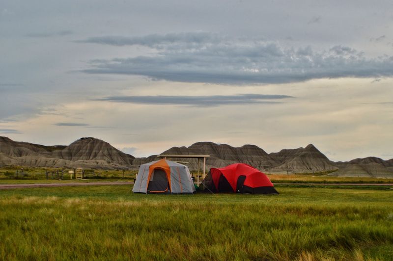
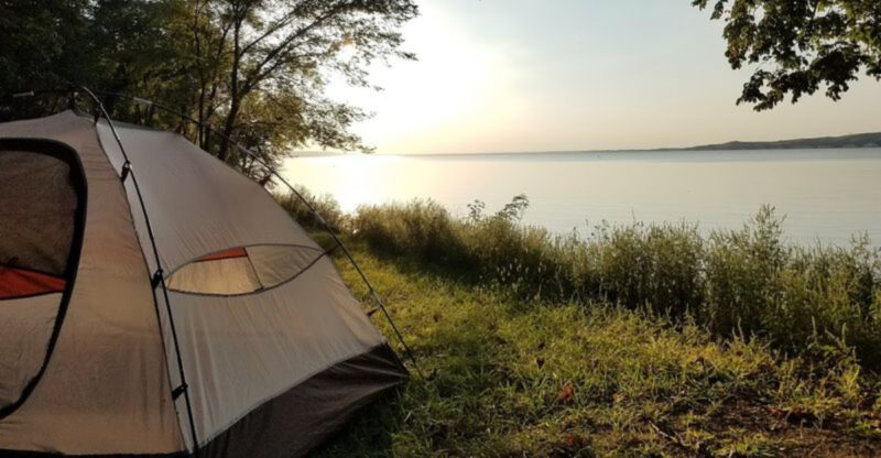
Sun shelters over picnic tables, fire rings, vault toilets, and a gravel lot: that’s the whole campground. Sites sit right off the parking area, spaced roughly fifty feet apart, open to the sky with no trees anywhere.
Camping runs first come, first served through an envelope system, and it’s cash only. Fees are modest, in the range of a few dollars to around fifteen a night, though checking current rates before you drive out is smart.
Water does not exist on site. Bring every drop you’ll drink and cook with, plus hand sanitizer, since the vault toilets have no sink and no light after dark.
Fire restrictions come and go depending on conditions, so meals that don’t need flame are a safe bet.
Then night falls, and the payoff arrives. Light pollution out here is close to nil, and the star field overhead is the reason some people make the trip at all.
Sunrise from a tent door across the badlands isn’t a bad second act.
Silence, Solitude and Who This Place Suits
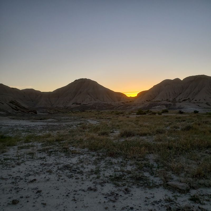
Wind. That’s frequently the only sound, and once you notice it, the quiet becomes the main attraction alongside the rocks.
Off-season arrivals can have the entire area to themselves, no other vehicle in the lot and no person visible in any direction. Photographers, geology buffs, and anyone hunting genuine solitude tend to leave satisfied.
Families do fine here too, with the caveat that kids can wander anywhere and the terrain includes steep drop-offs and loose clay. A little supervision goes a long way.
Cell service drops out entirely, which some treat as a feature. Nobody calls, nothing pings, and the reset that follows is the point.
Casual walkers get plenty from the short loop without committing to miles. Serious hikers have the Bison Trail waiting.
What the site doesn’t offer is amenities, shade, or a concession stand. Anyone expecting a developed state park experience should adjust expectations before the turn onto gravel.
Come prepared and this ranks among the most distinctive landscapes anywhere in the state.
Getting There Without Getting Stuck
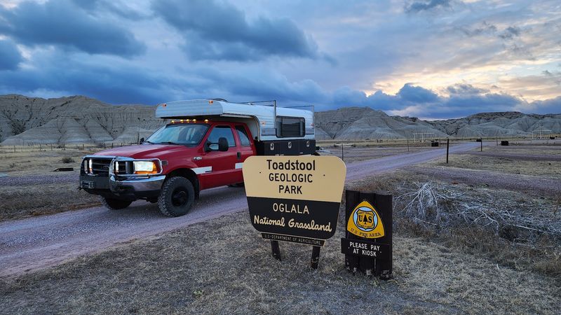
Fifteen or so miles of dirt and gravel stand between the pavement and the parking lot. From Crawford, the route heads northwest through the Oglala National Grassland, and the drive itself is a big part of the experience.
Washboard sections and uneven surfaces are standard. A vehicle with decent clearance handles it comfortably, and towing a trailer out here is a gamble.
Rain changes everything. The clay-heavy surface turns slick fast, and getting stranded is a real possibility, so checking the forecast before committing is the single most useful piece of planning.
Trails stay open year round for hiking. Seasonal day-use fees may apply, and the campground operates on its own rhythm, so confirming details with the Forest Service ahead of time saves a wasted trip.
The mailing address lists Harrison, Nebraska 69346, in Sioux County, though the park sits well out in the grassland between Harrison and Crawford.
Fill the fuel tank, load the cooler, and treat the last leg as a scenic prairie drive rather than an obstacle.
Why This Corner of Nebraska Stays With You
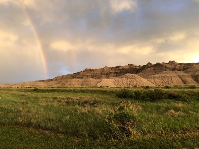
Sunset does something remarkable to white clay. The spires warm to amber, shadows stretch across the ravines, and the whole basin looks like it’s been lit from inside.
Nebraska carries a reputation for flat, and this place quietly dismantles it. The Panhandle hides terrain that surprises people who have lived in the state their entire lives.
Pairing the visit with Carhenge near Alliance, Fort Robinson, or the Hudson-Meng center builds a full weekend out of the northwest corner without much backtracking.
Fall stands out for a trip, with cooler air, thinner crowds, and goldenrod still holding on. Spring rewards wildflower hunters.
Summer works if water and an early start are part of the plan.
What makes it stick isn’t any single formation. It’s the combination of thirty-million-year-old rock, fossil tracks underfoot, a sod house on the grass, and a sky with nothing in the way.
Drive the gravel once and the memory tends to outlast the dust on the bumper.