10 Picturesque Waterfalls In Wisconsin That Make The Journey Completely Worth It
Hear that? Somewhere beyond the trees, Wisconsin is already giving away the ending.
The roar of a waterfall often reaches you before the view does, and that buildup makes the final reveal ridiculously satisfying.
Trails twist through forest and rock while the sound keeps getting louder. Then the trees open, and there it is!
Weather changes the personality of each stop too. Rain can turn a gentle cascade into a thundering wall.
Drier days reveal rock formations you might otherwise miss. That means the journey never feels identical twice.
Half the fun is the waterfall. The other half is chasing the sound toward it.
1. Big Manitou Falls At Pattison State Park, Superior
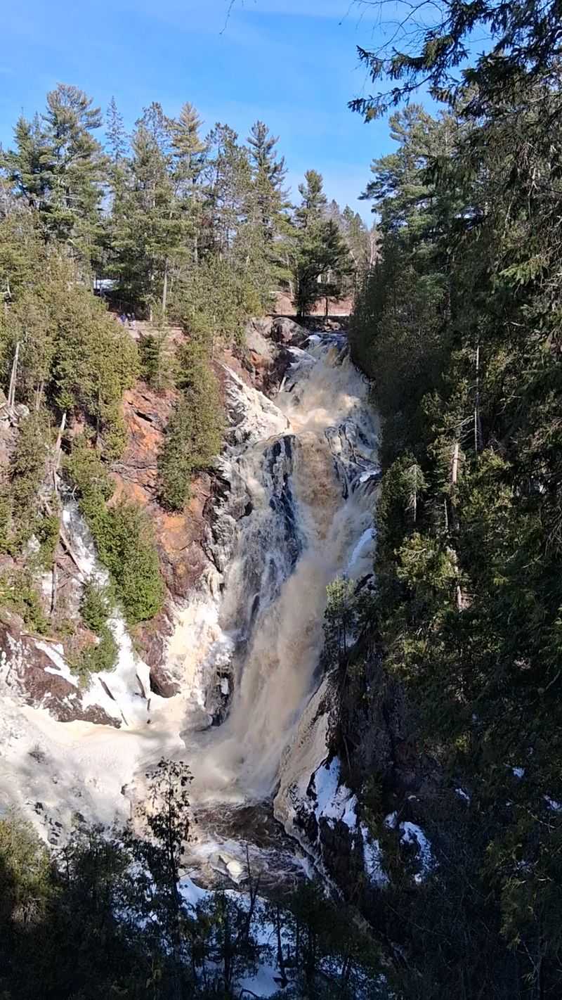
Worth the long drive? Big Manitou Falls at Pattison State Park, near Superior, answers with a 165-foot plunge into a steep river gorge.
It is Wisconsin’s tallest waterfall and one of the highest east of the Rocky Mountains.
The Black River carved the gorge through layers of sandstone, clay, and much harder ancient basalt. That geology gives the surrounding cliffs plenty of texture while the falls dominate the center of the view.
Several overlooks make the main attraction relatively easy to enjoy. A pedestrian tunnel leads from the main picnic area beneath Highway 35 to a half-mile network of paths with viewpoints on both sides of the river.
Visitors who want more distance can continue onto other park trails. The Beaver Trail circles Interfalls Lake, while a moderately steep river trail descends toward the Black River downstream from the falls.
The park stays open year-round, so the scenery shifts from summer greenery to autumn color and frozen winter edges. Accessible overlooks are available at both Big Manitou and Little Manitou Falls.
Stay behind railings and marked boundaries around the gorge. The cliffs are steep, and the river below moves with considerable force.
For navigation, use 6294 S State Rd 35. A Wisconsin state park vehicle admission sticker is required, and anyone planning a longer hike should bring water and suitable footwear.
2. Amnicon Falls, South Range
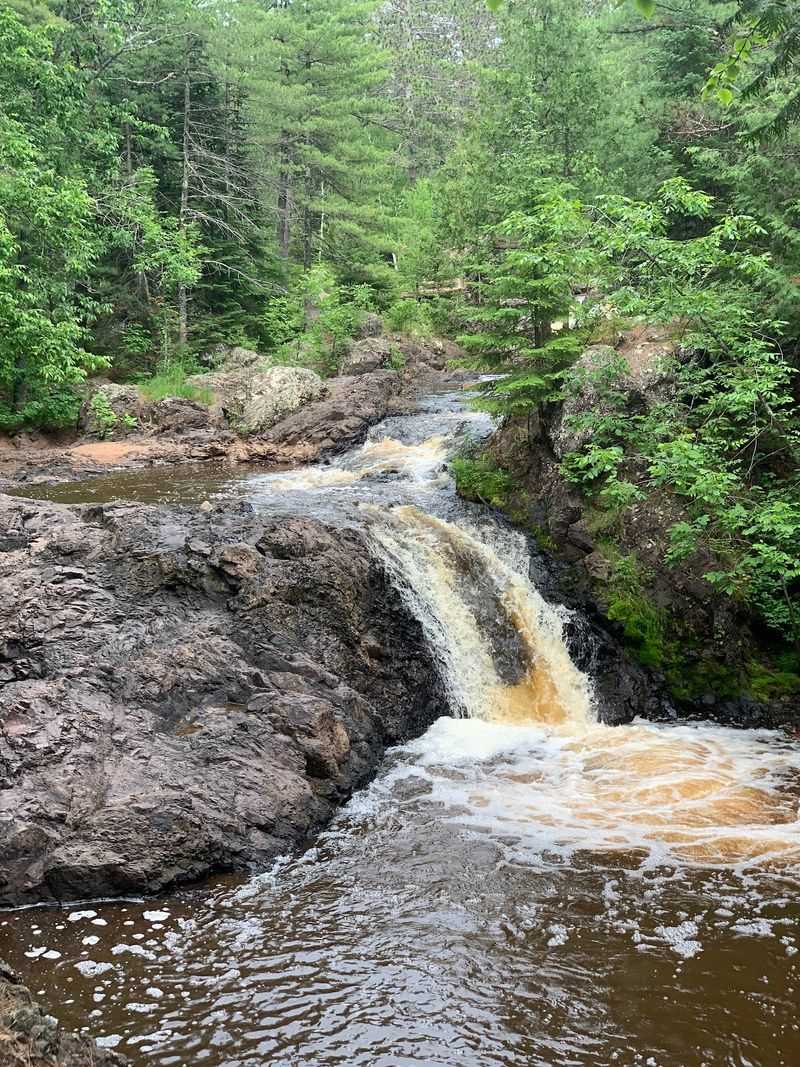
Wait, did that trail just lead to another waterfall? Here, one cascade is only the beginning.
Amnicon Falls State Park, near South Range, packs several falls and rapids into a remarkably compact stretch of river.
Upper Falls, Lower Falls, and Snake Pit Falls are the three main drops along the most popular quarter-mile island trail. Additional pools, rapids, and smaller cascades appear as the river works through the surrounding rock.
One of the park’s most recognizable landmarks is the covered Horton bridge near Lower Falls. The historic bowstring bridge was moved to its present location in 1930, with its roof added by Civilian Conservation Corps workers in 1939.
The park has about 1.8 miles of hiking trails in total. River walks are generally short and manageable, although rocky shoreline areas call for more careful footing.
The geology adds another reason to slow down. Amnicon Falls is one of Wisconsin’s best places to see evidence of the Douglas Fault, along with ancient basalt, sandstone, glacial deposits, and other rock formations shaped over immense spans of time.
Water levels naturally change with snowmelt and rainfall, so the same sections can look quieter or considerably more forceful from one season to another.
Set your route for 4279 S County Hwy U. The park is open year-round from 6 a.m. to 11 p.m., and a Wisconsin state park vehicle admission sticker is required.
3. Copper Falls, Mellen
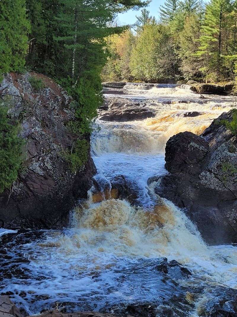
Now that is a gorge worth slowing down for. The rock walls make every bend interesting.
Copper Falls, near Mellen, sits inside one of Wisconsin’s most dramatic combinations of waterfalls, rivers, ancient rock, and deep forest.
The namesake falls drop about 29 feet on the Bad River before the water continues through a steep-walled canyon.
Nearby Brownstone Falls and the Tyler Forks cascades add several more moving-water views within the same part of the park.
Doughboys Nature Trail is the classic route through the area. The 1.7-mile loop follows the Bad River and Tyler Forks, passing overlooks for Copper Falls, Brownstone Falls, and the surrounding cascades.
Some sections include rock stairs and uneven surfaces, although part of the route has a crushed-granite surface and accessible trailhead. Altogether, Copper Falls State Park has about 17 miles of hiking trails.
The landscape began taking shape long before the park existed. Ancient lava flows, sandstone, shale, conglomerate, glaciers, and millions of years of river erosion all contributed to the gorges visible today.
Civilian Conservation Corps buildings from the 1930s add another layer to the setting. Their rustic log construction fits naturally among the mature hardwoods, hemlocks, pines, and cedars lining the trails.
Use 36764 Copper Falls Rd when planning the drive. The park is open year-round, requires a Wisconsin state park vehicle admission sticker, and offers enough trail mileage to turn a quick waterfall stop into a much longer outing.
4. Stephens’ Falls At Governor Dodge State Park, Dodgeville
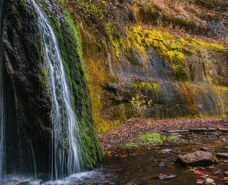
Here is a quieter idea for a waterfall day. Sometimes a short woodland walk wins.
Stephens’ Falls at Governor Dodge State Park, near Dodgeville, appears among rock outcrops, ferns, and a wooded stream.
The Stephens’ Falls Trail runs about half a mile. A paved quarter-mile approach leads to an overlook above the waterfall, making the upper view easier to reach than many waterfall trails.
Reaching the lower portion is more demanding. Stone steps and uneven terrain continue below the overlook, so footwear with reliable grip becomes more important there.
Governor Dodge sits in Wisconsin’s Driftless Area, a region bypassed by the glaciers that flattened much of the surrounding Midwest.
That history helped preserve the steep hills, valleys, bluffs, and exposed sandstone found throughout the park.
The waterfall can change noticeably with rainfall. Stronger flow brings more movement over the rock, while drier periods reveal more of the ledges and streambed.
There is much more nearby for anyone extending the visit. Governor Dodge covers about 5,350 acres and includes two lakes, nearly 40 miles of trails, picnic areas, and additional routes through wooded valleys and ridges.
For directions, use 4175 Hwy 23 N. The park remains open year-round, and a Wisconsin state park vehicle admission sticker is required.
5. Dave’s Falls, Amberg
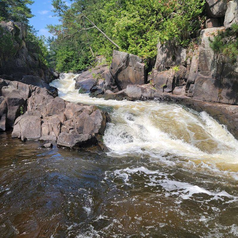
Do not let a modest waterfall height fool you. The rocks bring plenty of excitement.
Dave’s Falls, near Amberg, sends the Pike River through exposed formations that divide the scene into upper and lower sections.
The two areas show different sides of the same river. Broad water moves over rock near the upper falls before tightening into a more confined channel downstream.
Paths around the park allow visitors to compare several river views without committing to a long hike. The ground becomes rocky in places, so sturdy footwear makes the short exploration more comfortable.
Dave’s Falls County Park also includes a playground, picnic area, and hand-pump water. Those facilities make it easy to stretch a waterfall stop into a slower afternoon.
The river deserves respect even when the approach seems easy. Wet rock can become extremely slick, and stronger flow after rain can make the edges less predictable.
Spring often brings more water through the Pike River, while autumn adds color to the forest surrounding the falls. Both seasons change the look of the rock-lined channel considerably.
Use W7902 County Park Rd for navigation. Marinette County charges a vehicle day-use fee beginning May 1, and the same daily permit can be used at other participating county parks that day.
6. Long Slide Falls, Niagara
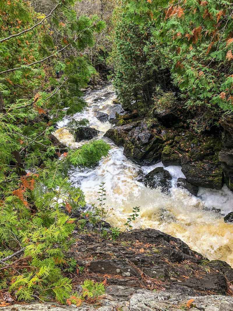
What happens when the river refuses to take the easy route? It puts on a show. Long Slide Falls, near Niagara, tumbles about 50 feet through a steep run of broken rock.
The main approach is short, with the county placing the falls about a quarter-mile from the paved parking area. That distance can make the outing sound easier than the terrain really is.
Viewing the lower portion is considerably more demanding. Marinette County describes the terrain there as advanced, so visitors do not need to descend all the way to appreciate the waterfall.
The long rocky drop gives the water several changes in direction before it reaches the bottom. Higher flows after rain or snowmelt can make the entire descent look much more powerful.
Anyone wanting another nearby stop can also visit Smalley Falls. It sits roughly half a mile upstream by road and requires only a short walk from its own parking area.
Morgan Park is a few miles farther east and adds camping, swimming, and picnic facilities for visitors turning the waterfall drive into a longer outing.
Use N20219 Morgan Park Rd for navigation. Long Slide Falls Park is part of the Marinette County park system, so a day-use vehicle permit is required during the county’s fee season.
7. Upson Falls, Upson
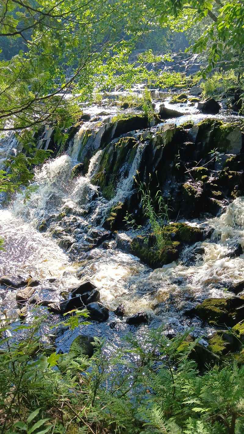
Small campground, big reason to stop. That combination makes a road trip more interesting.
Upson Falls, in Upson, drops about 20 feet into the Potato River beside a quiet town park.
The approach is short, generally about a quarter to half a mile depending on where the walk begins. Travel Wisconsin describes the surface as gravel, dirt, rocky, and uneven.
A dirt path leads toward the river, with a rocky incline providing another view of the falls. The short distance makes the stop manageable, but reliable shoes still help on the rougher ground.
Camping and picnic facilities sit nearby, so visitors do not need to treat the waterfall as a quick roadside photograph. The park can work equally well for a brief break or an overnight stop.
Flow varies with rainfall and seasonal conditions. Higher water spreads more forcefully across the drop, while lower levels expose additional rock in the Potato River.
The surroundings remain simple and relatively undeveloped compared with larger state parks. That gives the stop a quieter character without requiring a lengthy backcountry hike.
Access is from Hwy 77 in Upson, with signs directing visitors into Upson Town Park. Admission to the falls is currently free.
8. Fonferek’s Glen Falls, Green Bay
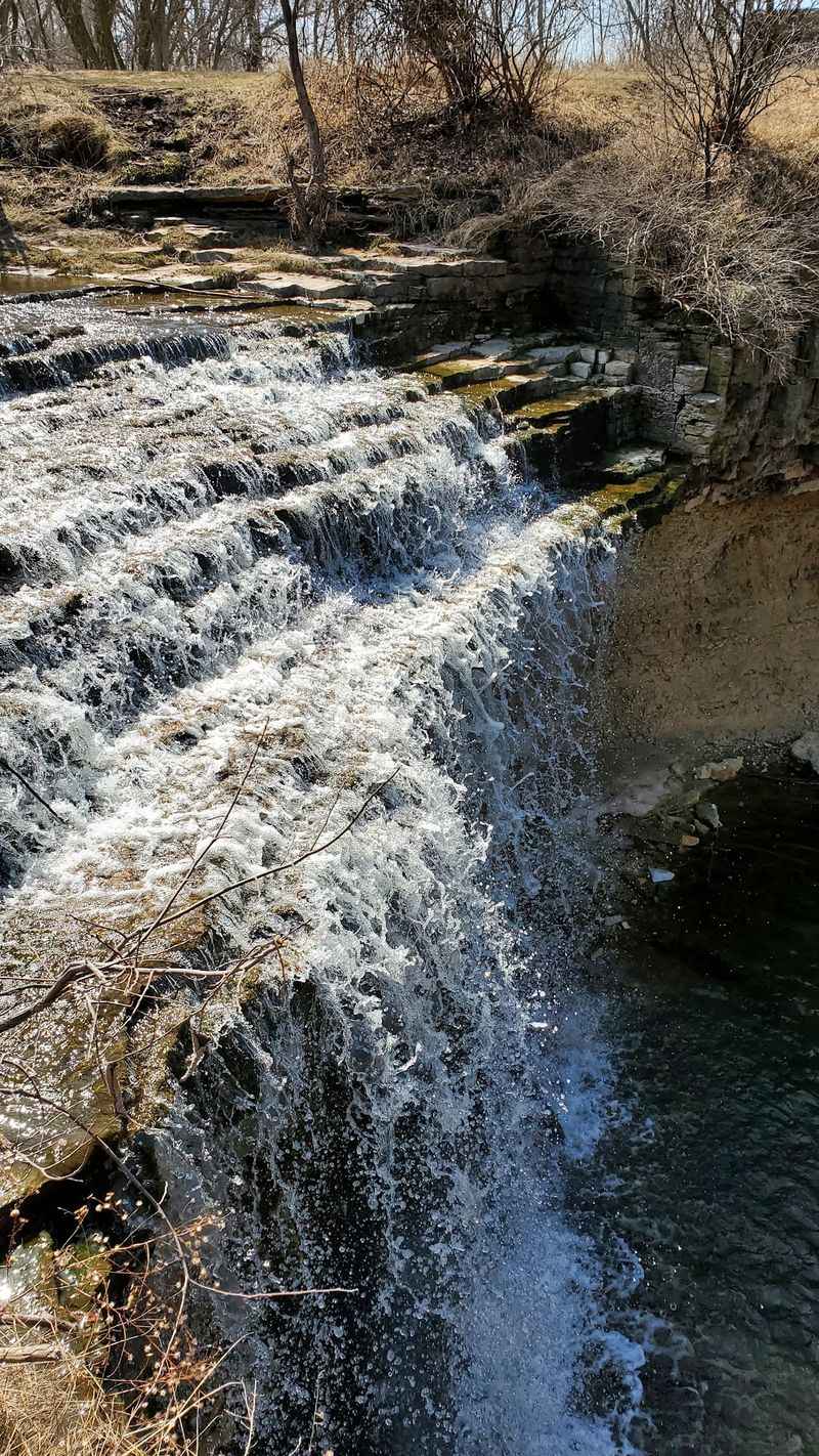
Here is the catch: timing can change the entire scene. That makes planning part of the fun.
Fonferek’s Glen Falls, near Green Bay, drops about 30 feet from a dolomite ledge along Bower Creek.
Rainfall matters considerably here. During wetter periods, the waterfall forms a stronger curtain, while extended dry weather can reduce the flow dramatically.
Fortunately, seeing the falls does not require a difficult descent. A designated overlook built in 2019 provides a clear view roughly 100 yards from the parking area.
Fonferek’s Glen Conservancy covers about 75 acres and protects more than the waterfall. Dolomite cliffs, a natural stone arch, restored prairie, and other features form part of the Niagara Escarpment landscape.
Visitors should take the conservancy’s safety warnings seriously. Outside the designated use area, Brown County warns of steep cliffs, falling rock, rugged terrain, and the absence of marked trails.
That means this is not a place to invent a shortcut toward the base of the waterfall. Staying within designated areas provides the safest view while protecting the fragile geological setting.
Enter 2825 Dutchman Rd for directions. The park is free, opens at 8 a.m., and closes at dusk; parking on surrounding streets is prohibited if the lot is full.
9. Big Falls County Park, Kennan
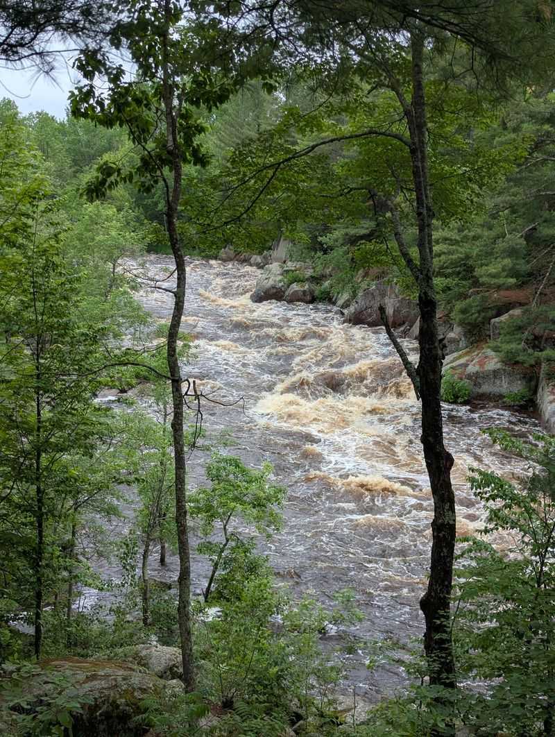
Ready for a river that refuses to travel in a straight line? Watch the rocks.
Big Falls County Park, near Kennan, follows the South Fork of the Jump River through a rugged stretch of moving water.
Rather than forming one clean vertical drop, the river cascades around huge granite rocks. Walking along the river reveals changing angles on the rapids and falls area.
A hiking trail follows the water through the park, while tall white and red pines frame much of the riverbank. The setting feels wild even though parking and picnic facilities are close by.
The county maintains picnic tables, grills, an open-air shelter, a playground, drinking water from a hand pump, and vault toilets. Six rustic campsites are also available on a first-come, first-served basis.
The campground is open year-round, although winter access is considerably more rustic because roads are not plowed. Visitors planning an overnight stay should arrive prepared for basic facilities.
Strong current and wet granite deserve caution along the river. Remaining on established footing gives plenty of opportunity to watch the water without turning the view into an unnecessary risk.
Use W11337 Big Falls Rd to plan the drive. Give the final stop enough time to unfold at its own pace rather than searching for one single dramatic drop.
The journey ends well when the river gets the last word.
10. Willow Falls At Willow River State Park, Hudson
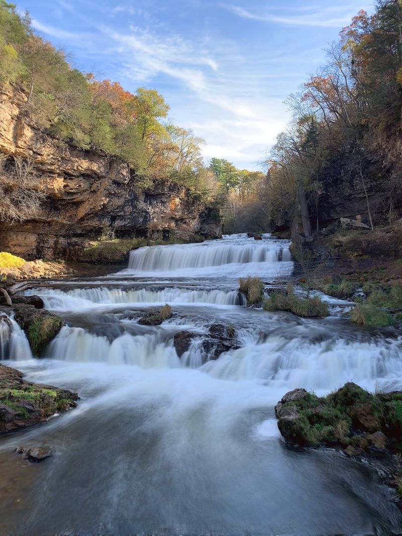
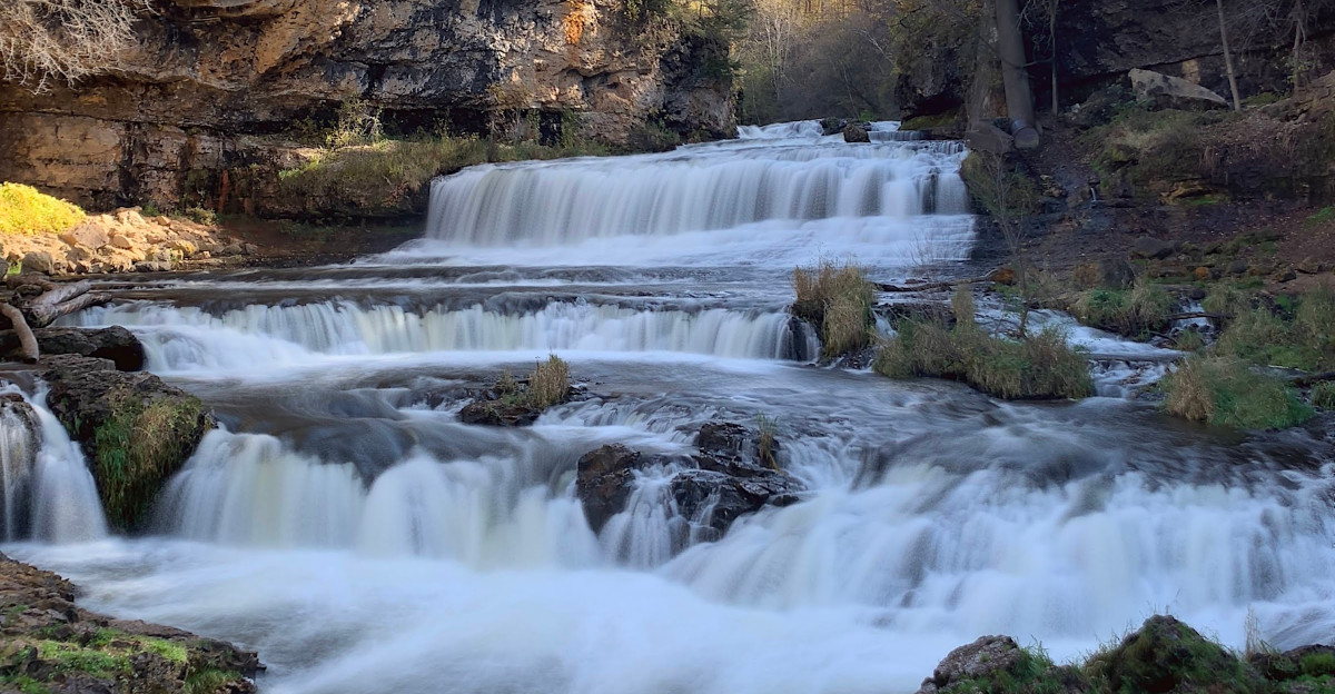
Okay, that wide curtain of water deserves a longer look. Several ledges keep the scene moving.
Willow Falls at Willow River State Park, near Hudson, spreads through a rocky gorge in a broad sequence of cascades.
Getting there can be as easy or demanding as the chosen route allows. The shortest option is the 0.4-mile Willow Falls Hill Trail, but the Wisconsin DNR describes that route as very steep.
A longer one-mile trail reaches the falls from the campground while following Little Falls Lake and the Willow River. Other park routes approach from farther away and include overlooks, forests, prairie, wetlands, and river-bottom habitat.
Trail surfaces vary considerably throughout the park. Wet leaves, exposed roots, loose gravel, rocks, and steep grades can make sections more demanding than the distance alone suggests.
Little Falls Lake adds another reason to stay after seeing the waterfall. Swimming, canoeing, kayaking, fishing, and nonmotorized boating are currently available, and the lake has returned to full pool.
Willow River State Park contains about 13 miles of hiking trails, so visitors who still have energy can easily extend the outing beyond the falls.
Navigation is straightforward with 1034 County Hwy A. The park is open year-round and requires a Wisconsin state park vehicle admission sticker.