11 Northern California Bike Trails That Feel Like Hidden Escapes In 2026
A good bike ride can make the rest of the day disappear surprisingly fast.
Once traffic noise fades and the scenery starts doing the entertaining, checking the time becomes much less important. Some trails are especially good at creating that escape.
Quiet stretches, unexpected views, and enough distance from the everyday rush can make an afternoon on two wheels feel more like a miniature getaway than a workout.
Northern California rewards curious cyclists with trails where the loudest interruption might be tires rolling over the path beneath them.
You do not need an epic expedition to get that feeling, either.
A few peaceful miles can be enough to reset the mood, especially when the route leads somewhere you would never experience quite the same way through a car window.
Pack water, check your tires, and leave a little flexibility in the schedule.
1. Bizz Johnson National Recreation Trail, Susanville

Can you imagine the feeling of pedaling out of a dark railroad tunnel and into bright canyon sunlight?
That exact moment happens twice on the Bizz Johnson National Recreation Trail, and it never gets old. Riders often say it feels like traveling back to the days of steam trains.
The trail follows an old railroad line for about 25.4 miles through the rugged Susan River Canyon. Along the way, you cross 12 bridges and trestles while the river rushes below.
The scenery shifts from dry, rocky canyon walls to cool forests of pine and fir, so your eyes never get bored.
You will want to pick your season wisely. Fall is a favorite because the leaves turn bright yellow and orange, making the canyon glow.
The surface is packed gravel and dirt, which means a mountain bike or gravel bike works best.
Skinny road tires will have a tough time here. Since the trail gently climbs as you head west, many riders enjoy an easier cruise on the way back.
Most of the route has no roads nearby, so you really feel far away from the world.
2. Last Chance Section Of The Coastal Trail, Del Norte Coast Redwoods
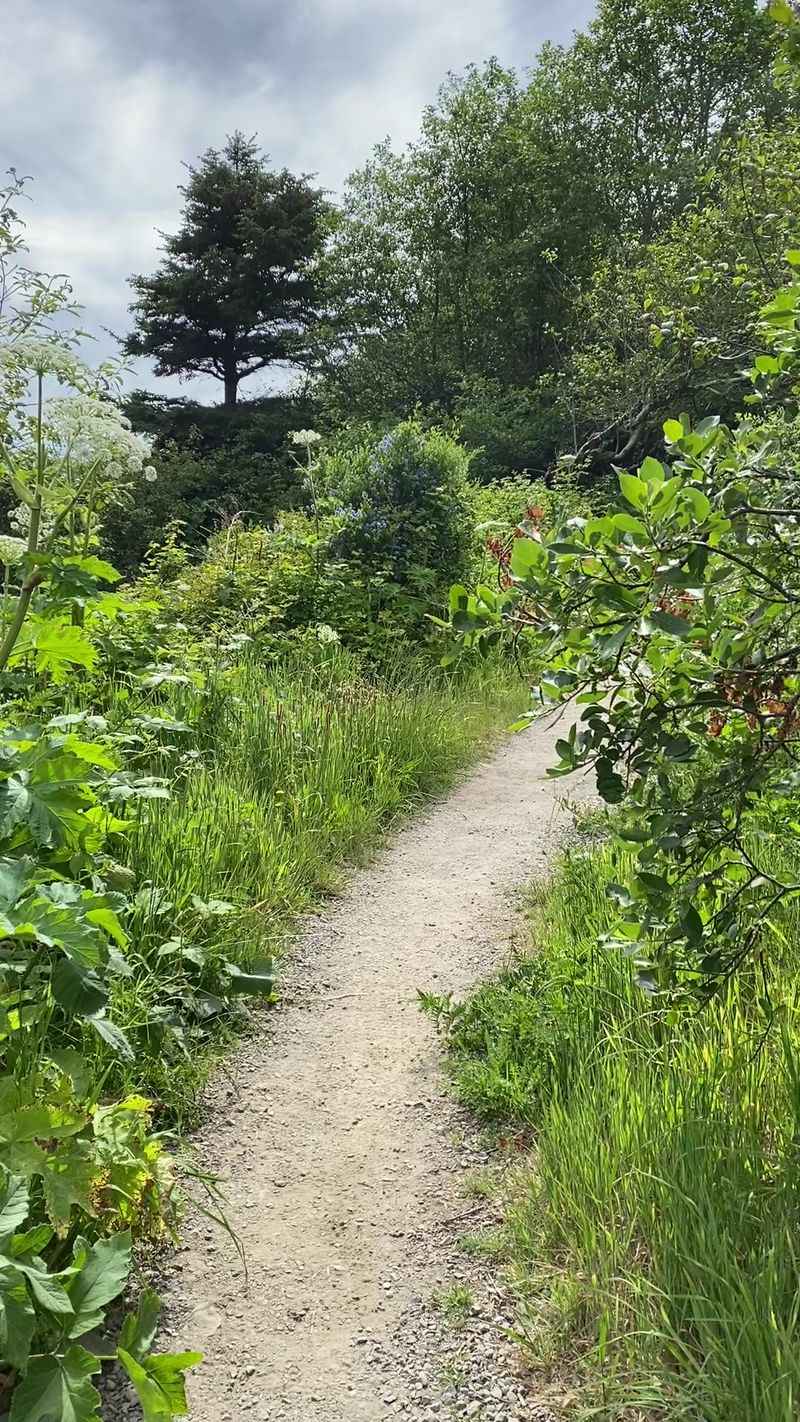
Silence is the first thing you notice here. Not the quiet of a library, but the deep hush of trees that have stood for over a thousand years.
The Last Chance Section of the Coastal Trail might be the most peaceful ride on this whole list.
Starting from the Crescent Beach Overlook at the south end of Enderts Beach Road, about three miles south of Crescent City, you roll onto the path of the old California Coastal Highway.
Cars stopped using this road long ago, and nature has been taking it back ever since. Ferns, moss, and giant redwoods crowd in from both sides.
The trail runs about 6 miles one way, with some steep stretches along the route, so plan on roughly 12 miles if you ride out and back.
Some parts get overgrown with brush, which adds to the wild feeling but can scratch your legs. Long pants or tall socks are a smart choice.
Every so often, the trees open up and you catch a view of the Pacific crashing against the bluffs. Those peeks feel like a reward for your effort.
Pack a rain jacket, even in summer, because coastal weather changes fast.
Very few people use this trail, so you might ride for an hour without seeing anyone at all.
3. Sacramento River Rail Trail, Redding And Shasta Area
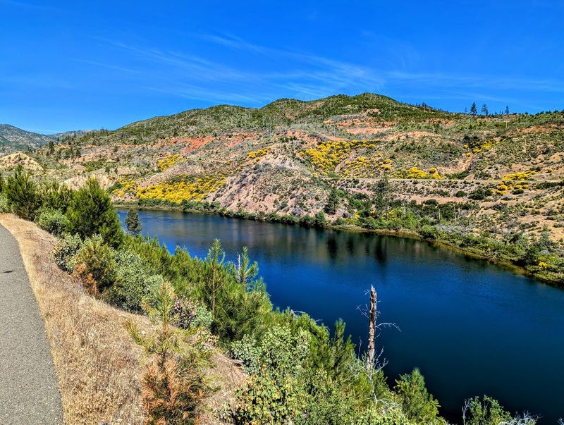
Here is a little secret the locals know. Just minutes from busy Redding, there is a smooth, paved trail where you can ride for miles and feel like you are deep in the mountains.
The Sacramento River Rail Trail runs about 11 miles along the western shore of Keswick Reservoir. The water sparkles below steep, forested hills, and the road noise fades away quickly.
Looking for a bigger challenge? The trail connects to the Sacramento River Trail, which lets you build a much longer ride.
Some cyclists start at the famous Sundial Bridge and pedal toward Shasta Dam, turning it into a trip of up to 38 miles round trip.
Easy parking makes the Keswick Dam Trailhead a handy place to begin, with restrooms and accessible facilities.
From there, the path rolls up and down with some gentle hills, so it works for many skill levels. Families with older kids can enjoy it without much trouble.
Redding summers are seriously hot, often over 100 degrees. Ride in the early morning or save this trail for spring and fall.
Bring extra water and sunscreen, because shade can be limited in spots.
Finishing at the dam and staring up at that giant wall of concrete is a moment you will remember.
4. Newton B. Drury Scenic Parkway, Prairie Creek Redwoods
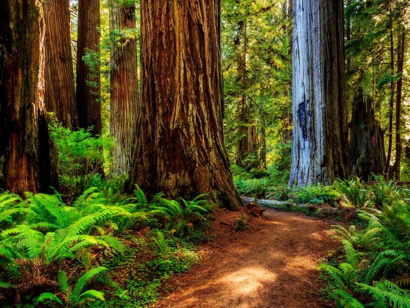
A road lined with trees as tall as skyscrapers, and not a single car in sight sounds like a drea, doesn’t it? That dream comes true once a month at Prairie Creek Redwoods State Park.
Timing is everything with this one, so mark your calendar.
On the first Saturday of each month from October through May, the park closes the scenic parkway to cars for Hike and Bike Day.
That opens up about 10 miles of smooth pavement for cyclists, walkers, and even leashed dogs. It is one of the most magical rides you can take anywhere.
The road rolls gently through ancient redwood groves. Sunlight filters through the branches in golden beams, and the air smells fresh and earthy.
Keep a lookout for Roosevelt elk, the huge animals that often graze in the meadows nearby.
E-bikes are allowed, which is great news for riders who want a little help on the hills.
Everyone needs to keep speeds at 20 miles per hour or less, though. With kids and pets around, riding slowly also gives you more time to stare up at the trees.
Park near the Prairie Creek Visitor Center and arrive early, because these special days are becoming more popular.
5. Truckee River Legacy Trail, Truckee
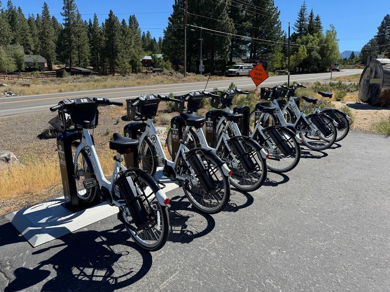
Not every mountain ride has to leave you gasping for air. California’s Truckee is famous for tough, rocky mountain-bike trails, but the Truckee River Legacy Trail offers a friendlier choice.
It is the kind of ride where you can actually talk with your friends while you pedal.
The paved path stretches about 6 miles, following the twists and turns of the Truckee River. It links downtown Truckee with the quiet Glenshire neighborhood.
Along the way, you get lovely views of the rushing water and the high peaks of the Sierra Crest.
A great place to begin is Truckee River Regional Park, the farthest west access point. You can also jump on from East River Street, where there is a handy bike repair station.
Families love this trail because it stays mostly gentle and smooth. Younger riders can handle it, especially if you turn around before the full distance.
The river also has calm spots where kids can toss rocks or dip their toes in during summer.
Here is a cool bonus: the trail gets plowed in winter. That means you can walk, run, or even ride a fat-tire bike here when snow covers the rest of town.
Few trails in the Sierra stay open all year like that.
6. Ten Mile Coastal Trail, Fort Bragg
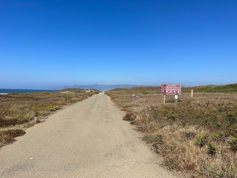
Salty air, crashing waves, and endless blue water. The Ten Mile Coastal Trail in Fort Bragg gives you all three, plus a little piece of logging history.
It might be the easiest way to enjoy the Mendocino Coast from a bike seat.
Locals often call it the Old Haul Road, because logging trucks once used this route to carry giant redwood logs. Today, it is a paved, multi-use trail running about 7 to 7.5 miles through MacKerricher State Park.
The trail kicks off at the Pudding Creek Trestle, at the west end of Elm Street right next to Glass Beach.
Before you ride, take a few minutes to visit the beach. It is covered in smooth, colorful sea glass left over from an old dump site long ago.
As you head north, the crowds thin out fast. The farther you go, the wilder things feel, with sand dunes and quiet stretches of shore.
Some older sections of pavement are worn, so ride carefully.
From December through April, keep your eyes on the water. Gray whales migrate past this coast, and you might spot a spout or even a tail.
Harbor seals like to rest on the rocks too.
7. Lake Almanor Recreation Trail, Lake Almanor
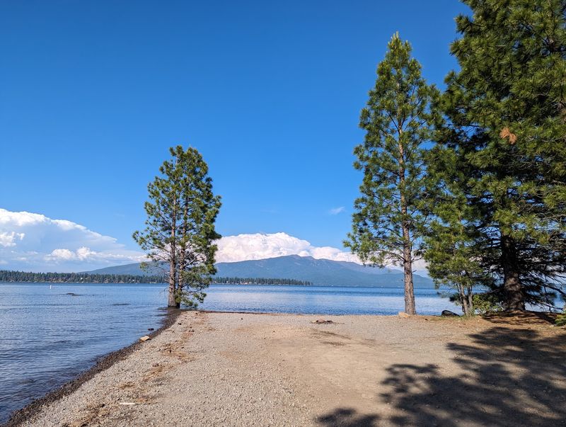
Some places just make you breathe slower. Lake Almanor is one of them, and its paved recreation trail is a lovely way to soak it all in.
Tall pines, shimmering water, and a volcano on the horizon make for a pretty perfect afternoon.
The trail runs about 11 miles one way, so a full out-and-back ride is around 22 miles. It is paved and closed to motor vehicles, which keeps things calm.
You can go the whole distance or turn around whenever your legs say it is time.
Views change as you move along the shore. One moment you are wrapped in shady forest, and the next you see the lake with Dyer Mountain and Lassen Peak rising behind it.
Lassen Peak is actually an active volcano, which is a pretty wild thing to see from a bike path.
Many riders like to begin at the Dyer View parking area. It has paved parking, restrooms, and picnic tables, so it is easy for families.
Another option is the Canyon Dam Boat Launch, off Highway 89 near the Rocky Point PG and E campground.
Early fall is a hidden gem time, with cooler air and fewer people. Pack a swimsuit if it is warm, because a dip in the lake after your ride feels amazing.
8. Monterey Bay Coastal Recreation Trail, Marina And Fort Ord
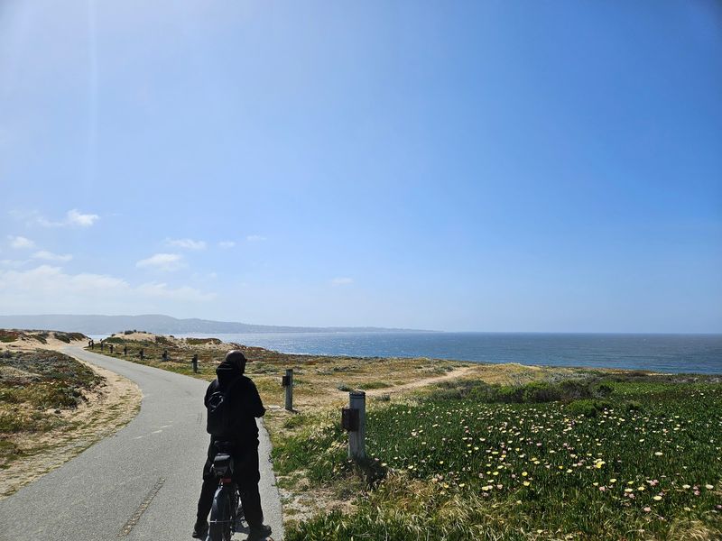
Okay, let’s be honest. Parts of the Monterey Bay Coastal Recreation Trail get crowded, especially near Cannery Row.
But head north toward Marina and Fort Ord, and the whole mood changes.
The full paved path runs about 19 miles, and the northern sections are the real treasure.
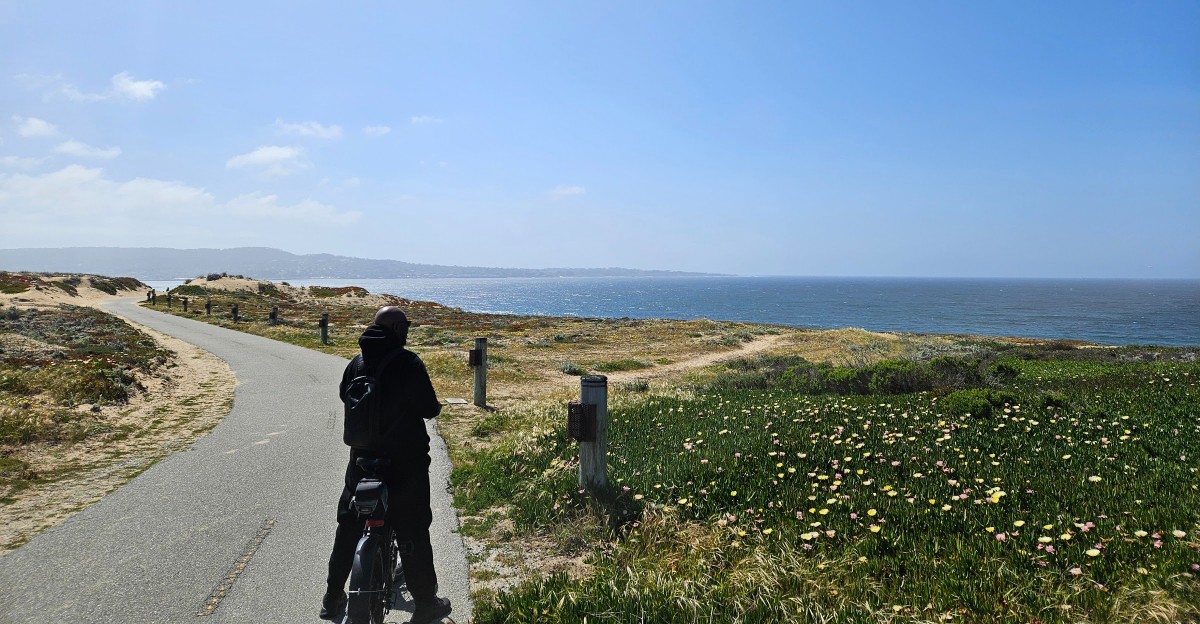
Riding through Fort Ord Dunes State Park, you roll past huge sand dunes with wide views of the ocean. There are fewer tourists, more birds, and a lot more breathing room.
Fort Ord used to be a large Army base, where thousands of soldiers trained. After it closed in the 1990s, much of the land became parks and open space, which is why this area feels so empty and wild today.
As of 2026, Sand City is planning a new multi-use trail along the railway corridor that would help close a gap in the existing Monterey Bay Coastal Recreation Trail.
Wind can be strong along the dunes, especially in the afternoon. Morning rides are usually calmer and cooler. A light jacket helps, since fog often hangs over the bay.
Even with a few detours, the quiet northern stretch is worth the effort. It shows a softer side of a trail most people only know for its busy parts.
9. Martis Valley Trail, Truckee
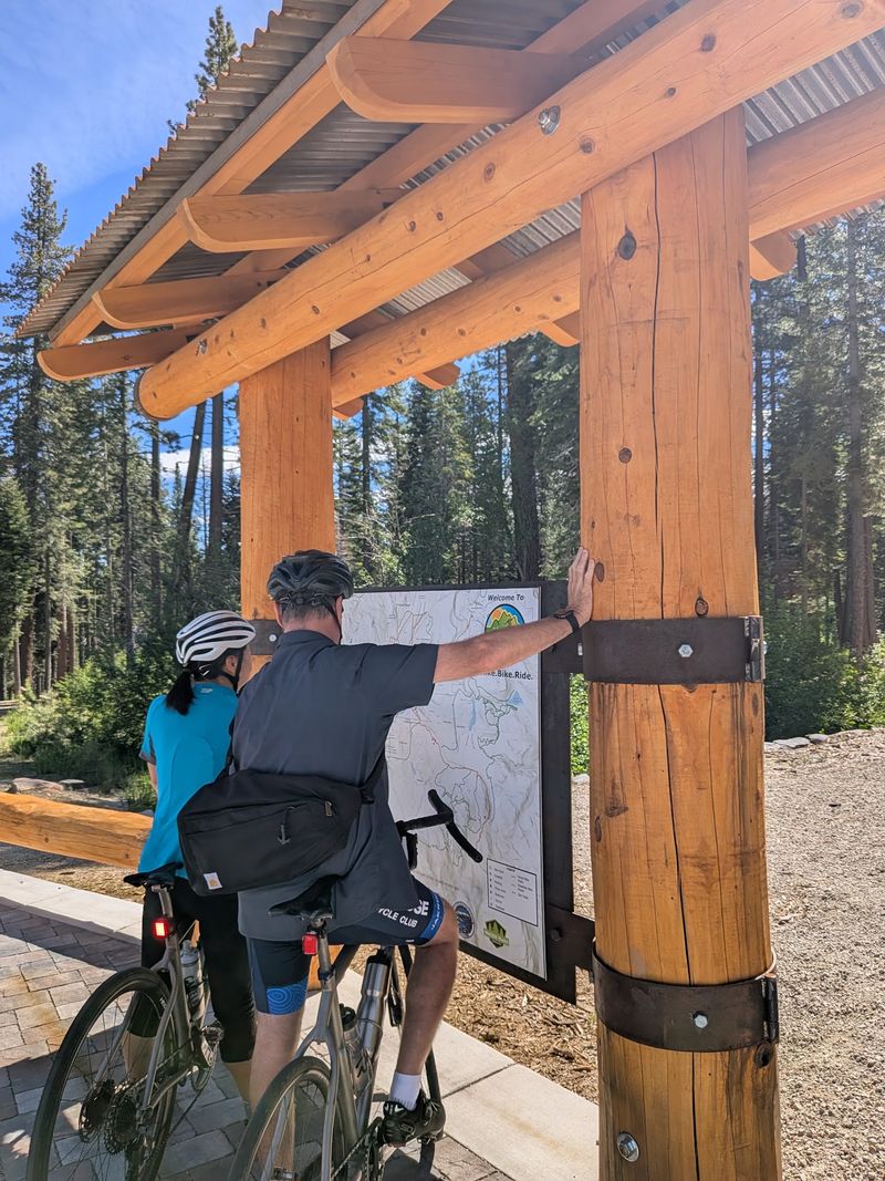
Wide open space is the star of the show here. While many Sierra trails squeeze you between trees, the Martis Valley Trail lets you see for miles.
Mountains rise on every side, and the sky feels enormous.
Free parking makes it easy to get rolling. The trail is paved and ADA accessible, so people of many ages and abilities can enjoy it.
That includes wheelchair users, parents with strollers, and young kids.
Big progress happened recently. As of March 2026, about 5.75 miles are finished, including a new 1.23-mile piece that connects the Northstar Castle Peak parking lots to Northstar Village.
When everything is done, the trail should stretch around 10 miles.
Along the way, you can spot Martis Peak, Frog Lake Cliff, Castle Peak, and the Sierra Crest. In early summer, wildflowers pop up across the valley in purple and yellow. Hawks often circle overhead looking for lunch.
You can also start from the Northstar Castle Peak lot. Riding toward Northstar Village involves some uphill work, so save energy for the climb. The ride back down is pure fun.
Because the valley has little shade, sunscreen and a hat are must-haves. At this high elevation, the sun hits harder than you might expect.
10. Hole In The Ground Trail, Donner Summit
Ready for something tougher? Hole in the Ground is a legendary mountain-bike trail near Donner Summit, and it is not for beginners. Experienced riders talk about it with big smiles and sore legs.
The full route runs about 13.5 miles, although riders using a car shuttle can shorten the trip to around 10 miles.
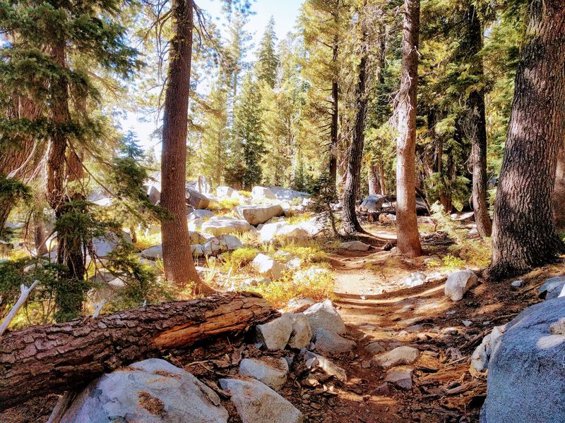
Expect steady climbing, bumpy rocky sections, and some steep, stair-like drops on the backside.
So why do people keep coming back? The scenery is incredible. You pass alpine meadows full of wildflowers, views of the Castle Peak area, and the calm waters of Lola Montez Lake.
Safety comes first on a trail like this. Wear a helmet, gloves, and knee pads if you have them. Bring a repair kit, a spare tube, and plenty of food, because help can be far away.
The trail sits at high elevation, so snow can linger into early summer. July through October is usually the best window.
Afternoon thunderstorms can pop up quickly, so start early and keep an eye on the sky.
Hop on I-80, take the Boreal Ridge Road and Castle Peak exit, then drive to the end of California’s Castle Valley Road for the main access point.
11. Sawtooth Trail, Truckee
Think of Sawtooth as the perfect middle step. It is harder than a paved path, but not as scary as the toughest Sierra trails. If you are ready to try real dirt riding, this could be your new favorite loop.
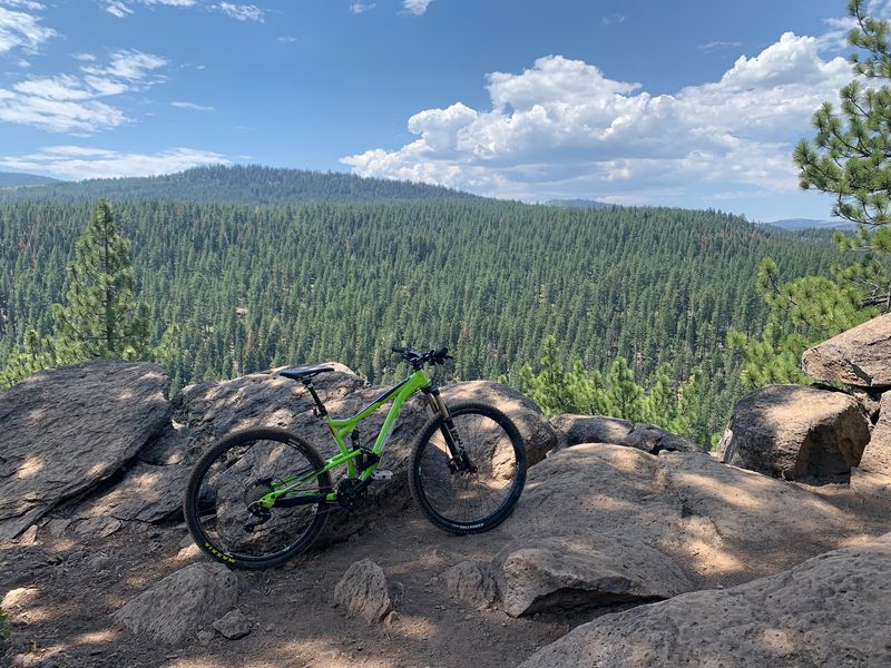
The single-track loop covers about 9 miles, winding through a mix of high desert and fragrant Jeffrey pine forest.
Here is a fun trick: sniff the bark of a Jeffrey pine, and many people say it smells like vanilla or butterscotch.
The ground rolls up and down gently, with some rocky spots to keep you focused. The trail is rated intermediate for mountain biking, with rolling terrain and rocky sections that keep riders focused.
The best moments come at two overlooks above the Truckee River Canyon. From up there, you can see the river cutting through the valley below.
It is a great place to snap photos and catch your breath.
Plan your trip for spring, summer, or fall, since snow covers the trail in winter. Weekday mornings are usually the quietest.