Out On Idaho’s Snake River Plain, A Lone Volcanic Butte Rises 2,350 Feet Above Flat Farmland
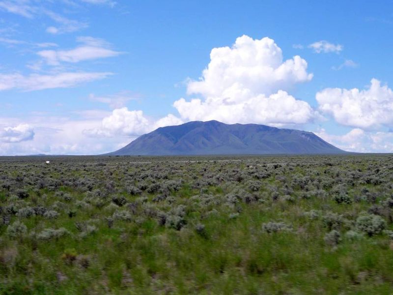
One of the largest rhyolite domes on Earth sits alone in the Idaho sagebrush, and most drivers never learn its name. It rises about 2,400 feet above ground so flat it looks ironed.
The mountain formed when two lobes of thick magma pushed up and merged about 300,000 years ago. Long after that, people chipped obsidian from it for thousands of years.
Later, wagon travelers on an Oregon Trail shortcut drank from springs at its base.
I like how it refuses to blend in. Everything around it is dark basalt and open range.
Then this pale, pine-topped giant just shows up and stays put.
The road to the top is steep, rocky, and single-lane. Right now, it’s also closed.
So why does this lonely peak keep pulling Idaho road-trippers out into the middle of nowhere?
A Mountain With No Neighbors
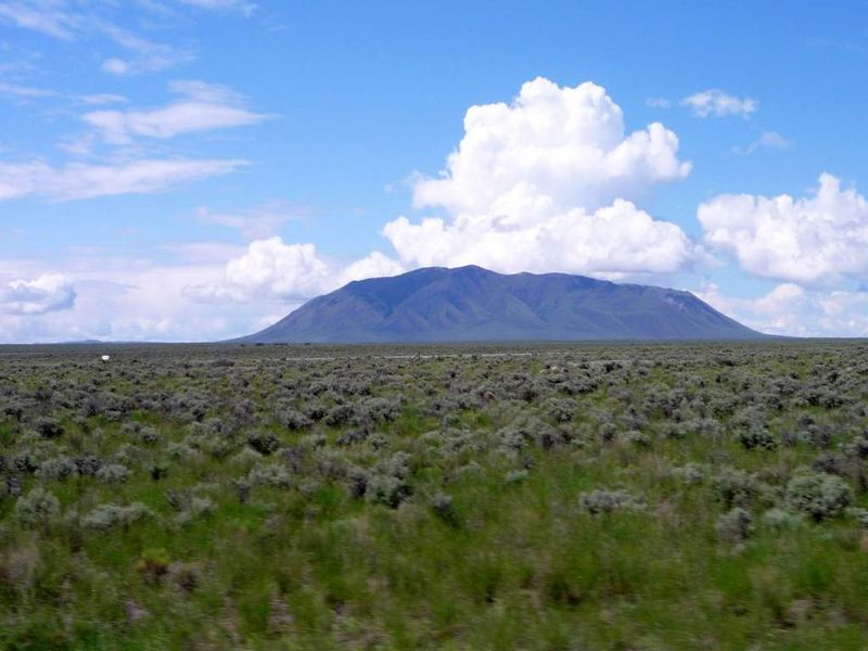
Big Southern Butte stands near the center of the eastern Snake River Plain in Butte County, Idaho. Nothing nearby comes close to matching its height.
The summit reaches about 7,550 feet above sea level. That puts the top roughly 2,400 to 2,500 feet above the surrounding plain, depending on where you measure.
Arco sits to the west, and tiny Atomic City lies closer on the southeast side. Between them, the ground runs wide open in nearly every direction.
That’s what makes the butte so easy to spot. Drivers on Highway 26 and Highway 20 can see it from miles away, like a landmark someone placed on purpose.
It also isn’t alone in the family. Middle Butte and East Butte rise farther east, so the trio has long helped travelers find their bearings out here.
Still, the big southern one wins the size contest easily. It’s the anchor of the skyline and the peak most people mean when they point and ask what that is.
If you’ve driven across this part of Idaho, you’ve almost certainly noticed it. Now you know it has a story worth hearing.
Born From Stubborn, Sticky Magma
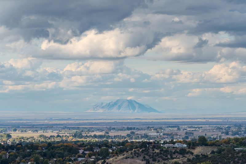
Most of the Snake River Plain is made of runny basalt lava that spread out flat. Big Southern Butte took a very different path.
It’s made of rhyolite, a thick and sticky magma that doesn’t like to flow far. Instead of spreading, it bulged upward into a dome.
Geologists say two lobes of that magma erupted and merged about 300,000 years ago. Together, they built one of the largest rhyolite domes in the world.
That size is a big deal for geology fans. Rhyolite domes are usually much smaller, so this one gets plenty of scientific attention.
The contrast is easy to see, even if you don’t know rock types. The butte looks lighter and more rugged than the dark ground spreading around it.
As the dome pushed up, it also lifted older basalt layers along one side. You can think of it as the butte shrugging the plain onto its shoulder.
For a place that seems so quiet now, it had a dramatic beginning. Every mile of flat farmland nearby makes that story feel bigger.
Obsidian And Ancient Footsteps
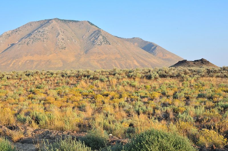
Long before anyone mapped it, people knew this butte held something valuable. Obsidian, the glassy black volcanic rock, came from here.
Obsidian breaks into sharp, clean edges. That made it a prized material for tools and points across many generations.
Archaeological evidence suggests people used the area since the end of the last ice age. That’s roughly 13,000 years of human history around one mountain.
I can’t imagine a better landmark for early travelers. You could see it from far off, and it offered both stone and water.
That long timeline gives the butte a different kind of weight. It isn’t just a scenic bump on the plain.
It’s one of the oldest gathering points in this part of Idaho. Generations shaped their routes and plans around it.
If you visit, treat any rock or artifact with care. Cultural materials on public land are protected, and leaving them in place keeps the story intact.
Looking up at the butte with that history in mind changes the view. Suddenly, the open plain feels far less empty.
Springs That Pulled Wagons Off Course
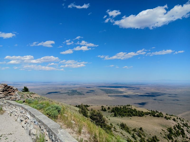
Water is a big deal on the eastern Snake River Plain. Freshwater springs at the base of Big Southern Butte made it a natural stopping point.
In the mid-to-late 1800s, travelers on Goodale’s Cutoff relied on those springs. That route served as a northern alternative to the main Oregon Trail.
Wagons crossing this lava country needed every reliable source they could find. A towering landmark with water at its feet was hard to pass up.
The story didn’t end with wagon trains. Stagecoach lines and later rail travel also used the springs.
An old stagecoach stop, known as Frenchman’s Cabin, sits near the butte. It’s a small reminder of how busy this lonely corner once was.
Today, the plain looks quiet and far from everything. Back then, it was part of a working travel corridor across Idaho.
You can almost trace the logic just by looking at the map. Head for the giant hill, find water, rest, then keep moving west.
Forests Where You’d Least Expect Them
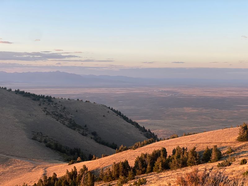
Sagebrush rules the plain below. Climb high enough on Big Southern Butte, though, and the plant life starts to change.
The butte supports lodgepole pine, aspen, and Douglas fir. Those trees feel a little surprising in such dry, open country.
Manzanita grows here too. That shrub adds another unexpected piece to the butte’s plant puzzle.
Height is the big reason for the difference. Upper slopes catch cooler temperatures and hold moisture longer than the flat ground around them.
In a sense, the butte works like a small island in a sea of sage. It creates its own little habitat zone.
That variety also gives photographers more to work with. Green trees against pale rock and distant plains make for strong contrast.
Aspen can bring extra color in fall, before snow returns. It’s one more reason late-season visits appeal to many hikers.
Just don’t expect a shady forest walk the whole way. Much of the route stays exposed, so the trees feel more like a reward than a promise.
One Lane, Lots Of Rocks
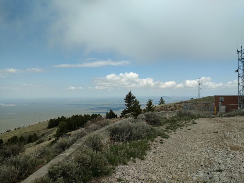
Nobody calls the summit road smooth. It’s a steep, rocky, single-lane BLM road that climbs to the top.
The road was originally built to serve a fire lookout. Over time, it became the main route for hikers, drivers, and anyone chasing the view.
A four-wheel-drive vehicle is strongly recommended for the access roads. That advice matters most closer to the butte, where conditions get rougher.
Since it’s one lane, oncoming traffic deserves real attention. Patience is part of the trip whether you’re driving or walking.
Hikers often treat it like a pick-your-own-adventure route. You can park at different points and climb as far as your legs agree.
Some people start at the bottom and hike the whole way. Others save energy and begin higher on the mountain.
Either way, the surface is loose and uneven. Good boots will treat you much better than sneakers here.
The climb asks for effort, but it pays back in distance. Every turn opens a little more of Idaho below you.
Views That Stretch Across Half A State
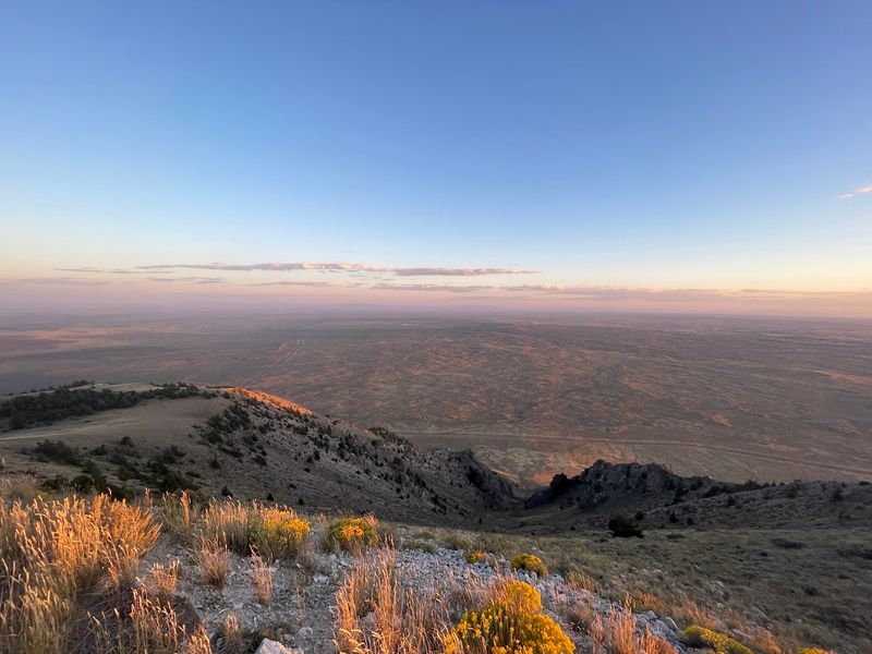
Flat land has one big advantage. When you finally get high above it, nothing blocks your view.
From the summit of Big Southern Butte, the Snake River Plain spreads out in every direction. Distant mountain ranges frame the edges of the scene.
That wide-open panorama is the main reason people make the climb. It’s the payoff for every rocky stretch on the way up.
You’ll also spot the smaller buttes to the east. Seeing them from above helps the whole landscape make sense.
Lava fields, farm country, and range land all mix together below. It’s like looking at a giant, real-life map of eastern Idaho.
Clear days matter for the best results. Haze or smoke can soften the far mountains quite a bit.
Photographers should plan for bright, exposed conditions. A wide lens helps capture just how much ground sits beneath you.
The top also has electronic installations. They don’t take away the view, but they do remind you this peak still has a job.
The Lookout That Watched The Plain
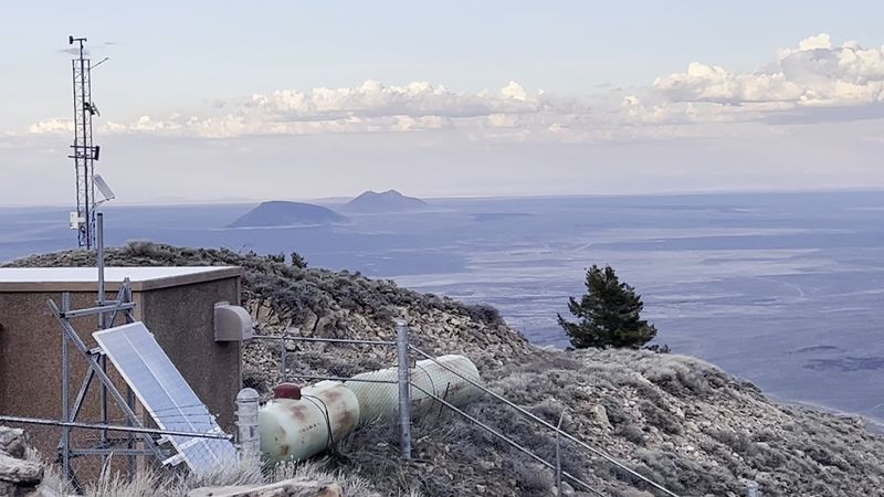
For years, someone kept watch from the top of Big Southern Butte. A fire lookout sat on the summit with a view built for spotting smoke.
It made perfect sense. Few places in eastern Idaho offer such a wide, unbroken look across dry country.
The lookout was last staffed in 2004. It was removed around 2013.
Electronic installations still stand at the summit today. They keep the peak useful in a more modern way.
I like how the butte keeps finding new purposes. First it offered stone, then water, then a watchtower, and now signal space.
If you remember seeing the old lookout, you’re holding a piece of history newer visitors missed. The summit looks different now than it did in earlier decades.
The road that once served lookout crews remains the route up. In a way, every visitor follows their old commute.
Standing where that lookout used to sit, you can see why they chose this spot. Fire watchers rarely got a better seat.
Boots, Saddles, And Binoculars
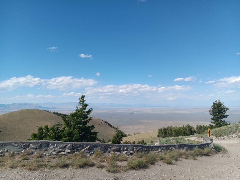
Hiking gets most of the attention here, but it’s far from the only option. Horseback riding is also part of the butte’s list of activities.
Hunters use the area too, so it pays to know the seasons. Bright clothing is a smart choice during fall.
Wildlife viewing is another draw. The mix of sagebrush, rock, and trees creates more habitat variety than the plain alone.
Binoculars are worth packing for that reason. They also help when picking out far-off landmarks from the top.
Photography may be the easiest activity of all. The butte offers big skies, strong shapes, and a landscape that looks different every hour.
For hikers, the flexible road route works well for mixed groups. Stronger walkers can push higher while others pick a shorter goal.
That flexibility helps families and casual explorers. Nobody has to commit to the summit to enjoy the day.
Just remember this isn’t a developed park. It’s open Idaho public land, and a little planning goes a long way.
Cattle Get The Right Of Way
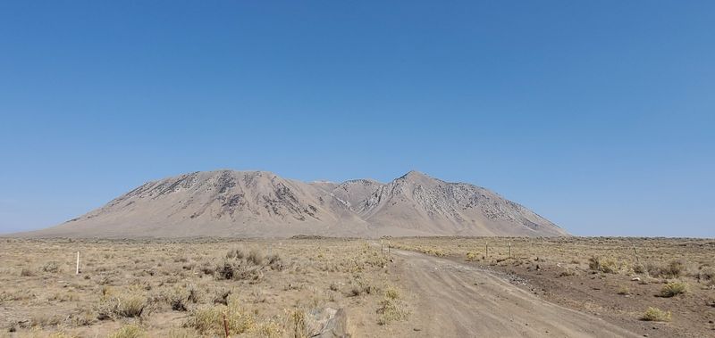
Cows don’t care about your schedule. Around Big Southern Butte, the land is open range, so cattle may share the road.
Visitors should be ready to slow down and yield. A little patience keeps both you and the herd calm.
Rattlesnakes are another possibility, especially in warmer months. Watch where you step and where you put your hands.
Shade is scarce for much of the climb. The sun can feel stronger than expected on exposed slopes.
Bring plenty of water, more than you think you’ll need. There are no reliable public facilities on the butte itself.
Restrooms and basic stops are better found in nearby Atomic City. Plan your breaks before heading out.
A hat, sunscreen, and sturdy boots all make sense here. So does telling someone where you’re going.
None of this should scare you off. It simply means the butte rewards visitors who arrive prepared and respect the land.
Right Now, The Gate Is Shut
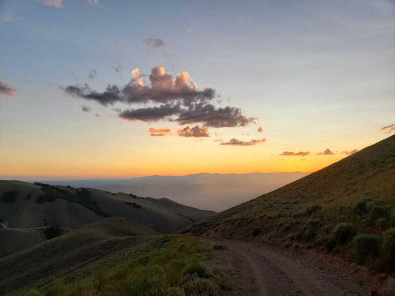
Timing matters more than usual this year. The road to the summit of Big Southern Butte is temporarily closed to vehicles.
Severe rainstorms caused heavy damage, including displaced boulders and serious erosion. Those conditions left the road impassable.
For safety, the BLM secured the gate at the base of the butte. It stays closed until repairs are finished.
The agency plans to share updates once the road reopens. Checking with the BLM before any trip is the smart move.
Hiking may still be possible to certain points where it’s safe. Even so, damaged sections call for real caution.
Loose rock and washouts can be tricky on foot too. Turning back early is always a reasonable choice.
Questions can go to the BLM Upper Snake Field Office at 1405 Hollipark Drive, Idaho Falls, Idaho 83401. They manage the area and track its condition.
Closures are frustrating, but they won’t last forever. The butte has waited 300,000 years, so a little longer won’t hurt.
Finding The Right Way In
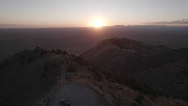
Getting close takes some map work. Access mainly comes from Arco or Atomic City.
From Atomic City, travelers can take Highway 26 to Main Street, also called Taber Road. From there, a right turn leads onto gravel road W 1600 N.
That route curves around the north side of the butte. It heads toward a landing strip and the uphill road.
From Arco, routes use County Road 300 North, also known as the Arco OHV Route. Either approach involves rough backcountry driving.
Here’s the important part for anyone using a phone map. Public access generally isn’t available from the east or north sides.
Routes from Highway 20 may lead through the Idaho National Laboratory site. That land is closed to the public.
Download maps ahead of time, since signal can be spotty. A four-wheel-drive vehicle is strongly recommended near the butte.
Fill your gas tank before leaving town too. Out here, the butte is close in view but far from services.
Best Months For The Climb
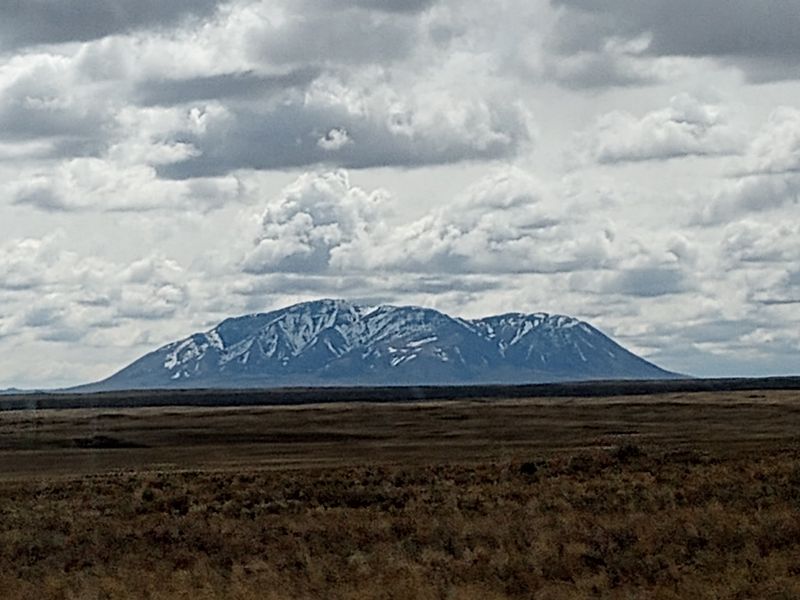
Snow decides a lot on this mountain. The usual season for visiting runs from about mid-May through October.
Exact timing depends on snow levels and road conditions. Late storms can push things back in spring.
Early summer tends to bring greener slopes. That’s also when warmer weather can wake up rattlesnakes.
Midsummer heat can be tough on an exposed climb. Starting early in the day helps beat the hottest hours.
Fall can bring cooler air and aspen color on the slopes. It also overlaps with hunting seasons, so stay visible.
Winter is a different story for most visitors. Snow and rough roads make the butte a better view from the highway.
This year, the road closure adds another layer to planning. Check with the BLM before setting any date.
Once it reopens, a clear-weather day is the ticket. That’s when the views across Idaho really earn their reputation.
Worth The Dust On Your Tires
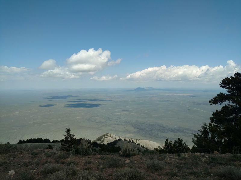
Some landmarks shout for attention with signs and gift shops. Big Southern Butte just stands there and lets the plain do the talking.
It offers a rare mix of deep geology, ancient history, and wide-open views. Few places in Idaho pack that much story into one lonely hill.
It suits hikers who like a challenge and drivers comfortable on rough roads. History fans and rock lovers will find plenty to think about too.
It’s less ideal for anyone wanting paved paths or restrooms. Comfort comes from preparation, not amenities.
Right now, patience is part of the plan. The summit road needs repairs before vehicles can climb again.
In the meantime, the butte still makes a great roadside landmark. Spotting it from Highway 26 never really gets old.
When the gate opens, pack water and a sense of adventure. The top of this volcanic dome is waiting.
And the next time someone asks about that big hill out by Arco, you’ll have an answer.