
Discover 10 Remote Spots In Virginia And How To Reach Them
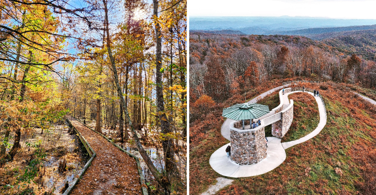
In one corner of Virginia, a lake sits so deep inside a swamp that the road in runs just inches above the water.
Four miles of it. One lane. Almost perfectly straight.
Now here’s the twist.
Elsewhere in the state, you can hike to a maze of sandstone channels on a mountaintop, or ride a ferry to an island where narrow streets replace highways.
Some spots skip private cars entirely, so you walk, bike, paddle, or catch a tram.
Your GPS might shrug at a few of these. Your legs might grumble at others. But each trip ends somewhere few people bother to find.
How far are you willing to go?
1. Tangier Island
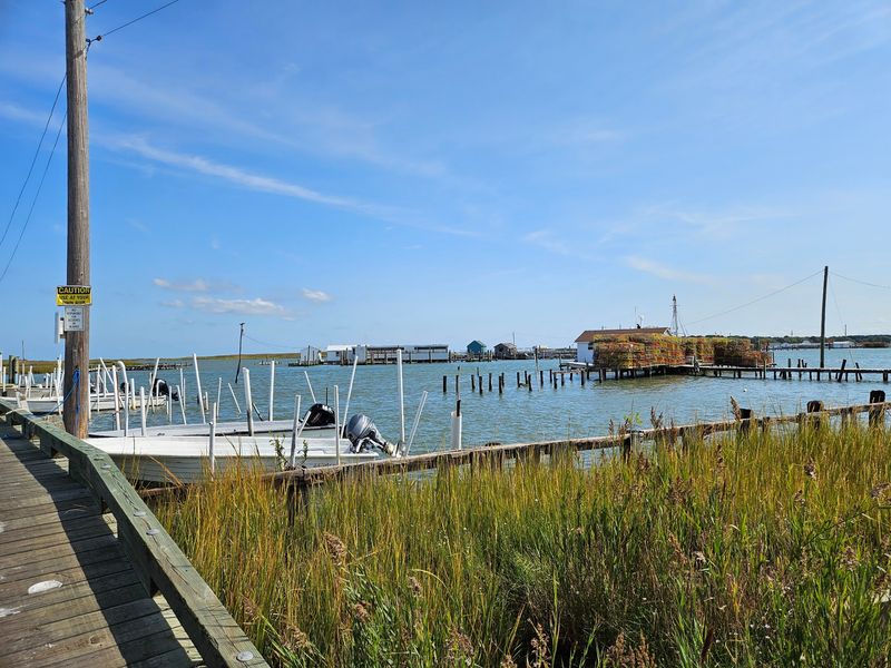
Leave your car keys at home, because they won’t help you here. Tangier Island sits out in the Chesapeake Bay, and you reach it by boat or small aircraft.
The crossing is part of the experience. Passenger cruises depart seasonally from Crisfield, Maryland, and Reedville, while private charters offer another option.
The Onancock passenger ferry is currently suspended, so check which departure point is operating before planning your trip. Boats also depend on weather and seasonal schedules.
When the harbor comes into view, the island’s narrow streets and low houses look entirely different from a mainland resort.
Golf carts, bicycles, and walking are common ways to get around. You can rent a golf cart or join a local tour to cover more ground.
The island’s working waterfront is closely tied to Chesapeake Bay seafood. Stop for a meal, browse small shops, and explore the Tangier History Museum to learn about the community’s maritime traditions.
A public beach adds a sandy place for a relaxed afternoon.
A few inns and vacation accommodations allow longer visits, especially if you’d rather enjoy the island after the sightseeing boats depart. For a day trip, keep a close eye on the return sailing rather than assuming boats run throughout the evening.
2. False Cape State Park, Virginia Beach
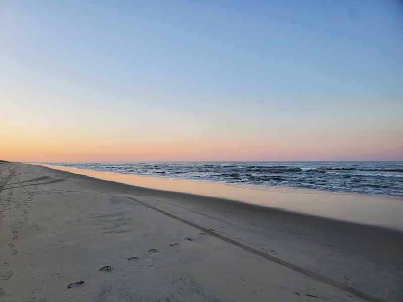
Here’s a beach that refuses to let you park next to it. False Cape State Park lies beyond the reach of private cars, which helps preserve its quiet shoreline.
To reach it, start near Back Bay National Wildlife Refuge and continue on foot or by bicycle, or reserve a guided tram trip.
Experienced paddlers can also approach by water. From April through October, one of the refuge’s two interior dike trails generally opens for walking and cycling. From November through March, the interior trails close, leaving the beach route or water access.
The reward is almost six miles of Atlantic coastline bordered by dunes, maritime forest, and marsh habitat.
There are hiking routes through several landscapes, plus chances to spot migrating birds. The historic Wash Woods area is included on some tram excursions.
Primitive camping is available by advance reservation, but reaching a campsite requires carrying supplies over a substantial distance.
Overnight campers use designated parking at Little Island City Park rather than the refuge lot. Drinking water is available at certain Barbour Hill sites, not throughout the park.
Bring water, sun protection, and insect repellent even for a day visit. The park opens from sunrise to sunset, and refuge travelers must complete their return before dusk.
For the park address, use 4001 Sandpiper Rd, Virginia Beach, VA 23456; day-use access begins near the refuge visitor center.
3. The Channels Natural Area Preserve, Saltville
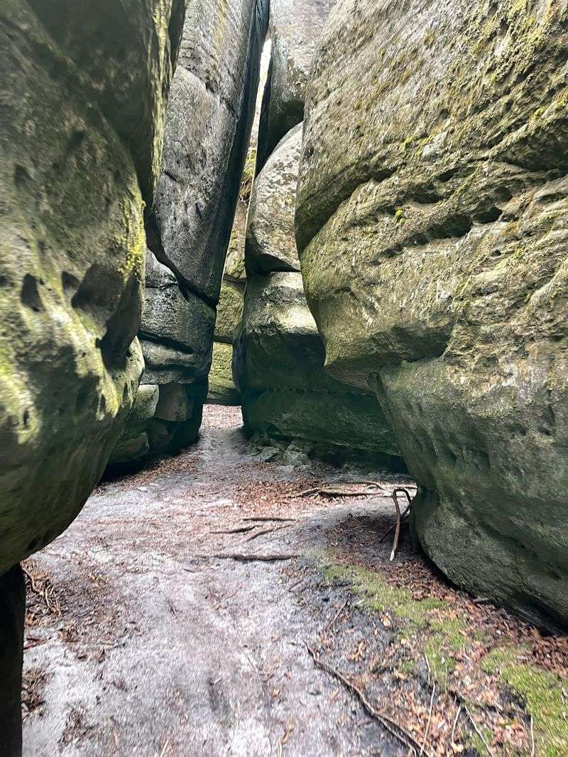
Somewhere on a Southwest mountain ridge, sandstone splits into a maze of narrow passages.
The Channels Natural Area Preserve turns that geology into one of the region’s most unusual hiking goals.
Start at the small parking area on Hayters Gap Road, near the Washington and Russell county line. The preferred route follows the Brumley Mountain Trail for about three and a half miles each way.
The uphill walk includes rocky, uneven sections, so allow enough time for a seven-mile round trip and a careful exploration of the rocks.
At the top, towering blocks of ancient sandstone form corridors and shadowy gaps. The rock itself formed roughly 400 million years ago; much later, natural processes opened the cracks that make the formation resemble a stone maze.
It’s tempting to wander from passage to passage, although staying mindful of the route back matters.
Forest surrounds the approach, with seasonal wildflowers and views along the ridge. The preserve lies within Channels State Forest, where hiking is permitted from dawn until dusk.
Camping and driving beyond gated forest roads aren’t part of a visit here.
Only ten vehicles fit in the main trailhead lot, and roadside parking along Route 80 isn’t permitted. There are no restrooms or trash bins, so bring supplies and carry everything back.
Begin at 4250 Hayters Gap Rd, Saltville, VA 24370, the trailhead’s navigation address.
4. Devil’s Bathtub, Duffield
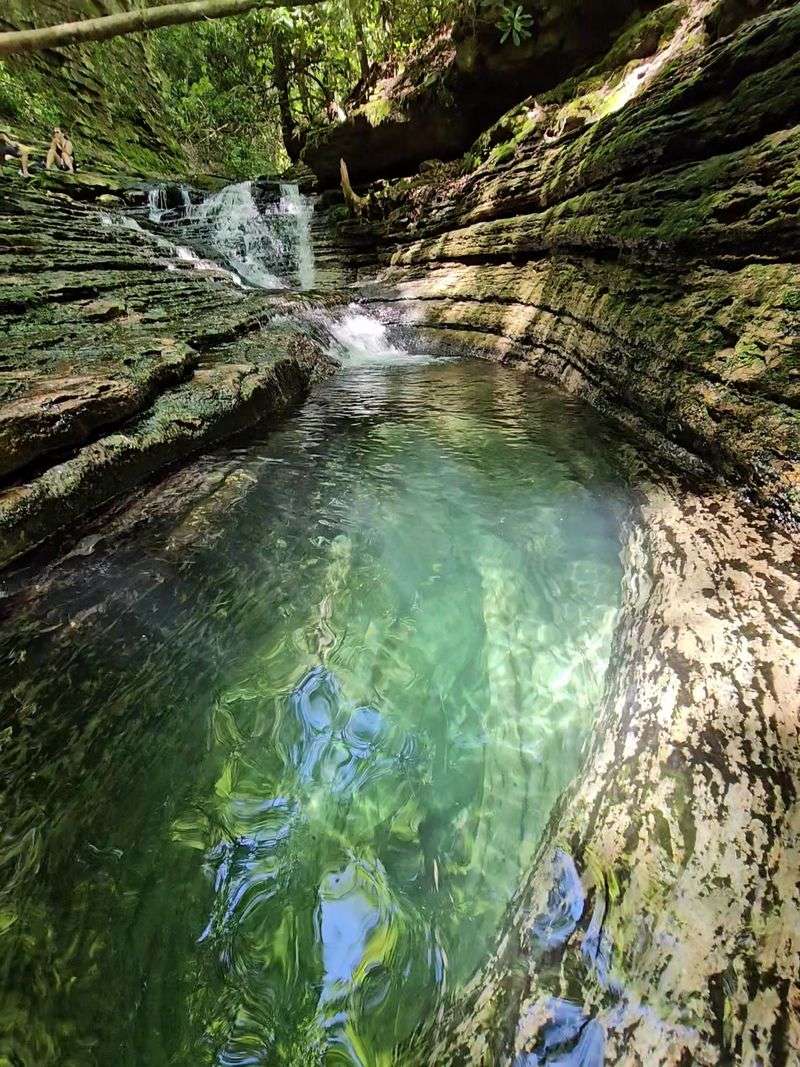
Despite the spooky name, this swimming hole looks more like candy than trouble.
Devil’s Bathtub holds blue-green water that can resemble a blue Jolly Rancher on a sunny day.
The pool sits along Devils Fork in the mountains near Duffield, framed by smooth rock and a small cascade. But reaching that brilliant water is a real hike, not a short stroll from the parking area.
The Devils Fork Trail forms a rugged loop of roughly seven miles, with steep sections and more than ten creek crossings without bridges.
Water levels change with rainfall, and the route can become difficult when the stream rises. Check the forecast, wear footwear with reliable grip, and allow plenty of daylight.
The creek crossings are part of the adventure, but they’re also a reason to take the route seriously.
The trail winds through hardwood forest and passes smaller waterfalls before reaching the distinctive basin.
The color is especially striking where sunlight reaches the clear water and pale rock beneath it. Pause for the scenery, then retrace your steps or follow the marked loop according to your plan.
Parking at the trailhead is limited. The access road can be rough, with a higher-clearance vehicle helpful for the final approach. Carry drinking water and a map for the backcountry stretch.
Reach the Devils Fork trailhead via Route 619 north of Fort Blackmore, near Duffield, VA 24244.
5. Mount Rogers National Recreation Area, Marion
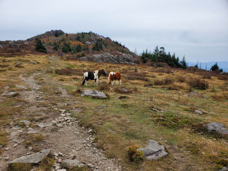
Big is an understatement for this mountain landscape. Mount Rogers National Recreation Area spreads across roughly 200,000 acres and surrounds the highest summit in Virginia.
Start at the Pat Jennings Visitor Center on Route 16 near Marion. It’s a useful first stop for maps, trail information, and choosing which part of this enormous forest fits your plans.
The recreation area offers mountain meadows, trout streams, thick woods, and more than 400 miles of trails.
The Appalachian Trail crosses high country here, winding through open ridges and spruce-fir forest.
Mount Rogers rises to 5,729 feet, although the summit itself is wooded rather than an open overlook. Much of the best scenery appears on the surrounding approach trails.
There are shorter walks as well as full-day hikes, plus opportunities for horseback riding, fishing, and camping.
Campground schedules and access vary with the season, so choose a specific destination before driving deep into the forest. Mountain roads can be narrow, and some forest routes are gravel. Taking it slowly leaves more time for unexpected scenery.
The Pat Jennings area also offers a short nature trail and picnic opportunities. It’s a convenient way to get acquainted with the region before deciding whether to spend your afternoon hiking or touring the mountain roads.
For the visitor center and a sensible starting point, follow 3714 Highway 16, Marion, VA 24354.
6. Lake Drummond
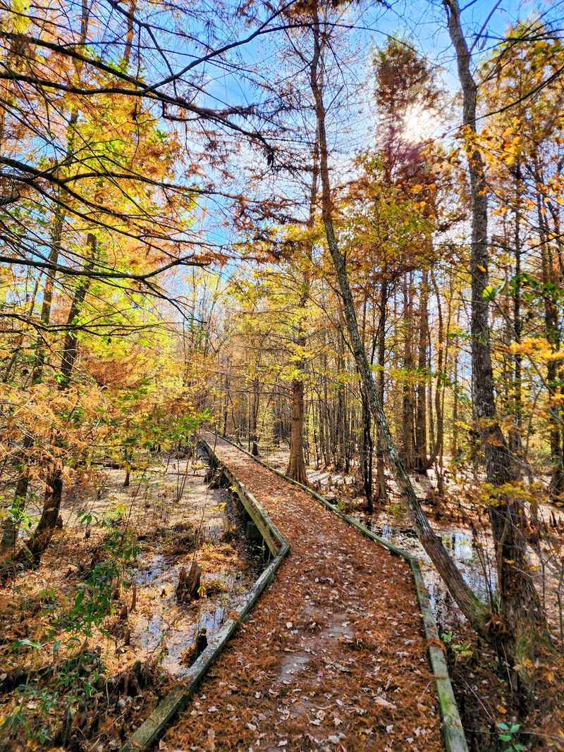
A lake in the middle of a swamp sounds like a legend, yet this one is real. Lake Drummond sits deep inside Great Dismal Swamp National Wildlife Refuge.
One of the most interesting ways in is the Lake Drummond Wildlife Drive. From the Railroad Ditch entrance near Suffolk, a narrow gravel road runs six miles toward the shore.
Water-filled ditches and wooded wetlands accompany the drive, with boardwalk stops along the way for birdwatching and glimpses of swamp wildlife.
The lake is broad but surprisingly shallow, its dark, tea-colored water reflecting bald cypress trees and open sky.
You can watch from the lakeside piers or launch an appropriate boat for fishing and quiet paddling. A permit is required for vehicle access, and the drive’s gate hours change with the seasons.
There’s a second way to approach the water. Paddlers can travel through the Feeder Ditch from the Dismal Swamp Canal, subject to water conditions and access arrangements.
The primitive recreation site near the lake is reached by water and is managed separately from the refuge.
Overnight camping isn’t permitted within the refuge itself, so plan the lakeside visit as a daytime outing unless you’ve arranged an authorized alternative.
Bring supplies, use a reliable map, and allow time for the slow gravel-road return. Enter the wildlife drive at 3120 Desert Rd, Suffolk, VA 23434.
7. Breaks Interstate Park
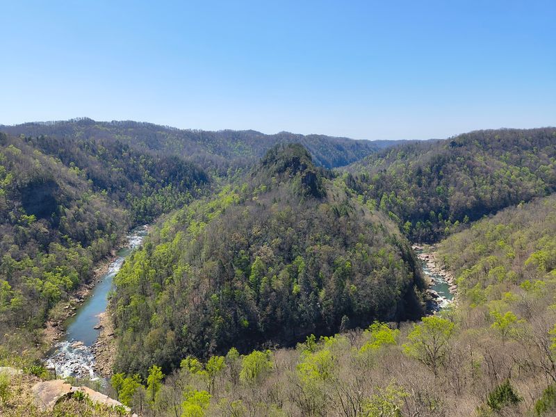
No shortcut leads here, and that’s part of the appeal. Breaks Interstate Park centers on a dramatic five-mile gorge along the Virginia-Kentucky border.
Winding mountain roads bring you to a remarkable landscape carved by the Russell Fork River.
The canyon reaches impressive depths, with wooded slopes and rocky outcrops opening onto enormous views. Several overlooks are reachable by road, so you can enjoy the scenery even without committing to a lengthy hike.
If you want to stretch your legs, choose among the park’s marked trails. Some descend toward the river, while others follow the rim.
Pick a route that fits your experience, because the terrain ranges from gentle woodland walks to steep, uneven stretches.
There is far more to do than look over a railing. The park offers camping, cabins, lodge accommodations, picnic areas, and a seasonal waterpark.
Canoeing and kayaking are available in appropriate conditions, while the Russell Fork attracts skilled paddlers to its challenging rapids.
Families can add playground time or a picnic overlooking the mountains. The visitor center covers the region’s natural and cultural history, making a useful indoor stop between outdoor activities.
The entrance gates operate throughout the year, although some facilities follow seasonal schedules and access can change with weather.
Give yourself time to enjoy the drive rather than rushing through every curve. Use 627 Commission Cir, Breaks, VA 24607, for the park entrance.
8. High Knob Lookout Tower, Norton
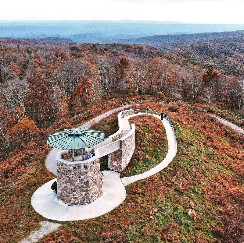
Who knew a mountaintop view could come with a ramp? High Knob Observation Tower near Norton has a gently rising walkway that helps more people reach its stone viewing platform.
The tower stands around 4,223 feet above sea level, with mountain ridges spreading in several directions.
On particularly clear days, the panorama can reach across portions of five states. Instead of a strenuous summit hike, you can drive much of the way and take a short path from the nearby parking area.
The road climbs through forested high country. From Norton, follow the High Knob route toward Forest Road 238 and the signed turn for the tower.
Curves and changing mountain weather encourage an unhurried approach, especially when clouds hang over the higher elevations.
Once at the platform, take time to study how the ridges overlap. The surrounding landscape includes valleys, forested slopes, and the distinctive terrain of the Cumberland Mountains.
A camera is useful, but the wide view is just as good enjoyed without one.
Several hiking routes are nearby, including trails connected with the High Knob recreation area. Combine a short tower visit with a longer woodland walk if you want an active afternoon.
Pack water and consider stopping for facilities before the summit drive. For navigation, seek High Knob Observation Tower via Forest Road 238 near Norton, VA 24273.
9. Whitetop Mountain
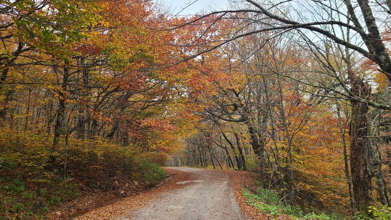
Virginia’s second-highest peak lets you cheat a little on the climb. Whitetop Mountain offers a drive-up approach to high mountain scenery, with broad views close to the road.
Forest Road 89 climbs from the Whitetop Road area toward the summit.
The route is gravel and can become difficult in wet or winter conditions, so check whether it’s passable before making the trip. A higher-clearance vehicle is a sensible choice when conditions are uncertain.
At approximately 5,525 feet, the mountain rises above a landscape of open meadows, spruce-fir forest, and distant ridgelines.
The summit has communication installations, but the surrounding overlooks and trails are the real reason to come. Mountain breezes and shifting clouds can make the scene look different from one hour to the next.
The Appalachian Trail crosses the high country nearby. For a longer outing, the route toward Buzzard Rock opens up more mountain scenery, with exposed sections and views over the valleys below.
Follow established paths to protect the fragile plants growing in this high-elevation habitat.
A quick visit can become a leisurely afternoon if you bring a picnic and make time for the changing light. Layers are useful even in summer because the mountaintop can feel much cooler than the roads below.
Use Whitetop Mountain, Grayson County, VA 24292, as your destination, then follow signs toward Forest Road 89.
10. Sounding Knob Fire Tower, Monterey
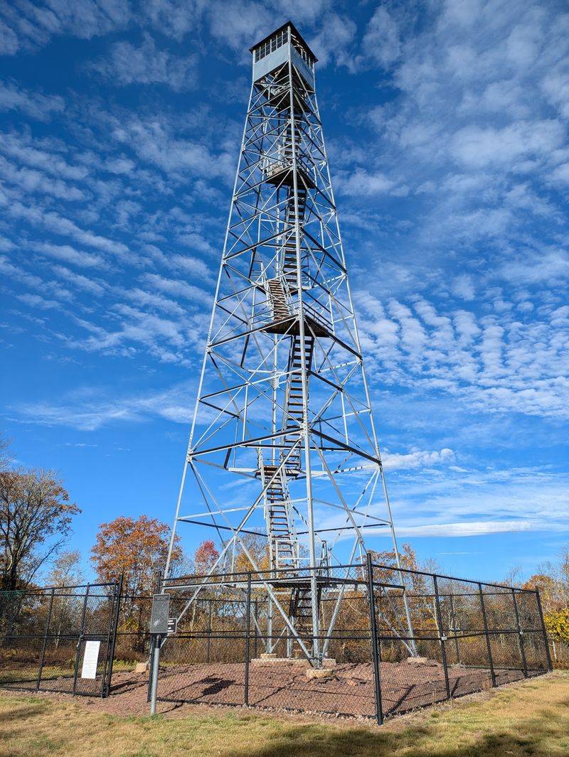
Here’s a fire tower you can practically park beside.
Sounding Knob Fire Tower overlooks the Allegheny Highlands near Monterey, with a gravel approach leading close to its base.
Highland County is among the state’s most sparsely populated places, and the winding roads already feel like the start of an adventure.
From Route 250, follow Sounding Knob Road for approximately 1.3 miles to reach the tower area. The gravel surface has drainage dips, so approach slowly if you’re driving a low-clearance car.
The original tower was constructed in 1934 by the Civilian Conservation Corps. After being dismantled and moved from its earlier site, it was restored and reassembled here in 2017.
Today it welcomes sightseers for wide-ranging mountain views. Reaching the top involves climbing more than 100 steps, so allow yourself time to climb and enjoy the panorama.
From above the treetops, you can see valleys, farms, and folded ridges extending across the surrounding highlands.
Autumn brings a particularly colorful landscape, while clear summer mornings reveal layers of distant mountains. The narrow stairway gives the arrival a little extra sense of achievement.
The tower is open year-round from sunrise to sunset. There are no amenities at the site, making Monterey a practical place for a restroom break or supplies before heading uphill.
Find the access road on Sounding Knob Rd, Monterey, VA 24465.