This Kentucky Stone Arch Marks Where Cherokee Families Waited During A Brutal Winter On The Trail Of Tears
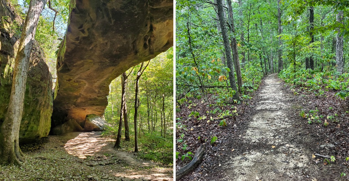
A sandstone arch 188 feet long stands in the woods of western Kentucky. It’s the largest freestanding arch east of the Mississippi River, and most people have never heard of it.
That alone would earn it a road trip. But in the winter of 1838 and 1839, about 1,766 Cherokee people waited nearby for roughly two weeks.
They were stuck on the Trail of Tears, and the frozen Ohio River blocked their path. I can’t imagine that kind of cold, or that kind of waiting.
Today you can walk part of the same old roadbed they traveled. A quiet forest trail can carry so much weight.
What does it feel like to stand beneath that stone today?
A Stone Bridge So Big It Holds A Record
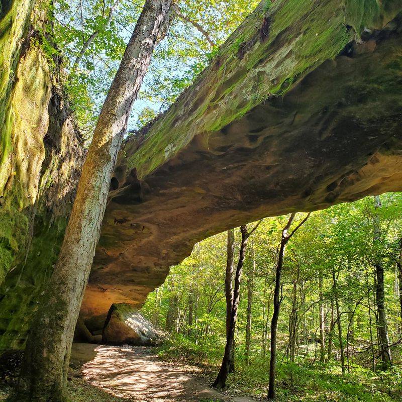
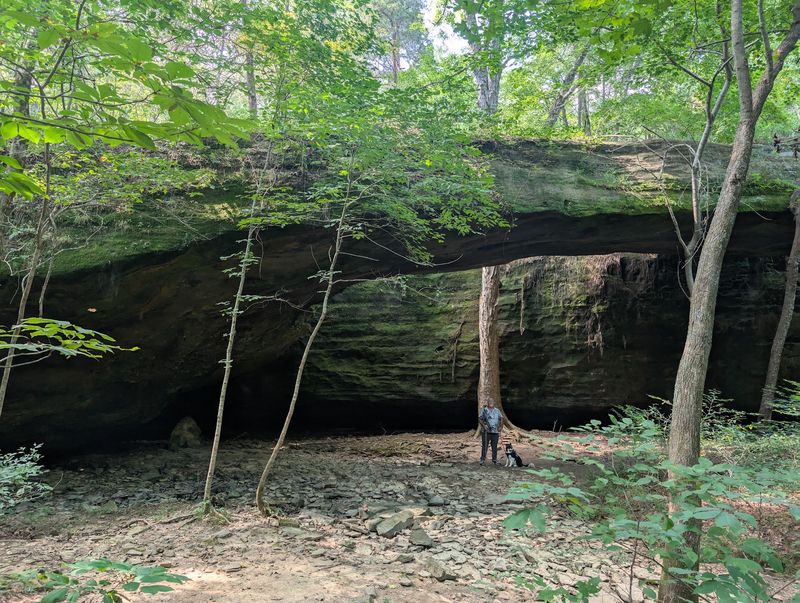
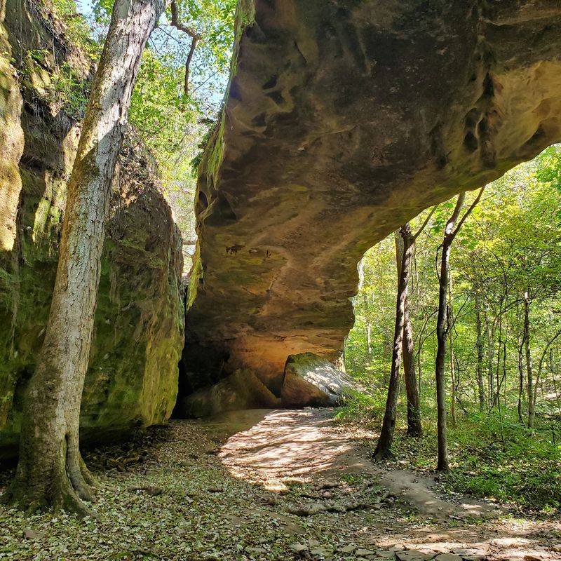
Mantle Rock Nature Preserve is home to a sandstone giant that stretches 188 feet long. It rises 30 feet high, which is roughly the height of a three-story building.
Many people call the spot Mantle Rock Preserve for short. Either name leads you to the largest freestanding arch east of the Mississippi River.
That’s a big title for a rock most travelers drive right past. The arch sits in Livingston County, in a quiet corner of western Kentucky.
Geologists say it formed from the Pounds Sandstone Member of the Caseyville Formation. Weathering and erosion slowly carved it over a very long time.
Up close, the stone tells its own story. You can spot honeycomb weathering, crossbedding, and joints running through the sandstone.
Honeycomb weathering looks like tiny pockets scooped out of the rock. Crossbedding shows tilted layers left behind by ancient moving water and sand.
Bring a camera, but also bring some patience. Photos rarely capture how long the span really feels when you stand under it.
Step back a few paces and look at the whole curve. That’s when the scale finally sinks in.
Point your GPS to 1800 Lola Road, Smithland. Some maps also list it on Mantle Rock Road, so look for the trailhead marker as you get close.
The Frozen River That Changed Everything
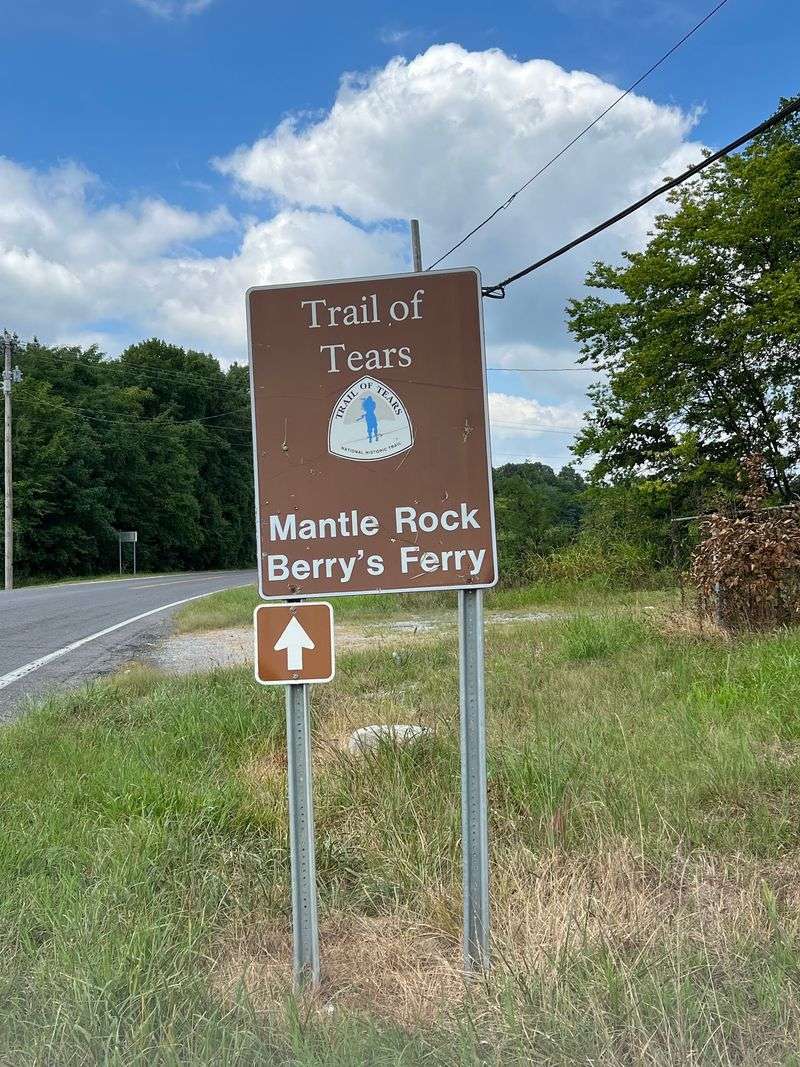
Ice did what no road could. During the harsh winter of 1838 and 1839, the Ohio River froze and stopped the Cherokee in their tracks.
They were being forced west on the Trail of Tears. Their route needed Berry’s Ferry to cross from Kentucky into Golconda, Illinois.
About 1,766 Cherokee people from the Peter Hildebrand Detachment spent around two weeks near Mantle Rock. They had to wait until the river became passable again.
That same winter, more than 10,000 Cherokee from 11 detachments passed through the wider area. Each group faced the same bitter cold and the same uncertain wait.
Here’s a detail many people get wrong. The space directly under the arch is not large enough to hold thousands of people.
Instead, the surrounding bluffs and smaller rock shelters likely offered refuge. The whole landscape served as a hard, cold waiting room.
Knowing this changes how the place feels. The arch is beautiful, but it also marks a painful chapter in American history.
Take a moment to read the trail signs slowly. They help connect the stone you see with the families who once stood nearby.
Your Feet Can Follow The Original Roadbed
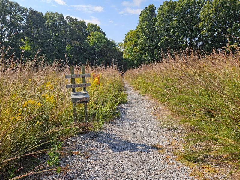
History usually stays behind glass. At this preserve, part of it sits right under your shoes.
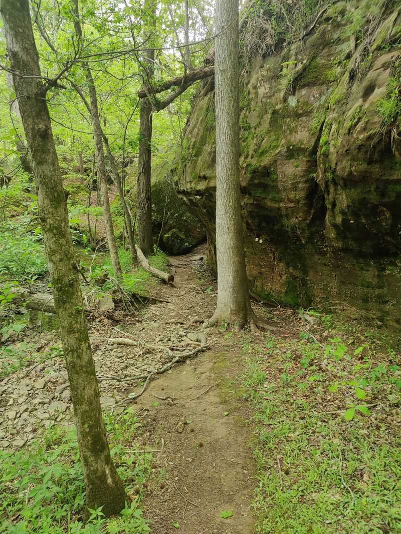
A section of the hiking trail follows the original roadbed the Cherokee traveled during their forced removal. It’s one of those details that makes you slow down without being asked.
The preserve is a certified site on the Trail of Tears National Historic Trail. The National Park Service recognized it, and it joined the National Register of Historic Places in 2004.
In 2010, the National Park Service and The Nature Conservancy teamed up for an upgrade. They unveiled new exhibits and a retracement hiking trail focused on this history.
Outdoor exhibits now line the route. They guide you through the journey in clear, simple steps as you walk.
Pace yourself here. Reading each sign takes only a minute, and together they build a full picture.
Families with kids might turn it into a quiet history lesson. Ask what it might feel like to walk this road in freezing weather.
That small question can stick with young hikers. It often sticks with grown-ups too.
Pick Your Path, Short Stroll Or Full Loop
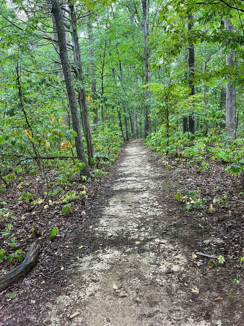
Good news for every kind of hiker. You get two ways to reach the arch, and both are rated easy.
The shorter option is less than a mile round trip. It heads more directly to Mantle Rock, so it’s great when time or energy runs low.
The full loop runs about 2.75 miles. It winds through hardwood forest and along ancient roadbeds, with no huge climbs.
Here’s a fun bonus for loop fans. Taking the longer route brings you to the arch from a different angle.
Think of it like meeting a famous landmark from the side door. The surprise reveal is half the charm.
The trail still has some uneven spots and rocks to step over. Sturdy shoes make the walk far more pleasant.
Plan for the season too. Hot summer days can drain you faster than the distance suggests.
Cooler months often feel kinder for the full loop. Just remember that wet weather can turn low spots muddy, so pack accordingly.
A Waterfall With A Secret Room Behind It
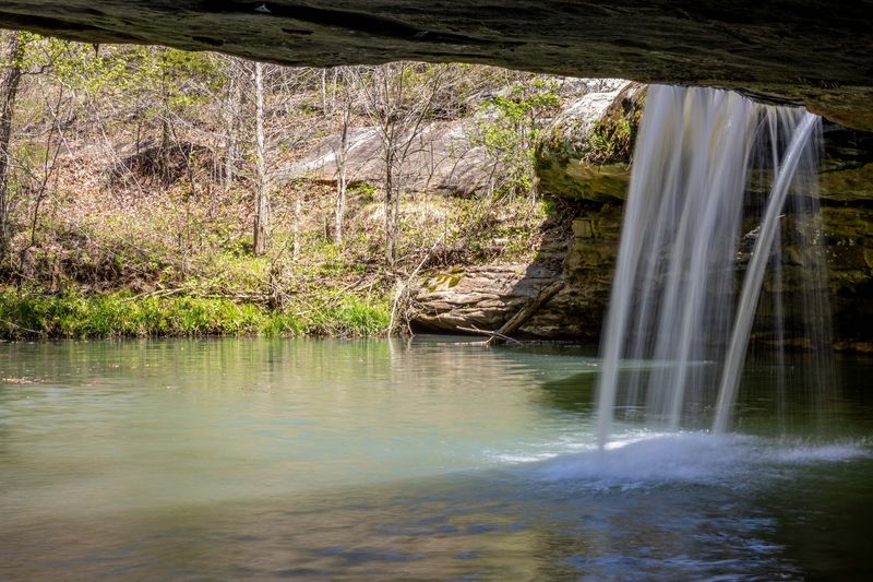
Joy Falls might be the best plot twist on the loop. This spring-fed waterfall drops about 20 feet over the rock.
Even better, a shelter cave sits behind it. Few trails in western Kentucky can offer that kind of surprise.
Timing matters with this one. Water flow depends on rainfall, so the falls can shrink to a trickle during dry spells.
Visit after a good rain for the best show. The creeks fill up, and the whole area feels livelier.
The loop also hides small slot canyons and sheer bluff walls. Each one shows a different side of the area’s sandstone.
A rock-lined stream adds more charm along the way. It’s a lovely place to pause and catch your breath.
Remember that rock climbing is not allowed anywhere in the preserve. The bluffs look tempting, but the rules protect fragile habitat.
Admire the cave from the trail and take your photos there. Your camera gets the shot, and the rocks stay safe.
Cactus In Kentucky? Yes, Really
Most folks don’t pack the word cactus for a Kentucky hike. Yet prickly pear cactus grows right here on the preserve.
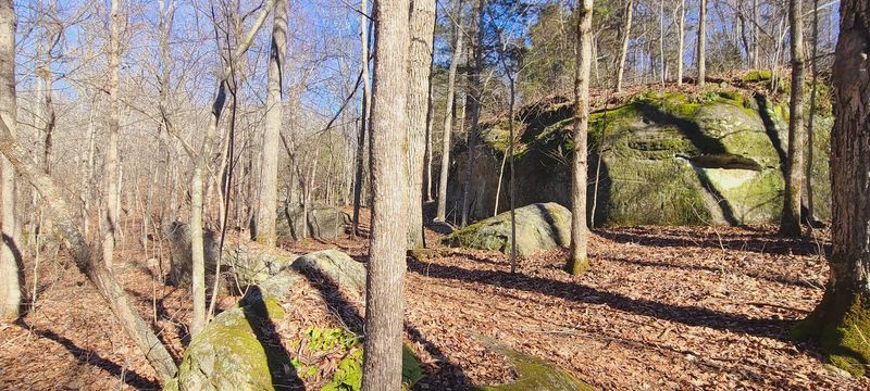
It thrives in the area’s sandstone glades. These open, rocky patches rank among the best examples of their kind in the state.
The glades are rare and fragile. That’s a big reason The Nature Conservancy bought the property in 1988.
Rare plants also call this place home. Look for June grass and Buckley’s goldenrod in the right season.
Spring brings a different kind of showstopper. Wildflowers pop up across the forest floor, adding bright color to the shady woods.
Bird watching is another welcome activity here. Bring binoculars and give the treetops some attention.
Because these plants are delicate, stay on marked trails. A single shortcut can crush something that took years to grow.
Leave No Trace rules apply too. Pack out everything you bring, and let the cactus keep its spot in the spotlight.
Know The Rules Before You Lace Up
Some places have long rule lists for no clear reason. These rules exist to protect a fragile landscape, and they’re easy to follow.
Camping, rock climbing, horseback riding, and mountain biking are all off limits. ATVs are not allowed either.
Dog owners, take note before you load up the car. Pets are not permitted on the trails.
Wheelchairs are allowed in pedestrian-accessible areas. Other power-driven mobility devices generally are not.
The preserve is open daily from sunrise to sunset. Even so, trails may close temporarily during prescribed fire seasons.
Those burns usually happen from February to April and October to November. The Nature Conservancy posts updates on its Facebook and Instagram pages.
Check those pages before you head out. It’s a quick step that can save you a wasted drive.
Also plan for no restroom facilities on site. Take care of that before arriving, and your hike will feel much more relaxed.
Pack Smart, Because The Woods Won’t Text Back
Cell service around the preserve can be spotty. Download directions ahead of time, and tell someone your plans.
Water and snacks belong in your bag, even for the short route. Summer heat can make a gentle walk feel longer.
Ticks are part of the deal in these woods. Long pants and a quick check after your hike help a lot.
Poison ivy grows here as well. Learn its three-leaf look before you go, and keep hands off unknown plants.
Snakes may also share the trail. Watch where you step, especially around rocks and fallen logs.
Good shoes really matter on this hike. Rocky sections and muddy patches can test flimsy sneakers.
Dress for the weather and the season. A light rain jacket can be a smart extra in spring.
None of this should scare you off. A little preparation simply lets you focus on the arch, the creek, and the history.
Plot Your Route To This Quiet Corner Of Kentucky
Getting here feels like a mini adventure on its own. The preserve sits near the Illinois-Kentucky border in Livingston County.
Mantle Rock Preserve is about 45 minutes north of Land Between the Lakes National Recreation Area. That makes it an easy add-on for a lakes vacation.
History fans can also think about the river crossing. Golconda, Illinois, sat on the other side of Berry’s Ferry during the Cherokee removal.
Seeing both sides can round out the story. The river suddenly feels like a real obstacle, not just a line on a map.
The setting is rural and peaceful. Expect forest, quiet roads, and plenty of room to think.
Plan to spend an hour or a few, depending on your route. Either way, Mantle Rock Nature Preserve offers a rare mix of geology and history.
Leave a little time for reflection at the end. Places like this deserve it.