Before Driving To This Idaho Waterfall This Fall, Know The Road Closes For Winter
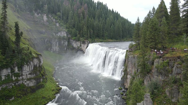
Autumn in eastern Idaho runs on a timer that most drivers never notice until the gate is already down. One scenic road near the Wyoming line carries you to a river that drops ten stories into a canyon of old volcanic rock, then quietly shuts to cars once the snow piles up.
This year, a big renovation project adds a second wrinkle to the plan. Knowing both before you fuel up can turn a wasted drive into a golden afternoon.
A Ten-Story Drop Near Ashton
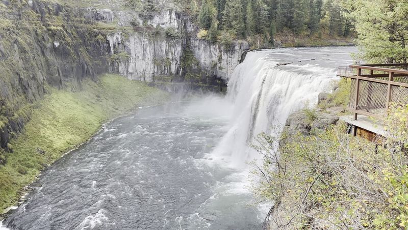
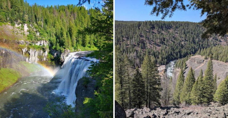
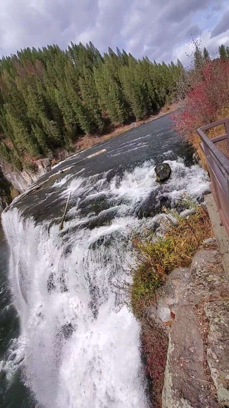
Sixteen miles northeast of Ashton, the Henrys Fork of the Snake River runs out of flat ground and falls off the edge. Upper Mesa Falls plunges about 114 feet, roughly the height of a ten-story building, and stretches close to 200 feet wide from bank to bank.
The falls sit inside the Caribou-Targhee National Forest in Fremont County, a corner of eastern Idaho better known for potato fields, fly fishing and the long road toward West Yellowstone. Plenty of travelers stumble onto it as a detour, then end up lingering for an hour or more once they hear the roar from the parking lot.
A smaller sibling waits downstream. Lower Mesa Falls tumbles through a series of cascades totaling around 65 feet, so one scenic drive delivers two very different waterfalls.
Getting there this fall takes more planning than usual, though. The road that leads in closes to cars for winter, and the Upper Mesa Falls Recreation Area itself shut down in August 2026 for a major renovation.
The sections ahead cover what makes the place worth the trip, plus the timing details that keep you from driving to a locked gate.
Born From Ancient Volcanic Ash
Roughly 1.3 million years ago, the ground here blew apart. An enormous eruption from the Henrys Fork Caldera spread a thick blanket of ash across the region, and that ash hardened into a rock layer geologists call Mesa Falls Tuff.
The river has spent the ages since then carving through it. Stand at the rail and you are looking at a slice of that ancient eruption, stacked in layers the water keeps grinding away one season at a time.
Interpretive signs along the Mesa Falls Scenic Byway explain the story, and they deserve a few minutes of reading before you reach the overlook. Kids who shrug at waterfalls tend to perk up when they learn the cliff under their feet came from a supervolcano.
The whole byway doubles as an outdoor geology lesson, so plan for stops.
For your map app, the official address is simply listed as Idaho, which is not much help. Aim instead for the Upper Mesa Falls turnoff on Idaho Highway 47, part of the scenic byway between Ashton and U.S. 20 near Harriman State Park.
The paved route runs about 28 miles, with viewpoints scattered along the way.
Where The Henrys Fork Runs Free
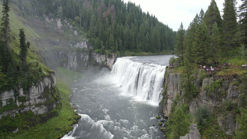
Most big rivers in Idaho work for a living. They spin turbines, fill canals and water crops across the Snake River Plain, which is why an untamed waterfall has become rare.
Upper and Lower Mesa Falls stand out as the last major waterfalls in the state, and in the entire Columbia River basin, untouched by irrigation or hydroelectric projects. No dam or diversion sits at the falls themselves, so the drop looks much as it has for thousands of years.
That shows up in the sound. The Henrys Fork arrives wide and calm, then tips over the lip in a thick curtain that sends a low rumble through the canyon.
Visitors often mention feeling the cool mist on their faces from the closest platforms.
Fall brings its own mood to the river. The air sharpens, weekday crowds thin out, and travelers who came in early October have described the trip as well worth it.
Bring a light jacket, because that spray can chill quickly on an autumn morning.
For eastern Idaho families who grew up passing canal gates and reservoirs, seeing a river behave the way nature intended feels like a small history lesson with a soundtrack.
Boardwalk To The Brink
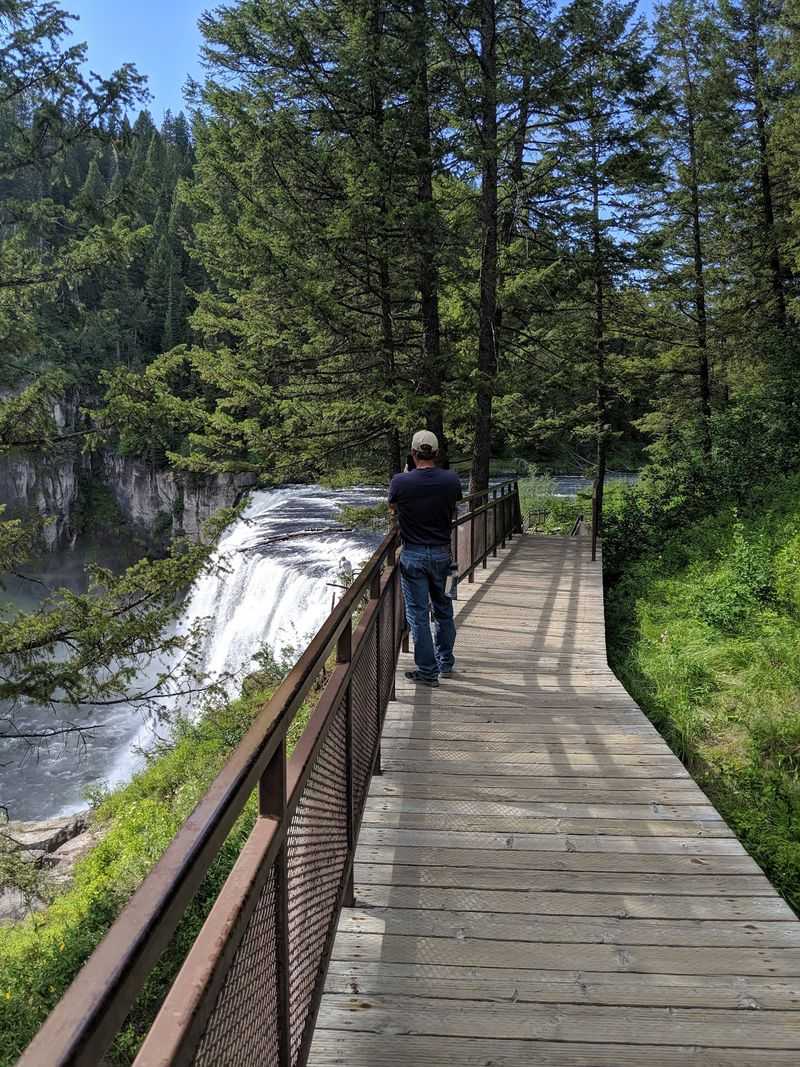
Good news for anyone who dreads a steep hike: the main view sits a short walk from the parking lot. A paved path and a long boardwalk lead right up to the brink of the falls, with several viewing platforms offering different angles along the way.
Visitors consistently praise how well the boardwalk was built. Overhangs let you stand almost level with the lip, watching the water roll over and disappear into white spray below.
Stairs are part of the deal, and some travelers describe quite a few sets of them. Take them slowly, especially with little ones or tired knees, because there is no prize for rushing.
An accessible trail also leads toward the falls, so wheelchair users and strollers have a route to the scenery too.
Once the weather turns, those same planks can get slick. One visitor who arrived with snow on the ground found the walkway and stairs a bit slippery, so sturdy shoes make sense on any late-season trip.
Restrooms are vault toilets near the lot, and people have noticed a colorful mural painted on the building. Garbage cans are scarce, so pack out whatever you bring.
Rainbows Caught In The Mist
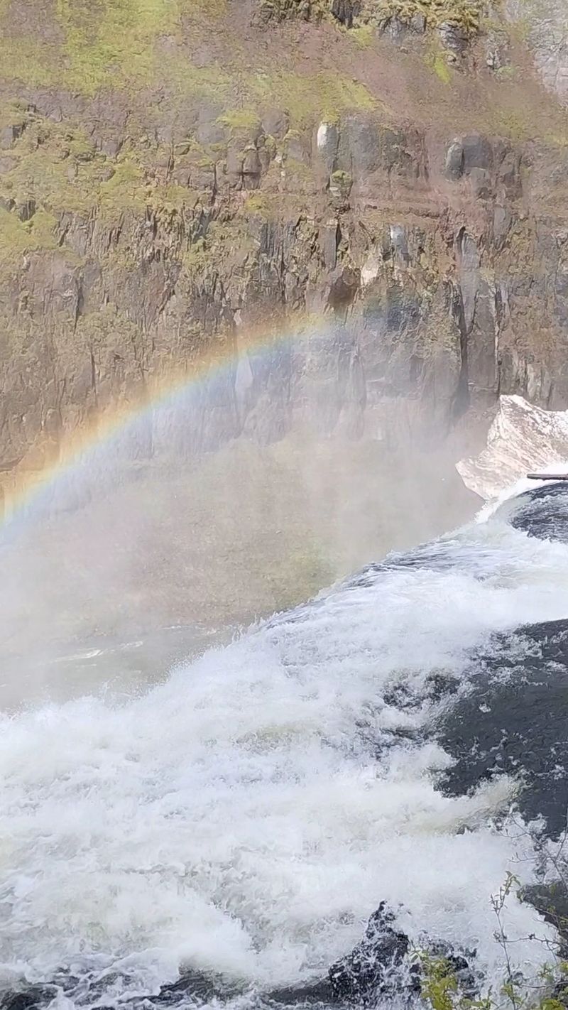
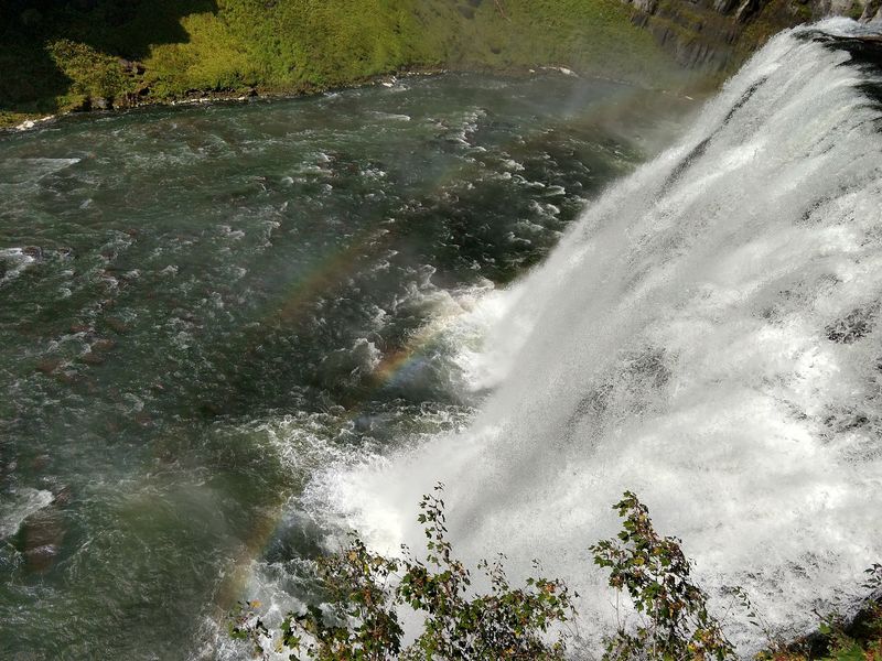
Sunrise here comes with a bonus. One traveler timed a visit so the sun climbed behind them while they faced the falls, and the spray lit up with rainbows hanging over the canyon.
Rainbows are the single most talked-about detail from visitors, and for good reason. With sunlight in the right spot, a band of color seems to float in the mist, shifting as you move from one platform to the next.
Some visitors say the rainbow almost always shows up.
A little physics helps you catch one. Keep the sun at your back and look toward the spray, and the colors appear opposite the light.
Morning worked beautifully for that sunrise visitor, so early arrivals have a solid shot. Even kids who hurry everywhere tend to stop and point.
Photographers should bring a lens cloth. Fine droplets drift onto everything near the closest platforms, which feels refreshing on skin but blurs a camera in seconds.
Autumn light runs lower and warmer, painting the rock walls in amber tones behind the white water. Color does not appear every hour, so plan a patient stop rather than a quick photo and go.
Big Falls Inn, Built By Hand
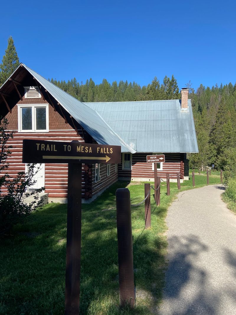
Old-fashioned craftsmanship greets you near the upper overlook. Big Falls Inn, a historic lodge dating to the early 1900s, now serves as a seasonal interpretive center explaining the geology and history of the area.
Visitors who have stepped inside mention the old workmanship, and it rewards a slow look at the woodwork. Past travelers also remember a gift shop and a penny press, a small souvenir stop that kids love.
Timing matters. The inn typically welcomes guests from about mid-May through the start of October, so a late-fall drive usually finds the doors closed even in normal years.
Several visitors have arrived to a locked visitor center, some during an earlier renovation, and most said the falls alone made the trip worthwhile.
For 2026, expect the building to stay off-limits along with the rest of the upper recreation area during the current construction project. The lodge is not going anywhere, though, and it makes a natural reason to plan a return trip once work wraps up.
Think of it as a museum that happens to sit beside a roaring river. The exhibits help explain what the water has been carving for more than a million years.
A Mile Down To Lower Mesa
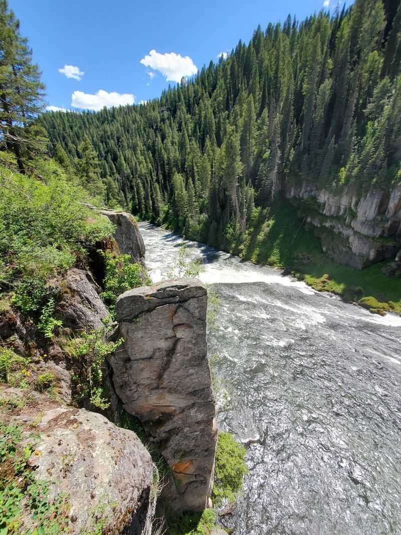
Twin waterfalls on one byway is a rare deal in Idaho. Lower Mesa Falls sits downstream of the upper drop, stepping down through a series of cascades that total around 65 feet, and it has its own roadside overlook along Highway 47.
Hikers normally get another option. A trail of about a mile links the upper area with the lower falls, and visitors who walked it say it brings you closer to the lower cascades than the view from the parking lot.
The connecting trail starts in the closed upper area, so save that walk for a later trip.
Right now, the lower overlook matters more than usual. With the Upper Mesa Falls Recreation Area closed for renovation, the Lower Mesa Falls overlook has served as the alternative viewing spot, and it remains accessible while the road is open.
That means a fall 2026 drive is not wasted. You still get the river, the canyon of volcanic rock and the sound of water pouring over ledges, just from a different vantage point.
Keep eyes on the pullouts, too. Visitors have even spotted cows wandering near the lots.
Construction Season At The Upper Falls
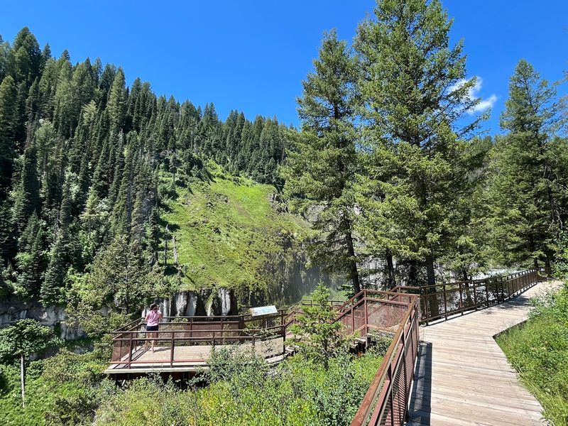
August 10, 2026, marked a turning point for this corner of Fremont County. On that day the entire Upper Mesa Falls Recreation Area closed for a major renovation project, and the closure is expected to continue through the winter.
The work list is long. Crews are tackling road repairs, chip sealing and trail paving, and a replacement of the well-loved boardwalk may also be on the horizon.
For a spot that visitors cherish for its easy access, those upgrades should pay off for years.
In the meantime, barricades mean business. Forest Service officials have asked everyone to respect closure signs, both for personal safety and for the crews working on site.
Slipping past a gate to grab a photo puts people at risk and can slow down the very improvements that will make the next visit better.
Change like this stirs up feelings among eastern Idaho families who have visited for generations. Some will miss the old planks and familiar rails, while others look forward to smoother pavement and fresh platforms.
Before driving, check with the Caribou-Targhee National Forest for current status. Reopening dates can shift with weather and construction progress, and a quick look saves a long, disappointing round trip.
When Highway 47 Trades Tires For Skis
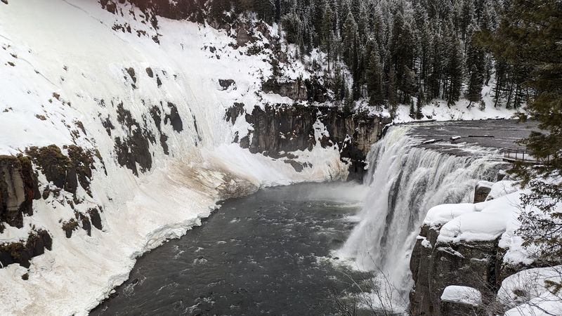
Snow flips the switch on this whole route. With the first plowable snowfall, Idaho Highway 47 closes to vehicle traffic at the Bear Gulch parking area, and cars do not get past that point again until spring.
Forest Service Route 294, the other half of the Mesa Falls Scenic Byway, transforms completely. The entire road becomes a groomed corridor for snowmobiles and cross-country skiers, turning a summer drive into a winter playground.
Exact dates change every year because the trigger is weather, not a calendar. An early storm can end the driving season quickly, so a fall trip is best treated as a first-chance outing rather than a someday plan.
Historically, Highway 47 reopens to vehicles around mid-May, depending on conditions.
Winter visitors who make the trip describe the snowy falls as even more impressive. Access comes by ski, snowshoe or snow machine, with Bear Gulch as the closest starting point and Osborn Bridge as another launch spot for a longer ride.
Keep in mind that the upper recreation area renovation is expected to run through this winter. Check current closures before planning any over-snow adventure toward the upper falls.
A Fall Drive Worth The Timing
Pack cash before leaving Ashton. The upper area normally charges a small day-use fee of a few dollars per vehicle, paid through a self-service box with envelopes and a form for your vehicle details, and there is no attendant or cash machine on site.
An annual national parks pass has covered the fee for many visitors, which makes the stop an easy add-on for Yellowstone-bound travelers. Once the renovation wraps up, confirm current fees before you go.
So who belongs here? Families with young kids, grandparents who want a big view without a big climb, and road-trippers heading toward Island Park or West Yellowstone all fit right in.
Weekday visitors often report having the platforms nearly to themselves.
This fall, the smart plan looks simple: drive the byway while Highway 47 stays open, stop at the Lower Mesa Falls overlook, and respect the barricades at the upper area. Watch the forecast, because the first real snow closes the road to cars until spring.
Then circle a date for next year. A refreshed Upper Mesa Falls, rainbow hanging in the spray, will be waiting at the end of that quiet stretch of eastern Idaho pavement.