9 Florida Areas Where Cottonmouth Activity Is Highest This Late Summer
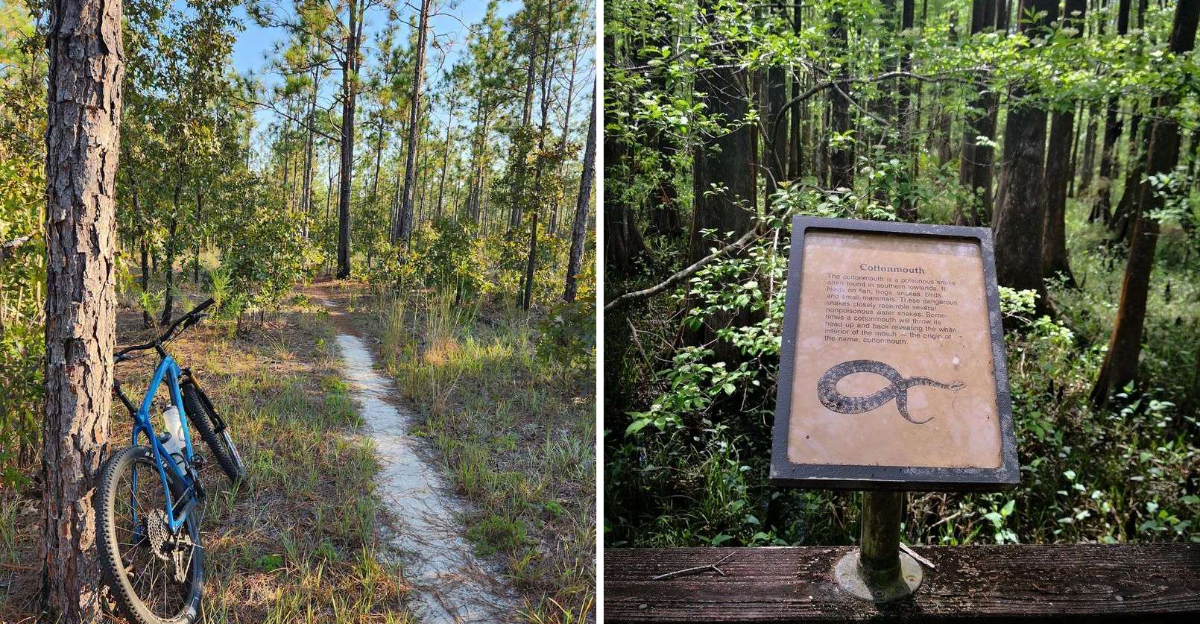
I’ll admit it, spotting a cottonmouth can make an ordinary nature walk suddenly feel a lot more interesting.
Late summer in Florida brings extra reasons to watch those wetland edges a little more closely.
These snakes favor marshes, swamps, riverbanks, and other watery habitats, and several beautiful recreation areas overlap with their territory.
That does not mean avoiding the outdoors! Knowing where encounters are more likely simply makes exploring smarter.
I’d still bring the binoculars and camera. I’d just watch where I put my feet.
These areas combine fascinating wildlife with the kind of scenery that makes paying attention part of the adventure.
1. Paynes Prairie Preserve State Park, Micanopy
A grassy basin the size of a small city hides more water than it lets on. Late summer rain fills the shallow flats fast. Frogs multiply, and cottonmouths follow the buffet.
Paynes Prairie Preserve State Park in Micanopy centers on a huge wet savanna ringed by hardwood hammocks. The La Chua Trail runs along a canal edge where snakes rest in warm sun. Cottonmouths here often sit coiled near the trail’s grassy shoulders.
Bison and wild horses roam the basin, which surprises first-time hikers. Alligators line the sinkhole area in impressive numbers. Birders scan for limpkins, sandhill cranes, and glossy ibis in the same shallows.
Early morning gives cooler air and better light for photos. Afternoon thunderstorms roll in quickly, so watch the sky. Closed-toe boots beat sandals on every trail here.
Stay centered on the path and scan a few steps ahead. Snakes usually hold still and prefer avoiding people entirely. Give any coiled animal a wide berth and keep moving calmly.
The Bolen Bluff Trail adds shady forest before opening onto the prairie rim. Cones Dike Trail stretches long and flat for serious walkers. The observation tower near the visitor center delivers a sweeping view worth the climb.
Mosquito repellent belongs in every pack during August and September. Water bottles matter too, since shade disappears fast on open dikes.
You can reach the park at 100 Savannah Blvd, Micanopy. Come for the prairie panorama, stay for the wildlife parade unfolding at your feet.
2. Hillsborough River State Park, Thonotosassa
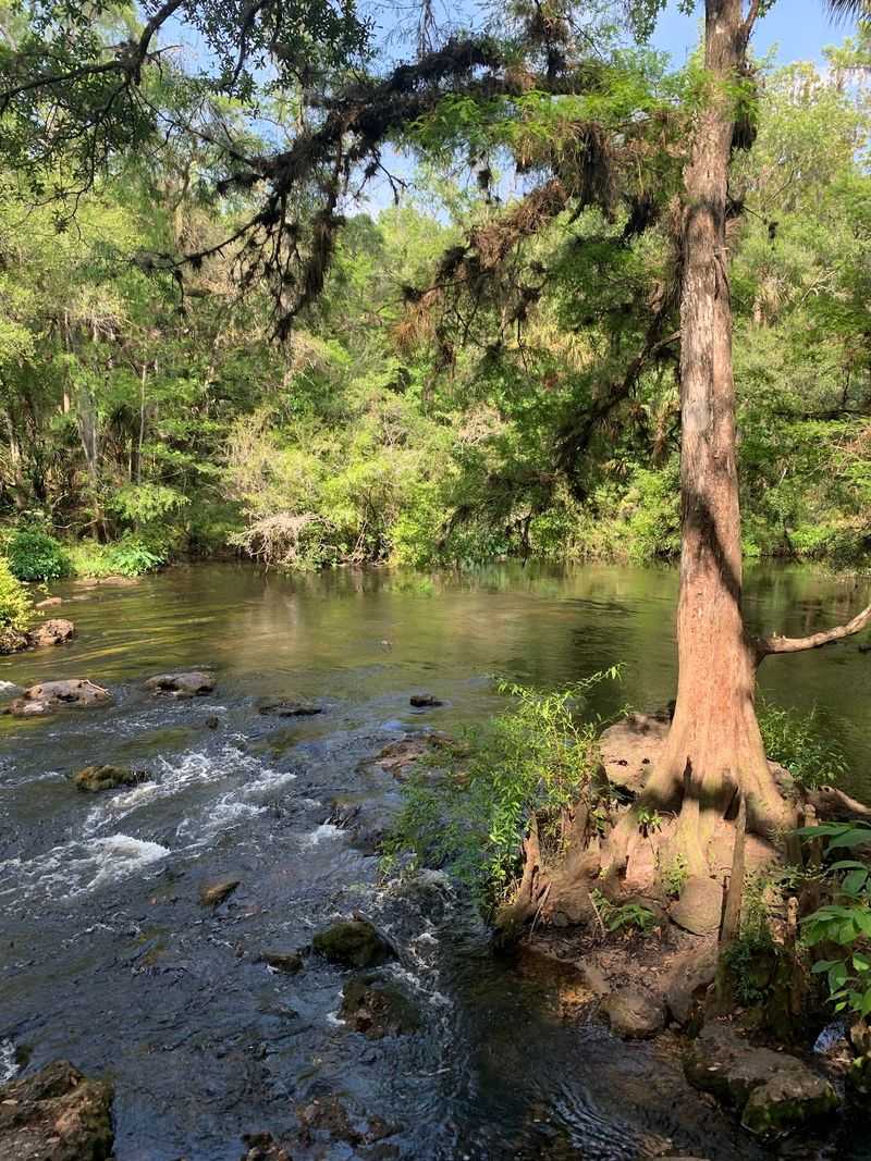
Rapids in Florida sound impossible, yet here they churn over limestone shelves. The river runs dark as strong tea. Along its banks, cottonmouths take advantage of every soggy log.
Set near Thonotosassa, Hillsborough River State Park protects one of the state’s oldest recreation areas, opened in the 1930s.
Civilian Conservation Corps crews built trails and a suspension bridge that still sways underfoot. That bridge gives a great look at the shaded water below.
Late summer swells the river and floods low floodplain forest. Cottonmouths hunt frogs and small fish in those flooded pockets. Hikers spot them most often near cypress knees and slow backwaters.
The Baynard Trail and River Rapids Nature Trail hug the water closely. Roots and mud make footing tricky after rain. Slow steps and a downward glance solve most surprises.
Paddlers launch canoes upstream and drift past turtles stacked on deadfalls. Barred owls call in the afternoon gloom. Otters occasionally appear where the current slows.
Bring long pants for the thicker sections of trail. A hiking stick helps test murky puddles before stepping in. Never reach blindly under logs or into leaf litter.
Camping here puts you beside the river at dawn, when mist hangs low. Fort Foster State Historic Site sits nearby for a history detour.
Find the entrance at 15402 US-301 N, Thonotosassa. Come away with muddy boots, a camera roll of cypress reflections, and healthy respect for who else uses the riverbank.
3. Myakka River State Park, Sarasota
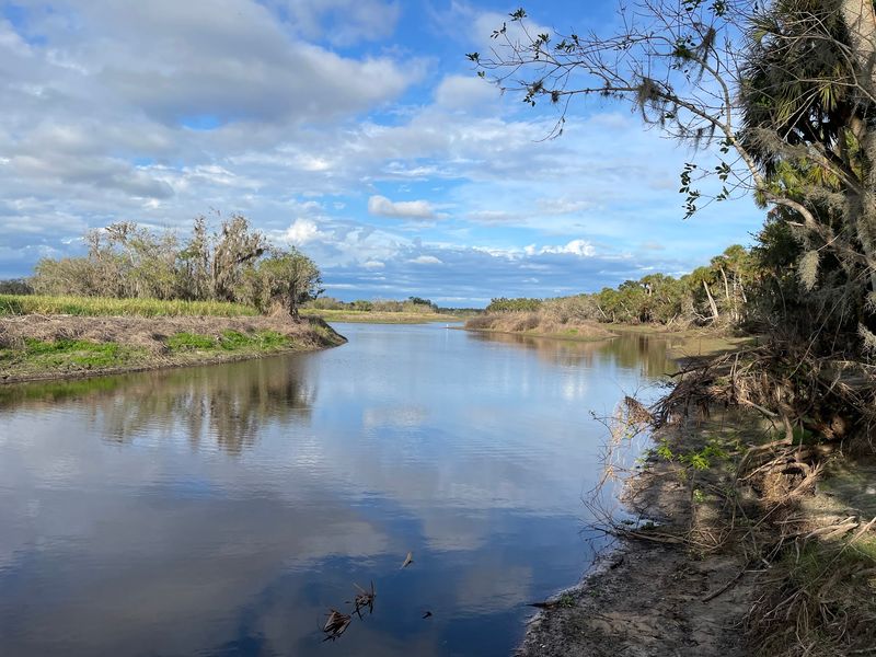
Are you seeing what I’m seeing along that weir? Alligators stack up shoulder to shoulder where water spills through. Cottonmouths work the quieter edges nobody photographs.
Sprawling across 37,000 acres near Sarasota, Myakka River State Park ranks among Florida’s largest. A slow river widens into two shallow lakes rimmed by marsh. Those marsh fringes stay warm and frog-filled through September.
The famous canopy walkway lifts hikers into oak and palm branches. A tower at the end clears the treetops for wide views. Below, the ground stays damp and snake-friendly all summer.
Cottonmouths here favor shorelines, culverts, and the grassy strips beside the main drive. Boat basin areas see regular sightings. Keep pets leashed and away from water’s edge.
Birdlife steals the show in late summer, with roseate spoonbills, wood storks, and anhingas working the shallows. Deer graze the prairie at dusk. Feral hogs leave rooted-up soil along trails.
Airboat tours skim the lake for open-water views. Bicycles handle the paved park road easily. Backcountry campers should pitch tents on higher, drier ground.
Watch for water crossing the road after heavy storms, since snakes travel then. Headlamps matter for any walk after sunset. Slow driving protects wildlife and tires alike.
The address is 13208 State Rd 72, Sarasota. Leave with sun on your shoulders, an appreciation for slow rivers, and photos your friends will not believe.
4. Corkscrew Swamp Sanctuary, Naples
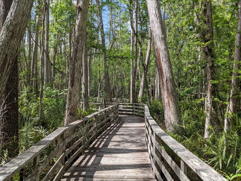
Some trees here started growing centuries ago and never moved an inch. Their trunks rise like columns above black water. Cottonmouths cruise between them, quiet as drifting sticks.
Corkscrew Swamp Sanctuary near Naples protects the largest old-growth bald cypress forest left in North America.
A two-mile boardwalk loops through wet prairie, pond cypress, and towering ancient stands. Elevated planks keep feet dry and eyes level with the swamp.
Late summer means high water and busy amphibians. Cottonmouths appear coiled on cypress knees or swimming with heads held high. Naturalists often point them out from safe boardwalk distance.
Photographers love the lettuce lakes, where alligators rest under floating greenery. Painted buntings visit in cooler months, while herons and limpkins stay year-round. Ghost orchids famously bloom high in these trees.
Rain arrives most afternoons, so morning trips work better. Ponchos beat umbrellas on narrow boardwalk stretches. Binoculars turn distant shapes into clear sightings.
Nothing needs to be touched or moved here, and staying on the boardwalk keeps everyone comfortable. Children should hold hands near railings. Quiet voices bring wildlife closer.
Volunteers stationed along the route share what has been seen that morning. A shorter loop exists for anyone short on time. The boardwalk is stroller and wheelchair friendly.
Head to 375 Sanctuary Rd W, Naples for the trailhead. Expect cool shade, ancient bark, and a swamp that hums with life you never knew existed.
5. Fakahatchee Strand Preserve State Park, Copeland
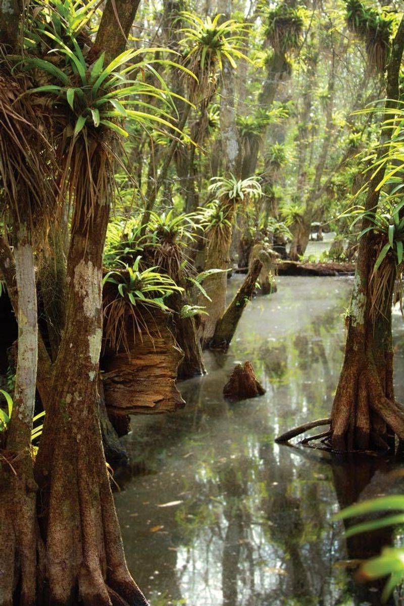
Orchid hunters once poled boats through this drowned forest looking for treasure. The strand still guards its secrets well. Cottonmouths patrol the same shallow sloughs today.
Fakahatchee Strand Preserve State Park in Copeland stretches roughly twenty miles long and five miles wide. Locals call it the Amazon of North America because of its dense plant life. Royal palms and bromeliads crowd every available inch.
Water levels peak in late summer, spreading across the forest floor. Cottonmouths hunt frogs, small fish, and crayfish in those warm inches. Sightings cluster along the Big Cypress Bend Boardwalk and Janes Scenic Drive.
The boardwalk ends at a gator pond framed by old-growth cypress. Bald eagles nest nearby some years. Barred owls answer each other across the canopy.
Adventurous hikers join guided swamp walks that go knee-deep into the strand. Doing that without a guide is unwise. Guides know the terrain, the depth, and the residents.
Insect repellent counts as required equipment through September. Long sleeves help more than you would guess. Closed shoes with grip handle slick limestone well.
Janes Scenic Drive suits slow driving and frequent stops. Dawn brings mist rising off the sloughs. Afternoon light filters green through the palms.
The entrance sits at 137 Coast Line Dr, Copeland. You will leave with damp shoes, orchid dreams, and stories about the wildest forest in Florida.
6. Big Cypress National Preserve, Ochopee
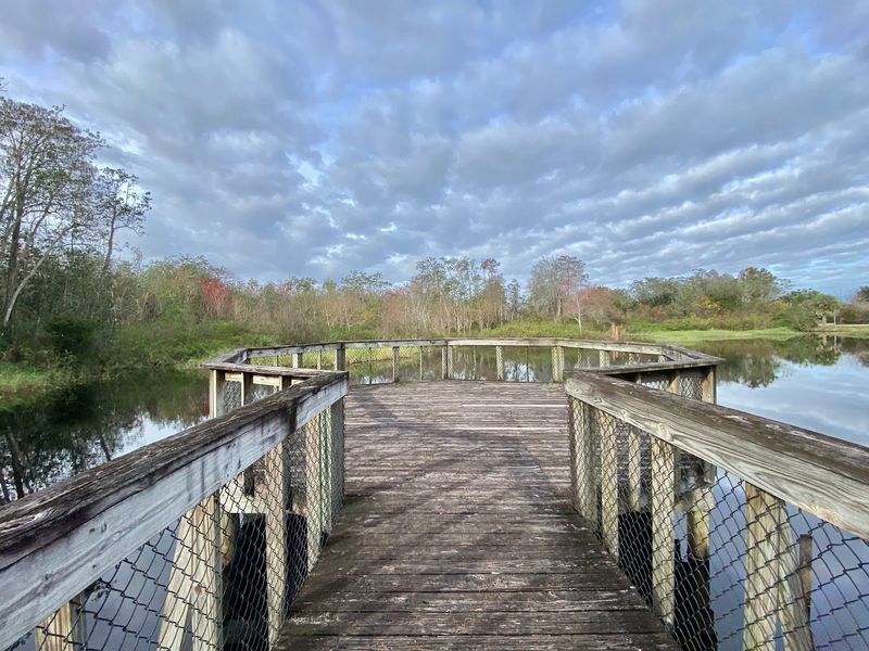
Cards on the table, this landscape looks empty until you slow down. Then the water starts moving. Cottonmouths, gators, and gar all share the same shallow sheet flow.
Big Cypress National Preserve, reached through the Nathaniel P. Reed Visitor Center in Ochopee, covers more than 700,000 acres of cypress strands and wet prairie.
Water slides slowly south toward the Everglades. Late summer sends levels to their annual high.
Cottonmouths concentrate where water meets solid ground, meaning canal banks, culverts, and roadside swales. The boardwalk behind the visitor center often hosts sunning gators. Snakes hide in nearby grass more than most people notice.
Loop Road delivers unforgettable slow driving through dense swamp scenery. Kirby Storter Roadside Park adds a short boardwalk into a cypress dome. Both reward patient watching.
Night skies here earn dark sky recognition, and stars pour out after sunset. Bring a red-filtered light for stargazing walks. Watch the pavement carefully for crossing wildlife.
Hikers on the Florida Trail section should expect standing water. Gaiters and quick-dry pants help. Never step where you cannot see the bottom.
Rangers post recent wildlife sightings and water conditions inside. Ask about swamp walk programs. Air conditioning inside makes a welcome break from humidity.
You will find it at 33000 Tamiami Trail E, Ochopee. Big skies, shallow water, and quiet cypress make this stretch linger in memory long after the drive home.
7. Lower Suwannee National Wildlife Refuge, Chiefland
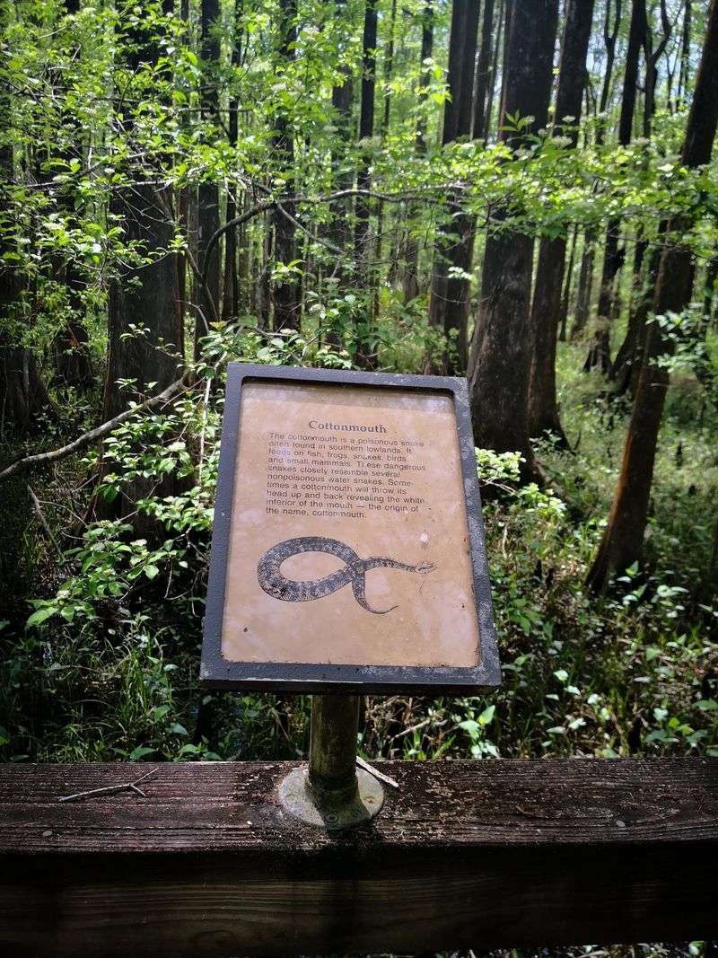
Tea-colored river water meets salty Gulf marsh in a slow, tangled handshake. Tidal creeks braid through cypress and pine. Cottonmouths thrive exactly in that overlap.
Lower Suwannee National Wildlife Refuge near Chiefland protects over 50,000 acres along the final stretch of the Suwannee River. Twenty miles of river frontage feed a maze of creeks and swamp. Very few developments interrupt the view.
Late summer water levels rise while frogs and small fish crowd the shallows. Cottonmouths hunt these edges morning and evening. The Shell Mound and River Trail boardwalks give safe, elevated vantage points.
Shell Mound itself is an ancient Native American shell midden with a Gulf overlook. Sunsets there glow orange across the salt marsh. Migratory birds pour through in fall.
Dennis Creek Trail crosses tidal flats where fiddler crabs scatter underfoot. Kayakers explore quiet creeks with the tide. Check tide charts before launching anywhere.
Refuge roads stay unpaved and puddled after storms. Higher clearance vehicles handle them better. Repellent, water, and a paper map cover the basics since signal fades quickly.
Boots protect ankles on grassy dike walks. Scan sunny gaps beside the trail. Slow, deliberate steps prevent nearly every close encounter.
Refuge access begins near 16450 NW 31st Pl, Chiefland. Wild, quiet, and refreshingly uncrowded, this coastline rewards anyone willing to wander a gravel road.
8. St. Marks National Wildlife Refuge, St Marks
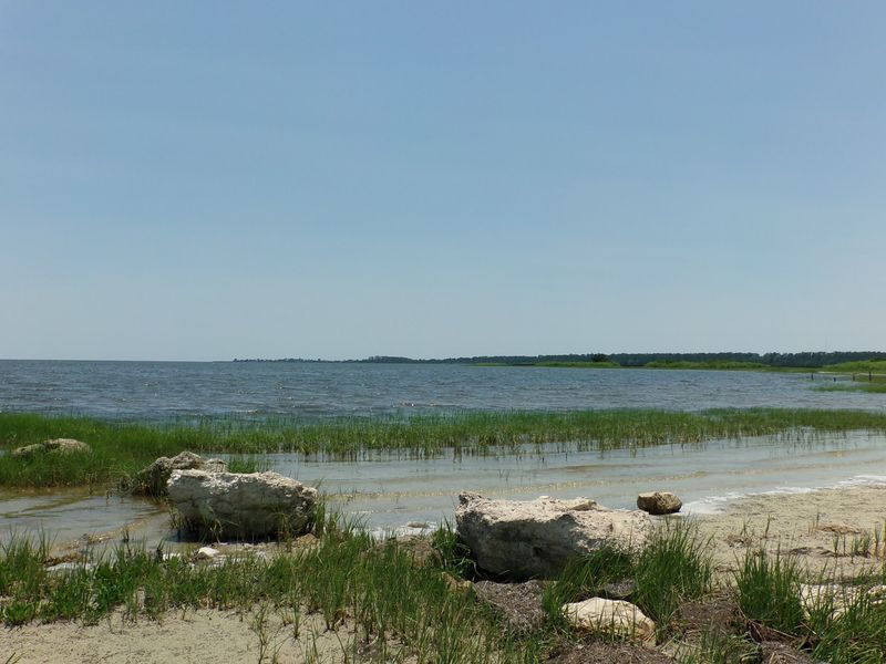
A white lighthouse has watched over these marshes since the 1800s. Salt pans, dikes, and tidal ponds spread out below it. Cottonmouths patrol every levee edge.
St. Marks National Wildlife Refuge in St Marks ranks among the oldest refuges in the country, established in 1931.
More than 86,000 acres of marsh, pine flatwoods, and coastal ponds stretch along Apalachee Bay. Water and land trade places constantly.
Late summer heat keeps snakes active near dawn and dusk. Cottonmouths favor levee tops beside the impoundments. Anglers and photographers see them most often near culverts.
Monarch butterflies stage here during fall migration in impressive numbers. Wading birds work the shallow pools daily. Alligators bask along Lighthouse Road ditches.
Biking the levee roads covers ground quickly and quietly. Tower Pond Trail and the Plum Orchard Pond Trail add short loops. Bring a spotting scope for distant shorebirds.
Sun exposure runs high on open dikes, so hats and water are non-negotiable. Watch where the grass meets the path. Stepping over logs rather than onto them is smarter.
The visitor center explains refuge history and current conditions. Ask about butterfly timing in September. Restrooms and shaded picnic tables sit nearby.
Drive to 1255 Lighthouse Rd, St Marks for the lighthouse and levees. Coastal light, salty air, and constant motion in the marsh make this refuge hard to leave.
9. Apalachicola National Forest, Bristol
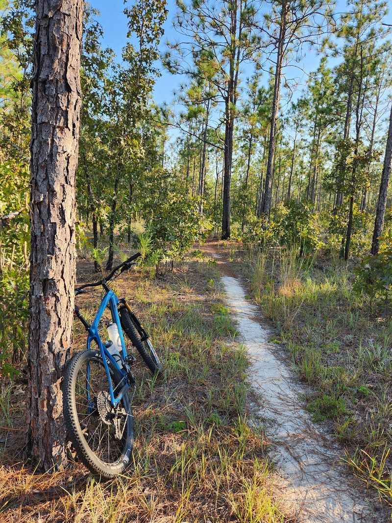
Longleaf pines stand in open ranks while dark creeks slip between them. Titi thickets crowd every low spot. Cottonmouths own those soggy edges completely.
The Apalachicola Ranger District, headquartered in Bristol, helps manage Florida’s largest national forest at over 600,000 acres.
Pine savanna, cypress domes, and blackwater streams fill the landscape. Bradwell Bay Wilderness holds famously deep, tea-dark water.
Late summer rainfall pushes creeks over their banks. Cottonmouths hunt frogs along those flooded margins. Hikers on the Florida Trail through the wilderness often wade for miles.
Carnivorous pitcher plants grow in seepage bogs here, which delights botanists. Red-cockaded woodpeckers nest in old pines. Black bears roam the deeper sections.
Leon Sinks Geological Area adds boardwalks over startling limestone sinkholes. Camel Lake and Wright Lake give swimming and camping options. Forest roads reach quiet corners with no crowds.
Wading sections demand a stick for probing depth and footing. Never place hands on submerged logs. Move slowly and let any snake leave on its own.
Cell coverage drops off fast, so download maps beforehand. Tell someone your route and return time. Extra socks improve every wet hike.
District information is available at 11152 NW State Route 20, Bristol. Between pitcher plant bogs and blackwater wading, this forest hands out adventure to anyone willing to get their boots soaked.