Giant 1880s Beehive Charcoal Kilns Tell A Ghost Town Story In The Sagebrush Near Leadore, Idaho
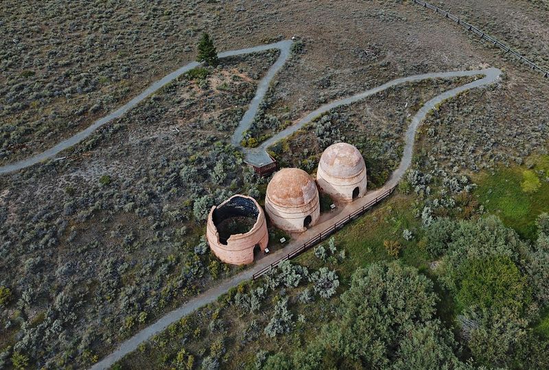
Four brick domes rise out of the sagebrush in east Idaho, each one taller than a two-story house and shaped like an old-fashioned beehive. From the highway they look small, almost like toys left on a hillside.
Up close, they tell a big story about a mining boom, a vanished town, and the workers who kept the fires burning more than 130 years ago. It is a short detour with a long memory, and it costs nothing to see.
Brick Domes Above Birch Creek
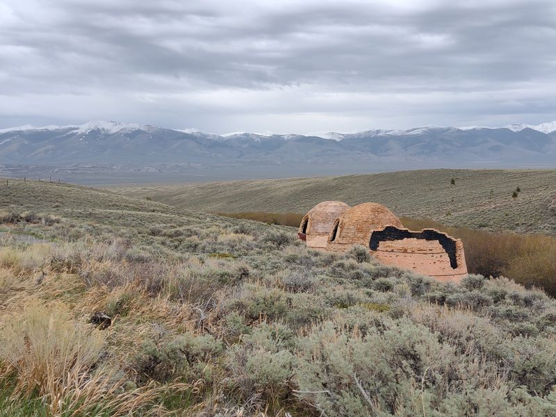
Drivers on Idaho State Highway 28 often spot the domes before they know what they are. Rounded and rust-colored, they sit against the foothills of the Birch Creek Valley in Lemhi County, roughly midway between Idaho Falls and Salmon.
These are the Birch Creek Charcoal Kilns, preserved today as the Charcoal Kilns Interpretive Site. The U.S.
Forest Service cares for them as part of the Caribou-Targee National Forest, and a short walking path loops past the surviving structures.
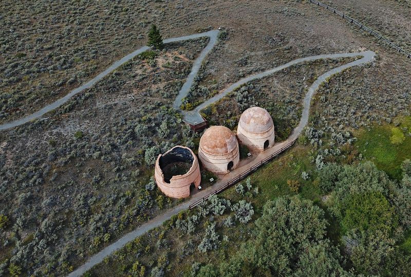
Only four kilns stand now, out of an original sixteen. Each one was built from local clay brick in the 1880s to turn timber into charcoal, the fuel that powered a smelter across the valley.
The site is small, and most people need well under an hour to see it. That compact size is part of the appeal.
You get a full chapter of Idaho mining history without a long hike or a crowded parking lot, just wind, sagebrush, and a handful of brick giants that have outlasted the town they served.
Leadore is the nearest community, a ranching town of about a hundred people up the road, so plan on bringing your own snacks and water.
Warren King’s 1886 Gamble
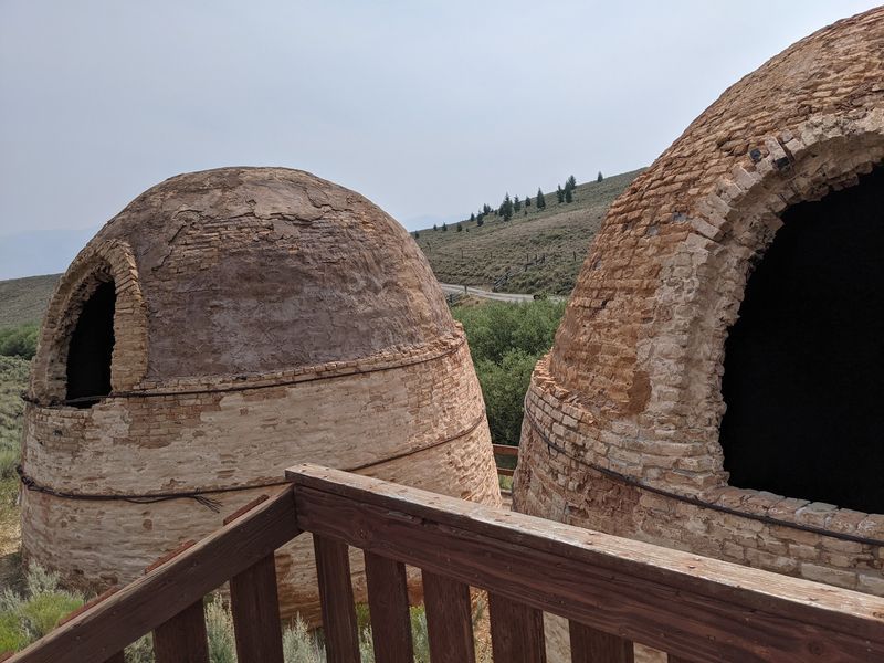
Around 1885 or 1886, a businessman named Warren King arrived from Montana with a plan. Sources disagree on whether he came from Butte or Missoula, but they agree on what he built: sixteen parabolic-domed kilns made from clay, possibly dug at nearby Jump Creek.
His customer was the Viola Mine, a lead and silver producer across the valley at a townsite called Nicholia. Smelting ore back then required huge amounts of charcoal, and the closest dense timber grew in the hills above Birch Creek.
So King went to the wood instead of hauling the wood to the mine. The kilns sat about ten miles from Viola, close to forests that could be cut, stacked, and slow-burned right on site.
It was a smart setup for its day. Charcoal burns hotter and cleaner than raw wood, and it weighs far less, which made the haul to Nicholia easier on wagons and teams.
For a few busy years, the plan worked. The valley filled with crews, smoke curled from sixteen chimneys, and a small industrial complex hummed in a place that now hears mostly meadowlarks and passing trucks.
Bigger Than They Look
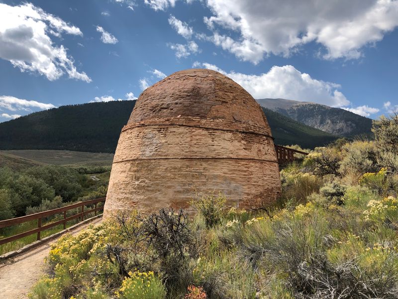
Scale is the first surprise. Visitors regularly mention that the kilns seem modest from the road and then tower over them once they step out of the car.
Each kiln stands 20 to 23 feet high and spans 20 to 21.5 feet across. The walls are about 14 inches thick, which explains how they held heat for days at a time and why they have survived well over a century of Idaho winters.
Walk to the base of one and tilt your head back. The curve of the dome pulls your eye up to a small opening at the top, while a doorway near the ground lets you peek into the dim, round interior.
Kids especially enjoy this part. A doorway sized for workers hauling wood feels like the entrance to a giant clay igloo, and the echo inside adds to the fun.
Photographers like the repeating shapes. Line up two or three domes from the right angle and the brickwork, sky, and sagebrush make a clean, simple frame that shows off just how massive these old ovens really are.
How Timber Became Fuel
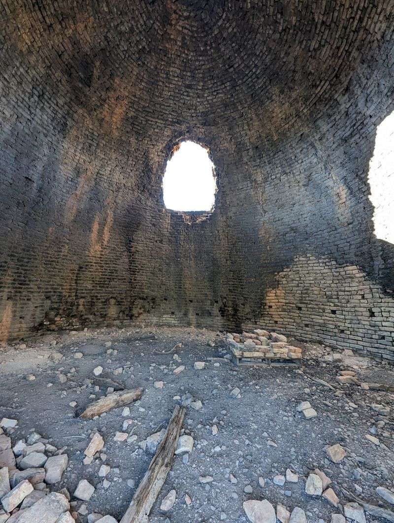
Thirty to forty cords of wood went into a single kiln at a time. That is a stack many times bigger than most backyard woodpiles, all cut into tidy four-foot lengths and arranged by hand inside the dome.
Once loaded, the doorway was sealed and a controlled burn began. Workers watched the fire closely, letting in just enough air to cook the wood slowly instead of letting it burn to ash.
The process took seven to eight days per load. When it finished and cooled, crews raked out the black charcoal and loaded it for the trip to the smelter at Nicholia.
Across all sixteen kilns, output reached roughly 44,000 to 50,000 bushels of charcoal every month. Picture a steady stream of wagons rolling across the valley floor, day after day, carrying fuel to melt silver and lead out of rock.
The interpretive signs walk through each step, so you can stand beside a kiln and trace the whole cycle. One visitor from the eastern states enjoyed comparing these to the beehive coke ovens back home, which share a similar shape but burned coal instead of timber.
Woodland, A Town In The Smoke
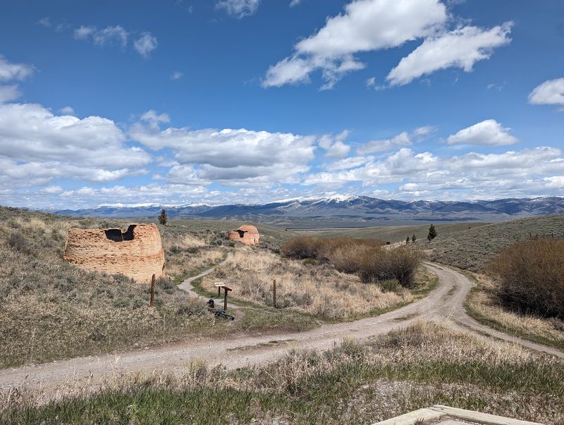
Somewhere near these kilns, a town once had a name. Woodland grew up beside the operation to house the crews who kept the fires going, and today almost nothing of it remains above ground.
Between 150 and 200 people worked the charcoal business. Many were immigrants of Chinese, Irish, and Italian descent who felled trees, bucked logs, stacked kilns, tended burns, and drove the loads to Nicholia.
It was hard, smoky work in a valley that swings from hot summers to bitter winters. Still, it drew enough families and single workers to support a small settlement of its own.
Standing at the site, it takes some imagination to fill in the empty ground. The signs help, and so does the silence, which makes it easier to picture voices, axes, and wagon wheels where there is now only sagebrush.
This is the ghost town heart of the story. The kilns are the bones that survived, but the people who lived here are the reason the place still feels worth a stop more than a century later.
Boom To Bust By 1889
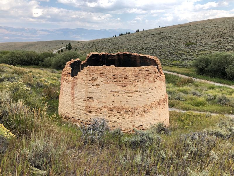
Three or four years. That is about how long the whole enterprise lasted before the bottom fell out.
By 1889, a fire at the Viola Mine’s hoisting works and a slump in lead and silver prices shut the mine down. With no smelter to feed, the charcoal kilns had no reason to keep burning, and they were simply abandoned.
Nicholia faded away. Woodland went with it, and the valley returned to cattle, sage grouse, and wind.
Over the following decades, most of the sixteen kilns crumbled. Many of their sturdy bricks were reportedly carried off by valley residents and reused in their own buildings, so pieces of the operation may still be hiding in old ranch structures around Birch Creek.
That reuse is a very Idaho kind of ending. Nothing good went to waste, even when a boom ended overnight.
It also explains why the surviving four matter so much. They are the last full-size examples of what once stood here in a long row, and they make the quick rise and fall of the 1880s easy to grasp.
A Careful 2000 Restoration
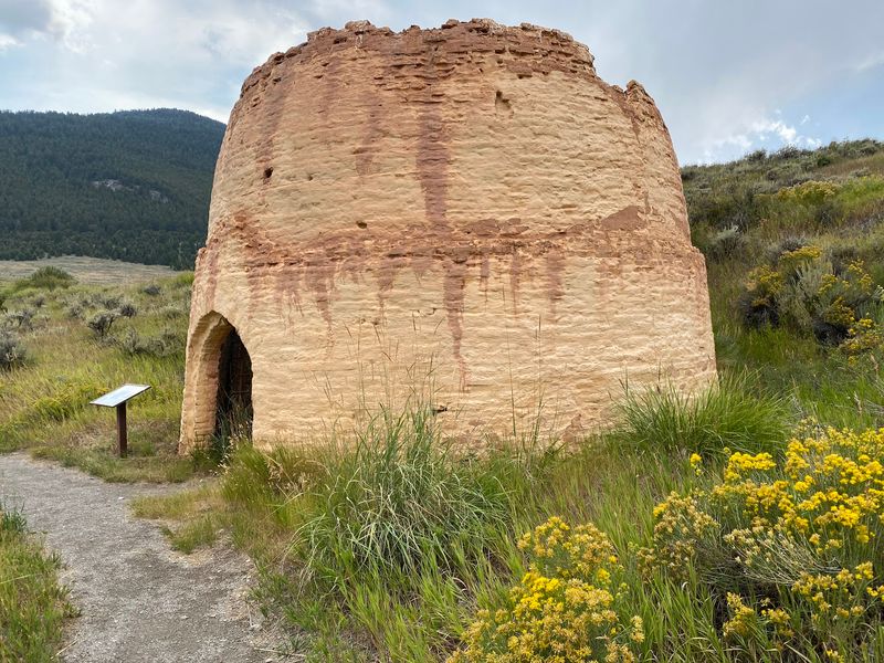
Long before restoration crews arrived, the kilns earned national recognition. They were listed on the National Register of Historic Places in 1972, a sign of how important they were to Idaho’s mining story.
In 2000, the four remaining kilns were restored to their original dimensions. The work stabilized the brick and preserved the iconic beehive shape, so what you see today closely matches what workers saw in the 1880s.
The Forest Service now manages and interprets the site. Visitors describe it as well kept, with a tidy path and plenty of room to walk around each structure.
One longtime visitor returned after sixty years away and still found it educational. Another called these some of the best preserved relics in Idaho from a time long gone.
Some guests have noted that a few signs show wear and could use a refresh, though most remain readable. That is a small trade-off for a remote site that sees harsh weather.
Treat the brick gently. Climbing on the domes or pulling at loose pieces undoes decades of care, so admire them from the ground and leave them for the next family.
Signs Along The Self-Guided Loop
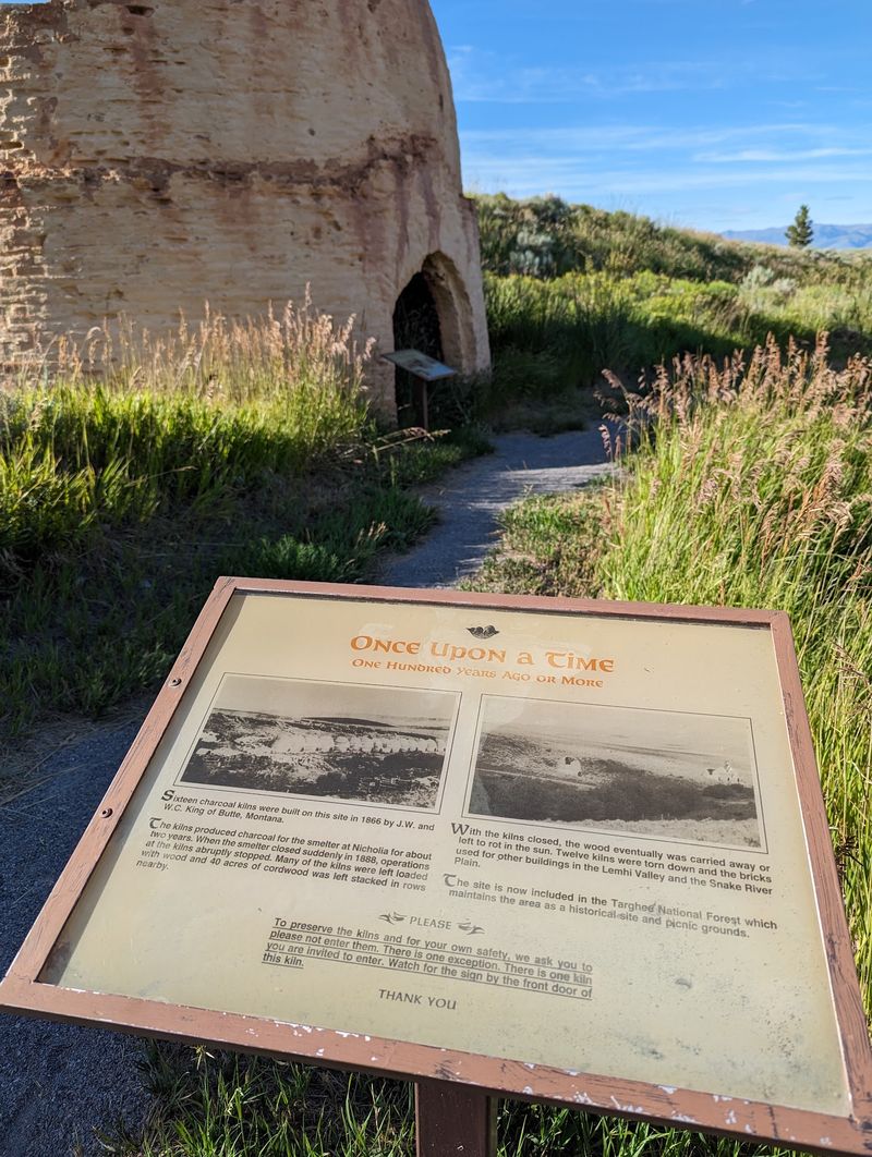
Reading your way around the kilns is the main activity, and it is a pleasant one. A short, easy trail leads past each structure with information boards stationed along the route.
The panels cover the kiln-building, the charcoal process, the Viola Mine, and the workers who made it all happen. One visitor joked that by the end, you should be an expert on kilns and Lemhi Valley mining history.
The walk is brief and mostly level. Families with young children manage it easily, and one parent mentioned that their four-year-old loved the detour.
Plan on about 20 to 30 minutes for the loop, longer if you read every word or linger for photos. People in a hurry can see the highlights in less.
A few visitors wished for even more signs covering the history, which says something about how interesting the story is. Once people learn a little, they want the rest.
Bring a curious mind and maybe a notebook for kids. Turning the signs into a scavenger hunt for numbers like cords, days, and bushels keeps young readers engaged the whole way.
Big Sky Vistas And Star Trails
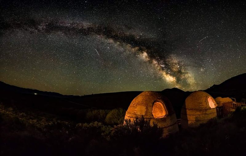
Look away from the brick for a moment and the valley opens wide. The Birch Creek Valley stretches between mountain ranges, and visitors often praise the views back toward the highway.
Early summer brings green slopes and wildflowers. One traveler arrived to find the hills still green and flowers in bloom along the five-mile approach.
After dark, the site changes character. With almost no lights for miles, the sky fills with stars, and at least one photographer called it a beautiful place for star trail shots with the domes in the foreground.
Night visits take planning in such a remote spot. Bring warm layers, since the high valley cools quickly once the sun drops, and know your route before heading out.
Daytime photographers have plenty to work with too. Morning and evening light paints the curved brick in warm tones, and the long shadows add depth to the rounded shapes.
Pets are welcome to stretch their legs, according to visitors, which makes this a handy break on a long Highway 28 drive. Keep them close and pack out anything you bring in.
Picnic Tables And Simple Comforts
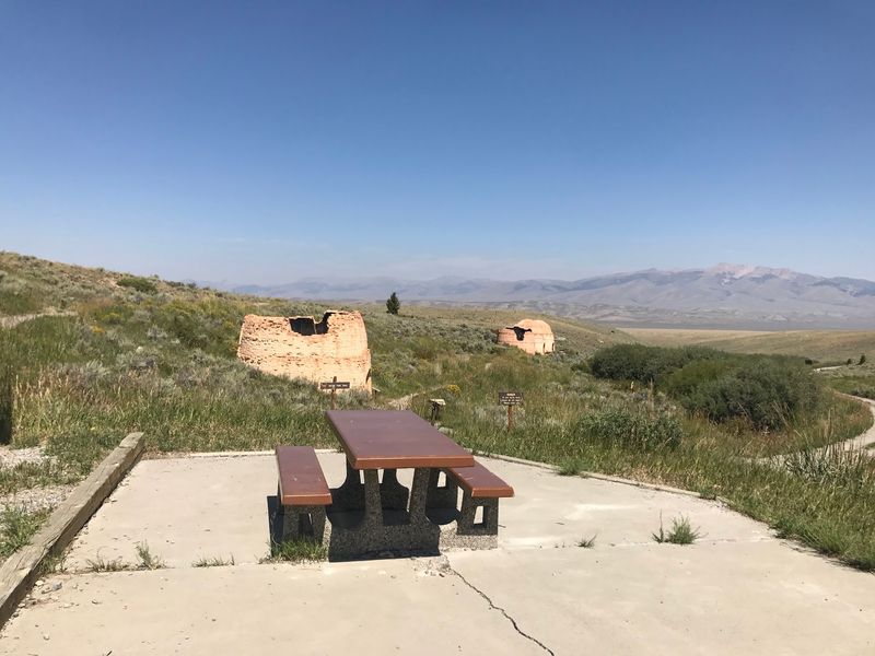
A sandwich tastes better beside a 130-year-old kiln. The site includes a small picnic area with a camp grill, so it works well as a lunch stop on a long drive through east Idaho.
There is a parking lot and a vault toilet. Visitors early in the season have noted the restroom can be rough or hard to reach when snow still lingers, so come prepared just in case.
Admission is free, with no tickets needed. That makes it an easy add-on for families watching their travel budget.
Services are otherwise nonexistent. No water fountains, snack bars, or gift shops wait here, which fits the quiet, end-of-the-road feeling many people enjoy.
Pack water, snacks, sunscreen, and a jacket even in summer. Wind sweeps across this open country, and shade is limited to whatever the kilns themselves cast.
Follow leave-no-trace habits. One visitor summed it up nicely: leave the place better than you found it, so the next group can enjoy the same clean, peaceful setting.
Five Miles Of Gravel
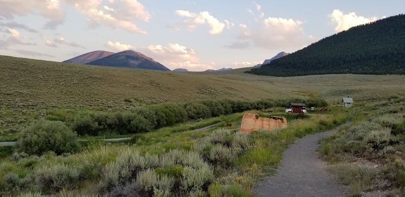
Getting there starts on Idaho State Highway 28, between Idaho Falls and Salmon. Watch for the turnoff onto Forest Road 533, then follow roughly five miles of gravel and dirt west to the site.
The official address is Caribou-Targee National Forest, Forest Road 533, Leadore, Idaho 83464. Leadore itself sits to the north, and the old ghost town of Gilmore lies about 18 minutes south of Leadore if you want a second stop.
Road opinions vary. Many say passenger cars handle it fine in dry weather, while others feel more comfortable in an SUV, truck, or Jeep.
Winter is a different matter. The road is not maintained in the cold months, and one visitor found snow still blocking the way in late April.
The site is open year-round when weather allows. Late spring through fall offers the most reliable access, but conditions shift, so check with the Forest Service before driving out.
Fill your tank before leaving larger towns. Fuel and services are scarce along this stretch of Highway 28.
Worth The Little Detour
Short stops can leave long impressions. Visitors keep describing this as a fun little detour, a slice of history, and a good place to stretch out after hours on the highway.
History fans will find a rare, well-preserved piece of Idaho’s mining past. Families get an easy walk, giant brick shapes for kids to marvel at, and a picnic table for lunch.
Photographers, stargazers, and road-trippers each find something too. The open valley, quiet setting, and free access make it simple to fit into almost any route through Lemhi County.
Expectations matter. The area is small, services are basic, and you will likely be back on the highway within an hour.
That compact scale is exactly what makes it work. You can learn about Warren King, Woodland, and the Viola Mine, then pair the visit with Gilmore or a stop in Leadore for a full day of ghost-town exploring.
Four brick domes, one vanished town, and a story that burned bright for only a few years. If your travels take you up Highway 28, give them half an hour.