10 Incredible Natural Rock Formations In Tennessee Worth Seeing In 2026
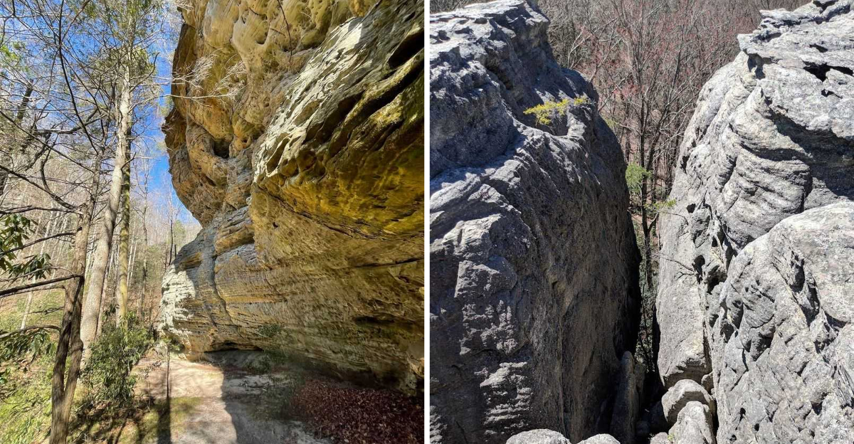
Who would have thought millions of years of geology could create such an entertaining road-trip itinerary?
Tennessee is packed with arches, caves, natural bridges, cliffs, and remarkable formations begging for a closer look.
Water, erosion, and time helped shape these landmarks into destinations that now give hikers fascinating reasons to explore.
Some can be reached on relatively easy routes, while others add a longer adventure to the experience. Each formation tells a different geological story, keeping every stop fresh and interesting.
History adds another layer at several locations along the journey.
Lace up your hiking shoes and bring some curiosity. These rocks have far more personality than their name suggests.
1. Twin Arches, Big South Fork National River And Recreation Area, Near Oneida
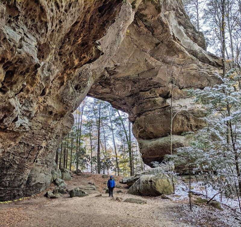
Just imagine, for a second, standing under a stone ceiling wide enough to shade a house. Your neck will ache from looking up.
Twin Arches sits inside Big South Fork National River and Recreation Area near Oneida. Together they form the largest natural bridge complex in the state.
North Arch spans roughly 93 feet, standing 62 feet tall with about 51 feet of clearance. South Arch goes bigger, standing 103 feet tall with a 135-foot span and about 70 feet of clearance.
Two hiking choices exist here, and both reward you. The short loop covers 1.2 miles, while the longer route runs 4.5 miles.
Steep wooden staircases carry you around and beneath the formations. A tunnel passes right through the South Arch itself.
Watch for historic homesteads and ancient rock shelters along the path. People sheltered under this sandstone long before trail maps existed.
Spring brings wildflowers and mild air, perfect for photos. Fall trades blooms for gold and crimson leaves overhead.
Bring water, since there are no taps at the trailhead. Sturdy shoes matter on those damp wooden steps. Navigation is easy once you find Divide Road. The Twin Arches Loop Trailhead branches directly off it.
Park headquarters sits at 4564 Leatherwood Road, Oneida, TN 37841. Stop there first for maps and current trail conditions. Few hikes in the region deliver this much stone for so little effort.
2. Stone Door, Savage Gulf State Natural Area, Near Beersheba Springs
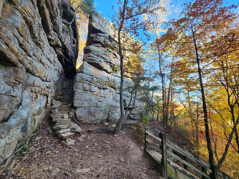
My jaw literally dropped at the sight of a hundred-foot crack splitting solid rock. Nature left a doorway standing wide open.
Great Stone Door rests inside Savage Gulf State Natural Area near Beersheba Springs. The gap measures 10 feet across and drops 100 feet deep.
Native American travelers used this passage for centuries. It served as a practical shortcut down into the wilderness below.
Today the walk is refreshingly short and friendly. Round trips run between 0.9 and 2 miles depending on your route.
The first stretch of trail is paved, which helps families and slower walkers. Strollers manage the early section without much trouble.
Views from the top sweep across rugged canyons and tall sandstone cliffs. Cumberland Plateau scenery here rivals anything in the Smokies.
Autumn draws the biggest crowds, with color peaking from late October into early November. Red, orange, and yellow fill the entire gulf.
Spring counters with rhododendron blooms and thick carpets of wildflowers. Cooler mornings make the overlook feel private.
Climbers and rappellers have designated areas, though a permit is required first. Check regulations before hauling gear up.
Trail access and restrooms are at the Stone Door Ranger Station, 1183 Stone Door Road, Beersheba Springs, TN 37305. Arrive early on weekends and that overlook may belong to you alone.
3. Alum Cave Bluffs, Great Smoky Mountains National Park, near Gatlinburg
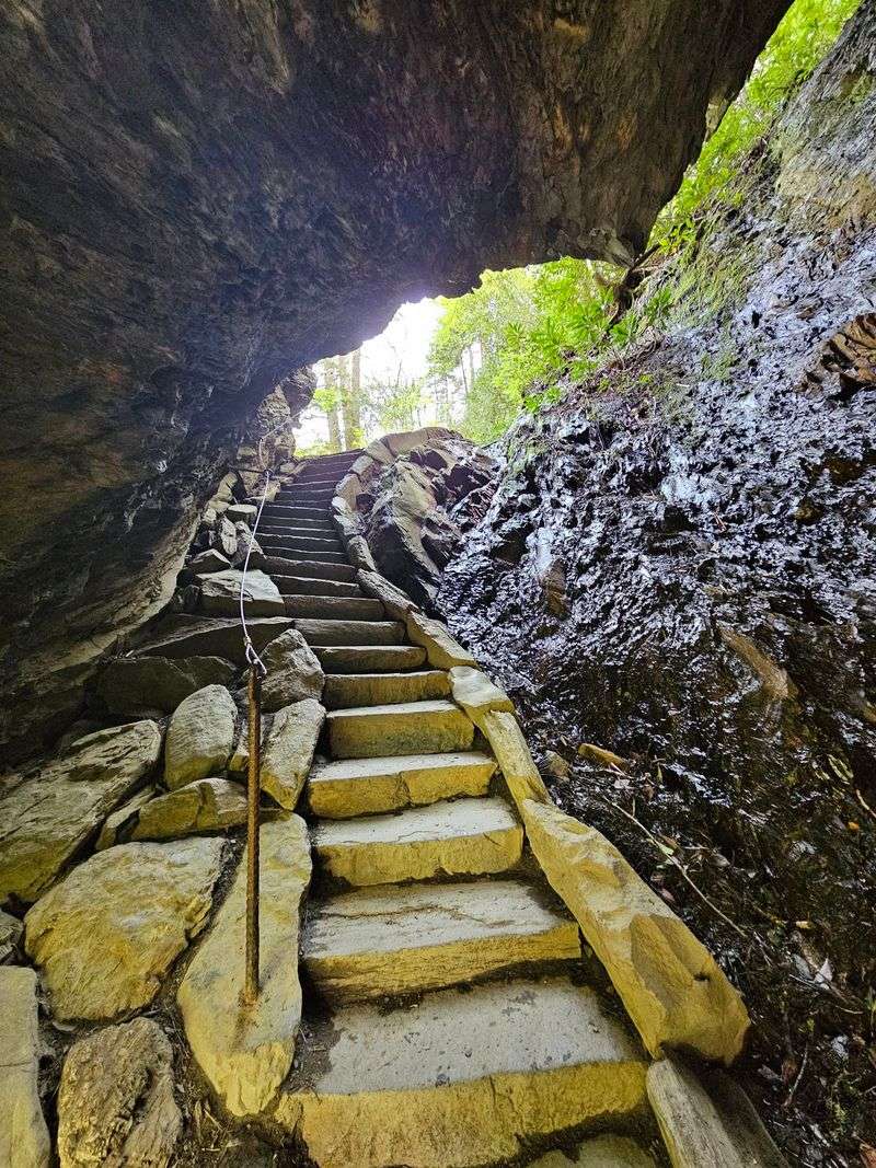
The name here is a bit of a fib. There is no cave, only an enormous leaning wall of rock.
Alum Cave Bluffs waits in Great Smoky Mountains National Park, roughly 11 miles from Gatlinburg. The concave bluff rises about 75 feet overhead.
Miners worked this rock in the early 1800s for epsom salts and alum. Both were valuable industrial goods at the time.
The hike runs 4.4 to 4.6 miles round trip and earns its moderate rating. Old-growth forest and rushing streams keep company along the way.
Arch Rock arrives first, a narrow stone tunnel with steps carved inside. Cables help you climb through the tight passage.
Higher up, Inspiration Point opens onto a rocky ledge above a wild valley. Peregrine falcons occasionally cut across the view.
Most hikers turn back at the bluffs and call it a fine day. Determined legs can push three more miles to Mount LeConte.
Spring floods the trailside with wildflowers and bright green growth. Fall delivers color plus thinner crowds on weekdays.
Parking sits at the Alum Cave Bluffs Trailhead on Newfound Gap Road, US 441. Both main lots fill fast, so aim for sunrise.
The trailhead lies about 6.8 miles south of Sugarlands Visitor Center. Pack layers, because the bluff area stays surprisingly cool.
4. Mushroom Rock, Signal Mountain
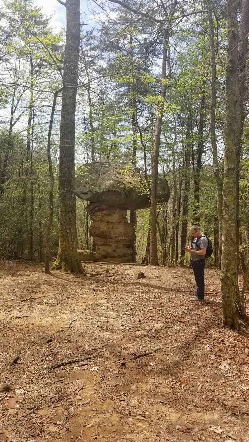
Call me silly, but some rocks really do look like giant fungi. This one wears a stone cap that seems ready to tip over.
Mushroom Rock stands on Signal Mountain near Chattanooga, and the resemblance is uncanny. The sandstone tower reaches 20 to 25 feet tall.
Several routes on the Cumberland Trail system lead to it. Choose based on how much sweat you want to invest.
Starting from Shackleford Ridge Park, the walk runs about 1.2 to 1.4 miles one way. That version suits a casual morning.
Tougher legs can begin at Suck Creek Road inside Prentice Cooper State Park. Expect a 6-mile round trip over rougher ground.
Many hikers extend the day by connecting toward Suck Creek. A 225-foot swinging bridge crosses North Suck Creek there.
Forest lanes along the way open to broad views of the Tennessee River Valley. Ferns and mossy boulders line the path.
Fall makes the surrounding hardwoods glow, though summer shade keeps the trail comfortable. Winter reveals ridgelines hidden by leaves.
No single address marks the formation itself. Use Signal Point Park at 100 Signal Point Rd, Signal Mtn, TN 37377 for access.
Bring a paper map, since junctions can confuse first-timers. Then let this cheerful stone toadstool prove nature has a sense of humor.
5. Walls Of Jericho, Near Cowan, On The Tennessee-Alabama Border
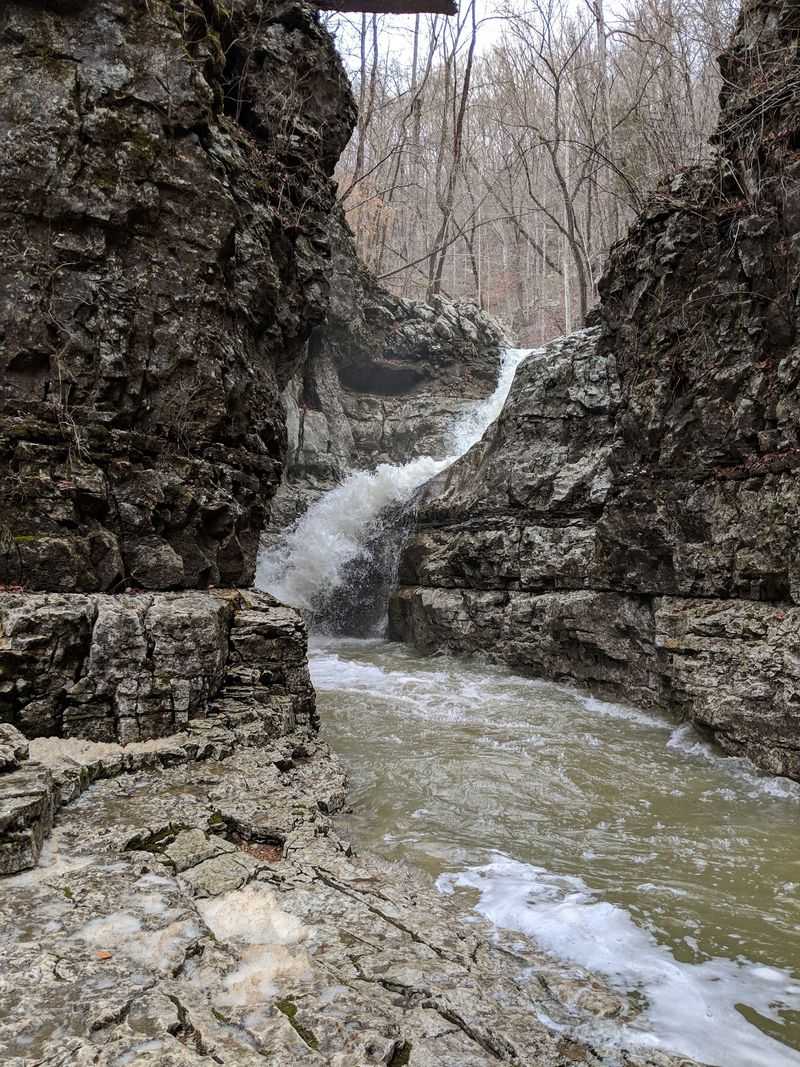
Let me level with you, this one asks for real effort. The payoff is a stone amphitheater carved by water over ages.
Walls of Jericho straddles the Tennessee-Alabama line near Cowan. The protected natural area covers 21,453 acres of true backcountry.
Round-trip distances run 6 to 7.6 miles with about 1,000 feet of descent. Remember, the climb out comes when you are tired.
Waterfalls, clear streams, and small caves appear as you drop toward the canyon floor. These waters feed the Paint Rock River headwaters.
Biologists treat the area as a hotspot for rare life. The Tennessee cave salamander lives among these wet rocks. Two trailheads serve the hike. The Alabama side runs about 6.5 miles and sits on AL 79 near Estillfork.
The Tennessee approach covers roughly 7.6 miles from Rowe Gap Rd, Belvidere, TN 37306. Both routes finish at the same stone bowl.
Early spring and late fall bring cooler air and stronger water flow. Full waterfalls make the descent far more dramatic.
Footing turns slick on wet limestone, so trekking poles help. Cell service disappears once you drop into the gorge.
Pack extra water and snacks for the return climb. Hikers who prepare properly leave this canyon grinning the whole drive home.
6. Lost Creek Falls And Cave, White County, Near Sparta
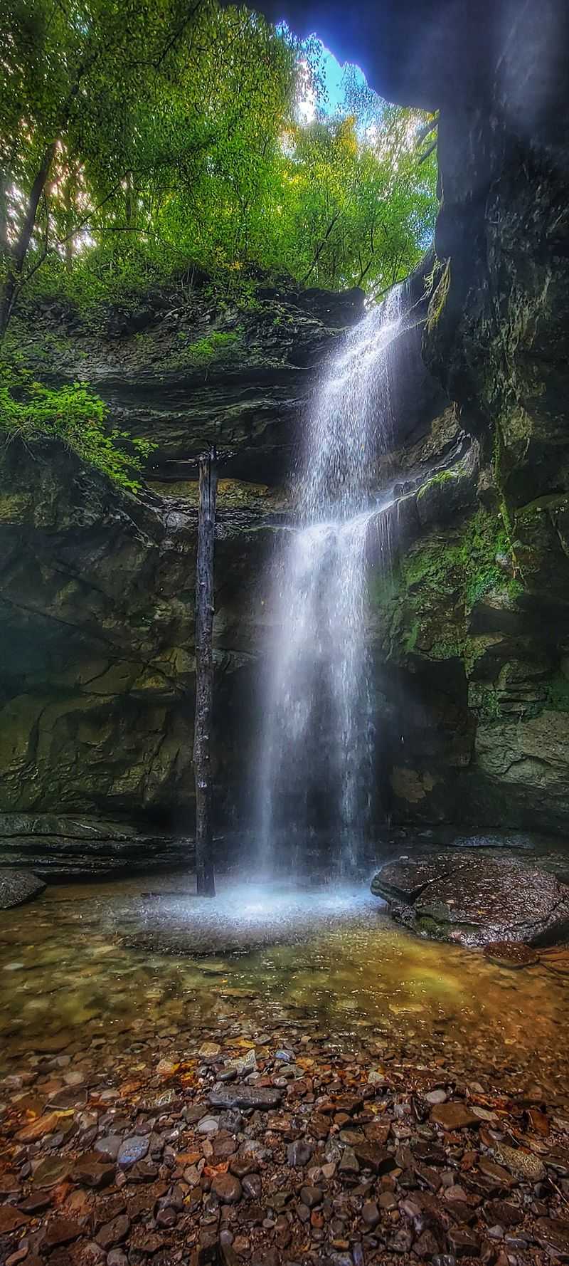
Here is a strange one for your list. A creek pours over a cliff, then vanishes straight into the ground.
Lost Creek Falls sits in White County near Sparta, dropping 40 to 60 feet. The water tumbles over a collapsed cave, then disappears into a sinkhole.
Directly across the basin gapes the entrance to Lost Creek Cave. Few cave mouths anywhere look this photogenic.
The cavern ranks among the largest in Middle Tennessee. Five entrances connect roughly seven miles of mapped passages.
Film crews noticed the scenery too. Scenes for the 1994 live-action Jungle Book were shot right here. Summer heat never fully reaches the sinkhole floor. Trapped cool air grows thick ferns, wildflowers, and liverworts.
Cave access closes September through May to protect hibernating bats. Summer entry requires a free permit from Scott’s Gulf Wilderness State Park.
Reaching the falls asks almost nothing of you. The walk runs just 0.16 to 0.25 miles from the parking area.
That short approach makes it wonderful for families and anyone with limited stamina. Strollers and small kids handle it fine.
Parking coordinates are N35 50.442, W85 21.660. The general address is White’s Cave Rd, Sparta, TN 38583. Go after steady rain and the falls roar loud enough to drown conversation.
7. Rock City Gardens, Lookout Mountain, Chattanooga
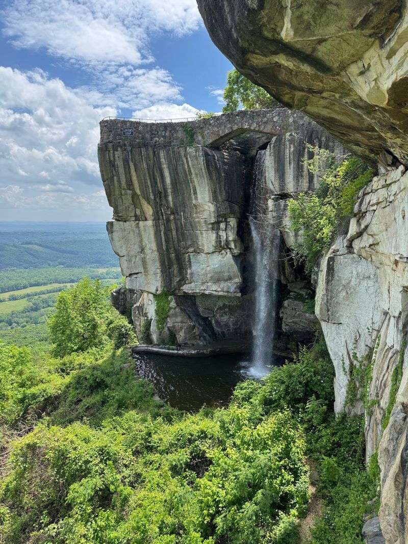
Have you given any thought to a trail that squeezes you between boulders? Bring a slim backpack, because the gaps are tight.
Rock City Gardens crowns Lookout Mountain, about six miles from downtown Chattanooga. Ancient stone formations mix with planted gardens throughout.
The Enchanted Trail stretches 4,100 feet through a maze of rock. Signs guide you the whole way.
Fat Man’s Squeeze and Needle’s Eye test your shoulders in the narrowest sections. Kids usually breeze through laughing.
Swing-A-Long Bridge sways above a deep chasm, and the Standing Stones Garden calms things back down. Lover’s Leap tops the highlights list.
On clear days, that overlook reveals views said to span seven states. Bring a camera with a wide lens.
Fairyland Caverns and Mother Goose Village glow with UV-lit dioramas of classic tales. Younger explorers adore these tunnels.
Every season here looks different. Fall brings Rocktoberfest and the Enchanted Pumpkin Patch among blazing leaves.
Winter turns the trail into the Enchanted Garden of Lights. Spring answers with over 400 native plant species blooming plus live music.
The attraction stays open year-round, so timing is flexible. Weekday mornings feel calmest along the narrow passages.
Find it at 1400 Patten Road, Lookout Mountain, GA 30750. Wear grippy shoes and let the stone maze do the rest.
8. Pogue Creek Canyon State Natural Area, Near Jamestown
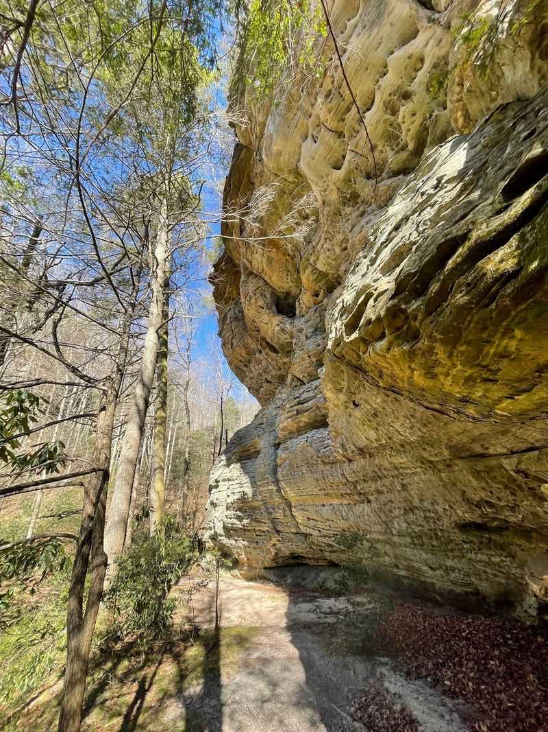
Sounds too good to be true, but a 3,000-acre canyon here stays remarkably quiet. Solitude comes standard on these trails.
Pogue Creek Canyon sits in Fentress County near Jamestown. Exposed cliffs glow reddish-orange and yellow when sunlight hits them.
The preserve connects with Pickett State Forest and neighbors Pickett CCC Memorial State Park. Together they form a large stretch of wild country.
Rockhouses appear throughout the canyon, large overhangs sheltering unusual plants. The federally endangered Cumberland sandwort grows in these damp alcoves.
Lucy Braun’s snakeroot, a state-listed species, also survives here. Botanists treasure the whole gorge.
Mixed mesophytic forest blankets the slopes with dozens of tree species. Undergrowth stays thick and green through summer.
Hiking options suit different energy levels. The Pogue Creek Overlook Trail covers 1.5 miles and delivers sweeping canyon panoramas.
Upper Canyon Trail plus Mesa Top can be combined for 6.3 moderate miles. Rock walls tower beside you much of the way.
Spring and fall bring the most pleasant temperatures and the best wildlife watching. Deer and hawks show up often. Cell signal fades quickly, so carry a printed map. Downloaded offline maps also work well.
Pickett CCC Memorial State Park manages the area, at 4605 Pickett Park Hwy, Jamestown, TN 38556. Stop in and grab trail beta first.
9. McCloud Mountain, Near Chattanooga
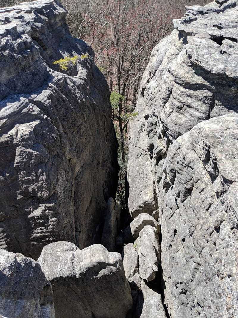
That came completely out of left field for me. A mountaintop retreat guards some of the state’s boldest stone.
McCloud Mountain rises in Duff, near La Follette, on a 1300-acre tract. The ridge sits at 2700 feet atop the Cumberland Mountains.
Geologists believe it holds one of the longest continuous chains of solid rock in the Southeast. That is a serious claim.
Chimney Rocks steal the show, 32 sandstone pillars jutting from the ridgeline. They range between 100 and 250 feet tall.
A Natural Bridge adds another highlight, a 65-foot arch measuring over 90 feet top to bottom. Photographers linger here.
Elephant’s Mouth Spring earned its name from a rock shaped like an elephant’s head. A year-round spring flows below it.
Overlooks reveal Norris Lake, Clinch Mountain, House Mountain, and the distant Great Smoky Mountains. Clear days stretch the view remarkably far.
A Skywalk boardwalk, built to ADA standards, opens those panoramas to wheelchairs and strollers. Accessibility like this is rare on ridgetops.
The property operates privately, which keeps crowds thin. Reservations at the restaurant or lodge are required for access.
Plan ahead, because spontaneous drop-ins will not work. The lodge address is 1220 McClouds Trail, Duff, TN 37729. Book a sunset table and watch those pillars turn amber.
10. Snoopers Rock Overlook, Tennessee River Gorge
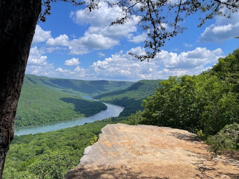
I had to do a double-take at the first photo I saw. The river bends below a flat stone platform like a stage.
Snoopers Rock sits inside Prentice Cooper State Forest near Chattanooga. Locals call the gorge below the Grand Canyon of Tennessee.
The overlook rests on a huge sandstone bluff with nothing blocking the view. The Tennessee River winds through cliffs far beneath your boots.
Sunrise and sunset draw photographers with tripods and thermoses. Morning light often reveals clouds pooled inside the gorge.
The main route follows the Cumberland Trail, a moderate 5.9-mile out-and-back. Shorter access exists, including a quarter-mile walk to the rock.
Along the longer trail, Indian Rockhouse appears, a natural staircase formed by split boulders. Small discoveries pile up quickly here.
Wildflowers, songbirds, and old hardwoods fill the forest. Every mile hands you something different.
Fall is the headline season, with color peaking mid-October through early November. Cloud inversions make those mornings unforgettable. Spring brings thick greenery and comfortable hiking weather. Summer works best in early hours.
Check the Prentice Cooper State Forest website for hunting dates, since closures happen. Safety rules apply to everyone.
The drive includes a long gravel road, so allow extra time. Reach the area from Game Reserve Rd, Chattanooga, TN 37405.