Kayak Through This Texas Canyon With Walls Higher Than The Empire State Building
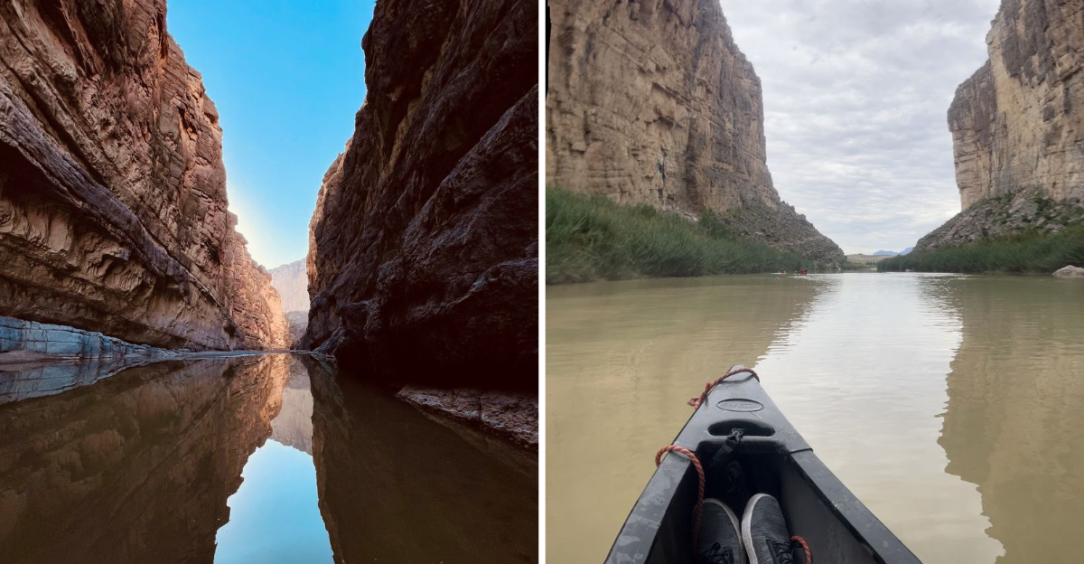
A kayak feels very small when limestone walls rise more than a thousand feet above the water.
In Texas, this canyon turns a paddle into a lesson in scale, geology, and just how dramatic a river can become.
The gorge narrows, the cliffs climb, and sound starts behaving differently between the walls.
Look up! The border runs through the river, with one country on either side and the same canyon holding both.
Fossils, wildlife, and layers of exposed rock add reasons to slow the paddle. The scenery deserves time.
Bring sun protection, water, and a secured camera. The river has a way of making everyone forget about dry land for a while.
Where Two Countries Share A River
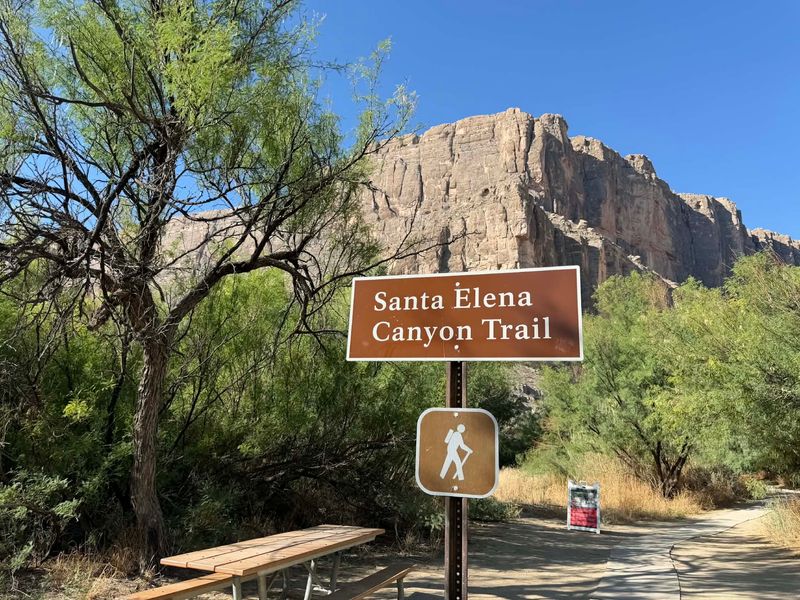
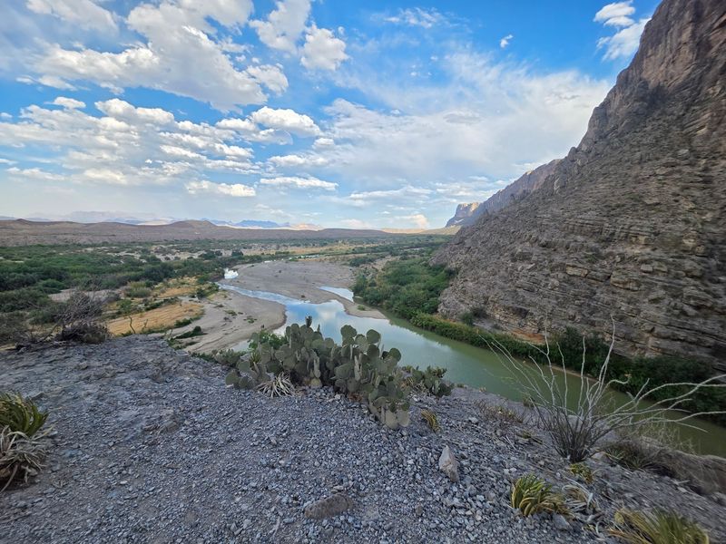
My first look came from a scenic pullout, and I actually laughed out loud. A flat desert stretched forever, then a wall of rock split open like a doorway.
That doorway is Santa Elena Canyon, tucked inside Big Bend National Park in West Texas. The cliffs climb roughly 1,500 feet above the water, which beats the Empire State Building by a comfortable margin.
The Rio Grande runs right through the middle of it. The international boundary follows the middle of the Rio Grande’s deepest channel, with the northern side of the canyon in the United States and the southern side in Mexico.
The narrow river corridor makes the international boundary unusually visible, with protected canyon walls rising on both the U.S. and Mexican sides.
Getting here takes commitment, and that is part of the appeal. The nearest services are far away, and the last miles feel wonderfully empty.
Most drivers arrive by the Ross Maxwell Scenic Drive, a 30-mile route with pullouts and exhibits worth stopping for.
Old Maverick Road provides a 14-mile dirt-road alternative, but it can be rough, washboarded, muddy, or impassable after rain, and current NPS guidance recommends high clearance and four-wheel drive.
Paddling Into The Shadowed Gorge
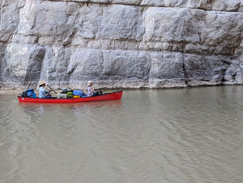
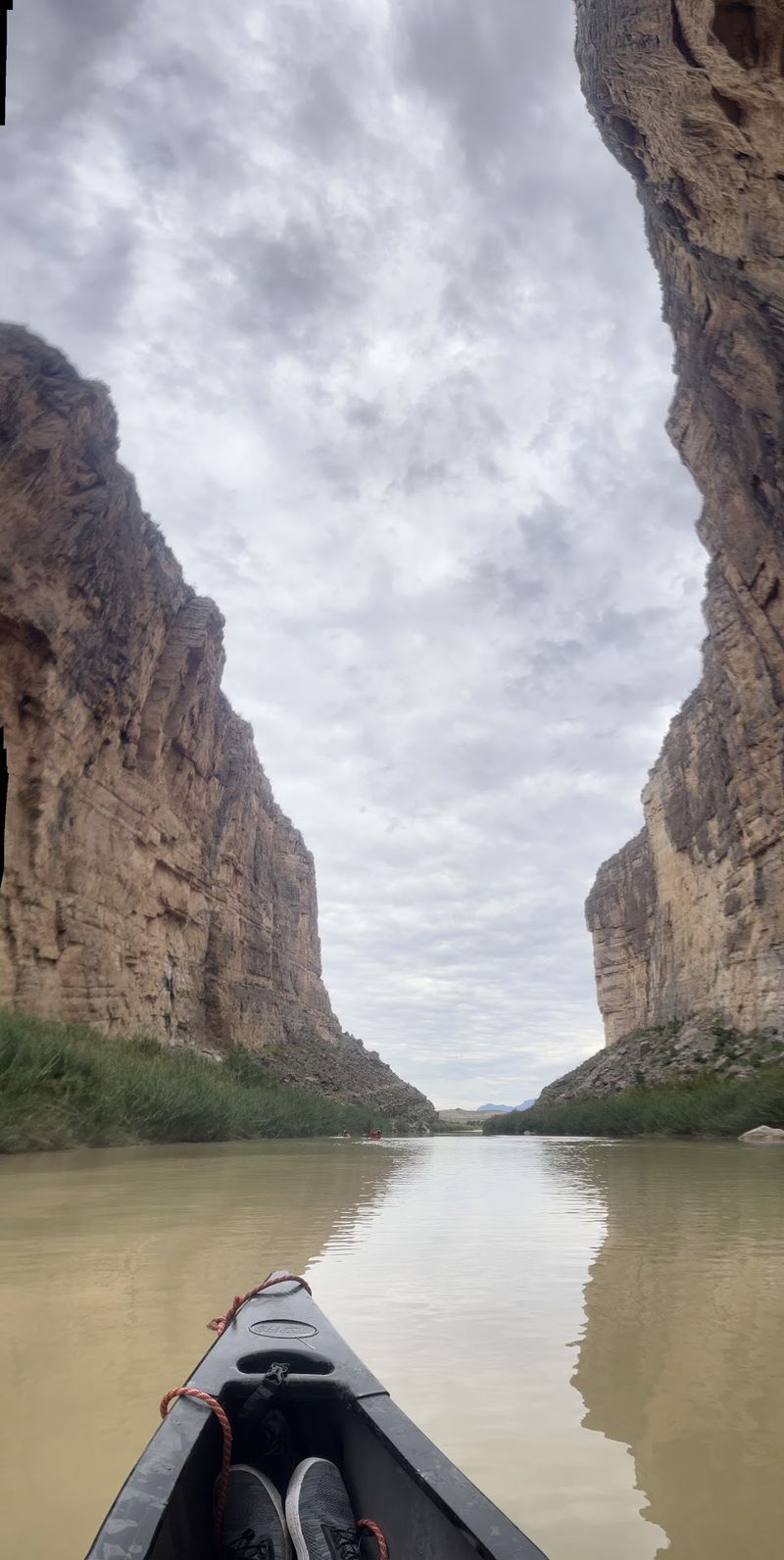
Nothing prepared me for the moment the walls closed in overhead. Sitting low in a kayak changes the whole scale of the place.
Local outfitters run guided trips lasting one to three days, and confident paddlers can go on their own. I chose what river folks call a boomerang trip.
A boomerang trip starts near the Santa Elena Canyon Trailhead, paddles upstream into the canyon, and returns downstream.
NPS says this option works best at low flows, with about 100 cfs considered ideal and flows under 200 cfs generally workable.
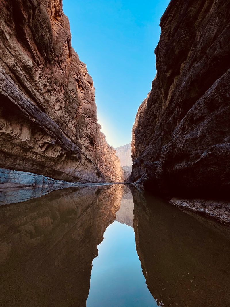
Inside, the water turns a deep bottle green. On clear mornings the surface mirrors the sky, and the reflection wobbles with every stroke.
Sound behaves strangely too. My paddle drips echoed off the rock, while canyon wrens dropped their tumbling calls from somewhere far above.
About two miles into the canyon sits the Rock Slide, which can rate as Class IV at certain water levels. River runners should scout it and match the trip to current flow, watercraft, and experience.
All day-use and overnight river trips within Big Bend National Park require an NPS river permit, with day-use permits currently free.
Reading Water Levels Before You Go
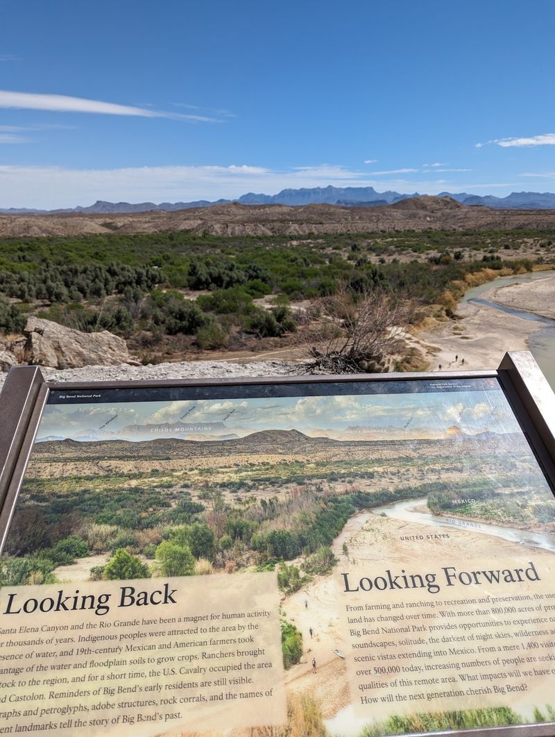
Rivers have moods, and this one keeps its own schedule. Learning that saved my trip from turning into a long walk pulling a boat.
September through January is generally considered a favorable period for Rio Grande trips, though water levels can rise or fall at any time.
Flows through Big Bend are strongly influenced by the Rio Conchos, seasonal rainfall, and upstream water management.
Flow recommendations depend on the type of trip. For an upstream boomerang trip, NPS considers about 100 cfs ideal and says flows below 100 may require some dragging, while 300 to 600 cfs is considered good for downstream travel in open boats.
Above about 600 cfs, NPS says rafts are generally more appropriate and advises novices to reconsider a Santa Elena trip. At exceptionally high flows above 2,000 cfs, the park recommends specific types of properly equipped watercraft.
Check the flow before you drive out, because there is no signal at the put-in. I wrote the numbers on a scrap of paper and kept it in my dry bag.
Storms change everything quickly here. July through September brings the heaviest rain, and Terlingua Creek can rise fast enough to block the trail entirely.
A Short Hike With Big Payoff
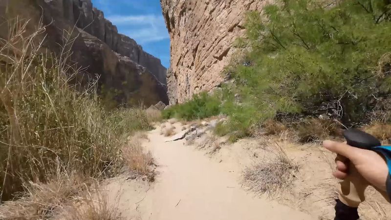
Not everyone wants a paddle, and honestly the footpath delivers plenty. I hiked it twice, once at sunrise and once near sunset.
The maintained Santa Elena Canyon Trail is 1.6 miles round trip with about 80 feet of elevation change and an average hiking time of roughly one hour.
The start involves crossing Terlingua Creek, which may be bone dry, ankle-deep, or thick with mud. Pick your crossing point carefully, since the obvious line is not always the right one.
After that, concrete steps switchback up to a viewpoint that stopped me in my tracks. The river bends below, and the canyon mouth yawns open ahead.
The path then drops back down toward the water and threads between boulders. It ends where the cliff plunges straight into the current, with nowhere left to walk.
Interpretive signs along the way explain fossils, minerals, and desert plants in plain language. Kids tend to love them, though drop-offs mean little ones need a hand nearby. Pets are not allowed on any trail in the park, so leave the dog at home.
Fossils Hiding In Ancient Limestone
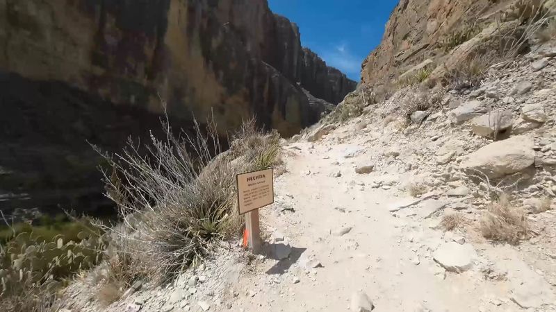
Here is a fact that rearranged my brain. The rock towering above the Rio Grande once sat at the bottom of a shallow sea.
The canyon walls expose Cretaceous limestone deposited when warm, shallow seas covered this region, with the prominent Santa Elena and Del Carmen limestone formations dating to the Early Cretaceous.
Walk slowly and you will spot the evidence yourself. Marine fossils and glittering calcite crystals sit embedded in the stone right along the trail.
Marine fossils can be seen in limestone along the trail, and the National Park Service asks visitors to photograph them without disturbing or collecting them.
The Terlingua Fault gets credit for much of the drama here. That break in the earth helped create the sharp wall that the river later sliced through.
Water did the rest of the work, and it still is. The Rio Grande carries sand and silt that grinds away at the limestone year after year.
Pedro de Rábago y Terán led a Spanish expedition into the Big Bend region in 1747 and had to detour around Santa Elena Canyon. The exact origin of the canyon’s Santa Elena name is less firmly documented.
Desert Creatures Along The Banks
Bring binoculars. I nearly left mine in the car and would have regretted it all day.
Ravens patrol the upper ledges, riding air currents that seem to come from nowhere. Canyon wrens supply the soundtrack with their bright, falling whistles.
Beavers actually live in the Rio Grande here, which surprises almost everyone. They burrow into the banks instead of building the classic wooden lodges.
Scan rocky slopes and you may spot aoudads, or Barbary sheep. The invasive animals spread into Big Bend from populations stocked on private Texas game ranches and have likely been present in the park since the 1970s.
The wider park holds around 75 mammal species, including javelinas, ringtails, coyotes, and black bears. Golden eagles and peregrine falcons work the thermals above the cliffs.
Down at ground level, keep your eyes open for roadrunners and Texas horned lizards. Western diamondback rattlesnakes live here too, so watch where you place hands and feet.
Plant life stays interesting as well. Mesquite, guayacan, cenizo, and mariola grow in the scrub, while riparian greenery crowds the water’s edge.
Best Light And Cooler Seasons
Timing turns a good visit into a great one. I learned that on my sunrise attempt, when the cliff face glowed orange while the gorge interior stayed inky black.
October through April brings the friendliest temperatures. Spring and fall feel especially comfortable, though spring break packs the parking lot early.
Summer heat out here is no joke, with afternoons that drain your energy fast. Winter nights can turn genuinely cold, so pack layers even if the day felt warm.
Morning and late afternoon deliver shade inside the canyon, which matters more than you expect. Midday light flattens the rock and washes out photographs.
Late-day temperatures can be more comfortable than midday conditions, while shifting light changes the appearance of the canyon walls.
Arrive early if you visit during peak months, since parking fills up. The lot is paved and decent sized, but it has limits.
Big Bend National Park sits far from city lights, making it a superb stargazing spot. After dark, the sky over this part of Texas fills with more stars than you can count.
Packing Smart For Remote Country
Preparation matters more here than at most parks. Services are thin, distances are long, and the desert does not negotiate.
Water tops the list every time. NPS recommends at least one gallon per person per day in Big Bend, with at least two liters per person for a half-day hike and more potentially needed in extreme heat.
Salty snacks help replace what you sweat out in the dry air. I carried nuts and pretzels, and they disappeared faster than expected.
Sunscreen and a wide hat are not optional. Shade comes in patches on the trail, and the sun finds you between them.
Cell service is unreliable across the whole park, so download maps before you arrive. Paper backups cost nothing and never run out of battery.
At the trailhead you will find parking, picnic tables, and vault restrooms, but the National Park Service describes the parking and trailhead area as unpaved. Bring all the drinking water you need.
Panther Junction Visitor Center is currently the dependable stop for ranger information and river permits during the warmer months.
Castolon Visitor Center is seasonal and is closed from May through October, while Luna’s Jacal remains a historic stop along Old Maverick Road when road conditions allow.
This corner of Texas rewards travelers who plan, then let the canyon do the rest.