Nebraska’s Highest Point Sits At 5,424 Feet In A Quiet Bison Pasture You Can Drive Right To
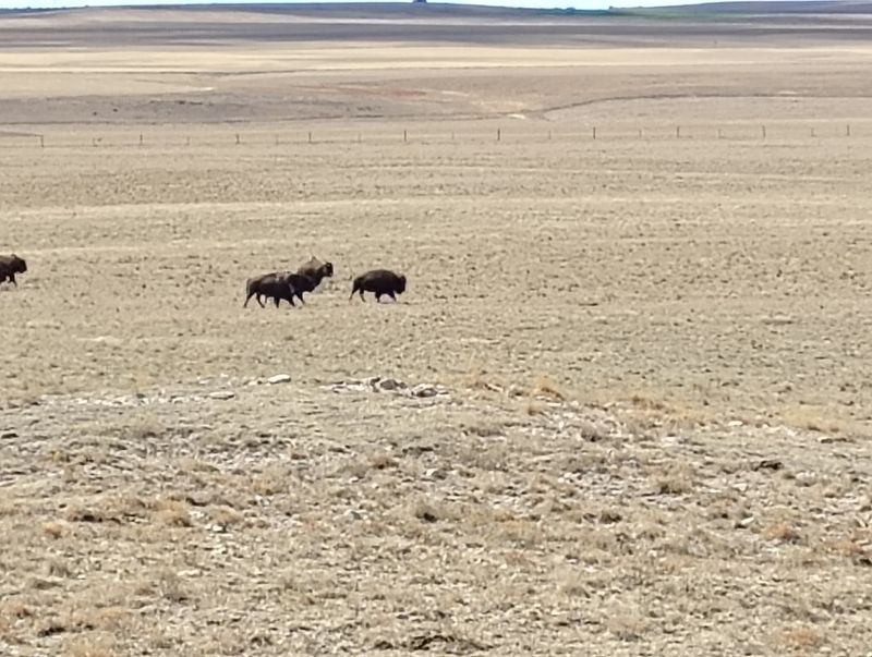
Most states guard their highest point behind switchbacks, trailheads, and a long climb. Nebraska hands you a dirt road, a cattle gate, and a herd of bison chewing grass in the distance.
The summit here is a slight swell in a pasture, marked by a stone monument and a bench, and you can park a few feet from it. It sounds almost like a joke until you stand there, wind pushing at your jacket, and see the plains rolling out in every direction.
A Pasture Summit in the Far Southwest Corner
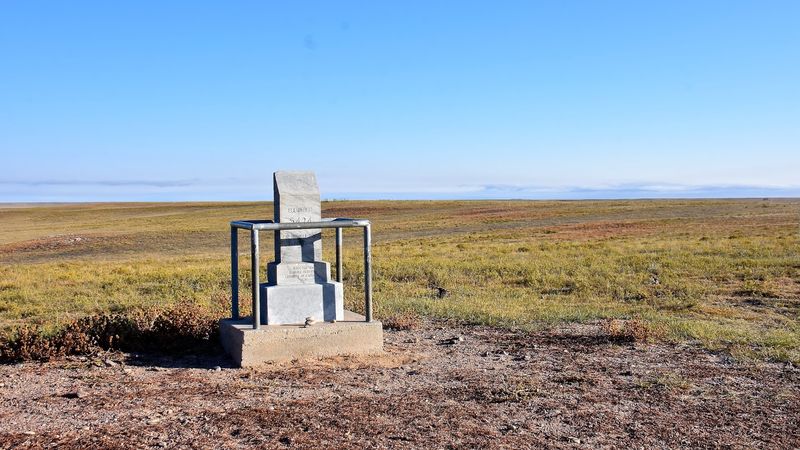
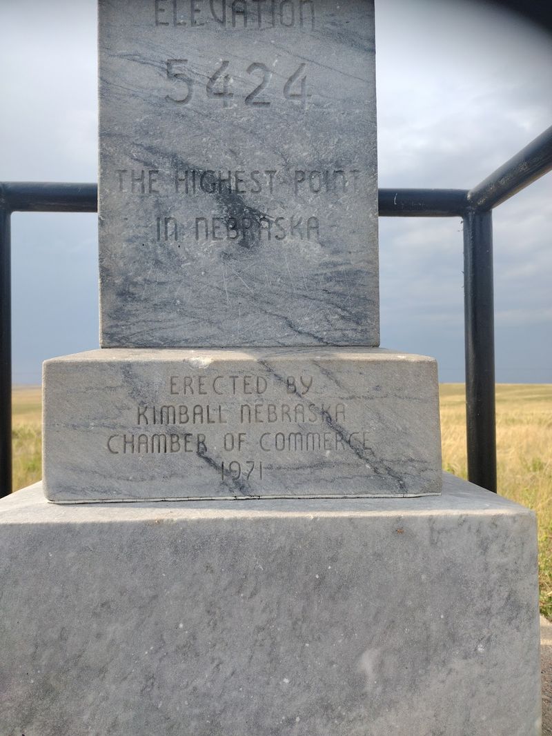
Drive to the far southwestern corner of Kimball County, where Nebraska, Wyoming, and Colorado nearly touch, and you arrive at Panorama Point. The elevation reads 5,424 feet, though a few sources list it a handful of feet higher.
What sits there is not a peak in any traditional sense. There is no summit ridge, no rocky outcrop, no switchback trail.
The land simply rises a little more here than anywhere else in the state, and a stone monument marks the spot where the measurements agreed.
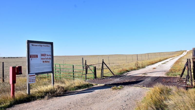
The surrounding ground belongs to High Point Bison, a working ranch whose owners keep the site open to anyone willing to make the drive. A dirt track leads from the entrance gate straight to the marker, past pasture fencing and grazing land.
Nebraska’s high point rewards a different kind of curiosity than a mountain does. You come for the oddity of it, the flatness, the fact that the tallest ground in an entire state is a place where bison wander through without noticing.
It is quiet in a way few landmarks manage.
How a 1951 Survey Put This Spot on the Map
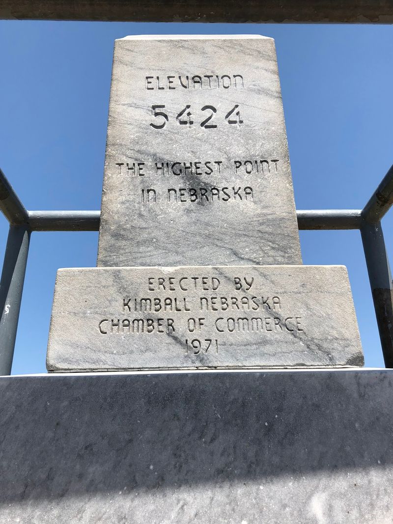
October 1951 is when someone finally pinned down where Nebraska actually peaks. Official recognition took another two decades, arriving in 1971.
Odd as that gap sounds, it makes sense out here. On terrain this gradual, the difference between the highest ground and the second-highest ground can be measured in inches across a stretch of pasture.
Determining a true high point on the High Plains takes careful surveying rather than a glance at the skyline.
The Rocky Mountain foothills climb steadily eastward into this corner of the state, and Nebraska catches the tail end of that rise just before the border cuts it off. A few more miles west and the land keeps climbing into Wyoming, where 5,424 feet would barely register.
That accident of geography is exactly what makes the site interesting. Nebraska’s ceiling is not a Nebraska feature at all.
It is the last inch of somewhere else, and the state gets to claim it because a boundary line happened to fall where it did.
The Stone Monument, the Bench, and the Guest Register
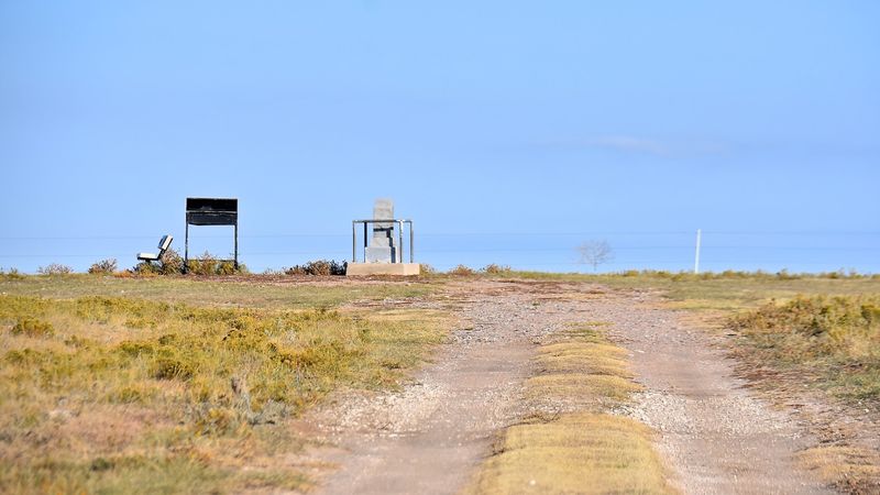
Three things sit at the top: a stone monument, a bench placed by the Highpointers Club, and a small metal desk holding a guest register.
Sign your name. Flip back through the pages and you find handwriting from people who drove in from Boulder, from the Black Hills, from wherever Interstate 80 happened to be taking them that week.
Some are working through all forty-eight continental state high points and this one is a checkmark on a long list.
The bench matters more than it sounds like it should. Sitting down changes the experience from a two-minute photo stop into something slower, where the wind and the grass and the distance start to register.
No visitor center stands nearby. No gift shop, no plaque wall, no interpretive signage explaining glacial history.
The monument states what the place is and lets the pasture handle the rest.
Bring a pen. The register box holds one sometimes, but wind and weather are hard on small supplies out here.
Bison Grazing Around the Marker
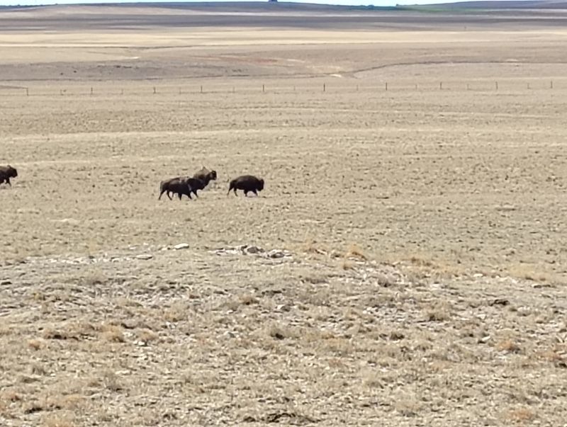
Shaggy brown shapes moving slowly across the grass are usually the first thing you notice before the monument itself. High Point Bison runs herds across this land, and the animals often graze within view of the marker.
They are not a petting zoo attraction. Bison are wild, powerful, and unpredictable, and the safe move is to stay in or near your vehicle when a herd is close and keep real distance between you and them.
A telephoto lens does the work your feet should not.
Whether you see them at all comes down to luck and where the herd has wandered that day. Some arrivals find bison spread across the pasture in a loose line.
Others find nothing but wind turbines turning on the horizon and grass bending in the breeze.
Either outcome fits the place. The bison turn a geographic footnote into a scene worth stopping for, and their absence leaves you with something quieter, which has its own appeal on a slow afternoon in the Panhandle.
Views That Reach the Rockies on Clear Days
Look west on a genuinely clear day and the Rocky Mountains show up as a pale, low ridge along the horizon. It is faint.
It is also unmistakable once you spot it.
Most days the view is grass and sky, layered out to a horizon that never quite resolves into anything. That expanse is the point of the name, and it delivers on it in a plain way rather than a dramatic one.
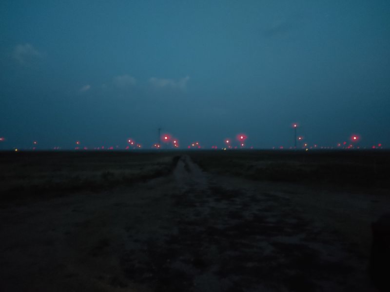
Wind turbines from nearby farms punctuate the sightlines, turning steadily. Fence posts run off in straight lines.
Cloud shadows slide across the pasture, and you can watch one travel for a long while before it reaches anything.
Morning and late afternoon light suits the landscape best, when low sun brings texture out of the grass and makes the subtle rise of the land visible. Midday flattens everything into pale green and washed blue.
Standing at Nebraska’s ceiling with three states essentially within reach is a strange, satisfying feeling that photos rarely capture.
Why Your GPS Will Probably Betray You
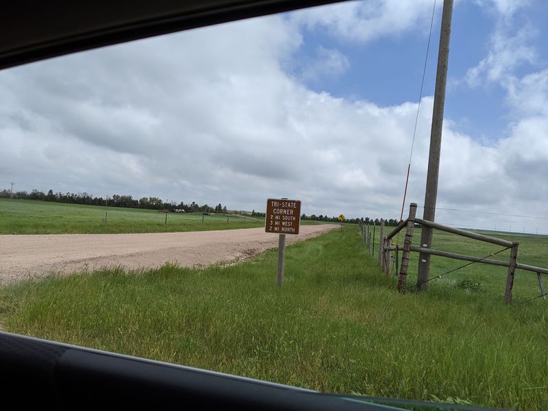
Here is the single most useful thing to know before leaving home: mapping apps regularly send people to the wrong spot. One common pin drops travelers at a private farmhouse roughly half a mile north of the correct turn, and another routes drivers along tire tracks beside fence lines that are not roads at all.
The turn you want is the one marked with the High Point Bison sign and the small fee station. Searching for the listing associated with Pine Bluff rather than the default pin tends to produce accurate directions.
Download offline maps before you go. Cell service disappears out here, and once the pavement ends there is nobody around to ask.
Peakbagger and similar mapping tools handle this location more reliably than the standard default pin. Screenshot the route if nothing else.
Respect the no-trespassing signs on nearby private drives. The ranch welcomes people at the marked gate, and the neighbors did not sign up for a steady stream of lost travelers in their yard.
The Three-Dollar Honor Box at the Gate
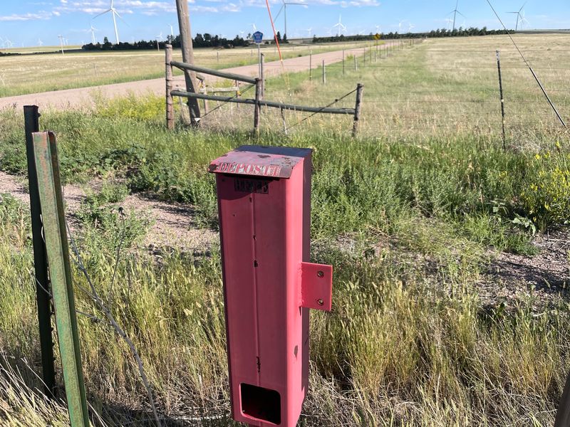
Three dollars per person, requested as a donation, dropped into a collection box at the entrance gate. That is the entire cost of standing on the highest ground in Nebraska.
Bring cash, and bring it in small bills. There is no card reader, no attendant, no change machine.
The box operates on trust, and the money goes toward maintaining the road, the gate, and the site itself.
Landowners are under no obligation to let anyone cross their pasture. The family behind High Point Bison chose to keep access open rather than fence it off, which is why this high point stays reachable when it could easily have become a place people only read about.
Paying the small fee is the least complicated way to keep that arrangement working. A few dollars against the wear that dirt roads and cattle gates take from steady traffic is a fair trade.
Tuck a few singles in the glove box before you head west. Nothing sours a long drive like arriving with nothing but a debit card.
Dirt Roads, Mud, and the Fuel Gauge Problem
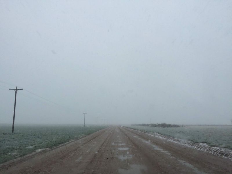
Miles of county dirt road separate the highway from the gate, and their condition swings with the weather. Dry and graded, they are an easy cruise in any passenger car.
Add snow or a hard rain and the same roads turn to slick, rutted mud that will test a low-clearance vehicle.
Fuel deserves serious thought. Services are scarce in this corner of the Panhandle, and more than one traveler has coasted back toward the interstate watching the needle sit near empty with no cell signal to call for help.
Fill the tank in Kimball or Pine Bluffs before turning south. Consider it part of the route rather than an optional errand.
Pack water, a paper map or offline route, and a charged phone even though it may not find a tower. A blanket in the trunk is sensible from late fall through early spring.
None of this makes the trip difficult. It just makes preparation the difference between a pleasant detour and a long, anxious afternoon.
Seasons on the High Plains Corner
September and October may be the best window. Grass turns gold, the heat backs off, the roads are usually dry, and the light stretches long across the pasture in a way that makes the subtle rise of the land visible.
Summer brings heat, strong sun, and very little shade. There is not a tree in sight up there, so a hat and water are not optional extras.
Winter is a different proposition entirely. Snow can make the dirt approach roads difficult or impassable, and wind chill on an exposed pasture at 5,424 feet is no small thing.
A trip in January calls for checking conditions first.
Spring runs muddy through thaw and rain, though the green that follows is worth timing a visit around if the roads have dried.
Wind is a constant regardless of month. Plan for it, hold onto hats and papers, and expect to hear it more than anything else while you stand at the marker.
Who Gets the Most out of Nebraska’s Ceiling
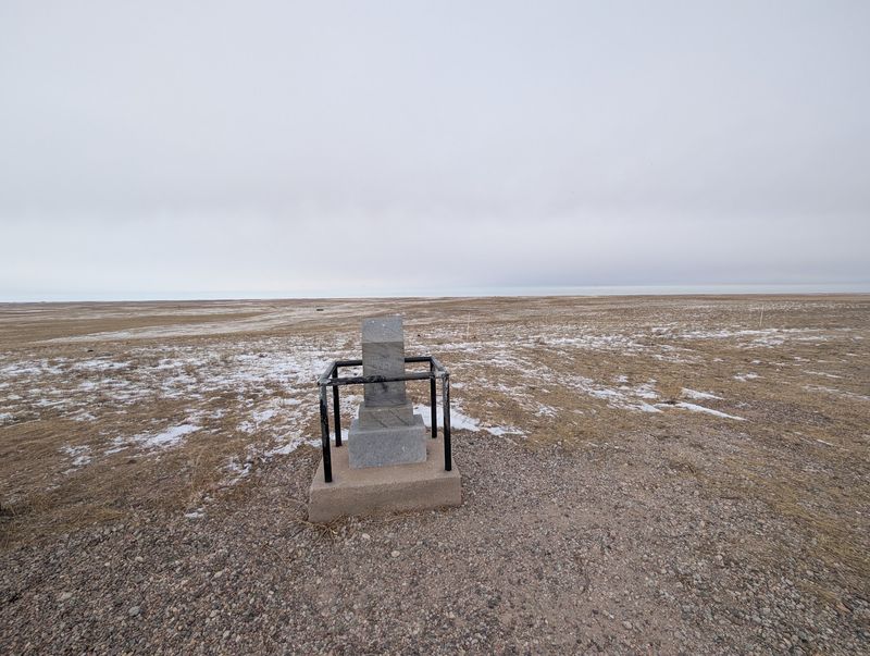
Highpointers make up a good share of the traffic here. People chasing all forty-eight continental state summits arrive knowing exactly what to expect: a drive-up marker, a register to sign, and a short stop before the next state.
Families passing through on Interstate 80 find it a reasonable detour, especially with kids who like the idea of standing on the tallest spot in an entire state without hiking a single step. The bison seal the deal for most children.
Photographers who work with open space and big skies get more from it than those looking for a dramatic subject. There is nothing here that photographs itself.
Anyone expecting a viewpoint with railings and a parking lot will be puzzled. The appeal runs on quiet, distance, and the small absurdity of the whole idea.
Retirees on a Panhandle drive tend to enjoy it most, sitting on the bench a while with no agenda pressing them along. It suits a slow schedule better than a tight one.
Building a Day Trip Around the Stop
Standing at the monument takes fifteen minutes. Getting there and back fills an afternoon, which is why pairing it with other stops makes the drive pay off.
Kimball sits on Interstate 80 to the northeast and works as a fuel-and-food anchor before the turn south. Pine Bluffs, just across the Wyoming line, offers another practical stop and is closer to the correct approach road.
From Omaha or Lincoln this is not a same-day round trip. Panhandle residents and anyone already traveling I-80 westbound are the natural audience.
Scotts Bluff National Monument and the wider Panhandle sit north of here for travelers building a longer loop through western Nebraska. Combining the two makes a solid weekend rather than a stretched-thin single day.
Give yourself extra time on the return. Losing a half hour to a wrong turn on unmarked county roads happens often enough that you should build the cushion into your plan rather than hope for the best.
The Verdict on a Very Flat Summit
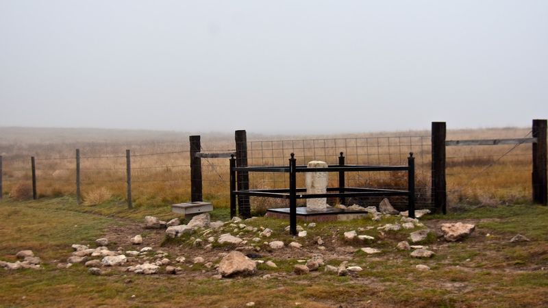
Nobody drives to Panorama Point for grandeur. The reward is stranger and smaller: a stone marker in a bison pasture, a register full of names, and a horizon that keeps going long after your eyes give up on it.
Go in with the right expectations and the place delivers. Prepare correctly, download your route, carry cash and a full tank, and it becomes a genuinely pleasant hour in a corner of the state most Nebraskans never see.
Show up unprepared, trusting a default map pin, and it turns into a frustrating loop past no-trespassing signs on roads that go nowhere.
What lingers afterward is the quiet. Wind through grass, a herd moving slowly a few hundred yards off, and the odd satisfaction of knowing there is no ground in Nebraska higher than where your boots are planted.
Three dollars and a dirt road buy you that. For a state high point you can reach without breaking a sweat, it holds up better than the numbers suggest.