10 Quiet New Mexico Towns Near The Manzano Mountains That Feel Frozen In Time
Some roads seem to lower the volume of everything around you.
Along the Manzano Mountains, New Mexico offers small communities shaped by adobe buildings, old churches, orchards, ranchland, and stories stretching across generations.
The route rewards people who notice details. A historic mission might appear beside a quiet road. Mountain scenery can open suddenly beyond a cluster of homes.
Nothing needs a giant sign to feel worth seeing. The history is scattered naturally through the landscape, which makes exploring feel less like checking boxes and more like discovering layers.
These towns invite slower driving and longer looks.
Keep the schedule loose, because this is the kind of region where an unplanned stop can easily become the most interesting part of the day.
1. Manzano, Torrance County
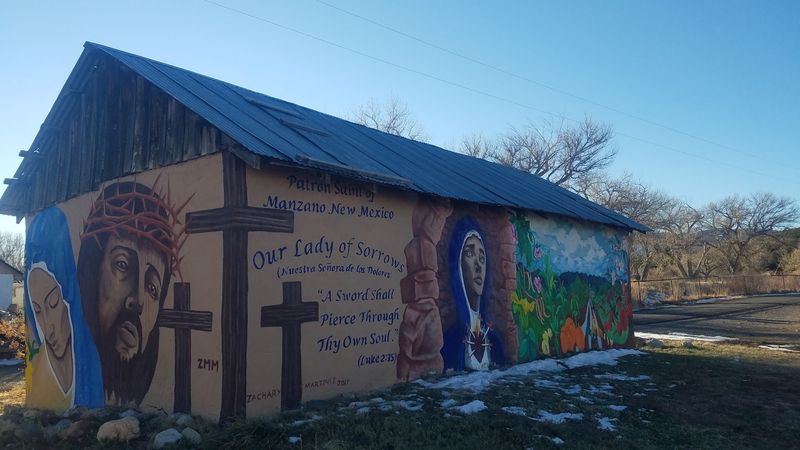
Just imagine for a second a village so small that 26 people make up the entire census count. Apple trees, not traffic lights, define this corner of Torrance County.
Manzano takes its name from the Spanish word for apple tree, and two ancient orchards still grow here. Local tradition claims they were planted before 1676, though studies point to sometime after 1800.
Either way, they rank among the oldest orchards in America. Settlers were reestablishing the Manzano area by the early 1800s, and the village later developed around its springs, orchards, and small lake.
East of that water stands a torreon, an old defensive tower raised to shield settlers during raids. It remains one of the most striking historical objects in the whole mountain range.
During the early 1800s, settlers reestablished communities along the eastern side of the Manzano Mountains, including Manzano.
Hikers get lucky here, since Manzano Mountains State Park sits close by with shaded trails and long views. Bring sturdy shoes and layers, because mountain weather changes its mind quickly.
The Quarai Ruins of Salinas Pueblo Missions National Monument are only a short drive away. Morning light makes those red stone walls glow beautifully for photos.
2. Tajique, Torrance County
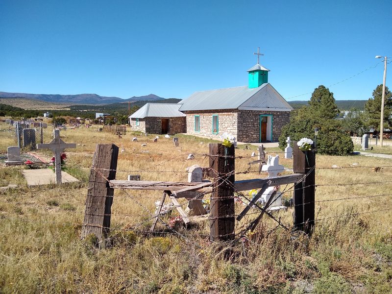
Let’s look at it from this angle: some communities whisper stories older than any state line. Here, those whispers reach back to a Tiwa pueblo.
Tajique holds 106 residents and sits quietly in Torrance County along Highway 55. Its melodic name likely comes from the Tiwa word Tush-yit-yay.
In the early 17th century, the community served as the seat of the San Miguel Mission. Raids and regional upheaval during the 1670s eventually led residents to abandon the pueblo and mission.
Determined settlers returned and re-established the village in 1834. The well-kept San Antonio Catholic Church still anchors the community today.
Tajique sits high in the Manzano foothills, where elevation helps moderate summer temperatures. Pine and juniper cover the slopes just west of the houses.
Cyclists and hikers love The Loop, a 14-mile Forest Service road that curves toward nearby Torreon. Autumn turns the canyons gold, so plan a September or October drive.
Cell service gets thin on that route, so download maps before you roll out. A picnic lunch never hurts either, since services are limited.
Wildlife sightings come easily at dawn, with mule deer grazing along the roadside. Keep your speed low and your camera ready.
3. Torreon, Torrance County
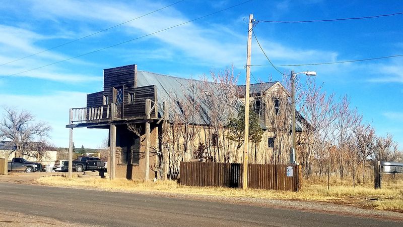
Farm fields hide one of the region’s oldest stories.
Torreon rests along NM State Route 55, cradled by the eastern slopes of the Manzano Mountains in Torrance County. Its 2020 population reached 187 residents.
The community sits on the ancient site of a Piro pueblo. That pueblo once belonged to the mission towns of the Salinas District.
By 1677, the area was abandoned as Apache groups moved through. New life arrived in the spring of 1841 with a land grant.
Nino Antonio Montoya and 26 farmers received that grant for resettlement. The name of the Torreon Grant honors the defensive towers built in nearby Manzano.
Historical accounts note raids remained a serious challenge until after the Civil War. Resilience is stitched into every irrigation ditch around town.
Outdoor lovers head straight for the Cibola National Forest Fourth of July Trailhead. Maples there blaze crimson in early October, which is rare in New Mexico.
Arrive early on fall weekends, because that small parking area fills fast. Weekdays reward you with near total solitude. Farming country rarely comes with this much depth beneath the soil.
4. Chilili, Bernalillo County
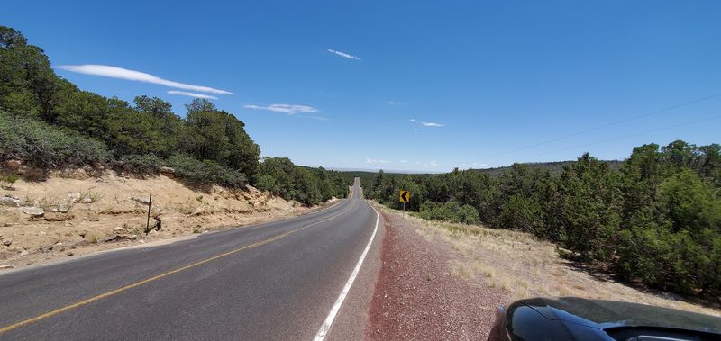
My jaw literally dropped at how fiercely this community protects its land. The historic Chilili Land Grant still shapes the community’s identity and relationship with the surrounding land.
Chilili sits in Bernalillo County with 126 residents counted in 2020. Long ago it was a Tewa Pueblo.
Hostilities forced abandonment between 1669 and 1676, yet the land endured. In 1841, Mexican Governor Manuel Armijo issued the community its land grant.
The U.S. government patented that claim in 1909, a rare and hard-won victory. Agriculture remains the heartbeat of the area.
Every August the village celebrates its San Juan Nepomucena church with a joyful gathering. Los Matachine Danzantes de la Sierra perform traditional dances that draw quiet crowds.
Rodeo fans have their own calendar here too. The local rodeo club hosts the annual Chilili Rodeo plus a twice-yearly Bull-A-Rama.
New Mexico State Road 337 winds gracefully through the settlement toward larger routes. That single road keeps the secluded character intact.
Respect matters here, since much of the surrounding land is privately held by grant heirs. Stick to public roadways and ask before wandering.
The elevation keeps summers pleasant, making it a fine escape from valley heat. Bring a jacket for evenings.
5. Punta De Agua, Torrance County
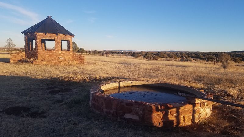
Are you seeing what I’m seeing on this stretch of highway? Stone walls, cottonwoods, and almost no one else.
Punta de Agua counted just 68 residents in 2020, tucked into Torrance County along NM 55. It sits 7 miles northwest of Mountainair and 5 miles southeast of Manzano.
That location makes it an easy pause between bigger stops. The Quarai unit of Salinas Pueblo Missions National Monument lies within the southwest part of the community.
San Vicente De Paul Iglesia Catolica rises here, built from rough-cut stone by early settlers. Its simple lines speak louder than any ornament could.
Ancestral Pueblo people established Quarai near a natural spring around 1300. The mission there stayed active until 1677 before falling silent.
Today the towering red sandstone church walls draw photographers and history lovers alike. Shaded trails loop past the ruins and along the spring-fed creek.
Spring brings running water and green cottonwoods, making April and May ideal months. Summer afternoons bring quick thunderstorms, so plan mornings for walking.
The name itself means point of water, a fitting title for this landscape. Water shaped every settlement decision made here.
Begin your discovery along NM-55, Punta de Agua, NM 87036. Few small settlements pack this much layered history into so few acres.
6. Mountainair, Torrance County
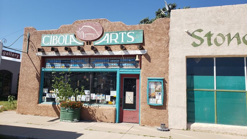
This town earned the title Pinto Bean Capital of the World. Beans built it, art keeps it interesting.
Mountainair anchors Torrance County and calls itself the gateway to ancient cities. Indian pueblos and 17th-century Spanish missions sit right at its doorstep.
Mountainair was founded in 1903 in anticipation of the Santa Fe Railway’s Belen Cutoff and later prospered through rail traffic, farming, and ranching. A prolonged drought in the late 1940s severely damaged the bean industry and reshaped the local economy.
The Salinas Pueblo Missions National Monument headquarters sits conveniently in town. Staff there help you plan trips to Quarai, Abó, and Gran Quivira.
Architecture fans should look for the Pueblo-deco style Shaffer Hotel from 1923. The Dr. Robert J. Saul Recreation Center from 1934 also earned National Register listing.
Murals brighten downtown walls, celebrating railroad heritage and historic buildings. Walking the few blocks takes less than an hour and rewards every step.
Manzano Mountains State Park and Cibola National Forest sit nearby for hiking and camping. Wildlife watchers spot hawks, wild turkeys, and the occasional black bear track.
Fuel up here, since gas stations grow scarce past the town limits. Weekend hours can be short, so check ahead.
7. Escabosa, Bernalillo County
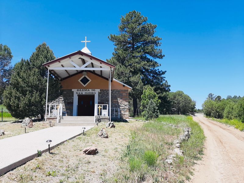
It makes you wonder what daily life looked like at 7,303 feet a century ago. Brooms, grocery shelves, and hand-hauled rock hold the answer.
Escabosa rests high in Bernalillo County along a winding mountain highway. Brothers from the Mora family homesteaded it in the late 19th century.
The name is Spanish for broomgrass, honoring the grasses early villagers used to make brooms. Practicality named this community, not poetry.
Filomeno Mora, one original homesteader, ran the grocery store and the post office during the 1920s and 1930s. His ancestral home is still cherished by descendants.
In 1932 or 1933, families built the Church of San Isidro Labrador from local rock. Each household contributed stone, making the walls a record of community effort.
The elevation delivers cool summer evenings and occasional snowy winters. Aspens and pines grow thick in the higher folds nearby.
Drive slowly, since the road curves sharply and livestock sometimes wanders close. Pullouts reveal long views east across the plains.
8. Veguita, Socorro County
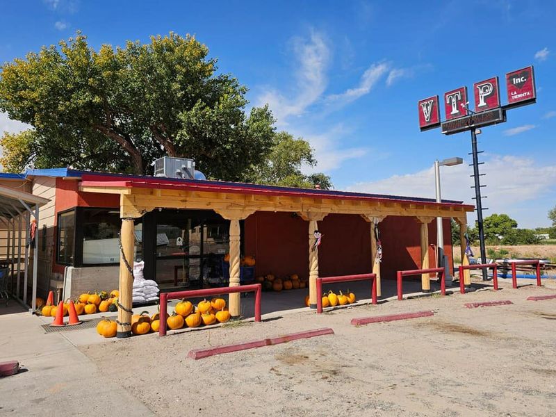
Let’s be real for a second, meadow of the beavers is an outstanding original name. Caravans once rested right here.
Veguita spreads along NM Highway 304 in Socorro County with 219 residents. Historically it was called La Vega de Las Nutrias.
New Mexico travelers on the historic Camino Real used the meadow as a stopping point. Settlers established the current village by 1860 and built a church early on.
The Veguita Trading Post still serves as a community fixture, supplying fuel and everyday goods. Locals and road-trippers both count on it.
In 2015, the community gained its own low-power radio station, KVNM-LP at 101.1 FM. Few settlements this size broadcast their own voice.
Several churches, including independent Christian congregations and a Catholic Diocese Mission Church, serve as spiritual anchors. Sunday mornings bring the streets a gentle hum.
Wide skies here produce sunsets that turn the whole valley orange and violet. Photographers should arrive about an hour before dusk.
The nearby Rio Grande invites easy fishing and slow kayaking trips. Cottonwood bosque trails come alive with birds during spring migration.
Farm stands sometimes appear along the highway during harvest season. Chile roasting scents the air come September.
9. Willard, Torrance County
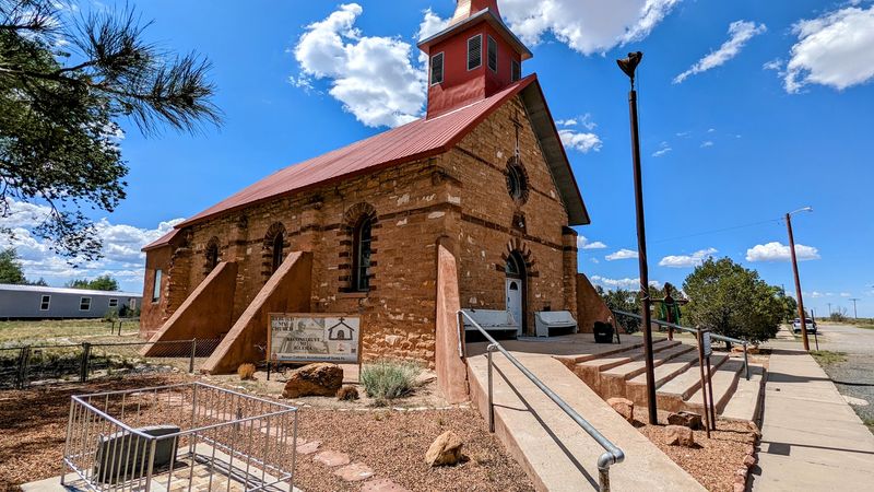
Have you given any thought to towns that peaked early and never chased growth again? One sits right on US-60.
Willard holds 201 residents in Torrance County and carries a fascinating origin story. Willard developed as a railroad community in the early 1900s at a junction tied to the Santa Fe Central and the Belen Cutoff.
The village was named for Colonel Willard S. Hopewell, a builder of the Santa Fe Central Railroad.
Railroad traffic and agriculture fueled prosperity for a while. When the rail line pulled back and farming struggled, momentum faded.
The community remains small today, with 201 residents recorded in the 2020 Census. That very stillness preserved its old-fashioned character.
History buffs can study available historic maps showing the original town layout. Comparing them to today’s streets makes for a fun scavenger hunt.
Two cemeteries, El Rosario Cem and Farmers Cem, quietly chronicle generations of families. Hand-forged iron crosses and weathered stones tell their own tales.
Grasslands stretch in every direction, so sunrise photography here is spectacular. Antelope sometimes cross the fields at first light.
Services are minimal, so fill your tank in a larger town first. Bring snacks and water for the drive.
Winter winds sweep hard across this open country. Pack a warm hat if you travel between November and March.
10. Corona, Lincoln County
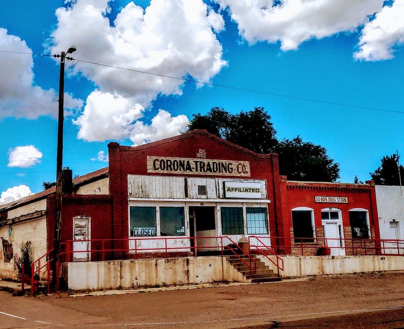
It came completely out of left field, learning about the 1947 mystery tied to this village. Ranchland here hides a famous secret.
New Mexico’s Corona sits in Lincoln County along U.S. Route 54 with 129 residents. Its elevation is high enough to keep summer evenings cool.
Open range surrounds the village, framed by hills speckled with pine and juniper. Cattle outnumber people by a wide margin.
The settlement began in the early 1900s as a strategic railroad stop. Mining and ranching grew up around those tracks.
In 1947, a local rancher discovered unusual debris on his land. The incident became famously connected to the larger Roswell story.
Residents pride themselves on traditional rural living and deep Hispanic roots. Regional history is treated as a shared inheritance, not a museum piece.
Corona remains a small rural community shaped largely by ranching, transportation history, and its remote location.
Corona’s remote setting and sparse development can provide dark night skies when weather conditions cooperate.
Fuel and supplies are limited, so plan your route carefully. Distances between towns out here are generous.
Spring winds can be fierce, while September brings calm golden afternoons. Choose your season with intention.