12 Scenic Spots In California That Feel Almost Suspiciously Photogenic In Person
Some views look like they are trying too hard. Ridiculous light. Perfect angles. Clouds behaving like unpaid extras.
A rock formation, beach, garden, or desert road can suddenly make every phone in the group come out at the same time.
California has places so photogenic that standing there in person almost feels like catching the scenery showing off.
Honestly, fair. A spot like that changes the whole mood fast.
The funny part is how unreal it can feel without any filter helping.
These are the places that make quick stops stretch longer, camera rolls fill faster, and regular travel photos look suddenly underqualified.
1. Tunnel View, Yosemite National Park
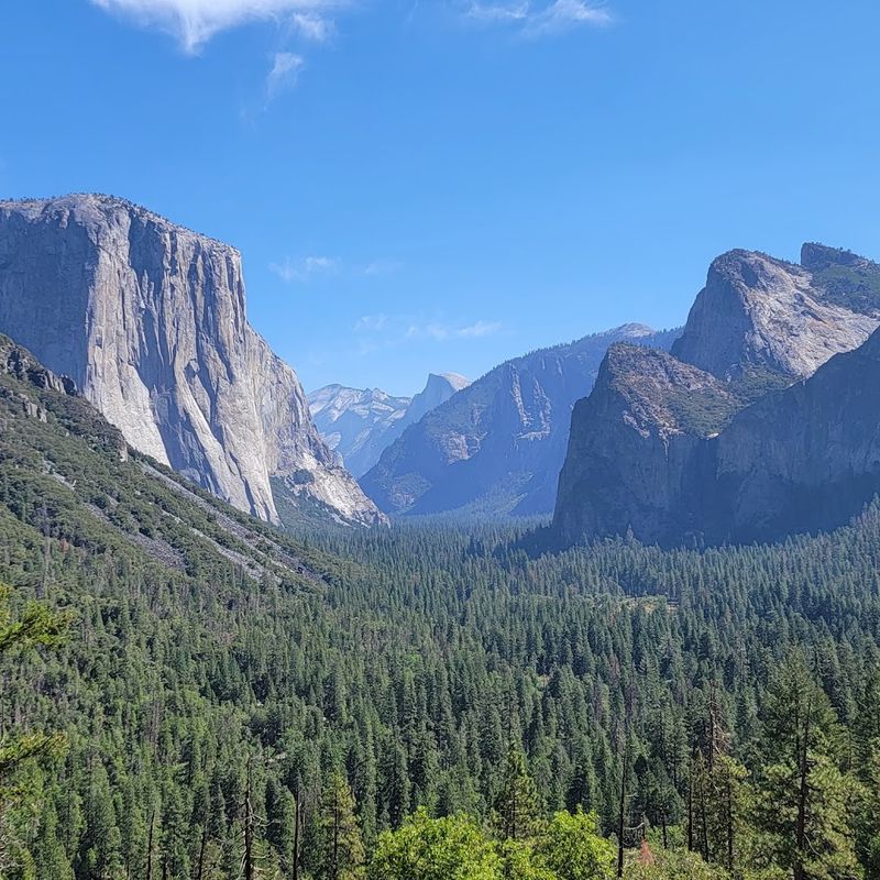
Few overlooks in the world manage to pack so much geological drama into a single frame, and Tunnel View in Yosemite delivers exactly that kind of visual overload.
El Capitan rises on the left, Half Dome anchors the far distance, and Bridalveil Fall threads down the right side of the valley like it was placed there on purpose.
The whole scene sits at the east end of the Wawona Tunnel, which means visitors step out of a dark passage directly into one of the most recognized views in American landscape photography.
Morning light tends to soften the scene with mist and golden tones, while late afternoon can cast long shadows across the valley floor that add real depth.
Parking at the overlook fills up quickly on weekends and during peak summer months, so arriving early on weekdays tends to make the experience noticeably calmer.
The National Park Service lists this as one of Yosemite Valley’s most famous viewpoints, and standing there in person makes it easy to understand why that reputation has held for generations.
Yosemite National Park charges an entrance fee, and timed entry permits may be required during busy seasons, so checking the official NPS website before visiting is genuinely useful.
2. Zabriskie Point, Death Valley National Park
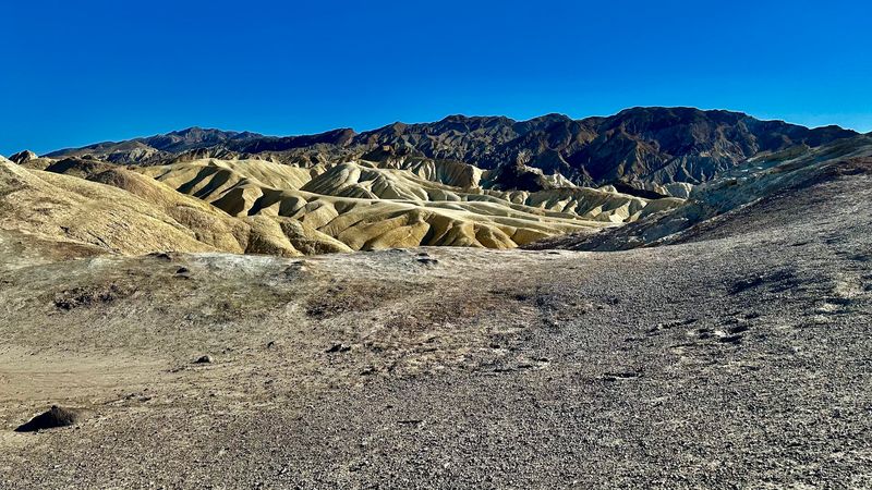
Golden badlands that look like they belong on another planet greet visitors at Zabriskie Point, and the scene reads as almost digitally enhanced even before any editing happens.
The folded ridges and eroded clay formations catch light in a way that shifts dramatically depending on the time of day, with sunrise and sunset producing the most vivid results.
Death Valley National Park describes this spot as an iconic vista and a favorite among photographers who plan entire trips around catching the right morning glow.
The short paved walk to the main overlook is accessible for most visitors, making it one of the more approachable dramatic landscapes in the park.
Temperatures in Death Valley can be extreme, particularly in summer, so visiting in spring or fall tends to be far more comfortable and safe.
Bringing plenty of water is essential regardless of the season, since the desert environment is unforgiving even on mild days.
The surrounding Amargosa Range adds a layered backdrop that gives the view real visual depth, and the absence of vegetation keeps the focus entirely on the geology.
Death Valley National Park charges an entrance fee, and conditions on the road can vary, so checking the NPS website before heading out is a practical first step.
3. Antelope Valley California Poppy Reserve, Lancaster
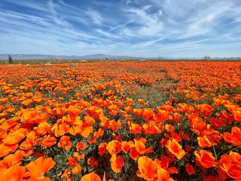
Rolling hills that turn almost entirely orange during peak bloom make the Antelope Valley California Poppy Reserve one of the most visually striking seasonal destinations in the state.
The intensity of the color can feel genuinely unreal, especially when the hills are covered edge to edge with blooms and the sky is a deep blue contrast above them.
California State Parks notes that the reserve sits on some of the state’s most consistently poppy-bearing land, with other wildflowers contributing purples, yellows, and whites to the spring palette.
Peak bloom timing varies from year to year and depends heavily on winter rainfall, so checking the reserve’s official bloom updates before making the drive is strongly recommended.
Weekends during peak season can draw large crowds, and the parking area fills up early, which makes arriving close to opening time a smart move for anyone hoping for a quieter experience.
Trails wind through the reserve at an easy pace, and the terrain is mostly gentle, which keeps the walk accessible for a wide range of visitors.
A day-use fee applies for entry, and the bloom season typically runs from mid-February through mid-April depending on conditions that year.
4. Mendocino Headlands State Park, Mendocino
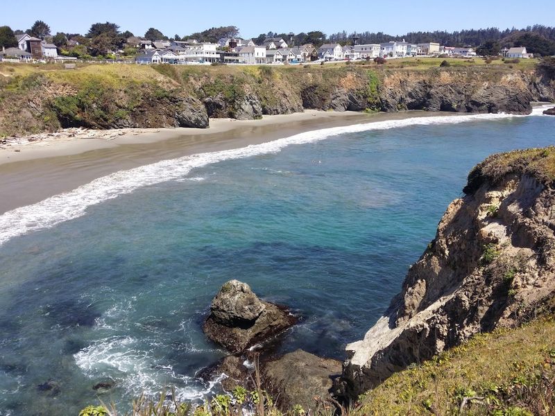
Rugged blufftop trails, dramatic sea arches, and hidden grottos combine with the backdrop of a historic village to give Mendocino Headlands State Park a postcard quality that feels almost theatrical in person.
California State Parks notes that the park wraps around Mendocino on three sides, offering miles of trails along the cliff edge with unobstructed Pacific views in nearly every direction.
The village itself adds a layer of visual charm, with Victorian-era buildings sitting close enough to the water that the town and the coastline feel like a single composition.
Fog is a frequent visitor along this stretch of the Northern California coast, and it tends to soften the scene in a way that makes the landscape feel moody and cinematic rather than harsh.
The trails are generally well-maintained and suitable for casual walkers, though some sections near the cliff edge require attention and appropriate footwear.
Wildlife including harbor seals and gray whales can sometimes be spotted from the bluffs depending on the season, adding a layer of unpredictability that keeps visits interesting.
Visiting on a weekday tends to offer a noticeably quieter experience compared to summer weekends when the area draws significant crowds from across the region.
5. Keys View, Joshua Tree National Park
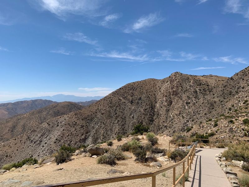
Sitting high in the Little San Bernardino Mountains, Keys View delivers one of the widest and most layered panoramas in all of Southern California.
The Coachella Valley stretches out far below, the Salton Sea glimmers on clear days in the far distance, and the San Jacinto and San Gorgonio mountain peaks rise dramatically on the horizon.
The National Park Service describes Keys View as offering broad views across the southern side of Joshua Tree, and the elevation at roughly 5,185 feet means temperatures here run noticeably cooler than the desert floor below.
Sunrise and late afternoon light tend to bring out the most color and contrast in the valley below, making early morning or evening visits especially rewarding for photography.
The short paved path from the parking area to the overlook railing is accessible and easy to walk, so the view is available to a wide range of visitors without requiring a strenuous hike.
Wind can pick up considerably at this elevation, so bringing a light layer is practical even on warm days.
Joshua Tree National Park charges an entrance fee, and timed entry permits may be required during peak periods.
Checking the NPS website before visiting helps avoid surprises and ensures entry goes smoothly on busy holiday weekends.
6. McArthur-Burney Falls Memorial State Park, Burney
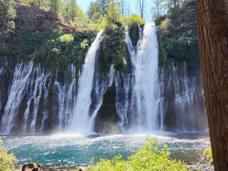
Water spilling across a wide green volcanic cliff face and dropping into a clear turquoise pool gives Burney Falls a look that genuinely makes people stop and stare before they even reach for a camera.
The falls measure roughly 129 feet tall and pull water from underground springs as well as the creek above, which means the flow stays consistent year-round rather than depending entirely on seasonal rainfall.
That reliability is part of what makes it such a dependable destination compared to other California waterfalls that can slow to a trickle in dry years.
The trail down to the base of the falls is moderately steep but short, and the payoff at the bottom is a close-up view of the cascade that feels genuinely impressive from any angle.
Mist from the falls keeps the surrounding vegetation lush and green even in summer, which adds to the almost tropical feel of the scene.
California State Parks currently requires day-use reservations on peak-season Fridays through Sundays and major summer holidays, so planning ahead is necessary rather than optional for those visits.
Entrance fees apply, and amenities including camping and a visitor center are available on site for those planning an extended stay.
7. Cypress Tree Tunnel, Point Reyes National Seashore
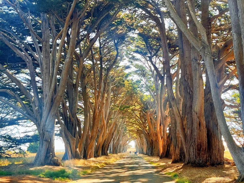
A road lined on both sides with towering Monterey cypress trees forms a natural arching canopy that looks genuinely cinematic even without a filter.
The trees were planted around 1930 and have grown into one of the most visually distinctive landscape features along the entire Northern California coast.
The National Park Service notes that the tunnel leads to the historic Point Reyes Receiving Station, which adds a layer of historical context to what is already a striking visual experience.
Light filtering through the dense canopy on a clear morning creates a dappled, almost storybook effect along the road, while overcast days give the tunnel a moodier and more dramatic quality.
The location sits within Point Reyes National Seashore, which means the surrounding area offers extensive additional trails, beaches, and wildlife viewing opportunities for visitors who want to make a full day of the trip.
Fog rolls through Point Reyes frequently, and catching the cypress tunnel wrapped in low mist is an entirely different and equally compelling visual experience.
Access to the tunnel road is open to vehicles as well as walkers and cyclists.
The Point Reyes National Seashore visitor center at 1 Bear Valley Road in Point Reyes Station, California, is a practical first stop for maps, current conditions, and information about other highlights in the park.
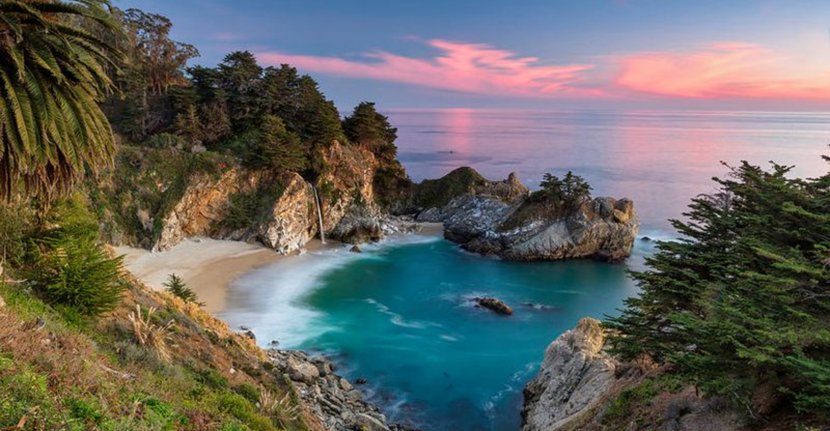
8. McWay Falls, Julia Pfeiffer Burns State Park, Big Sur
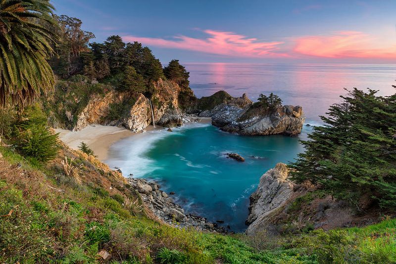
An 80-foot waterfall dropping straight onto a secluded cove beach with turquoise water below and steep coastal cliffs on all sides makes McWay Falls one of the most visually intense spots on the entire California coast.
The scene looks almost composited, like someone took the best parts of several different landscapes and stacked them together in one small cove.
Big Sur’s Highway 1 adds its own dramatic presence nearby, threading along cliff edges that frame the view from above.
Getting to the falls does not require a strenuous hike, which makes it accessible to a wide range of visitors.
However, California State Parks currently notes that the Overlook Trail is closed for long-term repair, and the only available view is from a small designated viewing area along Highway 1.
That limitation means the classic close-up angle is temporarily unavailable, but the highway viewpoint still delivers a clear and impressive look at the falls and the cove below.
Julia Pfeiffer Burns State Park is located at 52801 Highway 1 in Big Sur, California. An entrance fee applies for day use, and parking at the pull-off area is limited, so arriving early on weekends is advisable.
Road conditions on Highway 1 can change seasonally, so checking Caltrans updates before driving is a smart precaution.
9. Avalon Harbor, Catalina Island
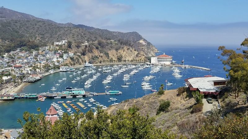
Colorful buildings stacked up hillsides, clear blue-green harbor water, boats of every size anchored in rows, and the round Art Deco silhouette of the Catalina Casino all combine to give Avalon a look that feels borrowed from the Mediterranean.
The whole scene comes into view gradually as the ferry approaches the island, and that slow reveal tends to make the first impression hit harder.
Golf carts rolling along the waterfront streets add a quirky and charming detail that makes the town feel like its own self-contained world.
Walking the waterfront promenade gives a comfortable ground-level view of the harbor and the hills behind it.
The light in the late afternoon tends to warm the white and pastel buildings and turn the water a deeper shade of blue-green, which is when the harbor looks its most photogenic.
The island is accessible by ferry from San Pedro, Long Beach, and Dana Point, with crossing times ranging from roughly one to two hours depending on the departure point.
Avalon has a compact and walkable downtown area with shops, restaurants, and beach access all within easy reach of the ferry terminal.
10. Morro Rock, Morro Bay
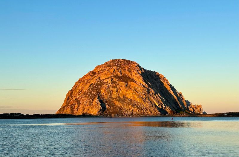
A single massive volcanic rock rising nearly 576 feet at the edge of the Pacific gives Morro Bay one of the most instantly recognizable silhouettes on the California coast.
The rock has a presence that is hard to describe in person because the scale only registers fully once there is something nearby to compare it against, like a fishing boat or a person walking the waterfront.
Morro Rock is considered a California Historical Landmark and serves as a protected nesting site for peregrine falcons, which adds a layer of ecological significance to what is already a visually commanding feature.
Evening light has a particular way of working with the rock, especially when thin fog or haze softens the horizon and turns the sky shades of orange and pink behind the dark volcanic mass.
The Embarcadero waterfront runs along the bay facing the rock and offers a comfortable walking path with clear sightlines and easy access to benches and viewpoints.
Pelicans, sea otters, and harbor seals are commonly spotted in the bay, making the area feel lively even on quieter days.
Morro Bay is located along Highway 1 in San Luis Obispo County and is a manageable stop on a Central Coast road trip.
11. Mono Lake Tufa State Natural Reserve, Lee Vining
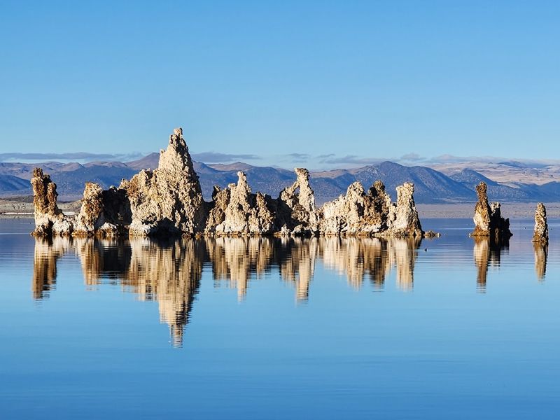
Pale limestone towers rising out of a flat ancient lake with mountains in the background and a wide open sky above create a scene at Mono Lake that genuinely looks like it belongs somewhere else entirely.
The tufa formations developed over thousands of years as calcium-rich freshwater springs met the alkaline lake water and slowly built up into columns and spires.
California State Parks manages the Mono Lake Tufa State Natural Reserve, and the South Tufa area offers the most accessible and visually concentrated collection of formations along the shoreline.
Sunrise turns the whole scene from merely unusual to something close to otherworldly, with the calm lake surface reflecting the sky in shades of pink and amber while the tufa towers glow in the early light.
The reserve sits at an elevation of roughly 6,380 feet in the Eastern Sierra, which means temperatures can drop sharply even in summer, and layering up for early morning visits is genuinely practical advice.
Brine shrimp and alkali flies support massive migratory bird populations at the lake, so the wildlife activity around the shore adds movement and sound to an otherwise serene landscape.
12. Bixby Bridge, Big Sur
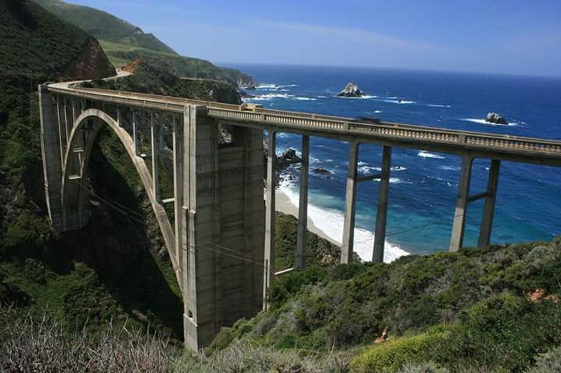
Even after seeing hundreds of photographs, the moment Bixby Bridge appears over the canyon while driving Highway 1 still tends to produce a genuine pause.
The concrete arch spans a 280-foot-deep canyon with the Pacific Ocean filling the background, and the combination of scale and coastal drama makes it feel almost purpose-built for wide-angle photography.
Built in 1932, it remains one of the most photographed bridges in the entire country and holds a place on the National Register of Historic Places.
Pulling off at the north side of the bridge gives a clear view of the full arch and the canyon below, while the south side offers a slightly different angle with more of the ocean visible in the frame.
Morning light from the east catches the hillsides and the bridge face in a warm tone that afternoon light does not replicate, which makes early arrival worthwhile for photography-focused visits.
The surrounding Big Sur coastline adds to the drama on both sides of the bridge, with cliffs, surf, and open Pacific horizon extending in either direction.
Highway 1 conditions through Big Sur can change due to weather and road maintenance, so checking Caltrans road information before driving the route is a practical habit worth keeping.