These 10 Virginia Road Trips Will Change Summer For The Better
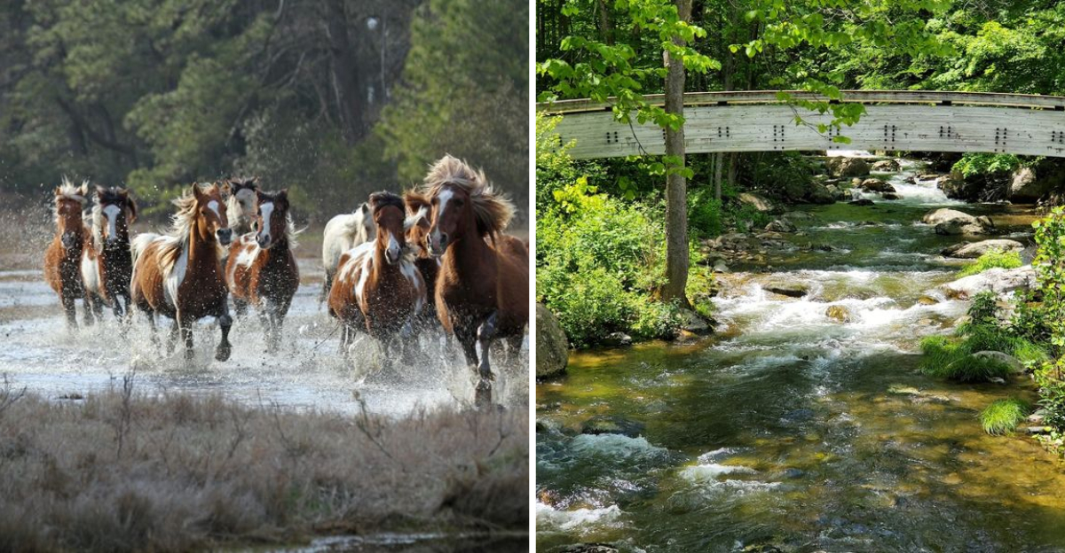
Wild ponies graze the dunes on one barrier island, while morning fog drapes the mountain ridges hours inland. That contrast is the pitch for a Virginia summer spent on the road.
The state stacks scenery, history, and detours into a surprisingly tight map. I have driven these routes myself, and each sent me home with a story I still retell.
One climbs switchbacks into the high mountains, another traces the coast toward salt marsh and sea. You swap the couch for a cooler and a full tank of gas.
The miles add up, but so do the memories.
Which route would you point the car toward first?
1. Blue Ridge Parkway (VA Stretch)
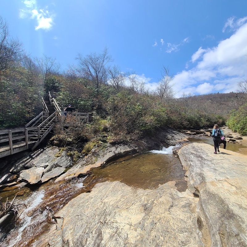
Hold the phone, because 217 miles of pure Appalachian magic is waiting for you. The Blue Ridge Parkway’s Virginia stretch runs from Rockfish Gap all the way to the North Carolina state line.
Every mile feels like a painting that someone forgot to put behind glass.
Mabry Mill is one of the most photographed spots along the entire parkway. The old gristmill sits beside a quiet pond, surrounded by wildflowers in summer.
Peaks of Otter offers a completely different mood, with a lake-backed mountain that practically begs you to stop and breathe.
The road has no stoplights and very little commercial interruption. That alone makes it a rare and genuinely peaceful summer experience. Wildlife sightings are common, so keep your eyes open around dawn and dusk.
Plan at least two days to do the Virginia section justice. Camping is available at multiple spots along the route.
The speed limit stays around 45 mph, which forces a slower, more rewarding pace through the scenery.
Autumn crowds are legendary, but summer brings lush green canopies and cooler temperatures at elevation. Bring layers even in July, since the ridge tops can surprise you. This drive earns its reputation every single time.
2. Skyline Drive, Shenandoah National Park
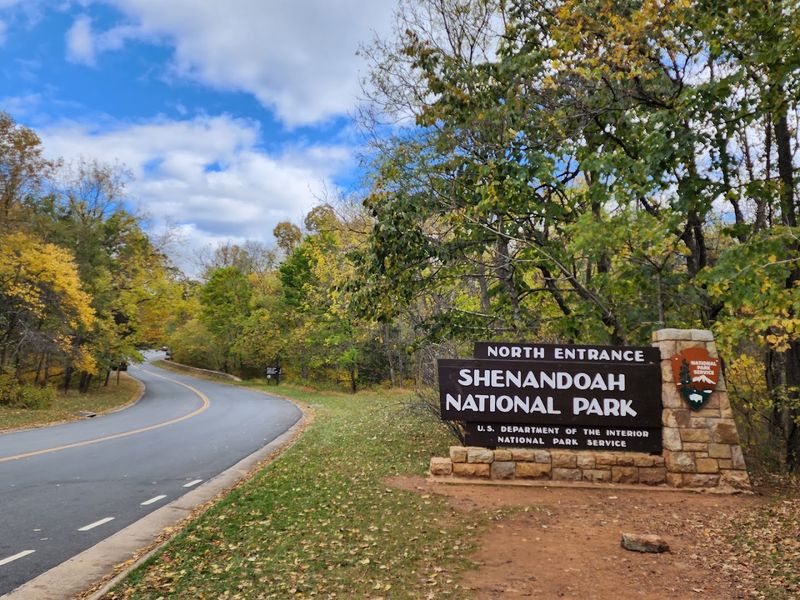
Cards on the table, this is the road trip that converts people into lifelong fans of this state.
Skyline Drive runs 105 miles from Front Royal down to Rockfish Gap, cutting straight through Shenandoah National Park. The posted speed limit is 35 mph, and honestly, you will not want to go faster.
There are 75 overlooks along the route, and each one frames the Shenandoah Valley differently. Some look west toward farm fields and small towns.
Others face east toward the Piedmont, where the land stretches out flat and golden in the afternoon light.
Whitetail deer graze practically roadside, sometimes so close you can hear them chewing. Black bears are spotted regularly during summer months. The park takes wildlife seriously, so feeding animals is strictly off-limits.
Hiking trails branch off from nearly every pullout along the drive. Big Meadows is a popular stop for its wide open fields and accessible trails. Skyland Resort sits near the highest point on the drive at just over 3,600 feet.
Entry fees apply since this is a national park, so grab an America the Beautiful pass if you plan multiple park visits this summer. Weekday mornings offer the quietest experience.
Fog rolling through the hollows at sunrise is something genuinely hard to forget.
3. The Crooked Road: Virginia’s Heritage Music Trail
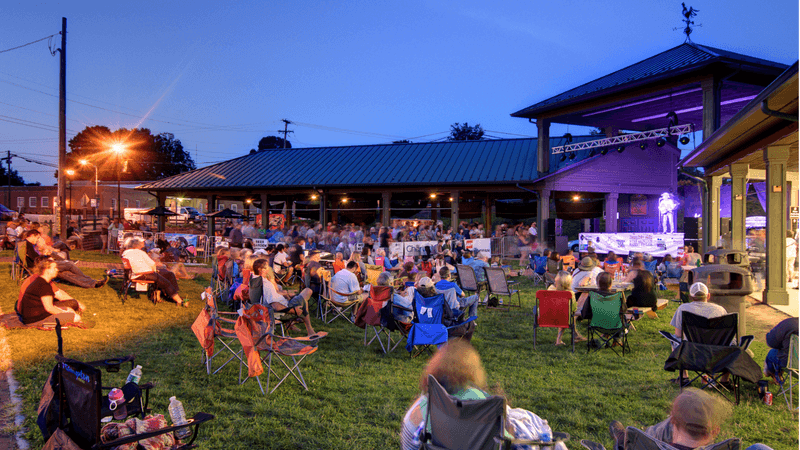
Just imagine for a second a road trip where the soundtrack changes every 20 miles.
The Crooked Road stretches roughly 330 miles across 19 counties in southwest part of the state. It is officially designated as Virginia’s Heritage Music Trail, and it earns that title with every twist and turn.
The trail connects communities where old-time, bluegrass, and country music were born and kept alive for generations. The Birthplace of Country Music Museum in Bristol anchors one end of the route.
Floyd Country Store in the town of Floyd anchors the spirit of the whole journey.
Friday night jamborees at the Floyd Country Store draw locals and travelers alike every single week. The music spills out the door and onto the sidewalk in summer.
It is participatory, unpretentious, and completely unlike anything you will find at a ticketed concert venue.
Small towns along the route each carry their own musical identity. Galax hosts one of the oldest fiddlers conventions in the country every August. The Rex Theater in Galax is another must-stop for live performances.
The scenery along this route is stunning in its own right. Rolling hills, creek-side roads, and old farm structures frame every mile. Pack a notebook, because the stories you collect here are just as memorable as the music.
4. Route To The Presidents
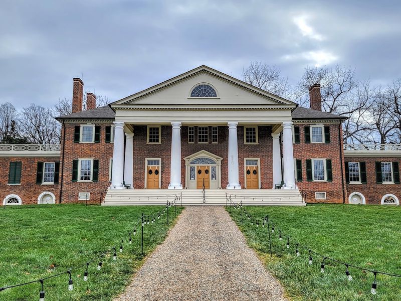
Food for thought: what if one weekend drive could take you through the homes of four American presidents?
The Route to the Presidents connects Mount Vernon, Monticello, Montpelier, and Ash Lawn-Highland in a loop that is genuinely doable over two days. This state is the birthplace of more U.S. presidents than any other state, and this route proves it.
Mount Vernon, George Washington’s estate, sits along the Potomac River south of Alexandria. The grounds are expansive and include working gardens, a blacksmith shop, and a reconstructed distillery.
Summer tours fill up fast, so booking ahead is smart.
Monticello, Thomas Jefferson’s hilltop home near Charlottesville, is architecturally stunning. The house reflects Jefferson’s obsession with design and innovation. The gardens alone could keep a curious traveler busy for hours.
Montpelier, James Madison’s estate in Orange County, offers a quieter and deeply thoughtful experience. Ash Lawn-Highland, James Monroe’s property, sits just minutes from Monticello.
Combining all four in a logical loop makes for one of the most historically rich road trips in the entire country.
Each estate tells a layered story about early American life. The history here is not sanitized, which makes it more meaningful. Bring comfortable shoes, because these grounds reward walkers who slow down and look closely.
5. Colonial Parkway, Historic Triangle
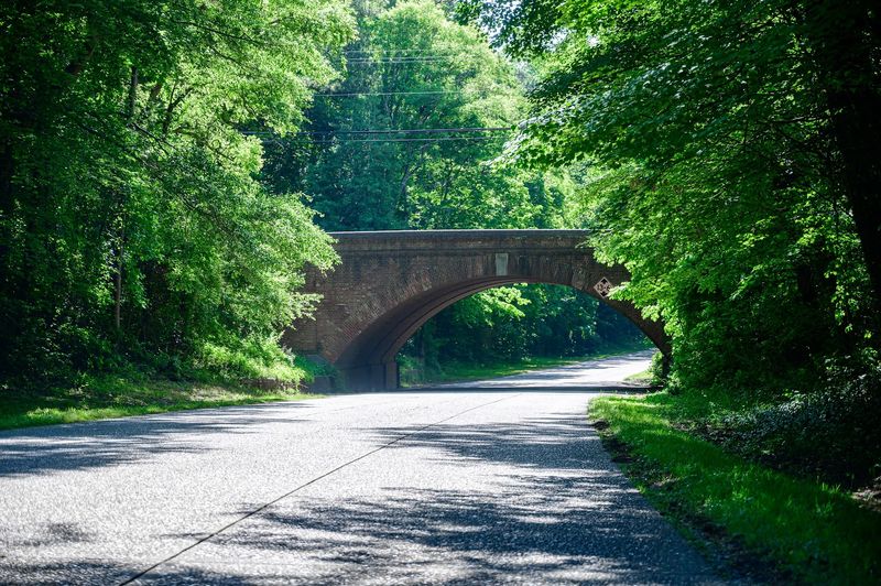
Let’s be real for a second, 23 miles has never felt so significant in American history.
The Colonial Parkway connects Jamestown, Williamsburg, and Yorktown in a single, unhurried drive through the Tidewater region. There are no gas stations, no billboards, and no fast food signs along the route.
That intentional absence of commercial interruption is what makes this drive feel different from the start. The National Park Service manages the parkway, and they have kept it beautifully preserved.
Tunnels of mature hardwood trees shade the road through most of the summer.
Jamestown was the first permanent English settlement in America, established in 1607. The living history museum at Historic Jamestowne brings that era to life with costumed interpreters and reconstructed buildings.
Children and adults both tend to leave genuinely impressed.
Williamsburg sits at the center of the route and deserves at least half a day. Colonial Williamsburg is one of the most detailed living history museums in the world. The restored streets, taverns, and trades feel like a real town, not a theme park.
Yorktown marks the end of the American Revolution at its battlefield. The drive from Jamestown to Yorktown covers roughly 400 years of American history in under an hour. Few roads anywhere carry that kind of weight.
6. Northern Neck Via Route 3, Fredericksburg To Irvington
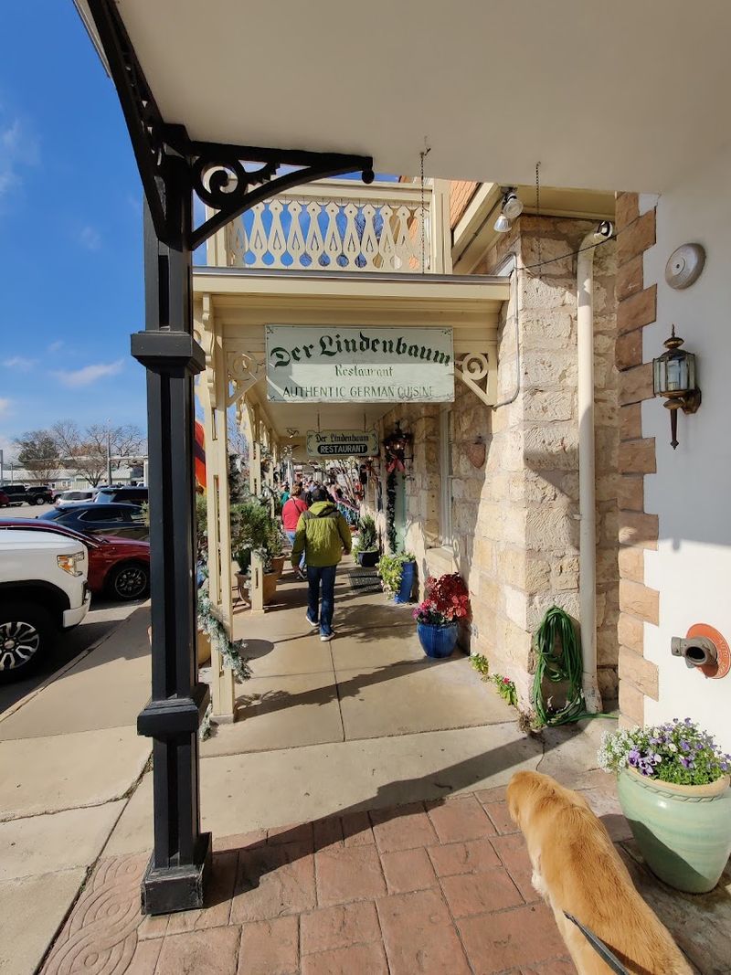
I had to do a double-take when I first saw the Northern Neck on a map, because it looks almost too peaceful to be real.
Route 3 runs roughly 90 miles from Fredericksburg to Irvington, ending where the Rappahannock River meets the Chesapeake Bay. The drive is low-key by design and rewards those who are not in a hurry.
The Northern Neck peninsula is defined by water on nearly every side. Creeks, rivers, and inlets cut through the land in every direction.
Small fishing villages and old tobacco farms line the route, giving the landscape a genuinely unhurried character.
George Washington was born on this peninsula at Popes Creek in Westmoreland County. The birthplace site is a quiet park with a simple monument and peaceful grounds.
It is the kind of stop that sneaks up on you emotionally.
Irvington is a charming small town with local shops and waterfront access. The Hope and Glory Inn is a well-known landmark in the area. Kilmarnock nearby has a growing food scene worth exploring.
Crabbing and fishing are part of the local culture here, and summer is prime season. Sunset views over the bay from almost any dock along this route are spectacular.
7. Eastern Shore And Chesapeake Bay Bridge-Tunnel
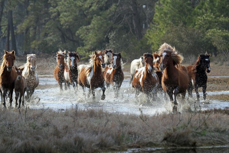
Are you seeing what I am seeing, because wild ponies on a barrier island beach sounds like something out of a dream?
The Eastern Shore road trip runs from Virginia Beach across the Chesapeake Bay Bridge-Tunnel and up through the barrier islands to Chincoteague. Depending on your route and stops, the drive covers between 70 and 163 miles of genuinely surprising coastal scenery.
The Chesapeake Bay Bridge-Tunnel itself is an engineering marvel. Stretching nearly 18 miles across open water, it connects Virginia Beach to the Eastern Shore.
The views from the bridge are dramatic in any weather, but summer sunrises here are something else entirely.
Chincoteague Island is famous for its annual pony swim, held every July. Wild ponies from Assateague Island swim across the channel in a tradition that has continued for decades.
The event draws visitors from across the country, so plan ahead if your trip lines up with late July.
Assateague Island National Seashore offers uncrowded beaches and excellent birding year-round. The ponies roam freely and can often be spotted near the road or on the beach.
Keeping a respectful distance is both required and the right thing to do.
Small towns like Cape Charles offer charming main streets and waterfront parks. The oysters here are celebrated up and down the East Coast. This route packs wildlife, history, and coastal beauty into one unforgettable summer loop.
8. Back Of The Dragon (Route 16), Marion To Tazewell
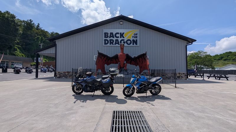
Call me silly, but 438 curves packed into 32 miles sounds less like a road and more like a challenge.
Route 16 between Marion and Tazewell is known as the Back of the Dragon. It earns that name with relentless twists, elevation changes, and scenery that keeps rewarding every new bend.
Motorcyclists discovered this route years ago and spread the word fast. Cars are equally welcome, and the drive is just as thrilling from behind a steering wheel.
The road surface is well-maintained, which matters a lot when the curves come this frequently.
Hungry Mother State Park sits near the Marion end of the route and is worth building a full day around. The park has a calm lake, hiking trails, and a sandy beach that is popular with families in summer.
Paddleboard and canoe rentals are available during the warm season.
The surrounding Appalachian landscape is rugged and largely undeveloped. Farms and forest alternate along the roadside, with occasional creek crossings adding to the drama.
Elevation gains and losses throughout the drive create natural air conditioning on hot summer days.
Tazewell County has its own quiet appeal at the end of the route. Small diners and local shops line the main street through town. After 438 curves, a good meal and a slow walk feel very well earned.
9. Route 58 Cross-State, Virginia Beach To Cumberland Gap
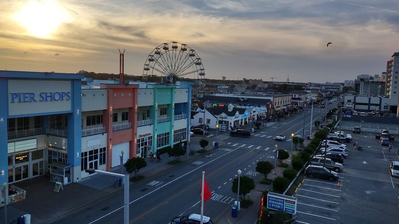
My jaw literally dropped when I first mapped out Route 58 and realized it crosses the entire state of Virginia in one continuous road.
Starting at the Atlantic Ocean in Virginia Beach and ending at the Cumberland Gap on the Kentucky and Tennessee border, the route covers 511 miles. That is the full width of Virginia, coast to mountains, in a single drive.
The eastern section passes through the Hampton Roads area and into the Tidewater lowlands. Farmland, small towns, and the occasional roadside produce stand fill the middle miles.
The landscape shifts noticeably as the Blue Ridge approaches from the west.
Martinsville Speedway is one of the notable stops along the route through Southside Virginia. The track is one of the oldest on the NASCAR circuit and sits right along Route 58.
Virginia International Raceway, known as VIR, is another motorsports landmark along this corridor.
The southwestern miles become increasingly dramatic as the road climbs toward the Appalachians. Patrick County and Carroll County offer rolling rural scenery that most travelers never see.
The final approach to Cumberland Gap through Lee County is genuinely breathtaking.
Cumberland Gap National Historical Park marks the western terminus of this epic drive. The gap itself was a major passage for early American settlers moving west. Finishing here gives the whole journey a sense of historical arrival that is hard to top.
10. Nelson County Scenic Loop
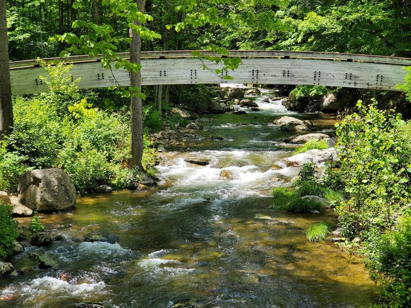
Sounds too good to be true, but a 50-mile loop in Nelson County manages to pack in the state’s tallest waterfall, mountain vineyards, and some of the most peaceful Blue Ridge scenery imaginable.
This is a short drive by road trip standards, but it punches well above its weight. Nelson County sits just south of Charlottesville, making it an easy add-on to a Blue Ridge Parkway trip.
Crabtree Falls is the undisputed highlight of the loop. At over 1,000 feet of cascading drops, it is the tallest cascading waterfall in Virginia and one of the tallest east of the Mississippi.
The trail to the upper falls takes about two hours round trip and is moderately challenging.
The surrounding George Washington National Forest adds deep green forest cover to the entire drive. Narrow roads wind past mountain streams and old homesteads that feel completely removed from modern life.
Summer brings full canopy coverage that keeps the roads cool and shaded.
Nelson County is also known for its cluster of farm wineries and cideries along the Rockfish Valley. The area earned the nickname the Beverage Capital of Virginia, and the rolling farmland scenery around each stop is stunning on its own.
Even non-drinkers enjoy the pastoral beauty of the countryside here.
The loop connects back easily to the Blue Ridge Parkway or to Charlottesville. Wildflowers bloom along the roadsides through most of summer. Fifty miles has rarely felt this rewarding or this full of genuine discovery.