This California State Park Has A Tick Problem Hikers Shouldn’t Ignore
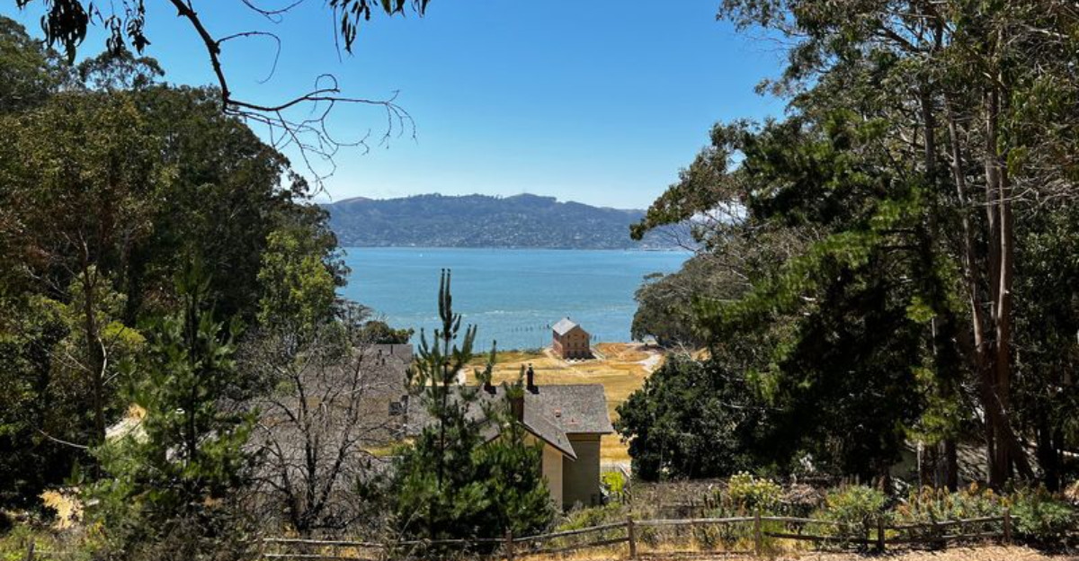
The ferry ride already makes this outing feel different before your shoes ever hit the trail.
Then the island opens up with sweeping bay views, quiet roads, grassy hills, historic sites, and enough walking routes to keep you moving for hours.
Bring water, wear comfortable shoes, and give yourself time to stop whenever the skyline steals your attention.
This California state park packs a surprising amount of scenery and history into one small island. There is just one practical detail hikers should keep in mind.
Ticks can be present in grassy and brushy areas, so basic precautions matter, especially when you leave the more developed paths.
Stick to clear trails, check your clothing afterward, and avoid brushing unnecessarily through tall vegetation.
Do that, then get back to the reason you came.
Know Why Ticks Are A Real Trail Concern Here
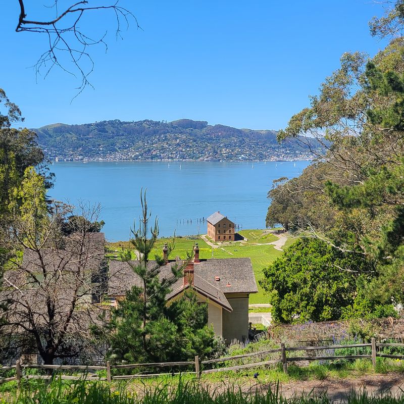
California State Parks doesn’t bury the warning in fine print.
Visitors to Angel Island are officially cautioned about ticks on the Fire Road, the North Ridge Trail, and the Sunset Loop, making this a documented hazard rather than an assumption or rumor.
Ticks in the Bay Area are most active during cooler, wetter months, roughly from late fall through early summer, though hikers should stay alert year-round.
The western black-legged tick, the species associated with Lyme disease in California, is commonly found in coastal scrub and grassy areas exactly like those covering much of Angel Island.
Wearing long sleeves and pants, tucking socks over pant cuffs, and doing a full-body tick check after every hike are practical steps that genuinely reduce risk.
Staying on the center of marked trails and avoiding brushing against tall grass or shrubs helps significantly.
Carrying a pair of fine-tipped tweezers in a small first-aid kit is a smart habit that takes up almost no space in a daypack.
Take The Ferry To An Island With No Road From The Mainland
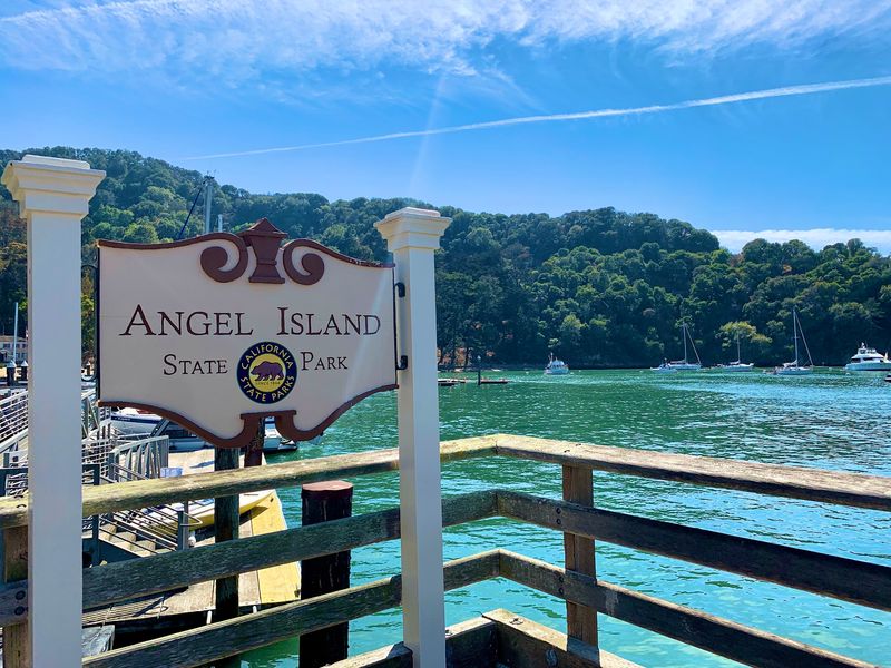
Getting to Angel Island already sets the trip apart from a typical park visit.
Public ferries depart from two mainland points, with the Angel Island Tiburon Ferry leaving from 21 Main Street in Tiburon, CA 94920, and the Golden Gate Ferry departing from the San Francisco Ferry Building.
Round-trip ferry tickets typically include park admission, which makes the pricing fairly straightforward to budget for.
The crossing itself takes just a short time but delivers early views of the Bay, Alcatraz, and the San Francisco skyline that set the tone for the whole visit.
Checking current ferry schedules before arriving is strongly recommended, because departure times vary by season and the last ferry back to the mainland runs at a fixed time.
Missing the last ferry is not a minor inconvenience on an island with no road access.
Visitors traveling with bikes should confirm in advance that their specific ferry allows bicycle boarding, as policies and space availability can vary.
Arriving at the ferry terminal a bit early leaves room for a relaxed departure without rushing.
Climb To The 788-Foot Summit Of Mount Livermore
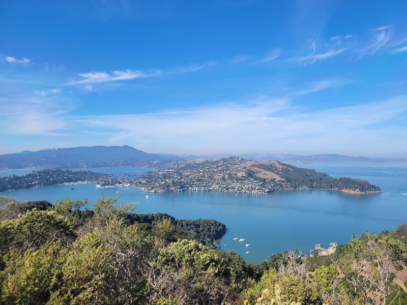
Standing at the highest point on Angel Island at 788 feet, the summit of Mount Livermore delivers a 360-degree view that is genuinely hard to match anywhere in the Bay Area.
On a clear day the Golden Gate Bridge, the San Francisco skyline, Alcatraz Island, the Marin Headlands, and Mount Tamalpais are all visible at once.
The North Ridge and Sunset Loop trails provide the classic route to the top and are designated for hikers only.
Bicycles are not permitted on the foot trails or on the road segment leading to the summit, so cyclists planning a visit should account for that restriction when mapping out their day.
The hike to the summit involves real elevation gain and some exposed sections of trail, so bringing layers is practical since Bay winds can shift quickly even on sunny days.
Ticks have been documented on both the North Ridge and Sunset Loop by California State Parks, so trail-appropriate clothing and a post-hike check remain important on this route.
The views at the top make every uphill step feel worthwhile.
Watch For More Than Ticks On The Quieter Fire Road
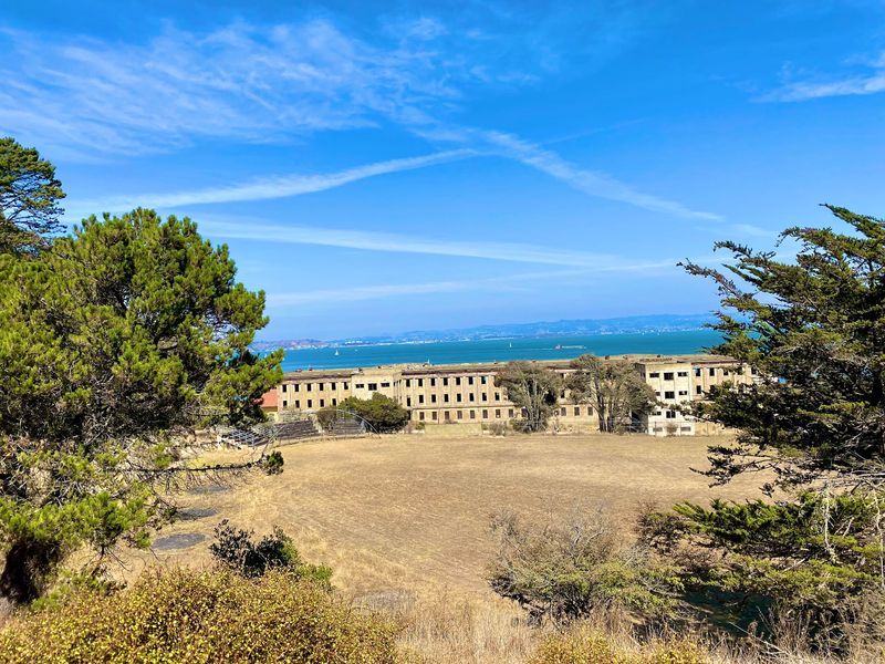
The Fire Road on Angel Island forms a three-mile dirt loop that feels noticeably quieter than the busier areas near the ferry landing.
Hikers and cyclists share the trail, and the moderate hills give legs a real workout without the intensity of the summit routes.
California State Parks flags three specific concerns for Fire Road users: ticks, uneven terrain, and poison oak.
Knowing what poison oak looks like is genuinely useful here, since the plant grows abundantly in coastal California and contact with it causes an itchy, blistering rash that can last for weeks.
The classic identification tip is “leaves of three, let it be,” and staying centered on the trail rather than brushing against trailside vegetation reduces exposure risk for both poison oak and ticks.
The dirt surface means the road can become muddy or slippery after rain, so checking conditions before visiting during wet months is a reasonable precaution.
Despite the hazards worth noting, the Fire Road offers a more removed, quieter feel compared to the Perimeter Road, and the natural surroundings are genuinely appealing for anyone who prefers a less populated trail experience.
Visit The Historic U.S. Immigration Station

Between 1910 and 1940 the U.S. Immigration Station on Angel Island served as the primary immigration processing point for the Pacific coast.
Hundreds of thousands of people passed through, and many were detained for days, weeks, or even months while their cases were reviewed under restrictive immigration laws of the era.
The preserved Detention Barracks Museum includes original carvings left in the walls by detained immigrants along with room arrangements that reflect actual detention conditions.
The Angel Island Immigration Museum, housed in the former hospital building, offers exhibits connecting historical immigration stories to present-day experiences, and admission to the museum is free.
Operating hours run Monday through Friday from 11:00 AM to 2:30 PM and Saturday through Sunday from 11:00 AM to 4:00 PM, though verifying current hours before visiting is always a practical step.
Self-guided entry to the Detention Barracks Museum costs five dollars for adults and three dollars for youth aged five to seventeen, with children under five admitted at no charge.
Shuttles run between the ferry docks and the Immigration Station, which is helpful given the uphill walk involved.
Nearly 200 Chinese poems were carved into the barrack walls and remain visible today as a remarkable historical record.
Explore Nearly A Century Of Military History
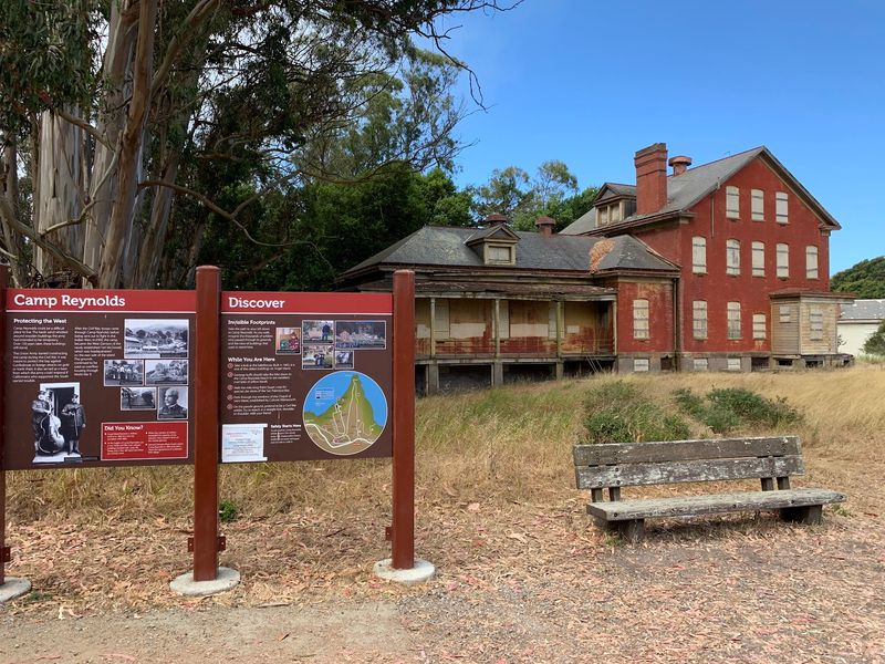
Few visitors expect a Civil War-era military post when they step off the ferry at a Bay Area state park, but Camp Reynolds on Angel Island dates back to that period and anchors one of the most layered military histories in California.
Fort McDowell, also known as East Garrison, adds buildings from both World War I and World War II to the mix, and a Nike missile radar site from a later Cold War-era military period rounds out the timeline.
Access to the interiors of these historic structures varies and often depends on volunteer availability.
Buildings at Camp Reynolds are generally closed to the public, though the bakehouse may open on certain days when volunteers are present.
The Chapel and Guard House at Fort McDowell may be open during summer weekends under similar conditions, so flexibility in expectations is helpful when planning a visit around these sites.
Even without interior access, walking through these areas delivers a strong sense of the island’s layered past.
The physical scale of the remaining structures communicates something that a museum exhibit alone cannot replicate.
Combining a walk through the military areas with a stop at the Immigration Station gives a visit to Angel Island a meaningful historical depth that surprises many first-time visitors.
Escape To Quarry Beach Or Perles Beach
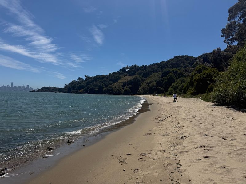
Two beaches on Angel Island offer very different atmospheres, and knowing the difference helps with planning.
Quarry Beach sits on the east side of the island near Fort McDowell and is relatively sheltered from wind, making it a more comfortable spot for sitting or picnicking on breezy Bay days.
Perles Beach lies to the southwest and is the larger of the two, offering the most expansive stretch of sand on the island.
Its more remote location means it tends to feel quieter than Quarry Beach, and the extra distance from the ferry landing naturally keeps foot traffic lower.
Both beaches are roughly a two-mile hike from the main ferry dock, so factoring that distance into the day’s itinerary is important especially for visitors with young children or limited mobility.
Neither beach has lifeguards on duty at all times, and California State Parks notes that Bay water can be cold and currents may be strong.
Wading and beach time are popular activities even when swimming conditions are uncertain.
Spend The Night After The Last Ferry Leaves
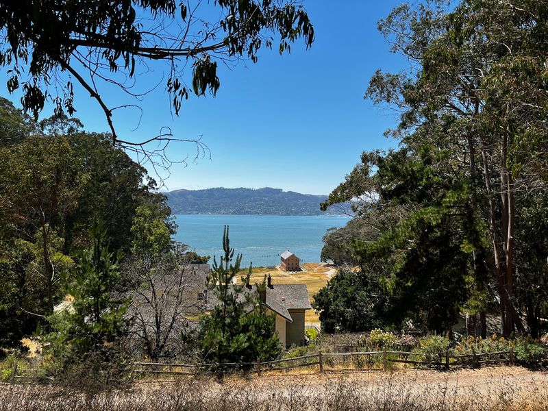
Camping on Angel Island is one of the more unusual overnight options in the Bay Area, and reservations fill up quickly after they open six months in advance through ReserveCalifornia.
The campsites sit roughly 1.5 to 2 miles from the ferry dock with some uphill sections involved, and transportation to the sites is not provided, so packing light and efficiently matters more here.
Staying overnight changes the experience of the island in a fundamental way.
Once the last ferry departs, the day-tripper crowds are gone and the island settles into a quieter rhythm that daytime visitors simply never get to experience.
Early morning light over the Bay from a hillside campsite tends to be one of those moments that makes the extra planning feel completely worth it.
Campers should bring all necessary gear including food, water, and a first-aid kit since facilities on the island are limited after visitor services close for the day.
Tick awareness remains relevant even at camp, particularly if campsites are near brushy or grassy vegetation.