This Connecticut Bike Trail Follows A Quiet Creek Through Beautiful Parks For A Scenic Escape
Bike trails that follow water are a specific kind of wonderful and this one delivers that experience better than most around here.
The creek runs alongside the path in a way that makes the whole ride feel completely immersive and the parks it winds through add a layer of scenery that keeps things genuinely interesting from start to finish.
Nothing about this trail is trying too hard. It just does what a really great trail does and does it consistently well throughout.
Connecticut has a bike trail so quietly scenic and so genuinely peaceful that people who discover it stop looking anywhere else for their regular ride.
The sound of water beside you, the shade from the trees overhead and that particular rhythm of a really well routed path creates something that makes an hour out here feel like a proper escape from everything else.
People come back to this one on repeat and honestly that reaction makes complete sense.
1. Starting The Ride Inside Wolfe Park
Starting a ride from a public park can make the first miles feel easier, especially when shaded scenery and useful amenities are close at hand. William E.
Wolfe Park provides access to the Rails-to-Trails bike path, part of the larger Pequonnock River Trail network, while also offering fields, playground areas, restrooms, parking, and seasonal recreation.
The route begins gently, passing through wooded stretches that create a calm introduction before longer forested sections unfold. Cyclists can follow the designated rail trail, but bikes are not permitted on walking trails, beaches, patios, or grassy areas, so posted signs deserve attention.
Park hours change with the season. From Memorial Day weekend through Labor Day, gates open at 7 a.m.; the lake side closes at sunset, while the pool side remains open until 9 p.m.
Other months follow shorter schedules, particularly in winter.
One important correction concerns the address. Monroe Parks and Recreation lists Wolfe Park at 285 Cutlers Farm Road in Monroe, not 670 Fan Hill Road.
With convenient trail access and a broad range of facilities, the park gives riders a practical, scenic place to begin exploring the region on two wheels.
2. Following An Old Railroad Route Beneath The Trees
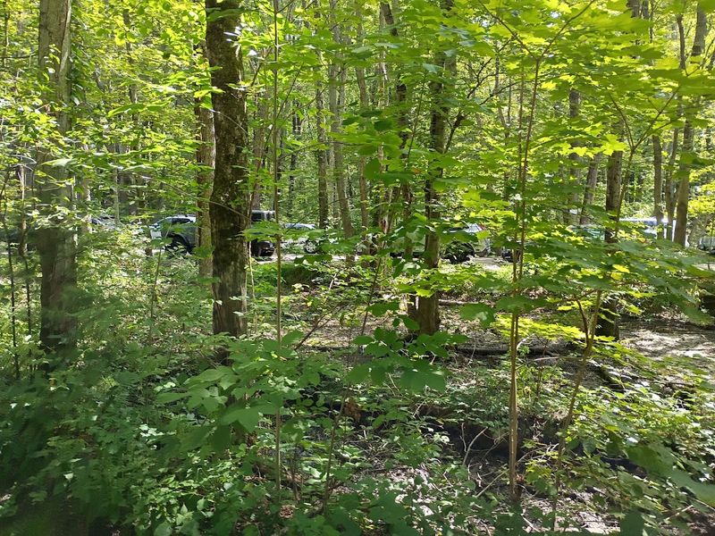
History follows riders along the Pequonnock River Trail, where sections of the route trace the former Housatonic Railroad corridor.
The state formally recognized the regional greenway in 2001, linking paths that had developed independently along the old railbed between Bridgeport, Trumbull, and Monroe.
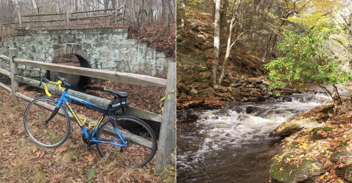
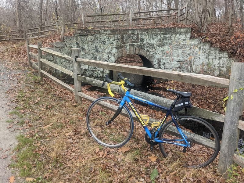
Evidence of the railroad era still appears beside the trail. Stonework, bridge remains, and the long, level grade reveal how the landscape once supported trains moving passengers and freight through the region.
Alternate names, including the Housatonic Rail Trail and Monroe Housatonic Railbed Trail, preserve that transportation legacy.
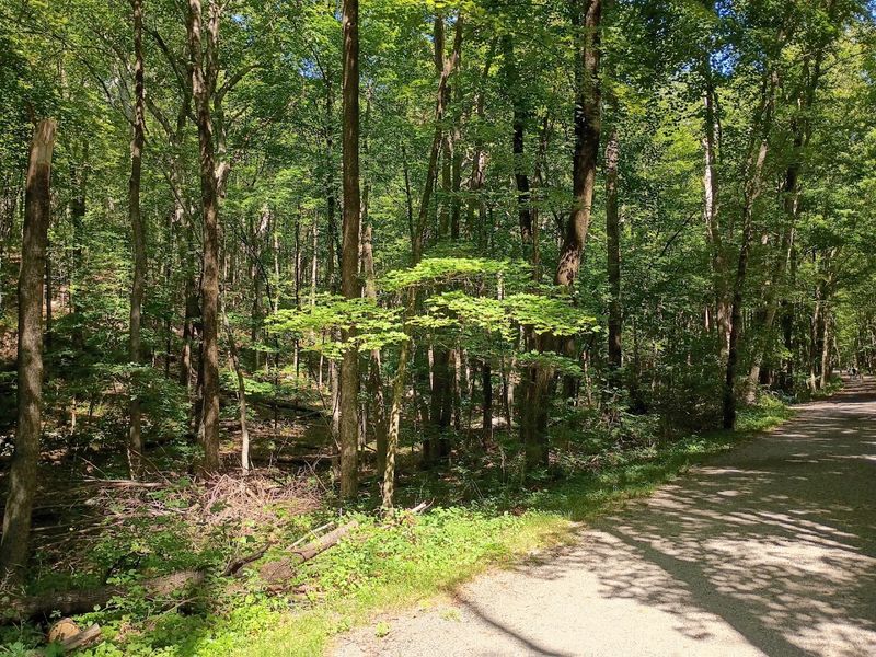
Beyond its history, the route offers an inviting ride beneath mature trees. Thick canopy covers much of the path, providing shade and helping wooded stretches feel cooler than nearby roads during warm weather.
Because rail lines required gradual slopes, many portions remain relatively flat and manageable for recreational cyclists and riders building confidence.
The combination of forest scenery and historic character gives the trail its appeal. Instead of simply following a modern greenway, cyclists move through a corridor shaped by earlier travel, with each quiet mile offering another reminder of the route’s working past across more than one community.
3. A Shaded Corridor Far From Busy Roads
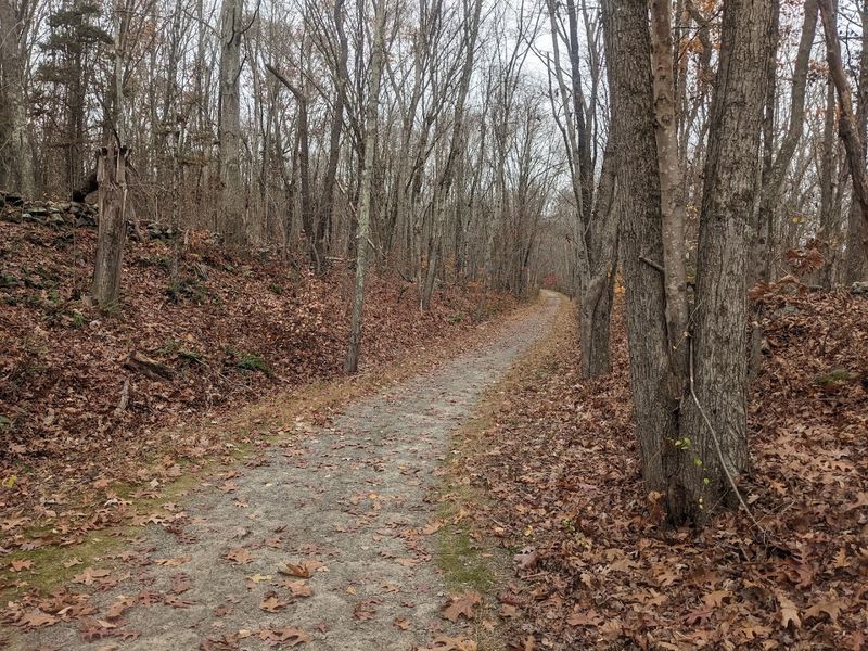
Shade becomes one of the Pequonnock River Trail’s greatest advantages as the route slips away from surrounding streets and into woodland. Mature trees arch above portions of the path, filtering sunlight and creating a cooler setting during summer rides or walks.
The change in atmosphere happens quickly. Road noise softens as the trail continues through the forest, while birds, moving leaves, and the river provide a calmer soundtrack.
In certain sections, dense growth nearly hides nearby homes and neighborhoods, giving visitors a surprising sense of distance from everyday traffic.
Brief road crossings interrupt that seclusion, so trail users should slow down and remain alert whenever the path meets vehicle routes. One of the most important crossings is at Route 111 near Old Mine Road in Trumbull.
Earlier descriptions mentioned a proposed signal, but that information is outdated. A dedicated traffic signal and crossing improvements were added to help pedestrians and cyclists navigate the busy roadway safely.
Beyond those intersections, the wooded character quickly returns. The blend of continuous shade, peaceful scenery, and easy access makes this trail especially appealing for outings, when the forest canopy can turn an ordinary trip into a refreshing break from the heat and suburban activity.
4. Creek Views Appear Between The Wooded Stretches
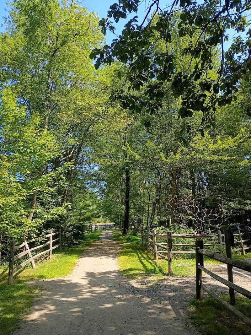
Running water has a way of making any outdoor space feel more alive, and the Pequonnock River does exactly that along significant portions of this trail.
The river flows beside the path for stretches that reveal themselves gradually, appearing through gaps in the trees or opening up fully where the bank rises above the water.
Those elevated vantage points offer a broader look at the river as it curves and winds through the landscape below.
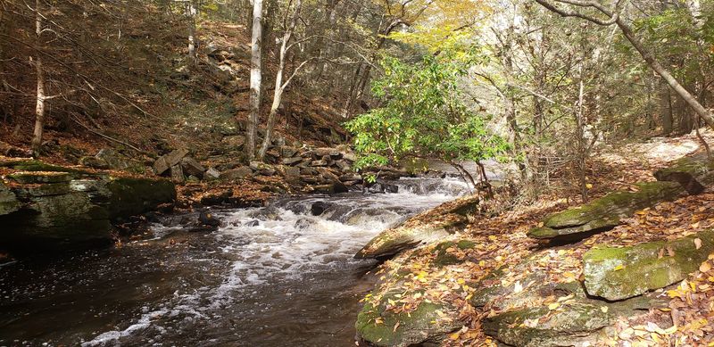
Rock formations and small rapids add texture to the riverbed, giving the views a dynamic quality that changes with the water level and the season.
In the southern section of Wolfe Park, the river noticeably widens and moves across a spread of large boulders, creating a scene that tends to draw people to pause for a moment.
The sound of water moving over stone carries through the surrounding trees in a way that feels genuinely restful.
Photography enthusiasts may want to explore the parallel blue trail that runs adjacent to the river, as it offers additional angles and compositions along the waterway.
Even without a camera, simply watching the river move through the valley provides a kind of quiet entertainment that keeps the ride from ever feeling monotonous or routine.
5. Great Hollow Lake Offers A Scenic Mid-Ride Pause
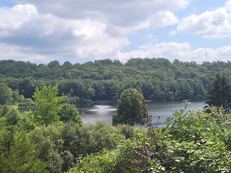
Halfway through a long trail ride, a calm lake with a sandy beach has an almost magnetic pull. Great Hollow Lake sits on the western side of William E.
Wolfe Park and serves as one of the most appealing rest stops along the entire Pequonnock River Trail corridor. The sixteen-acre lake is ringed by trees that reflect off the water’s surface, giving the spot a naturally photogenic quality throughout the year.
A designated swimming area and sand beach make the lake a practical cooling-off spot during warmer months. Picnic tables are available nearby, offering a comfortable place to sit and eat before continuing down the trail.
Restroom facilities are also accessible at the lake area, which adds a layer of convenience that longer rides genuinely benefit from.
Non-motorized watercraft are permitted on the lake, so some visitors arrive with kayaks or canoes for a quieter kind of exploration. A paved pedestrian path circles the lake’s perimeter, providing a pleasant option for those who want to stretch their legs after a long stretch of riding.
Parking is available at the Great Hollow Lake lot within the park, making it easy to access even for visitors who are not doing the full trail ride.
6. Autumn Color Transforms The Forested Miles
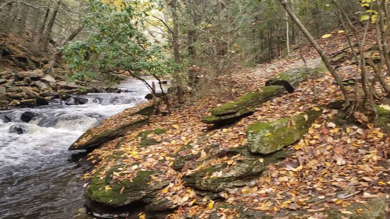
When October arrives in central Connecticut, the Pequonnock River Trail becomes a different kind of experience altogether. The northernmost segment of the trail, which winds through the forested interior of Wolfe Park, is particularly celebrated for its fall foliage display.
Beech trees contribute a warm and luminous yellow tone to the canopy, while oaks and maples layer in deeper oranges and reds that shift with the angle of the light throughout the day.
Peak fall color in this part of the state typically lands somewhere between mid and late October, though the broader foliage season stretches from late September through early November.
The most saturated and dramatic colors tend to appear in the first two weeks of October, when the combination of cool nights and mild days draws out the richest pigments in the leaves.
Riding through that kind of color feels noticeably different from a summer outing, with the light itself taking on a warmer and more golden quality.
The fallen leaves that accumulate on packed dirt sections can occasionally make the surface slightly slippery, so adjusting speed on curves is a sensible precaution during autumn rides.
Despite that minor consideration, the fall season is widely regarded as one of the most rewarding times to experience the trail in Monroe.
7. First-Time Riders Should Check The Trail Map
Arriving at a trail without any sense of its layout can turn an enjoyable outing into an unexpectedly confusing one. The Pequonnock River Trail spans approximately 16.2 to 16.9 miles in total, and the section running through Monroe alone accounts for roughly 9.7 miles of that distance.
That is a substantial stretch of trail with multiple access points, connecting segments, and occasional road crossings that benefit from a bit of advance familiarity.
Maps are posted at several trailheads and key points along the route, making them easy to consult before setting off.
Digital versions are also available through platforms like TrailLink and Engage Bridgeport, both of which provide downloadable or viewable maps that outline access points, surface types, and notable features along the way.
Reviewing one of these resources before a first visit helps riders understand how the different sections connect and where the brief on-road detours occur.
Some parts of the trail include splits or forks where the path divides or joins a residential street for a short distance. Knowing those points in advance prevents unnecessary backtracking or confusion mid-ride.
Trail maps also highlight features like the stone-arch bridge and creek overlooks, giving first-time visitors specific landmarks to look forward to as the ride unfolds.
8. A Longer Adventure Can Continue Toward Newtown
For riders who find themselves wanting more trail after completing the Monroe section, the path does not simply stop at a parking lot.
The Pequonnock River Trail extends northward to the Newtown town line, where the route ends temporarily amid woodland and the quiet presence of long-abandoned railroad tracks.
Those overgrown rails serve as a tangible reminder of the trail’s origins and add a subtle, almost contemplative quality to the northernmost stretch of the ride.
Plans for a formal extension into Newtown are in development, with the proposed addition designed to meet full accessibility standards.
Smooth and stable surfaces, gentle grades, and clearly marked entry points are all part of the design intent, aiming to make the extended route usable for individuals with mobility devices as well as casual walkers and cyclists.
Once completed, the full trail including the Newtown extension could reach approximately 16.9 miles end to end.
The expansion is expected to draw additional visitors to the area and open up longer loop and out-and-back options for those who want a more substantial outing.
Even in its current form, the northern segment near the Newtown border offers a quieter and less-traveled stretch of trail that rewards riders who push past the more accessible southern sections to explore what lies further up the old rail corridor.