This Enormous Connecticut Reservoir Was Built Over An Entire Forgotten Village
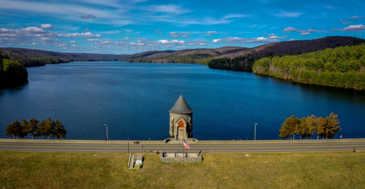
Calm water can hide some surprisingly complicated history. Looking across this enormous reservoir today, you would never immediately guess that its creation completely changed what once existed here.
The scenery feels peaceful now, which makes the story underneath it even stranger. Roads once led somewhere very different, and the landscape people knew had to make way for something much larger.
Connecticut has a reservoir whose quiet waters now cover land once connected to an entire community and its everyday life.
It is hard not to picture what the area might have looked like before everything changed. That thought gives an otherwise beautiful view a slightly mysterious edge.
Places like this make history feel unusually close. You are not staring at an old photograph or reading about a vanished landscape behind museum glass.
You are looking directly across what replaced it, while the story of what came before remains just beneath the surface.
1. Calm Waters Hide An Extraordinary Past
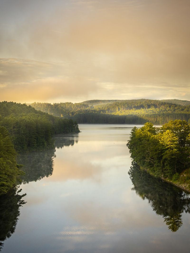
Calm water can hide a complicated story. On a still morning, the reservoir can look almost unreal, with the surrounding hills reflected across its smooth surface.
Yet the peaceful scenery exists because a community once occupying this valley had to make way for Hartford’s expanding water supply.
Plans for a larger reservoir developed during the 1920s as the region needed more dependable drinking water. The Metropolitan District began acquiring property later that decade, setting in motion a massive project that eventually transformed the valley.
Construction of the Saville Dam began in 1936, and the reservoir was filled during the 1940s. Today, Barkhamsted Reservoir remains an important part of the Metropolitan District’s water-supply system for the Hartford area.
The history underneath that transformation is easy to miss when admiring the view. Homes and farms were acquired, families relocated, and familiar roads disappeared as the project moved forward.
The former village of Barkhamsted Hollow was among the areas affected.
That contrast gives the landscape much of its fascination. The water looks wonderfully quiet, but knowing what came before adds another dimension to the scenery.
Visitors can admire the reservoir and the distinctive stone Saville Dam from public viewing areas nearby.
It is a beautiful roadside stop with a past worth knowing.
Once you know the story, that glassy stretch of water becomes much harder to see as ordinary.
2. Forested Hills Surround The Vast Reservoir
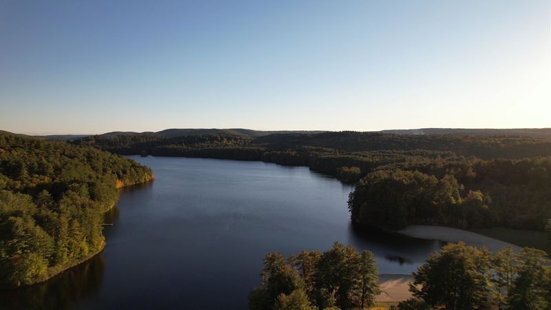
Numbers help here. The reservoir runs roughly eight miles north from central Barkhamsted, reaching almost to the Massachusetts state line, and it holds about 36.8 billion gallons.
That capacity makes it the largest single water supply reservoir in Connecticut.
All of that water sits inside the Litchfield Hills, hemmed in by steep, thickly wooded slopes that press right down to the shoreline. From certain angles the lake looks more like a northern wilderness pond than a piece of municipal infrastructure.
Because the reservoir is a public drinking water source, the shoreline is not an open recreation area. There is no swimming and no casual wandering along the banks, and posted signs mark where access stops.
Respecting those boundaries is part of visiting responsibly.
What you can do is take in the long views. Travelers heading into the Litchfield Hills often build in a stop at an overlook on the northwestern side, where the sightline stretches across water and treetops to the horizon with almost no buildings in frame.
Birds drift overhead, the forest absorbs road noise, and the whole setting feels bigger than a map suggests. It is a rare thing in southern New England to find this much undeveloped green in one sweep.
3. Saville Dam Anchors The Southern End
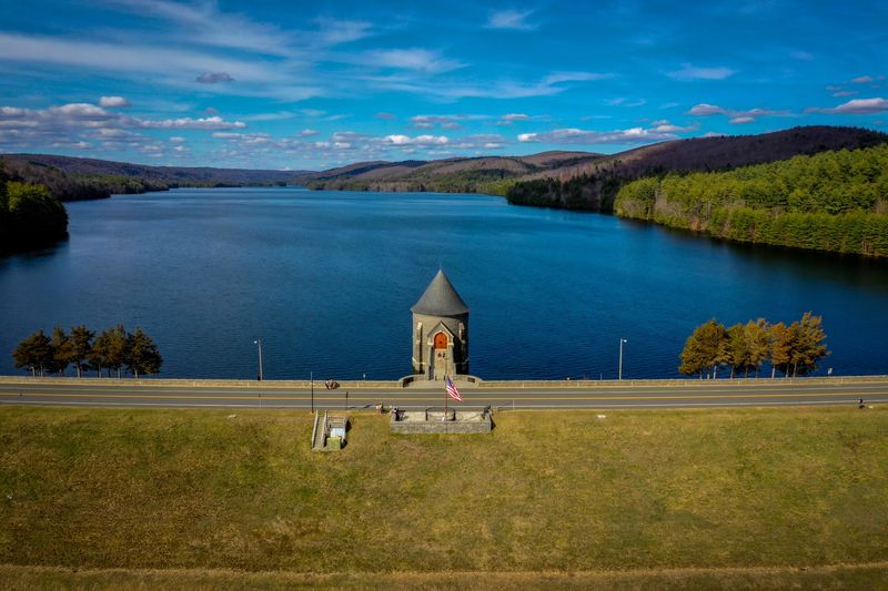
Some road views demand a second look. This one comes with turrets.
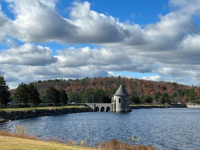
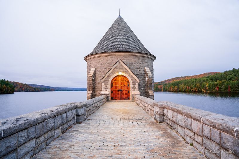
As Route 318 reaches Saville Dam, its stone gatehouse rises beside Barkhamsted Reservoir looking far more like part of an old castle than a piece of water infrastructure.
The scenery is impressive, but the engineering behind it is just as interesting. Construction of the dam and reservoir system was completed in 1940, creating the massive Barkhamsted Reservoir that remains a major source of drinking water for the Hartford region.
Route 318 crosses directly over Saville Dam, turning an ordinary drive into one of the most memorable stretches of road in the area. State transportation records even designate this portion of Route 318 as a scenic road.
The stonework steals much of the attention. Heavy masonry and the distinctive gatehouse give the structure its storybook appearance, especially when the surrounding hills begin changing color.
Drivers can reach the dam via Route 318, also known here as Saville Dam Road in Barkhamsted.
Rather than treating the roadway itself as a pedestrian overlook, use designated public areas where access is permitted and follow current parking restrictions.
Even from the road, the combination of water, hills, and remarkable stone architecture makes this drive difficult to forget.
4. Barkhamsted Hollow Once Filled This Valley
About a mile north of where the dam stands today, the valley floor held a working village called Barkhamsted Hollow. It was part of the town of Barkhamsted, which was incorporated in 1779, and it sat at a crossroads where roads and daily errands naturally converged.
Life there was largely self-contained. There was a church, a cluster of homes and farm buildings, and a general store known as LeGeyt’s, which also housed the local post office and served as the social center of the valley.
Picture a place where you could buy flour, mail a letter, and catch up on every bit of local news in the same five minutes. That kind of village did not need a downtown because the store was the downtown.
Barkhamsted Hollow was not alone in the valley. Hartland Hollow, another community upstream, shared the same fate when the water rose, and together the two lost neighborhoods account for much of what lies beneath the surface now.
None of those buildings survive in place. Standing on the dam and looking north, you are looking directly over a road network, a schoolyard’s worth of childhoods, and generations of farm work that no longer appear on any modern map.
5. Homes And Farms Vanished Beneath The Project
Land acquisition began around 1927, and it did not go quickly or evenly. Residents of Hartland Hollow tended to sell sooner, while families in Barkhamsted Hollow held on longer, reluctant to give up homes that had been in the same hands for generations.
Then the Great Depression tightened everything. As neighbors moved away and local businesses closed, staying became less a matter of stubbornness and more a matter of impossibility.
By the summer of 1936, the valley stood empty.
Clearing the land was an enormous undertaking. A land-stripping company removed every above-ground structure, crews cut down many acres of trees and farmland, and roughly twenty miles of highway had to be rerouted around the future waterline.
Four cemeteries holding approximately 1,300 interments were carefully exhumed and moved to higher ground, a task that says a great deal about how thorough the project had to be. Houses and barns were torn down and often burned in large bonfires.
What was left behind were cellar holes, empty and squared off in the dirt, waiting for the water. In total, more than a thousand people were displaced so the reservoir could fill and the region could drink.
6. Pieces Of The Old Community Were Preserved
Not everything went under. The one-room Center Schoolhouse once stood near what is now the reservoir’s west shore, and it escaped the flooding entirely.
In 1979 the Barkhamsted Historical Society moved the building to Route 181, where it still stands.
Visiting it is a small, grounding experience after looking at all that water. A single room, a handful of desks’ worth of space, and suddenly the valley feels like a neighborhood rather than a statistic.
The Soldiers Monument was rescued too. Originally erected in Barkhamsted Hollow in 1897, it was relocated rather than lost, which kept a piece of the community’s civic memory above the waterline.
West of the reservoir, several surviving buildings of Barkhamsted Center are recognized as part of the Barkhamsted Center Historic District. Driving that stretch gives you a sense of the architecture and scale that the Hollow shared before it was emptied.
If you want more than a scenic stop, pair the dam with these landmarks. Hours for small historical properties can be limited and seasonal, so it is worth checking ahead through the local historical society before planning a visit around an interior tour.
7. The Dam Offers One Of The Best Views
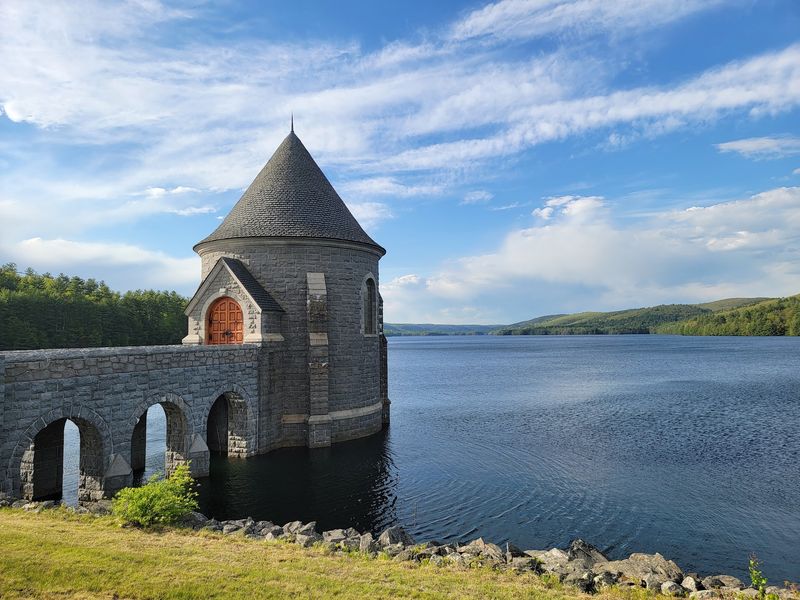
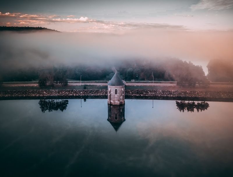
Photographers have known about this spot for years. Golden hour turns the water into a mirror, and early mornings sometimes deliver low fog sitting in the basin while the gatehouse turrets poke above it.
From the crest of the dam the contrast is striking. On one side the reservoir spreads north between the hills, and on the other the stonework and steep embankment show off the effort it took to build all this by hand and machine in the 1930s.
Practical notes matter here. Stopping and parking along the road itself is not allowed, the main lot near the dam was closed in 2020, and other small parking areas remain in use, with a walkable shoulder leading back toward the dam.
Some paved paths and lower areas have been closed at times, and posted signs mark where you should not go. Restrooms are not available at the dam, so plan that stop before you arrive.
Weekends on clear days draw a crowd, though the mood stays unhurried. Bring a folding chair, a snack, and a camera, and you can happily spend a couple of hours doing very little except looking.
8. Fall Colors Transform The Surrounding Hills
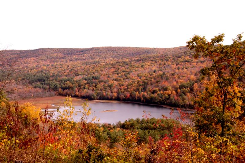
October is when this place shows off. The forested slopes that ring the reservoir shift into deep reds, burnt oranges, and bright yellows, and the still water doubles all of it in reflection.
Timing helps. In state’s northwest and northeast corners, peak foliage generally arrives from mid-October into early November, so a visit in that window gives you the best odds of catching full color.
Light matters as much as the calendar. Late afternoon and very early morning tend to produce the richest reflections, and the water is usually calmest before the day’s breeze picks up.
Autumn also happens to be the busiest season at the dam, so arriving early does double duty. You get quieter conditions, easier parking in the small lots, and softer light all at once.
Dress for hill-country weather, which runs cooler and breezier on the exposed crest of the dam than the forecast might suggest. A warm layer and comfortable shoes make a long look far more pleasant.
Winter has its own admirers, with bare branches and pale light giving the basin a stark beauty, and spring brings blue skies over endless new green. Still, if you can only come once, come in the fall.