This Forgotten Nebraska Ghost Town Still Has Massive Ruins You Can See From The Road
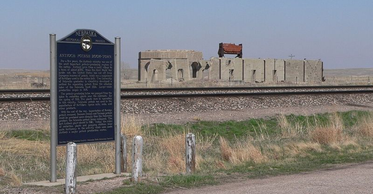
You almost miss it if you are driving too fast.
At first, the landscape looks quiet enough to blend into everything around it.
Then a hulking concrete shell appears beside the road and you are staring at the remains of a place that once had far more going on than the empty surroundings suggest.
Western Nebraska holds a few spots where the past refuses to disappear completely.
Slow down and look carefully. The ruins are large enough to make you wonder what stood here and how something so substantial ended up stranded in such a lonely setting.
You do not need a guided tour or a ticket to feel the intrigue. Sometimes one unexpected structure is enough to make you pull over and start asking questions.
That is the appeal of places like this.
They do not hand you the whole story immediately. They leave just enough behind to make you want to know what happened next.
Concrete Shapes Still Rising From The Sandhills
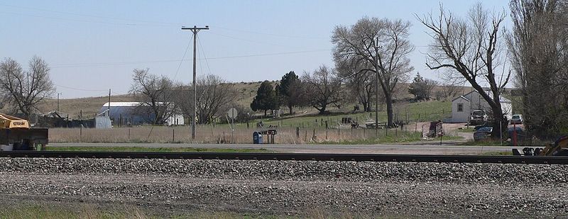
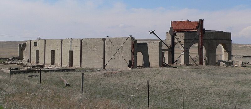
Some ruins barely whisper, but the remains near Antioch speak in huge concrete shapes that stand out against the soft hills.
From the road, the old structures look almost out of place, which is part of what makes them so memorable for travelers crossing this open part of western Nebraska.
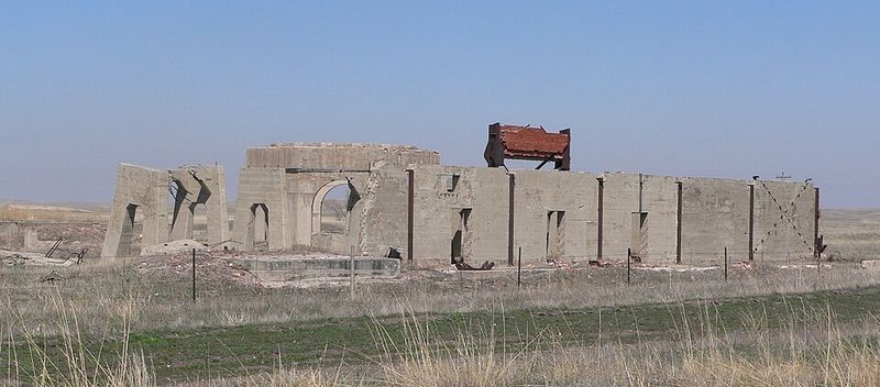
What can still be seen today are pieces of former potash facilities, including sturdy reduction plant remains and related structures tied to pumping operations.
Their rough surfaces, broken edges, and heavy forms show how serious the industrial work once was here, even though the town around them has long since faded away.
A roadside view gives the best first impression because the scale becomes clear without needing to step onto land that may be private.
Early morning and late afternoon light often helps the shapes stand out more clearly against the grass and sand.
Visitors who slow down safely and look carefully will notice how the quiet landscape and the stark concrete create a sharp contrast.
That contrast is the heart of Antioch’s appeal. It is not flashy or polished.
It is honest, weathered, and strangely powerful in a place that now feels calm and distant.
A Boomtown That Appeared With Stunning Speed
Quiet places do not always stay quiet, and Antioch is one of the clearest examples in Nebraska history.
Before its short boom, the community was little more than a small settlement with basic local buildings, but wartime demand changed everything with surprising speed.
During World War I, foreign supplies of potash were disrupted, and that opened the door for production in Nebraska’s Sandhills.
Because alkaline lakes in the region offered the raw material needed for extraction, Antioch suddenly became important.
Workers arrived, investment followed, and the town expanded far faster than most rural communities ever do.
Learning that background makes the ruins feel less mysterious and more human.
The concrete remains start to represent paydays, long shifts, crowded streets, and the rush of a place trying to keep up with its own growth.
Antioch did not grow over many quiet decades. It surged ahead because outside events created a need that local resources could fill right away.
For visitors, that fast rise is one of the most interesting parts of the story.
It shows how a remote place can become vital almost overnight, then return to stillness just as quickly when the wider world changes direction again.
Why Potash Put Antioch On The Map
A single mineral helped change Antioch from a tiny place into a name with statewide importance.
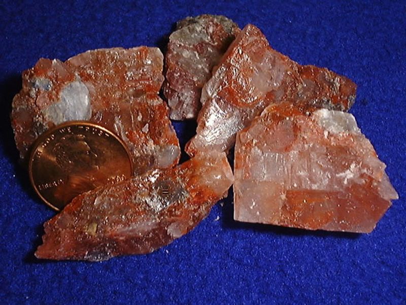
Potash, a potassium compound used in fertilizer and several industrial products, became extremely valuable when war disrupted the usual supply coming from Germany.
Prices rose sharply during that period, and Nebraska suddenly had an opening.
Scientists connected to the University of Nebraska helped develop a way to recover potash from alkaline lake water in the Sandhills.
Because the region had those lakes in abundance, Antioch found itself near the center of a brief but major industrial opportunity.
That history matters because it explains why such large ruins exist in a place that seems so small today. Nothing about the setting suggests a former industrial hotspot until the story of potash is added.
Then the landscape makes more sense. The lakes, the pumping systems, and the reduction plants all fit together as parts of a bigger process that answered a national need.
For travelers, understanding potash turns a simple roadside stop into something much richer. The site becomes a lesson in geology, agriculture, and world events all at once.
Antioch was not random. It was important for a clear reason, and that reason still shapes what remains visible today.
Five Plants Once Worked In This Area
Big stories often leave behind small clues, yet Antioch still offers large evidence of how active the area once was.
By the spring of 1918, five potash reduction plants operated nearby, showing just how intense the local industry had become in a very short time.
Those plants were linked to the American, Nebraska, Alliance, National, and Western companies.
Machinery, pumping systems, workers, and transport all had to function together to keep production moving.
After the market collapsed, much of the equipment was removed, sold, or scrapped, leaving behind foundations and fragments instead of complete buildings.
Knowing there were five separate plants helps visitors understand the scale of what happened here. The ruins are not leftovers from a single workshop or one isolated experiment.
They are pieces of a much larger industrial network that spread across the area around Antioch. That makes the remaining concrete seem even more impressive from the road.
A practical way to appreciate the site is to compare the emptiness of the current landscape with the amount of labor and planning that once filled it.
Empty grassland now covers ground that was once crowded with work and motion. That contrast helps the ghost town feel real instead of distant, and it gives the surviving structures deeper meaning.
How A Tiny Settlement Grew To Around 2,000 People
Population numbers can feel dry on paper, but Antioch’s growth tells a dramatic human story.
In only a short span, the community expanded from a very small settlement into a busy place with around 2,000 residents, and some accounts suggest even higher numbers during the boom.
That jump meant more than new houses. It likely changed daily life in every possible way, from noise and traffic to supplies and services.
A place that once felt isolated became crowded with workers and families connected to potash production. Temporary growth on that scale would have brought excitement, pressure, and constant adjustment.
For modern visitors, those numbers help explain why the ruins seem too large for the quiet area around them.
The remains belonged to an industrial moment strong enough to support a whole temporary community. Streets, businesses, and routines would have formed quickly because the work demanded them.
Then, once the industry faded, much of that human activity disappeared. One useful way to think about Antioch is as a snapshot of a boomtown cycle in fast motion.
Growth came in a rush, and decline followed before the place could settle into a long future.
That sharp rise and fall is part of what makes the site so interesting today. The landscape looks calm now, but the past here was anything but calm.
Highway 2 Gives Travelers A Clear View
Road trips usually deliver small surprises, and Antioch offers one of the most unusual in Nebraska.
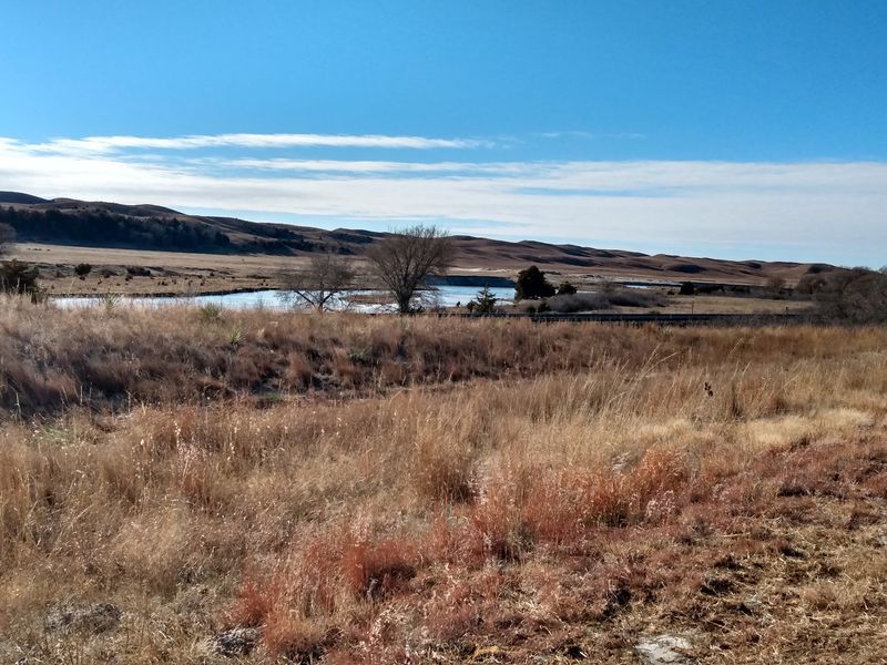
Travelers on Nebraska Highway 2 can spot the old ruins from the road, which makes the ghost town feel accessible even though the surrounding country is wide open and sparsely settled.
The site sits about 15 miles east of Alliance along a route known for Sandhills scenery. That location matters because visitors do not need a long hike to understand why Antioch stands out.
The remains rise into view beside a highway already famous for broad skies, grass-covered dunes, and a strong sense of distance.
Seeing the ruins while driving creates a different experience than visiting a museum or downtown historic district.
There is no busy entrance or crowded sidewalk. Instead, the landscape unfolds at highway speed, and the old concrete shapes suddenly break the natural rhythm of hills and grass.
Drivers should stay alert, slow down safely, and use only proper pull-off areas when stopping. A little planning helps because services in remote stretches can be limited.
Bringing water, checking fuel, and watching the weather are sensible steps. Antioch works best as a thoughtful roadside stop, not a rushed dash.
The easy visibility from Highway 2 is one reason the place remains memorable long after the drive continues west or east.
The Historical Marker Tells The Missing Story
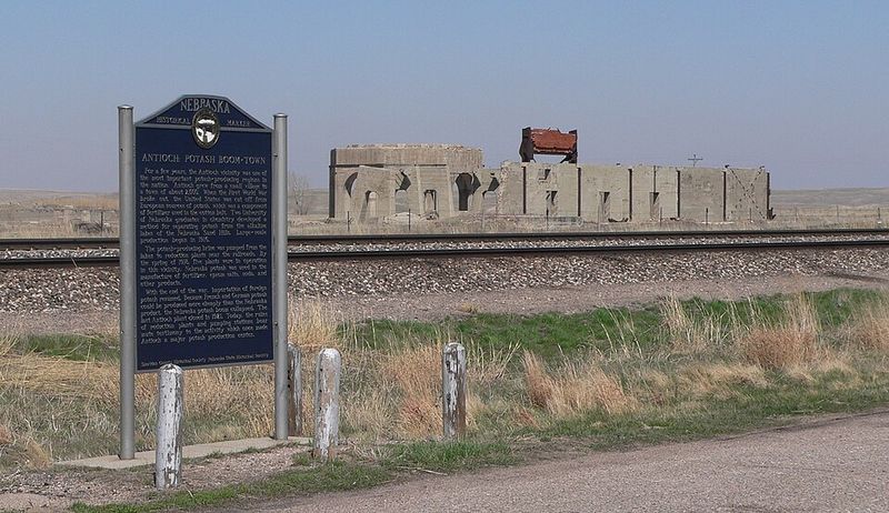
Ruins tell only part of the story, and the historical marker near Antioch helps fill in the rest.
A stop at the marker gives visitors a clearer sense of what the concrete remains once meant and why this quiet area briefly mattered so much.
The marker stands in a pull-out on the north side of Nebraska Highway 2 near Antioch.
Reading it adds helpful context about the town’s rise, the potash factories, and the fast collapse that followed when foreign competition returned after the war.
Without that information, the site can seem puzzling instead of powerful.
Practical travelers often find that a short pause at the marker makes the entire visit more rewarding.
The words on the sign connect dates, industry, and landscape in a way that turns scattered ruins into a real chapter of state history.
It also gives visitors a chance to stretch, slow down, and take in the broad setting without guessing at what happened here.
Since outdoor signs can weather over time, carrying a phone or notebook for quick notes may help if details feel easy to forget once back on the road.
The marker is not flashy, but it does exactly what a good historical stop should do. It gives structure to the scene and helps Antioch’s silent remains speak more clearly.
Reduction Plants And Pumping Stations Left Their Bones Behind
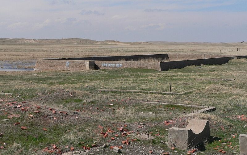
Even after machines are gone, heavy industry leaves behind a stubborn outline, and Antioch proves that well.
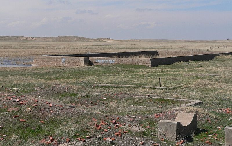
What remains today are mostly the concrete foundations, broken walls, and structural pieces connected to former reduction plants and pumping stations.
Those leftovers may sound plain, but they are the most direct link to the town’s working life.
Potash extraction in the Sandhills required systems that could move water and process material efficiently, so the surviving structures hint at a larger setup that once stretched beyond what the eye sees now.
Their durability explains why they still catch attention from the highway.
A careful visitor can learn a lot simply by observing shapes, spacing, and materials from a respectful distance.
Thick concrete suggests permanence, even though the industry itself turned out to be temporary. That mismatch between solid construction and short lifespan is one of the strongest lessons at Antioch.
The site also encourages patience. There is no polished exhibit here to guide every detail.
Instead, the remains ask people to slow down and consider what kind of effort built them and why so little stayed behind.
Looking at those sturdy fragments helps the past feel more physical. Antioch is not only a story in a book.
It is a place where the industrial skeleton still shows through the grass and sand.