This Historic Georgia Small Town Flourished Around A Busy Railroad Junction
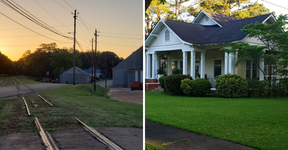
I only stopped because I needed gas, nothing more strategic than that. Ten minutes turned into two hours once I noticed the brick buildings lining the street, all facing the same direction like they were still waiting for something.
That something turned out to be a train, or at least the memory of one, since an old depot sat right where the town seemed to begin. Every storefront, every street corner, every faded sign pointed back to those tracks like the whole place grew out of a single idea.
Georgia holds towns like this in quiet corners, built entirely around sounds most people forgot to listen for anymore. I wandered until the sun started dropping, still finding new details in old brick.
Georgia rarely explains itself loudly, and this town proves that some of the best stories wait for someone willing to slow down.
The Historic Union Station At The Heart Of Railroad-Era Richland
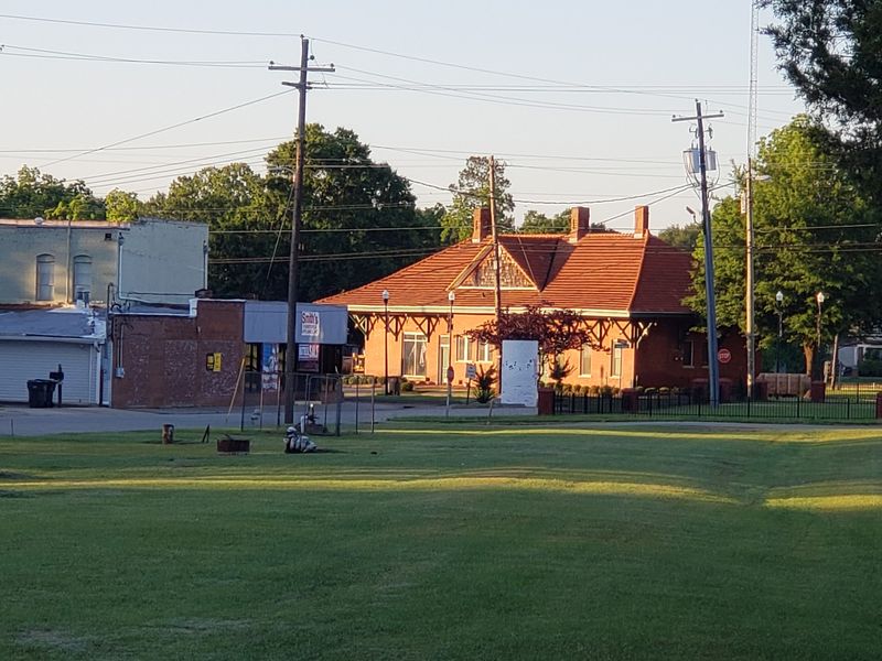
Most small towns have a main street. This one has a depot that acts like the town’s heart, and everything else grew outward from it.
Built in 1913, the passenger depot was known as Union Station. It served the Seaboard Air Line Railroad and handled heavy traffic across southwest Georgia.
Trains rolled through in several directions from this single building. That made it a true junction, not just a stop on somebody else’s line.
The architecture still shows its purpose clearly. Long platform overhangs kept passengers dry while they waited for the next arrival.
Standing at the edge of the old rail bed, you can picture the crowds. Suitcases, mail sacks, cotton bales, and travelers heading toward Alabama or Florida.
What impressed me most was how well the building has held up. It reads as sturdy rather than fragile, built for daily work instead of decoration.
Depots like this often disappeared once passenger service ended. Keeping one standing takes stubborn community effort over many decades.
The best time to visit is midday, when light hits the brick just right. Bring a camera with a wide lens if you have one.
You will find it in Richland, Georgia.
When The Rails Arrived And Changed The Map
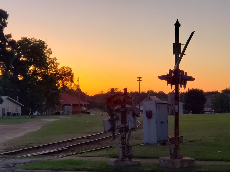
A single rail line can rewrite a community’s future. That is exactly what happened here in 1885, when track was laid through Stewart County.
Before the rails, this was farm country with modest ambitions. Afterward, the town found itself sitting on a valuable crossroads.
By 1889, two important lines met at this point. The Savannah, Americus and Montgomery crossed paths with the Columbus Southern.
Those routes were not local errands. One connected Americus to Montgomery, Alabama, and the other linked Columbus to Tallahassee, Florida.
Suddenly, goods from this area could reach distant markets quickly. Cotton and produce no longer depended on slow wagon hauls.
Junction towns tended to grow fast, and this one followed the pattern. People moved in because opportunity followed the track.
Look at the street layout today and the logic becomes obvious. Buildings face the rail corridor rather than turning their backs to it.
I like tracing the old alignments on a map before visiting. It makes the downtown grid suddenly make sense.
History here is not abstract. The rails explain why the buildings sit where they do, block by block.
A Downtown Built On Boom Years
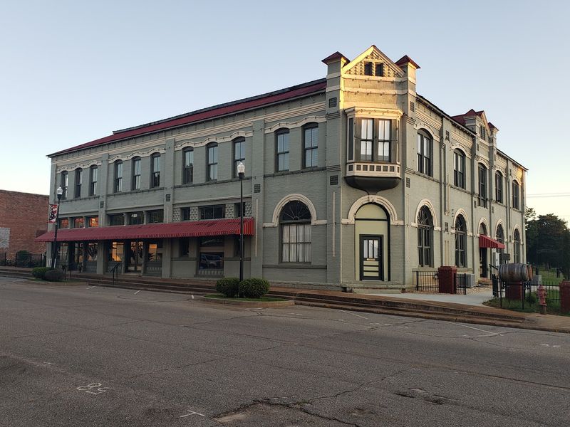
Twenty-five stores in one small Georgia town sounds like an exaggeration. In 1913, it was simply an accurate count.
Prosperity arrived with the trains, and the business district swelled to match. Three banks operated here at the same time.
Three hotels also served travelers passing through the junction. That tells you how many people were coming and going daily.
Industry set up shop nearby as well. A cotton seed oil mill, a guano fertilizer factory, and a Coca-Cola bottling plant all ran locally.
Walking the sidewalks now, the scale still shows. The storefronts are taller and more decorated than a village of this size would normally build.
Cornices, transom windows, and wide display glass hint at confident spending. Nobody builds like that unless business is good.
I counted architectural details for twenty minutes and lost track. Each facade carries slightly different brickwork.
Bring comfortable shoes and plan a slow loop. The rewards here come from noticing small things rather than rushing.
Photographers should aim for early morning. Shadows are softer and the streets are quiet enough to frame full buildings.
City Hall Museum And Welcome Center Combined
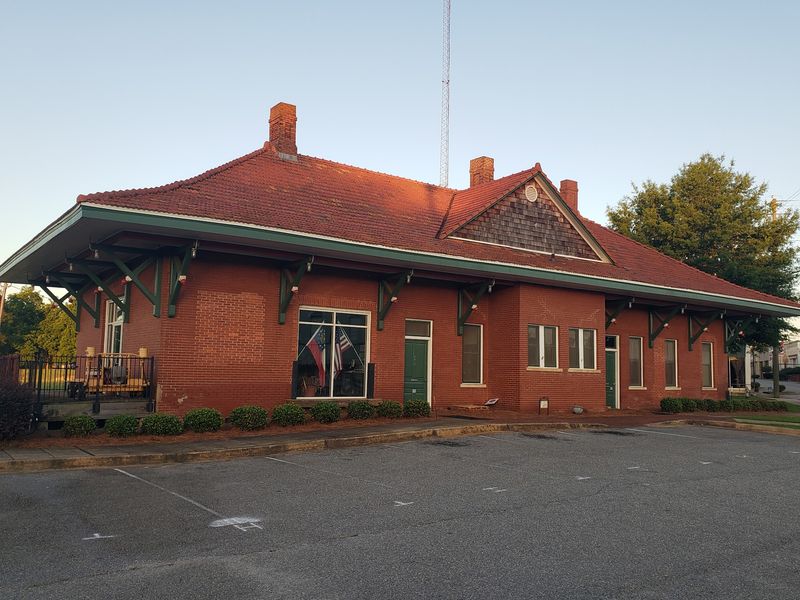
Very few buildings get a second act this good. The depot now works harder than it did in its final railroad years.
Freight service continued with CSX into the 1980s. The Georgia Southwestern Railroad used it briefly afterward.
Instead of letting the structure fade, the community renovated it thoroughly. Today it houses City Hall, a rail museum, and a welcome center.
The ownership arrangement is unusual and worth knowing. The Georgia Department of Transportation owns the building and leases it to the town for a token amount.
That partnership saved a landmark that could easily have been lost. It also gave residents a functioning civic space.
Inside, the museum focuses on railroad history rather than general nostalgia. Expect artifacts tied directly to the lines that crossed here.
You can find it at 100 Broad Street, which sits right in the middle of things. Parking nearby is simple and free.
Stop at the welcome center first if you are new to the area. Staff can point you toward the buildings worth seeing.
Call ahead about hours. Small-town schedules can shift with the season.
The Historic District Recognized In 1986
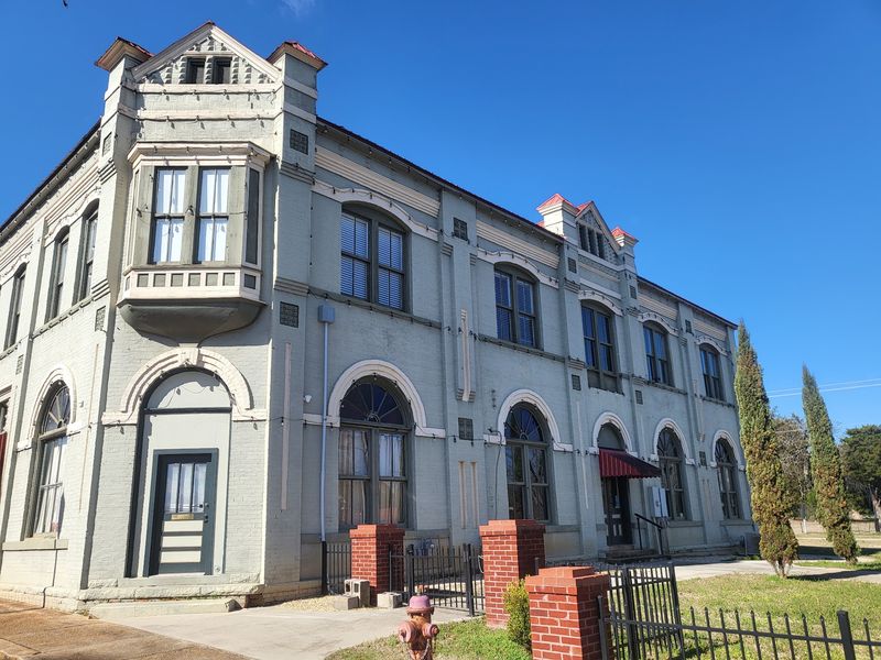
National recognition does not come easily to towns this size. Yet the older section earned a spot on the National Register of Historic Places in 1986.
The district covers more than just the commercial blocks. Surrounding residential streets are included too.
Architecture fans get a genuine variety here. Greek Revival, Victorian Eclectic, Neoclassical, and Craftsman bungalows all appear within a short walk.
That mix reflects decades of steady building. Each style marks a different era of prosperity tied to the rails.
Front porches dominate the residential streets. Deep overhangs and simple columns show practical southern design at work.
What I appreciate is the honesty of the neighborhood. These are lived-in homes, not a manufactured display village.
Be respectful while exploring. Photograph from the sidewalk and skip the private driveways.
Early evening light flatters these houses beautifully. Long shadows bring out porch details and window trim.
Pair the residential loop with the downtown walk for a full picture. Together they show how the community actually functioned.
Allow at least an hour. Rushing through defeats the purpose entirely.
From Chisholm To A Named Community
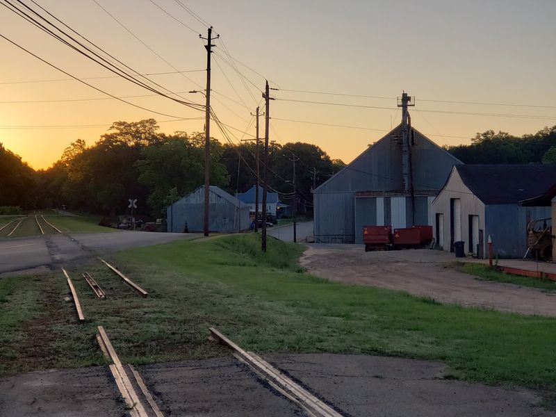
The town answered to a different name for its first several decades. Settlers arrived in 1827 and called the place Chisholm.
The current name came from South Carolina. Several pioneer families had lived in Richland there and carried the name west with them.
Official incorporation followed much later, around 1889 or 1890. Records differ slightly on the exact year.
Notice the timing. Incorporation arrived right as the railroad junction was taking shape.
That overlap is not a coincidence. Formal town government became necessary once commerce started multiplying.
Sixty years passed between first settlement and official status. The community existed long before paperwork acknowledged it.
Historical markers around the area fill in these details. Reading them takes only a few minutes each.
I find naming stories genuinely useful for understanding migration. Families rarely picked names at random.
If you enjoy genealogy, the local records here connect to South Carolina roots. That link surprises visitors who assume the name is purely descriptive.
Start your visit with the markers. Context makes every building afterward more interesting.
A Presidential Mother Was Born Here
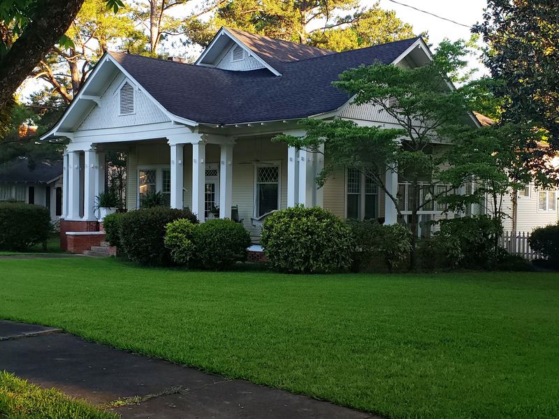
Presidential history usually points toward big cities. In this case, it points toward a quiet Georgia street.
Bessie Lillian Gordy Carter was born here in 1898. She later became the mother of President Jimmy Carter.
Her childhood home still stands on Broad Street. It sits within the downtown area, not hidden away on the outskirts.
The house is modest by design. That plainness is part of what makes it memorable.
Seeing it in person adds a human scale to the story. A national figure came from a family in a town of this size.
Broad Street itself is easy to navigate on foot. The home sits within a short walk of the depot.
Please view it from the public sidewalk and keep noise down. Residential respect matters in a place this small.
Combine this stop with the surrounding historic homes. The architecture of the same era surrounds it.
History buffs traveling the wider Carter route through Georgia should add this to the itinerary. It fills in an early chapter most visitors miss entirely.
Canyon Views And River Days Nearby
Georgia hides a canyon, and it sits close to this town. Providence Canyon earned the nickname Little Grand Canyon for good reason.
Its walls glow in shades of orange, pink, and white. Erosion carved the gullies into dramatic shapes over time.
Trails run along the rim and down into the canyon floor. Wear shoes you do not mind getting muddy.
Florence Marina offers a different pace nearby. Camping and fishing along the Chattahoochee River draw families for full weekends.
Combining the two makes an excellent day trip. History in the morning, geology in the afternoon.
The drive between them passes through open farmland. Rural Stewart County scenery is peaceful and uncluttered.
Spring and fall bring the best weather for hiking. Summer heat in this part of the state can be intense.
Pack water and snacks before leaving town. Services thin out quickly once you head into the countryside.
My advice is to build a loop rather than a straight line. Depot, downtown, canyon, then river.
You will leave understanding why the railroad mattered so much out here.