This Iconic 198-Foot North Carolina Lighthouse Once Served As A WWII Lookout Tower
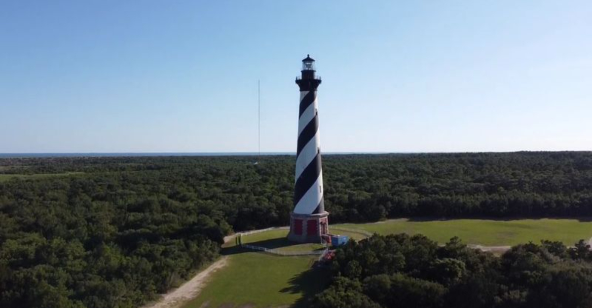
Wait. This thing is 198 feet tall?
That is already enough to make you crane your neck, but the story gets stranger the longer you look.
This striped giant has been standing on the Outer Banks since 1870, watching over a stretch of Atlantic water notorious for wrecks and rough conditions. Then World War II came along, and suddenly a lighthouse gallery was doing double duty as a lookout post.
Coast Guardsmen climbed high above the dunes and scanned the horizon for enemy submarines.
Submarines. Off North Carolina.
That is the part that makes an ordinary lighthouse visit feel wildly underqualified as “sightseeing.”
You arrive expecting ocean views and maybe a few nice photos. Instead, you get maritime history, wartime drama, and a brick tower that has somehow seen far more action than most people do in a lifetime.
Look Up At The Tallest Brick Lighthouse In The United States
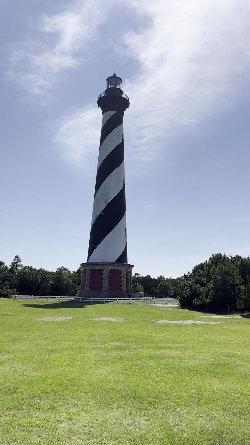
Stand at the base and tip your head back, and the tower seems to lean into the clouds. Measuring 198.49 feet from foundation to pinnacle, it holds the record as the tallest brick lighthouse in the country.
Height was not vanity. Hatteras Island sits low and flat, barely lifted above the waves, so engineers needed serious elevation to push the light beam far enough offshore for approaching ships to see it in time.
Roughly 1.25 million bricks form the walls, thick and heavy at the bottom and tapering as they rise. Run your eyes up the cone and you can trace how the taper works, narrowing gracefully toward the black iron gallery and lantern room.
The grounds sit at 46379 Lighthouse Rd, Buxton, with paved walkways and shaded benches that give you an easy spot to sit and take it all in. Morning light warms the white bands, while late afternoon throws long shadows across the sand and makes the stripes look sharper.
Trace Its Story Back To The Tower Completed In 1870
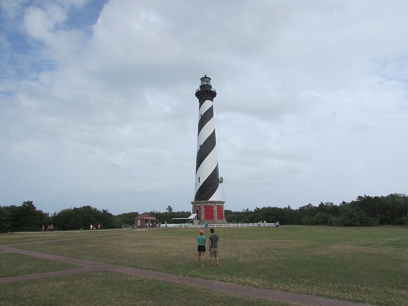
Construction crews broke ground in 1868, hauling brick, iron, and stone to a remote sandbar where nothing arrived easily. Two years later, on December 16, 1870, the new beacon glowed for the first time.
An earlier lighthouse from 1803 had stood on this cape, but sailors complained bitterly about it. Too short and too dull in color, it blended into the sky and dunes, leaving crews guessing about their position when it mattered most.
The replacement fixed both problems at once with dramatic height and a bold paint scheme. Its first-order Fresnel lens threw light farther than anything the cape had known before.
Walking the grounds today, you can picture the wagons, the workers, and the slow rise of brick courses in salty wind.
A small detail worth knowing: the original 1803 tower was eventually taken down, so the structure you photograph is entirely the 1870 build, still carrying its Victorian-era craftsmanship in every arched doorway and iron stair tread.
Learn Why Diamond Shoals Made This Stretch Of Coast So Dangerous
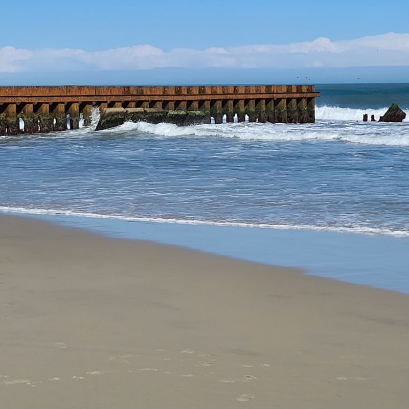
Fourteen miles of shallow sandbars reach southeast from the cape into open ocean, hidden just beneath the surface. Sailors named them Diamond Shoals, and mariners learned to fear them.
Two great ocean currents collide here. The warm Gulf Stream pushes north while colder Labrador water slides south, and where they meet, sand and broken shell drop out of the churn and pile into ridges that shift with every storm.
Hundreds upon hundreds of vessels have come to grief in these waters, which is why the region earned the grim nickname Graveyard of the Atlantic. Charts helped, but currents rearranged the bottom faster than surveyors could redraw them.
Standing on the beach near Buxton, you can sometimes spot the telltale line of white water breaking far offshore where no beach exists. It is a quiet reminder of why this tower was built so tall.
Anglers love the same collision of currents, since the mixing water draws remarkable numbers of fish close to shore.
Follow The Famous 1999 Move That Saved It From The Encroaching Atlantic
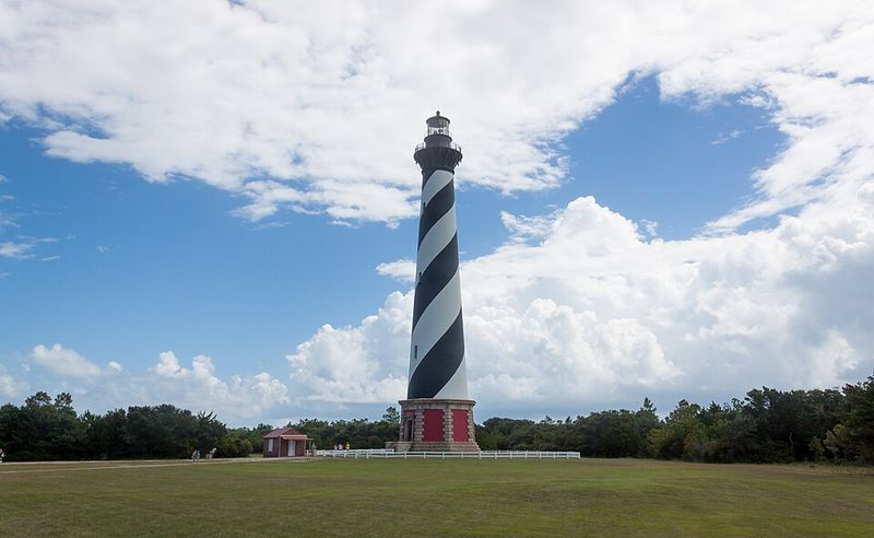
Picture a 4,800-ton brick tower creeping across the sand at the speed of a garden snail. That actually happened here in the summer of 1999.
Erosion had eaten away the beach until surf lapped dangerously close to the foundation. Engineers responded with hydraulic jacks, a steel track system, and roller beams, easing the entire structure forward in five-foot increments.
The journey ran from June 17 to July 9, taking 23 days to cover about 2,900 feet. Seven historic structures made the trip, repositioned to keep their original spacing and elevation relationships intact.
Today the lighthouse rests roughly 1,500 feet from the ocean’s edge, safely inland yet still commanding the horizon.
One of the best free experiences on the property is the short path leading to the original site. Granite stones mark where the tower once stood, circled by the names of every keeper who tended the light, and the walk gives you a real sense of just how far that brick giant traveled.
Take In The Black-And-White Spiral That Became An Outer Banks Landmark
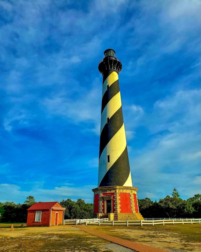
Few paint jobs in America are as recognizable as this one. The barber-pole swirl shows up on postcards, license plates, beach towels, and countless family photo albums.
Practical thinking drove the design. In 1873 the Lighthouse Board assigned each tower along the coast a unique daymark, a daytime pattern that let captains identify exactly which light they were passing without waiting for nightfall.
Four bands make up the scheme, two black and two white, each wrapping the cone one and a half times. Because the tower narrows as it rises, the stripes appear to tighten near the top, which creates that hypnotic twisting effect.
Nearby Bodie Island wears horizontal bands and Ocracoke stays plain white, so the system worked beautifully.
Restoration work has kept the tower under scaffolding in recent seasons, and the National Park Service has been repairing masonry and ironwork. Check the park website before you visit so you know exactly what the tower looks like on the day you arrive.
Explore The Historic Light Station And Keeper’s Buildings Around The Tower
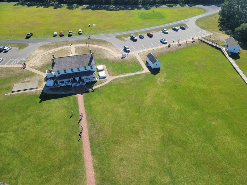
A lighthouse never worked alone, and the buildings scattered around the base prove it. Keepers lived here year-round with families, gardens, and chores that never quite ended.
The Principal Keeper’s Quarters and the Double Keepers’ Quarters still stand, along with an oil house, cisterns that once caught rainwater, and original sidewalks.
All seven historic structures were relocated during the 1999 move and carefully set down to preserve their original arrangement.
Inside the Double Keepers’ Quarters you will find the Hatteras Island Visitor Center and Museum of the Sea. Exhibits cover shipwrecks, lens technology, storms, and daily life at an isolated station, and rangers on duty are happy to answer questions.
The museum, gift shop, restrooms, and grounds stay open even when the tower itself is closed for work, so the trip is never wasted.
Families should ask about the Junior Ranger program, which turns the visit into a scavenger hunt for kids and ends with a badge and a swearing-in ceremony.
Imagine The View From Nearly 200 Feet Above Hatteras Island
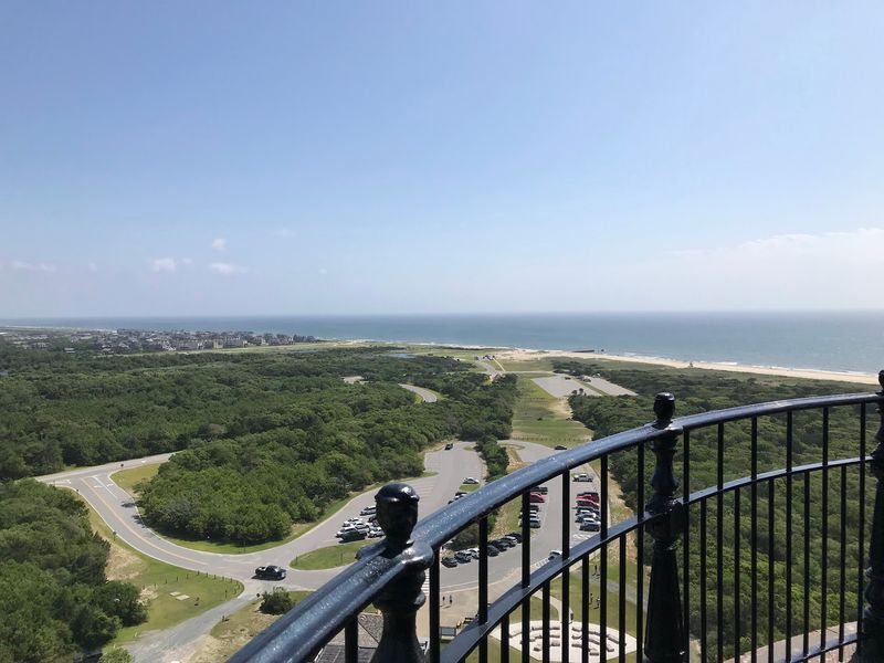
269 steps stand between the ground floor and the lens room. The cast-iron spiral stairway winds upward past small windows that frame slivers of sky, and the climb is equal to scaling a twelve-story building.
Reach the gallery and the payoff arrives all at once. Hatteras Island stretches thin and green below, sandwiched between Pamlico Sound on one side and the restless Atlantic on the other, with Highway 12 threading the middle like a gray ribbon.
The light itself shines 191 feet above mean high water and reaches ships as far as 20 miles offshore.
Climbing tickets have run about ten dollars, and staff sometimes close the stairs when interior temperatures climb past 100 degrees on hot, still days. Ask at the visitor center before buying.
Restoration has paused climbs in recent years, so verify current access at nps.gov or by calling 252-473-2111 before you plan your morning around the ascent.
Dig Into The Wartime History That Unfolded Along This Vulnerable Coast
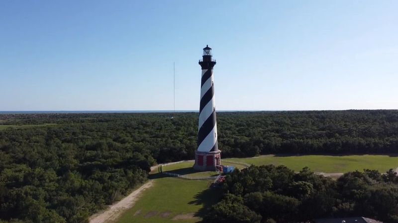
Wartime turned this navigation aid into a set of eyes on the ocean. From 1942 to 1945, the brick tower was leased to the U.S.
Coast Guard and served as a lookout station.
Guardsmen climbed those same 269 steps carrying binoculars, watching for enemy submarines that hunted merchant ships bound for England. Height gave them an advantage nothing else on the flat barrier island could match.
Sailors began calling these waters Torpedo Junction during the Battle of the Atlantic in 1942, when hundreds of vessels were lost within sight of the beaches. Residents sometimes saw smoke on the horizon from their front porches.
Erosion had actually pushed officials to deactivate the tower in 1935 in favor of a skeleton tower farther inland, but the brick giant returned to full duty in 1950.
For deeper context, pair your stop with the Graveyard of the Atlantic Museum in nearby Hatteras village, then walk the North Carolina beach and let the history settle in.