This 4-Mile Idaho Hike Leads Past 3 Stunning Alpine Lakes In The Selkirk Mountains
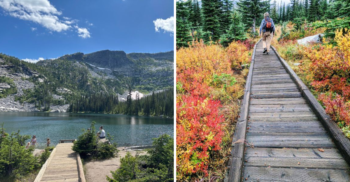
Three alpine lakes in about four miles feels like the mountains accidentally priced this hike wrong.
The first payoff arrives almost immediately, where a boardwalk reaches the lowest lake without demanding much effort at all. Keep climbing, though, and the easy introduction turns into a far more dramatic Selkirk outing.
Forest gives way to exposed rock as the trail works toward two higher basins, gaining roughly 500 feet along the standard route. Just when the scenery starts feeling familiar, another lake appears and resets the whole experience.
That is what makes this Idaho hike such a satisfying little overachiever.
It delivers the kind of high-country variety that usually comes with a much longer day, yet the full three-lake route can stay around four miles depending on the chosen spurs.
Three lakes. One afternoon. Very suspiciously good math.
Start With One Alpine Lake And Realize Two More Are Still Ahead
Before the main hike has properly begun, the lower Roman Nose lake is already beside the trailhead. An accessible boardwalk provides a short route toward the shoreline, making this first basin considerably easier to reach than most high-elevation lakes in northern Idaho.
Idaho Fish and Game identifies the water as having ADA access and manages it as a fishing destination.
Its records show a long history of trout stocking, including 3,323 triploid rainbow trout fry stocked on July 24, 2026, while brook trout and other trout have also been documented in the lake over time.
From the lower basin, Roman Nose Trail #165 and connecting paths continue into the surrounding forest toward the middle and upper lakes.
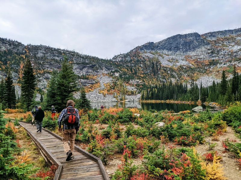
Subalpine vegetation surrounds the water, and alpine larch becomes especially noticeable as autumn approaches and the needles begin changing from green to gold.
The boardwalk and lower-lake access offer an easier way to experience part of the Roman Nose landscape. Farther along, the route becomes rougher with natural surfaces, uneven rock, and additional climbing.
Fishing rules and stocking information can change, so anglers should check the current Idaho Fish and Game regulations before bringing equipment to the lake.
You Can Reach Three Mountain Lakes Without Committing To An All-Day Trek
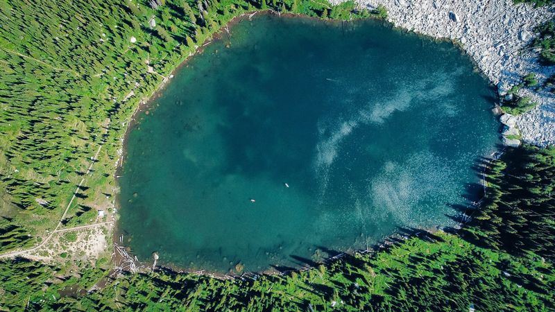
Distance remains one of the unusual features of this route. Depending on the exact combination of lake spurs and the scenic interpretive loop, hikers can visit all three basins in roughly four miles, although individual GPS tracks may come in somewhat longer.
Standard mapped versions generally involve about 450 to 535 feet of elevation gain, a more accurate figure than describing the trail as nearly flat.
After leaving the developed lower-lake area, the path shifts onto packed soil, roots, rock, and sections of open stone.
The middle and upper lakes require additional climbing, but neither involves the kind of sustained elevation gain found on many longer Selkirk Mountain routes.
Drinking water is not provided at the trailhead, so visitors need to bring enough for the entire outing rather than relying on lake water without treatment.
Reaching Roman Nose also takes more time than the mileage of the hike might suggest. Forest roads into the recreation area are remote and can become rough or rutted, particularly after weather or seasonal road damage.
Adequate vehicle clearance is useful on the final approach, and road conditions should be checked before departure rather than assuming that a normal passenger car will encounter the same surface conditions from one visit to the next.
Follow The Trail As The Selkirk Scenery Gets Wilder With Every Mile
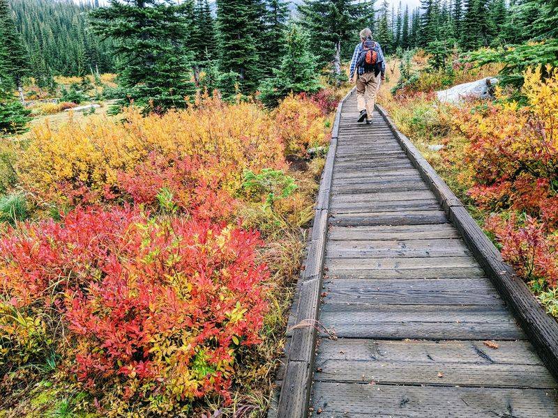
Rock begins to play a larger role as the route climbs away from the lower basin. Open slabs interrupt the forest, talus appears around the higher lakes, and breaks in the trees reveal portions of the surrounding Selkirk terrain.
Views from exposed sections can reach east toward the Kootenai River Valley and the Purcell Mountains, placing the relatively short hike within a much larger mountain landscape.
Roman Nose Peak rises to about 7,260 feet above the lake system, while subalpine fir and alpine larch cover parts of the higher slopes below it.
The larch is one of the seasonal features that distinguishes this part of northern Idaho, with its deciduous needles turning gold before dropping later in fall.
Wildlife awareness is also necessary here because the Selkirk Mountains support both black bears and grizzly bears.
Idaho Fish and Game recommends keeping bear spray within easy reach, making noise in areas with limited visibility, traveling in groups when practical, and staying at least 100 yards from bears.
Forest Service rules also require food and scented items to be stored securely during the applicable season.
Stop At The Middle Lake When You Want A Quiet Break
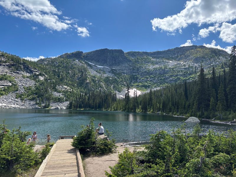
Roughly a mile into common versions of the route, a spur reaches the middle Roman Nose lake and creates a natural break between the developed lower basin and the rockier terrain ahead.
Forest still surrounds much of the water, while nearby openings provide glimpses of the higher slopes that separate the middle and upper basins.
Snowmelt and runoff can create a seasonal cascade between the upper and middle lakes, but its size and visibility vary throughout the year.
Designated camping is available within the broader Roman Nose recreation area, including backcountry sites near the upper lakes, though facilities are limited and there is no potable water.
Overnight visitors should confirm current camping restrictions before leaving home, especially because food-storage requirements are enforced in this bear habitat.
The middle lake itself does not require a long additional detour from the principal trail system, so it can be included without turning the hike into a significantly larger outing.
Mosquito activity can increase around wet areas during warmer months, particularly earlier in summer, making repellent a practical addition to a day pack.
From here, hikers return toward the connecting trail and continue upward rather than following one continuous shoreline route directly from the middle lake to the upper basin.
Keep Going To The Upper Lake For The Biggest Mountain Backdrop
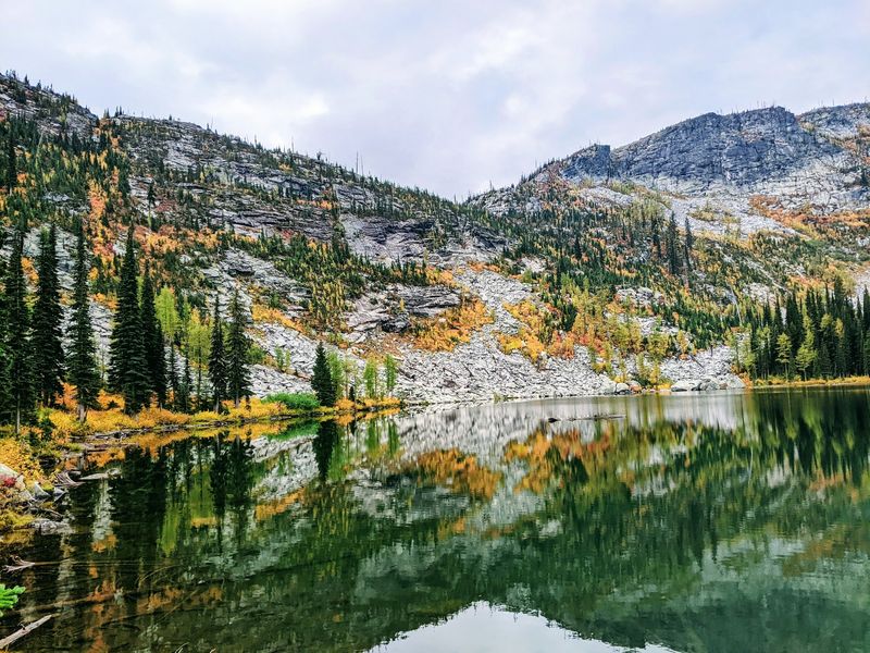
A quarter mile beyond the middle lake, roughly 1.6 miles in, the largest of the three waits inside a rugged granite cirque. Cliffs wrap almost entirely around the water, and the scale hits you the moment the trees open.
Upper Roman Nose Lake is the swimming lake. Smooth granite at the southwest end warms in the sun and serves as both a launch pad and a drying rack, though the water stays bracingly cold even in August.
Snowfields sometimes linger into July in shaded pockets high above the shoreline. Meltwater keeps the surface glassy and clear, so clear that submerged rocks look closer than they really are.
Bring a filter if you plan to linger.
Ambitious hikers continue toward the summit of Roman Nose Peak from here, but that is a long, demanding push better split across two days with a night at the lakes. For most visitors, this rocky amphitheater is reward enough, one of the most striking high basins in northern Idaho.
Bring A Camera Because Each Lake Feels Completely Different
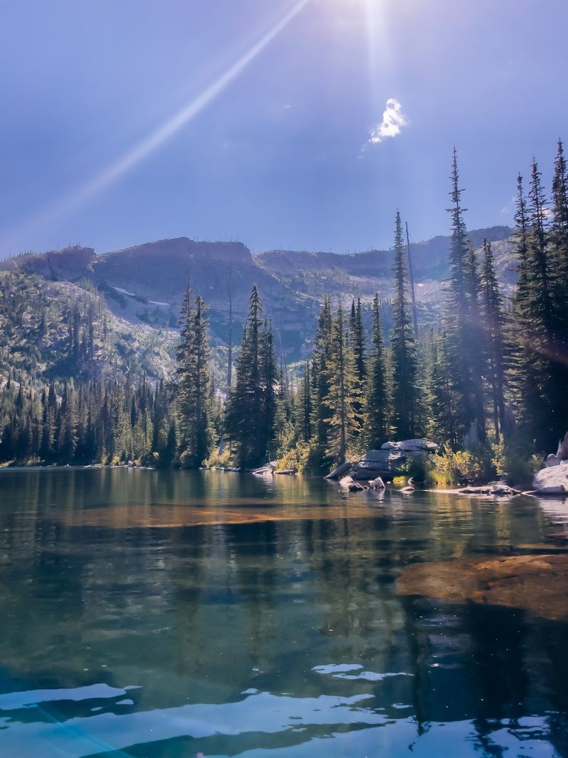
Changes in terrain give each lake a different visual setting even though all three sit within the same compact trail system. Forest and accessible shoreline features define the lower basin, where the boardwalk provides stable access close to the water.
Higher on the route, open rock around the middle-lake area begins revealing wider views beyond the trees. The upper lake sits beneath steeper slopes near Roman Nose Peak, producing a more enclosed alpine setting than the first two stops.
Those differences also become more pronounced later in the season when alpine larches shift toward gold against the gray rock and darker evergreen forest.
Photography conditions naturally depend on cloud cover, wildfire smoke, wind, and time of day, so no particular lighting period guarantees clear reflections or uninterrupted mountain views.
The remote approach road is another practical consideration for anyone carrying camera equipment, since dust and rough surfaces can affect exposed gear long before the hiking starts.
Keeping lenses and electronics protected during the drive is useful, as is carrying equipment rather than leaving valuables visible in a parked vehicle.
Wide views toward the surrounding mountains are available from several open portions of the route, while the lakes themselves provide closer compositions involving shoreline rock, forest, and the changing vegetation around each basin.
Take Your Time On The Return Instead Of Treating It Like A Race
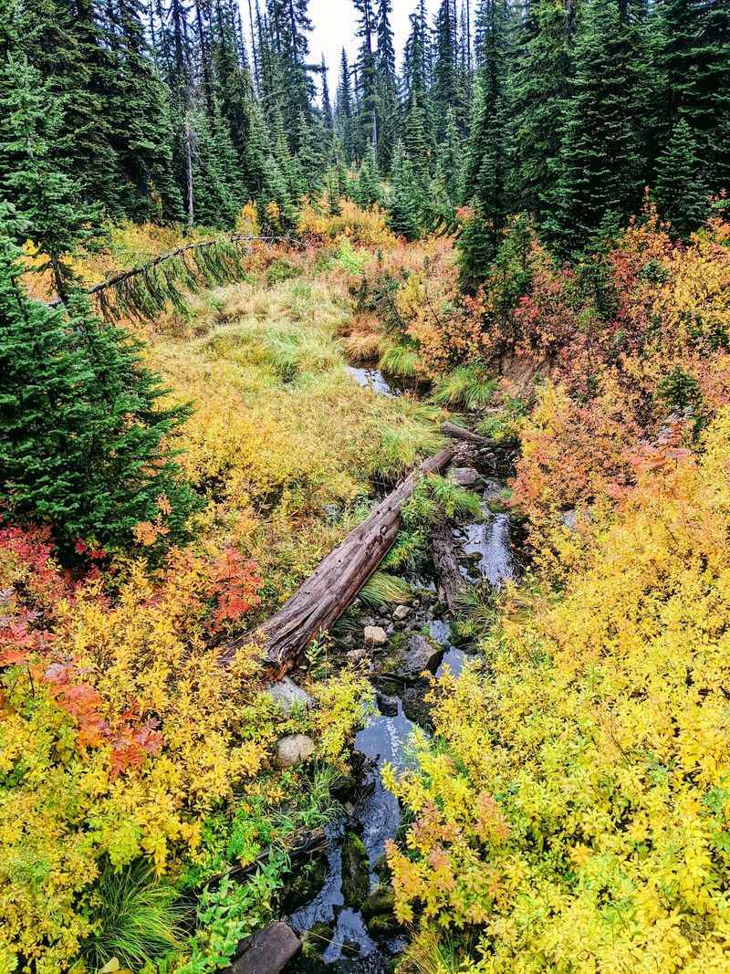
Late summer can bring huckleberries to parts of the Roman Nose area, adding another seasonal food source to a landscape already used by bears.
Idaho Fish and Game specifically notes that berry patches can attract both black bears and grizzlies, so sections with ripe fruit are places to pay closer attention to surroundings rather than moving silently through dense vegetation.
Bear spray should remain accessible instead of buried inside a backpack, and hikers should make their presence known where bends, trees, or brush block the view ahead.
Food carried for the hike should stay secured when it is not being eaten, with scraps and packaging packed back out.
The return trip generally retraces familiar terrain toward the lower basin, but downhill travel over exposed rock can still require careful footing, particularly after rain.
Once back at the trailhead, the rough forest-road drive remains part of the outing, and conditions can be different from those encountered earlier in the season.
Cell coverage is unreliable in remote parts of the Selkirks, making downloaded maps useful before leaving paved roads.
Hikers should also share their destination with someone who is not on the trip, especially when traveling farther into Idaho Panhandle National Forests where services and reliable communication are limited.
Leave With Three Alpine Lakes Checked Off In One Short Hike
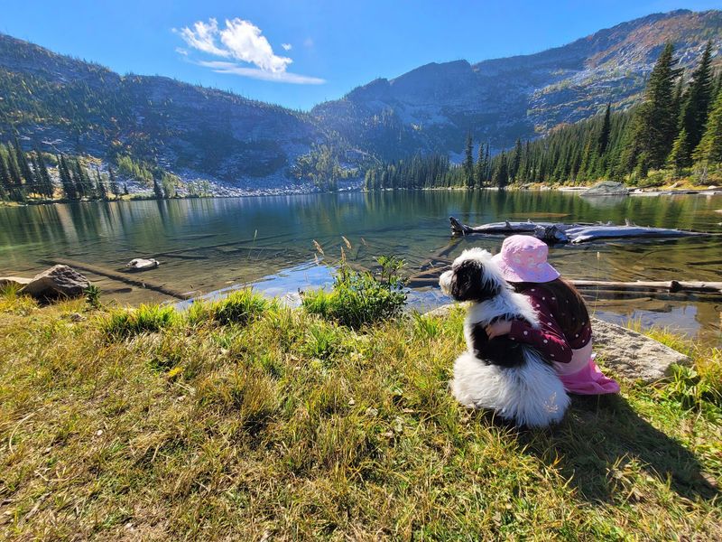
Three distinct lake basins fit into a hike that commonly lands near four miles, provided the route is limited to the established lake trails and connecting spurs.
The lower lake offers the easiest access, with a developed boardwalk and fishing opportunities along the shoreline. Reaching the middle and upper basins involves more climbing, natural trail surfaces, and increasingly rocky terrain.
Total mileage and elevation gain vary with the exact route, so downloaded mapping is more useful than treating a single distance as exact for every visitor.
Facilities around Roman Nose are basic: there is no potable water, camping is limited to appropriate sites, and food-storage regulations apply because of the presence of bears.
Access roads also deserve consideration before the hike begins, since remote forest-road conditions can change with weather and maintenance.
Summer generally provides the broadest hiking window once high-country snow has receded, while alpine larch adds a different feature as fall advances.
Idaho Fish and Game continues to manage fishing at the lower lake, including the July 2026 rainbow-trout stocking, and the broader recreation area remains part of the Idaho Panhandle National Forests system.
With those practical details accounted for, the route connects three Selkirk Mountain lakes without requiring the mileage or climbing associated with a full summit hike.