This 30-Mile Idaho Rail Trail Rolls Past Historic Trestles, Open Farmland, And Jaw-Dropping Teton Views
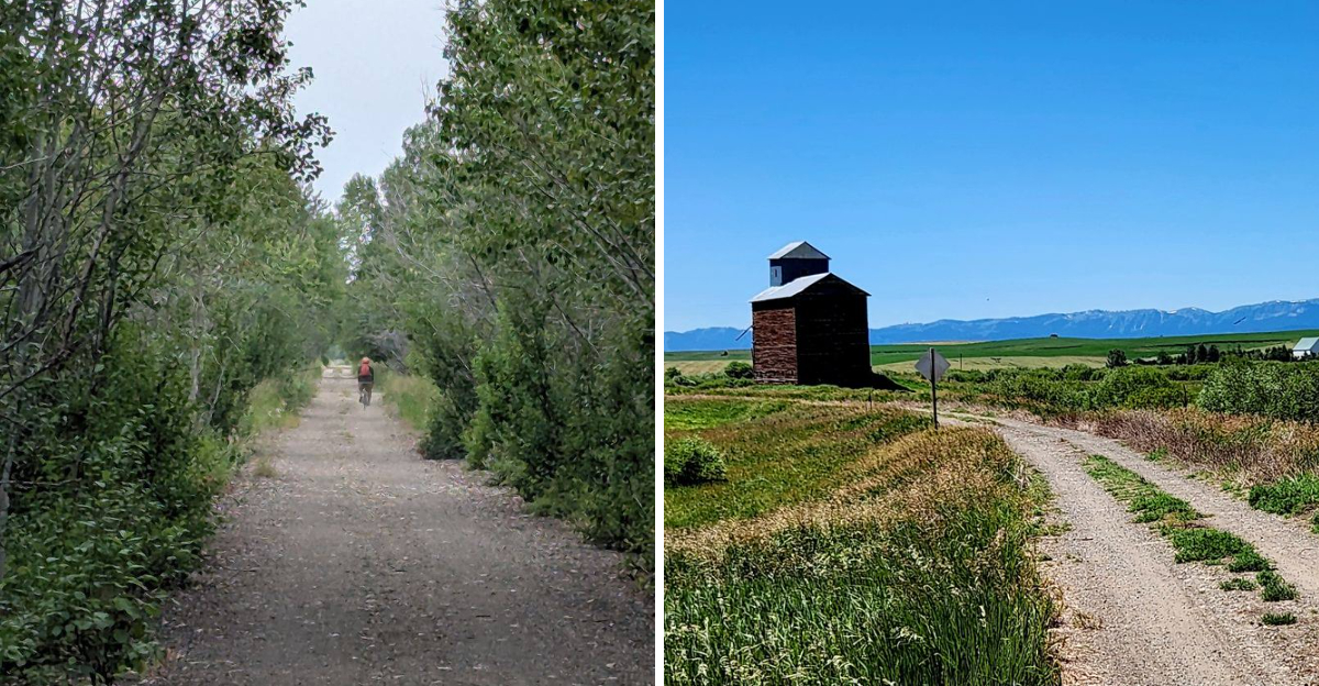
An old railroad line has quietly traded train cars for bike tires and hiking shoes.
For nearly 30 miles, this Idaho route slips through open farm country with the Tetons hovering in the distance like they were placed there for dramatic effect. The scenery keeps changing without ever feeling rushed, which makes it easy to settle into the rhythm of the old rail grade.
Then come the trestles.
They carry you high above creek corridors that slice through the farmland, adding just enough drama to make the route feel bigger than a simple country ride.
The best part is how little of the landscape feels staged.
You get working fields, long horizons, weathered rail history, and mountain views that seem to grow sharper the farther you go.
Bring more water than you think you need.
And clear some space on your phone, because the Tetons are going to be extremely demanding about photos.
Pedal Across Historic Trestles Left Behind By The Railroad Era
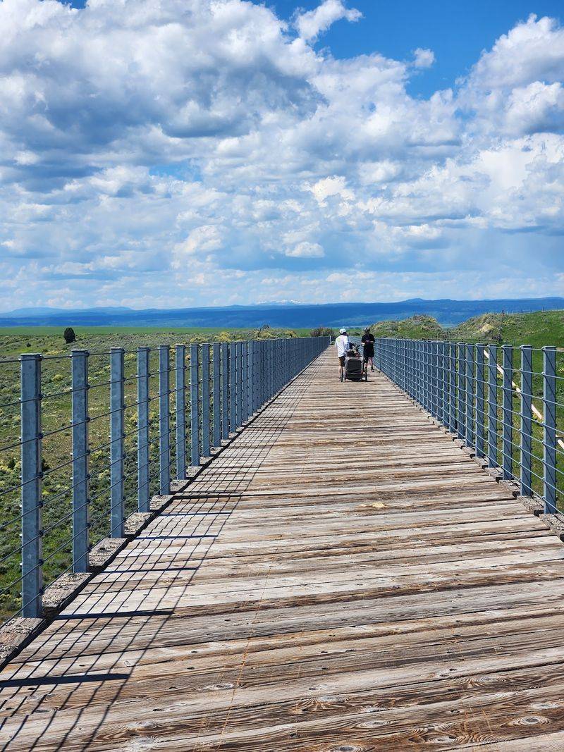
Steel, timber, and rivets tell the opening chapter of this route. When the rails were lifted from this old Union Pacific branch line, the crossings stayed behind, and several were carefully restored before the path opened in 2010.
Riders roll over spans above Fall River, Conant Creek, and Bitch Creek, each one framing water and canyon walls in a different way.
The Conant Creek Pegram Truss Railroad Bridge, finished in 1911, is the showpiece, and its unusual angled design earned it a spot on the National Register of Historic Places.
Slow down at the deck boards and listen. Wind moves through the trusses, gravel crunches under tires, and the creek murmurs far below.
Pause long enough to picture freight cars rumbling toward Yellowstone country, hauling grain, seed potatoes, and passengers through this quiet farm valley. A quick tip: walk your bike for photos, since railings are simple and the boards can feel narrow when two groups meet at once.
Bring a wide-angle lens if you carry one, because the trusses make excellent frames.
Roll Through Open Farmland With The Tetons Rising In The Distance
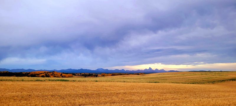
Farm country sets the pace on this middle stretch, where fields of barley, wheat, and famous seed potatoes fan out toward the horizon. Sprinkler lines hiss in July, and the air smells like warm soil and cut hay.
Then you look up. The Teton Range lifts above the fields, gray and jagged, and it keeps growing as you travel from Ashton toward Tetonia.
Few places in eastern Idaho let you watch mountains build slowly like that for hours.
Grain elevators, weathered barns, and the occasional tractor add scale to the scene, reminding you that this is working land rather than a manicured park.
Wave when a farm truck rolls across a crossing, since courtesy goes a long way in small communities.
Morning light softens the fields, while late afternoon sharpens shadows on the peaks and makes photos pop. Shade is scarce out here, so a brimmed hat, sunscreen, and extra water belong in your pack.
Sandhill cranes often stalk the stubble in early fall, their rattling calls carrying a surprising distance across the open ground.
Cross Creek Corridors On Bridges That Double As Natural Viewpoints
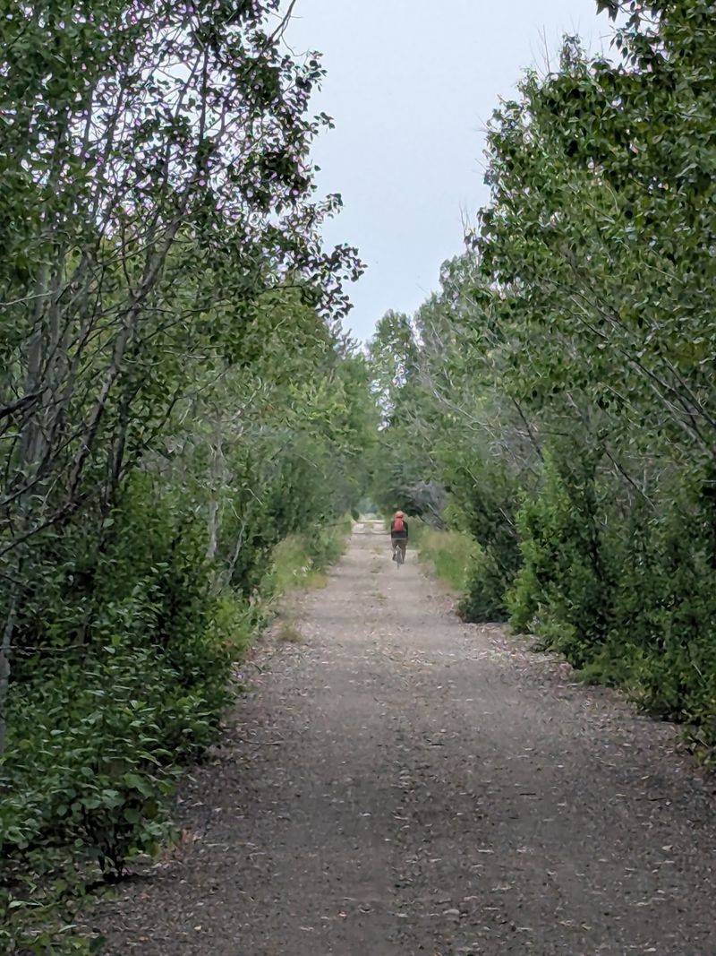
Several bridges along the trail cross waterways that cut through the surrounding farmland, creating some of the route’s most dramatic changes in scenery. Fall River, Conant Creek, and Bitch Creek are among the best-known crossings.
Around these drainages, the open agricultural landscape gives way to greener riparian vegetation. Cottonwoods and willows grow closer to the water, while the bridges offer elevated views into the creek corridors below.
These crossings also reveal how much engineering went into the former railroad line. Instead of dropping into each drainage and climbing back out, trains once traveled directly across substantial spans that now carry hikers and cyclists.
Slow down when approaching the bridges, especially when surfaces are wet or other trail users are crossing. The overlooks are worth a pause, but leave enough room for cyclists and walkers to pass safely.
Watch The Landscape Shift Between Fields, Aspen Groves, And Riparian Stretches
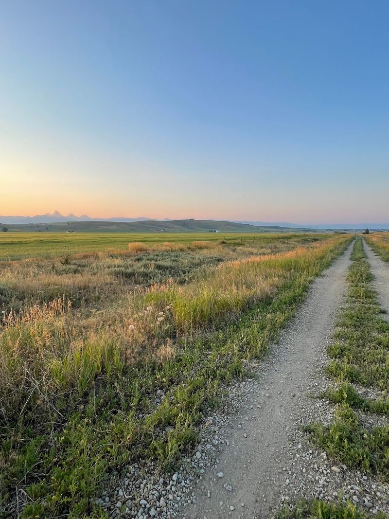
Variety keeps the miles interesting. One moment you are surrounded by cultivated ground that runs flat to the horizon; a mile later aspens close in, their trunks chalk-white and their leaves clattering in the breeze.
Wetter pockets follow, where springs and small creeks feed thickets of willow and tall grass. Wildflowers arrive in waves through the summer, lupine and balsamroot first, then yarrow and aster.
Late September is the headline act, when aspen groves shift to butter yellow against dark evergreen and pale stubble fields.
Wildlife takes advantage of these edges. Deer slip between the trees at dusk, hawks hunt the fence lines, and ground squirrels dash across the path with comic urgency.
The cinder-and-gravel surface drains quickly, which makes this corridor rideable in spring when muddier routes are still soft.
Keep an eye out for interpretive signs posted at intervals, since they explain local farming, geology, and railroad history in a few plain sentences. Reading two or three turns a pretty outing into a lesson about how this valley came to look the way it does.
Pause At The Creek Trestle For One Of The Route’s Most Dramatic Stops
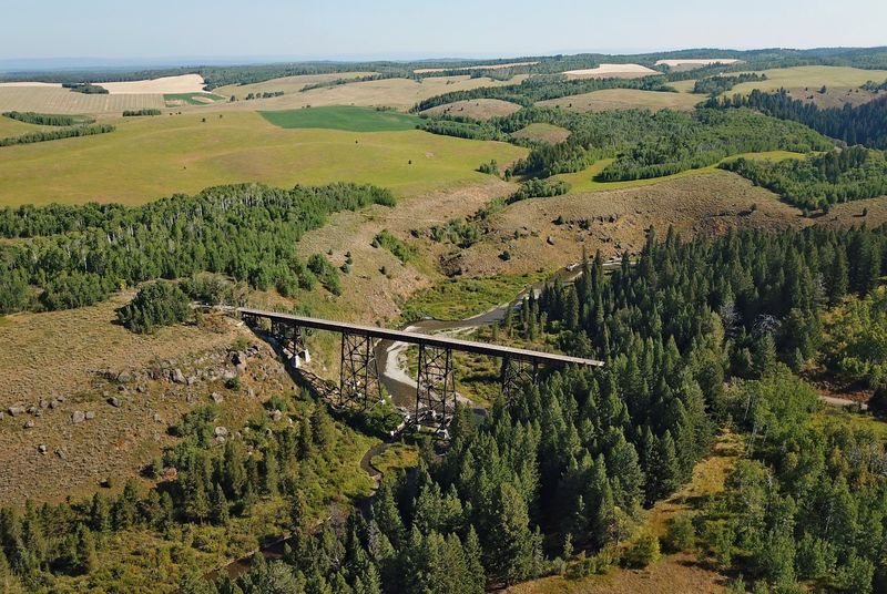
Nothing on the route stops conversation faster than the moment the brush opens and the big trestle appears. Built in 1924, the deck plate girder structure stretches 600 feet across the gorge and stands roughly 130 feet above the water.
From the middle of the span, the creek looks like a silver thread braided through basalt and brush. Wind funnels along the canyon, and the drop is real enough to make first-timers grip the handlebars a little tighter.
Fun fact: the unusual name likely traces back to early French-speaking trappers who called the drainage after a doe, or biche, before English speakers reshaped the word.
A parking area near the access point makes this a natural halfway break, and a vault toilet is available there. Bring a sandwich, find a patch of shade, and let the canyon do the entertaining.
Photographers do well in the hour before sunset, when low light rakes across the rock walls. Of all the stops in eastern Idaho rail-trail country, few deliver this much drama for so little effort.
Use Multiple Trailheads To Build A Ride That Fits Your Day
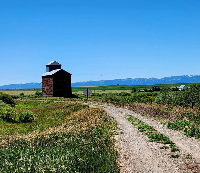
Planning gets easy when a trail has this many doors. Access points at Ashton, Marysville, Bitch Creek, Felt, Grainville, France, and Tetonia let you shape an outing that matches your energy, your schedule, and the ages in your group.
The Ashton end works well for families wanting a flat out-and-back with a snack at the turnaround. Parking there sits at 602 N 4700 E, with room for a car and a bike rack.
Felt sits nearer the middle of the corridor and makes a smart launch point for the big trestle. Riders often start there, pedal to the canyon, and return before lunch.
Look for the lot at 3895 Wells Ave, a short spin from the path.
Two vehicles open up a one-way trip with the mountains ahead of you the entire way.
Before loading the bikes, check current conditions, because a paving project is underway on parts of the route with some closures expected to reopen by mid-August 2026. A call to (208) 558-7368 confirms which segments are open that week.
Take Advantage Of The Gentle Railroad Grade For An Easier Long-Distance Adventure
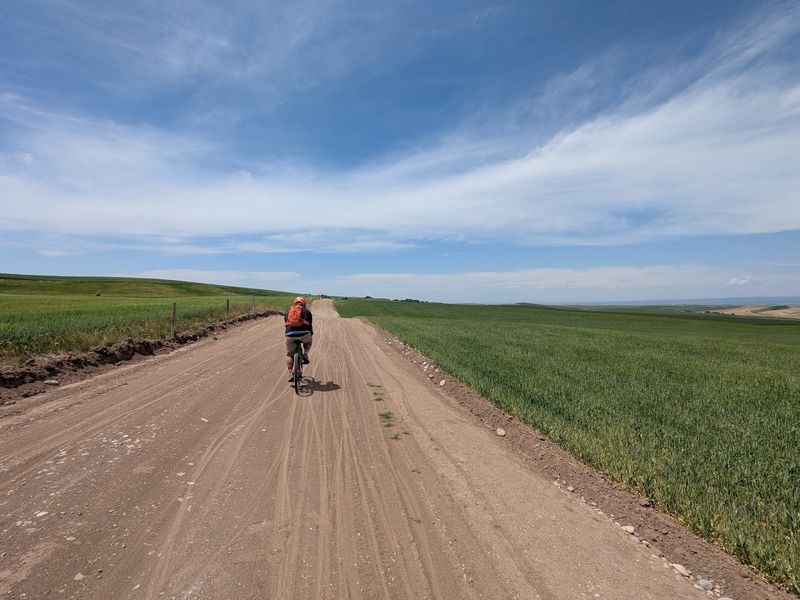
Railroad builders avoided steep ground, and modern trail users get the benefit. Across nearly 30 miles, the climb from Ashton to Tetonia adds up to about 787 feet, spread so gradually that most of it registers as barely noticeable effort.
That steadiness is why the route suits kids on their first long outing, grandparents on hybrids, and walkers logging a few quiet miles.
The surface is packed gravel, dirt, and cinder, wide and firm but loose in spots. Mountain bikes, gravel bikes, or anything with tires at least 1.75 inches wide will feel best, while skinny road tires struggle.
Between towns there are no stores, no drinking fountains, and no reliable water sources, so carry more than you think you need. Two full bottles per person is a sensible minimum on a warm afternoon.
Cell coverage comes and goes across the farmland, which is part of the charm and also a reason to share your plan. Few long-distance paths in Idaho make covering serious mileage feel this relaxed.
Snacks, sunscreen, and a patch kit finish the list.
Finish With Teton Views That Make The Mileage Feel Worth It
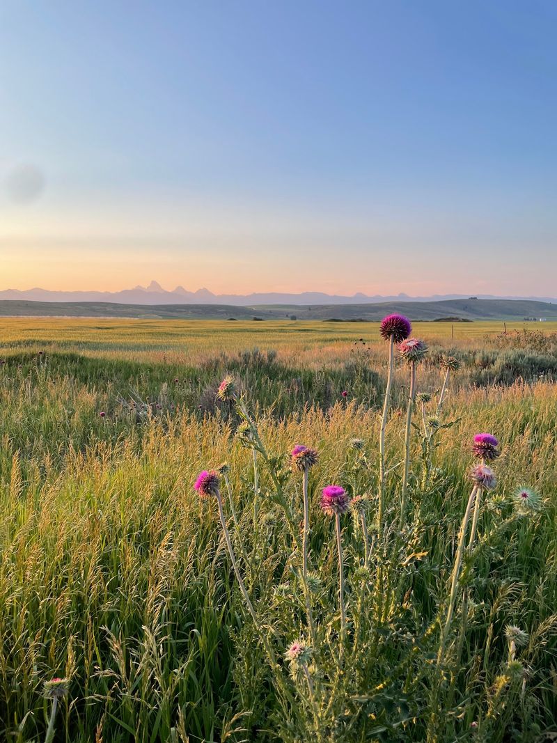
Rewards stack up at the eastern end. The peaks that hovered faintly for hours turn sharp and close, with canyons and lingering snowfields visible on their flanks, and the mileage suddenly feels like a bargain.
Local folks call this the quiet side of the Tetons, and the description fits: no shuttle lines, no parking lot scramble, just farmland, sky, and stone.
Tetonia makes a fitting finish line. Badger Creek Cafe serves home-style breakfast and lunch in a cozy dining room, the kind of spot where hash browns arrive crisp at the edges and coffee cups stay full.
You will find it at 110 N Main St, Tetonia, ID, an easy walk from the trail’s end.
Aim to arrive before the lunch rush winds down, since dining choices thin out later in the day along this stretch.
Sit near a window, stretch tired legs, and watch the range change color as the afternoon slides on. Rides in this corner of Idaho often end exactly this way, with a full plate and plans to return.