Two Hundred Steps Climb To The Top Of This Nebraska Rock Formation Pioneers Carved Names Into
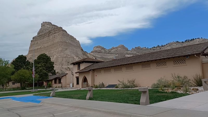
Covered wagons once rolled through a gap in a giant sandstone wall, and the grooves they left are still there. You can walk right inside them today in western Nebraska.
The rock above those ruts rises about 800 feet over the North Platte River. Native people called it the hill that is hard to go around.
To pioneers, it was a sign they were on the right track.
I like how this place lets you choose your own adventure. You can hike up through a tunnel carved by hand into the stone.
Or you can drive a 1930s road that punches through the rock three separate times.
I can’t imagine seeing it for the first time from a wagon seat, after weeks of flat prairie. So what did those travelers see when they finally reached the top?
A Sandstone Giant That Owns The Panhandle Skyline
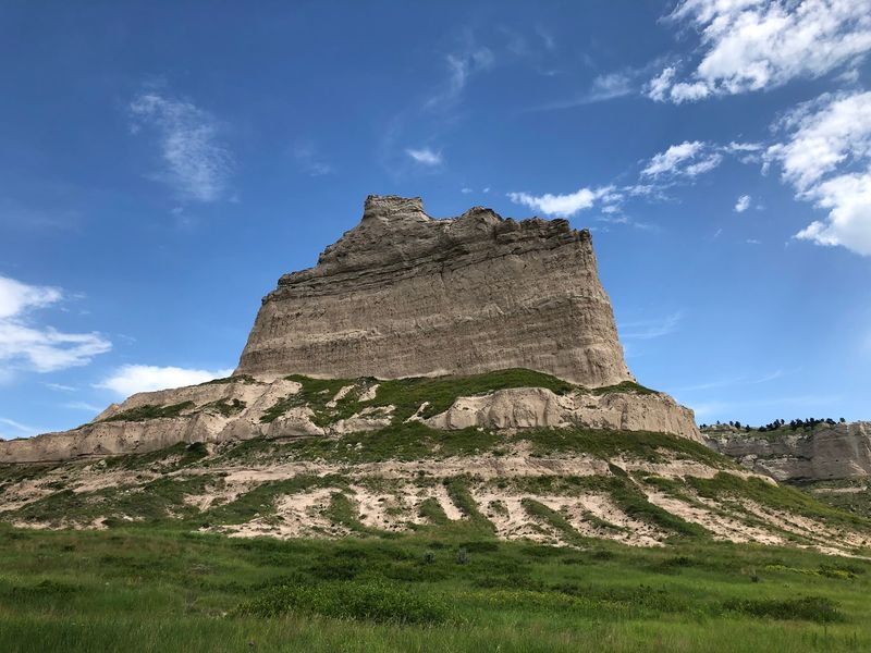
Scotts Bluff National Monument sits on the western side of Nebraska, just outside Gering, and it’s impossible to miss. The bluff towers about 800 feet above the North Platte River, which is a big deal in a state famous for wide-open flatland.
The National Park Service manages the site, and it covers more than 3,000 acres. That’s plenty of room for sandstone cliffs, rugged badlands and prairie grass to stretch out.
Erosion shaped these formations over millions of years. Wind and water slowly wore away the softer layers, leaving tall walls of rock standing like a fortress on the plains.
Folks in the Panhandle grow up with this skyline. For everyone else, the first glimpse from the highway usually causes a quick double take.
The monument carries a long official history, too. It was designated a national monument on December 12, 1919, so it has been protected for more than a century.
Budget-minded families will like this next part. Entry is free with no reservation needed, so the biggest cost is the gas it takes to get here and maybe a souvenir.
The Hill That Was Hard To Go Around
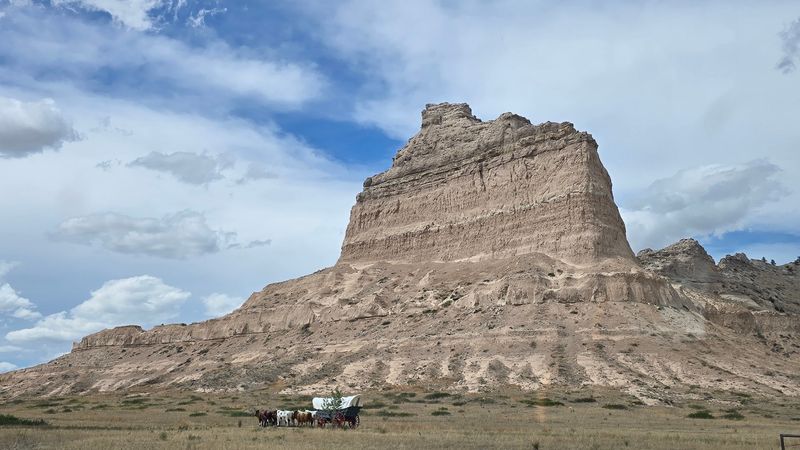
Long before any wagon showed up, Native peoples knew this landmark well. They called it Me-a-pa-te, meaning the hill that is hard to go around, and honestly, that name still fits perfectly.
Then came the great westward rush. Between 1843 and 1869, more than 250,000 emigrants passed by on the Oregon, California and Mormon Trails.
Pony Express riders galloped through the area as well. For a short, famous stretch of years, this valley served as one of the busiest routes on the continent.
Travelers wrote about the bluff constantly. It ranks as the second-most mentioned landmark in pioneer journals and diaries from that era.
Why all the attention? After weeks of rolling prairie, a towering wall of stone told weary families they were making real progress toward the West.
I love that those diary pages still exist. They turn a giant rock into a personal story, written by ordinary people hurrying toward Oregon or California.
Standing here today, you share a view with every one of those travelers. Same bluff, same river, just a far comfier ride to get here.
Wagon Ruts You Can Still Step Inside At Mitchell Pass
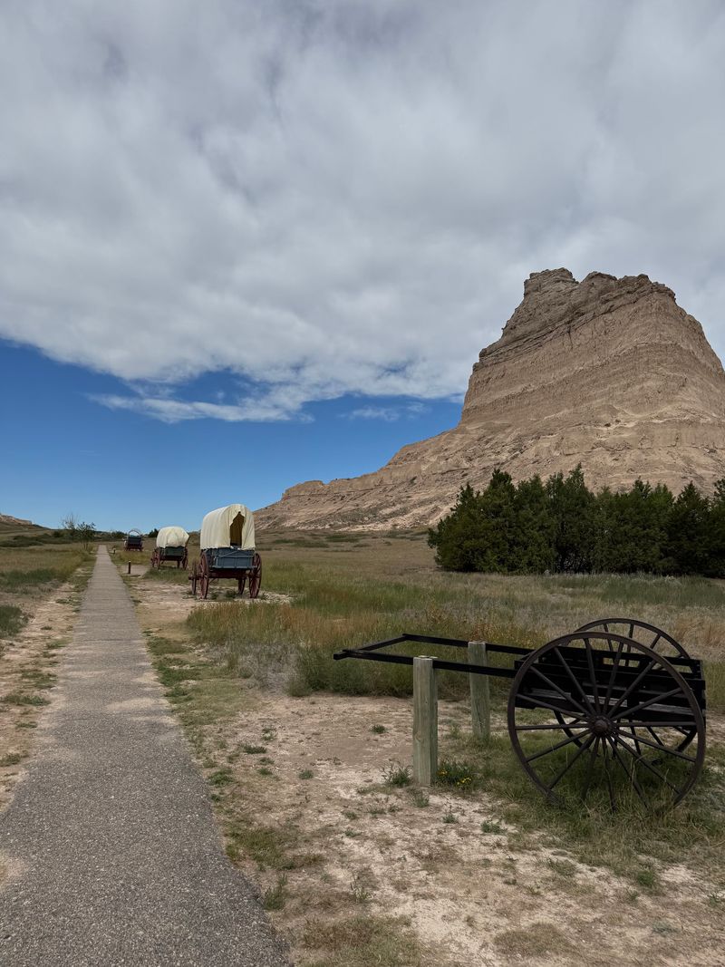
Thousands of wagon wheels left their mark near Mitchell Pass, and the grooves never faded away. Deep ruts cut by covered wagons are still visible on the monument grounds.
Mitchell Pass was the gap between the bluffs that wagon trains squeezed through. With so many wheels following the same path, the ground wore down into lasting channels.
You can walk right in the ruts yourself. It’s one of those rare history lessons where your shoes actually touch the evidence.
Near the visitor center, replica covered wagons sit beneath the bluff. Seeing their size up close makes the trip west feel far more real, and a lot more cramped.
Ranger talks sometimes focus on these Conestoga-style wagons. Living history demonstrations also pop up, giving kids a lively look at trail life.
Parents, take note. A short stroll in the ruts can turn into a surprisingly good mini history lesson, no textbook required.
I think this is the spot that sticks with people longest. A paved overlook is nice, but a groove worn by real wagon wheels feels personal in a way pictures can’t match.
Lace Up For A Hand-Carved Tunnel On The Saddle Rock Trail
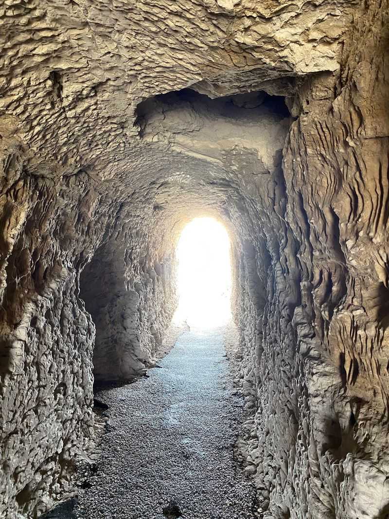
Ready for a workout with a payoff? The Saddle Rock Trail climbs 1.6 miles one way from the visitor center all the way to the summit.
It’s considered strenuous, so plan on breathing hard. Switchbacks and stairs take over on the upper stretches, adding plenty of steps to your day.
Then comes the showstopper. Partway up, the trail passes through a 100-foot tunnel carved by hand straight through the sandstone.
It feels like a secret passage on a prairie bluff. Nobody expects to duck through solid rock on a hike in Nebraska, and that surprise is half the fun.
The views improve with nearly every turn. You watch the valley floor shrink below as the path winds higher along the cliffs.
Bring plenty of water and sturdy shoes. Summer heat in the Panhandle is no joke, so an early start makes a lot of sense.
Keep your eyes open for wildlife, too. Rattlesnakes live in the area, and posted warnings remind hikers to stay alert and stick to the trail.
Three Tunnels And The Oldest Concrete Road In The State
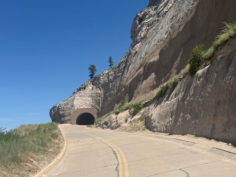
Skipping the hike still gets you a memorable ride. Summit Road winds 1.6 miles from the bottom to a parking area near the top.
Depression-era work crews built the road in the 1930s. Today it holds the title of the oldest concrete-paved road in Nebraska.
The route also tunnels through the rock three times. Each one swallows your car for a moment before revealing an even bigger view.
Expect a narrow road with sharp curves. Passengers get the best deal here, since they can snap photos while the driver keeps both eyes forward.
One important rule saves headaches. Oversized vehicles are not allowed because of the tunnels, so leave the big RV parked below.
The road keeps its own schedule, too. It runs on seasonal hours, closes well before sunset, and weather or rockfall can shut it temporarily.
Once you park, short trails lead out toward the edges. A brief walk is all it takes to go from car seat to cliff-top lookout, which feels like a pretty sweet shortcut.
Chimney Rock And Wyoming Peek In On A Clear Day
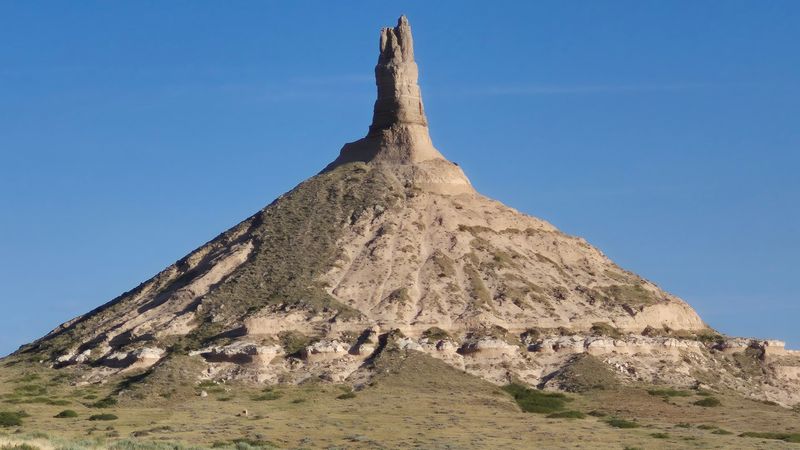
From the summit, the whole North Platte River Valley spreads out like a giant map. Gering and Scottsbluff sit below, with the badlands crumpling around them.
Look east and you may spot Chimney Rock. That famous spire is another trail landmark, roughly 20 miles away.
On especially clear days, the horizon stretches even farther. Laramie Peak in Wyoming, about 100 miles off, can sometimes be seen.
Two trails on top make the views easy to enjoy. The South Overlook trail is short, while the North Overlook trail runs a bit longer.
Both paths are paved and well kept. They work nicely for families who want big scenery without a big climb.
Weather changes the show, too. Fog, wind or haze can soften the scene, while bright days make the layered rock glow.
I believe this is where the pioneer story finally clicks. You can see exactly how far those wagons could look ahead, and how much ground they still had to cover before the mountains.
Films, Paintings And Passport Stamps At The Visitor Center
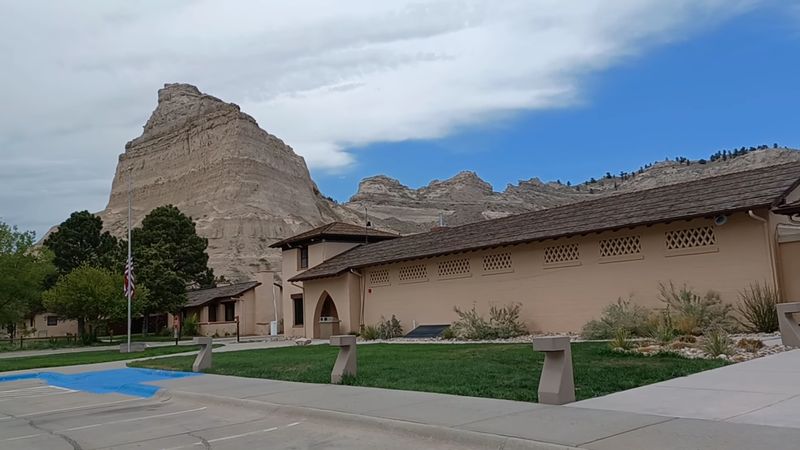
Start inside before heading up, because the backstory makes everything outside richer. A short film at the Scotts Bluff National Monument Visitor Center sets the scene on the Oregon Trail.
Exhibits follow the experiences of pioneer travelers. They cover the routes, the wagons and the people who chose this long, demanding journey.
Art fans get a treat as well. The center showcases the work of William Henry Jackson, a notable artist and photographer of the American West.
His images bring trail life into sharp focus. Kids and grown-ups alike can connect a painted scene to the very valley outside the window.
A bookstore on site stocks books and souvenirs. It’s a handy stop for trail guides, booklets and a keepsake or two.
Collect national park passport stamps? You can pick up a passport book here and start stamping your way across the country.
Restrooms and drinking water are available, too. Friendly rangers on duty can answer questions and point you toward other nearby sights worth adding to your route.
Cactus, Birds And A Welcome Mat For Your Dog
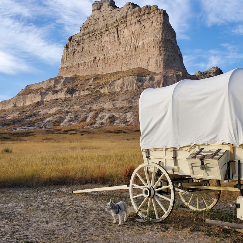
Cactus in Nebraska sounds like a typo, yet it really does grow out here. It’s a fun surprise for anyone expecting nothing but cornfields.
Bird watchers should pack binoculars. Many species of birds can be spotted across the monument’s cliffs and grasslands.
The mood is calm and wide open. Wind, rock and sky do most of the talking, which suits anyone craving a slower afternoon.
Families fit right in. Kids can explore wagons, walk the ruts and tackle short summit loops without a marathon effort.
Dog owners, good news. Pets are welcome on the grounds and trails, though they need to stay out of the buildings.
Serious hikers get their thrills on Saddle Rock, while casual walkers stick to the top. History lovers could easily spend half their visit indoors with the exhibits.
Small burrows dot the ground in places. That’s a gentle reminder that plenty of critters call this land home, so stay on marked paths and let them have their space.
Timing Your Visit Around Those Seasonal Hours
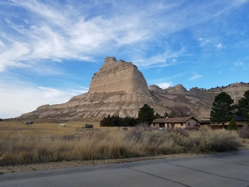
Mark this on your map: 190276 Old Oregon Trail, Gering, NE 69341. The monument sits right next to Gering in the Nebraska Panhandle.
Driving here from Denver takes around three hours. Chimney Rock is roughly a half-hour away, so pairing the two makes an easy day.
The grounds and trails are open daily from sunrise to sunset. The visitor center and Summit Road follow seasonal hours, so check before you go.
Timing matters most for drivers. The road to the top closes before the visitor center does, and late arrivals may only reach the summit on foot.
Admission costs nothing, and no appointment is needed. Plan about two hours to cover the film, museum, wagons and a summit stop.
Pack snacks or plan a meal in town. There’s no food service or lodging inside the monument, but Gering and Scottsbluff are close by.
Weather can affect access, too. Rockslides occasionally close the road until crews clear it, so checking conditions ahead saves frustration.
Why This Bluff Deserves A Spot On Your Calendar
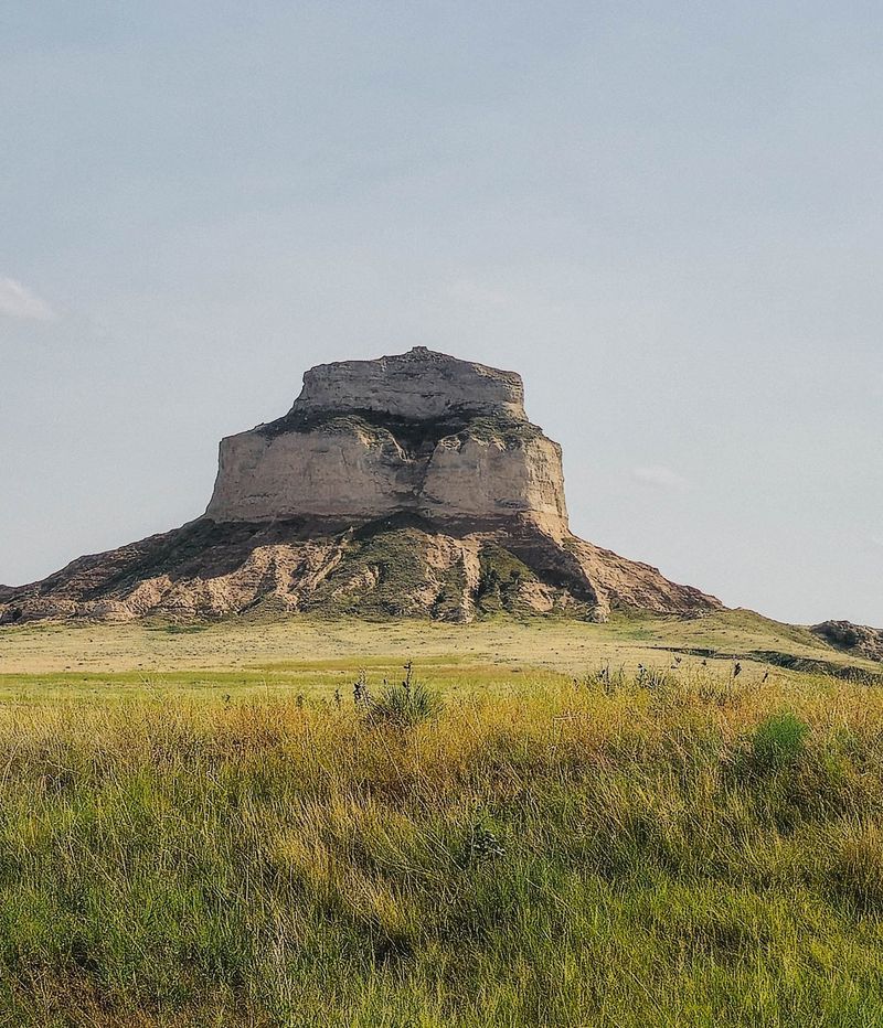
Few places in Nebraska let you stand in history, hike through rock and glimpse Wyoming in one visit. Scotts Bluff National Monument manages all three without charging a dime.
The trail story is the heart of it. More than 250,000 emigrants relied on this bluff as a guidepost, and their wagon ruts still mark the ground.
Then there’s the fun factor. A hand-carved tunnel on foot or three tunnels by car makes the climb feel like a small adventure.
The summit seals the deal. Chimney Rock on the horizon connects you to the landmark those pioneers had just passed.
I’d call it an ideal day trip for Nebraskans who think they’ve already seen their state. It also makes a smart stop for road-trippers crossing the Panhandle.
Go early, check the road schedule and bring water. Then pick your path up, because either route ends at the same jaw-dropping view.
Those wagon families earned every mile of this trail. You only need an afternoon to understand why they wrote about this rock so often.