Visitors Walk Across The Top Of A 1,600-Foot-Long Dam At This Idaho Overlook On The Snake River
The paved road along the Idaho side of this river simply runs out of Idaho.
To keep going, you cross a concrete dam and land in Oregon.
That crossing sits at the bottom of the deepest river gorge in North America.
The canyon walls climb thousands of feet on both sides. The river below keeps carving a path to the Pacific.
I like how ordinary the drive starts.
Farm country and small towns slowly give way to steep rock and quiet water. Then the canyon closes in, and the road gets serious.
I can’t imagine a better reward for a long, winding drive than standing on top of a working dam in that setting.
Jet boats launch just downstream. Bighorn country rises overhead.
So what does it actually feel like to reach the end of the road here?
The Last Concrete Wall Before Wild Hells Canyon
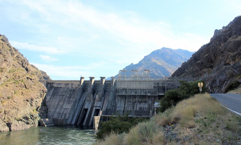
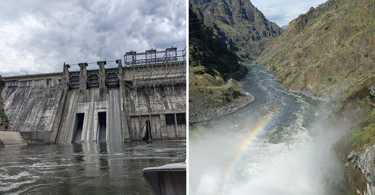
Hells Canyon Dam is the final dam in a chain of three on this stretch of the Snake River. Below it, the river runs free through the heart of the canyon.
Idaho Power Company owns and operates the dam, which generates hydroelectric power for the region. Google lists its location under Council, Idaho, even though the town sits far away over the mountains.
That address tells you something about this corner of Idaho. Towns are few, and the canyon does not care much for mailing logic.
The dam sits right on the line between Idaho and Oregon. The Snake River forms the state border here, so the structure literally ties two states together.
Most visitors arrive from the Idaho side by road. Once you cross the dam, you reach the Oregon bank and the launch area for river trips heading downstream.
It’s a working industrial site placed inside one of the most dramatic landscapes in the country. That contrast is the whole point of the trip.
You get thick concrete, humming power lines, and raw canyon rock all in one view. Few road trips in Idaho end quite like this.
Three Dams, One Big Idea
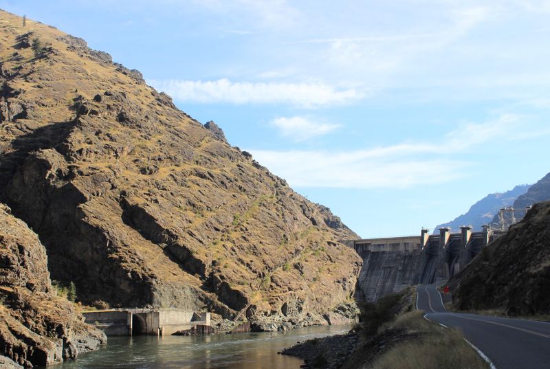
Back in the 1950s and 1960s, Idaho Power built a three-dam project on this part of the Snake River. Brownlee came first, then Oxbow, then Hells Canyon Dam at the downstream end.
Hells Canyon Dam was completed in the late 1960s. It became the last link in the system, sitting farthest into the canyon.
The project was not simple or quiet. Building concrete giants in a remote gorge meant roads, workers, and a lot of hauling through rough country.
There was also a long public debate over who should develop the canyon. Some favored a single federal high dam, while Idaho Power pushed for its smaller series of dams.
Idaho Power won that argument, and the three dams went up. Together, they still produce a large share of the company’s hydroelectric power today.
When you stand on the crest, you’re on the final chapter of that story. Everything upstream is shaped by the dams, and everything downstream feels wilder.
History buffs will appreciate that layer. Everyone else will just appreciate the view, and that’s fine too.
A Canyon Deeper Than The Grand Canyon
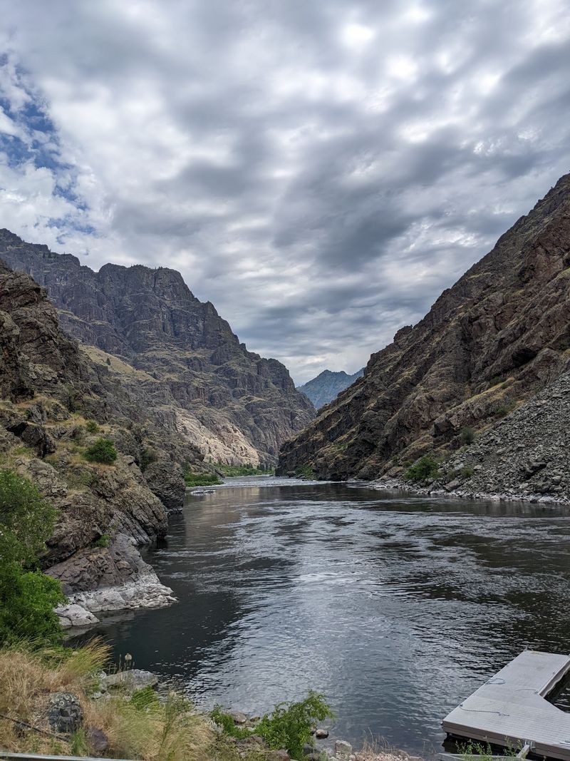
Here’s a fact that surprises plenty of Idahoans. Hells Canyon is the deepest river gorge in North America, deeper than the Grand Canyon.
The Seven Devils Mountains rise on the Idaho side, with He Devil Peak towering high above the river. The drop from that summit to the water is nearly 8,000 feet.
From the dam, you won’t see the full depth at once. The walls fold and bend, hiding the highest peaks behind layers of rock.
What you do see is plenty. Steep slopes of dark volcanic rock climb straight up from the water on both banks.
The canyon has a quiet, heavy feel down at river level. Sunlight comes and goes depending on the hour and the angle of the walls.
Geology fans will notice the layered basalt flows. They stack like pages in a very old, very large book.
It’s humbling in a friendly way. You feel small, but the river and rock make good company.
Bring a camera with a wide lens if you have one. The scale is tough to capture any other way.
Crossing The Crest On Foot Or By Car
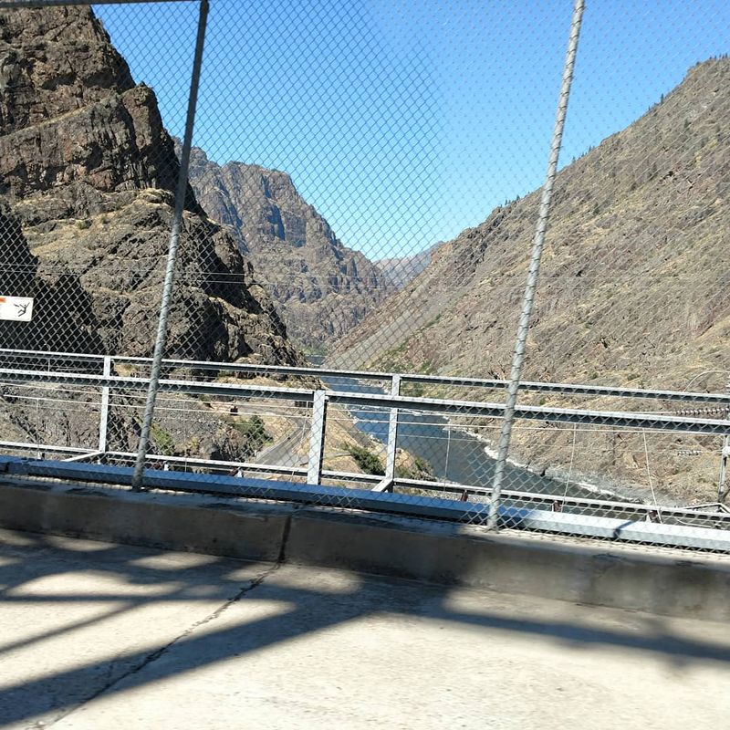
Yes, the road actually runs across the top of the dam. It’s the only way to reach the Oregon side from the Idaho road at this spot.
Drivers cross slowly, and many people stop nearby to take in the view. Walking the crest gives you a much better look than a quick drive.
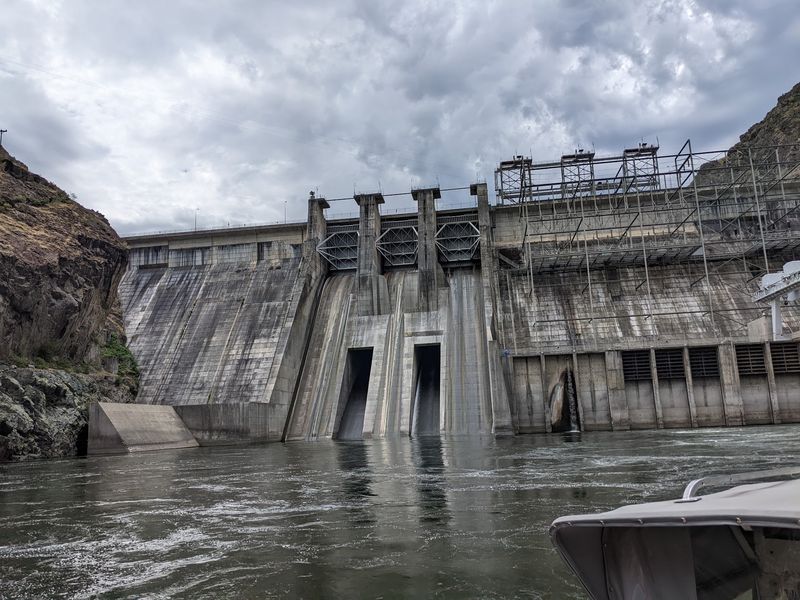
On one side, the reservoir sits calm and deep. On the other, the face of the dam drops toward the free-flowing river below.
That split view is the main event. Still water upstream, moving water downstream, and canyon walls framing both.
Keep an eye out for vehicles while you’re on the road surface. It’s a working route, not a pedestrian promenade.
Also respect any posted signs from Idaho Power. Some areas around the powerhouse are closed to the public for good reasons.
Kids usually love the idea of standing in two states at once. Technically, the border runs along the river, so the crossing delivers that thrill.
Wind can pick up in the canyon. A light jacket helps, even on warm days.
Twenty-Some Miles Of Road That Earn The View
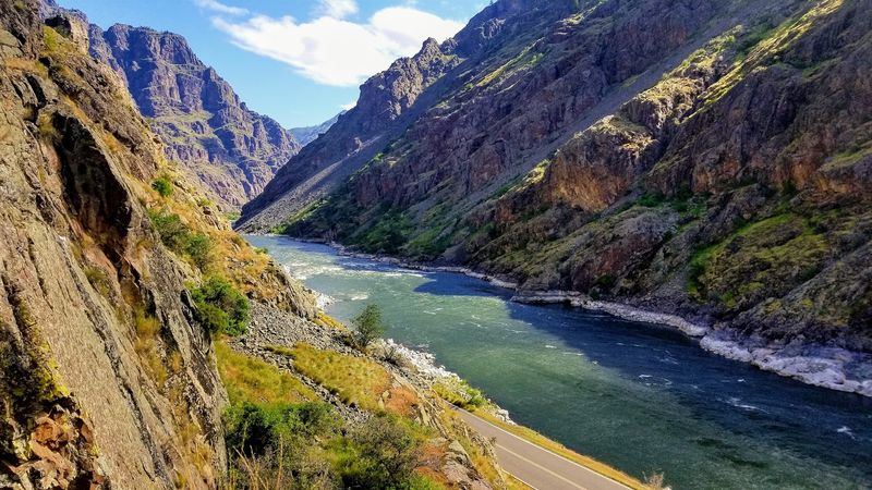
Getting here is half the adventure. The road to the dam follows the Idaho side of the reservoir north from the Oxbow area.
That stretch runs roughly 20-plus miles along the water. It twists with every bend in the canyon, so nobody sets speed records here.
Most drivers reach Oxbow by heading west from Cambridge on Idaho Highway 71. That route passes Brownlee Dam before reaching the canyon floor.
The drive delivers big views long before the destination. Steep slopes, quiet coves, and open water keep things interesting mile after mile.
Plan on a full day if you’re coming from the Treasure Valley. It’s a long haul, and you’ll want time to stop.
Fuel up before you leave the last towns. Services become sparse once you drop into the canyon.
Cell coverage can be spotty too. A paper map or downloaded directions is a smart backup.
Watch for rocks on the road and wildlife near the shoulder. The canyon is their neighborhood first.
Jet Boats Roaring Below The Spillway
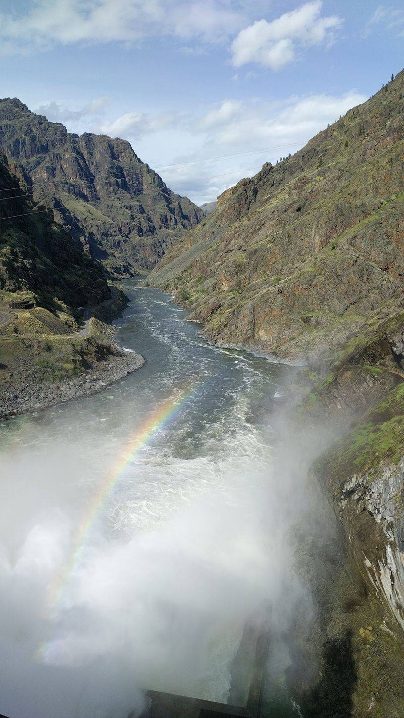
Just below the dam, the river turns into a launch point for some serious fun. Jet boat tours head downstream into the wildest part of Hells Canyon.
These powerful boats skim over shallow water and punch through rapids. The ride mixes splashy thrills with long stretches of quiet scenery.
Tours usually run during the warmer months. Booking ahead is wise, since trips depend on season and conditions.
Whitewater rafters also use this area to start multiday floats. The section below the dam holds some well-known rapids.
Private boaters need permits for parts of the river during the main season. The Forest Service manages that system, so check before you go.
Even if you skip the boat ride, watching a launch is entertaining. Engines rumble, gear gets loaded, and everyone looks a little excited.
Families often find the jet boats easier than rafting. You stay mostly dry, and nobody has to paddle.
Sunscreen and a hat are must-haves. Canyon sun reflects off the water with surprising strength.
A Visitor Center Waiting On The Oregon Bank
Cross the dam and follow the road a short way downstream. You’ll reach the Hells Canyon Creek Visitor Center, run by the U.S.
Forest Service.
It sits on the Oregon side and serves as a gateway to the Hells Canyon National Recreation Area. Interpretive displays explain the canyon’s geology, wildlife, and human history.
Rangers can share river conditions and permit details during the operating season. The center typically opens seasonally, so check before driving.
A boat launch sits nearby, and it’s a busy hub when trips are running. Watching rafts and jet boats come and go adds some energy to the stop.
Restrooms and parking make this a natural break after the long drive. Your legs will thank you.
The building also offers a good chance to learn before exploring. A few minutes inside makes the scenery outside mean more.
Kids tend to enjoy the displays about local animals. It’s a gentle way to sneak some learning into a road trip.
Grab a map while you’re there. Trails and roads are limited, and planning helps.
Bighorns, Eagles, And Other Canyon Residents
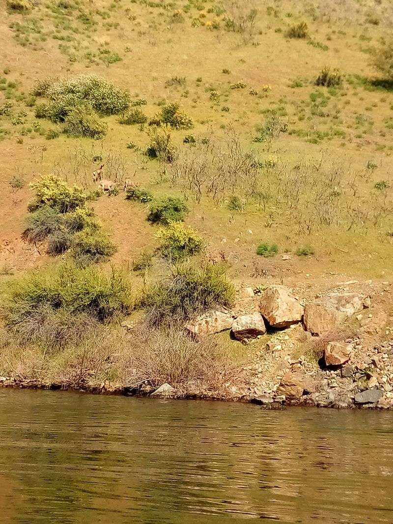
Keep your binoculars handy on this trip. Hells Canyon supports a wide range of wildlife, and the road gives you a front-row seat.
Bighorn sheep live in the canyon, though spotting them takes patience and luck. Scan the rocky slopes for movement and pale rumps.
Deer often graze near the water, especially in early morning and evening. Birds of prey ride the air currents above the cliffs.
Bald eagles show up in the canyon during colder months. Ospreys and hawks keep watch over the reservoir too.
Rattlesnakes also live here, which is worth remembering on any walk. Watch where you step and give them space.
The best viewing usually happens when the canyon is quiet. Pull off safely, cut the engine, and just look for a while.
Remember to keep a respectful distance from all animals. A zoom lens beats a close approach every time.
Wildlife sightings are never guaranteed. That uncertainty makes every sighting feel like a small win.
Reservoir Fishing With A Canyon Backdrop
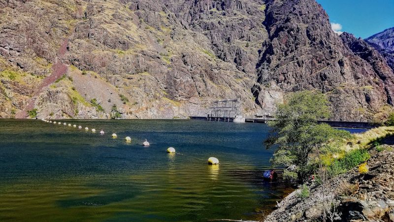
Anglers have plenty to like along the reservoir behind the dam. The calm water stretches back upstream toward Oxbow.
Hells Canyon Reservoir holds warmwater species like bass and crappie. Catfish and trout also turn up in the Snake River system here.
Shore fishing is possible at various pullouts along the road. Boaters can launch from ramps at Idaho Power parks upstream.
Below the dam, the free-flowing river offers a different experience. Sturgeon live in the Snake River, though rules for them are strict.
Fishing regulations change by season and species. Check current Idaho and Oregon rules before casting a line.
Since the river is the state line, licensing can get tricky. The two states have reciprocal rules for certain border waters, so read the details.
Early mornings can be peaceful on the water. The canyon walls hold shade longer, and the air stays cooler.
Even without a bite, the setting delivers. Few fishing spots in Idaho come with a backdrop this dramatic.