You’ll Ride Over 24 Trestles And A Century Old Tunnel On Kentucky’s Longest Rail Trail
Trains used to haul timber and coal through this part of eastern Kentucky. Then the rails came up and something better went down.
What you get now is the longest rail trail in the state, running roughly thirty five miles through three counties. Old railroad grades are wonderfully lazy.
The climb never gets steep, because a loaded coal train would not tolerate it. You cross twenty four trestles along the way.
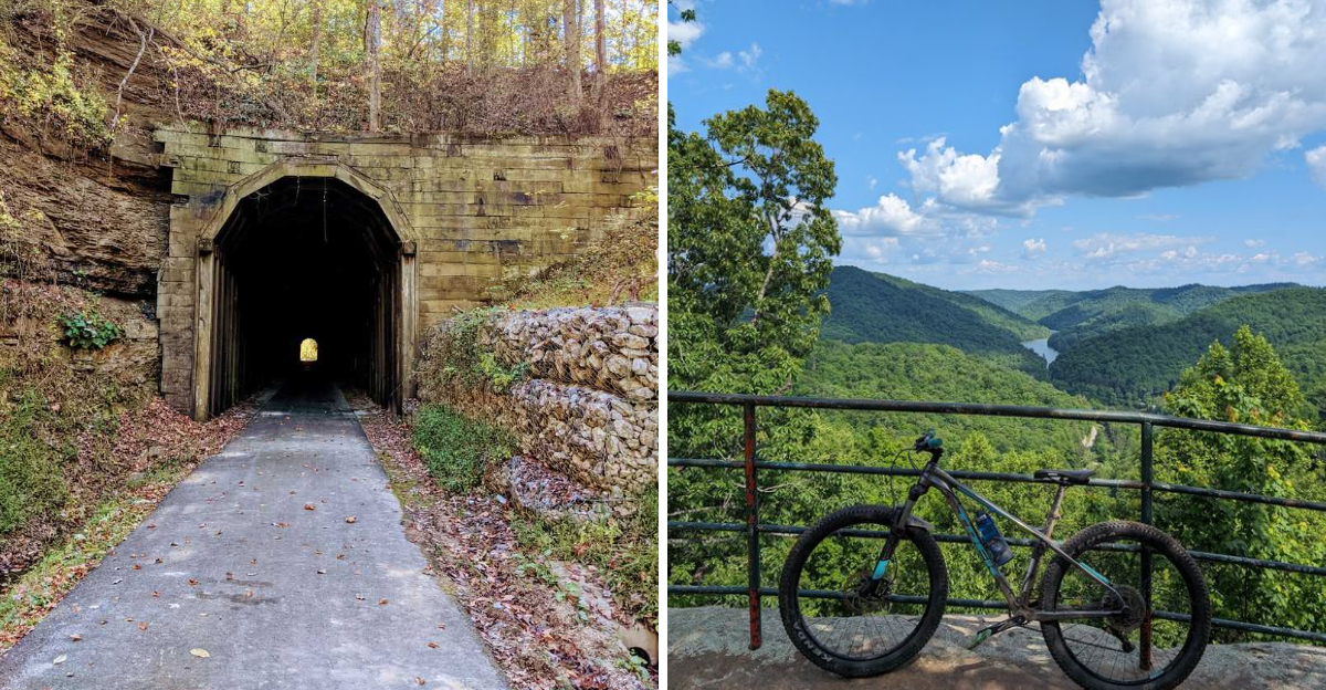
Some of them put you level with the treetops, which is a strange feeling on a bicycle. Then there is the tunnel.
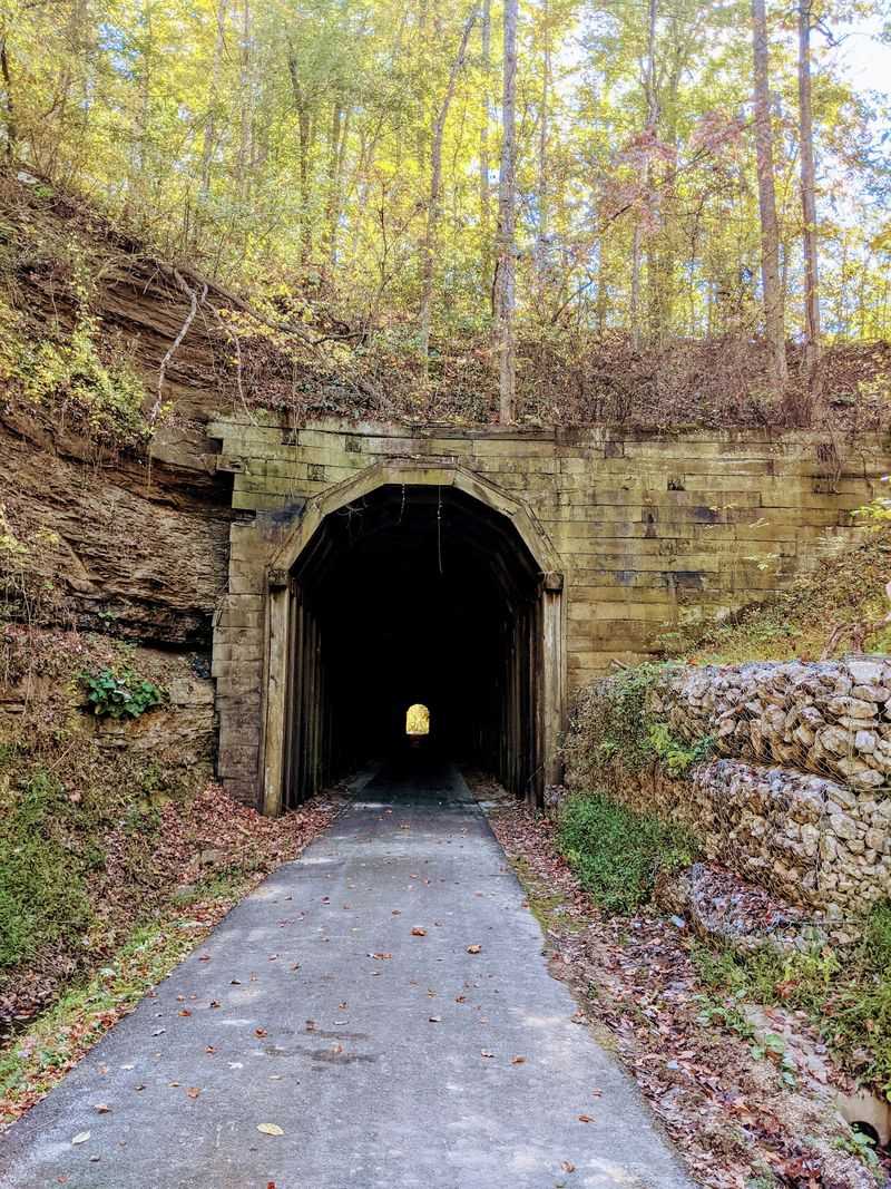
It runs over six hundred feet through a hillside and gets properly dark inside, so bring a light and mean it. There are waterfalls, wildflowers and old homesteads in between.
Horses are welcome here too. Nobody here is in a hurry.
Bring water, because services along the route are thin. The scenery does the rest.
The Trail That Used To Haul Coal Trains
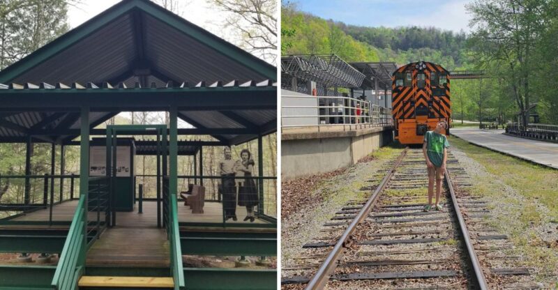
Dawkins Line Rail Trail runs along an old railroad corridor that once carried coal and timber through eastern Kentucky. Trains stopped rolling, and the state turned the grade into something far more fun.
The finished path stretches roughly 36 miles between Hagerhill and Evanston. That length makes it the longest rail trail in the state, and it keeps growing in reputation.
Railroad builders needed gentle grades, so the surface barely climbs. You will notice the slope only when your legs feel unusually strong.
Crushed limestone covers most of the route, packed firm and smooth. Hybrid bikes, gravel bikes, and mountain bikes all handle it without complaint.
Kentucky State Parks manages the trail, which means signage and upkeep stay consistent. Mileposts help you track progress and plan turnarounds.
Horses are welcome on much of the corridor, so expect hoofprints beside tire tracks. Share space politely and pass at walking speed.
Counties along the way include Johnson, Magoffin, and Breathitt. Each section shows off a slightly different personality of the mountains.
Plan your ride around daylight and weather, since services thin out fast. A little preparation turns a long day into a great one.
Twenty Four Trestles And Counting
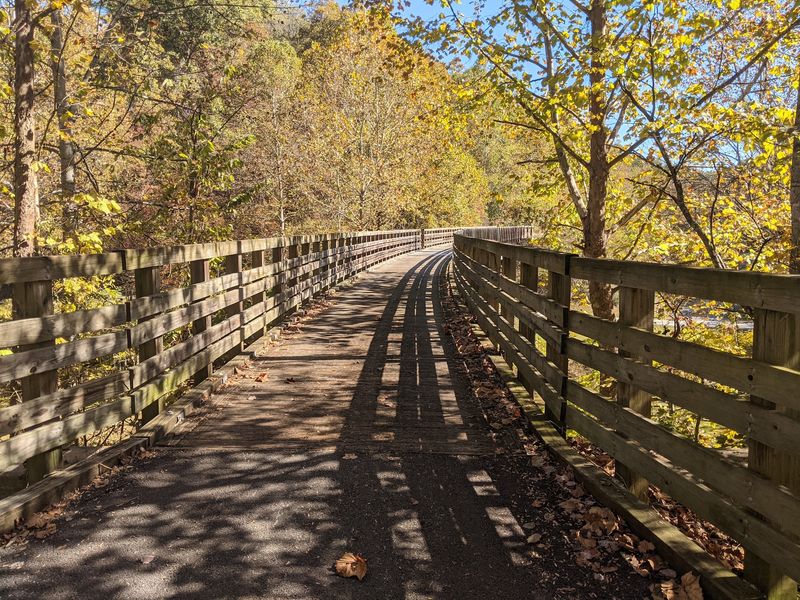
Counting trestles becomes a game about three miles in. The Dawkins Line carries riders across 24 of them, each one a converted railroad bridge.
Wooden decking replaced the old ties, and railings line both sides. The setup feels sturdy underfoot while still showing off the drop below.
Some crossings sit low over quiet creek beds. Others lift you into open air with treetops at eye level.
Slow down before you roll on. Boards can feel slick after rain, and the view deserves more than a blur.
Photographers love the geometry here. Straight lines of decking pull your eye toward green hills at the far end.
Kids usually announce every single bridge with genuine excitement. Adults pretend to be calmer and fail by trestle number six.
Listen while you cross, because creek sound carries up through the timbers. Birdsong often joins in from the hollow below.
Spacing works in your favor too. Trestles appear often enough that boredom never gets a chance.
Bring a friend who has never ridden a rail trail before. Their reaction on the first big crossing is worth the trip.
Gun Creek Tunnel, The Cool Dark Highlight
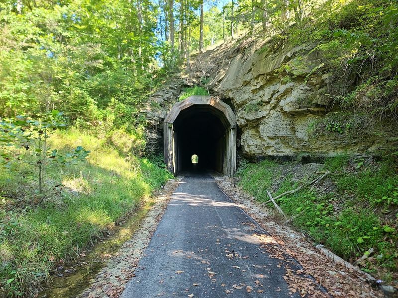
Gun Creek Tunnel steals the show for almost everyone who rides the Dawkins Line. Crews bored it through a Magoffin County hillside for the railroad more than a century ago.
The passage runs about 662 feet long. That is long enough for daylight to shrink to a small bright circle ahead.
Temperature drops noticeably inside. On a hot July afternoon, the change feels like stepping in front of an open cooler.
Bring a light. A headlamp or handlebar lamp turns a guessing game into a comfortable roll.
Sound behaves strangely in there. Tire crunch echoes, voices bounce, and even a quiet laugh comes back doubled.
Water sometimes drips from the rock overhead. Expect a few cold surprises on your neck.
The tunnel sits near the middle of the trail, which makes it a natural goal. Many riders start at Royalton or Swamp Branch to reach it faster.
Take a photo from the entrance looking in. The framed light at the far end makes an image people actually stop scrolling for.
Then ride back through again, because once is never enough.
Where To Start Your Ride
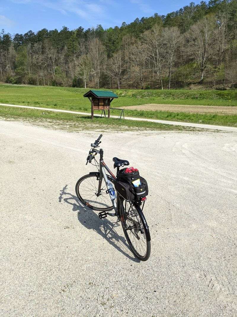
Trailheads spread across the route, which keeps planning flexible. Hagerhill anchors the western end near Paintsville, and Evanston marks the eastern finish.
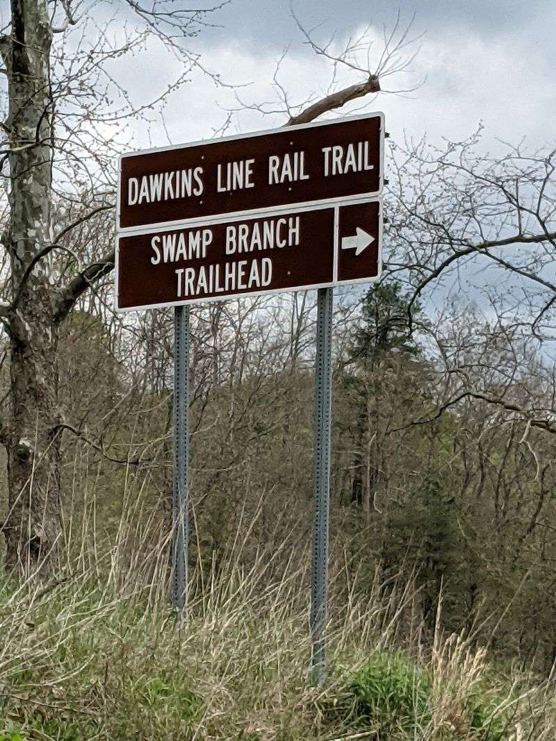
Between them you will find access points at Swamp Branch, Royalton, and Tuttle. Each offers parking and a place to unload gear.
Royalton works well for tunnel seekers. The distance to Gun Creek Tunnel stays manageable for a half day outing.
Hagerhill suits riders who want the longest possible push eastward. Start early if that is the plan.
Restrooms exist at several trailheads, though not at every one. Check before you commit to a long stretch with kids.
Cell signal comes and goes in the hollows. Download a map to your phone before leaving pavement.
Shuttles are not run by the park, so most groups leave a second vehicle. Two cars turn a 36 mile day into a one way cruise.
Kiosks post mileage charts and trail rules. Snap a picture of the board so you can check distances later.
Parking lots stay free, which is a pleasant thing to say about anything these days.
Wildlife Sightings Along The Corridor
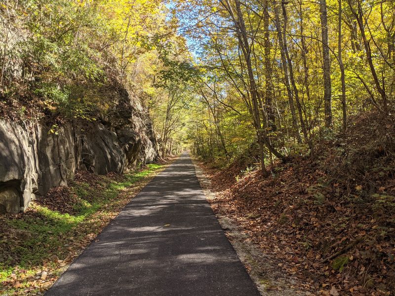
Quiet riders see the most. Roll slowly at dawn and the corridor turns into a wildlife highway.
White-tailed deer step out of the brush regularly. They freeze, stare, then bolt with that ridiculous flag of a tail.
Wild turkeys patrol the edges in small groups. Their heads pop up like periscopes when they hear gravel.
Box turtles cross the path in warmer months. Move them gently in the direction they were already headed.
Hawks ride thermals above the ridges. Watch for a shadow sliding across the trail ahead of you.
Creek crossings attract herons and kingfishers. A rattling call usually means a kingfisher just beat you to the fishing spot.
Butterflies gather on damp gravel in summer. Whole clouds of them lift as you approach.
Spring brings trillium, may apple, and redbud along the banks. Fall answers with sugar maple and sumac in bright red.
Snakes sun themselves on the warm surface occasionally. Give them room and they will slide off without drama.
Binoculars fit easily in a handlebar bag. Pack them and the ride becomes a moving nature program.
Gear That Makes The Miles Easier
Skinny road tires will fight you here. Anything 35mm or wider rolls happily over crushed limestone.
Tire pressure matters more than tire brand. Lower pressure smooths out the surface and reduces rattle in your hands.
Carry a spare tube, a patch kit, and a small pump. Help is far away in the middle sections.
Water is the big one. Fill more than you think you need, since taps are scarce between trailheads.
Snacks keep morale high on long stretches. Trail mix and a couple of bars go a long way.
A front light doubles as tunnel equipment and evening insurance. Add a rear blinker for horse riders and other cyclists.
Gloves cut down on hand fatigue from constant vibration. Padded shorts help too on a 30 mile day.
Sunscreen still counts, even with tree cover in places. Open sections bake in midsummer.
Bug spray earns its place near creek bottoms. Mosquitoes love the shady, damp spots.
Pack a trash bag for wrappers. Leaving the trail clean keeps it open and welcoming for everybody behind you.
Best Seasons To Roll Out
October turns the Dawkins Line into a color tunnel. Maples, oaks, and hickories light up across the ridges above the corridor.
Crowds stay light even during peak leaf season. You may go long stretches seeing nobody at all.
Spring runs a close second. Redbud and dogwood bloom while creeks run full and loud.
Summer works if you start early. Shade covers much of the route, but humidity in eastern Kentucky is no joke.
Winter rides can be lovely on clear days. Bare trees open up views you never notice in July.
Rain changes the surface quickly. Crushed stone drains well, though puddles collect in low spots for a day or two.
Check conditions before driving out. Storms occasionally drop limbs or wash gravel across the path.
Weekday mornings feel almost private. Weekend afternoons bring families, walkers, and the occasional horseback group.
Sunset light hits the trestles beautifully in fall. Time your turnaround so you finish while the glow lasts.
Layers solve most weather questions. Tunnels and hollows stay cooler than the open sections above them.
Nearby Stops Worth Adding To The Day
Paintsville sits close to the western trailhead and makes a solid base. Restaurants, lodging, and grocery stops cluster there.
Paintsville Lake State Park lies just minutes away. Boat rentals and a marina round out the weekend nicely.
The Loretta Lynn Homeplace at Butcher Hollow stands nearby in Van Lear. Tours run by family members share stories you cannot read online.
Van Lear also holds a coal miners museum. Exhibits explain the railroad history that created the corridor you just rode.
Salyersville serves the middle section of the trail. Fuel, food, and a motel room are easy to find there.
Jenny Wiley State Resort Park sits within reach for a second day. Hiking trails and a lodge make it a comfortable follow up.
Local diners open early, which suits cyclists perfectly. Order the biscuits and ask about trail conditions while you eat.
Small groceries along the highways cover last minute supplies. Stock up before heading toward the quieter trailheads.
Stretching a trail trip into a full weekend costs little. The region rewards anyone willing to slow down and look around.