Ride An Old Railroad Route Through Northern California With Mount Shasta Views And Miles Of Forest
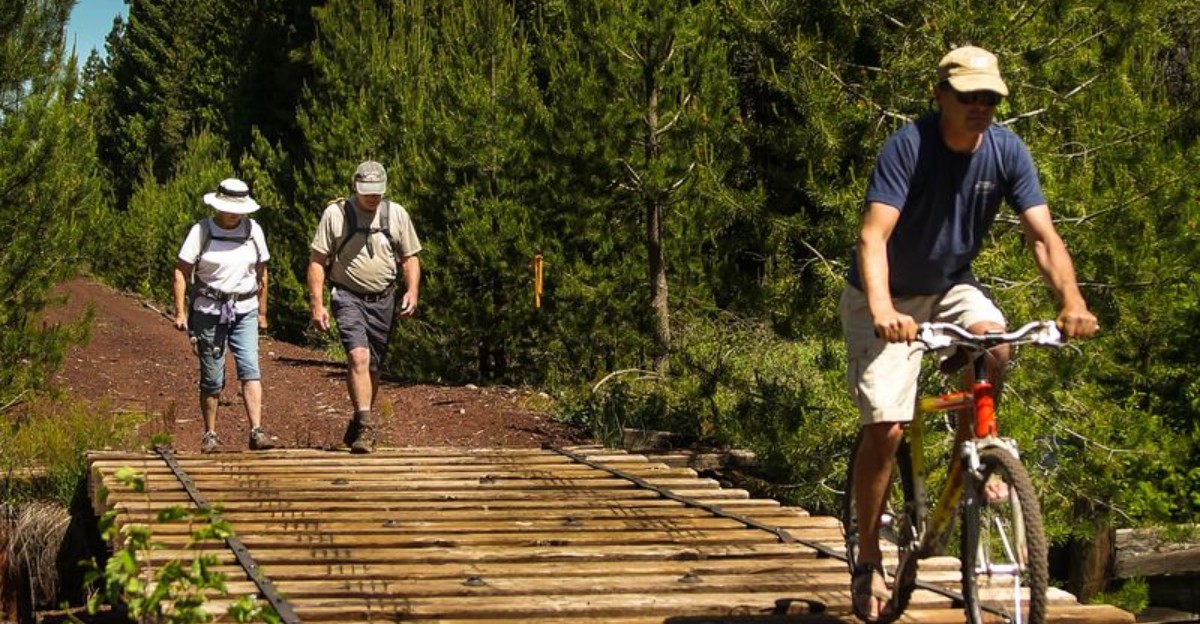
The train is gone, but its route still knows exactly where to take you. Follow the old rail corridor and civilization begins slipping behind the trees.
Forest takes over, long stretches of trail invite you to keep pedaling, and one enormous mountain appears when the landscape opens at just the right moment.
Northern California preserves this former railroad route as a trail through miles of rugged scenery near Mount Shasta.
Isn’t there something satisfying about traveling a path once shaped around locomotives under your own power?
You can still read pieces of the railroad story in the route itself, but now the soundtrack comes from tires on the trail and whatever is moving in the woods nearby.
Keep an eye on the horizon. Mount Shasta knows how to make an entrance.
An Old Railroad Becomes A Northern California Adventure
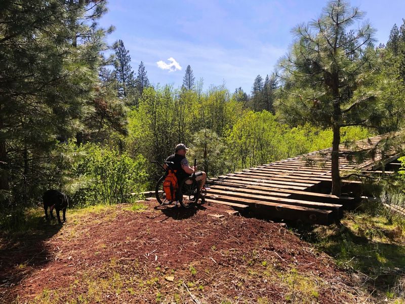
Logging built this landscape, and the railroad made the logging possible.
The corridor that riders now travel was once part of the McCloud Railway, a working line that carried lumber and freight through the forests east of the town of McCloud.
Rail operations on the sections east of McCloud ended in 2006.
Instead of letting the right-of-way disappear back into brush, local advocates worked between roughly 2005 and 2008 to imagine something else for it.
The result is a long recreational corridor that keeps the shape of a railroad.
Grades stay gentle because trains could never climb steep pitches, so the route rolls along at an easy angle even while gaining or losing elevation across many miles.
Riding here feels different from riding a typical park path. The straightaways run long, the curves are wide and sweeping, and cut banks occasionally rise on both sides where crews once blasted through rock.
Old railroad ties are gone, but the character remains in the ballast underfoot and in place names that once marked stations and sidings.
Anyone curious about how timber moved through this part of California will find the history sitting right there in the ground.
Plan the visit as a mix of exercise and quiet sightseeing rather than a fast workout, and the corridor rewards the slower pace.
Sixty Five Miles Are Already Open To Explore
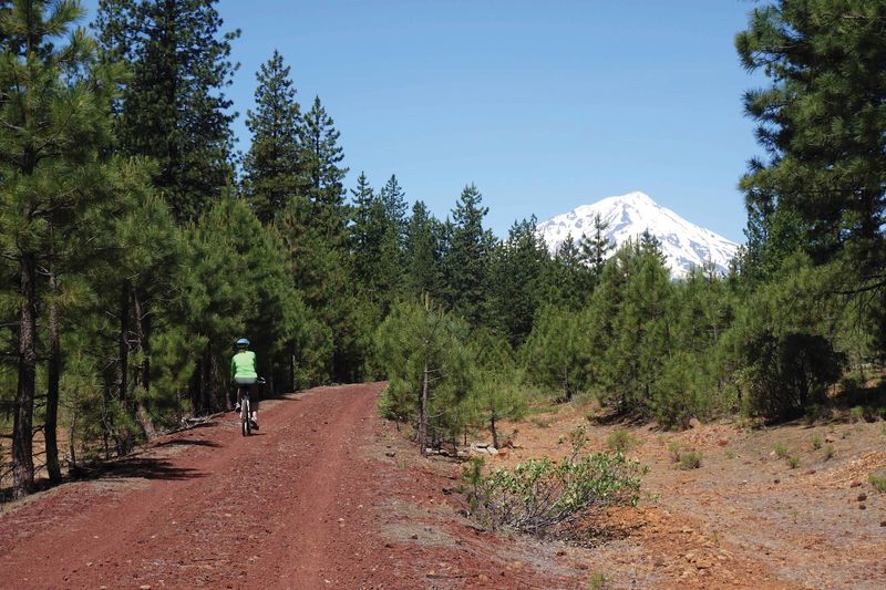
Roughly 65 miles of the corridor are currently open for non-motorized recreation, which is a lot of ground by any measure. The long-term vision stretches to about 80 miles linking McCloud and Burney.
Open mileage does not mean one continuous ribbon. Several segments remain closed because of damaged or unsafe bridges and storm impacts, so the accessible portions come in pieces rather than as a single end-to-end route.
That detail changes how a trip gets planned. Rather than aiming to ride the whole thing in one push, most visitors pick a section, ride out a comfortable distance, and turn around.
Out-and-back trips work especially well because shuttling a car between remote access points can eat a surprising amount of the day.
Dirt forest roads connect many trailheads, and driving them takes longer than the map suggests.
Checking the trail association website before heading out is the single most useful preparation step.
Closure status changes as repair projects move forward, and current information beats guesswork every time.
Families and casual riders often find a five or ten mile section plenty satisfying. Stronger riders can string together twenty miles or more on the longer open stretches without running out of forest to look at.
Mount Shasta Appears Beyond The Trees
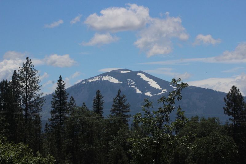
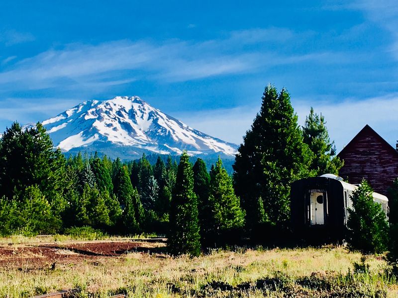
Nothing quite prepares a rider for the moment the trees open up and a 14,000-foot volcano fills the gap.
Mount Shasta stands as one of the defining scenic features along this corridor, appearing and disappearing as the forest thickens and thins.
Historic McIntosh Vista, a spot along the old railroad alignment, was specifically known for its westward view of the mountain.
Railroad crews and passengers once looked out at the same peak that riders photograph today.
Views come in glimpses rather than constant panoramas. Much of the route sits inside dense timber, so the mountain reveals itself at clearings, curves and higher open stretches.
Morning light tends to make the snowfields especially crisp, and clear days after a weather system passes often bring the sharpest visibility.
Summer haze from regional wildfire smoke can reduce or erase the view entirely, which is worth checking before driving out.
Riding westbound generally puts the peak ahead rather than behind. Small thing, but it changes the feel of a ride considerably when the mountain keeps appearing in front of the handlebars.
Stopping for a few minutes at each opening is a good habit.
The forest is beautiful on its own, though the combination of pine shade and a snow-covered summit is what people remember from this part of California.
The Red Cinder Surface Keeps The Railroad Character
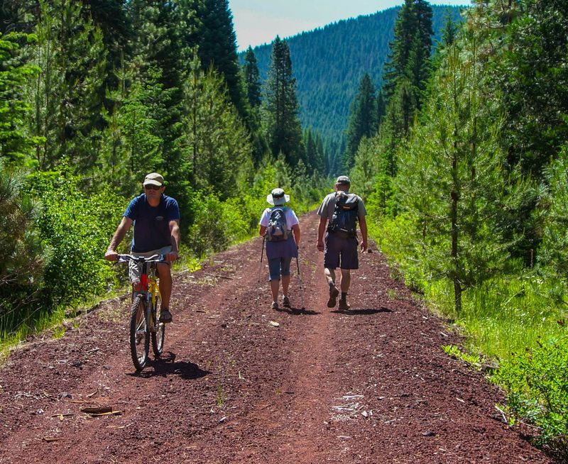
Look down while riding and the ground tells its own story.
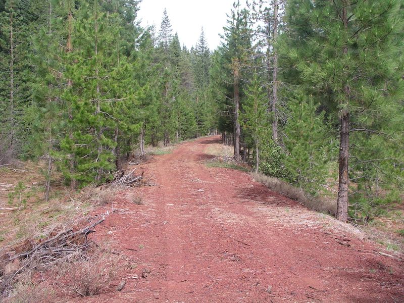
Much of the route consists of reddish cinder left along the old rail grade, a volcanic material common to this region and once used as ballast beneath the ties.
Texture varies quite a bit from one mile to the next. Some stretches are firmly compressed and roll almost as smoothly as packed gravel.
Other areas stay loose enough to make riding noticeably harder, with tires sinking slightly and forward progress requiring more effort.
The change can happen without warning, so keeping a steady cadence helps more than sprinting.
Pavement was never part of the plan, and that choice preserves something honest about the corridor. The surface still looks and feels like a rail bed rather than a suburban greenway.
Practical effects are worth knowing. Loose cinder can spray a fine reddish dust onto shoes, socks and bike frames, so darker clothing and a rag for the drivetrain make sense.
After rain, compacted sections often ride better than usual while low spots may hold puddles. Braking distances lengthen on the looser material, which matters on the occasional descent.
Riders who accept the surface for what it is tend to enjoy the day. Those expecting asphalt speeds usually come away tired and a little surprised.
Wide Tires Make This Ride Much More Enjoyable
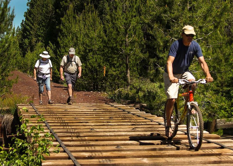
Equipment choice can make or break a day out here. The trail association recommends mountain bikes with wider tires, and that guidance comes straight from how the cinder behaves underfoot.
Narrow road-bike tires are poorly suited to the softer sections. They cut into the surface instead of floating over it, which turns an easy grade into slow, sinking work.
Cross-country and gravel bikes with reasonably wide tires also handle the terrain well. The general rule is that more rubber on the ground equals more stability and less fighting the loose spots.
Slightly lower tire pressure can help too, since it increases the contact patch and smooths out small chatter. Going too soft risks pinch flats on buried rock, so moderation applies.
Bringing repair supplies is simply part of riding remote country. A spare tube, patch kit, pump, tire lever and a basic multi-tool cover most roadside problems, and nobody is going to come along with a floor pump.
Hikers and horseback riders face fewer equipment questions, though sturdy footwear beats light sneakers on the cinder. Trekking poles work nicely on the softer stretches.
Gloves earn their place as well. Fine dust and long miles combine to make bare hands unhappy after a couple of hours in the saddle.
The Route Disappears Into Miles Of Forest
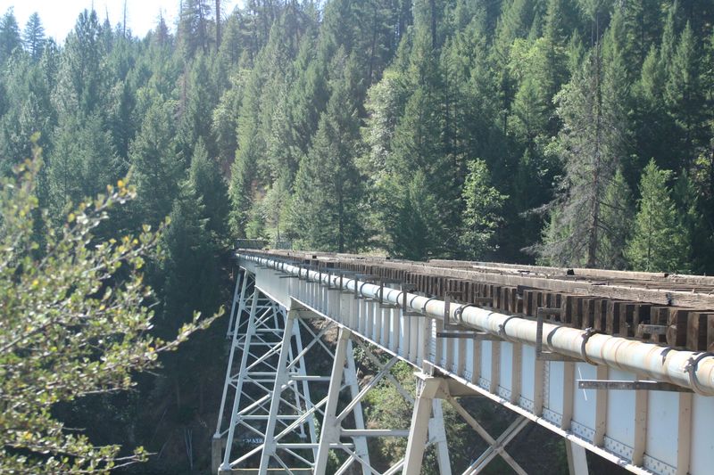
Quiet is the first thing most visitors notice. Long portions of the corridor pass through remote mountain and forest country between the McCloud and Burney areas rather than through developed communities.
Sections of the route travel near and through lands within the Shasta-Trinity and Lassen National Forests. Beyond the old grade itself, there is very little sign of modern life for miles at a stretch.
Wildlife shows up in small ways. Woodpeckers, jays, chipmunks and deer are all reasonable possibilities, and animal tracks often mark the softer cinder in the early morning.
Shade comes and goes depending on how close the timber grows to the grade. Open burned or logged areas can feel exposed on hot afternoons, so a hat and sunscreen are sensible even in a forest setting.
Solitude is part of the appeal, though it cuts both ways. Encountering nobody for hours is common, which makes self-reliance a real requirement rather than a suggestion.
Sound carries oddly out here. Wind moving through pine tops, a distant raven and the crunch of tires become the entire soundtrack for long stretches.
Anyone who enjoys unhurried riding with room to think will likely find this the most memorable part of the whole experience in this corner of California.
Bartle Wye Sends Riders In Different Directions
Junctions on a rail trail carry a certain charm, and the Bartle Wye is the best example along this route. Near Harris Spring Road, the historic railroad alignment splits into separate branches.
One open branch continues northeast toward Hambone, running roughly 12 to 13 miles. The other heads south toward Bartle Gap Road, covering something in the range of four to six miles.
Wyes existed so locomotives could be turned around, which is a nice bit of railroad logic to think about while standing at the split. The shape is still readable in the ground.
Beyond Bartle Gap Road, the trail is currently not accessible while bridge repairs and flood damage remediation remain pending. Planning around that closure avoids a frustrating dead end.
Harris Spring Road is paved and reaches the wye area, which makes it one of the more practical starting points for exploring both branches. Riders can sample one direction, return, and then try the other.
Choosing between branches often comes down to available time and energy. The Hambone direction offers more distance and more history, while the southern branch makes a shorter out-and-back.
Bringing a printed or downloaded map helps, since signage in remote sections is limited and phone service is unreliable.
Several Trailheads Make Shorter Trips Possible
Big mileage is optional, which is good news for anyone with limited time or mixed-ability company. Multiple access points let visitors build trips of very different lengths.
Pilgrim Creek Road sits about three miles east of downtown McCloud and offers off-road parking. Esperanza Road, roughly 4.8 miles east on Highway 89, is reached by a dirt road with off-road parking as well.
Military Pass Road, Forest Service road 43N19, lies about 9.9 miles east on Highway 89 and is a narrow dirt road with limited parking that can work as a drop-off.
Sheepheaven Road, Forest Service road 40N11, sits near 13.7 miles east on Highway 89 opposite the CalTrans barn with limited parking.
Harris Spring Road, paved and located 17 miles east on Highway 89, leads toward the wye.
On the eastern end, the Burney Depot Trailhead is found at the intersection of Black Ranch Road and Main Street, which is Highway 299, in Burney, California.
Several of these access points involve dirt forest roads, so a vehicle with decent clearance helps. Parking is informal and small at most locations rather than a developed lot.
Starting with a shorter section is a smart way to learn the surface before committing to a longer day.